Free with trial Travel Concept Argentina Landmark Flat Icons Design. Vector Illustration. Patagonia vectors Travel Concept Argentina Landmark Flat Icons Design .Vector Illustration
Free with trial Vector set of panorams countries South America - Chile, Peru, Argentina, Bolivia, Paraguay, Uruguay. Patagonia vectors Vector set of panorams countries South America. Chile, Peru, Argentina, Bolivia, Paraguay, Uruguay
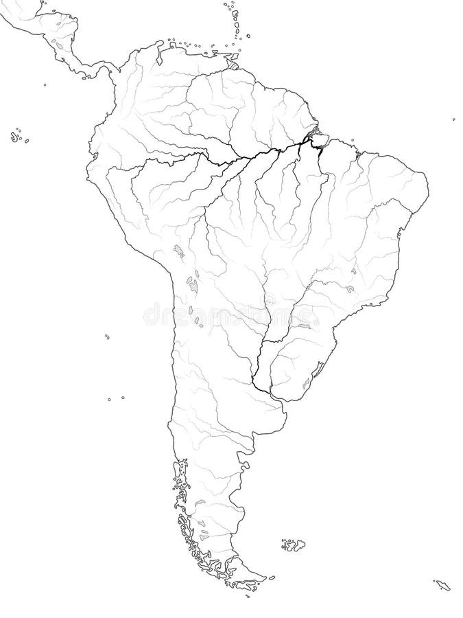
Free with trial World Map of SOUTH AMERICA: Latin America, Argentina, Brazil, Peru, Andes, Cordilleras, Amazon River, Selva, Llanos, Pampa, Patagonia. Geographic chart of continent with coastline, landscape & rivers. Patagonia vectors World Map of SOUTH AMERICA: Latin America, Argentina, Brazil, Peru, Patagonia, Amazon River. Geographic chart. World Map of SOUTH AMERICA: Latin America. World Map of SOUTH AMERICA: Latin America, Argentina, Brazil, Peru, Andes, Cordilleras, Amazon River, Selva, Llanos, Pampa, Patagonia. Geographic chart of continent with coastline, landscape & rivers.
Free with trial Argentina - set of icons. And illustrations. Patagonia vectors Argentina - set of icons. And illustrations
Free with trial Argentina icon set. Vector Illustration. Patagonia vectors Argentina icon set. Vector Illustration
Free with trial Patagonia political map. The southern end of continent South America, shared by Chile and Argentina. With Falkland Islands, a British overseas territory. English labeling. Gray illustration. Vector. Patagonia vectors Patagonia and Falkland Islands political map. Patagonia political map. The southern end of continent South America, shared by Chile and Argentina. With Falkland. Patagonia political map. The southern end of continent South America, shared by Chile and Argentina. With Falkland Islands, a British overseas territory. English labeling. Gray illustration. Vector.
Free with trial Stamp or emblem with text Monte Fitz Roy, Patagonia, vector illustration. Patagonia vectors Stamp or emblem with text Monte Fitz Roy, Patagonia. Vector illustration
Free with trial Vector illustration of a mountain landscape. With coniferous forest and the car in the foreground. Patagonia vectors Vector illustration of a mountain landscape. With coniferous forest and the car in the foreground
Free with trial Political map of the Falkland Islands and part of South America with national borders, most important cities, rivers and lakes. Vector illustration with English labeling and scaling. Patagonia vectors Falkland Islands Policikal Map. Political map of the Falkland Islands and part of South America with national borders, most important cities, rivers and lakes. Political map of the Falkland Islands and part of South America with national borders, most important cities, rivers and lakes. Vector illustration with English labeling and scaling.
Free with trial Chile political map with capital Santiago, national borders and neighbors. Republic and country in South America. Long, narrow strip of land. Gray illustration over white. English labeling. Vector. Patagonia vectors Chile political map. With capital Santiago, national borders and neighbors. Republic and country in South America. Long, narrow strip of land. Gray illustration. Chile political map with capital Santiago, national borders and neighbors. Republic and country in South America. Long, narrow strip of land. Gray illustration over white. English labeling. Vector.
Free with trial Argentina political map with capital Buenos Aires, national borders, most important cities, rivers and lakes. Illustration with English labeling and scaling. Vector. Patagonia vectors Argentina Political Map. With capital Buenos Aires, national borders, most important cities, rivers and lakes. Illustration with English labeling and scaling
Free with trial Amazing vector illustration. Torres del Paine national park. Nature of Chili. Towers. Patagonia vectors Torres del Paine national park. Nature of Chili. Towers. Amazing vector illustration. Torres del Paine national park. Nature of Chili. Towers. Amazing vector illustration. Torres del Paine national park. Nature of Chili. Towers.
Free with trial Chile landmarks. Retro styled image. Vector illustration. Patagonia vectors Chile landmarks. Retro styled image. Vector illustration
Free with trial Argentina love - heart with a set of icons. And illustrations. Patagonia vectors Argentina love - heart with a set of icons. And illustrations
Free with trial Argentina poster and background with set of icons. Argentina background and poster - set of icons and illustrations. Patagonia vectors Argentina poster and background with set of icons. Argentina background and poster - set of icons and illustrations
Free with trial Linear sketch of Fitz Roy mountain massif in Patagonia, Hand drawn vector illustration. Patagonia vectors Linear sketch of Fitz Roy mountain massif in Patagonia. Hand drawn vector illustration
Free with trial Linear sketch of Fitz Roy mountain in Patagonia, Hand drawn vector illustration. Patagonia vectors Linear sketch of Fitz Roy mountain in Patagonia. Hand drawn vector illustration
Free with trial Linear sketch of Fitz Roy mountain massif in Patagonia, Hand drawn vector illustration. Patagonia vectors Linear sketch of Fitz Roy mountain massif in Patagonia. Hand drawn vector illustration
Free with trial World Map of PATAGONIA in SOUTH AMERICA: Argentina, Chile, Paraguay, Uruguay, Patagonia, Pampa, Andes, Cordilleras, Paraná River. Geographic chart of continent with rivers and oceanic coastline. Patagonia vectors World Map of PATAGONIA: Argentina, Chile, Paraguay, Uruguay, Patagonia, Pampa. Geographic chart. World Map of PATAGONIA in SOUTH AMERICA: Argentina, Chile. World Map of PATAGONIA in SOUTH AMERICA: Argentina, Chile, Paraguay, Uruguay, Patagonia, Pampa, Andes, Cordilleras, Paraná River. Geographic chart of continent with rivers and oceanic coastline.
Free with trial WPA poster art of Monte Fitz Roy with Viedma Lake located in the Southern Patagonian Ice Field near El Chalten village in Patagonia, Argentina done in works project administration or Art Deco style. Patagonia vectors Monte Fitz Roy with Viedma Lake in Patagonia Argentina WPA Art Deco Poster. WPA poster art of Monte Fitz Roy with Viedma Lake located in the Southern Patagonian. WPA poster art of Monte Fitz Roy with Viedma Lake located in the Southern Patagonian Ice Field near El Chalten village in Patagonia, Argentina done in works project administration or Art Deco style.
Free with trial Antarctic Peninsula area, political map. From southern Patagonia and Falkland Islands, to South Georgia and the South Sandwich Islands, South Orkney Islands, and Drake Passage, to Antarctic Peninsula. Patagonia vectors Antarctic Peninsula area, from Patagonia to Antarctica, political map. Antarctic Peninsula area, political map. From southern Patagonia and Falkland Islands, to. Antarctic Peninsula area, political map. From southern Patagonia and Falkland Islands, to South Georgia and the South Sandwich Islands, South Orkney Islands, and Drake Passage, to Antarctic Peninsula.
Free with trial Linear sketch of Fitz Roy mountain in Patagonia, Hand drawn vector illustration. Patagonia vectors Linear sketch of Fitz Roy mountain in Patagonia. Hand drawn vector illustration
Free with trial Linear sketch of Fitz Roy mountain in Patagonia in night with moon, Hand drawn vector illustration white lines. Patagonia vectors Linear sketch of Fitz Roy mountain in Patagonia in night with moon. Hand drawn vector illustration white lines
Free with trial Monte Fitz Roy is a mountain in Patagonia, on the border between Argentina and Chile, vector illustration. Patagonia vectors Monte Fitz Roy is a mountain in Patagonia, on the border between Argentina and Chile. Vector illustration
Free with trial Vector map of Patagonia, the southern part of south America, Chi. Le and Argentina. Patagonia vectors Vector map of Patagonia, the southern part of south America, Chi. Le and Argentina
Free with trial Mountains peaks, vintage Patagonia, old looking hand drawn, sketch or engraved style, different versions for hiking, climbing. landscape of nature. valley with green trees. vector illustration. Patagonia vectors Mountains peaks, vintage Patagonia, old looking hand drawn, sketch or engraved style, different versions for hiking. Climbing. landscape of nature. valley with. Mountains peaks, vintage Patagonia, old looking hand drawn, sketch or engraved style, different versions for hiking, climbing. landscape of nature. valley with green trees. vector illustration
Free with trial Monte Fitz Roy, Patagonia icon, outline style. Monte Fitz Roy, Patagonia icon in outline style isolated on white background. Patagonia vectors Monte Fitz Roy, Patagonia icon, outline style. Monte Fitz Roy, Patagonia icon in outline style isolated on white background
Free with trial WPA poster art of Torres del Paine National Park from Lake Pehoe in the Chilean Patagonia within Magallanes and Chilean Antarctic Region Chile done in works project administration or Art Deco style. Patagonia vectors Torres Del Paine National Park from Lake Pehoe in Chile WPA Art Deco Poster. WPA poster art of Torres del Paine National Park from Lake Pehoe in the Chilean. WPA poster art of Torres del Paine National Park from Lake Pehoe in the Chilean Patagonia within Magallanes and Chilean Antarctic Region Chile done in works project administration or Art Deco style.
Free with trial Culture elements and famous places of Argentina study in infographic collage. Open big guide book and Argentinians, falls and animals Patagonia, sun sign and buildings cartoon vector illustration. Patagonia vectors Culture elements and famous places of Argentina study in infographic collage with book. Culture elements and famous places of Argentina study in infographic. Culture elements and famous places of Argentina study in infographic collage. Open big guide book and Argentinians, falls and animals Patagonia, sun sign and buildings cartoon vector illustration
Free with trial Mountain contour lines of Cerro Torre in Argentina and Chile region. Topographic elevation map showing steep ridges and terrain patterns. Isolated black and white design with natural geographic texture detail. Patagonia vectors Topographic contour map of Cerro Torre mountain in Patagonia, Argentina and Chile border region. Mountain contour lines of Cerro Torre in Argentina and Chile. Mountain contour lines of Cerro Torre in Argentina and Chile region. Topographic elevation map showing steep ridges and terrain patterns. Isolated black and white design with natural geographic texture detail.
Free with trial City logo isolated on white. Black label or logotype. Vintage badge calligraphy in grunge style. Great for t-shirts or poster, Patagonia, South America, Argentina, Chile. Patagonia vectors City logo isolated on white. Black label or logotype. Vintage badge calligraphy in grunge style. Great for t-shirts or. Poster, Patagonia, South America
Free with trial Illustration of a large rodent the mara. Patagonia vectors Mara. Illustration of a large rodent the mara. Illustration of a large rodent the mara.
Free with trial Landmarks of Argentina. Set of monochrome icons. Editable vector illustration. Patagonia vectors Icons of Argentina. Landmarks of Argentina. Set of monochrome icons. Editable vector illustration. Landmarks of Argentina. Set of monochrome icons. Editable vector illustration.
Free with trial A set of black and white outline icons of various items and concepts related to Argentina. Patagonia vectors Icons of Argentina. A set of black and white outline icons of various items and concepts related to Argentina. A set of black and white outline icons of various items and concepts related to Argentina.
Free with trial Chile political map with capital Santiago, with national borders, most important cities, rivers and lakes. Illustration with English labeling and scaling. Vector. Patagonia vectors Chile Political Map. With capital Santiago, with national borders, most important cities, rivers and lakes. Illustration with English labeling and scaling
Free with trial This illustration is design abstract wild animals, Llama cute free happy with love in green color background seamless pattern. Patagonia vectors Wild Llama crazy seamless pattern. This illustration is design abstract wild animals, Llama cute free happy with love in green color background seamless pattern. This illustration is design abstract wild animals, Llama cute free happy with love in green color background seamless pattern.
Free with trial Vector illustration of a mountain landscape. With the car in the foreground. Patagonia vectors Vector illustration of a mountain landscape. With the car in the foreground
Free with trial Argentina political map with capital Buenos Aires, national borders and neighbor countries. Republic in South America. Gray illustration isolated on white background. English labeling. Vector. Patagonia vectors Argentina political map. With capital Buenos Aires, national borders and neighbor countries. Republic in South America. Gray illustration isolated on white. Argentina political map with capital Buenos Aires, national borders and neighbor countries. Republic in South America. Gray illustration isolated on white background. English labeling. Vector.
Free with trial Vector panorama with Andean condor - Chile, South America. Illustration. Patagonia vectors Vector panorama with Andean condor - Chile, South America. Illustration
Free with trial Vector illustration of a mountain landscape. With coniferous forest and camping tent in the foreground. Patagonia vectors Vector illustration of a mountain landscape. With coniferous forest and camping tent in the foreground
Free with trial Vector illustration of a mountain landscape. With coniferous forest. Patagonia vectors Vector illustration of a mountain landscape. With coniferous forest
Free with trial Vector guanaco - Wild llama illustration. On white. Patagonia vectors Vector guanaco - Wild llama illustration. On white
Free with trial Vector illustration of a mountain landscape. With coniferous forest. Patagonia vectors Vector illustration of a mountain landscape. With coniferous forest
Free with trial Vector set of penguins: Magellanic, Chinstrap, Macaroni, Emperor and King penguin. Patagonia vectors Set of penguins: Magellanic, Chinstrap, Macaroni, Emperor and King penguin. Vector set of penguins: Magellanic, Chinstrap, Macaroni, Emperor and King penguin. Vector set of penguins: Magellanic, Chinstrap, Macaroni, Emperor and King penguin
Free with trial Vector panorama with greater rhea and Fitz Roy mountains - Argentina, South America. Illustration. Patagonia vectors Vector panorama with greater rhea and Fitz Roy mountains - Argentina, South America. Illustration
Free with trial Map of South America. Vector illustration. The names of countries, cities and rivers are on the layer. Patagonia vectors Map of South America. Vector illustration. Map of South America. The names of countries, cities and rivers are on the layer. Vector illustration
Free with trial Vector illustration of a mountain landscape. With coniferous forest and the car in the foreground. Patagonia vectors Vector illustration of a mountain landscape. With coniferous forest and the car in the foreground
Free with trial Vector panorama with guanaco - Wild llama and mountains Machu Picchu - Peru, South America. Illustration. Patagonia vectors Vector panorama with guanaco - Wild llama and mountains Machu Picchu - Peru, South America. Illustration
Free with trial Vector Magellanic penguin from Falkland Islands. Vector illustratios - Magellanic penguin from Falkland Islands. Patagonia vectors Vector Magellanic penguin from Falkland Islands. Vector illustratios - Magellanic penguin from Falkland Islands
Free with trial Vector greater rhea, flightless bird illustration. On white. Patagonia vectors Vector greater rhea, flightless bird illustration. On white
Free with trial Vector woodland forest illustration with animals. Vector woodland forest illustration with bison, puma, deer, fox and bald eagle. Patagonia vectors Vector woodland forest illustration with animals. Vector woodland forest illustration with bison, puma, deer, fox and bald eagle
Free with trial Patagonian mara black vector outline. Patagonian mara sitting and head portrait - south american fauna black and white vector design. Patagonia vectors Patagonian mara black vector outline. Patagonian mara sitting and head portrait - south american fauna black and white vector design
Free with trial Post stamp set with the Monte Fitz Roy. Is a mountain located in the South Patagonia, outdoor, expedition mountain adventure signs, vector illustration. Patagonia vectors Post stamp set with the Monte Fitz Roy. Is a mountain located in the South Patagonia, outdoor, expedition mountain adventure signs, vector illustration
Free with trial Vector set of Argentina word with animals: anteater, jaguar, lama, greater rhea, Andean condor , Pink flamingo, Magellanic penguin, Capybara and puma. Patagonia vectors Set of Argentina word with animals: anteater, jaguar, lama, greater rhea, Andean condor , Pink flamingo, Magellanic penguin, Capyb. Vector set of Argentina word. Vector set of Argentina word with animals: anteater, jaguar, lama, greater rhea, Andean condor , Pink flamingo, Magellanic penguin, Capybara and puma
Free with trial WPA poster art of Perito Moreno Glacier located in Los Glaciares National Park in southwest Santa Cruz Province, Argentina done in works project administration or Art Deco style. Patagonia vectors Perito Moreno Glacier in Los Glaciares National Park Argentina WPA Art Deco Poster. WPA poster art of Perito Moreno Glacier located in Los Glaciares National. WPA poster art of Perito Moreno Glacier located in Los Glaciares National Park in southwest Santa Cruz Province, Argentina done in works project administration or Art Deco style.
Free with trial Vector woodland forest illustration with forest animals. Vector woodland forest illustration with moose, wolf, kite and owl. Patagonia vectors Vector woodland forest illustration with forest animals. Vector woodland forest illustration with moose, wolf, kite and owl
Free with trial Chile infographics, statistical data, sights. Vector illustration. Patagonia vectors Chile infographics, statistical data, sights. Vector illustration
Free with trial Chile infographics, statistical data, sights. Vector illustration. Patagonia vectors Chile infographics, statistical data, sights. Vector illustration
Free with trial Vector map of Cape Horn National Park, Chile. Patagonia vectors Vector map of Cape Horn National Park, Chile.
Free with trial Fitz roy mountain line art logo vector symbol illustration design, mountain scenic vector design. Patagonia vectors Fitz roy mountain line art logo vector symbol illustration design, mountain scenic vector design.
Free with trial Argentina road and highway map. Vector illustration. Patagonia vectors Argentina road and highway map. Vector illustration
Free with trial Political map of Argentina. Administrative divisions - provinces. Simple black outline vector map with labels. Patagonia vectors Argentina - map of provinces. Political map of Argentina. Administrative divisions - provinces. Simple black outline vector map with labels. Political map of Argentina. Administrative divisions - provinces. Simple black outline vector map with labels.
Free with trial Cute alpaca grazes on meadows in peruvian mountains. Vector cartoon illustration of Andes landscape with snow rocks, green grass and funny llama. Guanaco in Chile highland. Patagonia vectors Cute alpaca grazes on meadows in mountains. Cute alpaca grazes on meadows in peruvian mountains. Vector cartoon illustration of Andes landscape with snow rocks. Cute alpaca grazes on meadows in peruvian mountains. Vector cartoon illustration of Andes landscape with snow rocks, green grass and funny llama. Guanaco in Chile highland
Free with trial Map of Tierra del Fuego, archipelago at the southern tip of South America. Patagonia vectors Map of Tierra del Fuego, archipelago at the southern tip of South America.
Free with trial Travel to Argentina set. Historic monuments and culture landmarks, Argentinian people in national costumes, Iguazu Falls and canyons of National Parks, bandoneon and llama cartoon vector illustration. Patagonia vectors Travel to Argentina set, historic monuments and culture landmarks, Argentinian people. Travel to Argentina set. Historic monuments and culture landmarks. Travel to Argentina set. Historic monuments and culture landmarks, Argentinian people in national costumes, Iguazu Falls and canyons of National Parks, bandoneon and llama cartoon vector illustration
Free with trial Highly detailed Argentina physical map with labeling. Patagonia vectors Detailed Argentina physical map with labeling. Highly detailed Argentina physical map with labeling. Highly detailed Argentina physical map with labeling.
Free with trial Gray mountain scenery. Gray mountain of scenery at the morning. Patagonia vectors Gray mountain scenery. Gray mountain of scenery at the morning
Free with trial Monte Fitz Roy Mountain. Argentina mountains. Vector illustration. Patagonia vectors Monte Fitz Roy Mountain. Argentina mountains. Vector illustration
Free with trial King penguin icon, simple style. King penguin icon. Simple illustration of king penguin vector icon for web. Patagonia vectors King penguin icon, simple style. King penguin icon. Simple illustration of king penguin vector icon for web
Free with trial Colorful mountain landscape seamless pattern set. Abstract hill nature background collection in vintage colors. Panoramic travel backdrop print, multicolor outdoor texture illustration. Patagonia vectors Colorful mountain landscape seamless pattern set. Abstract hill nature background collection in vintage colors. Panoramic travel backdrop print, multicolor
Free with trial Flying Roseate Spoonbill bird animal cartoon character. Isolated on white background. Vector illustration. Patagonia vectors Flying Roseate Spoonbill bird animal cartoon character vector illustration. Flying Roseate Spoonbill bird animal cartoon character. Isolated on white background. Flying Roseate Spoonbill bird animal cartoon character. Isolated on white background. Vector illustration
Free with trial Big set of abstract mountain landscape banner collection. Trendy flat collage art style backgrounds of diverse vintage travel scenery. Nature environment, winter biome, multicolor hills, desert dunes. Patagonia vectors Big set of abstract mountain landscape banner collection. Trendy flat collage art style backgrounds of diverse vintage travel scenery. Nature environment
Free with trial Colorful political map of Argentina. Administrative divisions - provinces. Simple flat vector map with labels. Patagonia vectors Argentina - map of provinces. Colorful political map of Argentina. Administrative divisions - provinces. Simple flat vector map with labels. Colorful political map of Argentina. Administrative divisions - provinces. Simple flat vector map with labels.
Free with trial Tropical jungle landscapes set in different different colors and times of day. Colorful horizontal vector Illustrations. Patagonia vectors Tropical jungle landscapes set in different different colors and times of day. Colorful horizontal vector Illustrations
Free with trial Vector Nature Landscape wallpaper with mountains in blur color. Illustration of travel and tourism in wild nature. Patagonia vectors Vector Nature Landscape wallpaper with mountains in blur color - Illustration of travel and tourism in wild nature. Vector Nature Landscape wallpaper with. Vector Nature Landscape wallpaper with mountains in blur color. Illustration of travel and tourism in wild nature.
Free with trial Abstract semblem with the Ojos del Salado, Argentina - Chile. Abstract stamp or emblem with Ojos del Salado, Argentina - Chile name, vector illustration. Patagonia vectors Abstract semblem with the Ojos del Salado, Argentina - Chile. Abstract stamp or emblem with Ojos del Salado, Argentina - Chile name, vector illustration
Free with trial Collection of realistic male, female and young guanacos. Lama guanicoe. Wild animals of South America. Vector illustration. Patagonia vectors Collection of realistic male, female and young guanacos. Lama guanicoe. Wild animals of South America. Vector illustration
Free with trial Tierra del Fuego Region of Argentina, Argentine Republic, Provinces of Argentina map vector illustration, scribble sketch Provincia de Tierra del Fuego, Antártida e Islas del Atlántico Sur map. Patagonia vectors Tierra del Fuego map vector. Tierra del Fuego Region of Argentina, Argentine Republic, Provinces of Argentina map vector illustration, scribble sketch Provincia. Tierra del Fuego Region of Argentina, Argentine Republic, Provinces of Argentina map vector illustration, scribble sketch Provincia de Tierra del Fuego, Antártida e Islas del Atlántico Sur map
Free with trial A herd of guanaco lamas in a mountainous area with rocks, grass and bushes. Lama guanicoe. Wild animals of South America. Realistic vector landscape. Patagonia vectors A herd of guanaco lamas in a mountainous area with rocks, grass and bushes. Lama guanicoe. Wild animals of South America. Realistic vector landscape
Free with trial Rio Negro blank outline map set. Rio Negro province blank vector outline map set. Patagonia vectors Rio Negro blank outline map set. Rio Negro province blank vector outline map set
 Sign in