Free with trial South Africa map designed in illustration with the provinces and the main cities. Pretoria vectors South Africa map. Designed in illustration with the provinces and the main cities
Free with trial South Africa country. Abstract vector color map of South Africa country. Pretoria vectors South Africa country. Abstract vector color map of South Africa country
Free with trial Political map of South Africa. South Africa political map with provincial boundaries-Host of Football World Cup 2010. Pretoria vectors Political map of South Africa. South Africa political map with provincial boundaries-Host of Football World Cup 2010
Free with trial South Africa map designed in illustration with the provinces and the main cities. Pretoria vectors Map of South Africa. South Africa map designed in illustration with the provinces and the main cities. South Africa map designed in illustration with the provinces and the main cities.
Free with trial Vector set of world city skylines. Vector set of city skylines. Pretoria vectors Vector set of world city skylines. Vector set of city skylines
Free with trial South Africa map. Color South africa map isolated over white. Pretoria vectors South Africa map. Color South africa map isolated over white
Free with trial South africa road map. South africa road and national park map. Pretoria vectors South africa road map. South africa road and national park map
Free with trial Republic of South Africa flag. Official colors. Correct proportion. Vector. Illustration. Pretoria vectors Republic of South Africa flag. Official colors. Correct proportion. Vector. Illustration
Free with trial Pretoria city skyline vector isolated. Vectored illustration of the urban area of south africa capital of pretoria with most famous landmarks blank background. Pretoria vectors Pretoria city skyline vector isolated. Vectored illustration of the urban area of south africa capital of pretoria with most famous landmarks blank background
Free with trial South African vector flag. The flag of South Africa Republic. Pretoria. South African flag. Vector illustration. Pretoria vectors South African vector flag. The flag of South Africa Republic. Pretoria. South African flag. The flag of South Africa Republic. Vector illustration. Pretoria
Free with trial Illustration of south africa with road signs for each biggest city, including cape town and port elizabeth, related to travel, soccer world cup and education, vector file available. Pretoria vectors South africa 3d map with cities. Illustration of south africa with road signs for each biggest city, including cape town and port elizabeth, related to travel. Illustration of south africa with road signs for each biggest city, including cape town and port elizabeth, related to travel, soccer world cup and education, vector file available
Free with trial Highly detailed physical map of the South Africa, in vector format,with all the relief forms,regions and big cities. Pretoria vectors South Africa physical map. Highly detailed physical map of the South Africa, in vector format,with all the relief forms,regions and big cities. Highly detailed physical map of the South Africa, in vector format,with all the relief forms,regions and big cities.
Free with trial South Africa infographics, statistical data, sights. Vector illustration. Pretoria vectors South Africa infographics, statistical data, sights. Vector illustration
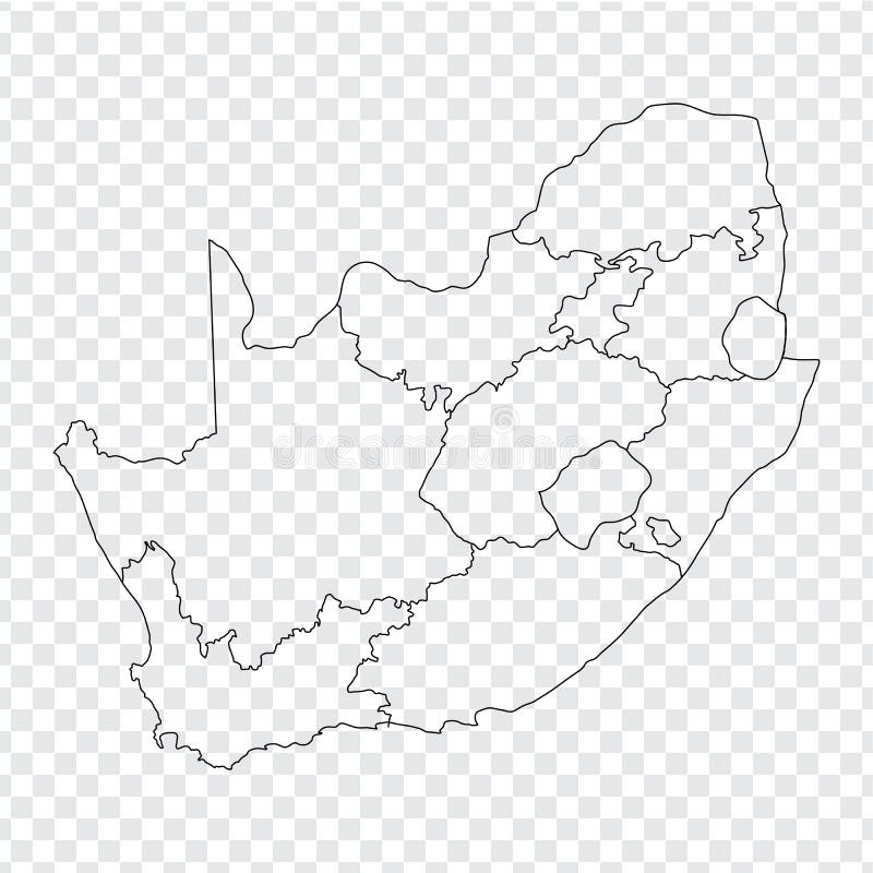
Free with trial Blank map South Africa. High quality map of South Africa with the provinces on transparent background. Stock vector. Vector illustration EPS10. Pretoria vectors Blank map South Africa. High quality map of South Africa with the provinces on transparent background. Stock vector. Vector illustration EPS10
Free with trial South Africa set. Detailed country shape with region borders, flags and icons isolated on white background. Pretoria vectors South Africa vector set. South Africa set. Detailed country shape with region borders, flags and icons isolated on white background. South Africa set. Detailed country shape with region borders, flags and icons isolated on white background.
Free with trial South African flag in the form of a big heart. Vector illustration on a white background. Brush strokes are drawn by hand. Independence Day. Pretoria vectors South African flag in the form of a big heart. Vector illustration on a white background. Brush strokes are drawn by hand. Independence Day
Free with trial Soccer South Africa balls in national flag colors in vector. South Africa is the official host of the FIFA Soccer World Cup in 2010. Pretoria vectors Soccer South Africa 2010. Soccer South Africa balls in national flag colors in vector. South Africa is the official host of the FIFA Soccer World Cup in 2010. Soccer South Africa balls in national flag colors in vector. South Africa is the official host of the FIFA Soccer World Cup in 2010.
Free with trial Vector of soccer ball with flags. Soccer ball with flags of all participants of WC 2010 in South Africa. Pretoria vectors Vector of soccer ball with flags. Soccer ball with flags of all participants of WC 2010 in South Africa
Free with trial Pretoria city skyline vector. Vectored illustration of the urban area of south africa capital of pretoria with most famous landmarks and sun beams background. Pretoria vectors Pretoria city skyline vector. Vectored illustration of the urban area of south africa capital of pretoria with most famous landmarks and sun beams background
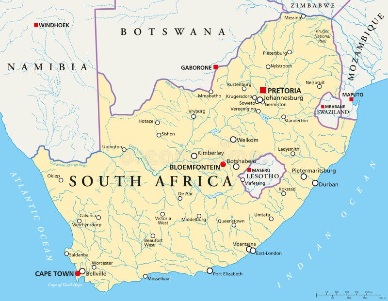
Free with trial Political map of South Africa with the capitals Pretoria, Bloemfontein and Cape Town, with national borders, most important cities, rivers and lakes. Illustration with English labeling and scaling. Pretoria vectors South Africa Political Map. Political map of South Africa with the capitals Pretoria, Bloemfontein and Cape Town, with national borders, most important cities. Political map of South Africa with the capitals Pretoria, Bloemfontein and Cape Town, with national borders, most important cities, rivers and lakes. Illustration with English labeling and scaling.
Free with trial Political map of South-Central Africa with capitals, national borders, rivers and lakes. With english labeling and scale. Pretoria vectors South-Central Africa Political Map. Political map of South-Central Africa with capitals, national borders, rivers and lakes. With english labeling and scale. Political map of South-Central Africa with capitals, national borders, rivers and lakes. With english labeling and scale.
Free with trial Travel Africa famous landmarks skyline on vintage paper sheet poster design background. Vector organized in layers for easy create your own postcard, brochure or marketing campaign. Pretoria vectors Travel Africa landmarks skyline vintage poster. Travel Africa famous landmarks skyline on vintage paper sheet poster design background. Vector organized in. Travel Africa famous landmarks skyline on vintage paper sheet poster design background. Vector organized in layers for easy create your own postcard, brochure or marketing campaign.
Free with trial Grunge rubber stamp set. With names of South Africa cities. Pretoria vectors Grunge rubber stamp set. With names of South Africa cities
Free with trial South africa administrative map. South africa administrative division map. Pretoria vectors South africa administrative map. South africa administrative division map
Free with trial High detailed South Africa physical map with labeling. Vector illustration. Pretoria vectors High detailed South Africa physical map with labeling. Vector illustration
Free with trial Vector set of african cities abstract skylines silhouettes. Pretoria vectors Vector set of african cities abstract skylines silhouettes. Set of african cities abstract skylines silhouettes
Free with trial South Africa Flag icon, isolated on white background. Pretoria vectors South Africa Flag icon. Isolated on white background
Free with trial South africa road, administrative and political vector map. Pretoria vectors South africa road, administrative and political vector map.
Free with trial Vector logo South Africa, 3 isolated images: lighthouse at Umhlanga Rocks on background national state flag, symbol RSA, banner republic of south africa, southern african ensign flags, bird blue crane. Pretoria vectors Vector logo South Africa. 3 isolated images: lighthouse at Umhlanga Rocks on background national state flag, symbol RSA, banner republic of south africa. Vector logo South Africa, 3 isolated images: lighthouse at Umhlanga Rocks on background national state flag, symbol RSA, banner republic of south africa, southern african ensign flags, bird blue crane
Free with trial Fifa World Cup 2010 South Africa vector map. Fifa World Cup Soccer 2010 South Africa vector map with cities with grass texture. Pretoria vectors Fifa World Cup 2010 South Africa vector map. Fifa World Cup Soccer 2010 South Africa vector map with cities with grass texture
Free with trial Soccer South Africa 2010. Vector of soccer field with flag of South Africa. Pretoria vectors Soccer South Africa 2010. Vector of soccer field with flag of South Africa
Free with trial Vector of soccer ball with flags. Of all qualifiers of WC 2010 in South Africa. Pretoria vectors Vector of soccer ball with flags. Of all qualifiers of WC 2010 in South Africa
Free with trial Vector of soccer ball and field with flags. Soccer ball and field with flags of all qualifiers of WC 2010 in South Africa. Pretoria vectors Vector of soccer ball and field with flags. Soccer ball and field with flags of all qualifiers of WC 2010 in South Africa
Free with trial Map soccer world cup 2010. Map with venues of soccer world cup 2010 in South Africa. Pretoria vectors Map soccer world cup 2010. Map with venues of soccer world cup 2010 in South Africa
Free with trial Rugby World Cup 2023 and champion South African team Springboks logo, world champions, vector illustration. Pretoria vectors Rugby World Cup 2023, South African team Springboks logo, world champions, vector illustration. Rugby World Cup 2023 and champion South African team Springboks. Rugby World Cup 2023 and champion South African team Springboks logo, world champions, vector illustration
Free with trial Pretoria skyline horizontal banner. Black and white silhouette of Pretoria, South Africa. Vector template for your design. Pretoria vectors Pretoria skyline horizontal banner. Black and white silhouette of Pretoria, South Africa. Vector template for your design
Free with trial Pretoria skyline silhouette. Black Pretoria city design isolated on white background. Pretoria vectors Pretoria skyline silhouette. Black Pretoria city design isolated on white background
Free with trial Pretoria skyline and landmarks silhouette, black and white design, vector illustration. Pretoria vectors Pretoria skyline and landmarks silhouette. Black and white design, vector illustration
Free with trial Pretoria South Africa city skyline silhouette white background. Pretoria South Africa city skyline silhouette. Vector illustration. Pretoria vectors Pretoria South Africa city skyline silhouette white background. Pretoria South Africa city skyline silhouette. Vector illustration
Free with trial Pretoria colorful architecture vector illustration, skyline city silhouette, skyscraper, flat design. Pretoria vectors Pretoria colorful architecture vector illustration. Skyline city silhouette, skyscraper, flat design
Free with trial Pretoria City Skyline, South Africa. Pretoria vectors Pretoria City Skyline, South Africa. Pretoria Linear City Skyline, South Africa
Free with trial Pretoria skyline. Linear style. Editable vector file. Pretoria vectors Pretoria skyline. Linear style. Editable vector file
Free with trial Cityscape Building Line art Vector Illustration design - Pretoria city. Pretoria vectors Cityscape Building Line art Vector Illustration design - Pretoria city
Free with trial Pretoria skyline, monochrome silhouette. Vector illustration. Pretoria vectors Pretoria skyline, monochrome silhouette. Vector illustration
Free with trial Pretoria South Africa skyline Detailed vector silhouette. Pretoria South Africa skyline Detailed silhouette Vector illustration. Pretoria vectors Pretoria South Africa skyline Detailed vector silhouette. Pretoria South Africa skyline Detailed silhouette Vector illustration
Free with trial Pretoria skyline silhouette in colorful geometric style. Symbol for your design. Vector illustration. Pretoria vectors Pretoria skyline silhouette in colorful geometric style. Symbol for your design. Vector illustration
Free with trial Pretoria skyline silhouette with reflection. Landscape Pretoria,South Africa. Vector illustration. Pretoria vectors Pretoria skyline silhouette with reflection. Landscape Pretoria,South Africa. Vector illustration
Free with trial Streets of Pretoria, city map, South Africa. Street map. Vector map of the city of Pretoria. Pretoria vectors Streets of Pretoria, city map, South Africa. Street map. Vector map of the city of Pretoria
Free with trial Urban vector city map of Pretoria, South Africa. Pretoria vectors Urban vector city map of Pretoria, South Africa.
Free with trial Pretoria South Africa city skyline silhouette. Vector illustration. Pretoria vectors Pretoria South Africa city skyline silhouette. Vector illustration
Free with trial Vector silhouette of Voortrekker Monument - the symbol of Pretoria, South Africa. Pretoria vectors Vector silhouette of Pretoria, South Africa. Vector silhouette of Voortrekker Monument - the symbol of Pretoria, South Africa. Vector silhouette of Voortrekker Monument - the symbol of Pretoria, South Africa.
Free with trial South Africa political map with the capitals Pretoria, Bloemfontein and Cape Town. With national borders and neighbor countries. Gray illustration with English labeling on white background. Vector. Pretoria vectors South Africa political map. With the capitals Pretoria, Bloemfontein and Cape Town. With national borders and neighbor countries. Gray illustration with English. South Africa political map with the capitals Pretoria, Bloemfontein and Cape Town. With national borders and neighbor countries. Gray illustration with English labeling on white background. Vector.
Free with trial South Africa,gray political map with nine provinces,with largest cities,and borders. Republic and southernmost country in Africa,with the three capitals Pretoria,Cape Town and Bloemfontein. Pretoria vectors South Africa, gray political map with provinces and largest cities. South Africa,gray political map with nine provinces,with largest cities,and borders. Republic. South Africa,gray political map with nine provinces,with largest cities,and borders. Republic and southernmost country in Africa,with the three capitals Pretoria,Cape Town and Bloemfontein.
Free with trial South Africa,political map with provinces,largest cities,international and administrative borders. Republic and southernmost country in Africa,with capitals Pretoria,Cape Town and Bloemfontein. Pretoria vectors South Africa, political map with provinces, largest cities and borders. South Africa,political map with provinces,largest cities,international and administrative. South Africa,political map with provinces,largest cities,international and administrative borders. Republic and southernmost country in Africa,with capitals Pretoria,Cape Town and Bloemfontein.
Free with trial Well-known building in Africa. Pretoria vectors African Architecture. Well-known building in Africa. Well-known building in Africa.
Free with trial Highly detailed vector map of Mozambique with administrative regions, main cities and roads. Pretoria vectors Mozambique map. Highly detailed vector map of Mozambique with administrative regions, main cities and roads. Highly detailed vector map of Mozambique with administrative regions, main cities and roads.
Free with trial Botswana map. Highly detailed vector map of Botswana with administrative regions, main cities and roads. Pretoria vectors Botswana map. Highly detailed vector map of Botswana with administrative regions, main cities and roads
Free with trial Ostrich farm eggs. woman peasant farmer. Pop art retro vector illustration vintage kitsch. Pretoria vectors Ostrich farm eggs. woman peasant farmer. Pop art retro vector illustration vintage kitsch
Free with trial Mozambique political map with capital Maputo. Republic and country in Southeast Africa bordered by the Indian Ocean. Gray illustration isolated on white background. English labeling. Vector. Pretoria vectors Mozambique political map. With capital Maputo. Republic and country in Southeast Africa bordered by the Indian Ocean. Gray illustration isolated on white. Mozambique political map with capital Maputo. Republic and country in Southeast Africa bordered by the Indian Ocean. Gray illustration isolated on white background. English labeling. Vector.
Free with trial Botswana political map with capital Gaborone and international borders. Republic and landlocked country in Southern Africa. Former Bechuanaland. Gray illustration with English labeling. Vector. Pretoria vectors Botswana political map. With capital Gaborone and international borders. Republic and landlocked country in Southern Africa. Former Bechuanaland. Gray. Botswana political map with capital Gaborone and international borders. Republic and landlocked country in Southern Africa. Former Bechuanaland. Gray illustration with English labeling. Vector.
Free with trial Administrative vector map of the Republic of Botswana. Pretoria vectors Administrative vector map of the Republic of Botswana.
Free with trial Highly Detailed South Africa Silhouette map. Vector illustration. Pretoria vectors Highly Detailed South Africa Silhouette map. Vector illustration
Free with trial Map of the Orange River Drainage Basin in southern Africa. Pretoria vectors Map of the Orange River Drainage Basin in southern Africa.
Free with trial High detailed South Africa physical map. Vector illustration. Pretoria vectors High detailed South Africa physical map. Vector illustration
Free with trial South africa road and National Park map. Pretoria vectors South africa road and National Park map.
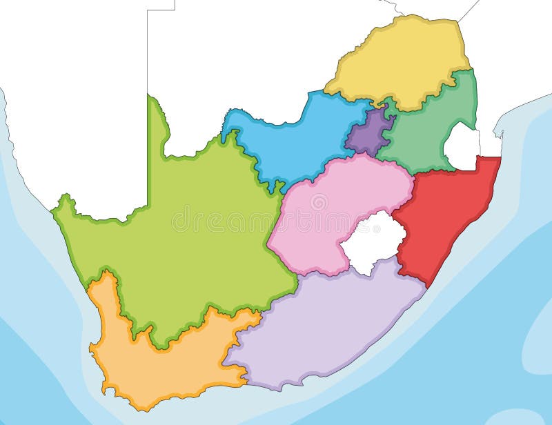
Free with trial Vector illustrated blank map of South Africa with provinces and administrative divisions, and neighbouring countries. Editable and clearly labeled layers. Pretoria vectors Vector illustrated blank map of South Africa with provinces and administrative divisions, and neighbouring countries. Editable and clearly labeled layers
Free with trial Road map of the states of southern Africa. Pretoria vectors Road map of the states of southern Africa.
Free with trial Vector illustrated map of South Africa with provinces and administrative divisions, and neighbouring countries. Editable and clearly labeled layers. Pretoria vectors Vector illustrated map of South Africa with provinces and administrative divisions, and neighbouring countries. Editable and clearly labeled layers
Free with trial Colorful South Africa political map with clearly labeled, separated layers. Vector illustration. Pretoria vectors Colorful South Africa political map with clearly labeled, separated layers. Vector illustration
Free with trial Highly detailed editable political map with separated layers. South Africa. Vector illustration. Pretoria vectors Highly detailed editable political map with separated layers. South Africa. Vector illustration
Free with trial Vector map of South Africa with provinces and administrative divisions. Editable and clearly labeled layers. Pretoria vectors Vector map of South Africa with provinces and administrative divisions. Editable and clearly labeled layers
Free with trial The detailed map of South Africa with regions or states. Administrative division. Vector illustration. Pretoria vectors The detailed map of South Africa with regions or states. Administrative division. Vector illustration
Free with trial South Africa - Highly detailed editable political map with labeling. Vector illustration. Pretoria vectors South Africa - Highly detailed editable political map with labeling. Vector illustration
Free with trial South Africa map design. South Africa map icon vector illustration symbol design. Pretoria vectors South Africa map design. South Africa map icon vector illustration symbol design
Free with trial South africa Landmark Global Travel And Journey paper background. Vector Design Template. used for your advertisement, book, banner, template, travel business or presentation. Pretoria vectors South africa Landmark Global Travel And Journey paper background. Vector Design Template.used for your advertisement, book, banner, template, travel business
Free with trial South africa Landmark Global Travel And Journey paper background. Vector Design Template. used for your advertisement, book, banner, template, travel business or presentation. Pretoria vectors South africa Landmark Global Travel And Journey paper background. Vector Design Template.used for your advertisement, book, banner, template, travel business
Free with trial South africa Landmark Global Travel And Journey paper background. Vector Design Template. used for your advertisement, book, banner, template, travel business or presentation. Pretoria vectors South africa Landmark Global Travel And Journey paper background. Vector Design Template.used for your advertisement, book, banner, template, travel business
Free with trial South africa Landmark Global Travel And Journey paper background. Vector Design Template. used for your advertisement, book, banner, template, travel business or presentation. Pretoria vectors South africa Landmark Global Travel And Journey paper background. Vector Design Template.used for your advertisement, book, banner, template, travel business
Free with trial South africa Landmark Global Travel And Journey paper background. Vector Design Template. used for your advertisement, book, banner, template, travel business or presentation. Pretoria vectors South africa Landmark Global Travel And Journey paper background. Vector Design Template.used for your advertisement, book, banner, template, travel business
Free with trial South africa Landmark Global Travel And Journey paper background. Vector Design Template. used for your advertisement, book, banner, template, travel business or presentation. Pretoria vectors South africa Landmark Global Travel And Journey paper background. Vector Design Template.used for your advertisement, book, banner, template, travel business
 Sign in