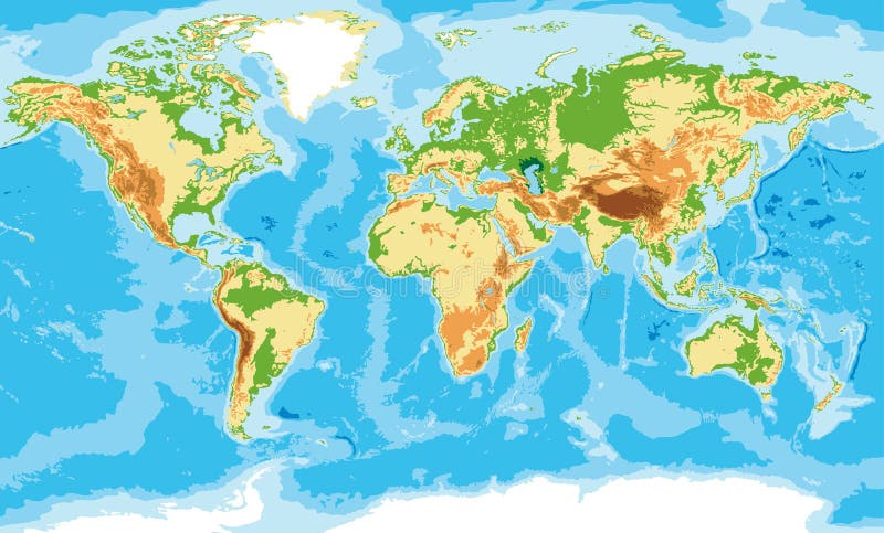
Free with trial Highly detailed physical map of the world,in vector format,with all the relief forms,countries and big cities. Southern vectors Physical map of the world. Highly detailed physical map of the world,in vector format,with all the relief forms,countries and big cities. Highly detailed physical map of the world,in vector format,with all the relief forms,countries and big cities.
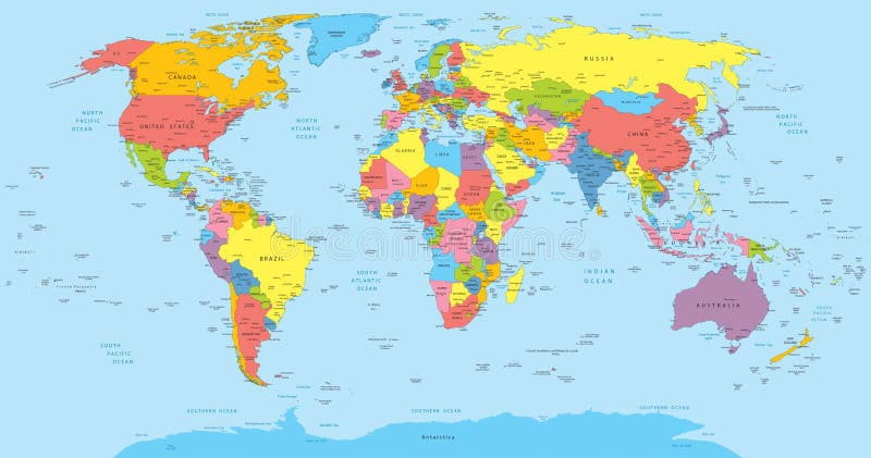
Free with trial Vector illustration of a High Detail Political Map of the world with different colors for each country. Each country has its capital and major cities. All seas and major lakes are named. Global colors used. All elements are separated in editable layers. Southern vectors World map with countries, country and city names. Vector illustration of a High Detail Political Map of the world with different colors for each country. Each. Vector illustration of a High Detail Political Map of the world with different colors for each country. Each country has its capital and major cities. All seas and major lakes are named. Global colors used. All elements are separated in editable layers.
Free with trial Vector Globe and World Map. With difference countries. Southern vectors Vector Globe and World Map. With difference countries
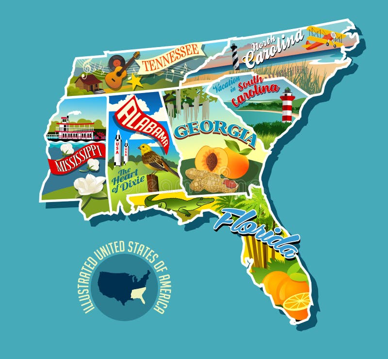
Free with trial Illustrated pictorial map of Southern United States. Includes Tennessee, Carolinas, Georgia, Florida, Alabama and Mississippi. Vector Illustration. Southern vectors Illustrated pictorial map of Southern United States. Includes Tennessee, Carolinas, Georgia, Florida, Alabama and Mississippi. Vector Illustration
Free with trial High detailed sky map of Southern hemisphere with names of stars. And constellations colored on white. Southern vectors High detailed sky map of Southern hemisphere with names of stars. And constellations colored on white
Free with trial Tilt of the Earth`s axis. seasons is the result from the Earth`s axis of rotation being tilted with respect to its orbital plane. the northern and southern hemispheres always experience opposite seasons. One part of the planet is more directly exposed to the rays of the Sun. Southern vectors Tilt of the Earth`s axis and Earth`s seasons. Tilt of the Earth`s axis. seasons is the result from the Earth`s axis of rotation being tilted with respect to its. Tilt of the Earth`s axis. seasons is the result from the Earth`s axis of rotation being tilted with respect to its orbital plane. the northern and southern hemispheres always experience opposite seasons. One part of the planet is more directly exposed to the rays of the Sun.
Free with trial Animal portrait flat icon set. African southern animal portrait flat icons set with hyena elephant jaguar isolated vector illustration. Southern vectors Animal portrait flat icon set. African southern animal portrait flat icons set with hyena elephant jaguar isolated vector illustration
Free with trial Traditional southern stars and bars confederate rebel flag. Southern vectors Confederate Rebel Flag. Traditional southern stars and bars confederate rebel flag. Traditional southern stars and bars confederate rebel flag.
Free with trial A vector illustration of a Peach. Southern vectors Peach. A vector illustration of a Peach. A vector illustration of a Peach.
Free with trial Illustration of six phases of the globe, white background. Southern vectors Globe phases. Illustration of six phases of the globe, white background. Illustration of six phases of the globe, white background.
Free with trial Banjo vector. Illustrations of banjo isolated on white background + vector eps file. Southern vectors Banjo vector. Illustrations of banjo isolated on white background + vector eps file. Illustrations of banjo isolated on white background + vector eps file
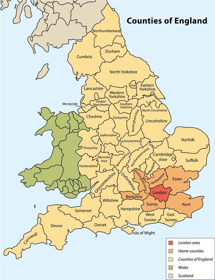
Free with trial Counties of England on vector map. Southern vectors Counties of England. On vector map
Free with trial Bingata: traditional design of Okinawa. Okinawa is one of Japanese prefecture. Southern vectors Set of Bingata banners. Bingata: traditional design of Okinawa. Okinawa is one of Japanese prefecture. Bingata: traditional design of Okinawa. Okinawa is one of Japanese prefecture.
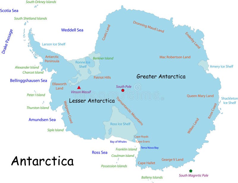
Free with trial Antarctica map designed in illustration with the names place. Southern vectors Antarctica map. Designed in illustration with the names place
Free with trial An illustration of the state of Florida. Southern vectors State of Florida. An illustration of the state of Florida. An illustration of the state of Florida.
Free with trial Illustration of globe with cross design isolated on white background. Southern vectors Globe with cross. Illustration of globe with cross design isolated on white background. Illustration of globe with cross design isolated on white background.
Free with trial An illustration of the state of California. Southern vectors State of California Outline. An illustration of the state of California. An illustration of the state of California.
Free with trial Spain Map - Vector Illustration Design Element. Southern vectors SPAIN MAP. Vector Illustration Design Element. Spain Map - Vector Illustration Design Element
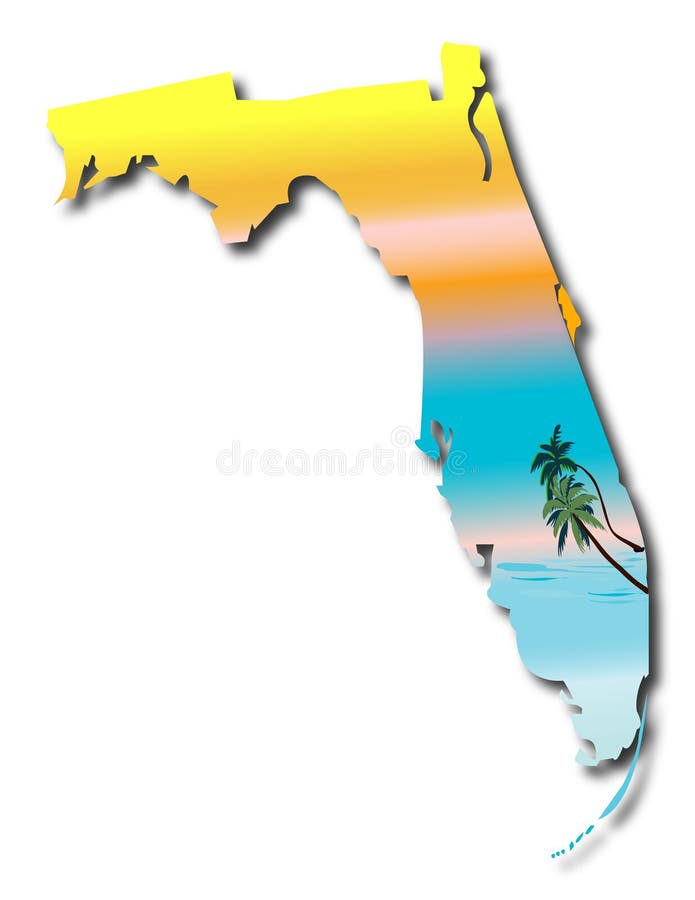
Free with trial Map of Florida. Florida State Map with sunshine and palms background vector. Southern vectors Map of Florida. Florida State Map with sunshine and palms background vector
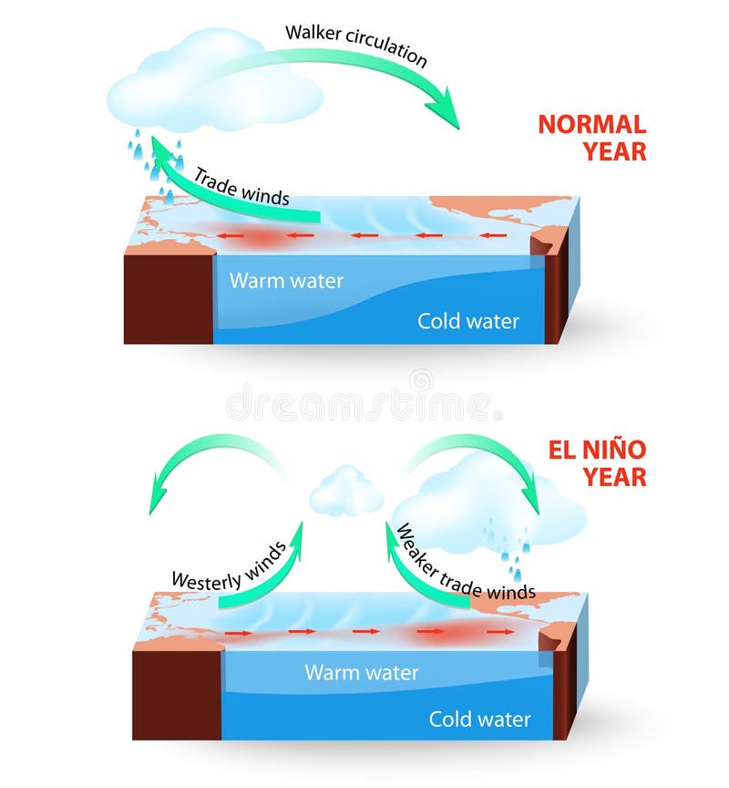
Free with trial El Nino Southern Oscillation (ENSO) is a global phenomenon in ocean and atmosphere. For an unknown reason El Nino events occur irregularly at intervals once every 2-7 years. The effects of El Niño mess up normal winter conditions throughout the Pacific Ocean and change global weather patterns and disrupt fisheries worldwide. Southern vectors Vector infographic. Cross section of El Nino South. El Nino Southern Oscillation (ENSO) is a global phenomenon in ocean and atmosphere. For an unknown reason El. El Nino Southern Oscillation (ENSO) is a global phenomenon in ocean and atmosphere. For an unknown reason El Nino events occur irregularly at intervals once every 2-7 years. The effects of El Niño mess up normal winter conditions throughout the Pacific Ocean and change global weather patterns and disrupt fisheries worldwide.
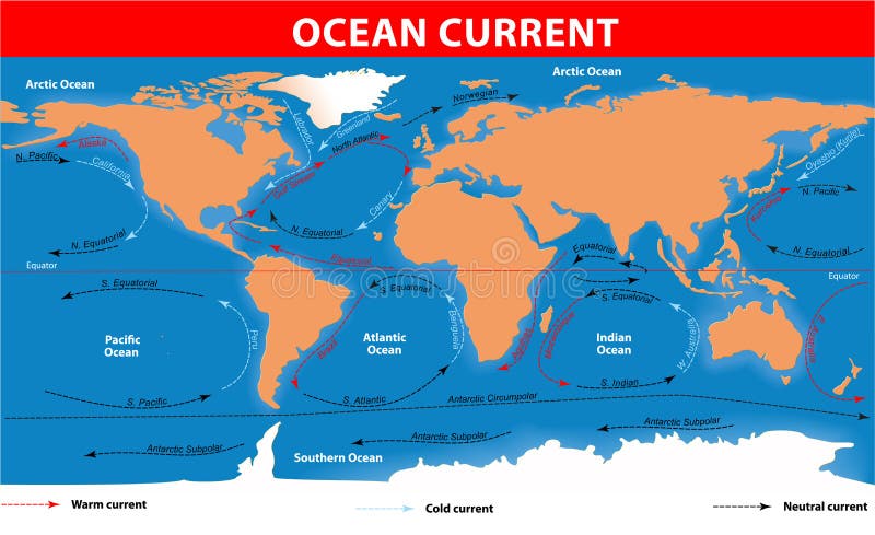
Free with trial Ocean surface currents. The ocean currents. Vector map. Southern vectors Ocean surface currents. The ocean currents. Vector map
Free with trial World logo. Business vector,illustration. Southern vectors World logo. Business vector,illustration
Free with trial Antarctica Political Map with south pole, scientific research stations and ice shelfs. English labeling and scaling. Illustration. Southern vectors Antarctica Political Map. With south pole, scientific research stations and ice shelfs. English labeling and scaling. Illustration
Free with trial An illustration of the state of Texas. Southern vectors State of Texas. An illustration of the state of Texas. An illustration of the state of Texas.
Free with trial An illustration of the state of California. Southern vectors State of California. An illustration of the state of California. An illustration of the state of California.
Free with trial An illustration of the state of Texas. Southern vectors State of Texas Outline. An illustration of the state of Texas. An illustration of the state of Texas.
Free with trial An illustration of the state of Florida. Southern vectors State of Florida Outline. An illustration of the state of Florida. An illustration of the state of Florida.
Free with trial Vectored illustration of standing penguin, a symbolic animal for many countries and territories as antarctica, falkland islands and southern chile. Southern vectors Penguin vector silhouette. Vectored illustration of standing penguin, a symbolic animal for many countries and territories as antarctica, falkland islands and. Vectored illustration of standing penguin, a symbolic animal for many countries and territories as antarctica, falkland islands and southern chile.
Free with trial Smiling sun. With glasses. Vector illustration. Southern vectors Smiling sun. With glasses. Vector illustration
Free with trial Globe. This image is a vector illustration Globe. Southern vectors Globe. This image is a vector illustration Globe
Free with trial Vintage metal sign - Delicious Chicken Dinners - Vector EPS 10 - Grunge and rusty effects can be easily removed for a cleaner look. Southern vectors Vintage metal sign - Delicious Chicken Dinners. Vector EPS 10 - Grunge and rusty effects can be easily removed for a cleaner look
Free with trial Luggage stickers Tennessee, South Carolina, North Carolina. Illustrations of south eastern united states. Southern vectors Luggage stickers Tennessee, South Carolina, North Carolina. Illustrations of south eastern united states
Free with trial Hawaii State map. Hawaii state vector map all islands. Southern vectors Hawaii State map. Hawaii state vector map all islands
Free with trial World map vector. Vector illustration. Southern vectors World map vector. Vector illustration
Free with trial New Orleans. Vector. Louisiana USA. Southern vectors New Orleans. Vector. New Orleans.Louisiana USA. Vector
Free with trial A map of the UK with postcode areas identified and coloured, created within Adobe Illustrator CS2 and can be edited. Continent placed on a white background. Southern vectors Postcode Map of UK. A map of the UK with postcode areas identified and coloured, created within Adobe Illustrator CS2 and can be edited. Continent placed on a. A map of the UK with postcode areas identified and coloured, created within Adobe Illustrator CS2 and can be edited. Continent placed on a white background.
Free with trial Illinois State map. Illinois State vector map by counties. Southern vectors Illinois State map. Illinois State vector map by counties
Free with trial California State Map. Vector map of California State by counties. Southern vectors California State Map. Vector map of California State by counties
Free with trial Latin America single states political map. Countries in different colors, with national borders and English country names. From Mexico to the southern tip of South America, including the Caribbean. Southern vectors Latin America single states political map. Countries in different colors, with national borders and English country names. From Mexico to the southern tip of
Free with trial Drawing of state of Texas. Outline drawing of the state of Texas. Southern vectors Drawing of state of Texas. Outline drawing of the state of Texas
Free with trial Colorful butterfly. Vector. Very realistic Colorful butterfly in vector. Southern vectors Colorful butterfly. Vector. Very realistic Colorful butterfly in vector
Free with trial Vector green globe and world map for design elements. Southern vectors Vector Green Globe and World Map. For design elements. Vector green globe and world map for design elements
Free with trial Colorful Skyline of Asian Cities. Skyline of Asian Cities for design. Southern vectors Colorful Skyline of Asian Cities. Skyline of Asian Cities for design
Free with trial Equator latitude and longitude vector illustration. Equator grid line explanation with northern and southern hemisphere, prime and tropic of cancer. Geographic axis position and location angle point. Southern vectors Equator latitude or longitude vector illustration. Equator line explanation. Equator latitude and longitude vector illustration. Equator grid line explanation. Equator latitude and longitude vector illustration. Equator grid line explanation with northern and southern hemisphere, prime and tropic of cancer. Geographic axis position and location angle point.
Free with trial Florida United States travel poster. Florida travel poster. detailed vector illustration of scenic beach with striped beach umbrella. Southern vectors Florida United States travel poster. Florida travel poster. detailed vector illustration of scenic beach with striped beach umbrella
Free with trial Illustration jungle with red flowers. Southern vectors Illustration jungle with red flowers.
Free with trial Globe. Vector Globe and Map of the World. Southern vectors Globe. Vector Globe and Map of the World
Free with trial All people of the world or the Global Christian Population of Earth under a Cross. Southern vectors World Global Christian Earth under Cross. All people of the world or the Global Christian Population of Earth under a Cross. All people of the world or the Global Christian Population of Earth under a Cross.
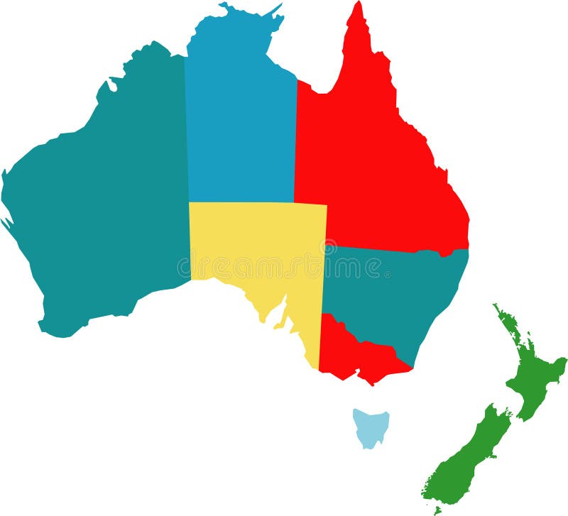
Free with trial Australia. Vector map of australia counties. Southern vectors Australia. Vector map of australia counties
Free with trial Hillbilly. A goofy hillbilly looking for someone to play his banjo for. Vector file included AI8. Southern vectors Hillbilly. A goofy hillbilly looking for someone to play his banjo for. Vector file included AI8
Free with trial Llustration with flowers and jungle toucan. Southern vectors Llustration with flowers and jungle toucan.
Free with trial Aqua blue vector world globe illustration. Southern vectors World Globe. Aqua blue vector world globe illustration. Aqua blue vector world globe illustration.
Free with trial World globe as blue glass ball. Southern vectors World Globe. As blue glass ball. World globe as blue glass ball
Free with trial Summer stamps. Set of different grungy summer- and holiday-themed rubber stamps. Southern vectors Summer stamps. Set of different grungy summer- and holiday-themed rubber stamps
Free with trial Pregnant woman 3. The pregnant woman. A vector illustration. Southern vectors Pregnant woman 3. The pregnant woman. A vector illustration
Free with trial Penguin Collection is hand drawn original artwork. The vector file is in AI-EPS8 format,. Southern vectors Penguin Collection. Is hand drawn original artwork. The vector file is in AI-EPS8 format
Free with trial Aqua blue vector world globe. Southern vectors Vector world globe. Aqua blue vector world globe. Aqua blue vector world globe.
Free with trial Globe of the world. Set of globe of the world vector. Southern vectors Globe of the world. Set of globe of the world vector
Free with trial General Mascot Logo. Vector Image of General Mascot Logo. Southern vectors General Mascot Logo. Vector Image of General Mascot Logo
Free with trial Antique map banners. Set of three grungy retro-styled banners based on antique maps. Southern vectors Antique map banners. Set of three grungy retro-styled banners based on antique maps
Free with trial Holiday cottage logo. Illustrated logo showing a small (holiday) cottage in tuscany, italy. Southern vectors Holiday cottage logo. Illustrated logo showing a small (holiday) cottage in tuscany, italy
Free with trial Globe and detail map of the world, Vector file easy to edit or change color. Southern vectors Globe map of the world. Globe and detail map of the world, Vector file easy to edit or change color. Globe and detail map of the world, Vector file easy to edit or change color.
Free with trial Crawfish Boil Invitation. Hot steamy kettle of crawfish with a green tablecloth frame. Southern vectors Crawfish Boil Invitation. Hot steamy kettle of crawfish with a green tablecloth frame
Free with trial Highly detailed physical map of the world,in vector format,with all the relief forms. Southern vectors Physical map of the world. Highly detailed physical map of the world,in vector format,with all the relief forms. Highly detailed physical map of the world,in vector format,with all the relief forms.
Free with trial World map. Vector illustration. Vector illustration of blue world map. Southern vectors World map. Vector illustration. Vector illustration of blue world map
Free with trial Vector dotted Map and Globe of the World. Easy change colors. Southern vectors Vector Dotted Map of the World. Vector dotted Map and Globe of the World. Easy change colors. Vector dotted Map and Globe of the World. Easy change colors.
Free with trial Georgia travel poster or sticker. Vector illustration of bald cypress in wetland swamp. Southern vectors Georgia travel poster or sticker. Vector illustration of bald cypress in wetland swamp
Free with trial Detailed world maps vector. Two detailed world maps, one with country borders, vector illustration. Southern vectors Detailed world maps vector. Two detailed world maps, one with country borders, vector illustration
Free with trial Vector dotted Globe of the World. Vector image. Southern vectors Vector Dotted Globes of the World. Vector dotted Globe of the World. Vector image. Vector dotted Globe of the World. Vector image.
Free with trial Louisiana travel poster or sticker. Vector illustration of paddle wheel riverboat and scenic landscape. Southern vectors Louisiana travel poster or sticker. Vector illustration of paddle wheel riverboat and scenic landscape
Free with trial Earth globes and map of the world, detailed vector illustration. Southern vectors Earth globes and map of the world. Detailed vector illustration
Free with trial Globe of the World in Different Position. S. Check my portfolio for similar vecor image and other image. Southern vectors Globe of the World in Different Position. S.Check my portfolio for similar vecor image and other image
Free with trial Vector design template with earth globe and map. Clean futuristic vector design template with earth globe and map. Southern vectors Vector design template with earth globe and map. Clean futuristic vector design template with earth globe and map
Free with trial Summer beach party poster design template with palm trees, banner tropical background. Vector illustration. Southern vectors Summer beach party poster design template with palm trees, banner tropical background. Vector illustration
Free with trial Kids in different traditional costumes (Greece, Italy, Portugal, Serbia). Southern vectors Kids in different traditional costumes (Greece, Italy, Portugal,. Serbia
Free with trial Indiana State map by counties. Indiana State vector map by counties. Southern vectors Indiana State map by counties. Indiana State vector map by counties
Free with trial Summer beach party poster design template with palm trees, banner tropical background. Vector illustration. Southern vectors Summer beach party poster design template with palm trees, banner tropical background. Vector illustration
Free with trial Grunge retro metal sign with palm trees and van. Surfing in California. Vintage advertising poster. Old fashioned design. Southern vectors Grunge retro metal sign with palm trees and van. Surfing in California. Vintage advertising poster. Old fashioned design.
Free with trial Vector round frame of watercolor orange and flowers. Watercolor illustration wreath of mandarin and leaves. Can be used as a greeting card for background, birthday, mother's day and so on. Southern vectors Vector round frame of watercolor orange and flowers. Watercolor illustration wreath of mandarin and leaves. Can be used as a greeting card for background
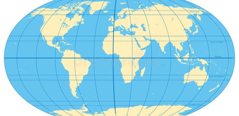
Free with trial World map with most important circles of latitudes and longitudes, showing Equator, Greenwich meridian, Arctic and Antarctic Circle, Tropic of Cancer and Capricorn. English. Illustration. Vector. Southern vectors World map with most important circles of latitudes and longitudes. Showing Equator, Greenwich meridian, Arctic and Antarctic Circle, Tropic of Cancer and. World map with most important circles of latitudes and longitudes, showing Equator, Greenwich meridian, Arctic and Antarctic Circle, Tropic of Cancer and Capricorn. English. Illustration. Vector.
 Sign in