Free with trial A Set of highway road signs seen in the US. Available in vector EPS format. State highway vectors US Highway Signs EPS. A Set of highway road signs seen in the US. Available in vector EPS format. A Set of highway road signs seen in the US. Available in vector EPS format.
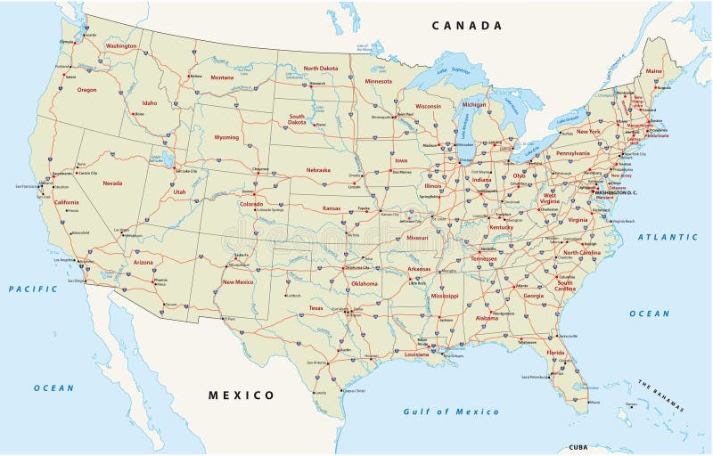
Free with trial Us interstate highway map. Map of the united states with the main streets, highways. State highway vectors Us interstate highway map. Map of the united states with the main streets, highways
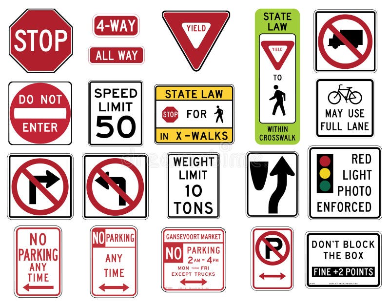
Free with trial Vector Illustration collection of the select Traffic Signs in the United States, isolated on white background. You can find other road signs in my portfolio. EPS file available. In the United States, road signs are, for the most part, standardized by federal regulations, most notably in the Manual on Uniform Traffic Control Devices (MUTCD) and its companion volume the Standard Highway Signs (SHS). There currently are no plans for adopting the Vienna Convention on Road Signs and Signals standards. Twenty-three states along with the District of Columbia and Puerto Rico use the manual without any alterations, 20 states have adopted it in conjunction with a supplemental volume, and seven states have a state version in substantial conformance to the MUTCD. There are also localized versions that are used in large cities such as New York City which use a naming system compatible with the MUTCD and/or state supplement. The MUTCD and SHS establish seven general categories of signs for road and highway use. Included illustrations are select examples of the following MUTCD categories: -- R1 Series STOP and YIELD -- R2 Series Speed Limit -- R3 Series Lane Usage and Turns (Left and Right Turn) -- R4 Regulation of Movement -- R5 Series: Exclusionary -- R7 Series: Parking. State highway vectors Traffic Signs in the United States - Regulatory Series. Vector Illustration collection of the select Traffic Signs in the United States, isolated on white. Vector Illustration collection of the select Traffic Signs in the United States, isolated on white background. You can find other road signs in my portfolio. EPS file available. In the United States, road signs are, for the most part, standardized by federal regulations, most notably in the Manual on Uniform Traffic Control Devices (MUTCD) and its companion volume the Standard Highway Signs (SHS). There currently are no plans for adopting the Vienna Convention on Road Signs and Signals standards. Twenty-three states along with the District of Columbia and Puerto Rico use the manual without any alterations, 20 states have adopted it in conjunction with a supplemental volume, and seven states have a state version in substantial conformance to the MUTCD. There are also localized versions that are used in large cities such as New York City which use a naming system compatible with the MUTCD and/or state supplement. The MUTCD and SHS establish seven general categories of signs for road and highway use. Included illustrations are select examples of the following MUTCD categories: -- R1 Series STOP and YIELD -- R2 Series Speed Limit -- R3 Series Lane Usage and Turns (Left and Right Turn) -- R4 Regulation of Movement -- R5 Series: Exclusionary -- R7 Series: Parking
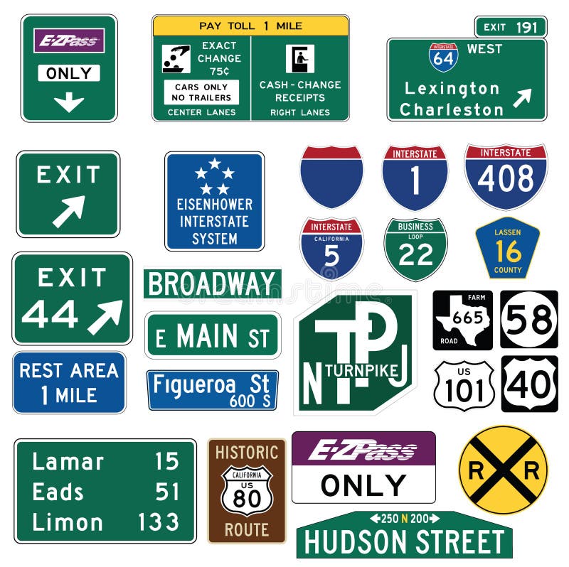
Free with trial Vector Illustration collection of the select Traffic Signs in the United States, isolated on white background. You can find other road signs in my portfolio. EPS file available. Guide signs are essential to direct road users along streets and highways, to inform them of intersecting routes, rnto direct them to cities, towns, villages, or other important destinations, to identify nearby rivers and streams, parks, forests, and historical sites, and generally to give such information as will help them along their way in the most simple, direct manner possible. rnrnIn the United States, road signs are, for the most part, standardized by federal regulations, most notably in the Manual on Uniform Traffic Control Devices (MUTCD) and its companion volume the Standard Highway Signs (SHS). There currently are no plans for adopting the Vienna Convention on Road Signs and Signals standards. Twenty-three states along with the District of Columbia and Puerto Rico use the manual without any alterations, 20 states have adopted it in conjunction with a supplemental volume, and seven states have a state version in substantial conformance to the MUTCD. There are also localized versions that are used in large cities such as New York City which use a naming system compatible with the MUTCD and/or state supplement. The MUTCD and SHS establish seven general categories of signs for road and highway use. rnrnIncluded illustrations are select examples of the MUTCD Guide Signs categories. rn. State highway vectors Traffic Guide Signs in the United States. Vector Illustration collection of the select Traffic Signs in the United States, isolated on white background. You can. Vector Illustration collection of the select Traffic Signs in the United States, isolated on white background. You can find other road signs in my portfolio. EPS file available. Guide signs are essential to direct road users along streets and highways, to inform them of intersecting routes, rnto direct them to cities, towns, villages, or other important destinations, to identify nearby rivers and streams, parks, forests, and historical sites, and generally to give such information as will help them along their way in the most simple, direct manner possible.rnrnIn the United States, road signs are, for the most part, standardized by federal regulations, most notably in the Manual on Uniform Traffic Control Devices (MUTCD) and its companion volume the Standard Highway Signs (SHS). There currently are no plans for adopting the Vienna Convention on Road Signs and Signals standards. Twenty-three states along with the District of Columbia and Puerto Rico use the manual without any alterations, 20 states have adopted it in conjunction with a supplemental volume, and seven states have a state version in substantial conformance to the MUTCD. There are also localized versions that are used in large cities such as New York City which use a naming system compatible with the MUTCD and/or state supplement. The MUTCD and SHS establish seven general categories of signs for road and highway use.rnrnIncluded illustrations are select examples of the MUTCD Guide Signs categories.rn
Free with trial Interstate and highway road signs. State highway vectors Blank Interstate and Highway Signs. Interstate and highway road signs. Interstate and highway road signs.
Free with trial Texas Interstate Map. Texas State Interstate and US Highway Map. State highway vectors Texas Interstate Map. Texas State Interstate and US Highway Map
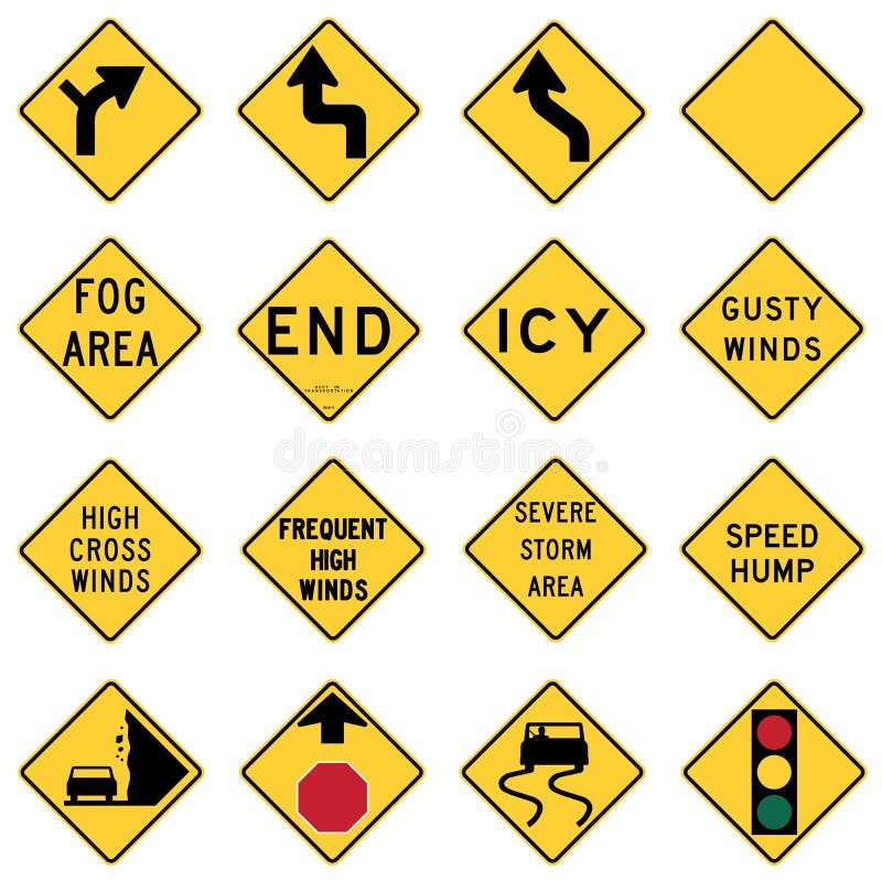
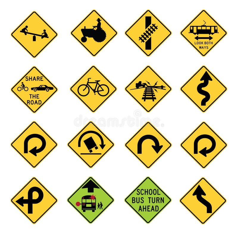
Free with trial Vector Illustration collection of the select Traffic Signs in the United States, isolated on white background. You can find other road signs in my portfolio. EPS file available. Warning signs are found in the W series of the national MUTCD. They highlight existing conditions, such as a curve, school, dead end street, or traffic signal. They can also warn possible danger such as bumps, bicycles, low flying aircraft or emergency vehicles. These signs are either yellow or fluorescent yellow in color and with the exception of a few signs are usually diamond shaped and sometimes have square or rectangular smaller signs or plaques associated with them. Most W series signs can also be found in with orange backgrounds, for temporary use in situations such as construction zones. Some of the temporary use signs are only for use in temporary situations. In the United States, road signs are, for the most part, standardized by federal regulations, most notably in the Manual on Uniform Traffic Control Devices (MUTCD) and its companion volume the Standard Highway Signs (SHS). There currently are no plans for adopting the Vienna Convention on Road Signs and Signals standards. Twenty-three states along with the District of Columbia and Puerto Rico use the manual without any alterations, 20 states have adopted it in conjunction with a supplemental volume, and seven states have a state version in substantial conformance to the MUTCD. There are also localized versions that are used in large cities such as New York City which use a naming system compatible with the MUTCD and/or state supplement. The MUTCD and SHS establish seven general categories of signs for road and highway use. Included illustrations are select examples of the MUTCD Warning Signs categories. State highway vectors Traffic Warning Signs in the United States. Vector Illustration collection of the select Traffic Signs in the United States, isolated on white background. You. Vector Illustration collection of the select Traffic Signs in the United States, isolated on white background. You can find other road signs in my portfolio. EPS file available. Warning signs are found in the W series of the national MUTCD. They highlight existing conditions, such as a curve, school, dead end street, or traffic signal. They can also warn possible danger such as bumps, bicycles, low flying aircraft or emergency vehicles. These signs are either yellow or fluorescent yellow in color and with the exception of a few signs are usually diamond shaped and sometimes have square or rectangular smaller signs or plaques associated with them. Most W series signs can also be found in with orange backgrounds, for temporary use in situations such as construction zones. Some of the temporary use signs are only for use in temporary situations. In the United States, road signs are, for the most part, standardized by federal regulations, most notably in the Manual on Uniform Traffic Control Devices (MUTCD) and its companion volume the Standard Highway Signs (SHS). There currently are no plans for adopting the Vienna Convention on Road Signs and Signals standards. Twenty-three states along with the District of Columbia and Puerto Rico use the manual without any alterations, 20 states have adopted it in conjunction with a supplemental volume, and seven states have a state version in substantial conformance to the MUTCD. There are also localized versions that are used in large cities such as New York City which use a naming system compatible with the MUTCD and/or state supplement. The MUTCD and SHS establish seven general categories of signs for road and highway use. Included illustrations are select examples of the MUTCD Warning Signs categories.
Free with trial Vector Illustration collection of the select Traffic Signs in the United States, isolated on white background. You can find other road signs in my portfolio. EPS file available. Warning signs are found in the W series of the national MUTCD. They highlight existing conditions, such as a curve, school, dead end street, or traffic signal. They can also warn possible danger such as bumps, bicycles, low flying aircraft or emergency vehicles. These signs are either yellow or fluorescent yellow in color and with the exception of a few signs are usually diamond shaped and sometimes have square or rectangular smaller signs or plaques associated with them. Most W series signs can also be found in with orange backgrounds, for temporary use in situations such as construction zones. Some of the temporary use signs are only for use in temporary situations. In the United States, road signs are, for the most part, standardized by federal regulations, most notably in the Manual on Uniform Traffic Control Devices (MUTCD) and its companion volume the Standard Highway Signs (SHS). There currently are no plans for adopting the Vienna Convention on Road Signs and Signals standards. Twenty-three states along with the District of Columbia and Puerto Rico use the manual without any alterations, 20 states have adopted it in conjunction with a supplemental volume, and seven states have a state version in substantial conformance to the MUTCD. There are also localized versions that are used in large cities such as New York City which use a naming system compatible with the MUTCD and/or state supplement. The MUTCD and SHS establish seven general categories of signs for road and highway use. Included illustrations are select examples of the MUTCD Warning Signs categories. State highway vectors Traffic Warning Signs in the United States. Vector Illustration collection of the select Traffic Signs in the United States, isolated on white background. You. Vector Illustration collection of the select Traffic Signs in the United States, isolated on white background. You can find other road signs in my portfolio. EPS file available. Warning signs are found in the W series of the national MUTCD. They highlight existing conditions, such as a curve, school, dead end street, or traffic signal. They can also warn possible danger such as bumps, bicycles, low flying aircraft or emergency vehicles. These signs are either yellow or fluorescent yellow in color and with the exception of a few signs are usually diamond shaped and sometimes have square or rectangular smaller signs or plaques associated with them. Most W series signs can also be found in with orange backgrounds, for temporary use in situations such as construction zones. Some of the temporary use signs are only for use in temporary situations. In the United States, road signs are, for the most part, standardized by federal regulations, most notably in the Manual on Uniform Traffic Control Devices (MUTCD) and its companion volume the Standard Highway Signs (SHS). There currently are no plans for adopting the Vienna Convention on Road Signs and Signals standards. Twenty-three states along with the District of Columbia and Puerto Rico use the manual without any alterations, 20 states have adopted it in conjunction with a supplemental volume, and seven states have a state version in substantial conformance to the MUTCD. There are also localized versions that are used in large cities such as New York City which use a naming system compatible with the MUTCD and/or state supplement. The MUTCD and SHS establish seven general categories of signs for road and highway use. Included illustrations are select examples of the MUTCD Warning Signs categories.
Free with trial Pennsylvania state road map with Interstates and U. S. Highways. All elements on 4 separate layers (State Fill, State Outline, Roads, Cities) for easy editing. Source: Public domain National Planning Network ( and United States Federal Highway Administration. State highway vectors Pennsylvania Interstate Map. Pennsylvania state road map with Interstates and U.S. Highways. All elements on 4 separate layers (State Fill, State Outline. Pennsylvania state road map with Interstates and U.S. Highways. All elements on 4 separate layers (State Fill, State Outline, Roads, Cities) for easy editing. Source: Public domain National Planning Network ( and United States Federal Highway Administration
Free with trial Us interstate highway, administrative and political vector map. State highway vectors Us interstate highway, administrative and political vector map.
Free with trial California state car license plate, letters, numbers and symbols, vector illustration, United States of America. State highway vectors California state car license plate, letters, numbers and symbols, vector illustration, USA. California state car license plate, letters, numbers and symbols. California state car license plate, letters, numbers and symbols, vector illustration, United States of America
Free with trial Vector illustration of a Route 66 highway sign. State highway vectors Route 66. Vector illustration of a Route 66 highway sign. Vector illustration of a Route 66 highway sign.
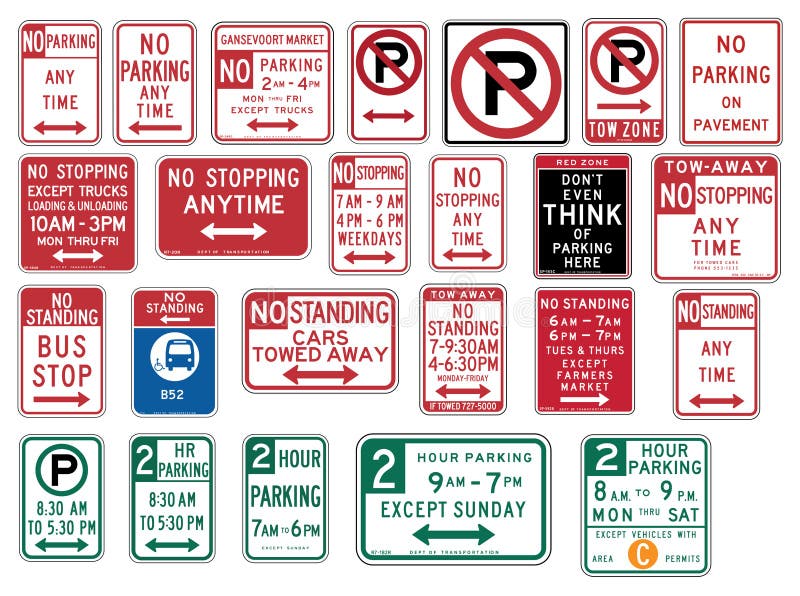
Free with trial Vector Illustration collection of the select Traffic Signs in the United States, isolated on white background. You can find other road signs in my portfolio. EPS file available. rnrnIn the United States, road signs are, for the most part, standardized by federal regulations, most notably in the Manual on Uniform Traffic Control Devices (MUTCD) and its companion volume the Standard Highway Signs (SHS). There currently are no plans for adopting the Vienna Convention on Road Signs and Signals standards. rnTwenty-three states along with the District of Columbia and Puerto Rico use the manual without any alterations, 20 states have adopted it in conjunction with a supplemental volume, and seven states have a state version in substantial conformance to the MUTCD. There are also localized versions that are used in large cities such as New York City which use a naming system compatible with the MUTCD and/or state supplement. The MUTCD and SHS establish seven general categories of signs for road and highway use. rnrnIncluded illustrations are select examples of the following MUTCD categories:rn-- R7 Series: Parkingrnrn. State highway vectors Traffic Signs in the United States - No Parking. Vector Illustration collection of the select Traffic Signs in the United States, isolated on white background. Vector Illustration collection of the select Traffic Signs in the United States, isolated on white background. You can find other road signs in my portfolio. EPS file available.rnrnIn the United States, road signs are, for the most part, standardized by federal regulations, most notably in the Manual on Uniform Traffic Control Devices (MUTCD) and its companion volume the Standard Highway Signs (SHS). There currently are no plans for adopting the Vienna Convention on Road Signs and Signals standards.rnTwenty-three states along with the District of Columbia and Puerto Rico use the manual without any alterations, 20 states have adopted it in conjunction with a supplemental volume, and seven states have a state version in substantial conformance to the MUTCD. There are also localized versions that are used in large cities such as New York City which use a naming system compatible with the MUTCD and/or state supplement. The MUTCD and SHS establish seven general categories of signs for road and highway use.rnrnIncluded illustrations are select examples of the following MUTCD categories:rn-- R7 Series: Parkingrnrn
Free with trial Vector illustration of a route 66 highway signs. State highway vectors Route 66. Vector illustration of a route 66 highway signs. Vector illustration of a route 66 highway signs.
Free with trial Montana, North Dakota, South Dakota, United States illustrations with state attractions. State highway vectors Montana, North Dakota, South Dakota, United States retro designs. Montana, North Dakota, South Dakota, United States illustrations with state attractions. Montana, North Dakota, South Dakota, United States illustrations with state attractions.
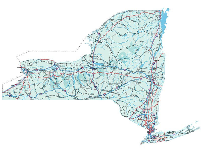
Free with trial New York state road map with Interstates and U. S. Highways. All elements on 5 separate layers (State Fill, State Outline, Water, Roads, Cities) for easy editing. Source: Public domain National Planning Network ( and United S. State highway vectors New York State Road Map. With Interstates and U.S. Highways. All elements on 5 separate layers (State Fill, State Outline, Water, Roads, Cities) for. New York state road map with Interstates and U.S. Highways. All elements on 5 separate layers (State Fill, State Outline, Water, Roads, Cities) for easy editing. Source: Public domain National Planning Network ( and United S
Free with trial Illinois state road map with Interstates and U. S. Highways. All elements on separate layers for easy editing. State highway vectors Illinois State Road Map. With Interstates and U. S. Highways. All elements on separate layers for easy editing
Free with trial Florida. Vector color map of Florida state. Usa. State highway vectors Florida. Vector color map of Florida state. Usa
Free with trial California state road map with Interstates and U. S. Highways. All elements on 5 separate layers (State Fill, State Outline, Water, Roads, Cities) for easy editing. Map created January 9, 2009. Source: Public domain National Planning Network ( and United. State highway vectors California Interstate Highway Map. California state road map with Interstates and U.S. Highways. All elements on 5 separate layers (State Fill, State. California state road map with Interstates and U.S. Highways. All elements on 5 separate layers (State Fill, State Outline, Water, Roads, Cities) for easy editing. Map created January 9, 2009. Source: Public domain National Planning Network ( and United
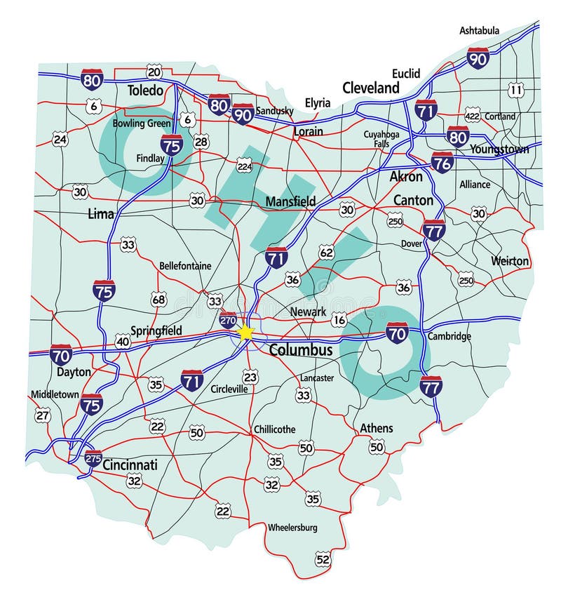
Free with trial Ohio state road map with Interstates, U. S. Highways and state roads. All elements on separate layers for easy editing. Map created November 26, 2009. ZIP File contains EPS-8 Adobefile,CS3 file, and large JPG file, 4469x4640. Source: Public domain National Planning Network ( and United States Federal Highway Administration (http:/. State highway vectors Ohio State Interstate Map. Ohio state road map with Interstates, U.S. Highways and state roads. All elements on separate layers for easy editing. Map created. Ohio state road map with Interstates, U.S. Highways and state roads. All elements on separate layers for easy editing. Map created November 26, 2009. ZIP File contains EPS-8 Adobefile,CS3 file, and large JPG file, 4469x4640. Source: Public domain National Planning Network ( and United States Federal Highway Administration (http:/
Free with trial California map warning sign. Warning sign in shape of California on blue illustration. State highway vectors California map warning sign. Warning sign in shape of California on blue illustration
Free with trial Copy space to add your own message and address on the backside or photo to the front of this retro postcard. EPS8 organized in groups for easy editing. State highway vectors Postcard, Add Location. Copy space to add your own message and address on the backside or photo to the front of this retro postcard. EPS8 organized in groups for. Copy space to add your own message and address on the backside or photo to the front of this retro postcard. EPS8 organized in groups for easy editing.
Free with trial Empty Interstate Sign. On white background. State highway vectors Empty Interstate Sign. On white background
Free with trial Texas map warning sign. Warning sign in shape of Texas on blue illustration. State highway vectors Texas map warning sign. Warning sign in shape of Texas on blue illustration
Free with trial Final set of road sign glossy. 8 of 8. State highway vectors Road Sign Glossy Vector (Set 8 of 8). Final set of road sign glossy . 8 of 8. Final set of road sign glossy . 8 of 8.
Free with trial Luggage stickers South Dakota Nebraska Kansas. Suitcase stickers South Dakota, Nebraska, Kansas. State highway vectors Luggage stickers South Dakota Nebraska Kansas. Suitcase stickers South Dakota, Nebraska, Kansas
Free with trial Highly Detailed Map of United States. With cities, roads, lakes, rivers, states, Alaska and Hawaii. State highway vectors Highly detailed road map of United States and colorful map point. Highly Detailed Map of United States. With cities, roads, lakes, rivers, states, Alaska and. Highly Detailed Map of United States. With cities, roads, lakes, rivers, states, Alaska and Hawaii.
Free with trial US route 66 sign, shield sign with route number. State highway vectors US route 66 sign. Shield sign with route number
Free with trial US route 66 sign, shield sign with route number. State highway vectors US route 66 sign. Shield sign with route number
Free with trial Route 66 sign set. Route 66 vestir sign set, isolated and colored. State highway vectors Route 66 sign set. Route 66 vestir sign set, isolated and colored
Free with trial Florida License car plate pattern design, with numbers, letters and symbols, United States of America, vector illustration. State highway vectors Florida License car plate pattern, USA. Florida License car plate pattern design, with numbers, letters and symbols, United States of America, vector. Florida License car plate pattern design, with numbers, letters and symbols, United States of America, vector illustration
Free with trial Ohio highway sign. Blank ohio highway sign on blue illustration. State highway vectors Ohio highway sign. Blank ohio highway sign on blue illustration
Free with trial Louisiana highway sign. Actual blank Louisiana highway sign illustration on blue. State highway vectors Louisiana highway sign. Actual blank Louisiana highway sign illustration on blue
Free with trial Georgia highway sign. Blank Georgia highway sign on blue illustration. State highway vectors Georgia highway sign. Blank Georgia highway sign on blue illustration
Free with trial South Carolina highway sign. Blank South Carolina highway sign on blue illustration. State highway vectors South Carolina highway sign. Blank South Carolina highway sign on blue illustration
Free with trial Florida highway sign. Blank Florida highway sign on blue illustration. State highway vectors Florida highway sign. Blank Florida highway sign on blue illustration
Free with trial WPA Poster Art of the Simpson-Reed Grove of Coast redwoods located in Jedediah Smith State Park part of Redwood National and State Parks in California done in works project administration style. State highway vectors Simpson-Reed Grove of Coast Redwoods Located in Jedediah Smith State Park Part of Redwood National and State Parks in California. WPA Poster Art of the Simpson. WPA Poster Art of the Simpson-Reed Grove of Coast redwoods located in Jedediah Smith State Park part of Redwood National and State Parks in California done in works project administration style.
Free with trial Wisconsin highway sign. Blank Wisconsin highway sign on blue illustration. State highway vectors Wisconsin highway sign. Blank Wisconsin highway sign on blue illustration
Free with trial New Mexico postage stamp design. Vector illustration of highway through arid landscape. Grunge postmark on separate layer. State highway vectors New Mexico highway through desert landscape. New Mexico postage stamp design. Vector illustration of highway through arid landscape. Grunge postmark on separate. New Mexico postage stamp design. Vector illustration of highway through arid landscape. Grunge postmark on separate layer
Free with trial Set for a highway. Character set for a highway. State highway vectors Set for a highway. Character set for a highway
Free with trial Pennsylvania highway sign. Blank Pennsylvania highway sign on blue illustration. State highway vectors Pennsylvania highway sign. Blank Pennsylvania highway sign on blue illustration
Free with trial 66 route sign icon. Vector road 66 highway interstate american freeway us california route symbol. State highway vectors 66 route sign icon. Vector road 66 highway interstate american freeway us california route symbol.
Free with trial Road map of the US American State of Texas. State highway vectors Road map of the US American State of Texas.
Free with trial Road map of the US American State of florida. State highway vectors Road map of the US American State of florida.
Free with trial USA state grunge vector signs of Hawaii, Virginia and Wisconsin, American travel or tourism design. Vintage plates and retro postcards with Aloha, Sic Semper Tyrannis and Forward state letterings. State highway vectors USA state signs of Hawaii, Virginia and Wisconsin. USA state grunge vector signs of Hawaii, Virginia and Wisconsin, American travel or tourism design. Vintage. USA state grunge vector signs of Hawaii, Virginia and Wisconsin, American travel or tourism design. Vintage plates and retro postcards with Aloha, Sic Semper Tyrannis and Forward state letterings
Free with trial Victoria State australian car license plate pattern, letters, numbers and symbols, vector illustration, Australia. State highway vectors Victoria State australian car license plate pattern, illustration, Australia. Victoria State australian car license plate pattern, letters, numbers and symbols. Victoria State australian car license plate pattern, letters, numbers and symbols, vector illustration, Australia
Free with trial Georgia US state car license plate, vector illustration, USA. Georgia US state car license plate pattern, letters, numbers and symbols, vector illustration, USA. State highway vectors Georgia US state car license plate, vector illustration, USA. Georgia US state car license plate pattern, letters, numbers and symbols, vector illustration, USA
Free with trial Iowa US state car license plate pattern, United States of America, numbers, letters and symbols, vector illustration. State highway vectors Iowa US state car license plate pattern, USA, illustration. Iowa US state car license plate pattern, United States of America, numbers, letters and symbols. Iowa US state car license plate pattern, United States of America, numbers, letters and symbols, vector illustration
Free with trial Oregon state car license plate pattern, letters, numbers and symbols, vector illustration, USA, United States odf America. State highway vectors Oregon state car license plate pattern, USA. Oregon state car license plate pattern, letters, numbers and symbols, vector illustration, USA, United States odf. Oregon state car license plate pattern, letters, numbers and symbols, vector illustration, USA, United States odf America
Free with trial Missouri state license plate pattern with letters and numbers, USA. Missouri state license plate pattern with letters and numbers, United States of America. State highway vectors Missouri state license plate pattern with letters and numbers, USA. Missouri state license plate pattern with letters and numbers, United States of America
Free with trial Pennsylvania US State car license plate, USA. Pennsylvania US State car license plate pattern, letters, numbers and symbols, vector illustration, United States. State highway vectors Pennsylvania US State car license plate, USA. Pennsylvania US State car license plate pattern, letters, numbers and symbols, vector illustration, United States
Free with trial Massachusetts state license plate car pattern, numbers, letters and symbols, United States, vector illustration. State highway vectors Massachusetts state license plate car pattern, numbers, letters and symbols, USA. Massachusetts state license plate car pattern, numbers, letters and symbols. Massachusetts state license plate car pattern, numbers, letters and symbols, United States, vector illustration
Free with trial Washington US State car license plate, letters, numbers and symbols, United States, vector illustration. State highway vectors Washington US State car license plate, letters, numbers and symbols, USA. Washington US State car license plate, letters, numbers and symbols, United States. Washington US State car license plate, letters, numbers and symbols, United States, vector illustration
Free with trial Virginia state road map with Interstates and U. S. Highways. All elements on 3 separate layers for easy editing. Map created May 31, 2009. Source: Public domain National Planning Network ( and United States Federal Highway Administration ( maps. State highway vectors Virginia Interstate Map. Virginia state road map with Interstates and U. S. Highways. All elements on 3 separate layers for easy editing. Map created May 31. Virginia state road map with Interstates and U. S. Highways. All elements on 3 separate layers for easy editing. Map created May 31, 2009. Source: Public domain National Planning Network ( and United States Federal Highway Administration ( maps.
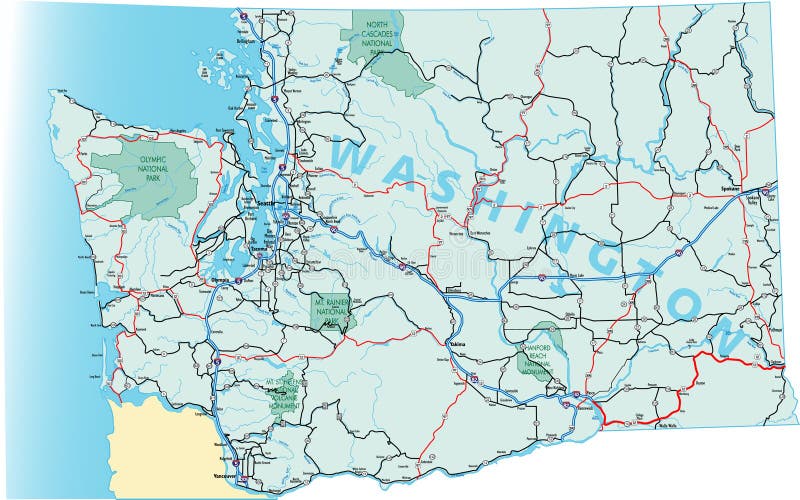
Free with trial Washington state road map with Interstates, U. S. Highways and state roads. All elements on separate layers for easy editing. State highway vectors Washington State Road Map. With Interstates, U.S. Highways and state roads. All elements on separate layers for easy editing
Free with trial Route 66 Interstate and Highway signs. State highway vectors Route 66 Signs. Route 66 Interstate and Highway signs. Route 66 Interstate and Highway signs.
Free with trial Car plates. Highway automobile license numbers old retro style vector signs collection. Illustration of auto plate, automobile number car. State highway vectors Car plates. Highway automobile license numbers old retro style vector signs collection. Illustration of auto plate, automobile number car
Free with trial USA states travel and tourism grunge banners with vector American Michigan, Montana and Maine. Vintage signs and postcards of US state nicknames with Great Lake, treasure and pine tree letterings. State highway vectors USA states travel and tourism grunge banners. With vector American Michigan, Montana and Maine. Vintage signs and postcards of US state nicknames with Great. USA states travel and tourism grunge banners with vector American Michigan, Montana and Maine. Vintage signs and postcards of US state nicknames with Great Lake, treasure and pine tree letterings
Free with trial Map of the city of Houston, U. S. state of Texas, USA. Vector map of the city of Houston, U. State highway vectors Map of the city of Houston, U.S. state of Texas, USA. Vector map of the city of Houston, U.S. state of Texas, USA
Free with trial Alberta road and national park map. Road map of the Canadian federal State with national parks. State highway vectors Alberta road and national park map. Road map of the Canadian federal State with national parks
Free with trial Map of the city of Houston, U. S. state of Texas, USA. Vector map of the city of Houston, U. State highway vectors Map of the city of Houston, U.S. state of Texas, USA. Vector map of the city of Houston, U.S. state of Texas, USA
Free with trial USA Maryland, Nebraska and Nevada vintage vector signs. American states travel and tourism destination of old line, battle born and cornhusker states, old grunge greeting banners and postcard design. State highway vectors USA Maryland, Nebraska, Nevada state vintage signs. USA Maryland, Nebraska and Nevada vintage vector signs. American states travel and tourism destination of old. USA Maryland, Nebraska and Nevada vintage vector signs. American states travel and tourism destination of old line, battle born and cornhusker states, old grunge greeting banners and postcard design
Free with trial Map of the city of Houston, U. S. state of Texas, USA. Vector map of the city of Houston, U. State highway vectors Map of the city of Houston, U.S. state of Texas, USA. Vector map of the city of Houston, U.S. state of Texas, USA
Free with trial Colorado state car license plate green style, letters, numbers and symbols, vector illustration, USA, United States of America. State highway vectors Colorado state car license plate green style, USA. Colorado state car license plate green style, letters, numbers and symbols, vector illustration, USA, United. Colorado state car license plate green style, letters, numbers and symbols, vector illustration, USA, United States of America
Free with trial Mississippi, Minnesota and Missouri vintage signs with vector USA state symbols of American travel and tourism design. North star, magnolia and show me state old grunge flags and stellar constellation. State highway vectors Mississippi, Minnesota and Missouri vintage signs. With vector USA state symbols of American travel and tourism design. North star, magnolia and show me state. Mississippi, Minnesota and Missouri vintage signs with vector USA state symbols of American travel and tourism design. North star, magnolia and show me state old grunge flags and stellar constellation
Free with trial Arizona State car license plate pattern, letters, numbers and symbols, vector illustration, USA, Un ited States of America. State highway vectors Arizona State car license plate pattern, letters, numbers and symbols, USA. Arizona State car license plate pattern, letters, numbers and symbols, vector. Arizona State car license plate pattern, letters, numbers and symbols, vector illustration, USA, Un ited States of America
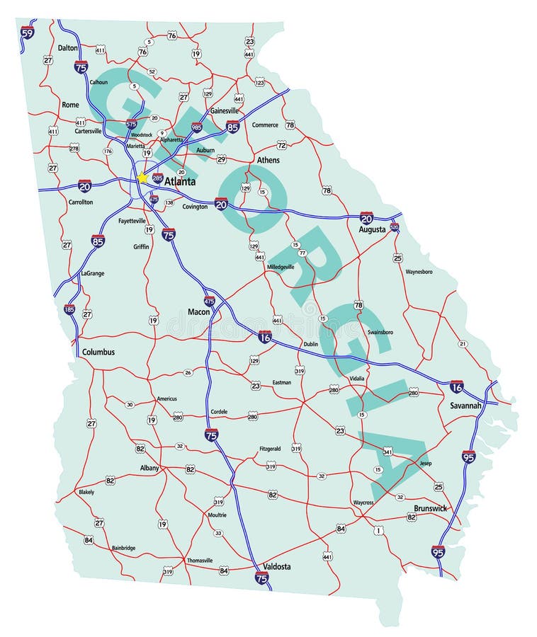
Free with trial Georgia state road map with Interstates, U. S. Highways and state roads. All elements on separate layers for easy editing. Map created December 1, 2009. ZIP File contains EPS-8 Adobe Illustrator file, Illustrator CS3 file, and large JPG file, 4212x5000. Source: Public domain National Planning Network ( and United States Federal Highway Administration (http:/. State highway vectors Georgia State Interstate Map. Georgia state road map with Interstates, U.S. Highways and state roads. All elements on separate layers for easy editing. Map. Georgia state road map with Interstates, U.S. Highways and state roads. All elements on separate layers for easy editing. Map created December 1, 2009. ZIP File contains EPS-8 Adobe Illustrator file, Illustrator CS3 file, and large JPG file, 4212x5000. Source: Public domain National Planning Network ( and United States Federal Highway Administration (http:/
Free with trial Washington state road map with Interstates and U. S. Highways. All elements on 5 separate layers (State Fill, State Outline, Water, Roads, Cities) for easy editing. Map created November 26, 2008. ZIP File contains EPS-8 Adobe Illustrator file, Illustrator CS3 file, and large JPG file, 3508x5133. Source: Public domain National Planning Network ( and United S. State highway vectors Washington State Road Map. With Interstates and U.S. Highways. All elements on 5 separate layers (State Fill, State Outline, Water, Roads, Cities) for. Washington state road map with Interstates and U.S. Highways. All elements on 5 separate layers (State Fill, State Outline, Water, Roads, Cities) for easy editing. Map created November 26, 2008. ZIP File contains EPS-8 Adobe Illustrator file, Illustrator CS3 file, and large JPG file, 3508x5133. Source: Public domain National Planning Network ( and United S
Free with trial Pennsylvania US State car license plate new style pattern, letters, numbers and symbols, vector illustration, United States. State highway vectors Pennsylvania US State car license plate new style pattern, USA. Pennsylvania US State car license plate new style pattern, letters, numbers and symbols, vector. Pennsylvania US State car license plate new style pattern, letters, numbers and symbols, vector illustration, United States
Free with trial Vintage route 66 road sign, retro style, vector illustration. State highway vectors Vintage route 66 road sign. Retro style, vector illustration
Free with trial Ohio warning sign. Warning sign in shape of Ohio on blue illustration. State highway vectors Ohio warning sign. Warning sign in shape of Ohio on blue illustration
Free with trial Set of vintage route 66 road signs. Vintage route 66 road signs. Retro style, illustration. State highway vectors Set of vintage route 66 road signs. Vintage route 66 road signs. Retro style, illustration
Free with trial Route 66 vector sign. Illustration on black background. State highway vectors Route 66 vector sign. Illustration on black background
Free with trial Route 66 sign, vector illustration. State highway vectors Route 66 sign. Vector illustration
Free with trial High detailed USA road map vector. High detailed USA interstate road map vector. State highway vectors High detailed USA road map vector. High detailed USA interstate road map vector
Free with trial Route 66 road sign. Vintage route 66 road sign, retro style, vector illustration. State highway vectors Route 66 road sign. Vintage route 66 road sign, retro style, vector illustration
Free with trial Retro route 66 sign. Vintage route 66 road sign with bullet holes, retro style, vector illustration. State highway vectors Retro route 66 sign. Vintage route 66 road sign with bullet holes, retro style, vector illustration
Free with trial Set of road sign navigation icons. State highway vectors Road Navigation Icons. Set of road sign navigation icons. Set of road sign navigation icons.
Free with trial Minnesota warning sign. Warning sign in shape of Minnesota on blue illustration. State highway vectors Minnesota warning sign. Warning sign in shape of Minnesota on blue illustration
 Sign in