Free with trial Vector illustration as skyline silhouette of the new regional area of oresund, involving the danish capital copenhagen and the swedish third biggest city malmo. Strait vectors New oresund region skyline. Vector illustration as skyline silhouette of the new regional area of oresund, involving the danish capital copenhagen and the. Vector illustration as skyline silhouette of the new regional area of oresund, involving the danish capital copenhagen and the swedish third biggest city malmo
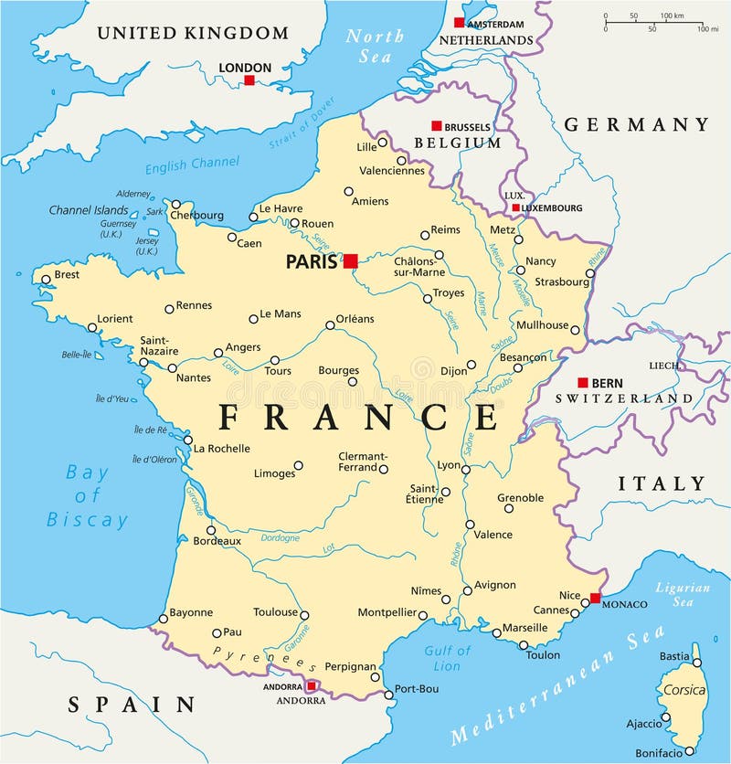
Free with trial France Political Map with capital Paris, national borders, most important cities and rivers. English labeling and scaling. Illustration. Strait vectors France Political Map. With capital Paris, national borders, most important cities and rivers. English labeling and scaling. Illustration
Free with trial Vector colored stripes. Retro styled background. Strait vectors Vector colored stripes. Retro styled background
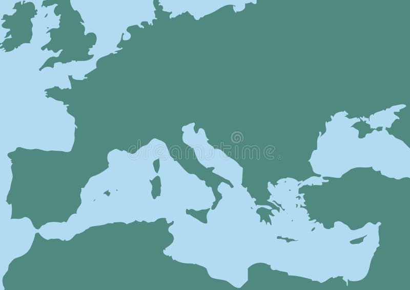
Free with trial Mediterranean Sea. Map of the Mediterranean Sea. Strait vectors Mediterranean Sea. Map of the Mediterranean Sea
Free with trial An illustration of the Golden Gate Bridge, a suspension bridge spanning the Golden Gate strait, the mile-wide, three-mile-long channel between San Francisco Bay and the Pacific Ocean. Strait vectors Golden Gate Bridge. An illustration of the Golden Gate Bridge, a suspension bridge spanning the Golden Gate strait, the mile-wide, three-mile-long channel. An illustration of the Golden Gate Bridge, a suspension bridge spanning the Golden Gate strait, the mile-wide, three-mile-long channel between San Francisco Bay and the Pacific Ocean
Free with trial Strait of Hormuz, Abu Musa and the Tunbs political map. Only sea passage from Persian Gulf to Arabian Sea. One of the most strategically important choke points in world. English labeling. Illustration. Strait vectors Strait of Hormuz, Abu Musa and the Tunbs Political Map. Only sea passage from Persian Gulf to Arabian Sea. One of the most strategically important choke points
Free with trial Torres Strait Islander Flag. The flag of the Australian Torres Strait Islander. Strait vectors Torres Strait Islander Flag. The flag of the Australian Torres Strait Islander
Free with trial North Korea and South Korea political map with capitals Pyongyang and Seoul. Korean peninsula, national borders, important cities, rivers and lakes. English labeling and scaling. Illustration. Strait vectors North Korea and South Korea Political Map. With capitals Pyongyang and Seoul. Korean peninsula, national borders, important cities, rivers and lakes. English. North Korea and South Korea political map with capitals Pyongyang and Seoul. Korean peninsula, national borders, important cities, rivers and lakes. English labeling and scaling. Illustration.
Free with trial Istanbul. Drawing illustration with graphics tablet. Strait vectors Istanbul. Drawing illustration with graphics tablet
Free with trial Silhouette of standing man. Vector silhouette of standing man on white. Strait vectors Silhouette of standing man. Vector silhouette of standing man on white
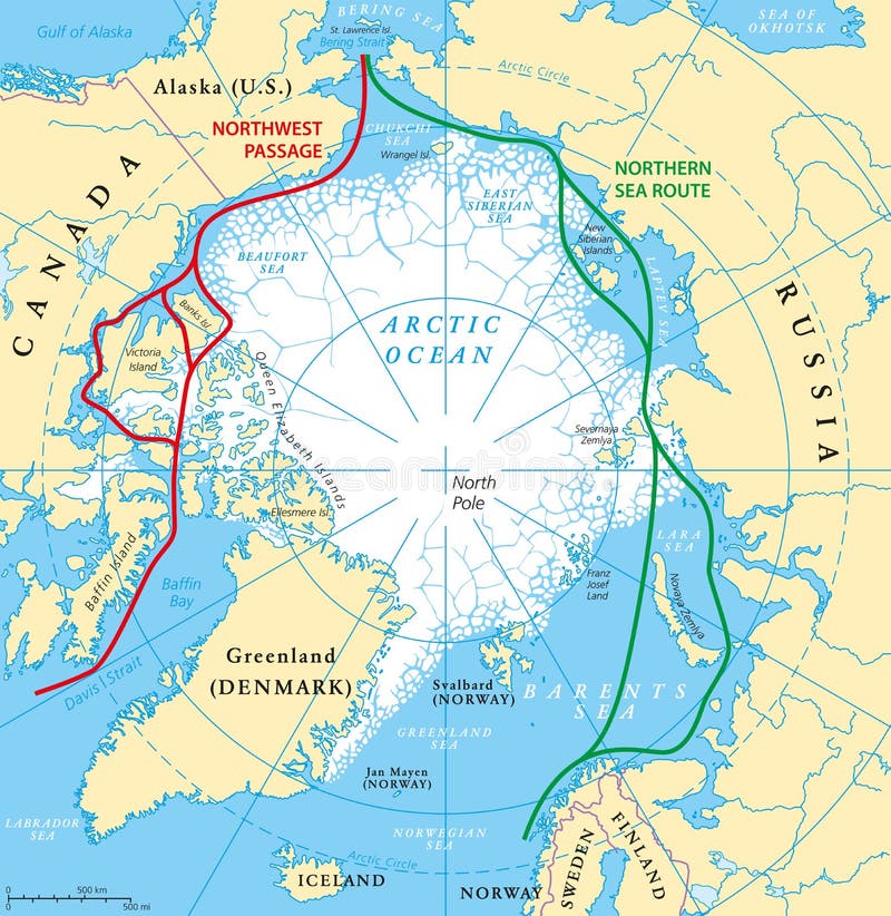
Free with trial Arctic Ocean sea routes map with Northwest Passage and Northern Sea Route. Arctic Region map with countries, national borders, rivers, lakes and average minimum extent of sea ice. English labeling. Strait vectors Arctic Ocean Sea Routes Map. With Northwest Passage and Northern Sea Route. Arctic Region map with countries, national borders, rivers, lakes and average. Arctic Ocean sea routes map with Northwest Passage and Northern Sea Route. Arctic Region map with countries, national borders, rivers, lakes and average minimum extent of sea ice. English labeling.
Free with trial Taiwan, Republic of China, political map with capital Taipei, national borders, important cities, rivers and lakes. English labeling and scaling. Illustration. Strait vectors Taiwan, Republic of China, Political Map. With capital Taipei, national borders, important cities, rivers and lakes. English labeling and scaling. Illustration
Free with trial Landforms collection with educational labeled formation examples scenery. Landscape view with geographical nature surface terrains vector illustration. Typical topography view with ground and water. Strait vectors Landforms collection with educational labeled formation examples scenery. Landscape view with geographical nature surface terrains vector illustration. Typical
Free with trial Map of North Europe. With Baltic sea. Strait vectors Map of North Europe. With Baltic sea
Free with trial Map of Great Britain. Computer generated illustration with Map of Great Britain and Ireland. Strait vectors Map of Great Britain. Computer generated illustration with Map of Great Britain and Ireland
Free with trial UAE United Arab Emirates political map with capital Abu Dhabi, national borders, important cities and bodies of water. English labeling and scaling. Illustration. Strait vectors UAE United Arab Emirates Political Map. With capital Abu Dhabi, national borders, important cities and bodies of water. English labeling and scaling
Free with trial Chile Map. Highly detailed vector map of Chile with administrative regions, main cities and roads. Strait vectors Chile Map. Highly detailed vector map of Chile with administrative regions, main cities and roads
Free with trial Radial background. Background illustration of radial rays. Strait vectors Radial background. Background illustration of radial rays
Free with trial Purple funky illustration. Vector art. Purple funky illustration of sun and plants. Vector. Strait vectors Purple funky illustration. Vector art. Purple funky illustration of sun and plants. Vector
Free with trial Detaild florida keys road and travel vector map. Strait vectors Detaild florida keys road and travel vector map.
Free with trial Jawa Barat, West Java administrative and political vector map, Indonesia. Strait vectors Jawa Barat, West Java administrative and political vector map, Indonesia.
Free with trial Cat continuous line drawing - cute pet stretching himself with his tail holds high side view isolated on white background. Editable stroke vector illustration of domestic animal for logo or decoration. Strait vectors Cat continuous line drawing - cute pet stretching himself with his tail holds high isolated on white background. Cat continuous line drawing - cute pet. Cat continuous line drawing - cute pet stretching himself with his tail holds high side view isolated on white background. Editable stroke vector illustration of domestic animal for logo or decoration
Free with trial Silhouette of Istanbul at sunset. Vector silhouette of Istanbul cityscape against sunset sky. Strait vectors Silhouette of Istanbul at sunset. Vector silhouette of Istanbul cityscape against sunset sky
Free with trial Strait of Hormuz, political map. Waterway between Persian Gulf and Gulf of Oman, a strategically extremely important choke point, with Iran to the north and UAE and Oman exclave Musandam to the south. Strait vectors Strait of Hormuz, waterway between Persian Gulf and Gulf of Oman, map. Strait of Hormuz, political map. Waterway between Persian Gulf and Gulf of Oman, a. Strait of Hormuz, political map. Waterway between Persian Gulf and Gulf of Oman, a strategically extremely important choke point, with Iran to the north and UAE and Oman exclave Musandam to the south.
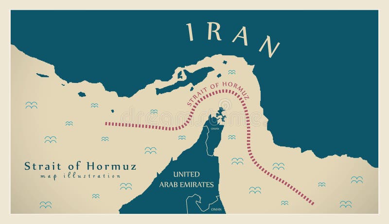
Free with trial Strait of Hormuz map illustration. Strait vectors Strait of Hormuz map illustration. Strait of Hormuz modern map illustration
Free with trial Torres Strait Islander Flag Border Grunge. The flag of the Australian Torres Strait Islander. Strait vectors Torres Strait Islander Flag Border Grunge. The flag of the Australian Torres Strait Islander
Free with trial This image displays various designs of Aboriginal and Torres Strait Islander flags. Strait vectors Australian Aboriginal and Torres Strait Islander Flags in Multiple Styles. This image displays various designs of Aboriginal and Torres Strait Islander flags. This image displays various designs of Aboriginal and Torres Strait Islander flags.
Free with trial Papua New Guinea political map with capital Port Moresby, national borders, most important cities, rivers and lakes. Illustration with English labeling and scaling. Vector. Strait vectors Papua New Guinea Political Map. With capital Port Moresby, national borders, most important cities, rivers and lakes. Illustration with English labeling and
Free with trial Man raised collar silhouette. Vector man with raised collar silhouette. Strait vectors Man raised collar silhouette. Vector man with raised collar silhouette
Free with trial A cartoon of a heavy drinker and his New Years resolution to quit. Vector and high resolution jpeg files available. Strait vectors Stop drinking resolution. A cartoon of a heavy drinker and his New Years resolution to quit. Vector and high resolution jpeg files available. A cartoon of a heavy drinker and his New Years resolution to quit. Vector and high resolution jpeg files available.
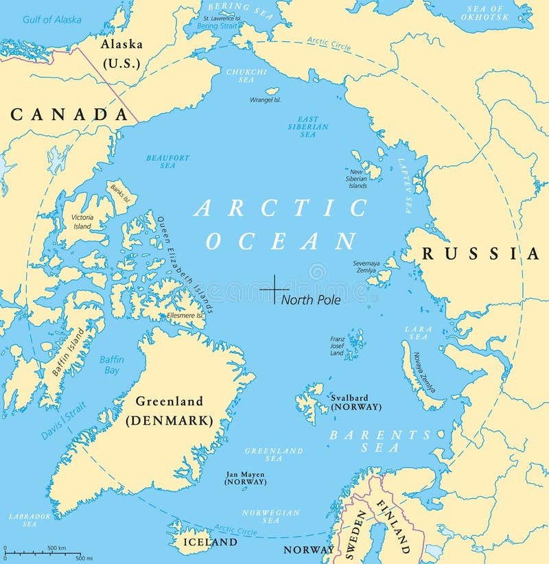
Free with trial Arctic Ocean map with North Pole and Arctic Circle. Arctic region map with countries, national borders, rivers and lakes. Map without sea ice. English labeling and scaling. Strait vectors Arctic Ocean Map. With North Pole and Arctic Circle. Arctic region map with countries, national borders, rivers and lakes. Map without sea ice. English labeling
Free with trial US State Alaska Political Map with capital Juneau, national borders, important cities, rivers and lakes. English labeling and scaling. Illustration. Strait vectors Alaska Political Map. US State Alaska Political Map with capital Juneau, national borders, important cities, rivers and lakes. English labeling and scaling. US State Alaska Political Map with capital Juneau, national borders, important cities, rivers and lakes. English labeling and scaling. Illustration.
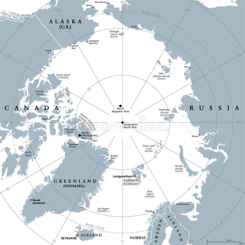
Free with trial Arctic region, gray political map. Polar region around North Pole of Earth. The Arctic Ocean region, with North Magnetic Pole and North Geomagnetic Pole, longitudes and latitudes. Illustration. Vector. Strait vectors Arctic region, polar region around North Pole, gray political map. Arctic region, gray political map. Polar region around North Pole of Earth. The Arctic Ocean. Arctic region, gray political map. Polar region around North Pole of Earth. The Arctic Ocean region, with North Magnetic Pole and North Geomagnetic Pole, longitudes and latitudes. Illustration. Vector
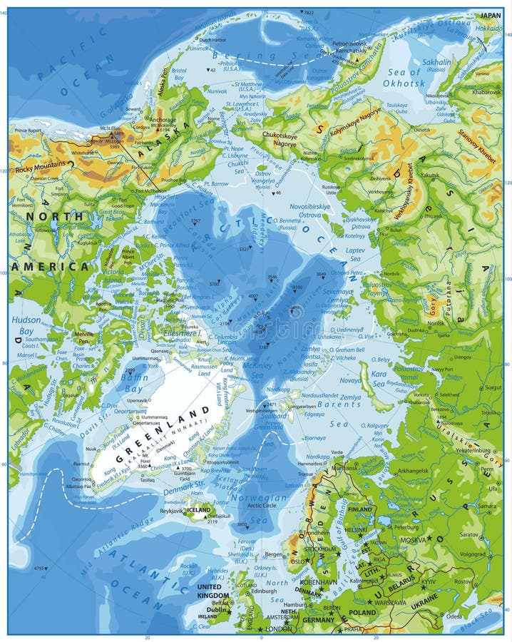
Free with trial Arctic Ocean Physical Map. Highly detailed vector illustration. Strait vectors Arctic Ocean Physical Map. Highly detailed vector illustration
Free with trial Thailand map. Highly detailed vector map of thailand with administrative divisions,main cities and roads. Strait vectors Thailand map. Highly detailed vector map of thailand with administrative divisions,main cities and roads
Free with trial Highly detailed map of Argentina with administrative regions,main cities and roads. Strait vectors Argentina map. Highly detailed map of Argentina with administrative regions,main cities and roads. Highly detailed map of Argentina with administrative regions,main cities and roads.
Free with trial Australia Political Map with capital Canberra, national borders, important cities, rivers and lakes. English labeling and scaling. Illustration. Strait vectors Australia Political Map. With capital Canberra, national borders, important cities, rivers and lakes. English labeling and scaling. Illustration
Free with trial South Korea political map with capital Seoul, national borders, important cities, rivers and lakes. English labeling and scaling. Illustration. Strait vectors South Korea Political Map. With capital Seoul, national borders, important cities, rivers and lakes. English labeling and scaling. Illustration
Free with trial 27 of 50 states of the United States, divided into counties with territory nicknames, Detailed vector Florida Map with name and date admitted to the Union, travel poster and postcard for design. Strait vectors 27 of 50 states of the United States, divided into counties with territory nicknames, Detailed vector Florida Map with name and. Date admitted to the Union. 27 of 50 states of the United States, divided into counties with territory nicknames, Detailed vector Florida Map with name and date admitted to the Union, travel poster and postcard for design
Free with trial Arctic Ocean Political Map. Retro colors. Highly detailed vector illustration. Strait vectors Arctic Ocean Political Map. Retro colors. Highly detailed vector illustration
Free with trial Geographic position of the North Pole of the Earth, political map. Magnetic, Geomagnetic and Geographic North Pole. Map of the Arctic Ocean and the Arctic Circle with latitudes and longitudes. Vector. Strait vectors Geographic position of the North Pole of the Earth, political map. Magnetic, Geomagnetic and Geographic North Pole. Map of the Arctic Ocean and the Arctic
Free with trial Black and yellow stripes. Decorative simple wallpapers with stripes for wrap or background. editable vector. Strait vectors Black and yellow stripes. Decorative simple wallpapers with stripes for wrap or background. editable vector
Free with trial New Zealand map hand draw vector. illustration EPS10. Strait vectors New Zealand map hand draw vector. Illustration EPS10
Free with trial Bali map. Road map of the Indonesian resort island of Bali. Strait vectors Bali map. Road map of the Indonesian resort island of Bali
Free with trial Indo-Pacific major energy SLOCs, political map. Geopolitically critical Sea Lines Of Communication. Primary maritime routes between ports, used for trade, logistics and naval forces. Illustration. Strait vectors Indo-Pacific major energy SLOCs, Sea Lines Of Communication, map. Indo-Pacific major energy SLOCs, political map. Geopolitically critical Sea Lines Of. Indo-Pacific major energy SLOCs, political map. Geopolitically critical Sea Lines Of Communication. Primary maritime routes between ports, used for trade, logistics and naval forces. Illustration.
Free with trial The Middle East,political map with capitals and international borders. Geopolitical region encompassing the Arabian Peninsula,the Levant,Turkey,Egypt,Iran and Iraq. Formerly called Near East. Strait vectors The Middle East, political map with capitals and international borders. The Middle East,political map with capitals and international borders. Geopolitical. The Middle East,political map with capitals and international borders. Geopolitical region encompassing the Arabian Peninsula,the Levant,Turkey,Egypt,Iran and Iraq. Formerly called Near East.
Free with trial Road map marmara sea with istanbul. Vector road map marmara sea with istanbul. Strait vectors Road map marmara sea with istanbul. Vector road map marmara sea with istanbul
Free with trial Map of the historical center of Istanbul with sights flat style vector illustration. Strait vectors Map of Istanul. Map of the historical center of Istanbul with sights flat style vector illustration. Map of the historical center of Istanbul with sights flat style vector illustration.
Free with trial Road map of the indonesian island of bali. Strait vectors Road map of the indonesian island of bali. Road vector map of the indonesian island of bali
Free with trial Road map of the indonesian island sumatra. Strait vectors Road map of the indonesian island sumatra.
Free with trial Jawa Timur, East Java administrative and political vector map, Indonesia. Strait vectors Jawa Timur, East Java administrative and political vector map, Indonesia.
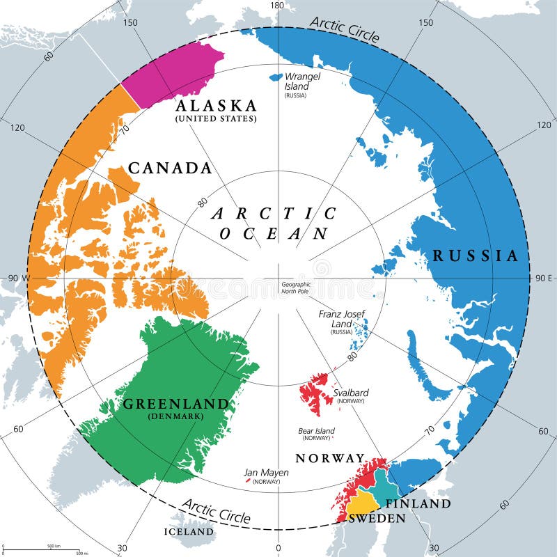
Free with trial Countries within the Arctic Circle, political map. Countries within about 66 degrees north the Equator and North Pole. Alaska (U. S. ), Canada, Finland, Greenland (Denmark), Norway, Sweden and Russia. Strait vectors Countries within the Arctic Circle, Arctic Region countries, political map. Countries within the Arctic Circle, political map. Countries within about 66 degrees. Countries within the Arctic Circle, political map. Countries within about 66 degrees north the Equator and North Pole. Alaska (U.S.), Canada, Finland, Greenland (Denmark), Norway, Sweden and Russia.
Free with trial Vector road and national park map of the Indonesian island java. Strait vectors Vector road and national park map of the Indonesian island java.
Free with trial Lombok administrative and political map, Indonesia. Strait vectors Lombok administrative and political map, Indonesia.
Free with trial Map of the Arctic region, the northwest passage and the northern sea route. Strait vectors Map of the Arctic region, the northwest passage and the northern sea route.
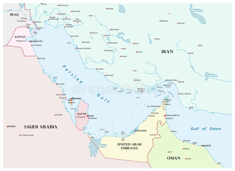
Free with trial Map of the Persian Gulf and its neighboring countries. Strait vectors Map of the Persian Gulf and its neighboring countries.
Free with trial Road map of Indonesian Lesser Sunda Islands Bali and Lombok. Strait vectors Road map of Indonesian Lesser Sunda Islands Bali and Lombok. Vector road map of Indonesian Lesser Sunda Islands Bali and Lombok
Free with trial Jawa Tengah, Central Java administrative and political vector map, Indonesia. Strait vectors Jawa Tengah, Central Java administrative and political vector map, Indonesia.
Free with trial Set of Singapore simple icons. For Web and Mobile Applications. Strait vectors Set of Singapore simple icons. For Web and Mobile Applications
Free with trial Crazy Chicken Character with Cartoon Style. Vector. Strait vectors Crazy Chicken Character with Cartoon Style. Vector
Free with trial Nunavut administrative and political vector map with flag. Strait vectors Nunavut administrative and political vector map with flag.
Free with trial Cartoon Singapore icons set. Universal Singapore icons to use for web and mobile UI, set of basic Singapore elements isolated vector illustration. Strait vectors Singapore icons set, cartoon style. Cartoon Singapore icons set. Universal Singapore icons to use for web and mobile UI, set of basic Singapore elements isolated. Cartoon Singapore icons set. Universal Singapore icons to use for web and mobile UI, set of basic Singapore elements isolated vector illustration
Free with trial Shipping lanes of the Strait of Hormuz, political map. Sea passage from Persian Gulf to Gulf of Oman into the open ocean. Strategically important choke points for shipping oil and natural gas. Vector. Strait vectors Shipping lanes of the Strait of Hormuz, political map. Sea passage from Persian Gulf to Gulf of Oman into the open ocean. Strategically important choke points
Free with trial Persian Gulf region, multi colored political map. Arabian Gulf, a sea in West Asia, located between Iran and the Arabian Peninsula, connected to the Gulf of Oman in the east by the Strait of Hormuz. Strait vectors Persian Gulf region, and the Strait of Hormuz, multi colored map. Persian Gulf region, multi colored political map. Arabian Gulf, a sea in West Asia, located. Persian Gulf region, multi colored political map. Arabian Gulf, a sea in West Asia, located between Iran and the Arabian Peninsula, connected to the Gulf of Oman in the east by the Strait of Hormuz.
Free with trial Crazy cartoon woman in strait-jacket. Strait vectors Crazy cartoon woman in strait-jacket. Crazy cartoon funny woman in strait-jacket
Free with trial Strait of Tiran political map. Narrow sea passage between Sinai and Arabian peninsulas, seperates the Gulf of Aqaba from the Red Sea. Tiran and Sanafir Island. Illustration. English labeling. Vector. Strait vectors Strait of Tiran political map. Narrow sea passage between Sinai and Arabian peninsulas, seperates the Gulf of Aqaba from the Red Sea. Tiran and Sanafir Island
Free with trial Strait of Hormuz region political map. English labeling. Strait between the Persian Gulf and the Gulf of Oman. The only sea passage from the Persian Gulf to the open ocean. Gray illustration. Vector. Strait vectors Strait of Hormuz region political map. English labeling. Strait between the Persian Gulf and the Gulf of Oman. The only sea passage from the Persian Gulf to
Free with trial Bering Strait, political map. Strait between the North Pacific Ocean and the Arctic Ocean, separating the Chukchi Peninsula of the Russian Far East from the Seward Peninsula of Alaska, United States. Strait vectors Bering Strait, political map, strait between Russia and United States. Bering Strait, political map. Strait between the North Pacific Ocean and the Arctic Ocean. Bering Strait, political map. Strait between the North Pacific Ocean and the Arctic Ocean, separating the Chukchi Peninsula of the Russian Far East from the Seward Peninsula of Alaska, United States.
Free with trial The Bosporus or Bosphorus, political map. The Strait of Istanbul, a narrow, natural strait and international waterway in Turkey. It connects the Black Sea with the Sea of Marmara. Illustration. Vector. Strait vectors The Bosporus or Bosphorus, Strait of Istanbul, political map. The Bosporus or Bosphorus, political map. The Strait of Istanbul, a narrow, natural strait and. The Bosporus or Bosphorus, political map. The Strait of Istanbul, a narrow, natural strait and international waterway in Turkey. It connects the Black Sea with the Sea of Marmara. Illustration. Vector
Free with trial Mentally ill man wearing strait jacket. Retro art style illustration of mentally ill man wearing strait jacket looking outside through the window. Strait vectors Mentally ill man wearing strait jacket. Retro art style illustration of mentally ill man wearing strait jacket looking outside through the window
Free with trial Map of the Bering Strait between Russia and Alaska. Strait vectors Map of the Bering Strait between Russia and Alaska.
Free with trial Bab el Mandeb political map. Strait between Yemen on Arabian Peninsula and Djibouti and Eritrea on Horn of Africa. Connects the Red Sea and the Gulf of Aden. Illustration. English labeling. Vector. Strait vectors Bab el Mandeb Strait political map. Bab el Mandeb political map. Strait between Yemen on Arabian Peninsula and Djibouti and Eritrea on Horn of Africa. Connects. Bab el Mandeb political map. Strait between Yemen on Arabian Peninsula and Djibouti and Eritrea on Horn of Africa. Connects the Red Sea and the Gulf of Aden. Illustration. English labeling. Vector.
Free with trial Persian Gulf region,political map. Also Arabian Gulf,a mediterranean Sea in West Asia,located between Iran and Arabian Peninsula,connected to the Gulf of Oman in the east by the Strait of Hormuz. Strait vectors Persian Gulf region, Strait of Hormuz, and Gulf of Oman, political map. Persian Gulf region,political map. Also Arabian Gulf,a mediterranean Sea in West Asia. Persian Gulf region,political map. Also Arabian Gulf,a mediterranean Sea in West Asia,located between Iran and Arabian Peninsula,connected to the Gulf of Oman in the east by the Strait of Hormuz.
Free with trial Mentally ill man wearing strait jacket. Graphic illustration of mentally ill man wearing strait jacket looking outside through the window. Strait vectors Mentally ill man wearing strait jacket. Graphic illustration of mentally ill man wearing strait jacket looking outside through the window
Free with trial Smoke rocket. Smoke jets trailing, fiery foggy trails jet airplane. Missile, shuttle or spaceship strait and curve contrail, comet or meteor falling in space. Vector isolated on black background set. Strait vectors Smoke rocket. Smoke jets trailing, fiery foggy trails jet airplane. Missile, shuttle or spaceship strait and curve. Contrail, comet or meteor falling in space. Smoke rocket. Smoke jets trailing, fiery foggy trails jet airplane. Missile, shuttle or spaceship strait and curve contrail, comet or meteor falling in space. Vector isolated on black background set
Free with trial Cable-stayed bridge across the East Bosphorus Strait of the Sea of Japan, connecting the mainland of the city of Vladivostok with Russky Island. Strait vectors Cable-stayed bridge across the strait. Cable-stayed bridge across the East Bosphorus Strait of the Sea of Japan, connecting the mainland of the city of. Cable-stayed bridge across the East Bosphorus Strait of the Sea of Japan, connecting the mainland of the city of Vladivostok with Russky Island
Free with trial Strait of Gibraltar, political map. Also known as Straits of Gibraltar. Narrow strait, connecting the Atlantic Ocean to the Mediterranean Sea, separating the Iberian Peninsula from Morocco and Africa. Strait vectors Strait of Gibraltar, also known as Straits of Gibraltar, political map. Strait of Gibraltar, political map. Also known as Straits of Gibraltar. Narrow strait. Strait of Gibraltar, political map. Also known as Straits of Gibraltar. Narrow strait, connecting the Atlantic Ocean to the Mediterranean Sea, separating the Iberian Peninsula from Morocco and Africa.
Free with trial Clean vector map illustration of the Strait of Hormuz showing maritime shipping routes between the Persian Gulf and the Gulf of Oman. The map highlights surrounding countries including Iran, Oman, United Arab Emirates, Saudi Arabia, Iraq, and key geographic features such as the Zagros and Hajar Mountains. Designed in a minimal and neutral style, suitable for educational, infographic, and geographic reference use. Strait vectors Strait of Hormuz Maritime Route Map. Clean vector map illustration of the Strait of Hormuz showing maritime shipping routes between the Persian Gulf and the Gulf. Clean vector map illustration of the Strait of Hormuz showing maritime shipping routes between the Persian Gulf and the Gulf of Oman. The map highlights surrounding countries including Iran, Oman, United Arab Emirates, Saudi Arabia, Iraq, and key geographic features such as the Zagros and Hajar Mountains. Designed in a minimal and neutral style, suitable for educational, infographic, and geographic reference use.
Free with trial Taiwan Strait,gray political map. Important waterway and disputed international waters,separating the island of Taiwan and continental Asia,which connects the East China Sea and South China Sea. Strait vectors Taiwan Strait, separating Taiwan and continental Asia, gray political map. Taiwan Strait,gray political map. Important waterway and disputed international waters. Taiwan Strait,gray political map. Important waterway and disputed international waters,separating the island of Taiwan and continental Asia,which connects the East China Sea and South China Sea.
Free with trial Strait of Gibraltar, waterway between Spain and Morocco vector map. Strait vectors Strait of Gibraltar, waterway between Spain and Morocco vector map.
 Sign in