Free with trial Map of Europe black - detailed - showing countries border. Straits vectors Map of Europe Black. Detailed - showing countries border
Free with trial Drill bit. Sharp tooth, long tsava,small nozzle narrow Straits wide thick,powerful hard alloy otselos,hoe drill expensive. Straits vectors Drill bit. Sharp tooth, long tsava,small nozzle narrow Straits wide thick,powerful hard alloy otselos,hoe drill expensive
Free with trial Administrative structure vector map of the Malay Peninsula, Malaysia. Straits vectors Administrative structure vector map of the Malay Peninsula, Malaysia.
Free with trial Caption: the places where the owner`s origin. Straits vectors Colorful and historical colonial style three storey terrace houses. Isolated. Caption: the places where the owner`s origin. Caption: the places where the owner`s origin.
Free with trial Isolated. Caption: traditional herbal shop left. Straits vectors Colorful and historical colonial style three storey shophouse. Isolated. Caption: traditional herbal shop left. Isolated. Caption: traditional herbal shop left.
Free with trial Bosporus and Dardanelles, political map. The Turkish Straits, internationally significant and narrow waterways in Turkey. Passages, connecting the Aegean Sea and the Sea of Marmara with the Black Sea. Straits vectors Bosporus and Dardanelles, the Turkish Straits, political map. Bosporus and Dardanelles, political map. The Turkish Straits, internationally significant and. Bosporus and Dardanelles, political map. The Turkish Straits, internationally significant and narrow waterways in Turkey. Passages, connecting the Aegean Sea and the Sea of Marmara with the Black Sea.
Free with trial Bosphorus and Dardanelles, gray political map. The Turkish Straits, internationally significant, narrow waterways in Turkey. Passages, connecting the Aegean Sea and Sea of Marmara with the Black Sea. Straits vectors Bosporus and Dardanelles, the Turkish Straits, gray political map. Bosphorus and Dardanelles, gray political map. The Turkish Straits, internationally. Bosphorus and Dardanelles, gray political map. The Turkish Straits, internationally significant, narrow waterways in Turkey. Passages, connecting the Aegean Sea and Sea of Marmara with the Black Sea.
Free with trial Strait of Gibraltar, political map. Also known as Straits of Gibraltar. Narrow strait, connecting the Atlantic Ocean to the Mediterranean Sea, separating the Iberian Peninsula from Morocco and Africa. Straits vectors Strait of Gibraltar, also known as Straits of Gibraltar, political map. Strait of Gibraltar, political map. Also known as Straits of Gibraltar. Narrow strait. Strait of Gibraltar, political map. Also known as Straits of Gibraltar. Narrow strait, connecting the Atlantic Ocean to the Mediterranean Sea, separating the Iberian Peninsula from Morocco and Africa.
Free with trial Straits of Tiran political map. Narrow sea passages between Sinai and Arabian peninsulas which seperate the Gulf of Aqaba from Red Sea. Gray illustration on white background. English labeling. Vector. Straits vectors Straits of Tiran political map. Narrow sea passages between Sinai and Arabian peninsulas which seperate the Gulf of Aqaba from Red Sea. Gray illustration on
Free with trial A detailed map illustrating major global shipping routes, highlighting key straits and canals such as the Strait of Hormuz, Strait of Malacca, Suez Canal, and Panama Canal. The map features cargo ships navigating through these critical waterways, emphasizing their importance in international trade and commerce. Straits vectors Global Shipping Routes Map. A detailed map illustrating major global shipping routes, highlighting key straits and canals such as the Strait of Hormuz, Strait of. A detailed map illustrating major global shipping routes, highlighting key straits and canals such as the Strait of Hormuz, Strait of Malacca, Suez Canal, and Panama Canal. The map features cargo ships navigating through these critical waterways, emphasizing their importance in international trade and commerce.
Free with trial A charming, hand-drawn illustration depicting a lively row of traditional shophouses, characteristic of Southeast Asian architecture, particularly Peranakan or Straits Chinese styles. Each two-story building is rendered in distinct, bright colors like blue, pink, green, and orange, featuring classic elements such as arched windows, louvered shutters, and awnings. Small figures of people walking along the street add a sense of daily life and activity. This cheerful artwork evokes a nostalgic feel of a bustling old town street, perfect for travel, cultural, or historical themes. Straits vectors Vibrant Hand-Drawn Peranakan Shophouses Street Illustration. A charming, hand-drawn illustration depicting a lively row of traditional shophouses, characteristic. A charming, hand-drawn illustration depicting a lively row of traditional shophouses, characteristic of Southeast Asian architecture, particularly Peranakan or Straits Chinese styles. Each two-story building is rendered in distinct, bright colors like blue, pink, green, and orange, featuring classic elements such as arched windows, louvered shutters, and awnings. Small figures of people walking along the street add a sense of daily life and activity. This cheerful artwork evokes a nostalgic feel of a bustling old town street, perfect for travel, cultural, or historical themes.
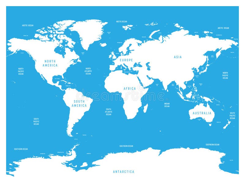
Free with trial Oceanographical map of World with labels of oceans, seas, gulfs, bays and straits. Vector map with white lands and blue water. Straits vectors Oceanographical map of World with labels of oceans, seas, gulfs, bays and straits. Vector map with white lands and blue. Water
Free with trial World map of Oceans with labels of oceans, seas, gulfs, bays and straits. Straits vectors World map of Oceans with labels of oceans, seas, gulfs, bays and straits.
Free with trial Cornus florida is flowering dogwood native to state of the southeastern U. S. bordering on the Atlantic, the Straits of Florida, and the Gulf of Mexico, vintage line drawing or engraving illustration. Straits vectors Cornus Florida vintage illustration. Cornus florida is flowering dogwood native to state of the southeastern U.S. bordering on the Atlantic, the Straits of. Cornus florida is flowering dogwood native to state of the southeastern U.S. bordering on the Atlantic, the Straits of Florida, and the Gulf of Mexico, vintage line drawing or engraving illustration
Free with trial High detailed World map. With labels of main oceans, seas, gulfs, bays and straits. Vector map with white lands and blue water. Straits vectors High detailed World map. With labels of main oceans, seas, gulfs, bays and straits. Vector map with white lands and blue. Water
Free with trial Key West and Lower Keys, Florida, United States, gray political map. Southwestern part of the Florida Keys, off the southern coast of Florida, stretching from Key West to the Seven Mile Bridge. Vector. Straits vectors Key West and Lower Keys, Florida, United States, gray political map. Southwestern part of the Florida Keys, off the southern coast of Florida, stretching from
Free with trial Florida Keys, United States, gray political map. Coral cay archipelago off southern coast of Florida Peninsula, extend in an arc to the westernmost of the inhabited islands Key West, to Dry Tortugas. Straits vectors Florida Keys, United States, gray political map. Coral cay archipelago off southern coast of Florida Peninsula, extend in an arc to the westernmost of the
Free with trial Machinac Bridge_Vector. Machinac Bridge looking north across the Straits. Straits vectors Machinac Bridge_Vector. Machinac Bridge looking north across the Straits
Free with trial Orchid sign vector. Blank orchid sign board design in colour and greyscale vector illustrations. Straits vectors Orchid sign vector. Blank orchid sign board design in colour and greyscale vector illustrations
Free with trial Oil drill bit. Sharp tooth, long tsava,small nozzle narrow Straits wide thick,powerful hard alloy otselos,hoe drill expensive. Straits vectors Oil drill bit. Sharp tooth, long tsava,small nozzle narrow Straits wide thick,powerful hard alloy otselos,hoe drill expensive
Free with trial Florida Keys, United States, political map. Coral cay archipelago off the southern coast of Florida Peninsula, extend in an arc to the westernmost of the inhabited islands Key West, to Dry Tortugas. Straits vectors Florida Keys, United States, political map. Coral cay archipelago off the southern coast of Florida Peninsula, extend in an arc to the westernmost of the
Free with trial The Mediterranean Sea subdivisions, political map with straits, countries and the Black Sea. Connected to the Atlantic Ocean, surrounded by the Mediterranean Basin, almost completely enclosed by land. Straits vectors Mediterranean Sea subdivisions, political map, with the Black Sea. The Mediterranean Sea subdivisions, political map with straits, countries and the Black Sea. The Mediterranean Sea subdivisions, political map with straits, countries and the Black Sea. Connected to the Atlantic Ocean, surrounded by the Mediterranean Basin, almost completely enclosed by land.
Free with trial NEOM political map of the 500 billion dollar megacity project in Saudi Arabia along the Red Sea coast. Location of the smart and tourist city with autonomous judicial system. English labeling. Vector. Straits vectors NEOM, megacity project in Saudi Arabia, political map. NEOM political map of the 500 billion dollar megacity project in Saudi Arabia along the Red Sea coast. NEOM political map of the 500 billion dollar megacity project in Saudi Arabia along the Red Sea coast. Location of the smart and tourist city with autonomous judicial system. English labeling. Vector.
Free with trial Key West - custom calligraphy text. Vector version of my own calligraphy. Straits vectors Key West - custom calligraphy text. Vector version of my own calligraphy
Free with trial Map of the Gulf Stream with its northern extension North Atlantic Drift. Warm and swift Atlantic Ocean current, originates in Gulf of Mexico, flows through Straits of Florida and up the US coastline. Straits vectors Map of the Gulf Stream with its northern extension North Atlantic Drift. Warm and swift Atlantic Ocean current, originates in Gulf of Mexico, flows through
Free with trial The Mediterranean Sea, political map with subdivisions, straits, islands and countries. Connected to the Atlantic Ocean, surrounded by the Mediterranean Basin, almost completely enclosed by land. Straits vectors The Mediterranean Sea, political map with subdivisions. Straits, islands and countries. Connected to the Atlantic Ocean, surrounded by the Mediterranean Basin. The Mediterranean Sea, political map with subdivisions, straits, islands and countries. Connected to the Atlantic Ocean, surrounded by the Mediterranean Basin, almost completely enclosed by land.
Free with trial Landmark of Istanbul Hagia Sophia. Vector illustration. Straits vectors Landmark of Istanbul Hagia Sophia. Vector illustration
Free with trial With solid colour background. Vectror. Straits vectors Line art of a group of historical colonial style shophouses. With solid colour background. Vectror. With solid colour background. Vectror.
Free with trial Dogwood branch with golden line flowers seamless pattern. Cornus florida. Line drawing. White background. Straits vectors Dogwood branch with golden line flowers seamless pattern. Cornus florida. Line drawing. White background. Dogwood branch with golden line flowers seamless pattern. Cornus florida. Line drawing. White background. Dogwood branch with golden line flowers seamless pattern. Cornus florida. Line drawing. White background.
Free with trial Vector map of Bimini Island, The Bahamas. Straits vectors Vector map of Bimini Island, The Bahamas.
Free with trial Caption: the places where the owner`s origin. Straits vectors Colorful and historical colonial style double storey terrace houses. Isolated. Caption: the places where the owner`s origin. Caption: the places where the owner`s origin.
Free with trial Mackinaw from Round Island located in straits of Mackinaw connecting lake Michigan and lake Huron vintage line drawing. Straits vectors Mackinaw from Round Island vintage illustration. Mackinaw from Round Island located in straits of Mackinaw connecting lake Michigan and lake Huron vintage line. Mackinaw from Round Island located in straits of Mackinaw connecting lake Michigan and lake Huron vintage line drawing
Free with trial Singapore's old shop houses are charming, heritage-rich two-floor buildings with a unique blend of architectural styles. The Chinese title means Nanyang(singapore) style. Straits vectors Old, two-story shophouse in Singapore 1. Singapore's old shop houses are charming, heritage-rich two-floor buildings with a unique blend of architectural styles. Singapore's old shop houses are charming, heritage-rich two-floor buildings with a unique blend of architectural styles. The Chinese title means Nanyang(singapore) style.
Free with trial Welcome to Historic Mackinaw City Michigan. In best quality design. Straits vectors Welcome to Historic Mackinaw City Michigan. In best quality design
Free with trial The ridicule holds the achiever 's cup in his pass. Trendy style, Vector Illustration. Vector illustration for your design. Straits vectors The ridicule holds the achiever 's cup in his pass. Trendy style, Vector Illustration. Vector illustration for your design
Free with trial Tourism in Malaysia Truly Asia Illustration. Woman Standing At Petronas Tower Represented Tourism in Malaysia Truly Asia Illustration. Straits vectors Tourism in Malaysia Truly Asia Illustration. Woman Standing At Petronas Tower Represented Tourism in Malaysia Truly Asia Illustration
Free with trial Danish straits, Denmark, political map. The Baltic Sea connected with the North Sea through Kattegat and Skagerrak. Danish Straits are international waterways and open to commercial shipping. Vector. Straits vectors Danish straits, Denmark, political map. The Baltic Sea connected with the North Sea through Kattegat and Skagerrak. Danish Straits are international waterways
Free with trial Danish straits and southern Baltic Sea, political map. Belts and sounds in Denmark connecting the Baltic Sea through Kattegat and Skagerrak to North Sea, regarded as international waterways. Vector. Straits vectors Danish straits and southern Baltic Sea, political map. Belts and sounds in Denmark connecting the Baltic Sea through Kattegat and Skagerrak to North Sea
Free with trial Danish straits and southern Baltic Sea, gray political map. Belts and sounds in Denmark, international waterways, connecting the Baltic Sea through Kattegat and Skagerrak to the North Sea. Vector. Straits vectors Danish straits and southern Baltic Sea, gray political map. Belts and sounds in Denmark, international waterways, connecting the Baltic Sea through Kattegat
Free with trial Danish straits, Denmark, gray political map. Baltic Sea connected with North Sea through Kattegat and Skagerrak. The Danish Straits are international waterways and open to commercial shipping. Vector. Straits vectors Danish straits, Denmark, gray political map. Baltic Sea connected with North Sea through Kattegat and Skagerrak. The Danish Straits are international waterways
Free with trial Malacca Malaysia straits mosque building. Masjid selat melaka islamic religious place of worship line art outline vector background design. Straits vectors Malacca Straits Mosque Masjid Selat Melaka Line Art Outline. Malacca Malaysia straits mosque building. Masjid selat melaka islamic religious place of worship. Malacca Malaysia straits mosque building. Masjid selat melaka islamic religious place of worship line art outline vector background design
Free with trial Malacca Malaysia straits mosque architecture building. Islamic religious place of worship masjid selat melaka line art vector background. Straits vectors Masjid Selat Melaka Straits Mosque Malacca Malaysia Line Art. Malacca Malaysia straits mosque architecture building. Islamic religious place of worship masjid. Malacca Malaysia straits mosque architecture building. Islamic religious place of worship masjid selat melaka line art vector background
Free with trial Masjid Selat Melaka Malacca Straits Mosque building architecture. Malaysia Islamic religious place of worship line art vector background. Straits vectors Melaka Straits Mosque Masjid Selat Melaka Malaysia Line Art. Masjid Selat Melaka Malacca Straits Mosque building architecture. Malaysia Islamic religious place. Masjid Selat Melaka Malacca Straits Mosque building architecture. Malaysia Islamic religious place of worship line art vector background
Free with trial Key West and Lower Keys, Florida, United States, political map. Part of Florida Keys, a coral cay archipelago off the southern coast of Florida, stretching from Key West to Seven Mile Bridge. Vector. Straits vectors Key West and Lower Keys, Florida, United States, political map. Part of Florida Keys, a coral cay archipelago off the southern coast of Florida, stretching
Free with trial Oresund Region, or also Greater Copenhagen Region, gray political map. Transnational cross-border metropolitan area spanning eastern Denmark and southern Sweden centered on the Oresund strait. Vector. Straits vectors Oresund Region, or also Greater Copenhagen Region, gray political map. Transnational cross-border metropolitan area spanning eastern Denmark and southern
Free with trial Oresund Region, also known as Greater Copenhagen Region, political map. Transnational cross-border metropolitan area spanning eastern Denmark and southern Sweden centered on the Oresund strait. Vector. Straits vectors Oresund Region, also known as Greater Copenhagen Region, political map. Transnational cross-border metropolitan area spanning eastern Denmark and southern
Free with trial Map of the Malaysian island of Langkawi. Straits vectors Map of the Malaysian island of Langkawi.
Free with trial Sinai Peninsula region, Egypt, political map. Sinai, a continental land bridge between Asia and Africa. The Suez Canal, an artificial sea-level waterway, connects Mediterranean Sea and Red Sea. Vector. Straits vectors Sinai Peninsula, land bridge between Asia and Africa, political map. Sinai Peninsula region, Egypt, political map. Sinai, a continental land bridge between Asia. Sinai Peninsula region, Egypt, political map. Sinai, a continental land bridge between Asia and Africa. The Suez Canal, an artificial sea-level waterway, connects Mediterranean Sea and Red Sea. Vector
Free with trial Map of the Malay Peninsula, Malaysia. Straits vectors Map of the Malay Peninsula, Malaysia.
Free with trial A clear, simplified map showing the Strait of Hormuz, Persian Gulf, and Gulf of Oman, with neighboring countries Iran, UAE, and Oman. Straits vectors Geography of strait of Hormuz. A clear, simplified map showing the Strait of Hormuz, Persian Gulf, and Gulf of Oman, with neighboring countries Iran, UAE, and. A clear, simplified map showing the Strait of Hormuz, Persian Gulf, and Gulf of Oman, with neighboring countries Iran, UAE, and Oman.
Free with trial BATIK is a Javanese Indonesian cultural cloth with pictures that is made specifically by writing or applying wax to the cloth. Straits vectors Batik as an Indonesian cultural heritage since ancient times. BATIK is a Javanese Indonesian cultural cloth with pictures that is made specifically by writing or. BATIK is a Javanese Indonesian cultural cloth with pictures that is made specifically by writing or applying wax to the cloth.
Free with trial A clean, minimalist black outline of the geographical shape of Turkey on a white background. This vector graphic is ideal for educational materials, travel guides, or design projects requiring a clear representation of the country's borders. Its simplicity makes it highly versatile for various applications, from digital presentations to print media. The image focuses solely on the country's silhouette, devoid of any internal details or color. Straits vectors Outline Map of Turkey - Simple Black and White Vector. A clean, minimalist black outline of the geographical shape of Turkey on a white background. This vector. A clean, minimalist black outline of the geographical shape of Turkey on a white background. This vector graphic is ideal for educational materials, travel guides, or design projects requiring a clear representation of the country's borders. Its simplicity makes it highly versatile for various applications, from digital presentations to print media. The image focuses solely on the country's silhouette, devoid of any internal details or color.
Free with trial An infographic depicting global trade crises, international conflicts, economic disruptions, and supply chain issues. The graphic features a world map with hotspots, a meeting of business professionals and diplomats, cargo ships navigating narrow straits, industrial pipes with valves, financial charts with dollar and euro signs, and container shipping cranes dealing with tariffs. Ideal for concepts related to geopolitics, international trade agreements, embargoes, economic sanctions, and global market instability. Straits vectors Global Trade Crisis And International Economic Conflict Concept. An infographic depicting global trade crises, international conflicts, economic disruptions, and. An infographic depicting global trade crises, international conflicts, economic disruptions, and supply chain issues. The graphic features a world map with hotspots, a meeting of business professionals and diplomats, cargo ships navigating narrow straits, industrial pipes with valves, financial charts with dollar and euro signs, and container shipping cranes dealing with tariffs. Ideal for concepts related to geopolitics, international trade agreements, embargoes, economic sanctions, and global market instability.
Free with trial Jumping Dolphin isolated on transparent background. Generative AI. Straits vectors Jumping Dolphin isolated on transparent background. Generative AI
Free with trial A series of shophouses buildings with a few windows in singapore. AI generated of a series of shophouses buildings with a few windows in singapore. Straits vectors A series of shophouses buildings with a few windows in singapore. AI generated of a series of shophouses buildings with a few windows in singapore
Free with trial Of a row of colorful heritage shophouses with windows and doors in singapore. Straits vectors A row of colorful heritage shophouses with windows and doors in singapore. AI generated of a row of colorful heritage shophouses with windows and doors in. of a row of colorful heritage shophouses with windows and doors in singapore
Free with trial Of a row of colorful heritage shophouses in singapore with the windows and doors. Straits vectors A row of colorful heritage shophouses in singapore with the windows and doors. AI generated of a row of colorful heritage shophouses in singapore with the. of a row of colorful heritage shophouses in singapore with the windows and doors
Free with trial Four stylized colonial windows from Singapore, featuring colorful fanlights, shutters, and heritage-inspired charm. Straits vectors Colonial Architecture Window. Four stylized colonial windows from Singapore, featuring colorful fanlights, shutters, and heritage-inspired charm. Four stylized colonial windows from Singapore, featuring colorful fanlights, shutters, and heritage-inspired charm.
Free with trial This conceptual depicts the intersection of international geopolitics and global energy markets. A large cargo ship is positioned opposite an oil barrel, separated by jagged, lightning-bolt-like lines that signify conflict, instability, or disruption. National flags, including those of Israel, the United States, and Iran, are integrated into the design, highlighting the complex diplomatic and military tensions in the Middle East that threaten maritime trade routes and energy security. The flat style makes it suitable for editorial content, news analysis, economic reports, and articles discussing global oil prices and international relations. Straits vectors Geopolitical Tensions Affecting Global Oil Shipping and Trade. This conceptual depicts the intersection of international geopolitics and global energy markets. A. This conceptual depicts the intersection of international geopolitics and global energy markets. A large cargo ship is positioned opposite an oil barrel, separated by jagged, lightning-bolt-like lines that signify conflict, instability, or disruption. National flags, including those of Israel, the United States, and Iran, are integrated into the design, highlighting the complex diplomatic and military tensions in the Middle East that threaten maritime trade routes and energy security. The flat style makes it suitable for editorial content, news analysis, economic reports, and articles discussing global oil prices and international relations.
Free with trial Strait of Gibraltar, gray political map. Also known as Straits of Gibraltar. A narrow strait, connecting Atlantic Ocean to Mediterranean Sea, separating the Iberian Peninsula from Morocco and Africa. Straits vectors Strait of Gibraltar, also Straits of Gibraltar, gray political map. Strait of Gibraltar, gray political map. Also known as Straits of Gibraltar. A narrow strait. Strait of Gibraltar, gray political map. Also known as Straits of Gibraltar. A narrow strait, connecting Atlantic Ocean to Mediterranean Sea, separating the Iberian Peninsula from Morocco and Africa.
Free with trial This image represents Straits Settlements 2 Cents Stamp in 1892, vintage line drawing or engraving illustration. Straits vectors Straits Settlements 2 Cents Stamp in 1892, vintage illustration. This image represents Straits Settlements 2 Cents Stamp in 1892, vintage line drawing or. This image represents Straits Settlements 2 Cents Stamp in 1892, vintage line drawing or engraving illustration
Free with trial This image represents Straits Settlements 32 Cents Stamp in 1868, vintage line drawing or engraving illustration. Straits vectors Straits Settlements 32 Cents Stamp in 1868, vintage illustration. This image represents Straits Settlements 32 Cents Stamp in 1868, vintage line drawing or. This image represents Straits Settlements 32 Cents Stamp in 1868, vintage line drawing or engraving illustration
Free with trial This image represents Straits Settlements 5 Cents Registration Envelope in 1891, vintage line drawing or engraving illustration. Straits vectors Straits Settlements 5 Cents Registration Envelope in 1891, vintage illustration. This image represents Straits Settlements 5 Cents Registration Envelope in 1891. This image represents Straits Settlements 5 Cents Registration Envelope in 1891, vintage line drawing or engraving illustration
Free with trial Vector map of Straits View colorful illustration template design on white background Logo Vector Design. Abstract, designs concept, logos, logotype element for template. Straits vectors Vector map of Straits View colorful illustration template design on white background. Logo Vector Design. Abstract, designs concept, logos, logotype element for
Free with trial The Torres Straits Islanders flag set on a parchment background of browns shades and black over a white background. Straits vectors Old And Worn Parchment With The Torres Straits Islanders Flag Flag. The Torres Straits Islanders flag set on a parchment background of browns shades and black. The Torres Straits Islanders flag set on a parchment background of browns shades and black over a white background
Free with trial Oceanographical map of World with labels of oceans, seas, gulfs, bays and straits. Vector map with green lands and white water. Straits vectors Oceanographical map of World with labels of oceans, seas, gulfs, bays and straits. Vector map with green lands and white. Water
Free with trial Hydrological map of World with labels of oceans, seas, gulfs, bays and straits. Vector map with white lands and blue water. Straits vectors Hydrological map of World with labels of oceans, seas, gulfs, bays and straits. Vector map with white lands and blue. Water
Free with trial Hydrological map of World with labels of oceans, seas, gulfs, bays and straits. Vector map with yellow lands and blue water. Straits vectors Hydrological map of World with labels of oceans, seas, gulfs, bays and straits. Vector map with yellow lands and blue. Water
Free with trial Gulf Stream, gray political map. A warm and swift Atlantic Ocean current, originating in the Gulf of Mexico, flowing through the Straits of Florida up the coastlines of the United States and Canada. Straits vectors Gulf Stream, warm and swift Atlantic Ocean current, gray political map. Gulf Stream, gray political map. A warm and swift Atlantic Ocean current, originating in. Gulf Stream, gray political map. A warm and swift Atlantic Ocean current, originating in the Gulf of Mexico, flowing through the Straits of Florida up the coastlines of the United States and Canada.
Free with trial Landmark of Istanbul Hagia Sophia. Vector illustration. Straits vectors Landmark of Istanbul Hagia Sophia. Vector illustration
Free with trial World map on blue background. Continent land islands straits bays archipelagos lakes geography location isolated vector illustration. Straits vectors World map on blue background. Continent land islands straits bays archipelagos lakes geography location isolated vector illustration
Free with trial Mediterranean Sea and the Black Sea marine waters, political map. Geographic subregions for fisheries and aquaculture management. Western, Central and Eastern Mediterranean, Adriatic and Black Sea. Straits vectors Mediterranean Sea and the Black Sea marine waters, geographic subregions map. Mediterranean Sea and the Black Sea marine waters, political map. Geographic. Mediterranean Sea and the Black Sea marine waters, political map. Geographic subregions for fisheries and aquaculture management. Western, Central and Eastern Mediterranean, Adriatic and Black Sea.
Free with trial Dogwood branch with flowers. Cornus florida. Golden Line drawing. Straits vectors Dogwood branch with flowers. Cornus florida. Golden Line drawing.
Free with trial Linked. Book store and coffee shop. Straits vectors Three storey colorful and historical colonial style shop house. Linked. Book store and coffee shop. Linked. Book store and coffee shop.
Free with trial With solid colour background. Vector. Straits vectors Line art of a group of historical colonial style shophouses. With solid colour background. Vector. With solid colour background. Vector.
Free with trial Oceanographical map of World with labels of ocean. S, seas, gulfs, bays and straits. Vector map with blue lands and white water. Straits vectors Oceanographical map of World with labels of ocean. S, seas, gulfs, bays and straits. Vector map with blue lands and white water
Free with trial With color applied. Signboard`s caption: the places where the owner`s origin. Straits vectors Hand drawn line`s double story colonial style shop house. With color applied. Signboard`s caption: the places where the owner`s origin. With color applied. Signboard`s caption: the places where the owner`s origin.
Free with trial Havana high printable detail travel vector map with water objects, roads, railways. Straits vectors Havana (La Habana, Cuba) street map outline for poster, paper cutting. Havana high printable detail travel vector map with water objects, roads, railways. Havana high printable detail travel vector map with water objects, roads, railways.
Free with trial Dogwood branch with flowers. Cornus florida. Line drawing. Straits vectors Dogwood branch with flowers. Cornus florida. Line drawing.
Free with trial Linked. Signboard`s caption: the places where the owner`s origin. Straits vectors Three storey colorful and historical colonial style shophouse. Linked. Signboard`s caption: the places where the owner`s origin. Linked. Signboard`s caption: the places where the owner`s origin.
 Sign in