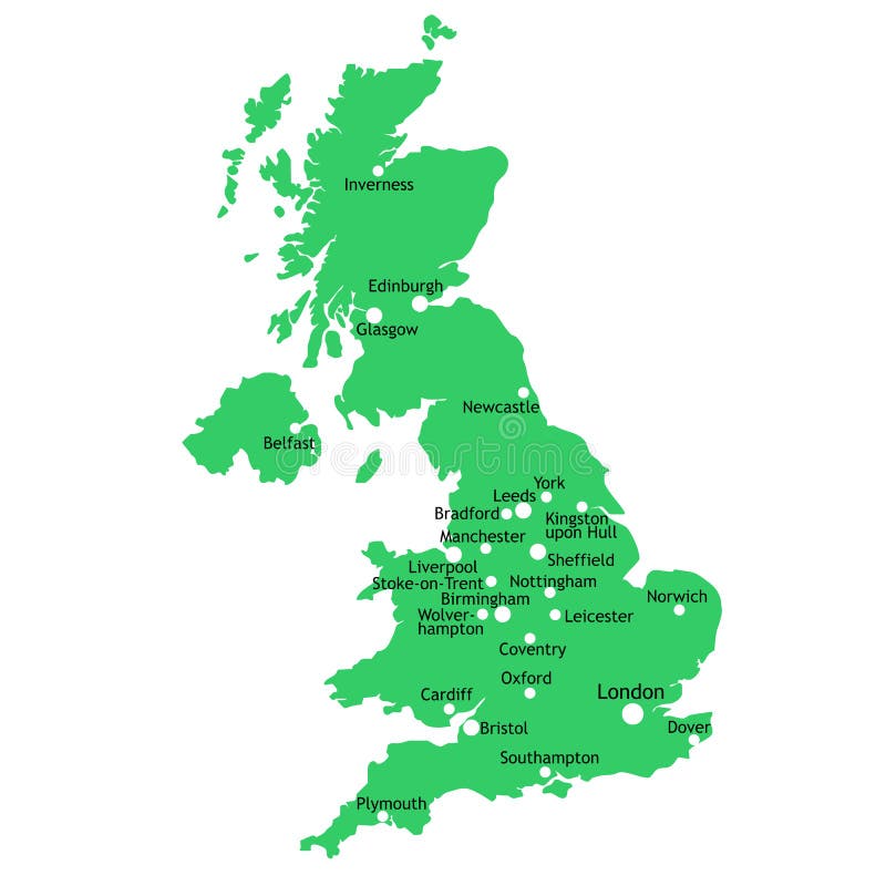
Free with trial Vector world map. Isolated over a white background. Towns vectors Vector world map. Isolated over a white background
Free with trial Vector world map. Isolated over a white background. Towns vectors Vector world map. Isolated over a white background
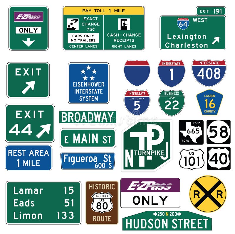
Free with trial Vector Illustration collection of the select Traffic Signs in the United States, isolated on white background. You can find other road signs in my portfolio. EPS file available. Guide signs are essential to direct road users along streets and highways, to inform them of intersecting routes, rnto direct them to cities, towns, villages, or other important destinations, to identify nearby rivers and streams, parks, forests, and historical sites, and generally to give such information as will help them along their way in the most simple, direct manner possible. rnrnIn the United States, road signs are, for the most part, standardized by federal regulations, most notably in the Manual on Uniform Traffic Control Devices (MUTCD) and its companion volume the Standard Highway Signs (SHS). There currently are no plans for adopting the Vienna Convention on Road Signs and Signals standards. Twenty-three states along with the District of Columbia and Puerto Rico use the manual without any alterations, 20 states have adopted it in conjunction with a supplemental volume, and seven states have a state version in substantial conformance to the MUTCD. There are also localized versions that are used in large cities such as New York City which use a naming system compatible with the MUTCD and/or state supplement. The MUTCD and SHS establish seven general categories of signs for road and highway use. rnrnIncluded illustrations are select examples of the MUTCD Guide Signs categories. rn. Towns vectors Traffic Guide Signs in the United States. Vector Illustration collection of the select Traffic Signs in the United States, isolated on white background. You can. Vector Illustration collection of the select Traffic Signs in the United States, isolated on white background. You can find other road signs in my portfolio. EPS file available. Guide signs are essential to direct road users along streets and highways, to inform them of intersecting routes, rnto direct them to cities, towns, villages, or other important destinations, to identify nearby rivers and streams, parks, forests, and historical sites, and generally to give such information as will help them along their way in the most simple, direct manner possible.rnrnIn the United States, road signs are, for the most part, standardized by federal regulations, most notably in the Manual on Uniform Traffic Control Devices (MUTCD) and its companion volume the Standard Highway Signs (SHS). There currently are no plans for adopting the Vienna Convention on Road Signs and Signals standards. Twenty-three states along with the District of Columbia and Puerto Rico use the manual without any alterations, 20 states have adopted it in conjunction with a supplemental volume, and seven states have a state version in substantial conformance to the MUTCD. There are also localized versions that are used in large cities such as New York City which use a naming system compatible with the MUTCD and/or state supplement. The MUTCD and SHS establish seven general categories of signs for road and highway use.rnrnIncluded illustrations are select examples of the MUTCD Guide Signs categories.rn
Free with trial Tennessee map. Illustrated design of the map of Tennessee (USA), including counties and county seats. Isolated against a white background. Towns vectors Tennessee map. Illustrated design of the map of Tennessee (USA), including counties and county seats. Isolated against a white background
Free with trial Indiana map. Colorful illustrated design of the map of Indiana (USA), including counties and county seats. Isolated against a white background. Towns vectors Indiana map. Colorful illustrated design of the map of Indiana (USA), including counties and county seats. Isolated against a white background
Free with trial State of New York designed in illustration with the counties and the main cities. (Map is hight resolution). Towns vectors State of New York. Designed in illustration with the counties and the main cities. (Map is hight resolution
Free with trial State of New York designed in illustration with the counties and the main cities. (Map is hight resolution). Towns vectors State of New York. Designed in illustration with the counties and the main cities. (Map is hight resolution
Free with trial Route 66. USA map with names of major towns. Towns vectors Route 66. USA map with names of major towns
Free with trial The Empire of Alexander the Great an his conquest course from Greece to India to Babylon in 334-323 B. C. with towns, provinces and year dates. Isolated vector illustration o black background. Towns vectors Alexander the Great Empire. The Empire of Alexander the Great an his conquest course from Greece to India to Babylon in 334-323 B.C. with towns, provinces and. The Empire of Alexander the Great an his conquest course from Greece to India to Babylon in 334-323 B.C. with towns, provinces and year dates. Isolated vector illustration o black background.
Free with trial Ancient city at night (version with the giant moon). Towns vectors Ancient city under full moon. Ancient city at night (version with the giant moon. Ancient city at night (version with the giant moon)
Free with trial Golden city under golden sky (version with sky dragon). Towns vectors Golden city under golden sky (dragon version). Golden city under golden sky (version with sky dragon. Golden city under golden sky (version with sky dragon)
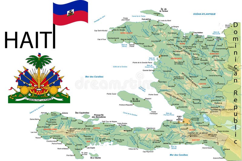
Free with trial Haiti map with major towns. Towns vectors Haiti map. Haiti map with major towns. Haiti map with major towns.
Free with trial Tennessee State by counties. Vector map of Tennessee State by counties. Towns vectors Tennessee State by counties. Vector map of Tennessee State by counties
Free with trial Map towns (vector). Town icons for map designs. Towns vectors Towns for maps (vector). Map towns (vector). Town icons for map designs. Map towns (vector). Town icons for map designs.
Free with trial Eco friendly green towns. Eco and environment friendly green towns. Towns vectors Eco friendly green towns. Eco and environment friendly green towns
Free with trial Rubber stamps with the names of the biggest USA cities. Towns vectors Stamp towns USA. Rubber stamps with the names of the biggest USA cities. Rubber stamps with the names of the biggest USA cities.
Free with trial State of Nebraska. Colorful illustrated design of the map of Nebraska (USA), including counties and county seats. Isolated against a white background. Towns vectors State of Nebraska. Colorful illustrated design of the map of Nebraska (USA), including counties and county seats. Isolated against a white background
Free with trial Colorful illustrated design of the map of Arkansas (USA), including counties and county seats. Isolated against a white background. Towns vectors Colorful Arkansas map. Colorful illustrated design of the map of Arkansas (USA), including counties and county seats. Isolated against a white background. Colorful illustrated design of the map of Arkansas (USA), including counties and county seats. Isolated against a white background.
Free with trial Arkansas map. Illustrated design of the map of Arkansas (USA), including counties and county seats. Isolated against a white background. Towns vectors Arkansas map. Illustrated design of the map of Arkansas (USA), including counties and county seats. Isolated against a white background
Free with trial Romania. Traveling series: Romania - Collection of an hand drawn illustrations. Description: Full sized hand drawn illustrations drawing on white background. Towns vectors Romania. Traveling series: Romania - Collection of an hand drawn illustrations. Description: Full sized hand drawn illustrations drawing on white background
Free with trial Eco city concept (previous version of this image Modern City Day & Night is in my gallery). Towns vectors Eco City. Concept (previous version of this image Modern City Day & Night is in my gallery
Free with trial State of Tennessee. Colorful illustrated design of the map of Tennessee (USA), including counties and county seats. Isolated against a white background. Towns vectors State of Tennessee. Colorful illustrated design of the map of Tennessee (USA), including counties and county seats. Isolated against a white background
Free with trial Skyline New York. Skyline from New York with liberty. Towns vectors Skyline New York. Skyline from New York with liberty
Free with trial Skyline of Hongkong. At sunset with modern skyscrapers. Towns vectors Skyline of Hongkong. At sunset with modern skyscrapers
Free with trial Golden city under golden sky (other versions of this image are in my gallery). Towns vectors Golden city under golden sky. (other versions of this image are in my gallery
Free with trial Yellow background with two plane shapes and the name of more important cities from all over the world written in various ways with green letters. Towns vectors Flying around the world. Yellow background with two plane shapes and the name of more important cities from all over the world written in various ways with green. Yellow background with two plane shapes and the name of more important cities from all over the world written in various ways with green letters
Free with trial A set of four detailed isolated maps of New Zealand on a white background. Designed for the travel and tourism industry and includes the top ten NZ attractions, main cities and towns and top twenty things to do. Vector illustrations may be re-colored, edited and re-sized without loosing quality. Towns vectors New Zealand Tourism Vector Maps Set. A set of four detailed isolated maps of New Zealand on a white background. Designed for the travel and tourism industry and. A set of four detailed isolated maps of New Zealand on a white background. Designed for the travel and tourism industry and includes the top ten NZ attractions, main cities and towns and top twenty things to do. Vector illustrations may be re-colored, edited and re-sized without loosing quality.
Free with trial Map of Italy. Geographical map of Italy with the main towns. Towns vectors Map of Italy. Geographical map of Italy with the main towns
Free with trial Landmarks of China. Set of monochrome icons. Editable vector illustration. Towns vectors Icons of China. Landmarks of China. Set of monochrome icons. Editable vector illustration. Landmarks of China. Set of monochrome icons. Editable vector illustration.
Free with trial Map of the World. Made with rounded squares pattern. Towns vectors Map of the World. Made with rounded squares pattern
Free with trial State of Tennessee, USA. Illustration of State of Tennessee, USA. Towns vectors State of Tennessee, USA. Illustration of State of Tennessee, USA
Free with trial State of New York, USA. Illustration of State of New York, USA. Towns vectors State of New York, USA. Illustration of State of New York, USA
Free with trial City navigation map. Flat plan of streets parks and river with top view, simple cartoon city map. Vector illustration downtown pattern with beautiful mapping image town squares, square. Towns vectors City navigation map. Flat plan of streets parks and river with top view, simple cartoon city map. Vector downtown. City navigation map. Flat plan of streets. City navigation map. Flat plan of streets parks and river with top view, simple cartoon city map. Vector illustration downtown pattern with beautiful mapping image town squares, square
Free with trial Germany - outline map made of city names. German concept. Towns vectors Germany map. Germany - outline map made of city names. German concept. Germany - outline map made of city names. German concept.
Free with trial India map. Outline illustration country map with state names and their capital cities. Towns vectors India map. Outline illustration country map with state names and their capital cities
Free with trial Alberta road and national park map. Road map of the Canadian federal State with national parks. Towns vectors Alberta road and national park map. Road map of the Canadian federal State with national parks
Free with trial Map of Belgium. Belgium map with administrative division into provinces. Brussels is the capital city, other cities are capitals of provinces. Towns vectors Map of Belgium. Belgium map with administrative division into provinces. Brussels is the capital city, other cities are capitals of provinces
Free with trial Map of Australia. With all important cities and administrative division into states. Towns vectors Map of Australia. With all important cities and administrative division into states
Free with trial Vector world map. Grey on whitte vector world map. Towns vectors Vector world map. Grey on whitte vector world map
Free with trial Canada administrative, political and road vector map. Towns vectors Canada administrative, political and road vector map.
Free with trial Road map of the US American State of florida. Towns vectors Road map of the US American State of florida.
Free with trial Province manitoba vector road and travel map. Towns vectors Province manitoba vector road and travel map.
Free with trial Florida road map with national parks. Towns vectors Florida road map with national parks. Florida vector road map with national parks
Free with trial Small towns houses. In wintertime and summer. Towns vectors Small towns houses. In wintertime and summer
Free with trial Illustration of ecological green towns. Towns vectors Eco town. handwritten illustrations. Illustration of ecological green towns. Illustration of ecological green towns.
Free with trial Montana state detailed editable map with cities and towns, geographic sites, roads, railways, interstates and U. S. highways. Vector EPS-10 file, trending color scheme. Towns vectors Montana state detailed editable map. With cities and towns, geographic sites, roads, railways, interstates and U.S. highways. Vector EPS-10 file, trending color
Free with trial Abstract places, villages, small streets, old towns in Santorini, Spain, Greece and Italy in blue colors. Travel Vector. Illustrations. Towns vectors Abstract places, villages, small streets, old towns in Santorini, Spain, Greece and Italy in blue colors. Travel Vector. Illustrations
Free with trial Glibe with man hands. The businessman holds the globe turned the Africa. Black and white vector illustration. Towns vectors Glibe with man hands. The businessman holds the globe turned the Africa. Black and white vector illustration
Free with trial Hands holding the planet Earth from six different sides. The North America, the South America, the Europe, the Africa, the Asian region and the Australia is shown. Towns vectors Hand with globe. Hands holding the planet Earth from six different sides. The North America, the South America, the Europe, the Africa, the Asian region and the. Hands holding the planet Earth from six different sides. The North America, the South America, the Europe, the Africa, the Asian region and the Australia is shown
Free with trial Meandering river. Editable vector generic map of a meandering river valley. Towns vectors Meandering river. Editable vector generic map of a meandering river valley
Free with trial Skyline of New York. Illustration Skyline of New York. Towns vectors Skyline of New York. Illustration Skyline of New York
Free with trial Map of the World. Made with rounded squares pattern. Towns vectors Map of the World. Made with rounded squares pattern
Free with trial The hand and the world. The big hand holding the blue world. Towns vectors The hand and the world. The big hand holding the blue world
Free with trial Mining town. Coal Mining Towns, vector illustration. Towns vectors Mining town. Coal Mining Towns, vector illustration
Free with trial Travelling plane. Abstract colorful illustration with various large city names written in the background, blue globe and passenger plane. Towns vectors Travelling plane. Abstract colorful illustration with various large city names written in the background, blue globe and passenger plane. Travelling plane
Free with trial Skylines. Vector roofs and skylines of the cities and towns. Towns vectors Skylines. Vector roofs and skylines of the cities and towns
Free with trial British Columbia Map. Canada state with cities and towns. Towns vectors British Columbia Map. Canada state with cities and towns
Free with trial Retro color map of Washington state with a main relief, rivers, lakes and highways. Towns vectors Retro color map of Washington state. With a main relief, rivers, lakes and highways
Free with trial Earth day and Recycle,Print size a4. Towns vectors Earth day and Recycle,Print size a4. Earth day and Recycle,Print size
Free with trial New French regions. Nouvelles regions de France. Separated departments. Towns vectors New French regions. Nouvelles regions de France. Separated departments
Free with trial Maldives political map with capital Male on Kings Island and important towns. Republic and island country in the Indian Ocean. A chain of twenty six atolls. English labeling. Detailed Illustration. Towns vectors Maldives Political Map. With capital Male on Kings Island and important towns. Republic and island country in the Indian Ocean. A chain of twenty six atolls. Maldives political map with capital Male on Kings Island and important towns. Republic and island country in the Indian Ocean. A chain of twenty six atolls. English labeling. Detailed Illustration.
Free with trial A detailed green map of New Zealand on a white background. Includes driving distances and driving times for all major towns and cities. Vector illustration may be edited and re-sized without loosing quality. Towns vectors New Zealand Green Vector Map - Driving Distances. A detailed green map of New Zealand on a white background. Includes driving distances and driving times for all. A detailed green map of New Zealand on a white background. Includes driving distances and driving times for all major towns and cities. Vector illustration may be edited and re-sized without loosing quality.
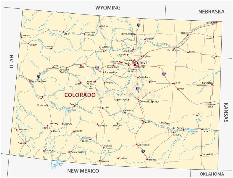
Free with trial Colorado road map. Street map of the US state Colorado. Towns vectors Colorado road map. Street map of the US state Colorado
Free with trial Vector Map of the U. S. state of Michigan. Towns vectors Vector Map of the U.S. state of Michigan.
Free with trial Iraq. Map of Iraq with provinces (governorates) in various colours and cities: Baghdad, Mosul, Karbala, Najaf and others. Towns vectors Iraq. Map of Iraq with provinces (governorates) in various colours and cities: Baghdad, Mosul, Karbala, Najaf and others
Free with trial Australia. Map of Australia with all important cities and administrative division into states. Towns vectors Australia. Map of Australia with all important cities and administrative division into states
Free with trial Road map of the Australian state New South Wales map. Towns vectors Road map of the Australian state New South Wales map.
Free with trial India. Map of India. Outline illustration country map with major cities (state capitals. Towns vectors India. Map of India. Outline illustration country map with major cities (state capitals
Free with trial Road map of the australian state victoria. Towns vectors Road map of the australian state victoria.
Free with trial Road map of the US American State of West Virginia. Towns vectors Road map of the US American State of West Virginia.
Free with trial Vector Map of the U. S. state of Texas. Towns vectors Vector Map of the U.S. state of Texas.
Free with trial Road map of the US American State of Utah. Towns vectors Road map of the US American State of Utah.
Free with trial Picture of a black silhouette of towns and cities on a white background. Towns vectors Silhouette of city. Picture of a black silhouette of towns and cities on a white background. Picture of a black silhouette of towns and cities on a white background.
Free with trial City Skyline Sets. Cityscape sets with various parts of a city. Small towns or suburbs and downtown silhouettes. Towns vectors City Skyline Sets. Cityscape sets with various parts of a city. Small towns or suburbs and downtown silhouettes
 Sign in