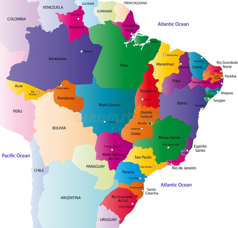
Free with trial Brazil map designed in illustration with the 26 states colored in bright colors and with the main cities. On an illustration neighbouring countries are shown too. Chile provinces vectors Brazil map
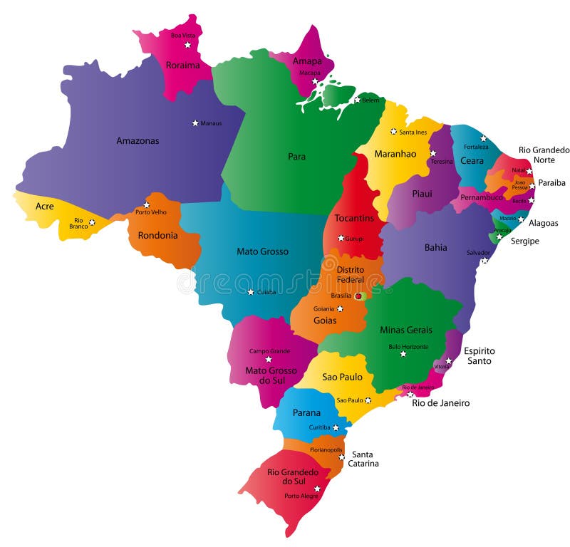
Free with trial Brazil map designed in illustration with 26 states colored in bright colors and with the main cities. Neighbouring countries are in an additional format (. AI) in the latent layer. Chile provinces illustrations Map of Brazil. Brazil map designed in illustration with 26 states colored in bright colors and with the main cities. Neighbouring countries are in an additional format (.AI) in the latent layer.
Free with trial Brazil map designed in illustration with the 26 states. Chile provinces vectors Brazil
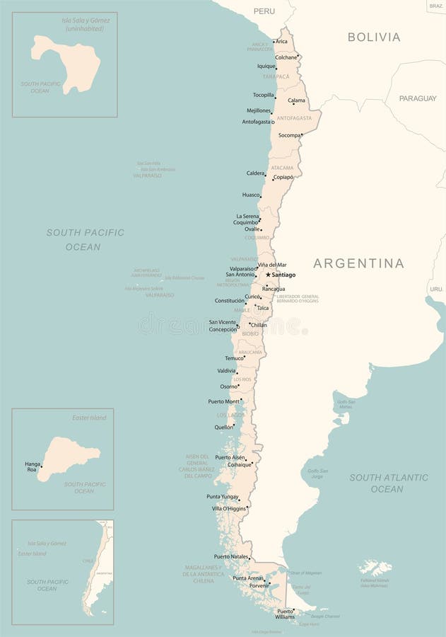
Free with trial Blank map Republic of Chile. High quality map of Chile with provinces on transparent background for your web site design, logo, app, UI. South America. EPS10. Chile provinces vectors Blank map Republic of Chile. High quality map of Chile with provinces on transparent background for your web site design, logo, a. Blank map Republic of Chile. High quality map of Chile with provinces on transparent background for your web site design, logo, app, UI. South America. EPS10
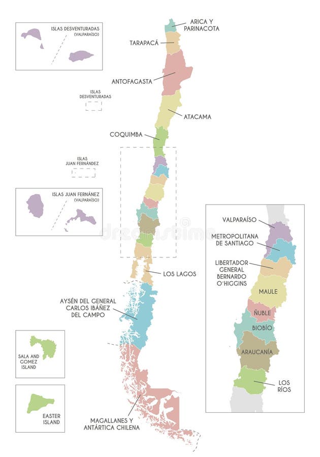
Free with trial Pastel Colored Labeled Flat Provinces Map of the South American Country of Chile. Chile provinces vectors Map of Administrative Division of Chile. Pastel Colored Labeled Flat Provinces Map of the South American Country of Chile
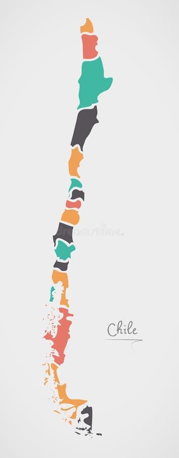
Free with trial Chile Map with states and modern round shapes illustration. Chile provinces vectors Chile Map with states and modern round shapes
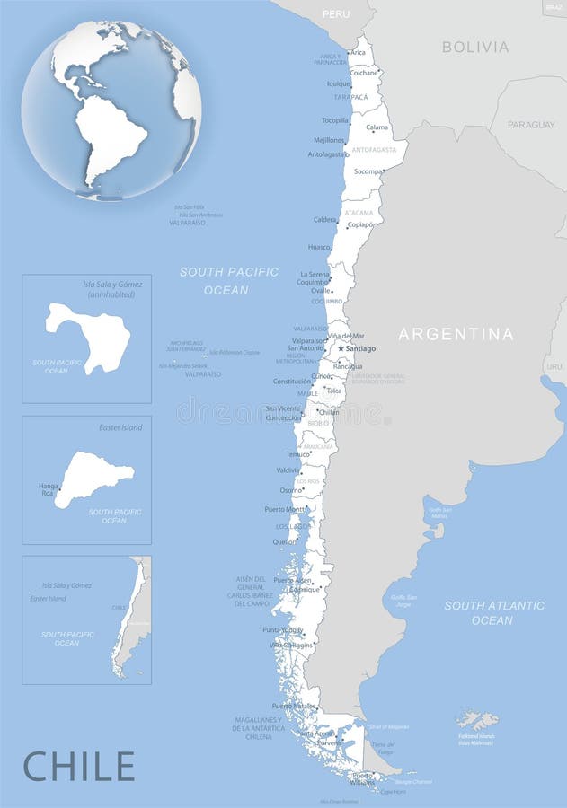
Free with trial Blue-gray detailed map of Chile and administrative divisions and location on the globe. Vector illustration. Chile provinces illustrations Blue-gray detailed map of Chile and administrative divisions and location on the globe
Free with trial Blank map Los Rios Region of Chile. High quality map Los Rios with municipalities on transparent background for your web site design, logo, app, UI. Republic of Chile. EPS10. Chile provinces vectors Blank map Los Rios Region of Chile. High quality map Los Rios with municipalities on transparent background
Free with trial Glossy and colorful stickers with reflection set. Chile provinces illustrations Set of stickers and buttons - Chile. Glossy and colorful stickers with reflection set
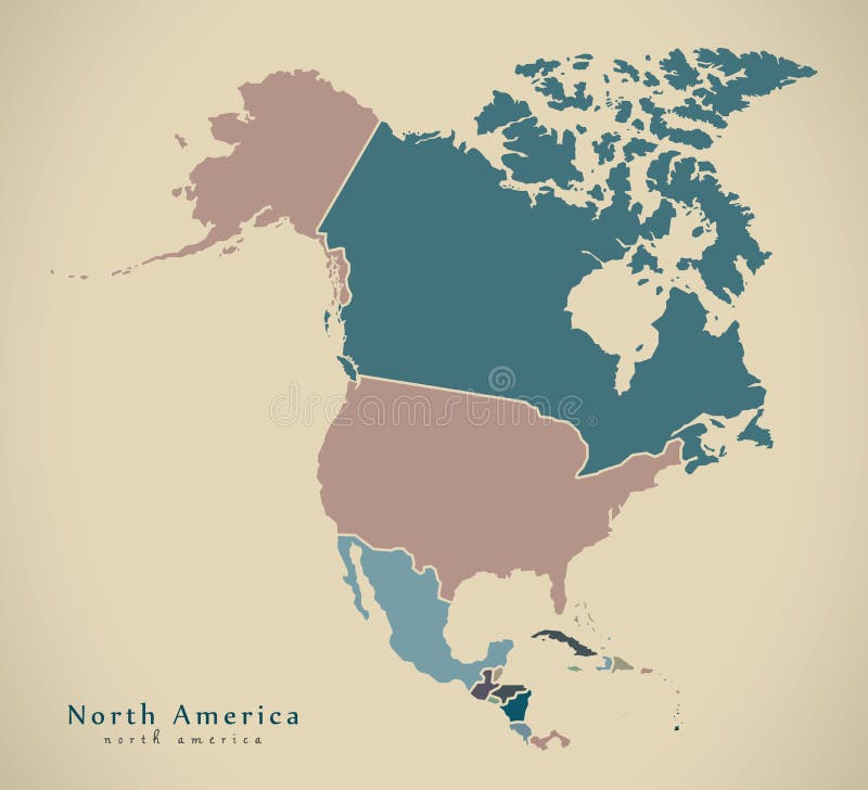
Free with trial North and South America. Mainland America. Modern Map - America with all countries complete. Map of America. Chile provinces vectors North and South America. Mainland America. Modern Map - America with all countries complete
Free with trial Modern Map - North America Map with countries colored complete illustration. Chile provinces illustrations Modern Map - North America Map with countries colored complete
Free with trial Multicolor Map Of Chile With Provinces, vector editable design, can be used for business or presentation design. Chile provinces vectors Multicolor Map Of Chile With Provinces
Free with trial Chile Detailed Map With States, vector editable design, can be used for business or presentation design. Chile provinces vectors Chile Detailed Map With States
Free with trial States Map Of Chile With Detailed Borders, vector editable design, can be used for business or presentation design. Chile provinces vectors States Map Of Chile With Detailed Borders
Free with trial A detailed 3D rendered map of Chile, showcasing the country's geographical features and political divisions. The image highlights the diverse terrain, from the Andes Mountains to the coastal regions, with a gradient color scheme to represent elevation. White lines delineate the administrative boundaries. This image is suitable for educational materials, travel guides, geographical presentations, and illustrating economic or political data related to Chile. Chile provinces illustrations 3D Rendered Map of Chile with Political Divisions. A detailed 3D rendered map of Chile, showcasing the country's geographical features and political divisions. The image highlights the diverse terrain, from the Andes Mountains to the coastal regions, with a gradient color scheme to represent elevation. White lines delineate the administrative boundaries. This image is suitable for educational materials, travel guides, geographical presentations, and illustrating economic or political data related to Chile.
Free with trial 3D map of chile on a simple background with high-resolution. Chile provinces illustrations Chile 3D map. 3D map of chile on a simple background with high-resolution
Free with trial Blank map O'Higgins Region of Chile. High quality map O'Higgins with municipalities on transparent background for your web site design, logo, app, UI. Republic of Chile. EPS10. Chile provinces vectors Blank map O\'Higgins Region of Chile. High quality map O\'Higgins with municipalities on transparent background. Blank map O'Higgins Region of Chile. High quality map O'Higgins with municipalities on transparent background for your web site design, logo, app, UI. Republic of Chile. EPS10
Free with trial Blank map Nuble Region of Chile. High quality map Nuble with municipalities on transparent background for your web site design, logo, app, UI. Republic of Chile. EPS10. Chile provinces vectors Blank map Nuble Region of Chile. High quality map Nuble with municipalities on transparent background
Free with trial Metropolitana de Santiago region of Chile vector map illustration. Chile provinces vectors Metropolitana de Santiago region of Chile vector map illustration
Free with trial Chile - detailed map with administrative divisions country. Vector illustration. Chile provinces illustrations Chile - detailed map with administrative divisions country. Vector illustration
Free with trial Chile - detailed map with administrative divisions country. Vector illustration. Chile provinces illustrations Chile - detailed map with administrative divisions country
Free with trial Chile - detailed map of the country in brown colors, divided into regions. Vector illustration. Chile provinces illustrations Chile - detailed map of the country in brown colors, divided into regions
Free with trial This is a High-resolution vector map. Clean line art, black & white silhouette - Ideal for travel & tourism projects. Fully scalable and print ready format. Chile provinces vectors Chile Map Vector Illustration - Silhouette, Outline, Chile Travel and Tourism Map. This is a High-resolution vector map. Clean line art, black & white silhouette - Ideal for travel & tourism projects. Fully scalable and print ready format.
Free with trial Vintage Map Of Argentina With Provincial Boundaries On Retro Paper. Background. Chile provinces illustrations Vintage Map Of Argentina With Provincial Boundaries On Retro Paper. Background
Free with trial Itata province outline map set. Chile provinces vectors Itata outline map. Itata province outline map set
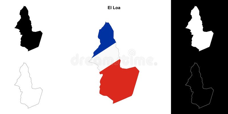
Free with trial El Loa province outline map set. Chile provinces vectors El Loa outline map. El Loa province outline map set
Free with trial Choapa province outline map set. Chile provinces vectors Choapa outline map. Choapa province outline map set
Free with trial Valdivia province outline map set. Chile provinces vectors Valdivia outline map. Valdivia province outline map set
Free with trial Tocopilla province outline map set. Chile provinces vectors Tocopilla outline map. Tocopilla province outline map set
Free with trial Llanquihue province outline map set. Chile provinces vectors Llanquihue outline map. Llanquihue province outline map set
Free with trial Isla de Pascua province outline map set. Chile provinces vectors Isla de Pascua outline map. Isla de Pascua province outline map set
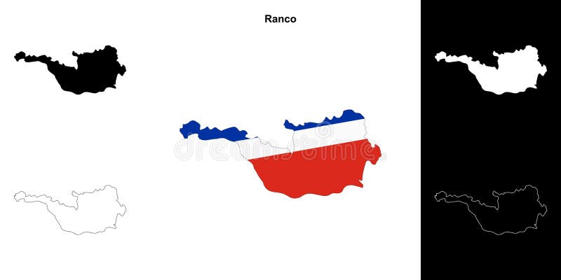
Free with trial Ranco province outline map set. Chile provinces vectors Ranco outline map. Ranco province outline map set
Free with trial Talca province outline map set. Chile provinces vectors Talca outline map. Talca province outline map set
Free with trial Copiapo province outline map set. Chile provinces vectors Copiapo outline map. Copiapo province outline map set
Free with trial Petorca province outline map set. Chile provinces vectors Petorca outline map. Petorca province outline map set
Free with trial Chanaral province outline map set. Chile provinces vectors Chanaral outline map. Chanaral province outline map set
Free with trial Melipilla province outline map set. Chile provinces vectors Melipilla outline map. Melipilla province outline map set
Free with trial Colchagua province outline map set. Chile provinces illustrations Colchagua outline map. Colchagua province outline map set
Free with trial Capitan Prat province outline map set. Chile provinces vectors Capitan Prat outline map. Capitan Prat province outline map set
Free with trial Cardenal Caro province outline map set. Chile provinces vectors Cardenal Caro outline map. Cardenal Caro province outline map set
Free with trial Ultima Esperanza province outline map set. Chile provinces vectors Ultima Esperanza outline map. Ultima Esperanza province outline map set
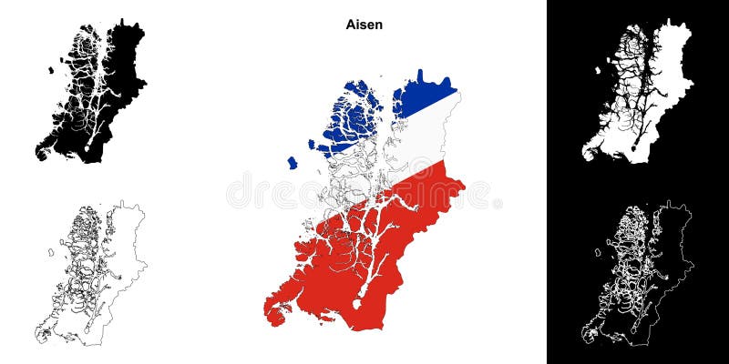
Free with trial Aisen province outline map set. Chile provinces vectors Aisen outline map. Aisen province outline map set
Free with trial San Felipe de Aconcagua province outline map set. Chile provinces vectors San Felipe de Aconcagua outline map. San Felipe de Aconcagua province outline map set
Free with trial Chacabuco province outline map set. Chile provinces vectors Chacabuco outline map. Chacabuco province outline map set
Free with trial Valparaiso province outline map set. Chile provinces vectors Valparaiso outline map. Valparaiso province outline map set
Free with trial Arica province outline map set. Chile provinces vectors Arica outline map. Arica province outline map set
Free with trial Los Andes province outline map set. Chile provinces vectors Los Andes outline map. Los Andes province outline map set
Free with trial Concepcion province outline map set. Chile provinces vectors Concepcion outline map. Concepcion province outline map set
Free with trial Location of Magallanes Region on map Chile. 3d location sign similar to the flag of Magallanes. Quality map with provinces of Chile for your design. EPS10. Chile provinces vectors Location of Magallanes Region on map Chile. 3d location sign similar to the flag of Magallanes. Quality map with provinces of. Location of Magallanes Region on map Chile. 3d location sign similar to the flag of Magallanes. Quality map with provinces of Chile for your design. EPS10
Free with trial Location of Nuble Region on map Chile. 3d location sign similar to the flag of Nuble. Quality map with provinces of Chile for your design. EPS10. Chile provinces vectors Location of Nuble Region on map Chile. 3d location sign similar to the flag of Nuble. Quality map with provinces of Chile for. Location of Nuble Region on map Chile. 3d location sign similar to the flag of Nuble. Quality map with provinces of Chile for your design. EPS10
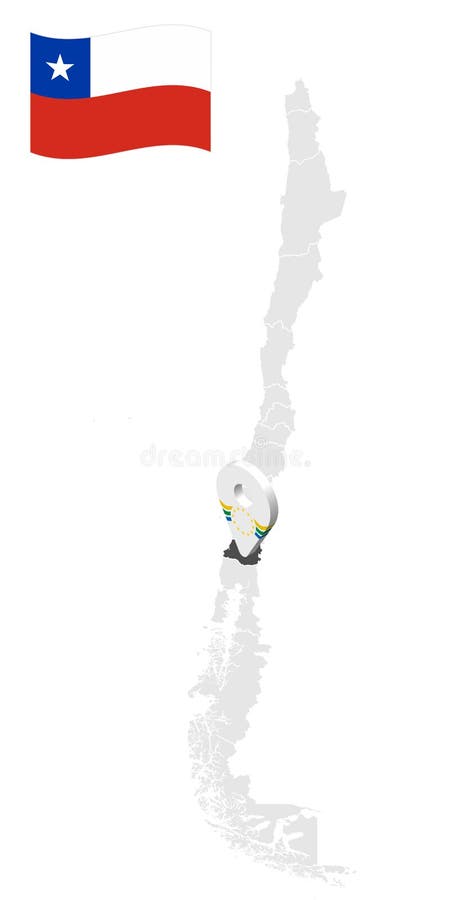
Free with trial Location of Aysen Region on map Chile. 3d location sign similar to the flag of Aysen. Quality map with provinces of Chile for your design. EPS10. Chile provinces vectors Location of Aysen Region on map Chile. 3d location sign similar to the flag of Aysen. Quality map with provinces of Chile for. Location of Aysen Region on map Chile. 3d location sign similar to the flag of Aysen. Quality map with provinces of Chile for your design. EPS10
Free with trial Location of Maule Region on map Chile. 3d location sign similar to the flag of Maule. Quality map with provinces of Chile for your design. EPS10. Chile provinces vectors Location of Maule Region on map Chile. 3d location sign similar to the flag of Maule. Quality map with provinces of Chile for your
Free with trial Location of Atacama Region on map Chile. 3d location sign similar to the flag of Atacama. Quality map with provinces of Chile for your design. EPS10. Chile provinces vectors Location of Atacama Region on map Chile. 3d location sign similar to the flag of Atacama. Quality map with provinces of Chile. Location of Atacama Region on map Chile. 3d location sign similar to the flag of Atacama. Quality map with provinces of Chile for your design. EPS10
Free with trial Location of Biobio Region on map Chile. 3d location sign similar to the flag of Biobio. Quality map with provinces of Chile for your design. EPS10. Chile provinces vectors Location of Biobio Region on map Chile. 3d location sign similar to the flag of Biobio. Quality map with provinces of Chile fo. Location of Biobio Region on map Chile. 3d location sign similar to the flag of Biobio. Quality map with provinces of Chile for your design. EPS10
Free with trial Location of Valparaiso Region on map Chile. 3d location sign similar to the flag of Valparaiso. Quality map with provinces of Chile for your design. EPS10. Chile provinces vectors Location of Valparaiso Region on map Chile. 3d location sign similar to the flag of Valparaiso. Quality map with provinces of. Location of Valparaiso Region on map Chile. 3d location sign similar to the flag of Valparaiso. Quality map with provinces of Chile for your design. EPS10
Free with trial Location of Antofagasta Region on map Chile. 3d location sign similar to the flag of Antofagasta. Quality map with provinces of Chile for your design. EPS10. Chile provinces vectors Location of Antofagasta Region on map Chile. 3d location sign similar to the flag of Antofagasta. Quality map with provinces of. Location of Antofagasta Region on map Chile. 3d location sign similar to the flag of Antofagasta. Quality map with provinces of Chile for your design. EPS10
Free with trial Location of Araucania Region on map Chile. 3d location sign similar to the flag of Araucania. Quality map with provinces of Chile for your design. EPS10. Chile provinces vectors Location of Araucania Region on map Chile. 3d location sign similar to the flag of Araucania. Quality map with provinces of Ch. Location of Araucania Region on map Chile. 3d location sign similar to the flag of Araucania. Quality map with provinces of Chile for your design. EPS10
Free with trial Location of Los Lagos Region on map Chile. 3d location sign similar to the flag of Los Lagos. Quality map with provinces of Chile for your design. EPS10. Chile provinces vectors Location of Los Lagos Region on map Chile. 3d location sign similar to the flag of Los Lagos. Quality map with provinces of Ch. Location of Los Lagos Region on map Chile. 3d location sign similar to the flag of Los Lagos. Quality map with provinces of Chile for your design. EPS10
Free with trial Location of Los Rios Region on map Chile. 3d location sign similar to the flag of Los Rios. Quality map with provinces of Chile for your design. EPS10. Chile provinces vectors Location of Los Rios Region on map Chile. 3d location sign similar to the flag of Los Rios. Quality map with provinces of Chil. Location of Los Rios Region on map Chile. 3d location sign similar to the flag of Los Rios. Quality map with provinces of Chile for your design. EPS10
Free with trial Location of Coquimbo Region on map Chile. 3d location sign similar to the flag of Coquimbo. Quality map with provinces of Chile for your design. EPS10. Chile provinces vectors Location of Coquimbo Region on map Chile. 3d location sign similar to the flag of Coquimbo. Quality map with provinces of Chil. Location of Coquimbo Region on map Chile. 3d location sign similar to the flag of Coquimbo. Quality map with provinces of Chile for your design. EPS10
Free with trial Location of Tarapaca Region on map Chile. 3d location sign similar to the flag of Tarapaca. Quality map with provinces of Chile for your design. EPS10. Chile provinces vectors Location of Tarapaca Region on map Chile. 3d location sign similar to the flag of Tarapaca. Quality map with provinces of Chil. Location of Tarapaca Region on map Chile. 3d location sign similar to the flag of Tarapaca. Quality map with provinces of Chile for your design. EPS10
Free with trial Chile 3d map with borders of regions. Vector illustration The map of Chile isolated on white and rendered in 3D in white color. A stylized map of Chile showing the different provinces. All isolated on white background. Chile provinces illustrations Chile map in 3D. 3d map with borders of regions. Chile 3d map with borders of regions. Vector illustration The map of Chile isolated on white and rendered in 3D in white color. A stylized map of Chile showing the different provinces. All isolated on white background.
Free with trial High quality political map of Argentina and Chile with borders of the regions or provinces. Vector illustration. Chile provinces vectors High quality political map of Argentina and Chile with borders of the regions or provinces
Free with trial White Labeled Flat Provinces Map of the South American Country of Chile. Chile provinces vectors Map of Administrative Division of Chile. White Labeled Flat Provinces Map of the South American Country of Chile
Free with trial White Flat Provinces Map of the South American Country of Chile. Chile provinces vectors Map of Administrative Division of Chile. White Flat Provinces Map of the South American Country of Chile
Free with trial Grey Flat Provinces Map of the South American Country of Chile. Chile provinces vectors Map of Administrative Division of Chile. Grey Flat Provinces Map of the South American Country of Chile
Free with trial Flag of the Tarapaca Region Spanish: Region de Tarapaca is one of Chile`s 16 first-order administrative divisions. It comprises two provinces, Iquique and Tamarugal. Chile provinces illustrations Glossy glass flag of the Tarapaca Region, Chile. Flag of the Tarapaca Region Spanish: Region de Tarapaca is one of Chile`s 16 first-order administrative divisions. It comprises two provinces, Iquique and Tamarugal.
Free with trial Flag of Magallanes Regionalism Chile officially the Magallanes y la Antártica Chilena Region is one of Chile`s 16 first order administrative divisions. It is the southernmost, largest, and second least populated region of Chile. It comprises four provinces: Última Esperanza, Magallanes, Tierra del Fuego, and Antártica Chilena. Chile provinces illustrations Glossy glass flag of Magallanes Regionalism Chile. Flag of Magallanes Regionalism Chile officially the Magallanes y la Antártica Chilena Region is one of Chile`s 16 first order administrative divisions. It is the southernmost, largest, and second least populated region of Chile. It comprises four provinces: Última Esperanza, Magallanes, Tierra del Fuego, and Antártica Chilena.
Free with trial Flag of the Flag of Arica and Parinacota Region Chile is one of Chile`s 16 first order administrative divisions. It comprises two provinces, Arica and Parinacota. Chile provinces illustrations Glossy glass flag of the Arica and Parinacota Region Chile Region, Chile. Flag of the Flag of Arica and Parinacota Region Chile is one of Chile`s 16 first order administrative divisions. It comprises two provinces, Arica and Parinacota.
Free with trial Location of Santiago Metropolitan Region on map Chile. 3d location sign similar to the flag of Santiago Metropolitan. Quality map with provinces of Chile for your design. EPS10. Chile provinces vectors Location of Santiago Metropolitan Region on map Chile. 3d location sign similar to the flag of Santiago Metropolitan. Quality map. Location of Santiago Metropolitan Region on map Chile. 3d location sign similar to the flag of Santiago Metropolitan. Quality map with provinces of Chile for your design. EPS10
Free with trial Location of Arica y Parinacota Region on map Chile. 3d location sign similar to the flag of Arica y Parinacota. Quality map with provinces of Chile for your design. EPS10. Chile provinces vectors Location of Arica y Parinacota Region on map Chile. 3d location sign similar to the flag of Arica y Parinacota. Quality map with. Location of Arica y Parinacota Region on map Chile. 3d location sign similar to the flag of Arica y Parinacota. Quality map with provinces of Chile for your design. EPS10
Free with trial Location of O`Higgins Region on map Chile. 3d location sign similar to the flag of Libertador General Bernardo O`Higgins. Quality map with provinces of Chile for your design. EPS10. Chile provinces vectors Location of O`Higgins Region on map Chile. 3d location sign similar to the flag of Libertador General Bernardo O`Higgins. Quali. Location of O`Higgins Region on map Chile. 3d location sign similar to the flag of Libertador General Bernardo O`Higgins. Quality map with provinces of Chile for your design. EPS10
Free with trial Flag of the Flag of the Araucania Region is one of Chile`s 16 first-order administrative divisions, and comprises two provinces: Malleco in the north and Cautín in the south. Chile provinces illustrations Glossy glass flag of the Araucania Region, Chile. Flag of the Flag of the Araucania Region is one of Chile`s 16 first-order administrative divisions, and comprises two provinces: Malleco in the north and Cautín in the south.
Free with trial Vector map of Chile with regions and territories and administrative divisions. Editable and clearly labeled layers. Chile provinces vectors Vector map of Chile with regions and territories and administrative divisions.
Free with trial Vector blank map of Chile with regions and territories and administrative divisions. Editable and clearly labeled layers. Chile provinces vectors Vector blank map of Chile with regions and territories and administrative divisions.
Free with trial Vector map of Chile with regions and territories and administrative divisions. Editable and clearly labeled layers. Chile provinces vectors Vector map of Chile with regions and territories and administrative divisions.
Free with trial Vector illustrated blank map of Chile with regions and territories and administrative divisions, and neighbouring countries and territories. Editable and clearly labeled layers. Chile provinces vectors Vector illustrated blank map of Chile with regions and territories and administrative divisions, and neighbouring countries. Vector illustrated blank map of Chile with regions and territories and administrative divisions, and neighbouring countries and territories. Editable and clearly labeled layers
Free with trial Vector blank map of Chile with regions and territories and administrative divisions, and neighbouring countries and territories. Editable and clearly labeled layers. Chile provinces vectors Vector blank map of Chile with regions and territories and administrative divisions, and neighbouring countries and territories.