Free with trial South America political map with each country independently selectable. Map suriname vectors South America political map
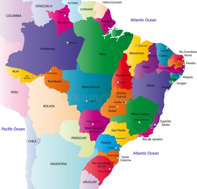
Free with trial Brazil map designed in illustration with the 26 states colored in bright colors and with the main cities. On an illustration neighbouring countries are shown too. Map suriname vectors Brazil map
Free with trial Vector map of america and illustration. Map suriname vectors South America. Vector map of america and illustration
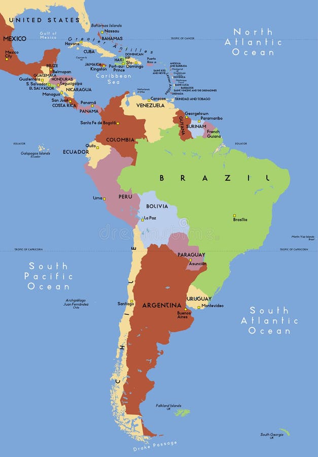
Free with trial Political map of South America with present states borders, detailed vector map. Map suriname vectors South America political map. Political map of South America with present states borders, detailed vector map.
Free with trial Brazil map designed in illustration with 26 states colored in bright colors and with the main cities. Neighbouring countries are in an additional format (. AI) in the latent layer. Map suriname illustrations Map of Brazil. Brazil map designed in illustration with 26 states colored in bright colors and with the main cities. Neighbouring countries are in an additional format (.AI) in the latent layer.
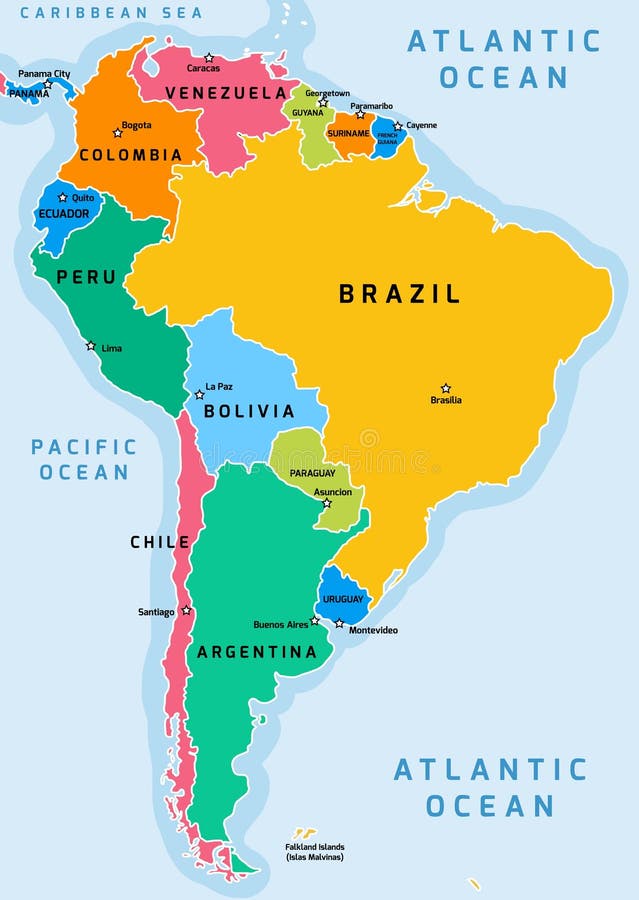
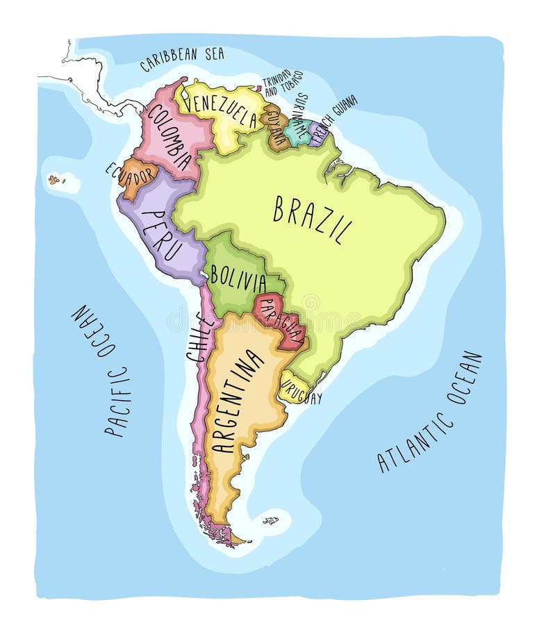
Free with trial A full color map of south america with the country names called out. Map suriname vectors South america 01. A full color map of south america with the country names called out
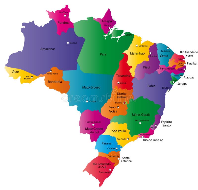
Free with trial Brazilmap designed in illustration with states colored in green colors and with the main cities. Neighbouring countries are in an additional format (. AI) in the latent layer. Map suriname vectors Brazil
Free with trial Central america with names of countries -Vector -. Map suriname vectors Central america. Central america with names of countries -Vector -
Free with trial 3D world render of Latin America. Map suriname illustrations Latin America 3D World. 3D world render of Latin America.
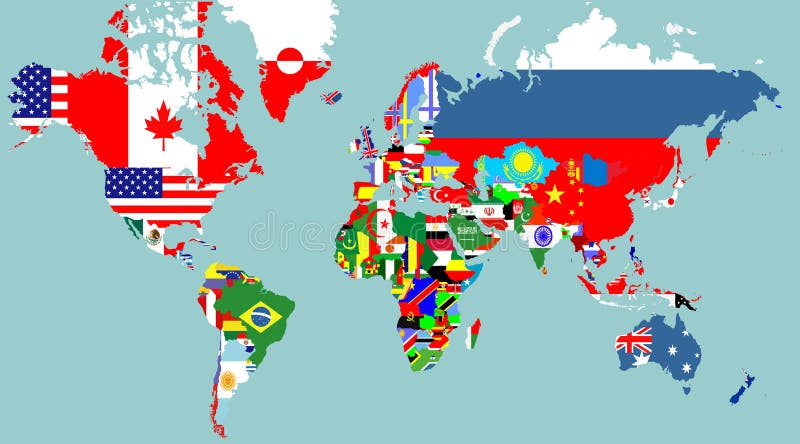
Free with trial Outline maps of the world with national flags vector illustration. Map suriname vectors Outline maps of the world with
Free with trial Illustration of a detailed political map of Suriname. The black triangle indicates the highest point of this country. Map suriname vectors Suriname map. Illustration of a detailed political map of Suriname. The black triangle indicates the highest point of this country.
Free with trial Vector color map of Ecuador country. Map suriname vectors Ecuador map. Vector color map of Ecuador country
Free with trial Highly detailed map of the South American countries. All countries are separate elements and layered in alphabetic order. Map suriname illustrations Map of South America. Highly detailed map of the South American countries. All countries are separate elements and layered in alphabetic order
Free with trial Vector political map of south and north america. Map suriname vectors Political map of south and north america
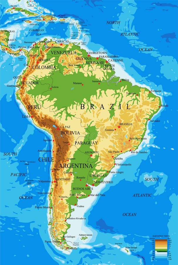
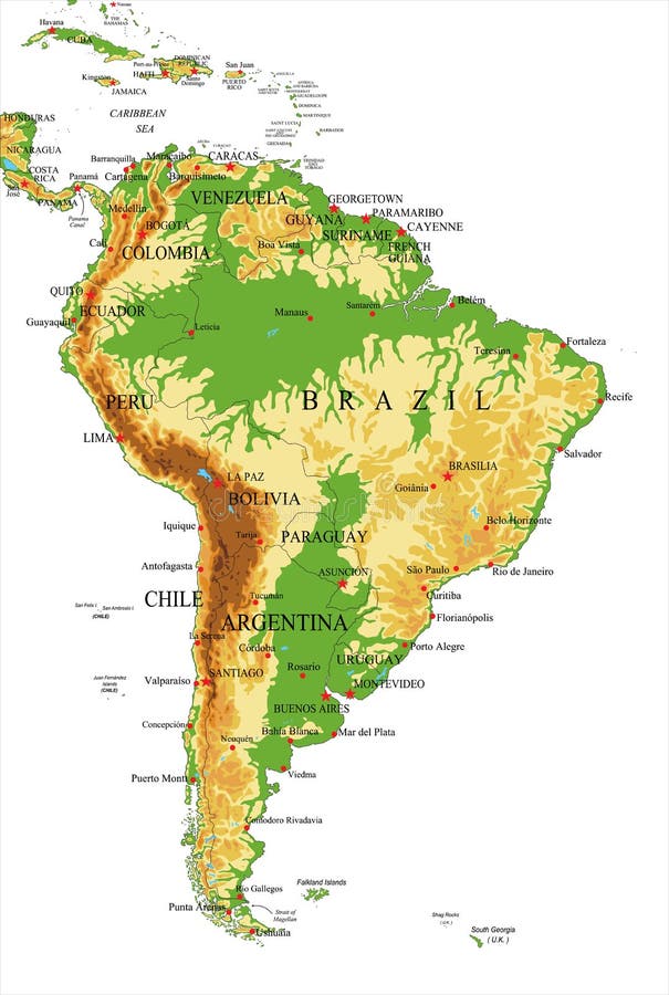
Free with trial Highly detailed physical map of South America, in vector format, with all the relief forms, countries and big cities. Map suriname vectors South America-physical map. Highly detailed physical map of South America, in vector format, with all the relief forms, countries and big cities.
Free with trial South America political division map - vector illustration. Map suriname vectors South America map. South America political division map - vector illustration
Free with trial Highly detailed physical map of South America,in vector format,with all the relief forms,countries and big cities. Map suriname vectors South America-physical map. Highly detailed physical map of South America,in vector format,with all the relief forms,countries and big cities.
Free with trial Map of South America. Political division - countries and capital ciites. Countries are separate objects, you can change color of every country. Map suriname vectors South America administrative map. Map of South America. Political division - countries and capital ciites. Countries are separate objects, you can change color of every country.
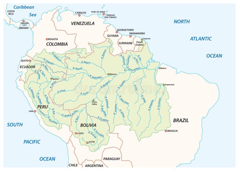
Free with trial Vector map of the Amazon River drainage basin. Map suriname vectors Vector map of the Amazon River drainage basin
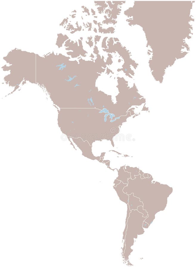
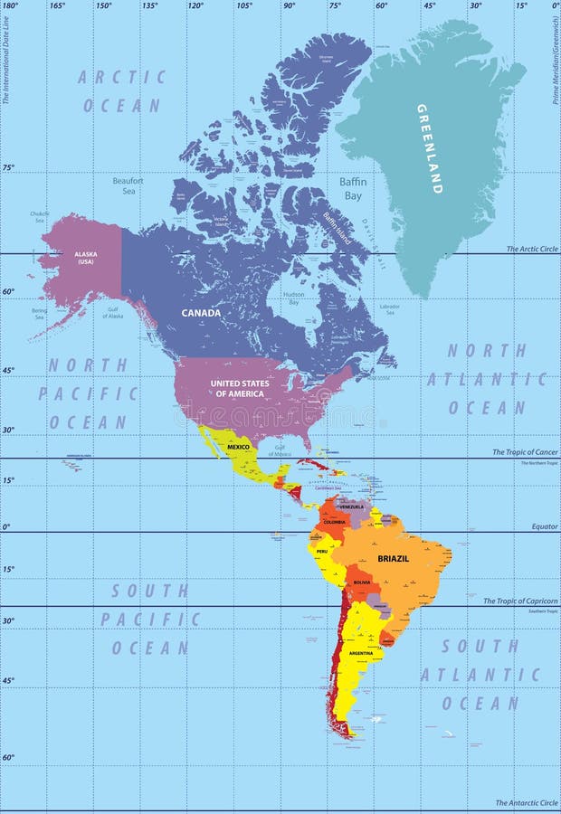
Free with trial North and South America map - highly detailed illustration. Map suriname illustrations North and South America - map - illustration. North and South America map - highly detailed illustration.
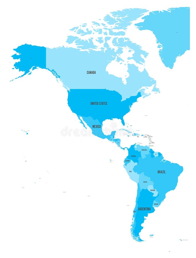
Free with trial Political map of Americas in four shades of blue on white background. North and South America with country labels. Simple flat vector illustration. Map suriname vectors Political map of Americas in four shades of blue on white background. North and South America with country labels
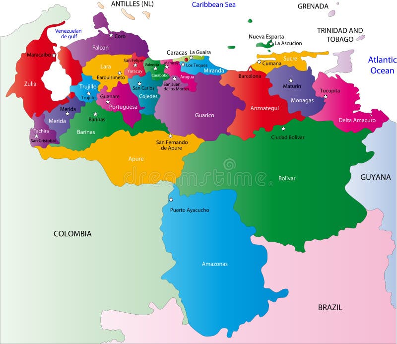
Free with trial Venezuela map designed in illustration with regions colored in bright colors. Vector illustration. Map suriname vectors Venezuela map
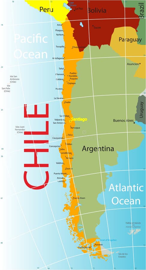
Free with trial Chile map with major town. Map suriname vectors Chile map. Chile map with major town.
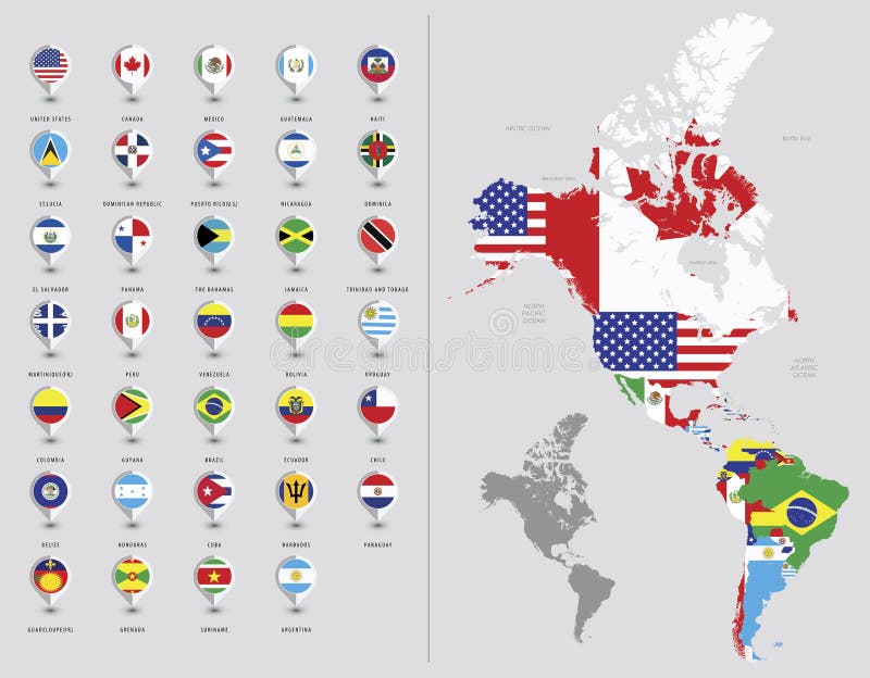
Free with trial Map pointers with flags illustration. South America. Map suriname vectors Map pointers with flags. South America. Map pointers with flags illustration. South America.
Free with trial A collection of map shaped flags of the world in the style of doodle-like sketches. Map suriname illustrations World flag map sketches collection 12. A collection of map shaped flags of the world in the style of doodle-like sketches
Free with trial Vector part of world map with region of Latin American countries mixed with their national flags. Map suriname vectors Vector part of world map with region of Latin American countries mixed with their national flags
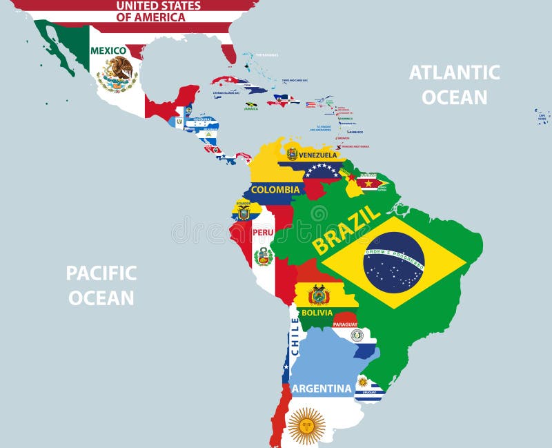
Free with trial Map of North and South America. Flags of the Americas template for your design. Map suriname vectors Map of North and South America. Flags of the Americas
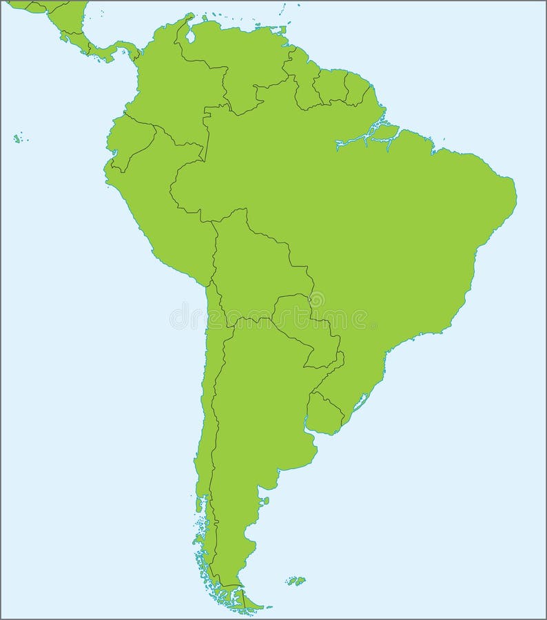
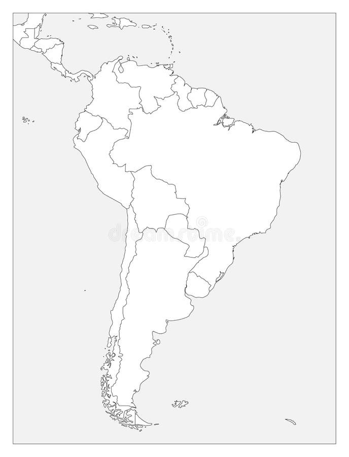
Free with trial Blank political map of South America. Simple flat vector outline map. Map suriname vectors Blank political map of South America. Simple flat vector outline map
Free with trial Blank political map of South America. Simple flat vector outline map. Map suriname vectors Blank political map of South America. Simple flat vector outline map
Free with trial Political map of South America with single states,capitals and national borders. Vector illustration with english labeling and scale. Map suriname vectors South America Single States. Political map of South America with single states,capitals and national borders. Vector illustration with english labeling and scale.
Free with trial A basic map of south america with the countries in green and a blue background. Map suriname vectors South america 02. A basic map of south america with the countries in green and a blue background
Free with trial Flags of nations on America continent flying at their capital cities. Map suriname illustrations America flags on map ( central view). Flags of nations on America continent flying at their capital cities
Free with trial Flags of nations on America continent flying at their capital cities. Map suriname illustrations America flags on map ( whole continent view). Flags of nations on America continent flying at their capital cities.
Free with trial Flags of nations on America continent flying at their capital cities. Map suriname illustrations America flags on map ( souther view). Flags of nations on America continent flying at their capital cities
Free with trial Abstract vector color map of Chile country colored by national flag. Map suriname vectors Chile
Free with trial Abstract vector color map of Brazil country colored by national flag. Map suriname vectors Brazil
Free with trial South America as seen from space. Map suriname illustrations Planet Earth. South America as seen from space
Free with trial South America as seen from space with cloud formations. Map suriname illustrations Planet Earth. South America as seen from space with cloud formations
Free with trial South america with names of countries -Vector -. Map suriname vectors South america. South america with names of countries -Vector -
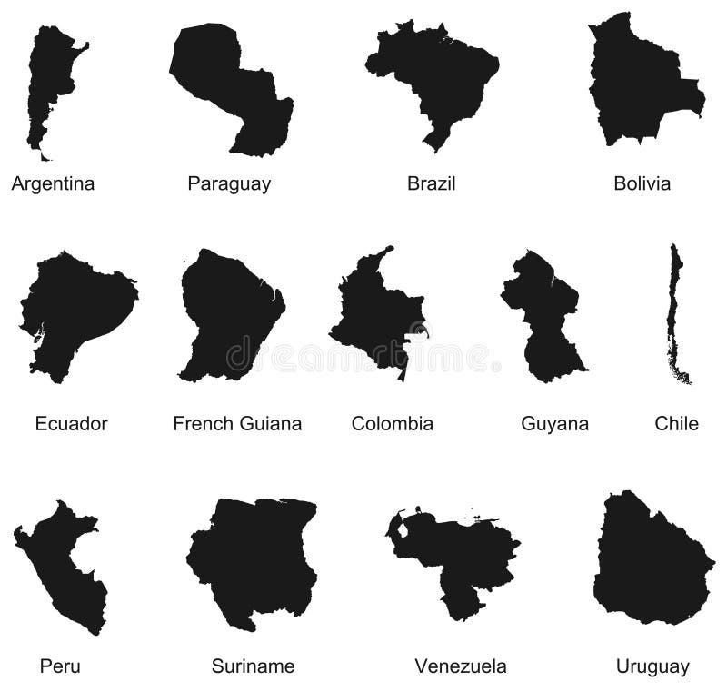
Free with trial Detailed vector illustration of 13 south america country maps. Map suriname vectors 13 South America Country Maps
Free with trial 3d Outline maps of the countries in North and South America continent. Map suriname vectors 3d North and Sout American continent. 3d Outline maps of the countries in North and South America continent
Free with trial Outline maps of the countries in North and South America continent. Map suriname vectors North and Sout American continent. Outline maps of the countries in North and South America continent
Free with trial Latin, Caribbean, North and South American country regions' vector maps. Map suriname vectors Latin, Caribbean, North and South American country regions' vector maps
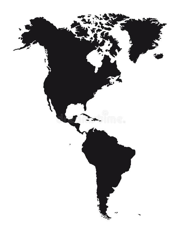
Free with trial Silhouette American continent isolated over white background. vector. Map suriname vectors American continent
Free with trial Outline maps of the countries with national flags vector illustration. Map suriname vectors Outline maps of the countries
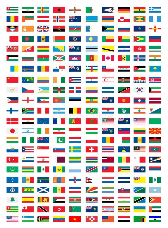
Free with trial National flags vector illustration on white background. Map suriname vectors National flags
Free with trial Outline maps of the world with national flags on blue background. Map suriname vectors Outline maps of the world
Free with trial Outline maps of the countries with national flags illustration. Map suriname vectors Outline maps of the countries
Free with trial Outline maps of the countries with national flags vector iilustration. Map suriname vectors Outline maps of the countries
Free with trial Flags of the World, South America illustration. Map suriname vectors Flags of the World, South America
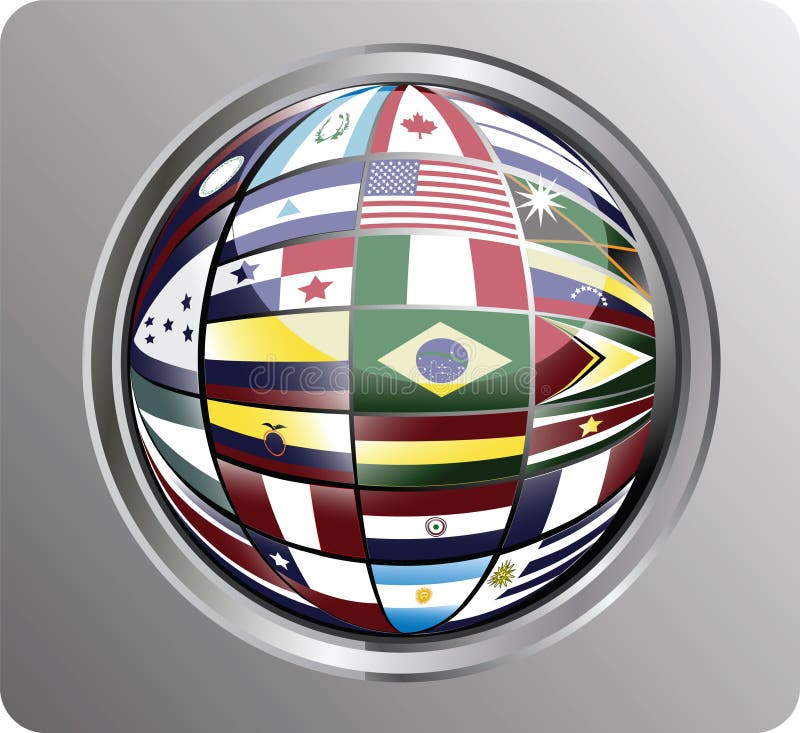
Free with trial Vector illustration of north, central and south america in a globe shape saved in EPS format. no transparency used. Map suriname vectors North, central and south america flags. Vector illustration of north, central and south america in a globe shape saved in EPS format. no transparency used
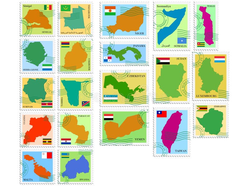
Free with trial Colored collection of vector stamp. Map suriname vectors Vector stamp collection. Colored collection of vector stamp
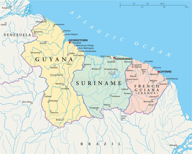
Free with trial Guyana, Suriname and French Guiana political map with capitals Georgetown, Paramaribo and Cayenne, national borders, important cities, rivers and lakes. Illustration with English labeling. Vector. Map suriname vectors Guyana, Suriname and French Guiana Political Map
Free with trial Hand drawn map of South America. Text, line and colors on different layers. Perfect for infographics. Includes Brazil, Argentina, Chile, Paraguay, Uruguay, Colombia, Venezuela, Peru, Ecuador. Map suriname vectors Hand drawn map of South America.
Free with trial Detailed illustration of a South America Map on Vintage Handwriting BlackBoard Illustration in EPS10 with color space in RGB. Map suriname vectors South America Map on Vintage Handwriting BlackBoard
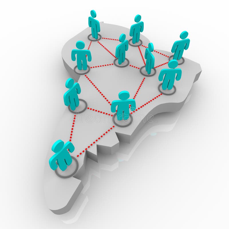
Free with trial A map of South America with a network of figures standing atop it. Map suriname illustrations Map of South America - Network of People. A map of South America with a network of figures standing atop it.
Free with trial Brazil political map with capital Brasilia, national borders and neighbors. Federal republic and country in South America. Gray illustration isolated on white background. English labeling. Vector. Map suriname vectors Brazil political map
Free with trial South America single states political map. All countries in different colors, with national borders and country names. English labeling and scaling. Illustration on white background. Map suriname vectors South America single states political map
Free with trial A blue map of South America on a white background. Map suriname illustrations Map of South America - Blue. A blue map of South America on a white background
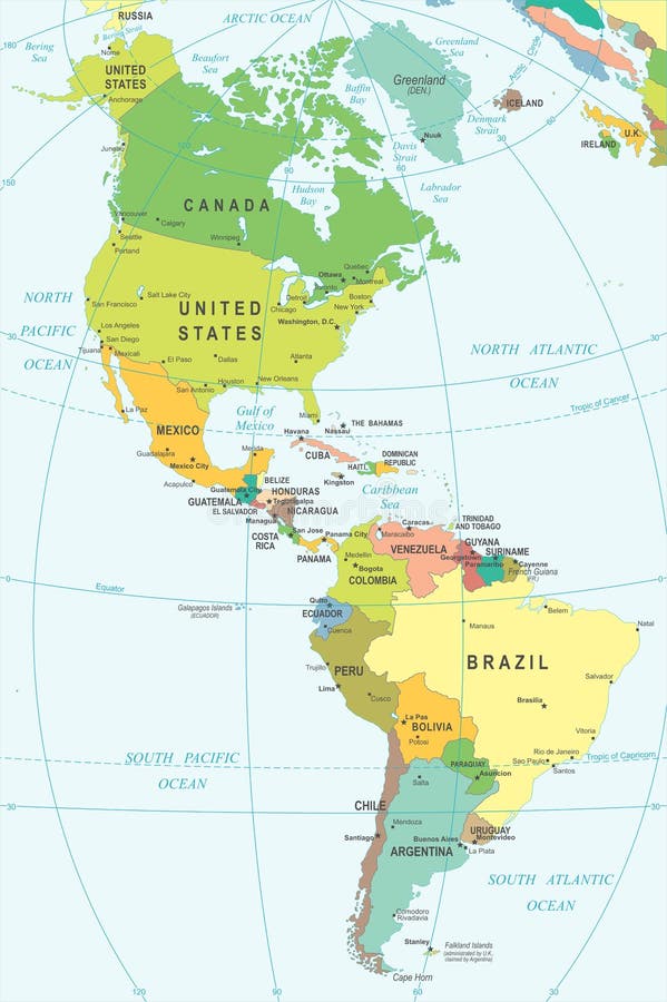
Free with trial Vector high detailed map of North and South America. Map suriname vectors High detailed map of North and South America
Free with trial South America map - highly detailed vector illustration. Map suriname vectors South America - map - illustration. South America map - highly detailed vector illustration.
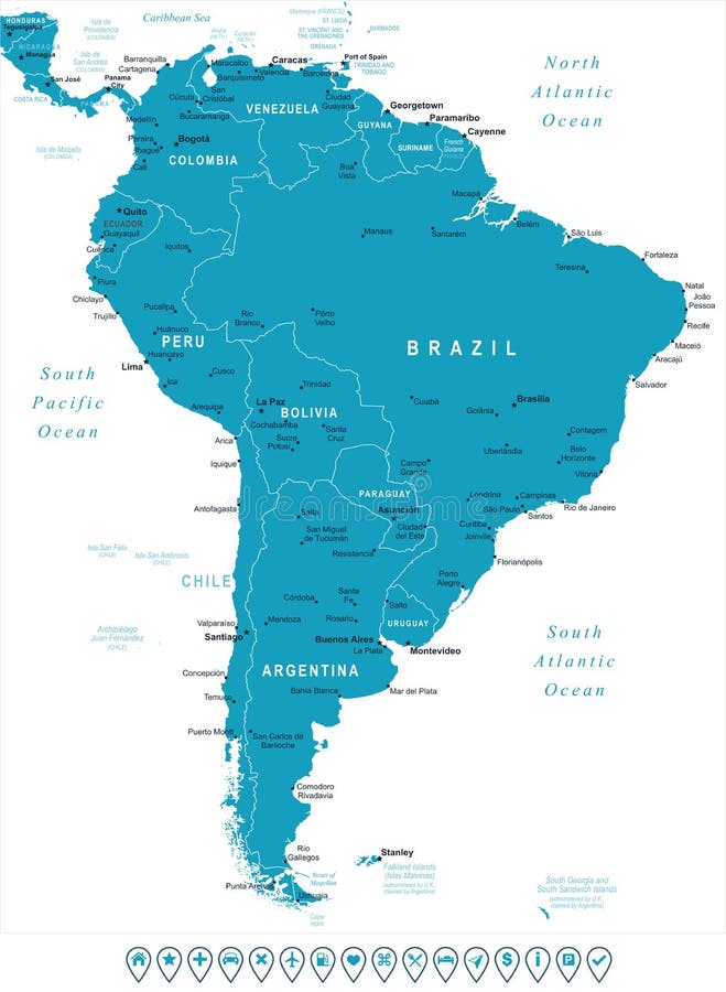
Free with trial South America map - highly detailed vector illustration. Image contains land contours, country and land names, city names, water object names, navigation icons. Map suriname vectors South America - map and navigation labels - illustration. South America map - highly detailed vector illustration. Image contains land contours, country and land names, city names, water object names, navigation icons.
Free with trial Stamp Postal of Vancouver Island. Map Silhouette rubber Seal. Design Retro Travel. Seal Map of Vancouver Island. Grunge for your design. Canada. EPS10. Map suriname vectors Stamp Postal of Vancouver Island. Map Silhouette rubber Seal. Design Retro Travel. Seal Map of Vancouver Island. Grunge for your design. Canada. EPS10
Free with trial Political map of Americas in grey on white background. North and South America with country labels. Simple flat vector illustration. Map suriname vectors Political map of Americas in grey on white background. North and South America with country labels. Simple flat vector
Free with trial American map with country and city names vector. Map suriname vectors American map with country and city names
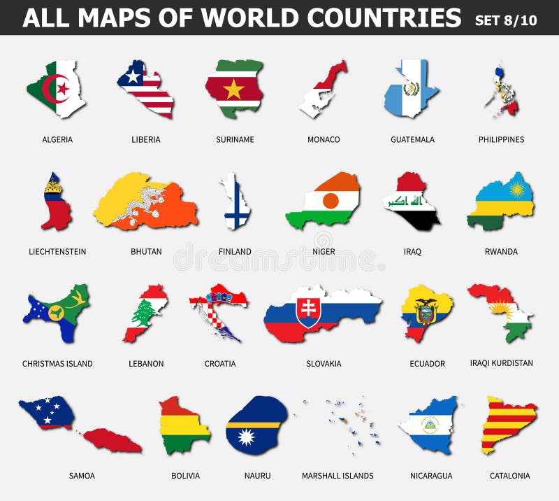
Free with trial All maps of world countries and flags. Set 8 of 10. Collection of outline shape of international country map with shadow. Flat design. Vector. Map suriname vectors All maps of world countries and flags . Set 8 of 10 . Collection of outline shape of international country map with shadow . Flat
Free with trial South American Political map and silhouette vetctor illustration. Map suriname vectors Highly Detailed Continent Silhouette and political map - South America. South American Political map and silhouette vetctor illustration