Free with trial Hong Kong City Skyline Black and White Vector Illu. Hong Kong City Skyline Panorama Black Isolated on White Background Vector Illustration. Central region vectors Hong Kong City Skyline Black and White Vector Illu. Hong Kong City Skyline Panorama Black Isolated on White Background Vector Illustration
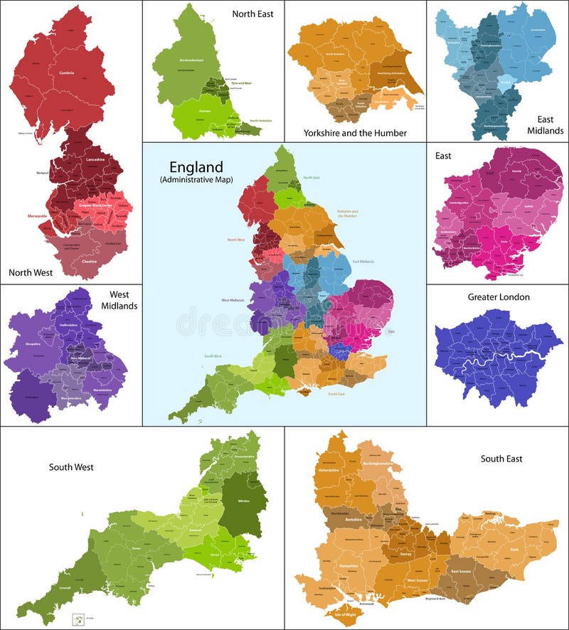
Free with trial The map shows the current subdivisions of England with a principal local authority: two-tier non-metropolitan counties and their non-metropolitan districts, metropolitan boroughs, unitary authorities, London boroughs and the sui generis City of London and Isles of Scilly. Central region vectors England map. The map shows the current subdivisions of England with a principal local authority: two-tier non-metropolitan counties and their non-metropolitan. The map shows the current subdivisions of England with a principal local authority: two-tier non-metropolitan counties and their non-metropolitan districts, metropolitan boroughs, unitary authorities, London boroughs and the sui generis City of London and Isles of Scilly
Free with trial Hong Kong City Skyline Color Panorama Vector Illustration. Hong Kong City Skyline Panorama Color on White Background Vector Illustration. Central region vectors Hong Kong City Skyline Color Panorama Vector Illustration. Hong Kong City Skyline Panorama Color on White Background Vector Illustration
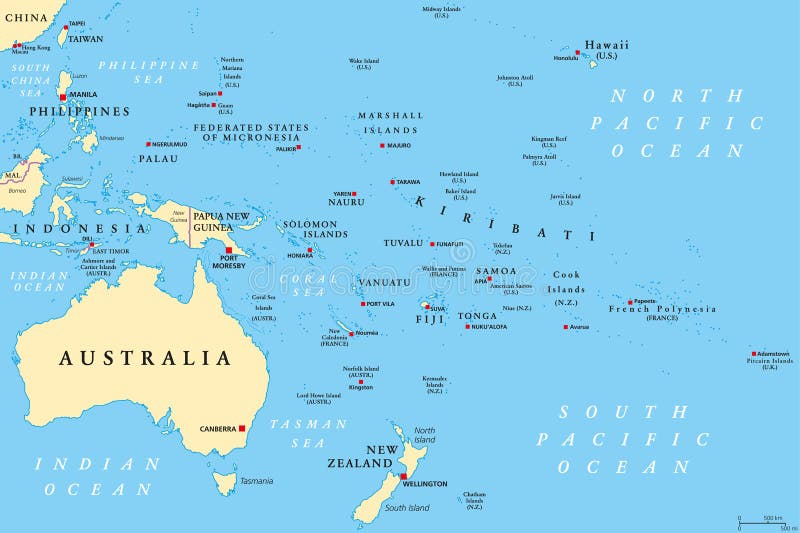
Free with trial Oceania political map. Region, centered on central Pacific Ocean islands. With Melanesia, Micronesia and Polynesia, including Australasia and Malay Archipelago. Illustration. English labeling. Vector. Central region vectors Oceania political map. Region, centered on central Pacific Ocean islands. With Melanesia, Micronesia and Polynesia, including Australasia and Malay Archipelago
Free with trial United States, Census regions and divisions, political map. Region definition widely used for data collection and analysis. The most commonly used classification system. English. Illustration. Vector. Central region vectors United States, Census regions and divisions, political map. Region definition widely used for data collection and analysis. The most commonly used
Free with trial Scotland map. Scotland is divided into 32 areas designated as council areas which are all governed by unitary authorities designated as councils. Central region vectors Scotland map. Scotland is divided into 32 areas designated as council areas which are all governed by unitary authorities designated as councils
Free with trial Wales map. Administrative Wales map which is divided into 22 unitary authority areas. Central region vectors Wales map. Administrative Wales map which is divided into 22 unitary authority areas
Free with trial Province of Canada - Quebec. Administrative division of Canada. Map of Quebec with regions and main cities, vector illustration. Central region vectors Province of Canada - Quebec. Administrative division of Canada. Map of Quebec with regions and main cities, vector illustration
Free with trial Administrative division of Canada with regions and main cities. Central region vectors Canada map. Administrative division of Canada with regions and main cities. Administrative division of Canada with regions and main cities.
Free with trial Vector map of Africa with present political borders. Central region vectors Africa vector map. Vector map of Africa with present political borders. Vector map of Africa with present political borders.
Free with trial During La Niña years, the pool of warm oceanic waters shifts westward. Rainfall increases over Indonesia and the western Pacific region and decreases over the east-central and eastern Pacific Ocean. The climate is drier and colder off the coast of America. Central region vectors La Nina. During La Niña years, the pool of warm oceanic waters shifts westward. Rainfall increases over Indonesia and the western Pacific region and decreases. During La Niña years, the pool of warm oceanic waters shifts westward. Rainfall increases over Indonesia and the western Pacific region and decreases over the east-central and eastern Pacific Ocean. The climate is drier and colder off the coast of America.
Free with trial Amsterdam colored vector map. View from above. Central region vectors Amsterdam colored vector map. View from above
Free with trial Central America and the Caribbean map. Highly detailed vector, map of the caribbean area. Central region vectors Central America and the Caribbean map. Highly detailed vector, map of the caribbean area
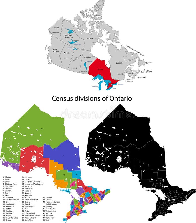
Free with trial Province of Canada - Ontario. Administrative division of Canada. Map of Ontario with census divisions, vector illustration. Central region vectors Province of Canada - Ontario. Administrative division of Canada. Map of Ontario with census divisions, vector illustration
Free with trial Province of Canada - New Brunswick. Administrative division of Canada. Map of New Brunswick with counties and main cities, vector illustration. Central region vectors Province of Canada - New Brunswick. Administrative division of Canada. Map of New Brunswick with counties and main cities, vector illustration
Free with trial Vector map of China provinces colored by regions. Chinese names gives in parentheses. Central region vectors Vector map of China provinces colored by regions. Chinese names gives in parentheses
Free with trial Hong Kong City Skyline and Big Buddha Statue Panorama Color on White Background Vector Illustration. Central region vectors Hong Kong Skyline and Buddha Statue Color Vector Illustration. Hong Kong City Skyline and Big Buddha Statue Panorama Color on White Background Vector. Hong Kong City Skyline and Big Buddha Statue Panorama Color on White Background Vector Illustration
Free with trial Europe vector map. Abstract europe vector map on white. Central region vectors Europe vector map. Abstract europe vector map on white
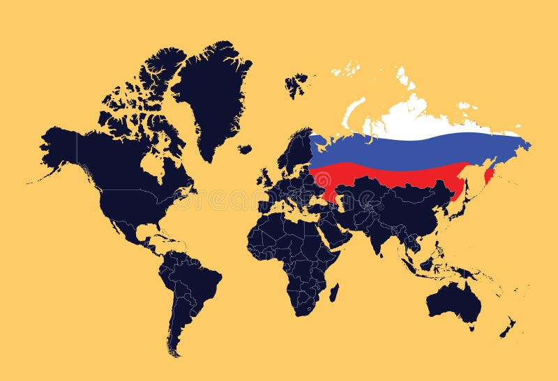
Free with trial An illustration ow world map showing Russian Federation (represented by the flag). Central region vectors World map showing Russian Federation. An illustration ow world map showing Russian Federation (represented by the flag. An illustration ow world map showing Russian Federation (represented by the flag)
Free with trial Poland set. Detailed country shape with region borders, flags and icons isolated on white background. Central region vectors Poland set. Detailed country shape with region borders, flags and icons isolated on white background
Free with trial Puerto Rico set. Detailed country shape with region borders, flags and icons isolated on white background. Central region vectors Puerto Rico set. Detailed country shape with region borders, flags and icons isolated on white background
Free with trial Sudan political map with new borders. Vector illustration of actual political situation in Sudan, Africa, 2011. Central region vectors Sudan political map. With new borders. Vector illustration of actual political situation in Sudan, Africa, 2011
Free with trial Vector posters with highly detailed silhouettes of maps of the states of America, Division West North Central - North Dakota, South Dakota, Nebraska - set 7 of 17 for design. Central region vectors Vector posters with highly detailed silhouettes of maps of the states of America, Division West North Central - North Dakota,. South Dakota, Nebraska - set 7 of
Free with trial Central America and the Caribbean map. Vector. Central region vectors Central America and the Caribbean map. Vector
Free with trial Middle America political map with capitals and borders. Mid-latitudes of the Americas region. Mexico, Central America, the Caribbean and northern South America. Illustration. English labeling. Vector. Central region vectors Middle America political map. With capitals and borders. Mid-latitudes of the Americas region. Mexico, Central America, the Caribbean and northern South America. Middle America political map with capitals and borders. Mid-latitudes of the Americas region. Mexico, Central America, the Caribbean and northern South America. Illustration. English labeling. Vector.
Free with trial Vector posters with highly detailed silhouettes of maps of the states of America, Division East North Central - Illinois, Indiana, Ohio - set 4 of 17. Central region vectors Vector posters with highly detailed silhouettes of maps of the states of America, Division East North Central - Illinois, Indiana. Ohio - set 4 of 17
Free with trial Tampa bay area map. Map of the west central Florida region Tampa Bay Area. Central region vectors Tampa bay area map. Map of the west central Florida region Tampa Bay Area
Free with trial Caribbean islands Central America map state names card colors 3D. Vector. Central region vectors Caribbean islands Central America map state names card colors 3D. Vector
Free with trial Colored vector illustration of the United States, the standard US time zones, the US region. Central region vectors United states. Standard time zones of united states. USA region. Colored vector illustration of the United States, the standard US time zones, the US region. Colored vector illustration of the United States, the standard US time zones, the US region.
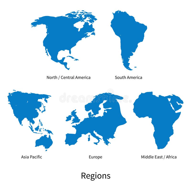
Free with trial Detailed vector map of North - Central America, Asia Pacific, Europe, South America, Middle and East Africa, Regions on white. Central region vectors Detailed vector map of North - Central America, Asia Pacific, Europe, South America, Middle and East Africa Regions. Detailed vector map of North - Central. Detailed vector map of North - Central America, Asia Pacific, Europe, South America, Middle and East Africa, Regions on white
Free with trial Caribbean islands Central America map, new political detailed map, separate individual states, with state names, isolated on white. Background 3D vector. Central region vectors Caribbean islands Central America map, new political detailed map, separate individual states, with state names, isolated on white. Background 3D vector
Free with trial Caribbean islands Central America map state names Black blackboard separate states individual blank. Central region vectors Caribbean islands Central America map Black blackboard separate states individual. Caribbean islands Central America map state names Black blackboard separate. Caribbean islands Central America map state names Black blackboard separate states individual blank
Free with trial Czech Republic map - country in Central Europe. Vector file of Czech Republic map - country in Central Europe, unitary parliamentary republic in Europe. Central region vectors Czech Republic map - country in Central Europe. Vector file of Czech Republic map - country in Central Europe, unitary parliamentary republic in Europe
Free with trial America. Very detailed map of Central America. File easy to edit and apply. Central region vectors America. Very detailed map of Central America. File easy to edit and apply
Free with trial Central Europe Map. Blue Central Europe Map in vectors. Central region vectors Central Europe Map. Blue Central Europe Map in vectors
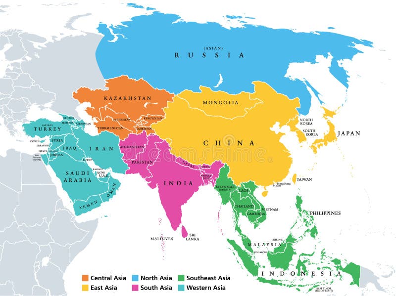
Free with trial Main regions of Asia. Political map with single countries. Colored subregions of the Asian continent. Central, East, North, South, Southeast and Western Asia. English labeled. Illustration. Vector. Central region vectors Asia, continent, main regions, political map with subregions. Main regions of Asia. Political map with single countries. Colored subregions of the Asian. Main regions of Asia. Political map with single countries. Colored subregions of the Asian continent. Central, East, North, South, Southeast and Western Asia. English labeled. Illustration. Vector.
Free with trial Latin America subregions map. The subregions Caribbean, North, Central and South America in different colors and with national borders of each nation. Illustration on white background. Central region vectors Latin America subregions map. The subregions Caribbean, North, Central and South America in different colors and with national borders of each nation
Free with trial Southern Africa political map with borders of the countries and English labeling. The southernmost region of the African continent. Gray illustration on white background. Vector. Central region vectors Southern Africa political map. With borders of the countries and English labeling. The southernmost region of the African continent. Gray illustration on white
Free with trial Regions of Europe, political map, with single countries. Northern, Western, Southeastern, Eastern, Central, Southern and Southwestern Europe in different colors. English labeling. Illustration. Vector. Central region vectors Regions of Europe, political map, with single countries. Northern, Western, Southeastern, Eastern, Central, Southern and Southwestern Europe in different
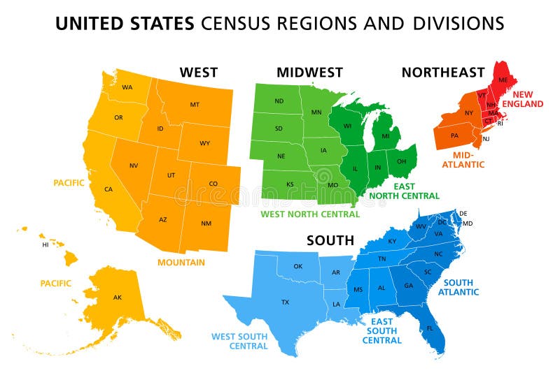
Free with trial Map of United States split into Census regions and divisions. Region definition, widely used for data collection and analysis. Most commonly used classification system. English. Illustration. Vector. Central region vectors Map of United States split into Census regions and divisions. Region definition, widely used for data collection and analysis. Most commonly used
Free with trial Ontario map - province located in east-central Canada. Vector file of Ontario map - province located in east-central Canada. Central region vectors Ontario map - province located in east-central Canada. Vector file of Ontario map - province located in east-central Canada
Free with trial Honduras flag and map - Republic of Honduras. Vector file of Honduras flag and map - Republic of Honduras, country in Central America. Central region vectors Honduras flag and map - Republic of Honduras. Vector file of Honduras flag and map - Republic of Honduras, country in Central America
Free with trial Political map of Africa in vector. Central region vectors Africa political map. Political map of Africa in vector. Political map of Africa in vector.
Free with trial Ethiopia map. Administrative division of the the Federal Democratic Republic of Ethiopia. Central region vectors Ethiopia map. Administrative division of the the Federal Democratic Republic of Ethiopia
Free with trial Northern Ireland map. Illustration of Northern Ireland which divided into 26 districts for local government purposes. Central region vectors Northern Ireland map. Illustration of Northern Ireland which divided into 26 districts for local government purposes
Free with trial Province of Canada - British Columbia. Administrative division of Canada. Map of British Columbia with regions and main cities, vector illustration. Central region vectors Province of Canada - British Columbia. Administrative division of Canada. Map of British Columbia with regions and main cities, vector illustration
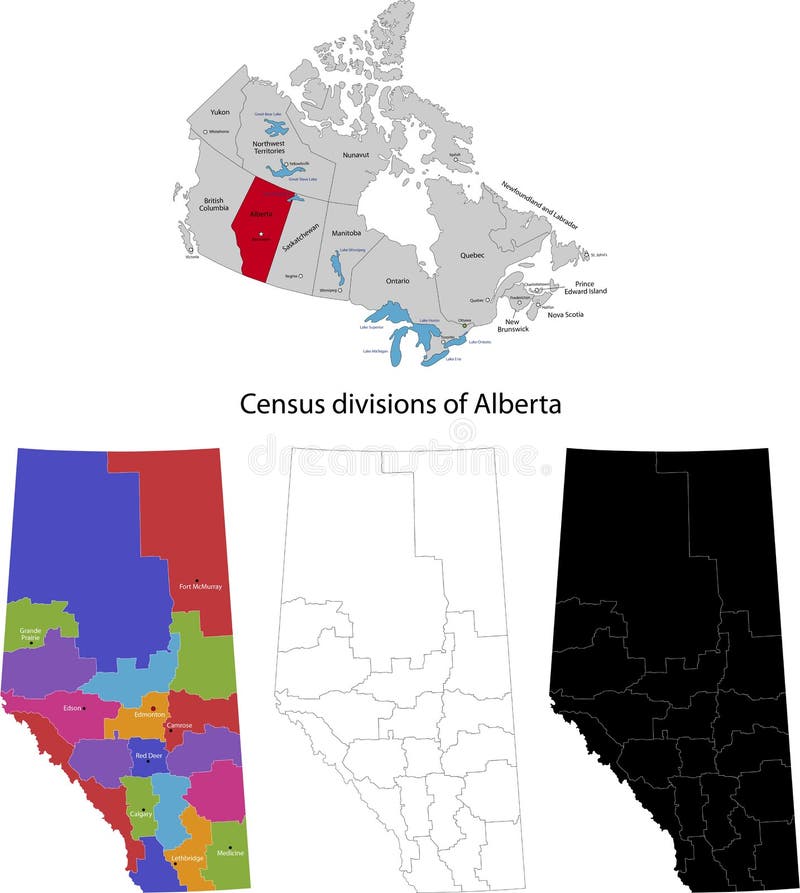
Free with trial Province of Canada - Alberta. Administrative division of Canada. Map of Alberta with regions and main cities, vector illustration. Central region vectors Province of Canada - Alberta. Administrative division of Canada. Map of Alberta with regions and main cities, vector illustration
Free with trial Tanzania map. Administrative division of the United Republic of Tanzania. Central region vectors Tanzania map. Administrative division of the United Republic of Tanzania
Free with trial Province of Canada - Nova Scotia. Administrative division of Canada. Map of Nova Scotia with regions and main cities, vector illustration. Central region vectors Province of Canada - Nova Scotia. Administrative division of Canada. Map of Nova Scotia with regions and main cities, vector illustration
Free with trial Costa Rica Map. Map of the Republic of Costa Rica with the provinces colored and boudaries. Central region vectors Costa Rica Map. Map of the Republic of Costa Rica with the provinces colored and boudaries
Free with trial Democratic Republic of the Congo map. Administrative division of the Democratic Republic of the Congo. Central region vectors Democratic Republic of the Congo map. Administrative division of the Democratic Republic of the Congo
Free with trial Green city over globe. Funky stylized Green city over globe. Central region vectors Green city over globe. Funky stylized Green city over globe
Free with trial Province of Canada - Manitoba. Administrative division of Canada. Map of Manitoba with regions and main cities, vector illustration. Central region vectors Province of Canada - Manitoba. Administrative division of Canada. Map of Manitoba with regions and main cities, vector illustration
Free with trial Panama map. Highly detailed vector map of Panama with administrative regions, main cities and roads. Central region vectors Panama map. Highly detailed vector map of Panama with administrative regions, main cities and roads
Free with trial Mozambique map. Administrative division of the Republic of Mozambique. Central region vectors Mozambique map. Administrative division of the Republic of Mozambique
Free with trial The Caribbean Physical Map. Highly detailed vector illustration. Central region vectors The Caribbean Physical Map. Highly detailed vector illustration
Free with trial Maculopathy. Medical illustration of the symptoms of maculopathy. Central region vectors Maculopathy. Medical illustration of the symptoms of maculopathy
Free with trial Province of Canada - Prince Edward Island. Administrative division of Canada. Map of Prince Edward Island with regions and main cities, vector illustration. Central region vectors Province of Canada - Prince Edward Island. Administrative division of Canada. Map of Prince Edward Island with regions and main cities, vector illustration
Free with trial London city plan, detailed vector map. View from above. Central region vectors London city plan, detailed vector map. View from above
Free with trial Administrative division of Canada. Map of Newfoundland and Labrador with regions and main cities, vector illustration. Central region vectors Province of Canada - Newfoundland and Labrador. Administrative division of Canada. Map of Newfoundland and Labrador with regions and main cities, vector. Administrative division of Canada. Map of Newfoundland and Labrador with regions and main cities, vector illustration
Free with trial Vector detailed map Amsterdam. View from above. Central region vectors Vector detailed map Amsterdam. View from above
Free with trial Hong Kong City Skyline Grayscale Panorama Vector Illustration. Hong Kong City Skyline Panorama Grayscale on White Background Vector Illustration. Central region vectors Hong Kong City Skyline Grayscale Panorama Vector Illustration. Hong Kong City Skyline Panorama Grayscale on White Background Vector Illustration
Free with trial Ohio, OH, political map. State in East North Central region of Midwestern United States of America. Capital Columbus. The Buckeye State. Birthplace of Aviation. Heart of It All. Illustration. Vector. Central region vectors Ohio, OH, political map, The Buckeye State, The Heart of It All. Ohio, OH, political map. State in East North Central region of Midwestern United States of. Ohio, OH, political map. State in East North Central region of Midwestern United States of America. Capital Columbus. The Buckeye State. Birthplace of Aviation. Heart of It All. Illustration. Vector.
Free with trial Barcelona city plan, detailed vector map. Detailed city map, vector map of Barcelona city plan, detailed vector map for printing of posters. Central region vectors Barcelona city plan, detailed vector map. Detailed city map, vector map of Barcelona city plan, detailed vector map for printing of posters
Free with trial Chicago city plan, detailed vector map. Detailed city map, vector map of Chicago for printing of posters. Central region vectors Chicago city plan, detailed vector map. Detailed city map, vector map of Chicago for printing of posters
Free with trial Mexico map, new political detailed map, separate individual states, with state names, isolated on white background 3D. Vector. Central region vectors Mexico map, new political detailed map, separate individual states, with state names, isolated on white background 3D. Vector
Free with trial Jawa Barat, West Java administrative and political vector map, Indonesia. Central region vectors Jawa Barat, West Java administrative and political vector map, Indonesia.
Free with trial The detailed map of the Austria with regions. Central region vectors The detailed map of the Austria with regions.
Free with trial Vector maps set. High detailed 46 maps of African countries with administrative division and cities. Political map, map of Africa continent, world map, globe, infographic elements. Part 1. Central region vectors Vector maps set. High detailed 46 maps of African countries with administrative division and cities. Political map, map of Africa. Continent, world map, globe. Vector maps set. High detailed 46 maps of African countries with administrative division and cities. Political map, map of Africa continent, world map, globe, infographic elements. Part 1
Free with trial The detailed map of the Germany with regions or states and cities, capitals. Central region vectors The detailed map of the Germany with regions or states and cities, capitals.
Free with trial Scandinavian states Denmark, Norway, Finland, Sweden and Iceland blue highlighted in the political map of Europe. Vector illustration. Central region vectors Scandinavian states Denmark, Norway, Finland, Sweden and Iceland blue highlighted in the political map of Europe. Vector. Illustration
Free with trial Jamaica set. Detailed country shape with region borders, flags and icons isolated on white background. Central region vectors Jamaica set. Detailed country shape with region borders, flags and icons isolated on white background
Free with trial Cuba set. Detailed country shape with region borders, flags and icons isolated on white background. Central region vectors Cuba set. Detailed country shape with region borders, flags and icons isolated on white background
Free with trial Panama set. Detailed country shape with region borders, flags and icons isolated on white background. Central region vectors Panama set. Detailed country shape with region borders, flags and icons isolated on white background
Free with trial Czech Republic set. Detailed country shape with region borders, flags and icons isolated on white background. Central region vectors Czech Republic set. Detailed country shape with region borders, flags and icons isolated on white background
Free with trial Vector illustration of the map with regions or stes and the official flag of Mexico. Central region vectors Mexico map with official flag. Vector illustration of the map with regions or stes and the official flag of Mexico. Vector illustration of the map with regions or stes and the official flag of Mexico.
Free with trial West africa map with flags. West africa administrative map with flags. Central region vectors West africa map with flags. West africa administrative map with flags
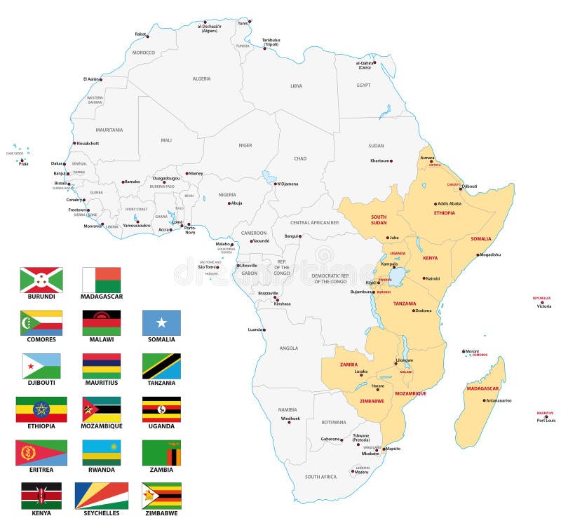
Free with trial East africa map with flags. East africa administrative map with flags. Central region vectors East africa map with flags. East africa administrative map with flags
Free with trial Detailed map of US regions, isolated states with names, Colorful infographics of the United States of America, vector illustration. Detailed map for your design. Central region vectors Detailed map of US regions, isolated states with names, Colorful infographics of the United States of America, vector illustration. Detailed map for your design
Free with trial Hong Kong - 6 APRIL 2019: Graphic vector of Hong Kong Government headquarter Complex, It comprises the Central Government Offices, the Legislative Council Complex and Office of the Chief Executive. Central region vectors Graphic vector of Hong Kong Government headquarter Complex. Hong Kong - 6 APRIL 2019: Graphic vector of Hong Kong Government headquarter Complex, It comprises. Hong Kong - 6 APRIL 2019: Graphic vector of Hong Kong Government headquarter Complex, It comprises the Central Government Offices, the Legislative Council Complex and Office of the Chief Executive.
 Sign in