Free with trial Illustrated logotype headline of the title Fair, with clipart images of fair food, a prize premium ribbon and balloons. County vectors Country Fair Clipart Set/eps. Illustrated logotype headline of the title Fair, with clipart images of fair food, a prize premium ribbon and balloons. Illustrated logotype headline of the title Fair, with clipart images of fair food, a prize premium ribbon and balloons.
Free with trial Vote stamp. Vector vote stamp on a solid white background. Color of all the elements can be replaced for additional illustration format. County vectors Vote stamp. Vector vote stamp on a solid white background. Color of all the elements can be replaced for additional illustration format
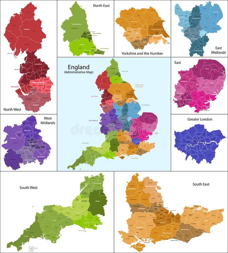
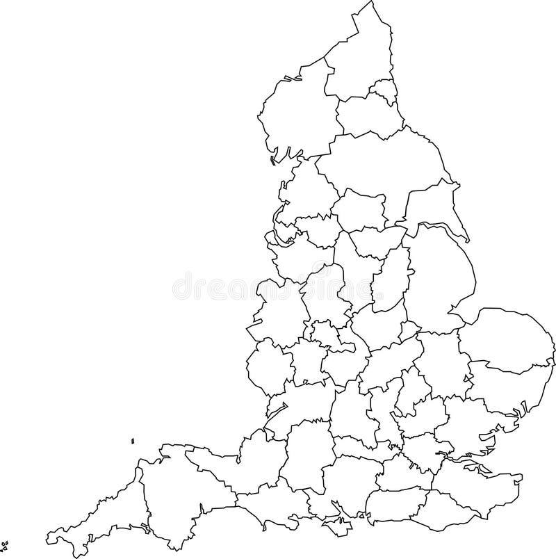
Free with trial The map shows the current subdivisions of England with a principal local authority: two-tier non-metropolitan counties and their non-metropolitan districts, metropolitan boroughs, unitary authorities, London boroughs and the sui generis City of London and Isles of Scilly. County vectors England map. The map shows the current subdivisions of England with a principal local authority: two-tier non-metropolitan counties and their non-metropolitan. The map shows the current subdivisions of England with a principal local authority: two-tier non-metropolitan counties and their non-metropolitan districts, metropolitan boroughs, unitary authorities, London boroughs and the sui generis City of London and Isles of Scilly
Free with trial WPA poster art of Saguaro National Park with giant Saguaro cactus growing in Sonoran Desert in Pima County Arizona United States done in works project administration or federal art project style. County vectors Saguaro National Park with Giant Saguaro Cactus in Sonoran Desert Pima County Arizona WPA Poster Art. WPA poster art of Saguaro National Park with giant Saguaro. WPA poster art of Saguaro National Park with giant Saguaro cactus growing in Sonoran Desert in Pima County Arizona United States done in works project administration or federal art project style
Free with trial Map of California state designed in illustration with the counties and the county seats. (Map is hight resolution). County vectors State of California. Map of California state designed in illustration with the counties and the county seats. (Map is hight resolution. Map of California state designed in illustration with the counties and the county seats. (Map is hight resolution)
Free with trial Tennessee map. Illustrated design of the map of Tennessee (USA), including counties and county seats. Isolated against a white background. County vectors Tennessee map. Illustrated design of the map of Tennessee (USA), including counties and county seats. Isolated against a white background
Free with trial Colorful map of the state of Louisiana with counties and county seats. County vectors Map of Louisiana. Colorful map of the state of Louisiana with counties and county seats. Colorful map of the state of Louisiana with counties and county seats.
Free with trial State of Arizona. Map of Arizona state designed in illustration with the counties and the county seats. (Map is hight resolution. County vectors State of Arizona. Map of Arizona state designed in illustration with the counties and the county seats. (Map is hight resolution
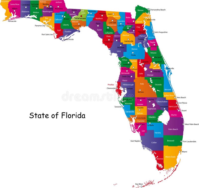
Free with trial Map of Florida state designed in illustration with the counties and the county seats. (Map is hight resolution). County vectors Map of Florida state. Designed in illustration with the counties and the county seats. (Map is hight resolution
Free with trial Texas map. Illustrated design of the map of Texas (USA), including counties and county seats. Isolated against a white background. County vectors Texas map. Illustrated design of the map of Texas (USA), including counties and county seats. Isolated against a white background
Free with trial Kentucky map. Illustrated design of the map of Kentucky (USA), including counties and county seats. Isolated against a white background. County vectors Kentucky map. Illustrated design of the map of Kentucky (USA), including counties and county seats. Isolated against a white background
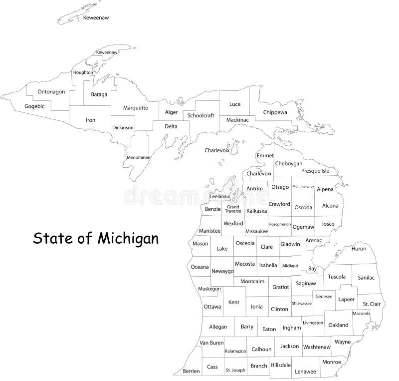
Free with trial Michigan state. Map of Michigan state designed in illustration with the counties and the county seats. (Map is hight resolution. County vectors Michigan state. Map of Michigan state designed in illustration with the counties and the county seats. (Map is hight resolution
Free with trial State of Texas. Colorful illustrated design of the map of Texas (USA), including counties and county seats. Isolated against a white background. County vectors State of Texas. Colorful illustrated design of the map of Texas (USA), including counties and county seats. Isolated against a white background
Free with trial Map of Mississippi state designed in illustration with the counties and the county seats. County vectors Mississippi map. Map of Mississippi state designed in illustration with the counties and the county seats. Map of Mississippi state designed in illustration with the counties and the county seats.
Free with trial State of Oregon. Map of Oregon state designed in illustration with the counties and the county seats. (Map is hight resolution. County vectors State of Oregon. Map of Oregon state designed in illustration with the counties and the county seats. (Map is hight resolution
Free with trial Map of Virginia. Illustrated design of the map of Virginia (USA), including counties and county seats. Isolated against a white background. County vectors Map of Virginia. Illustrated design of the map of Virginia (USA), including counties and county seats. Isolated against a white background
Free with trial State of Florida. Map of Florida state designed in illustration with the counties and the county seats. (Map is hight resolution. County vectors State of Florida. Map of Florida state designed in illustration with the counties and the county seats. (Map is hight resolution
Free with trial State of Georgia. Map of Georgia state designed in illustration with the counties and the county seats. (Map is hight resolution. County vectors State of Georgia. Map of Georgia state designed in illustration with the counties and the county seats. (Map is hight resolution
Free with trial State of Illinois. Illustrated design of the map of Illinois (USA), including counties and county seats. Isolated against a white background. County vectors State of Illinois. Illustrated design of the map of Illinois (USA), including counties and county seats. Isolated against a white background
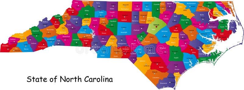
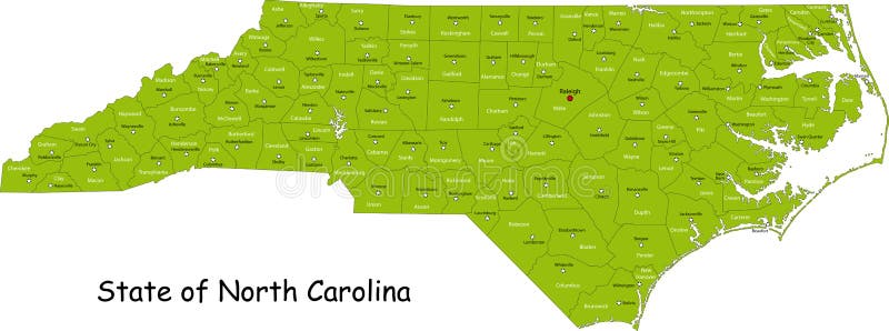
Free with trial North Carolina map. Colorful illustrated design of the map of North Carolina (USA), including counties and county seats. Isolated against a white background. County vectors North Carolina map. Colorful illustrated design of the map of North Carolina (USA), including counties and county seats. Isolated against a white background
Free with trial Map of Wisconsin state designed in illustration with the counties and the county seats. (Map is hight resolution). County vectors State of Wisconsin. Map of Wisconsin state designed in illustration with the counties and the county seats. (Map is hight resolution. Map of Wisconsin state designed in illustration with the counties and the county seats. (Map is hight resolution)
Free with trial Map of South Carolina state designed in illustration with the counties and the county seats. (Map is hight resolution). County vectors South Carolina state. Map of South Carolina state designed in illustration with the counties and the county seats. (Map is hight resolution. Map of South Carolina state designed in illustration with the counties and the county seats. (Map is hight resolution)
Free with trial Map of Michigan state designed in illustration with the counties and the county seats. (Map is hight resolution). County vectors Map of Michigan state. Designed in illustration with the counties and the county seats. (Map is hight resolution
Free with trial Map of California state designed in illustration with the counties and the county seats. (Map is hight resolution). County vectors Map of California state. Designed in illustration with the counties and the county seats. (Map is hight resolution
Free with trial Illustrated design of the map of North Carolina (USA), including counties and county seats. Isolated against a white background. County vectors State of North Carolina. Illustrated design of the map of North Carolina (USA), including counties and county seats. Isolated against a white background. Illustrated design of the map of North Carolina (USA), including counties and county seats. Isolated against a white background.
Free with trial Map of New Hampshire state designed in illustration with the counties and the county seats. (Map is hight resolution). County vectors Map of New Hampshire state. Designed in illustration with the counties and the county seats. (Map is hight resolution
Free with trial Commonwealth of Pennsylvania designed in illustration with the counties and the county seats. (Map is hight resolution). County vectors Commonwealth of Pennsylvania. Designed in illustration with the counties and the county seats. (Map is hight resolution
Free with trial Commonwealth of Pennsylvania designed in illustration with the counties and the county seats. (Map is hight resolution). County vectors Commonwealth of Pennsylvania. Designed in illustration with the counties and the county seats. (Map is hight resolution
Free with trial Map of Washington state designed in illustration with the counties and the county seats. (Map is hight resolution). County vectors State of Washington. Map of Washington state designed in illustration with the counties and the county seats. (Map is hight resolution. Map of Washington state designed in illustration with the counties and the county seats. (Map is hight resolution)
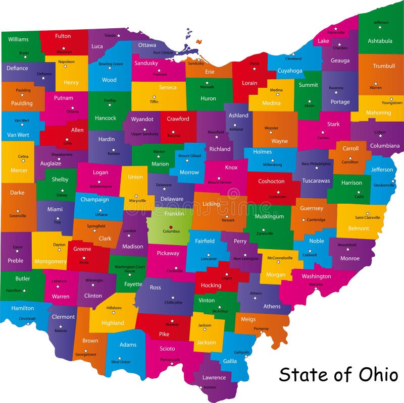
Free with trial Ohio map. Map of Ohio state designed in illustration with the counties and the county seats. County vectors Ohio map. Map of Ohio state designed in illustration with the counties and the county seats
Free with trial Hawaii map. Map of Hawaii state designed in illustration with the counties and the county seats. County vectors Hawaii map. Map of Hawaii state designed in illustration with the counties and the county seats
Free with trial Indiana map. Colorful illustrated design of the map of Indiana (USA), including counties and county seats. Isolated against a white background. County vectors Indiana map. Colorful illustrated design of the map of Indiana (USA), including counties and county seats. Isolated against a white background
Free with trial Illinois map. Colorful illustrated design of the map of Illinois (USA), including counties and county seats. Isolated against a white background. County vectors Illinois map. Colorful illustrated design of the map of Illinois (USA), including counties and county seats. Isolated against a white background
Free with trial Map of Minnesota state designed in illustration with the counties and the county seats. County vectors Minnesota map. Map of Minnesota state designed in illustration with the counties and the county seats. Map of Minnesota state designed in illustration with the counties and the county seats.
Free with trial Green map of the state of Louisiana with counties and county seats. County vectors Louisiana map. Green map of the state of Louisiana with counties and county seats. Green map of the state of Louisiana with counties and county seats.
Free with trial Map of Ohio state designed in illustration with the counties and the county seats. County vectors State of Ohio. Map of Ohio state designed in illustration with the counties and the county seats. Map of Ohio state designed in illustration with the counties and the county seats.
Free with trial Michigan state. Map of Michigan state designed in illustration with the counties and the county seats. (Map is hight resolution. County vectors Michigan state. Map of Michigan state designed in illustration with the counties and the county seats. (Map is hight resolution
Free with trial Map of Vermont state designed in illustration with the counties and the county seats. (Map is hight resolution). County vectors Map of Vermont. State designed in illustration with the counties and the county seats. (Map is hight resolution
Free with trial California map. Map of California state designed in illustration with the counties and the county seats. (Map is hight resolution. County vectors California map. Map of California state designed in illustration with the counties and the county seats. (Map is hight resolution
Free with trial State of Nevada. Map of Nevada state designed in illustration with the counties and the county seats. (Map is hight resolution. County vectors State of Nevada. Map of Nevada state designed in illustration with the counties and the county seats. (Map is hight resolution
Free with trial Map of Missouri. Illustrated design of the map of Missouri (USA), including counties and county seats. Isolated against a white background. County vectors Map of Missouri. Illustrated design of the map of Missouri (USA), including counties and county seats. Isolated against a white background
Free with trial New Jersey state designed in illustration with the counties and the county seats. (Map is hight resolution). County vectors New Jersey state. Designed in illustration with the counties and the county seats. (Map is hight resolution
Free with trial State of Florida. Map of Florida state designed in illustration with the counties and the county seats. (Map is hight resolution. County vectors State of Florida. Map of Florida state designed in illustration with the counties and the county seats. (Map is hight resolution
Free with trial State of Georgia. Map of Georgia state designed in illustration with the counties and the county seats. (Map is hight resolution. County vectors State of Georgia. Map of Georgia state designed in illustration with the counties and the county seats. (Map is hight resolution
Free with trial State of Virginia. Colorful illustrated design of the map of Virginia (USA), including counties and county seats. Isolated against a white background. County vectors State of Virginia. Colorful illustrated design of the map of Virginia (USA), including counties and county seats. Isolated against a white background
Free with trial Map of Washington state designed in illustration with the counties and the county seats. (Map is hight resolution). County vectors Stae of Washington. Map of Washington state designed in illustration with the counties and the county seats. (Map is hight resolution. Map of Washington state designed in illustration with the counties and the county seats. (Map is hight resolution)
Free with trial Map of Wisconsin state designed in illustration with the counties and the county seats. (Map is hight resolution). County vectors State of Wisconsin. Map of Wisconsin state designed in illustration with the counties and the county seats. (Map is hight resolution. Map of Wisconsin state designed in illustration with the counties and the county seats. (Map is hight resolution)
Free with trial Map of Minnesota state designed in illustration with the counties and the county seats. County vectors State of Minnesota. Map of Minnesota state designed in illustration with the counties and the county seats. Map of Minnesota state designed in illustration with the counties and the county seats.
Free with trial New Jersey state designed in illustration with the counties and the county seats. (Map is hight resolution). County vectors State of New Jersey. New Jersey state designed in illustration with the counties and the county seats. (Map is hight resolution. New Jersey state designed in illustration with the counties and the county seats. (Map is hight resolution)
Free with trial Map of South Carolina state designed in illustration with the counties and the county seats. (Map is hight resolution). County vectors South Carolina state. Map of South Carolina state designed in illustration with the counties and the county seats. (Map is hight resolution. Map of South Carolina state designed in illustration with the counties and the county seats. (Map is hight resolution)
Free with trial Map of Connecticut state designed in illustration with the counties and the county seats. (Map is hight resolution). County vectors Map of Connecticut state. Designed in illustration with the counties and the county seats. (Map is hight resolution
Free with trial Map of Massachusetts state designed in illustration with the counties and the county seats. (Map is hight resolution). County vectors Map of Massachusetts state. Designed in illustration with the counties and the county seats. (Map is hight resolution
Free with trial Map of Massachusetts state designed in illustration with the counties and the county seats. (Map is hight resolution). County vectors Map of Massachusetts state. Designed in illustration with the counties and the county seats. (Map is hight resolution
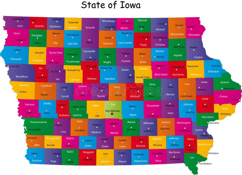
Free with trial State of Iowa. Colorful illustrated design of the map of Iowa (USA), including counties and county seats. Isolated against a white background. County vectors State of Iowa. Colorful illustrated design of the map of Iowa (USA), including counties and county seats. Isolated against a white background
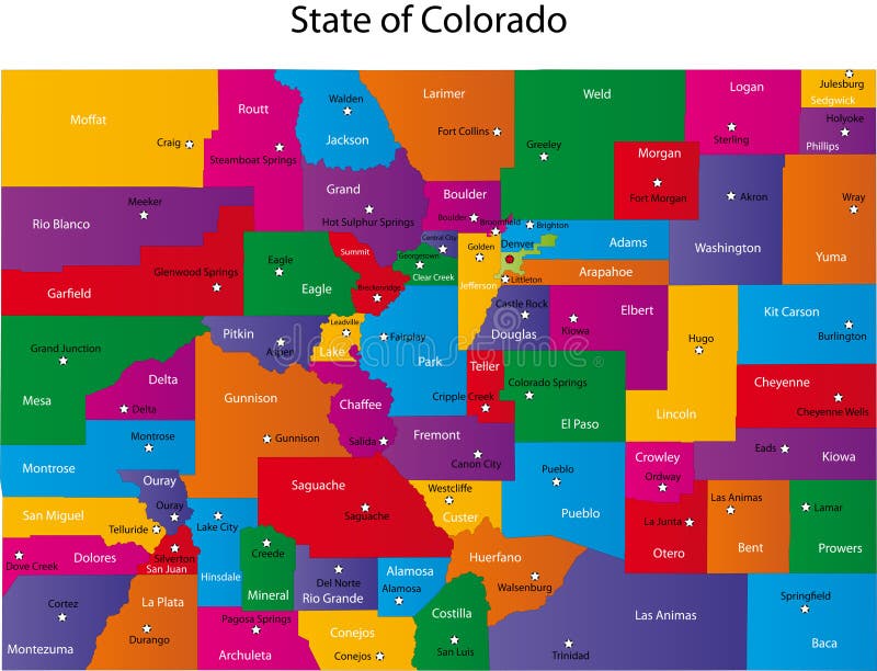
Free with trial Map of Colorado state designed in illustration with the counties and the county seats. County vectors Map of Colorado. State designed in illustration with the counties and the county seats
Free with trial South Carolina. Map of South Carolina state designed in illustration with the counties and the county seats. (Map is hight resolution. County vectors South Carolina. Map of South Carolina state designed in illustration with the counties and the county seats. (Map is hight resolution
Free with trial Little county Christian church. Vector Illustration. County vectors Little county Christian church. Vector Illustration
Free with trial Florida counties. Florida state counties map with boundaries and names. Eps file contains separate layers with county name, boundaries and layer with counties. County vectors Florida counties. Florida state counties map with boundaries and names. Eps file contains separate layers with county name, boundaries and layer with counties
Free with trial Scotland map. Scotland is divided into 32 areas designated as council areas which are all governed by unitary authorities designated as councils. County vectors Scotland map. Scotland is divided into 32 areas designated as council areas which are all governed by unitary authorities designated as councils
Free with trial Wales map. Administrative Wales map which is divided into 22 unitary authority areas. County vectors Wales map. Administrative Wales map which is divided into 22 unitary authority areas
Free with trial Map of Alabama state designed in illustration with the counties and the county seats. County vectors Alabama state. Map of Alabama state designed in illustration with the counties and the county seats. Map of Alabama state designed in illustration with the counties and the county seats.
Free with trial Map of Alabama state designed in illustration with the counties and the county seats. County vectors State of Alabama. Map of Alabama state designed in illustration with the counties and the county seats. Map of Alabama state designed in illustration with the counties and the county seats.
Free with trial Skyline. Of an imaginative city in America. County vectors Skyline. Of an imaginative city in America
Free with trial Map Mexico. A map of Mexico showing the different provinces in blue tone. County vectors Map Mexico. A map of Mexico showing the different provinces in blue tone
Free with trial Sweden map. Hand drawn with counties on separate layers. County vectors Sweden map. Hand drawn with counties on separate layers
Free with trial Map Netherlands. A map of the netherlands showing the different provinces. County vectors Map Netherlands. A map of the netherlands showing the different provinces
Free with trial Map Netherlands. A map of the netherlands showing the different provinces in green tone. County vectors Map Netherlands. A map of the netherlands showing the different provinces in green tone
Free with trial Vector map of Africa with present political borders. County vectors Africa vector map. Vector map of Africa with present political borders. Vector map of Africa with present political borders.
Free with trial Golden Gate bridge - hand drawing illustration. County vectors Golden Gate bridge. Hand drawing illustration
Free with trial New Jersey State by counties. Vector map of New Jersey State by counties. County vectors New Jersey State by counties. Vector map of New Jersey State by counties
Free with trial South Korea map designed in illustration with the regions colored in bright colors and with the main cities. (Map is hight resolution). County vectors South Korea map. Designed in illustration with the regions colored in bright colors and with the main cities. (Map is hight resolution
Free with trial Colorful Map of Maryland with county. County vectors Map of Maryland. Colorful Map of Maryland with county. Colorful Map of Maryland with county.
Free with trial State of New York designed in illustration with the counties and the main cities. (Map is hight resolution). County vectors State of New York. Designed in illustration with the counties and the main cities. (Map is hight resolution
Free with trial State of New York designed in illustration with the counties and the main cities. (Map is hight resolution). County vectors State of New York. Designed in illustration with the counties and the main cities. (Map is hight resolution
Free with trial Map of South Korea. South Korea map designed in illustration with the regions colored in bright colors and with the main cities. (Map is hight resolution. County vectors Map of South Korea. South Korea map designed in illustration with the regions colored in bright colors and with the main cities. (Map is hight resolution
Free with trial Green Map of Maryland with county and cities. County vectors Maryland map (USA). Green Map of Maryland with county and cities. Green Map of Maryland with county and cities.
Free with trial A chart of illustrated English football emblems. County vectors Chart Of Illustrated English Football Club Emblems. A chart of illustrated English football emblems. A chart of illustrated English football emblems.
Free with trial A blank map of England featuring geographical counties (also known as ceremonial counties or Lieutenancy Areas). County vectors Blank map of England - counties. A blank map of England featuring geographical counties (also known as ceremonial counties or Lieutenancy Areas. A blank map of England featuring geographical counties (also known as ceremonial counties or Lieutenancy Areas)
Free with trial Natural products vector logo. Vector illustration as logo brand for products and goods from natural sources or natural parks and reservoirs. County vectors Natural products vector logo. Vector illustration as logo brand for products and goods from natural sources or natural parks and reservoirs
Free with trial Map of Italy. Concept infographic template with regions made out of puzzle pieces. County vectors Map of Italy. Concept infographic template with regions made out of puzzle pieces
 Sign in