Free with trial Illustration of a summer city park. District vectors City park. Illustration of a summer city park. Illustration of a summer city park.
Free with trial Generic nameless city map with streets, railway, green belts and a river. Eps file available. District vectors Nameless City Map. Generic nameless city map with streets, railway, green belts and a river. Eps file available. Generic nameless city map with streets, railway, green belts and a river. Eps file available.
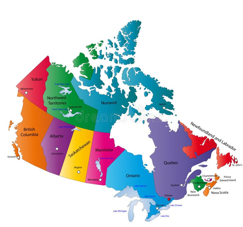
Free with trial Canada map designed in illustration with the states colored in bright colors and with the main cities. Neighbouring countries are in an additional format (. AI) in the latent layer. District vectors Canada map. Designed in illustration with the states colored in bright colors and with the main cities. Neighbouring countries are in an additional format (. AI
Free with trial Vector isometric city horizontal banner. Cartoon town district. Street Intersection road 3d. Very high detail projection. A lot of cars end buildings top view. Vector illustration stock clipart. District vectors Vector isometric city horizontal banner. Cartoon town district. Street Intersection road 3d. Very high detail projection. A lot of cars end buildings top view
Free with trial Vector isometric shopping district. With shops and parking lots. District vectors Vector isometric shopping district. With shops and parking lots
Free with trial Isometric industrial and business city district map. Isometric set of the buildings, road elements and plants. District vectors Isometric industrial and business city district map. Isometric set of the buildings, road elements and plants
Free with trial Neighborhood houses. Row of houses in quiet neighborhood district of large busy town. District vectors Neighborhood houses. Row of houses in quiet neighborhood district of large busy town
Free with trial Street Map With GPS Pins Icons. Illustration of a symbolized city map with roads, street, district blocks and places, with gps icons. District vectors Street Map With GPS Pins Icons. Illustration of a symbolized city map with roads, street, district blocks and places, with gps icons
Free with trial Singapore skyline panoramic view with modern central business district skyscrapers and historical temple building abstract vector illustration. District vectors Singapore Skyline Flat Panoramic View Poster. Singapore skyline panoramic view with modern central business district skyscrapers and historical temple building. Singapore skyline panoramic view with modern central business district skyscrapers and historical temple building abstract vector illustration
Free with trial Big modern city illustration. Vector cityscape background. Urban buildings, skyscrapers of the business downtown district. District vectors Big modern city illustration. Vector cityscape background. Urban buildings, skyscrapers of business downtown district. Big modern city illustration. Vector. Big modern city illustration. Vector cityscape background. Urban buildings, skyscrapers of the business downtown district.
Free with trial Vector city skyscrapers, modern buildings, waterfront, financial district, business, rich vibrant urban life. Modern architecture design. District vectors City waterfront high-rise buildings skyscrapers urban. Vector city skyscrapers, modern buildings, waterfront, financial district, business, rich vibrant urban. Vector city skyscrapers, modern buildings, waterfront, financial district, business, rich vibrant urban life. Modern architecture design.
Free with trial Capitol vector icon illustration design template, administration, cathedral, construction, democracy, patriotism, business, republican, legislation, historic, politic, history, democratic, law, district, national, monument, residence, states, dc, architecture, dome, united, washington, building, american, congress, usa, capital, government, house, landmark, logo, symbol, white, senate, president, election, hill, federal, politics, political, power. District vectors Capitol vector icon illustration. Design template, administration, cathedral, construction, democracy, patriotism, business, republican, legislation, historic. Capitol vector icon illustration design template, administration, cathedral, construction, democracy, patriotism, business, republican, legislation, historic, politic, history, democratic, law, district, national, monument, residence, states, dc, architecture, dome, united, washington, building, american, congress, usa, capital, government, house, landmark, logo, symbol, white, senate, president, election, hill, federal, politics, political, power
Free with trial Mexico map designed in illustration with states colored in bright colors and with the main cities. Neighbouring countries are in an additional format (. AI) in the latent layer. District vectors Mexico map. Designed in illustration with states colored in bright colors and with the main cities. Neighbouring countries are in an additional format (.AI) in
Free with trial Map of California state designed in illustration with the counties and the county seats. (Map is hight resolution). District vectors State of California. Map of California state designed in illustration with the counties and the county seats. (Map is hight resolution. Map of California state designed in illustration with the counties and the county seats. (Map is hight resolution)
Free with trial Urban vector city map seamless texture. Urban vector blue city map seamless texture pattern. District vectors Urban vector city map seamless texture. Urban vector blue city map seamless texture pattern
Free with trial Chicago Skyline. White Line and Black Line. District vectors Chicago Skyline. White Line and Black Line
Free with trial South Holland - province of the Netherlands. Administrative division of the Netherlands. Map of South Holland with municipalities. District vectors South Holland - province of the Netherlands. Administrative division of the Netherlands. Map of South Holland with municipalities
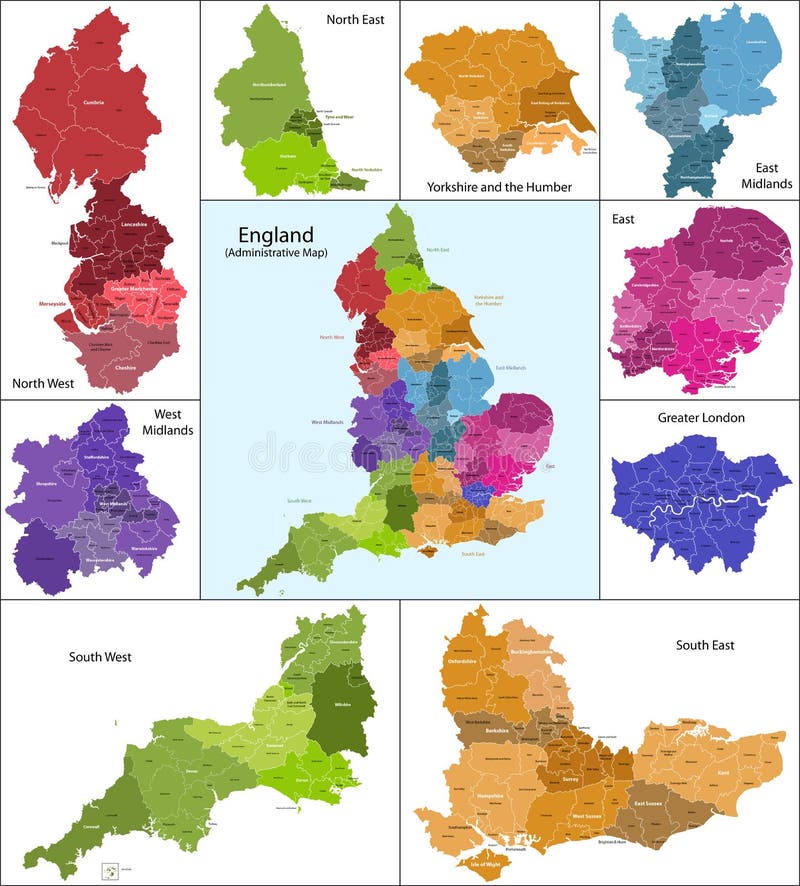
Free with trial The map shows the current subdivisions of England with a principal local authority: two-tier non-metropolitan counties and their non-metropolitan districts, metropolitan boroughs, unitary authorities, London boroughs and the sui generis City of London and Isles of Scilly. District vectors England map. The map shows the current subdivisions of England with a principal local authority: two-tier non-metropolitan counties and their non-metropolitan. The map shows the current subdivisions of England with a principal local authority: two-tier non-metropolitan counties and their non-metropolitan districts, metropolitan boroughs, unitary authorities, London boroughs and the sui generis City of London and Isles of Scilly
Free with trial Scotland map. Scotland is divided into 32 areas designated as council areas which are all governed by unitary authorities designated as councils. District vectors Scotland map. Scotland is divided into 32 areas designated as council areas which are all governed by unitary authorities designated as councils
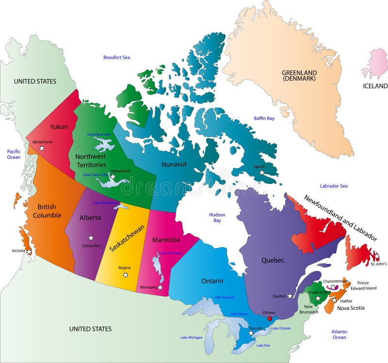
Free with trial Canada map designed in illustration with states colored in bright colors and with the main cities. On an illustration neighbouring countries are shown too. District vectors Canada color map. Canada map designed in illustration with states colored in bright colors and with the main cities. On an illustration neighbouring countries. Canada map designed in illustration with states colored in bright colors and with the main cities. On an illustration neighbouring countries are shown too
Free with trial State of Arizona. Map of Arizona state designed in illustration with the counties and the county seats. (Map is hight resolution. District vectors State of Arizona. Map of Arizona state designed in illustration with the counties and the county seats. (Map is hight resolution
Free with trial Map of Florida state designed in illustration with the counties and the county seats. (Map is hight resolution). District vectors Map of Florida state. Designed in illustration with the counties and the county seats. (Map is hight resolution
Free with trial Wales map. Administrative Wales map which is divided into 22 unitary authority areas. District vectors Wales map. Administrative Wales map which is divided into 22 unitary authority areas
Free with trial Architecture background with family house. Architecture concept with family house building in village style. District vectors Architecture background with family house. Architecture concept with family house building in village style
Free with trial Brasilia skyline. Vector illustration of Brasilia skyline. District vectors Brasilia skyline. Vector illustration of Brasilia skyline
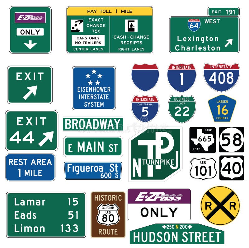
Free with trial Vector Illustration collection of the select Traffic Signs in the United States, isolated on white background. You can find other road signs in my portfolio. EPS file available. Guide signs are essential to direct road users along streets and highways, to inform them of intersecting routes, rnto direct them to cities, towns, villages, or other important destinations, to identify nearby rivers and streams, parks, forests, and historical sites, and generally to give such information as will help them along their way in the most simple, direct manner possible. rnrnIn the United States, road signs are, for the most part, standardized by federal regulations, most notably in the Manual on Uniform Traffic Control Devices (MUTCD) and its companion volume the Standard Highway Signs (SHS). There currently are no plans for adopting the Vienna Convention on Road Signs and Signals standards. Twenty-three states along with the District of Columbia and Puerto Rico use the manual without any alterations, 20 states have adopted it in conjunction with a supplemental volume, and seven states have a state version in substantial conformance to the MUTCD. There are also localized versions that are used in large cities such as New York City which use a naming system compatible with the MUTCD and/or state supplement. The MUTCD and SHS establish seven general categories of signs for road and highway use. rnrnIncluded illustrations are select examples of the MUTCD Guide Signs categories. rn. District vectors Traffic Guide Signs in the United States. Vector Illustration collection of the select Traffic Signs in the United States, isolated on white background. You can. Vector Illustration collection of the select Traffic Signs in the United States, isolated on white background. You can find other road signs in my portfolio. EPS file available. Guide signs are essential to direct road users along streets and highways, to inform them of intersecting routes, rnto direct them to cities, towns, villages, or other important destinations, to identify nearby rivers and streams, parks, forests, and historical sites, and generally to give such information as will help them along their way in the most simple, direct manner possible.rnrnIn the United States, road signs are, for the most part, standardized by federal regulations, most notably in the Manual on Uniform Traffic Control Devices (MUTCD) and its companion volume the Standard Highway Signs (SHS). There currently are no plans for adopting the Vienna Convention on Road Signs and Signals standards. Twenty-three states along with the District of Columbia and Puerto Rico use the manual without any alterations, 20 states have adopted it in conjunction with a supplemental volume, and seven states have a state version in substantial conformance to the MUTCD. There are also localized versions that are used in large cities such as New York City which use a naming system compatible with the MUTCD and/or state supplement. The MUTCD and SHS establish seven general categories of signs for road and highway use.rnrnIncluded illustrations are select examples of the MUTCD Guide Signs categories.rn
Free with trial Generic city map with streets, railway, important buildings, green belts, industrial zone and a river. Symbols of churches, synagogues, historic buildings, monuments, post offices, cinemas, theatres, harbours, lots, taxi-cabs, hospital and youth hostels. District vectors City Map. Generic city map with streets, railway, important buildings, green belts, industrial zone and a river. Symbols of churches, synagogues, historic. Generic city map with streets, railway, important buildings, green belts, industrial zone and a river. Symbols of churches, synagogues, historic buildings, monuments, post offices, cinemas, theatres, harbours, lots, taxi-cabs, hospital and youth hostels.
Free with trial Texas map. Illustrated design of the map of Texas (USA), including counties and county seats. Isolated against a white background. District vectors Texas map. Illustrated design of the map of Texas (USA), including counties and county seats. Isolated against a white background
Free with trial Kentucky map. Illustrated design of the map of Kentucky (USA), including counties and county seats. Isolated against a white background. District vectors Kentucky map. Illustrated design of the map of Kentucky (USA), including counties and county seats. Isolated against a white background
Free with trial Malaysia map designed in illustration with the provinces and the main cities. (Map is hight resolution). District vectors Malaysia map. Designed in illustration with the provinces and the main cities. (Map is hight resolution
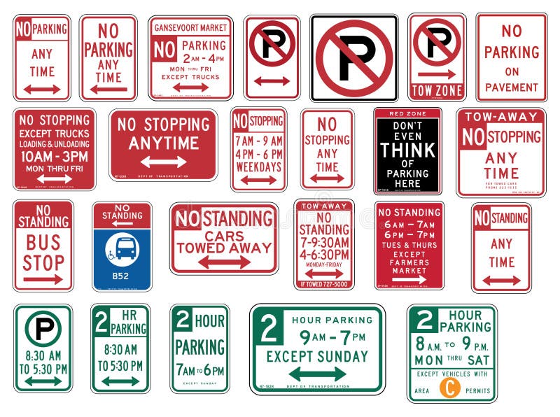
Free with trial Vector Illustration collection of the select Traffic Signs in the United States, isolated on white background. You can find other road signs in my portfolio. EPS file available. rnrnIn the United States, road signs are, for the most part, standardized by federal regulations, most notably in the Manual on Uniform Traffic Control Devices (MUTCD) and its companion volume the Standard Highway Signs (SHS). There currently are no plans for adopting the Vienna Convention on Road Signs and Signals standards. rnTwenty-three states along with the District of Columbia and Puerto Rico use the manual without any alterations, 20 states have adopted it in conjunction with a supplemental volume, and seven states have a state version in substantial conformance to the MUTCD. There are also localized versions that are used in large cities such as New York City which use a naming system compatible with the MUTCD and/or state supplement. The MUTCD and SHS establish seven general categories of signs for road and highway use. rnrnIncluded illustrations are select examples of the following MUTCD categories:rn-- R7 Series: Parkingrnrn. District vectors Traffic Signs in the United States - No Parking. Vector Illustration collection of the select Traffic Signs in the United States, isolated on white background. Vector Illustration collection of the select Traffic Signs in the United States, isolated on white background. You can find other road signs in my portfolio. EPS file available.rnrnIn the United States, road signs are, for the most part, standardized by federal regulations, most notably in the Manual on Uniform Traffic Control Devices (MUTCD) and its companion volume the Standard Highway Signs (SHS). There currently are no plans for adopting the Vienna Convention on Road Signs and Signals standards.rnTwenty-three states along with the District of Columbia and Puerto Rico use the manual without any alterations, 20 states have adopted it in conjunction with a supplemental volume, and seven states have a state version in substantial conformance to the MUTCD. There are also localized versions that are used in large cities such as New York City which use a naming system compatible with the MUTCD and/or state supplement. The MUTCD and SHS establish seven general categories of signs for road and highway use.rnrnIncluded illustrations are select examples of the following MUTCD categories:rn-- R7 Series: Parkingrnrn
Free with trial Caribbean map. Colorful Caribbean map with countries and capital cities. District vectors Caribbean map. Colorful Caribbean map with countries and capital cities
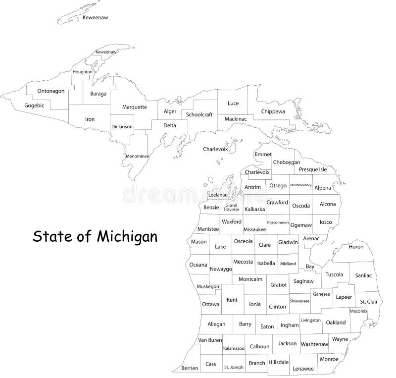
Free with trial Michigan state. Map of Michigan state designed in illustration with the counties and the county seats. (Map is hight resolution. District vectors Michigan state. Map of Michigan state designed in illustration with the counties and the county seats. (Map is hight resolution
Free with trial Brooklyn bridge in New York - vector illustration. District vectors Brooklyn bridge in New York. Vector illustration
Free with trial State of Texas. Colorful illustrated design of the map of Texas (USA), including counties and county seats. Isolated against a white background. District vectors State of Texas. Colorful illustrated design of the map of Texas (USA), including counties and county seats. Isolated against a white background
Free with trial Board game with a block path. On the city. District vectors Board game with a block path. On the city
Free with trial Map of Mississippi state designed in illustration with the counties and the county seats. District vectors Mississippi map. Map of Mississippi state designed in illustration with the counties and the county seats. Map of Mississippi state designed in illustration with the counties and the county seats.
Free with trial State of Oregon. Map of Oregon state designed in illustration with the counties and the county seats. (Map is hight resolution. District vectors State of Oregon. Map of Oregon state designed in illustration with the counties and the county seats. (Map is hight resolution
Free with trial Map of Virginia. Illustrated design of the map of Virginia (USA), including counties and county seats. Isolated against a white background. District vectors Map of Virginia. Illustrated design of the map of Virginia (USA), including counties and county seats. Isolated against a white background
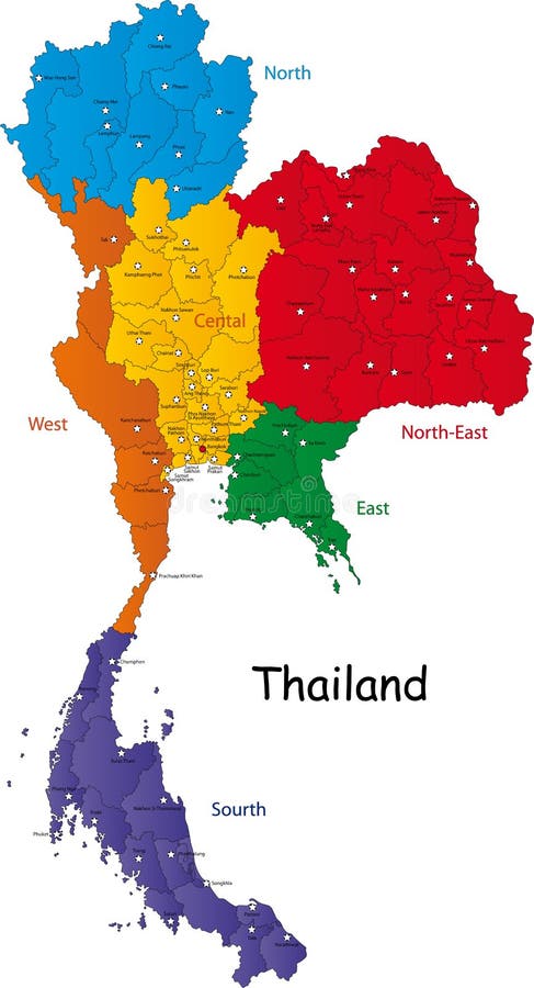
Free with trial Map of Thailand. Thailand map designed in illustration with the regions and provinces with the main cities. (Map is in high resolution. District vectors Map of Thailand. Thailand map designed in illustration with the regions and provinces with the main cities. (Map is in high resolution
Free with trial Vector poster map city London. Detailed city map, vector map london for print of posters. District vectors Vector poster map city London. Detailed city map, vector map london for print of posters
Free with trial Saudi Arabia map designed in illustration with the provinces and the main cities. District vectors Saudi Arabia map. Designed in illustration with the provinces and the main cities
Free with trial State of Florida. Map of Florida state designed in illustration with the counties and the county seats. (Map is hight resolution. District vectors State of Florida. Map of Florida state designed in illustration with the counties and the county seats. (Map is hight resolution
Free with trial South Africa map designed in illustration with the provinces and the main cities. District vectors South Africa map. Designed in illustration with the provinces and the main cities
Free with trial Vector China map. Green China map with regions colored in green. Vector illustration. District vectors Vector China map. Green China map with regions colored in green. Vector illustration
Free with trial State of Georgia. Map of Georgia state designed in illustration with the counties and the county seats. (Map is hight resolution. District vectors State of Georgia. Map of Georgia state designed in illustration with the counties and the county seats. (Map is hight resolution
Free with trial State of Illinois. Illustrated design of the map of Illinois (USA), including counties and county seats. Isolated against a white background. District vectors State of Illinois. Illustrated design of the map of Illinois (USA), including counties and county seats. Isolated against a white background
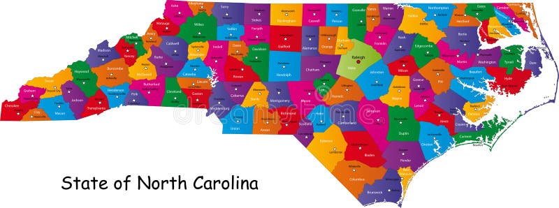
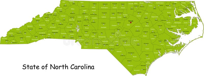
Free with trial North Carolina map. Colorful illustrated design of the map of North Carolina (USA), including counties and county seats. Isolated against a white background. District vectors North Carolina map. Colorful illustrated design of the map of North Carolina (USA), including counties and county seats. Isolated against a white background
Free with trial Map of Wisconsin state designed in illustration with the counties and the county seats. (Map is hight resolution). District vectors State of Wisconsin. Map of Wisconsin state designed in illustration with the counties and the county seats. (Map is hight resolution. Map of Wisconsin state designed in illustration with the counties and the county seats. (Map is hight resolution)
Free with trial South Africa map designed in illustration with the provinces and the main cities. District vectors Map of South Africa. South Africa map designed in illustration with the provinces and the main cities. South Africa map designed in illustration with the provinces and the main cities.
Free with trial Map of South Carolina state designed in illustration with the counties and the county seats. (Map is hight resolution). District vectors South Carolina state. Map of South Carolina state designed in illustration with the counties and the county seats. (Map is hight resolution. Map of South Carolina state designed in illustration with the counties and the county seats. (Map is hight resolution)
Free with trial Japan. Map designed in illustration with regions colored in bright colors. Vector illustration. District vectors Japan. Map designed in illustration with regions colored in bright colors. Vector illustration
Free with trial Map of Michigan state designed in illustration with the counties and the county seats. (Map is hight resolution). District vectors Map of Michigan state. Designed in illustration with the counties and the county seats. (Map is hight resolution
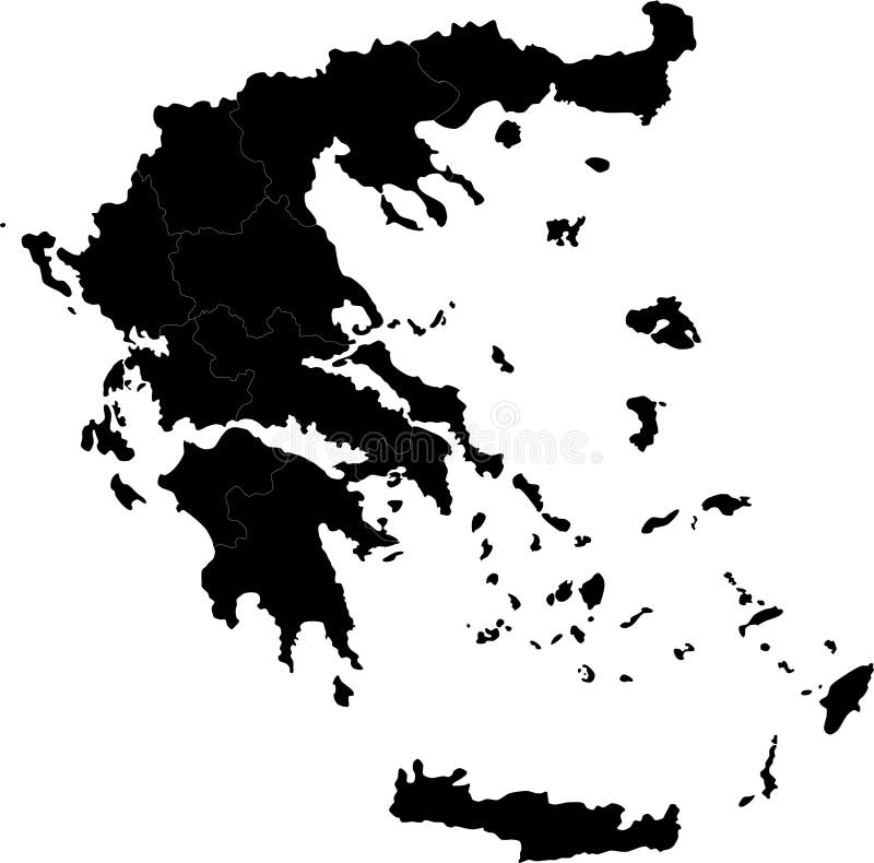
Free with trial Greece. Blind map of Greece with regions borders. Names of the regions, main cities, and neighbouring countries are in an additional format (. AI) in the latent. District vectors Greece. Blind map of Greece with regions borders. Names of the regions, main cities, and neighbouring countries are in an additional format (.AI) in the latent
Free with trial Symbols of a man, woman and child. Could be used for a family washroom sign or anything to indicate family. District vectors Black and White Family. Symbols of a man, woman and child. Could be used for a family washroom sign or anything to indicate family. Symbols of a man, woman and child. Could be used for a family washroom sign or anything to indicate family.
Free with trial Map of California state designed in illustration with the counties and the county seats. (Map is hight resolution). District vectors Map of California state. Designed in illustration with the counties and the county seats. (Map is hight resolution
Free with trial Illustrated design of the map of North Carolina (USA), including counties and county seats. Isolated against a white background. District vectors State of North Carolina. Illustrated design of the map of North Carolina (USA), including counties and county seats. Isolated against a white background. Illustrated design of the map of North Carolina (USA), including counties and county seats. Isolated against a white background.
Free with trial Province of Canada - Quebec. Administrative division of Canada. Map of Quebec with regions and main cities, vector illustration. District vectors Province of Canada - Quebec. Administrative division of Canada. Map of Quebec with regions and main cities, vector illustration
Free with trial Administrative division of Canada with regions and main cities. District vectors Canada map. Administrative division of Canada with regions and main cities. Administrative division of Canada with regions and main cities.
Free with trial Map of New Hampshire state designed in illustration with the counties and the county seats. (Map is hight resolution). District vectors Map of New Hampshire state. Designed in illustration with the counties and the county seats. (Map is hight resolution
Free with trial Commonwealth of Pennsylvania designed in illustration with the counties and the county seats. (Map is hight resolution). District vectors Commonwealth of Pennsylvania. Designed in illustration with the counties and the county seats. (Map is hight resolution
Free with trial Commonwealth of Pennsylvania designed in illustration with the counties and the county seats. (Map is hight resolution). District vectors Commonwealth of Pennsylvania. Designed in illustration with the counties and the county seats. (Map is hight resolution
Free with trial Vector male and female signs. Woman and man silhouettes for wc or toilette. District vectors Vector male and female signs. Woman and man silhouettes for wc or toilette
Free with trial Colorful retro suburb neighborhood. Cartoon city. District vectors Cartoon city. Colorful retro suburb neighborhood. Cartoon city. Colorful retro suburb neighborhood. Cartoon city.
Free with trial Abstract city landscape. Modern background. District vectors Abstract city. Landscape. Modern background
Free with trial Building icon. Vector black illustration of Building icon on white. District vectors Building icon. Vector black illustration of Building icon on white
Free with trial Map of Washington state designed in illustration with the counties and the county seats. (Map is hight resolution). District vectors State of Washington. Map of Washington state designed in illustration with the counties and the county seats. (Map is hight resolution. Map of Washington state designed in illustration with the counties and the county seats. (Map is hight resolution)
Free with trial City. A Cities skyline as an illustration. Also in. ai file. District vectors City. A Cities skyline as an illustration. Also in .ai file
Free with trial Montreal cityscape. Background, vector illustration. District vectors Montreal cityscape. Background, vector illustration
Free with trial Turkey. Map designed in illustration with regions colored in bright colors. Vector illustration. District vectors Turkey. Map designed in illustration with regions colored in bright colors. Vector illustration
Free with trial Road Map and compass, computer illustration on a white background. District vectors Road Map and compass. Computer illustration on a white background
Free with trial Ohio map. Map of Ohio state designed in illustration with the counties and the county seats. District vectors Ohio map. Map of Ohio state designed in illustration with the counties and the county seats
Free with trial Japan map. Designed in illustration with regions colored in green colors. Vector illustration. District vectors Japan map. Designed in illustration with regions colored in green colors. Vector illustration
Free with trial China map. People's Republic of China map designed in illustration with regions colored in bright colors. Vector illustration. District vectors China map. People's Republic of China map designed in illustration with regions colored in bright colors. Vector illustration
Free with trial Hawaii map. Map of Hawaii state designed in illustration with the counties and the county seats. District vectors Hawaii map. Map of Hawaii state designed in illustration with the counties and the county seats
Free with trial Panama map designed in illustration with the regions colored in bright colors and with the main cities. (Map is hight resolution). District vectors Panama map. Designed in illustration with the regions colored in bright colors and with the main cities. (Map is hight resolution
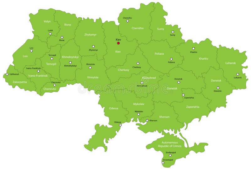
Free with trial Ukraine map designed in illustration with the oblasts colored in green colors and with the main cities. Neighbouring countries are in an additional format (. AI) in the latent layer. District vectors Ukraine map. Designed in illustration with the oblasts colored in green colors and with the main cities. Neighbouring countries are in an additional format (. Ukraine map designed in illustration with the oblasts colored in green colors and with the main cities. Neighbouring countries are in an additional format (. AI) in the latent layer.
Free with trial Illinois map. Colorful illustrated design of the map of Illinois (USA), including counties and county seats. Isolated against a white background. District vectors Illinois map. Colorful illustrated design of the map of Illinois (USA), including counties and county seats. Isolated against a white background
Free with trial Thailand map designed in illustration with the provinces and the main cities. (Map is hight resolution). District vectors Thailand map. Designed in illustration with the provinces and the main cities. (Map is hight resolution
Free with trial India map designed in illustration with the regions colored in bright colors and with the main cities. On an illustration neighbouring countries are shown too. District vectors Map of India. India map designed in illustration with the regions colored in bright colors and with the main cities. On an illustration neighbouring countries. India map designed in illustration with the regions colored in bright colors and with the main cities. On an illustration neighbouring countries are shown too
 Sign in