Free with trial Generic nameless city map with streets, railway, green belts and a river. Eps file available. Districts vectors Nameless City Map. Generic nameless city map with streets, railway, green belts and a river. Eps file available. Generic nameless city map with streets, railway, green belts and a river. Eps file available.
Free with trial Generic city map with streets, railway, important buildings, green belts, industrial zone and a river. Symbols of churches, synagogues, historic buildings, monuments, post offices, cinemas, theatres, harbours, lots, taxi-cabs, hospital and youth hostels. Districts vectors City Map. Generic city map with streets, railway, important buildings, green belts, industrial zone and a river. Symbols of churches, synagogues, historic. Generic city map with streets, railway, important buildings, green belts, industrial zone and a river. Symbols of churches, synagogues, historic buildings, monuments, post offices, cinemas, theatres, harbours, lots, taxi-cabs, hospital and youth hostels.
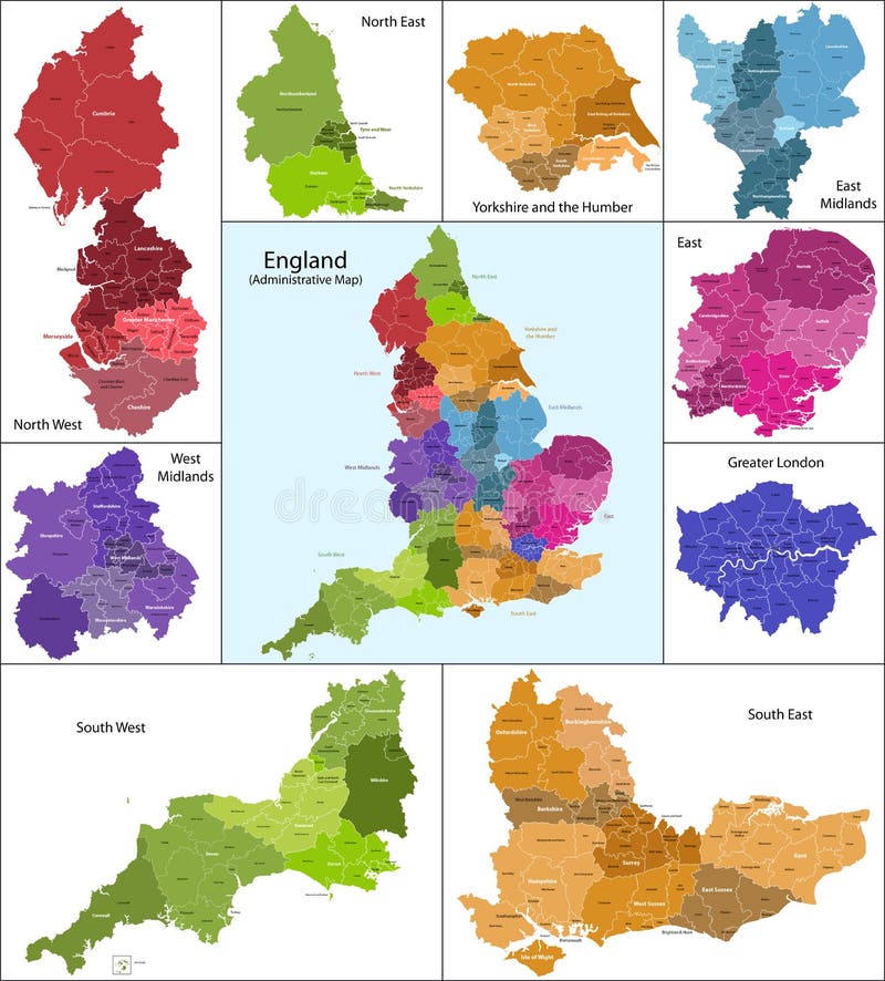
Free with trial The map shows the current subdivisions of England with a principal local authority: two-tier non-metropolitan counties and their non-metropolitan districts, metropolitan boroughs, unitary authorities, London boroughs and the sui generis City of London and Isles of Scilly. Districts vectors England map. The map shows the current subdivisions of England with a principal local authority: two-tier non-metropolitan counties and their non-metropolitan. The map shows the current subdivisions of England with a principal local authority: two-tier non-metropolitan counties and their non-metropolitan districts, metropolitan boroughs, unitary authorities, London boroughs and the sui generis City of London and Isles of Scilly
Free with trial Regions and districts of Czech republic on vector map. Districts vectors Czech republic vector map. Regions and districts of Czech republic on vector map. Regions and districts of Czech republic on vector map.
Free with trial Russian regions vector map. Vector political map of Russia with districts on white background. Districts vectors Russian regions vector map. Vector political map of Russia with districts on white background
Free with trial Federal states of Germany map with administrative districts and subdivisions. Districts vectors Federal states of Germany map with administrative districts and subdivisions. Vector federal states of Germany map with administrative districts and subdivisions
Free with trial Vietnam map designed in illustration with the provinces and the main cities. (Map is hight resolution). Districts vectors Vietnam map. Designed in illustration with the provinces and the main cities. (Map is hight resolution
Free with trial Map of Italy. A stylized map of Italy showing the different provinces. All isolated on white background. Districts vectors Map of Italy. A stylized map of Italy showing the different provinces. All isolated on white background
Free with trial Map of Vietnam. Vietnam map designed in illustration with the regions and provinces colored in bright colors and with the main cities. (Map is hight resolution. Districts vectors Map of Vietnam. Vietnam map designed in illustration with the regions and provinces colored in bright colors and with the main cities. (Map is hight resolution
Free with trial Map of India. An illustrated map of india. Districts vectors Map of India. An illustrated map of india
Free with trial Poland map designed in illustration with the 16 provinces colored in green colors and with the main cities. Neighbouring countries are in an additional format (. AI) in the latent layer. Districts vectors Poland. Map designed in illustration with the 16 provinces colored in green colors and with the main cities. Neighbouring countries are in an additional format. Poland map designed in illustration with the 16 provinces colored in green colors and with the main cities. Neighbouring countries are in an additional format (.AI) in the latent layer.
Free with trial City map vector. Illustration of a generic folded map on white backdround + vector eps file. Districts vectors City map vector. Illustration of a generic folded map on white backdround + vector eps file. Illustration of a generic folded map on white backdround + vector eps file
Free with trial A stylized map of South Africa showing the different provinces. All isolated on white background. Districts vectors Map of South Africa. A stylized map of South Africa showing the different provinces. All isolated on white background. A stylized map of South Africa showing the different provinces. All isolated on white background.
Free with trial Generic vector city map. Illustration of a generic nameless city map with streets + vector eps file. Districts vectors Generic vector city map. Illustration of a generic nameless city map with streets + vector eps file. Illustration of a generic nameless city map with streets + vector eps file
Free with trial Image illustrates a background that could be used to resemble night or Ramadan night in Egyptian suburbs and districts, other images could be inserted in the foreground, for example pedestrians, cafes and small shops. The silhouette of a mosque appears in the background a long with some low rise buildings. The Ramadan crescent also appears in the sky. EPS also available. Districts vectors Egyptian Suburb Background. Image illustrates a background that could be used to resemble night or Ramadan night in Egyptian suburbs and districts, other images. Image illustrates a background that could be used to resemble night or Ramadan night in Egyptian suburbs and districts, other images could be inserted in the foreground, for example pedestrians, cafes and small shops. The silhouette of a mosque appears in the background a long with some low rise buildings. The Ramadan crescent also appears in the sky. EPS also available.
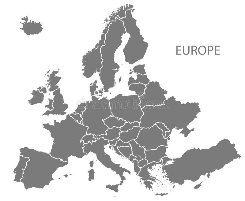
Free with trial Grey Europe map Vector illustrations. Vector illustrations of Europe map with grey countries and white borders. Districts vectors Grey Europe map Vector illustrations. Vector illustrations of Europe map with grey countries and white borders
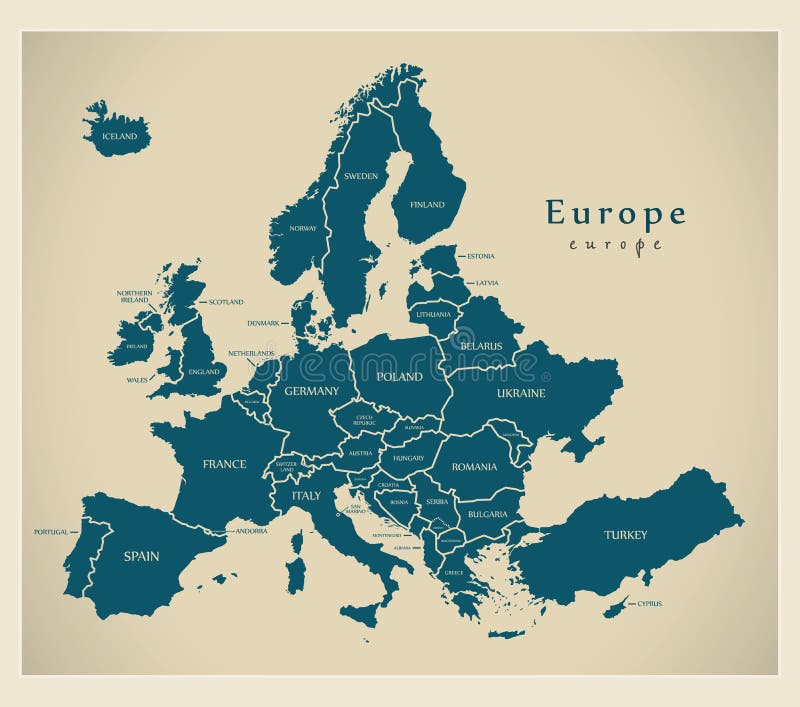
Free with trial Modern Map - Europe with countries and labels. Illustration. Districts vectors Modern Map - Europe with countries and labels. Illustration
Free with trial Poland flag. Vector illustration of a map and flag from Poland. Districts vectors Poland flag. Vector illustration of a map and flag from Poland
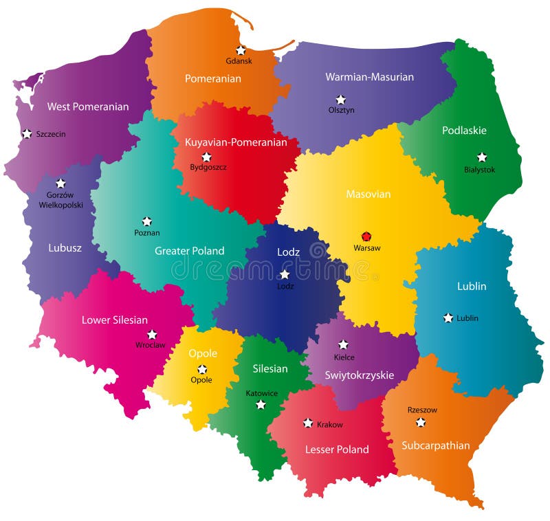
Free with trial Poland map designed in illustration with the 16 provinces colored in bright colors and with the main cities. On an illustration neighbouring countries are shown too. Districts vectors Poland map. Designed in illustration with the 16 provinces colored in bright colors and with the main cities. On an illustration neighbouring countries are
Free with trial Poland map designed in illustration with the 16 provinces colored in bright colors and with the main cities. Neighbouring countries are in an additional format (. AI) in the latent layer. Districts vectors Color Poland map. Poland map designed in illustration with the 16 provinces colored in bright colors and with the main cities. Neighbouring countries are in an. Poland map designed in illustration with the 16 provinces colored in bright colors and with the main cities. Neighbouring countries are in an additional format (.AI) in the latent layer.
Free with trial Czech Republic flag. Vector illustration of a map and flag from Czech Republic. Districts vectors Czech Republic flag. Vector illustration of a map and flag from Czech Republic
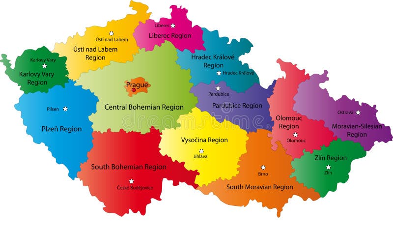
Free with trial Czech Republic map designed in illustration with the regions colored in bright colors and with the main cities. Neighbouring countries are in an additional format (. AI) in the latent layer. Districts vectors Czech Republic map. Designed in illustration with the regions colored in bright colors and with the main cities. Neighbouring countries are in an additional. Czech Republic map designed in illustration with the regions colored in bright colors and with the main cities. Neighbouring countries are in an additional format (.AI) in the latent layer.
Free with trial Modern Map - Europe with updated states from 2019 in grey. Illustration. Districts vectors Modern Map - Europe with updated states from 2019 in grey. Illustration
Free with trial Vector map of Lima with named districts and travel icons. Districts vectors Map of Lima with Districts. Vector map of Lima with named districts and travel icons. Vector map of Lima with named districts and travel icons.
Free with trial London by night. London map at night with described districts as a stars and milky way as a Thames. Districts vectors London by night. London map at night with described districts as a stars and milky way as a Thames
Free with trial Image illustrating an everyday situation in Egypt's districts and alleys, were local people buy beans from bean carts in the streets for their daily breakfast and their Sohour (supper) in the holy month of Ramadan. Each person gets his own container (bowl, dish, or cup) so the seller would put the corresponding amount of beans that would fill the container. Then he adds vinegar or lemon syrup and tops it with spices like cumin. Image could be used in topics related to Egypt, Egyptians, Egyptian districts, local people, old Cairo, Egyptian food, Ramadan, customs and traditions in Egypt…etc. EPS also available. Districts vectors Beans Cart. Image illustrating an everyday situation in Egypt's districts and alleys, were local people buy beans from bean carts in the streets for their daily. Image illustrating an everyday situation in Egypt's districts and alleys, were local people buy beans from bean carts in the streets for their daily breakfast and their Sohour (supper) in the holy month of Ramadan. Each person gets his own container (bowl, dish, or cup) so the seller would put the corresponding amount of beans that would fill the container. Then he adds vinegar or lemon syrup and tops it with spices like cumin. Image could be used in topics related to Egypt, Egyptians, Egyptian districts, local people, old Cairo, Egyptian food, Ramadan, customs and traditions in Egypt…etc. EPS also available.
Free with trial Vienna city map. Map of vienna with all districts, highways, expressways and major roads. Districts vectors Vienna city map. Map of vienna with all districts, highways, expressways and major roads
Free with trial Brazil map info-graphics vector template with regions, districts, state, country isolated in different color with pointer marks for education and printing purpose. Districts vectors Brazil map infographics vector template with regions and pointer marks. Brazil map info-graphics vector template with regions, districts, state, country isolated. Brazil map info-graphics vector template with regions, districts, state, country isolated in different color with pointer marks for education and printing purpose
Free with trial Taiwan higt detailed map with subdivisions. Administrative map of Taiwan with districts and cities name, colored by states and administrative districts. Vector illustration. Districts vectors Taiwan higt detailed map with subdivisions. Administrative map of Taiwan with districts and cities name, colored by states and. Administrative districts. Vector
Free with trial Vector map of British Isles administrative divisions colored by countries and regions. Districts and counties maps and flags of United Kingdom,Northern Ireland, Wales, Scotland and Republic of Ireland. Districts vectors Vector map of British Isles administrative divisions colored by countries and regions. Districts and counties maps and flags of United Kingdom,Northern Ireland
Free with trial Vector Germany map (colored by states and administrative districts) with subdivisions. Districts vectors Germany map colored by states and administrative districts with subdivisions. Vector Germany map (colored by states and administrative districts) with. Vector Germany map (colored by states and administrative districts) with subdivisions
Free with trial Laos map designed in illustration with the regions and provinces with the main cities. (Map is hight resolution). Districts vectors Laos map. Designed in illustration with the regions and provinces with the main cities. (Map is hight resolution
Free with trial Northern Ireland map. Illustration of Northern Ireland which divided into 26 districts for local government purposes. Districts vectors Northern Ireland map. Illustration of Northern Ireland which divided into 26 districts for local government purposes
Free with trial Detailed Map of Kerala. A Detailed Map of Kerala with all districts, names and boundaries. Districts vectors Detailed Map of Kerala. A Detailed Map of Kerala with all districts, names and boundaries
Free with trial A stylized map of Cuba showing the different provinces. Districts vectors Map Cuba. A stylized map of Cuba showing the different provinces. A stylized map of Cuba showing the different provinces.
Free with trial Map of France. An illustrated map of France in blue tone. Districts vectors Map of France. An illustrated map of France in blue tone
Free with trial Vietnam map designed in illustration with the provinces and the main cities. (Map is hight resolution). Districts vectors Vietnam. Map designed in illustration with the provinces and the main cities. (Map is hight resolution
Free with trial A vector illustration of a cityscape at night overlooking a harbour. Districts vectors City Skyline at night. A vector illustration of a cityscape at night overlooking a harbour. A vector illustration of a cityscape at night overlooking a harbour.
Free with trial A stylized map of Austria showing the different provinces. Districts vectors Map Austria. A stylized map of Austria showing the different provinces. A stylized map of Austria showing the different provinces.
Free with trial A stylized map of Thailand showing the different provinces. Districts vectors Map Thailand. A stylized map of Thailand showing the different provinces. A stylized map of Thailand showing the different provinces.
Free with trial Image illustrates a man who walks around selling juice in Egypt's districts. He carries a big teapot-like container with a number of glasses to sell his juice to the local people. Image could be used in topics related to Egypt, customs and traditions in Egypt…etc. EPS also available. Districts vectors The Juice Man. Image illustrates a man who walks around selling juice in Egypt's districts. He carries a big teapot-like container with a number of glasses to. Image illustrates a man who walks around selling juice in Egypt's districts. He carries a big teapot-like container with a number of glasses to sell his juice to the local people. Image could be used in topics related to Egypt, customs and traditions in Egypt…etc. EPS also available.
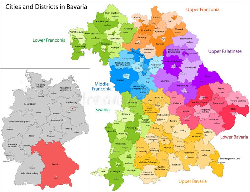
Free with trial State of Germany - Bavaria. Administrative division of Germany. Map of Bavaria with cities and districts. Districts vectors State of Germany - Bavaria. Administrative division of Germany. Map of Bavaria with cities and districts
Free with trial Colored street decoration hung between buildings facing each other in small alleys and districts in Egypt. It is an Egyptian tradition to celebrate the coming of the holy month of Ramadan. Districts vectors Ramadan Street Decoration 1. Colored street decoration hung between buildings facing each other in small alleys and districts in Egypt. It is an Egyptian. Colored street decoration hung between buildings facing each other in small alleys and districts in Egypt. It is an Egyptian tradition to celebrate the coming of the holy month of Ramadan.
Free with trial Map of France. An illustrated map of France. Districts vectors Map of France. An illustrated map of France
Free with trial Electric colored lamps used as street decoration hung between buildings facing each other in small alleys and districts in Egypt. It is an Egyptian tradition to celebrate the coming of the holy month of Ramadan. Districts vectors Ramadan Colored Lamps Street Decoration 3. Electric colored lamps used as street decoration hung between buildings facing each other in small alleys and. Electric colored lamps used as street decoration hung between buildings facing each other in small alleys and districts in Egypt. It is an Egyptian tradition to celebrate the coming of the holy month of Ramadan.
Free with trial Map of India. An illustrated map of india. Districts vectors Map of India. An illustrated map of india
Free with trial Map of France. Stylized map of France showing cities, provinces and various rivers. All on white background. Districts vectors Map of France. Stylized map of France showing cities, provinces and various rivers. All on white background. Stylized map of France showing cities, provinces and various rivers. All on white background.
Free with trial Portugal Districs Map. Portugal vector map with districts. Districts vectors Portugal Districs Map. Portugal vector map with districts
Free with trial A stylized map of Poland showing the different provinces. All isolated on white background. Districts vectors Map of Poland. A stylized map of Poland showing the different provinces. All isolated on white background. A stylized map of Poland showing the different provinces. All isolated on white background.
Free with trial A stylized map of Portugal showing the different provinces. All isolated on white background. Districts vectors Map of Portugal. A stylized map of Portugal showing the different provinces. All isolated on white background. A stylized map of Portugal showing the different provinces. All isolated on white background.
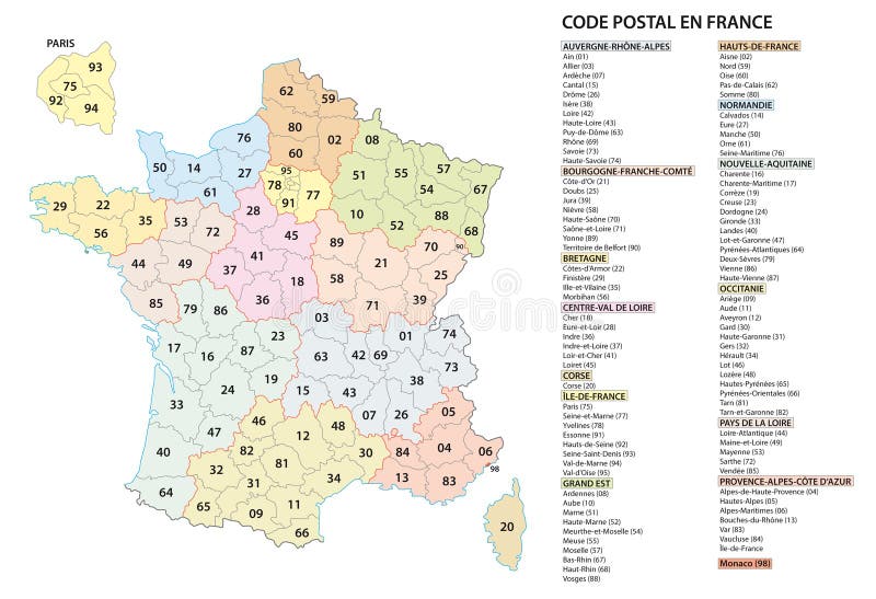
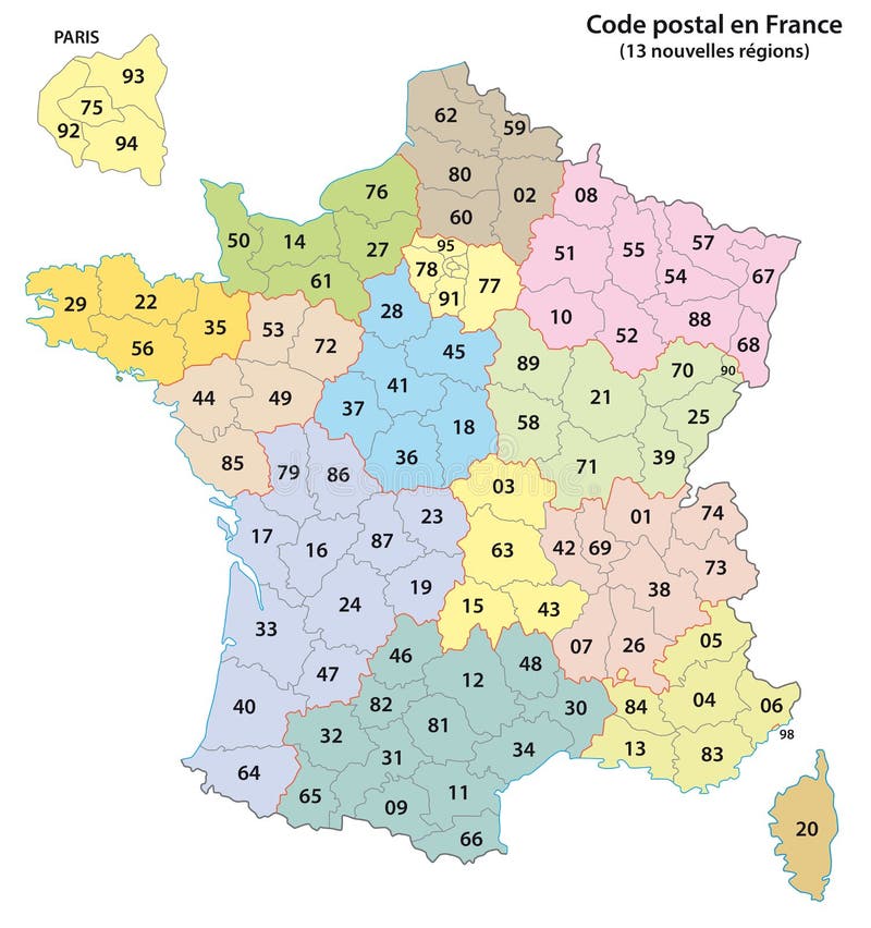
Free with trial France 2 digit postcodes postal codes vector map. Districts vectors France 2 digit postcodes postal codes vector map.
Free with trial Grey Europe map Vector illustrations. Vector illustrations of Europe map with grey countries and white borders. Districts vectors Grey Europe map Vector illustrations. Vector illustrations of Europe map with grey countries and white borders
Free with trial Highly detailed vector map of Lower and Mid Manhattan in New York including all streets, parks, names of sub districts, points of interests, labels, neighborhoods. Districts vectors New York Map - Lower and Mid Manhattan. Highly detailed vector map of Lower and Mid Manhattan in New York including all streets, parks, names of sub districts. Highly detailed vector map of Lower and Mid Manhattan in New York including all streets, parks, names of sub districts, points of interests, labels, neighborhoods.
Free with trial Map of the Golden Horseshoe metropolitan area around the western end of Lake Ontario, Ontario. Canada. Districts vectors Map of the Golden Horseshoe metropolitan area around the western end of Lake Ontario Ontario Canada. Map of the Golden Horseshoe metropolitan area around the. Map of the Golden Horseshoe metropolitan area around the western end of Lake Ontario, Ontario. Canada
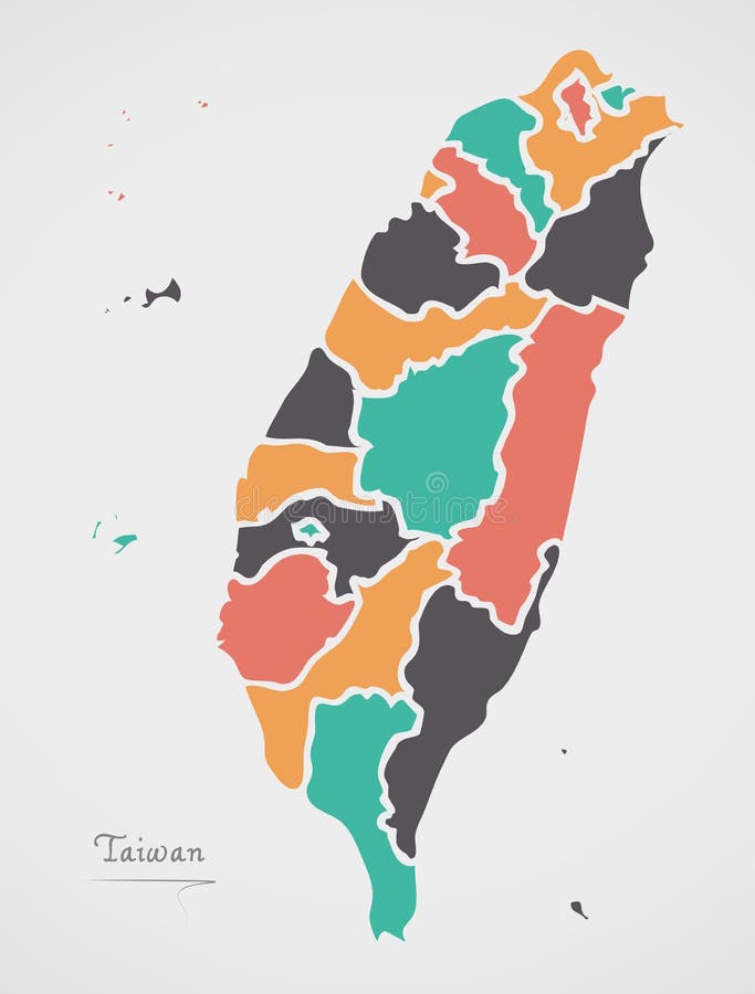
Free with trial Taiwan Map with states and modern round shapes. Illustration. Districts vectors Taiwan Map with states and modern round shapes. Illustration
Free with trial Berlin city map with boroughs grey illustration silhouette shape. Districts vectors Berlin city map with boroughs grey illustration silhouette shape. Berlin city map with boroughs grey illustration silhouette
Free with trial San Francisco city map USA labelled black illustration. San Francisco city map USA labelled black. Districts vectors San Francisco city map USA labelled black illustration. San Francisco city map USA labelled black
Free with trial Czech Republic map designed in illustration with the regions colored in grey colors and with the main cities. Neighbouring countries are in an additional format (. AI) in the latent layer. Districts vectors Map of Czech Republic. Czech Republic map designed in illustration with the regions colored in grey colors and with the main cities. Neighbouring countries are. Czech Republic map designed in illustration with the regions colored in grey colors and with the main cities. Neighbouring countries are in an additional format (.AI) in the latent layer.
Free with trial Czech Republic map designed in illustration with the regions colored in bright colors and with the main cities. On an illustration neighbouring countries are shown too. Districts vectors Vector map of Czech Republic. Czech Republic map designed in illustration with the regions colored in bright colors and with the main cities. On an illustration. Czech Republic map designed in illustration with the regions colored in bright colors and with the main cities. On an illustration neighbouring countries are shown too
Free with trial Map of Poland. Blind map of Poland with regions borders and names of the 16 province. Districts vectors Map of Poland. Blind map of Poland with regions borders and names of the 16 province
Free with trial Map of the Brazilian States with flags. Districts vectors Map of the Brazilian States with flags.
Free with trial France 2-digit postcodes map 2017. 13 Regions. Districts vectors France 2-digit postcodes map 2017. 13 Regions
Free with trial Vector map of United Kingdom colored by countries and regions. Districts and counties map of England, Wales, Scotland and Northern Ireland. Districts vectors Vector map of United Kingdom administrative divisions colored by countries and regions. Districts and counties map of England, Wal. Vector map of United Kingdom. Vector map of United Kingdom colored by countries and regions. Districts and counties map of England, Wales, Scotland and Northern Ireland
Free with trial Vector map of Portugal districts and autonomous regions, subdivided into municipalities. Each region have own color palette. Flag of Portugal. Districts vectors Vector map of Portugal districts and autonomous regions, subdivided into municipalities. Each region have own color palette. Flag. Of Portugal
Free with trial Vector map neighborhoods of Manhattan. Districts. Districts vectors Vector map neighborhoods of Manhattan. Districts
Free with trial Madrid administrative map. Map of the city districts of the Spanish capital of Madrid. Districts vectors Madrid administrative map. Map of the city districts of the Spanish capital of Madrid
Free with trial Vietnam map info-graphics vector template with regions, districts, state, country isolated in different color with pointer marks for education and printing purpose. Districts vectors Vietnam map infographics vector template with regions and pointer marks. Vietnam map info-graphics vector template with regions, districts, state, country. Vietnam map info-graphics vector template with regions, districts, state, country isolated in different color with pointer marks for education and printing purpose
Free with trial China map info-graphics vector template with regions, districts, state, country isolated in different color with pointer marks for education and printing purpose. Districts vectors China map infographics vector template with regions and pointer marks. China map info-graphics vector template with regions, districts, state, country isolated. China map info-graphics vector template with regions, districts, state, country isolated in different color with pointer marks for education and printing purpose
Free with trial USA united states of Ameria map info-graphics vector template with regions, districts, state, country isolated in different color with pointer marks for education and printing purpose. Districts vectors USA united states of Ameria map infographics vector template with regions and pointer marks. USA united states of Ameria map info-graphics vector template with. USA united states of Ameria map info-graphics vector template with regions, districts, state, country isolated in different color with pointer marks for education and printing purpose
Free with trial Peru map info-graphics vector template with regions, districts, state, country isolated in different color with pointer marks for education and printing purpose. Districts vectors Peru map infographics vector template with regions and pointer marks. Peru map info-graphics vector template with regions, districts, state, country isolated in. Peru map info-graphics vector template with regions, districts, state, country isolated in different color with pointer marks for education and printing purpose
Free with trial Romania map info-graphics vector template with regions, districts, state, country isolated in different color with pointer marks for education and printing purpose. Districts vectors Romania map infographics vector template with regions and pointer marks. Romania map info-graphics vector template with regions, districts, state, country. Romania map info-graphics vector template with regions, districts, state, country isolated in different color with pointer marks for education and printing purpose
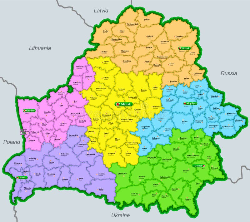
Free with trial Administrative map of the Republic of Belarus with partial borders of Poland, Lithuania, Latvia, Russia and Ukraine. Districts vectors Map of the Republic of Belarus marked by regions and districts in english and russian. Administrative map of the Republic of Belarus with partial borders of. Administrative map of the Republic of Belarus with partial borders of Poland, Lithuania, Latvia, Russia and Ukraine
Free with trial High Quality map of Mexico City is a capital United Mexican States with borders of the districts. Map of Mexico City for your we. B site design app UI. EPS10. Districts vectors High Quality map of Mexico City is a capital United Mexican States with borders of the districts. Map of Mexico City for your we. B site design app UI. EPS10
Free with trial Districts of Portugal. Map of regional country administrative divisions. Colorful vector illustration. Districts vectors Districts of Portugal. Map of regional country administrative divisions. Colorful vector illustration.
Free with trial Map of Israel with named districts. Vector map of Israel with named districts and travel icons. Districts vectors Map of Israel with named districts. Vector map of Israel with named districts and travel icons
Free with trial Map of Laos. Laos map designed in illustration with the regions and provinces with the main cities. (Map is hight resolution. Districts vectors Map of Laos. Laos map designed in illustration with the regions and provinces with the main cities. (Map is hight resolution
Free with trial Map of Laos. Laos map designed in illustration with the provinces and the main cities. (Map is hight resolution. Districts vectors Map of Laos. Laos map designed in illustration with the provinces and the main cities. (Map is hight resolution
Free with trial India. An illustrated map of india. Districts vectors India. An illustrated map of india
Free with trial City map. Detailed illustration of a nameless city map. Districts vectors City map. Detailed illustration of a nameless city map
Free with trial Poland map designed in illustration with the 26 districts colored in green colors and with the main cities. Neighbouring countries are in an additional format (. AI) in the latent layer. Districts vectors Latvia map. Poland map designed in illustration with the 26 districts colored in green colors and with the main cities. Neighbouring countries are in an. Poland map designed in illustration with the 26 districts colored in green colors and with the main cities. Neighbouring countries are in an additional format (.AI) in the latent layer.
 Sign in