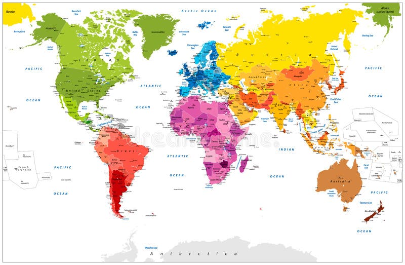
Free with trial Detailed World Map spot colored illustration. Highly detailed spot colored illustration of World Map: land contours, countries and land names, city names and water object names. Map vectors Detailed World Map spot colored illustration. Highly detailed spot colored illustration of World Map: land contours, countries and land names, city names and
Free with trial Highly detailed physical map of Cuba,in vector format,with all the relief forms,regions and big cities. Map vectors Cuba relief map. Highly detailed physical map of Cuba,in vector format,with all the relief forms,regions and big cities. Highly detailed physical map of Cuba,in vector format,with all the relief forms,regions and big cities.
Free with trial Wind rose. Marine wind roses, compass nautical navigation sailing symbols, geographic map antique vintage elements and tattoo vector science isolated star direction icons. Map vectors Wind rose. Marine wind roses, compass nautical navigation sailing symbols, geographic map antique vintage elements and. Tattoo vector science isolated star
Free with trial Travelers learning map - continuous line drawing. Vector linear illustration. Map vectors Travelers learning map - continuous line drawing. Vector linear illustration
Free with trial Flat map mobile phone GPS navigation ifographics 3d isometric concept. Phone with digital map, transport on roads (bus, car, van, truck), search bar magnifier glass, compass sign. Map vectors Flat map mobile phone GPS navigation 3d isometric concept. Flat map mobile phone GPS navigation ifographics 3d isometric concept. Phone with digital map. Flat map mobile phone GPS navigation ifographics 3d isometric concept. Phone with digital map, transport on roads (bus, car, van, truck), search bar magnifier glass, compass sign.
Free with trial Stamp with map of Barbados. Grunge stamp with map of Barbados - vector illustration. Map vectors Stamp with map of Barbados. Grunge stamp with map of Barbados - vector illustration
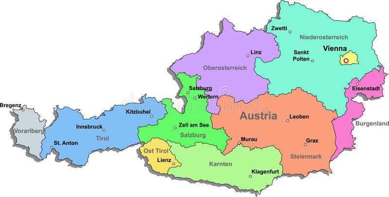
Free with trial Austria map - federal states. A political map of Austria showing the different federal states. Map vectors Austria map - federal states. A political map of Austria showing the different federal states
Free with trial Low polygon Globe Map with social icons wireframe mesh on blue background. Space for your text. Map vectors Low polygon Globe Map with social icons wireframe mesh on blue background. Space for your text
Free with trial North Africa and Middle East political map with most important capitals and international borders. Maghreb, Mediterranean, West and Central Asian countries. Illustration with English labeling. Vector. Map vectors North Africa and Middle East political map. With most important capitals and international borders. Maghreb, Mediterranean, West and Central Asian countries. North Africa and Middle East political map with most important capitals and international borders. Maghreb, Mediterranean, West and Central Asian countries. Illustration with English labeling. Vector
Free with trial Simple world map in flat style isolated on white background. Vector illustration. Map vectors Simple world map in flat style isolated on white background. Vector illustration
Free with trial Map Austria. A simple map of austria. Map vectors Map Austria. A simple map of austria
Free with trial Iceland map. Highly detailed vector map of Iceland with administrative regions,main cities and roads. Map vectors Iceland map. Highly detailed vector map of Iceland with administrative regions,main cities and roads
Free with trial Detailed map of Nigeria. Each file is constructed using multiple layers including country borders, county names, main roads and a highly detailed state silhouette. Each file is fully customizable with the ability to change the color of individual counties to suit your needs. Map vectors Nigeria map. Detailed map of Nigeria. Each file is constructed using multiple layers including country borders, county names, main roads and a highly detailed. Detailed map of Nigeria. Each file is constructed using multiple layers including country borders, county names, main roads and a highly detailed state silhouette. Each file is fully customizable with the ability to change the color of individual counties to suit your needs.
Free with trial Austria map. Color Austria map with regions on a white background. Map vectors Austria map. Color Austria map with regions on a white background
Free with trial Vector background with all streets of New York and surroundings map. Map vectors Vector black map of New york. Vector background with all streets of New York and surroundings map. Vector background with all streets of New York and surroundings map.
Free with trial Latin America subregions map. The subregions Caribbean, North, Central and South America in different colors and with national borders of each nation. Illustration on white background. Map vectors Latin America subregions map. The subregions Caribbean, North, Central and South America in different colors and with national borders of each nation
Free with trial City top view. Building and street with cars and trucks. Urban traffic vector map. Illustration of street road traffic, transport and building. Map vectors City top view. Building and street with cars and trucks. Urban traffic vector map. Illustration of street road traffic, transport and building
Free with trial Radar screen with world map. Vector EPS10. Map vectors Radar screen with world map. Vector EPS10
Free with trial Myanmar political map with capital Naypyidaw, national borders, important cities, rivers and lakes. Also called Burma and old capital Rangoon, Yangon. English labeling. Illustration. Map vectors Myanmar Burma Political Map. Myanmar political map with capital Naypyidaw, national borders, important cities, rivers and lakes. Also called Burma and old. Myanmar political map with capital Naypyidaw, national borders, important cities, rivers and lakes. Also called Burma and old capital Rangoon, Yangon. English labeling. Illustration.
Free with trial Snowy Winter Game Level Map. Illustration of scary snowy witner for creating game level map for adventure or puzzle games with Christmas and winter theme. Map vectors Snowy Winter Game Level Map. Illustration of scary snowy witner for creating game level map for adventure or puzzle games with Christmas and winter theme
Free with trial City map generator. City map example. Elements for creating your perfect city. Colour version. Seamless pattern. Vector illustration. Map vectors City map generator. City map example. Elements for creating your perfect city. Colour version. Seamless pattern. Vector illustration
Free with trial Graphic set with hand drawn elements for pirate map design on white. Vintage adventures and treasure hunt concept. Doodle drawings with old ships, wind compass, mystic and geographical symbols. Map vectors Set with hand drawn elements for treasure hunt and pirate map on white. Graphic set with hand drawn elements for pirate map design on white. Vintage adventures. Graphic set with hand drawn elements for pirate map design on white. Vintage adventures and treasure hunt concept. Doodle drawings with old ships, wind compass, mystic and geographical symbols
Free with trial Shanghai map. Highly detailed vector map of Shanghai with administrative regions,main cities and roads. Map vectors Shanghai map. Highly detailed vector map of Shanghai with administrative regions,main cities and roads
Free with trial Man on a hiking trip holding a map in his hands. Nature landscape of mountains, hills, meadows and river. Hiking, camping. Man on a hiking trip holding a map in. Map vectors Man on a hiking trip holding a map in his hands. Nature landscape of mountains, hills, meadows and river. Hiking, camping. Man on a hiking trip holding a map in
Free with trial Middle America political map with capitals and borders. Mid-latitudes of the Americas region. Mexico, Central America, the Caribbean and northern South America. Illustration. English labeling. Vector. Map vectors Middle America political map. With capitals and borders. Mid-latitudes of the Americas region. Mexico, Central America, the Caribbean and northern South America. Middle America political map with capitals and borders. Mid-latitudes of the Americas region. Mexico, Central America, the Caribbean and northern South America. Illustration. English labeling. Vector.
Free with trial Zodiac constellation map with leo virgo scorpio libra aquarius sagittarius pisces capricorn taurus aries gemini cancer symbols vector illustration. Map vectors Zodiac constellation map with leo virgo scorpio symbols vector illustration. Zodiac constellation map with leo virgo scorpio libra aquarius sagittarius pisces. Zodiac constellation map with leo virgo scorpio libra aquarius sagittarius pisces capricorn taurus aries gemini cancer symbols vector illustration
Free with trial United States map abstract vector background - black and white glowing lines connected on a dark solid color background. Map vectors United States map abstract vector background. Black and white glowing lines connected on a dark solid color background
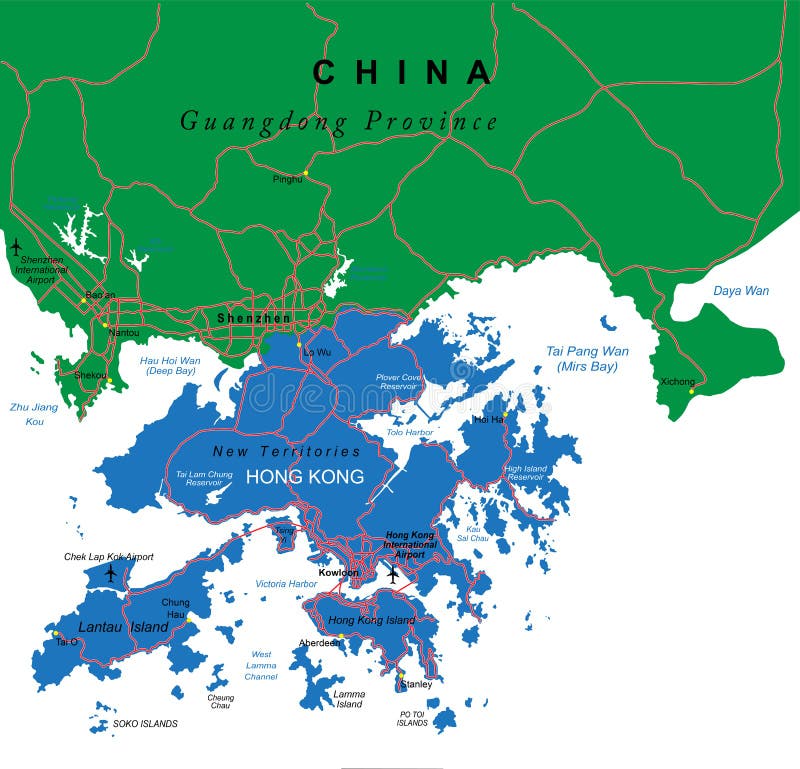
Free with trial Highly detailed vector map of Hong Kong with administrative regions,main cities and roads. Map vectors Hong Kong map. Highly detailed vector map of Hong Kong with administrative regions,main cities and roads. Highly detailed vector map of Hong Kong with administrative regions,main cities and roads.
Free with trial A stylized map of Poland showing the different provinces. All isolated on white background. Map vectors Map of Poland. A stylized map of Poland showing the different provinces. All isolated on white background. A stylized map of Poland showing the different provinces. All isolated on white background.
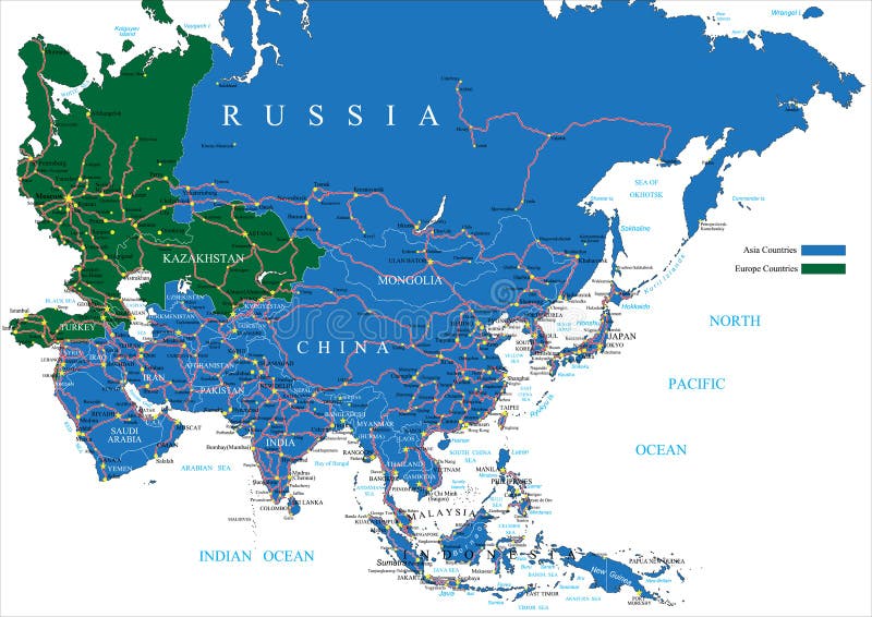
Free with trial Highly detailed vector map of Asia with countries, main cities and roads. Map vectors Asia road map. Highly detailed vector map of Asia with countries, main cities and roads. Highly detailed vector map of Asia with countries, main cities and roads.
Free with trial Vintage map of United States of America 50 states vector map isolated on dark background. Map vectors Vintage map of United States of America 50 states. Vector map isolated on dark background
Free with trial Arkansas State map by counties. Arkansas state vector map by counties. Map vectors Arkansas State map by counties. Arkansas state vector map by counties
Free with trial Colorado state road map with Interstates, U. S. Highways and state roads. All elements on separate layers for easy editing. Map vectors Colorado State Interstate Map. Colorado state road map with Interstates, U.S. Highways and state roads. All elements on separate layers for easy editing. Colorado state road map with Interstates, U.S. Highways and state roads. All elements on separate layers for easy editing.
Free with trial World Map - Mercator Projection. A black and white vector world map in Mercator projection, showing longitudes and latitudes. Map vectors World Map - Mercator Projection. A black and white vector world map in Mercator projection, showing longitudes and latitudes
Free with trial Southern Africa political map with borders of the countries and English labeling. The southernmost region of the African continent. Gray illustration on white background. Vector. Map vectors Southern Africa political map. With borders of the countries and English labeling. The southernmost region of the African continent. Gray illustration on white
Free with trial Accurate world map down to the last tiny island. Took me 2 days to do this for a project I was working on. otherwise I would not have bothered! You get to benifit from my hard work :). Map vectors Accurate World Map [detailed]. Accurate world map down to the last tiny island. Took me 2 days to do this for a project I was working on. otherwise I would not. Accurate world map down to the last tiny island. Took me 2 days to do this for a project I was working on. otherwise I would not have bothered! You get to benifit from my hard work :)
Free with trial World Map (Aitoff Projection). Aitoff projection of world map (vectorial format file). The Aitoff projection is a modified azimuthal map projection. Map vectors World Map (Aitoff Projection). Aitoff projection of world map (vectorial format file). The Aitoff projection is a modified azimuthal map projection
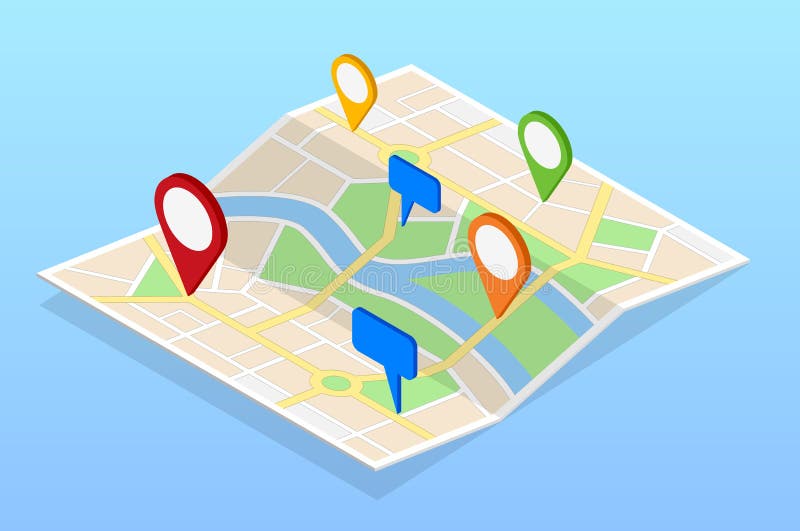
Free with trial Isometric City navigation map with pins or gps map, cityscape. Vector illustration. Map vectors Isometric City navigation map with pins or gps map, cityscape. Vector illustration.
Free with trial Vector map of the world colored by continents. On deep blue background. Map vectors Vector map of the world colored by continents. On deep blue background
Free with trial North America flora and fauna map, flat elements. Animals, birds. And sea life big set. Build your geography infographics collection. Vector illustration. Map vectors North America flora and fauna map, flat elements. Animals, birds. And sea life big set. Build your geography infographics collection. Vector illustration
Free with trial Map of Germany. Concept infographic template with states made out of puzzle pieces. Map vectors Map of Germany. Concept infographic template with states made out of puzzle pieces
Free with trial Highly detailed vector map of Costa Rica with administrative regions,main cities and roads. Map vectors Costa Rica map. Highly detailed vector map of Costa Rica with administrative regions,main cities and roads. Highly detailed vector map of Costa Rica with administrative regions,main cities and roads.
Free with trial Dotted World Map Background. Earth Globe. Globalization Concept. Black And White. Vector. Map vectors Dotted World Map Background. Earth Globe. Globalization Concept. Black And White. Vector
Free with trial Political map of South America. Vector illustration of Political map of South America. Map vectors Political map of South America. Vector illustration of Political map of South America
Free with trial Full vector Folded map of the world with a perspective view. Complete with colorful map pointers. Map vectors Vector Folded map of the world. Full vector Folded map of the world with a perspective view. Complete with colorful map pointers. Full vector Folded map of the world with a perspective view. Complete with colorful map pointers.
Free with trial Highly detailed vector map of Czech and Slovak Republics with administrative regions, main cities and roads. Map vectors Czech and Slovak Republics map. Highly detailed vector map of Czech and Slovak Republics with administrative regions, main cities and roads. Highly detailed vector map of Czech and Slovak Republics with administrative regions, main cities and roads.
Free with trial Vectior World Map with color geo location pins. Map vectors Vectior World Map with color geo location pins. Vectior World Map with color geo location pin pointers
Free with trial Landmark and Showplace Symbol Map pointer Mark Icons Vector Template Illustration. Map vectors Landmark and Showplace Symbol Map Pointer Mark. Icons Vector Template Illustration
Free with trial Kurdish areas in the Middle East, political map. Countries with their capitals, national borders and important cities. Kurdish areas in orange color. Illustration with English labeling. Vector. Map vectors Kurdish areas in the Middle East, political map. Countries with their capitals, national borders and important cities. Kurdish areas in orange color
Free with trial A generic city map of an imaginary city with light colors with many cute important places icons. Map vectors Imaginary city MAP with important places icons. A generic city map of an imaginary city with light colors with many cute important places icons. A generic city map of an imaginary city with light colors with many cute important places icons.
Free with trial A stylized map of Portugal showing the different provinces. All isolated on white background. Map vectors Map of Portugal. A stylized map of Portugal showing the different provinces. All isolated on white background. A stylized map of Portugal showing the different provinces. All isolated on white background.
Free with trial Blank world map. Modern style blank world map. Map vectors Blank world map. Modern style blank world map
Free with trial Mushroom Village Game Level Map. Illustration of fantasy mushroom village for creating game level map for adventure or puzzle games. Map vectors Mushroom Village Game Level Map. Illustration of fantasy mushroom village for creating game level map for adventure or puzzle games
Free with trial Marker hand drawn chart. Mind map doodle elements. Elements drawn marker for structure and management. Illustration of figures painted marker. Map vectors Marker hand drawn chart. Mind map doodle elements. Elements drawn marker for structure and management. Illustration of figures painted marker
Free with trial Vector world map. Fully editable world map with details ready to use. Map vectors Vector world map. Fully editable world map with details ready to use
Free with trial Infographic travel and landmark japan map shape template design. country navigator concept vector illustration / graphic or web design layout. Map vectors Infographic travel and landmark japan map shape template design. Country navigator concept vector illustration / graphic or web design layout
Free with trial Dark blue blank world map fake3D. Modern style dark blue blank world map fake3D. Map vectors Dark blue blank world map fake3D. Modern style dark blue blank world map fake3D
Free with trial Hand drawn doodle sketch political world map and geo tag pin pointers marker vector illustration. Map vectors Hand drawn doodle sketch political world map and. Geo tag pin pointers marker vector illustration
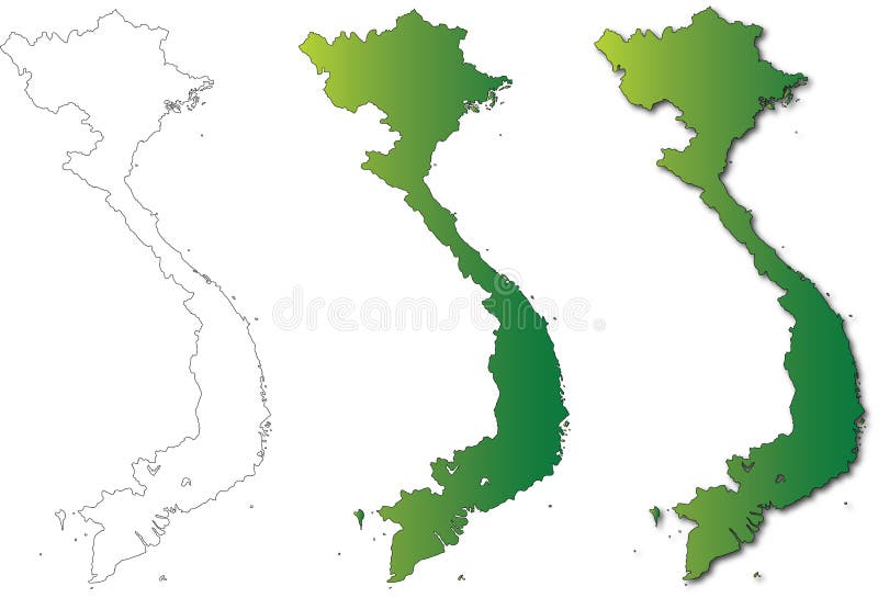
Free with trial A set of 3 Vietnam hand drawn detailed vector map illustrations on a white background. Basic outline, gradient and drop shadow variations for maximum design and education flexibility. Images may be separated, resized and edited easily with no loss of quality. Map vectors Vietnam Map Set Illustration on White Background. A set of 3 Vietnam hand drawn detailed vector map illustrations on a white background. Basic outline, gradient. A set of 3 Vietnam hand drawn detailed vector map illustrations on a white background. Basic outline, gradient and drop shadow variations for maximum design and education flexibility. Images may be separated, resized and edited easily with no loss of quality.
Free with trial Taiwan Travel map, hand drawn style attractions and specialties with two travelers. Map vectors Taiwan Travel map. Hand drawn style attractions and specialties with two travelers
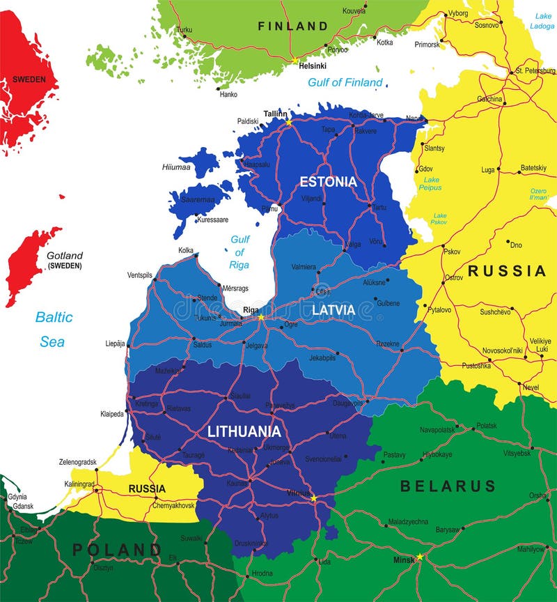
Free with trial Highly detailed vector map of the Baltic states with administrative regions,main cities and roads. Map vectors Baltic states map. Highly detailed vector map of the Baltic states with administrative regions,main cities and roads. Highly detailed vector map of the Baltic states with administrative regions,main cities and roads.
Free with trial Turkey travel map. And Turkish words for cotton castle on the left side, saffron city in the middle and ruins of ani on the right side. Map vectors Turkey travel map. And Turkish words for cotton castle on the left side, saffron city in the middle and ruins of ani on the right side
Free with trial Mexico map vector. Mexico map north america vector. Map vectors Mexico map vector. Mexico map north america vector
Free with trial World map infographcis and clean design business vector elements eps10. Map vectors World map infographcis and clean design business vector elements. Eps10
Free with trial Detailed infographic elements set with world map graphics and ch. Arts eps8. Map vectors Detailed infographic elements set with world map graphics and ch. Arts eps8
Free with trial Road trip map vector infographics. Banner with information to highway illustration. Map vectors Road trip map vector infographics. Banner with information to highway illustration
Free with trial World map dot. Abstract world map background. Vector. Map vectors World map dot. Abstract world map background. Vector
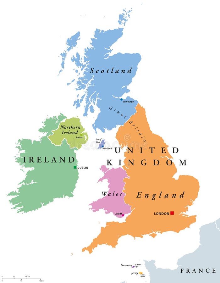
Free with trial United Kingdom countries and Ireland political map. England, Scotland, Wales, Northern Ireland, Guernsey, Jersey, Isle of Man and their capitals in different colors. Illustration on white background. Map vectors United Kingdom countries and Ireland political map. England, Scotland, Wales, Northern Ireland, Guernsey, Jersey, Isle of Man and their capitals in different
Free with trial Hand illustrated vector map of Europe. Detailed illustration of states. Map vectors Hand illustrated vector map of Europe. Detailed illustration of states
Free with trial Diversity people concept world map, group cartoon over american continent. Vector illustration layered for easy editing. Map vectors America people cartoons, world map diversity illus. Diversity people concept world map, group cartoon over american continent. Vector illustration layered for. Diversity people concept world map, group cartoon over american continent. Vector illustration layered for easy editing.
Free with trial Sweet world mobile GUI map screen video web games. Map vectors Sweet world mobile GUI map screen video web games.
Free with trial Reading a map: Places around town - Giving direction - Worksheet for education. Map vectors Reading a map: Places around town - Giving direction. Worksheet for education
Free with trial Vector layout business flyer with world map, magaz. Ine cover, template or corporate banner design. Map vectors Vector layout business flyer with world map, magaz. Ine cover, template or corporate banner design
Free with trial European Union map with new 27 number of states with United Kingdom greyed out. Vector illustration. Map vectors European Union map. With new 27 number of states with United Kingdom greyed out. Vector illustration
Free with trial Minnesota line map. Vector high quality map of the American state of Minnesota simple hand made line drawing map. Map vectors Minnesota line map. Vector high quality map of the American state of Minnesota simple hand made line drawing map
Free with trial Map Czech Republic. An illustrated map of the Czech Republic showing the single regions. Map vectors Map Czech Republic. An illustrated map of the Czech Republic showing the single regions
Free with trial Nordic-Baltic Eight NB8 member states political map. Regional co-operation format of Denmark, Estonia, Finland, Iceland, Latvia, Lithuania, Norway and Sweden. English labeling. Illustration. Vector. Map vectors Nordic-Baltic Eight NB8 member states political map. Regional co-operation format of Denmark, Estonia, Finland, Iceland, Latvia, Lithuania, Norway and Sweden
Free with trial Industrial internet of things (IOT) concept. World map of connected value chain of goods. Including business process automation. Map vectors Industrial internet of things (IOT) concept. World map of connected value chain of goods. Including business process automation
Free with trial Europe & North Africa blind map, easy to edit and change colour. EPS 10. Map vectors Europe & North Africa Blind Map. Easy to edit and change colour. EPS 10
 Sign in