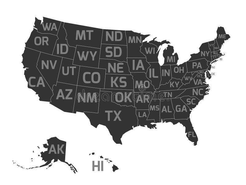
Free with trial Map of United States od America, aka USA, with US states abbreviation zip codes. Flat simplified dark grey vector map with light grey labels on white background. Mapping vectors Map of USA with state abbreviations. Map of United States od America, aka USA, with US states abbreviation zip codes. Flat simplified dark grey vector map with. Map of United States od America, aka USA, with US states abbreviation zip codes. Flat simplified dark grey vector map with light grey labels on white background.
Free with trial Abstract vector landscape background. Cyberspace landscape grid. 3d technology vector illustration. Mapping vectors Abstract vector landscape background. Cyberspace grid. 3d technology illustration. Abstract vector landscape background. Cyberspace landscape grid. 3d. Abstract vector landscape background. Cyberspace landscape grid. 3d technology vector illustration.
Free with trial Board game. View from above. Vector illustration. Mapping vectors Speedway. Board game. View from above. Vector illustration. Board game. View from above. Vector illustration.
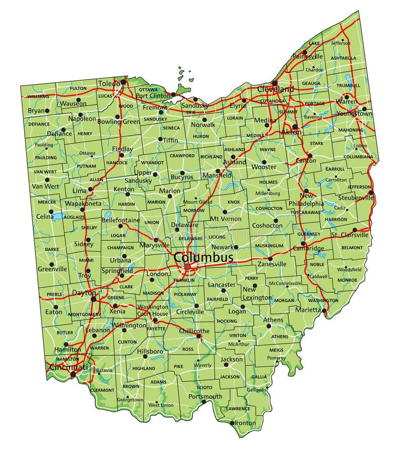
Free with trial High detailed Ohio physical map with labeling. Mapping vectors Detailed Ohio physical map with labeling. High detailed Ohio physical map with labeling. High detailed Ohio physical map with labeling.
Free with trial Ancestry or Genealogy Icon Set web banner w Family Tree Album, f. Ancestry / Genealogy Icon Set web banner with Family Tree Album, family record, etc. Mapping vectors Ancestry or Genealogy Icon Set web banner w Family Tree Album, f. Ancestry / Genealogy Icon Set web banner with Family Tree Album, family record, etc
Free with trial Stylized vector Jamaica map showing big cities, capital Kingston, administrative divisions. Mapping vectors Jamaica map with administrative divisions. Stylized vector Jamaica map showing big cities, capital Kingston, administrative divisions. Stylized vector Jamaica map showing big cities, capital Kingston, administrative divisions.
Free with trial Sweden map with borders, cities, capital and administrative divisions. Infographic vector map. Editable layers clearly labeled. Mapping vectors Sweden infographic map vector illustration. Sweden map with borders, cities, capital and administrative divisions. Infographic vector map. Editable layers. Sweden map with borders, cities, capital and administrative divisions. Infographic vector map. Editable layers clearly labeled.
Free with trial India map with borders, cities, capital and administrative divisions. Infographic vector map. Editable layers clearly labeled. Mapping vectors India infographic map vector illustration. India map with borders, cities, capital and administrative divisions. Infographic vector map. Editable layers clearly. India map with borders, cities, capital and administrative divisions. Infographic vector map. Editable layers clearly labeled.
Free with trial Hungary map with borders, cities, capital and administrative divisions. Infographic vector map. Editable layers clearly labeled. Mapping vectors Hungary infographic map vector illustration. Hungary map with borders, cities, capital and administrative divisions. Infographic vector map. Editable layers. Hungary map with borders, cities, capital and administrative divisions. Infographic vector map. Editable layers clearly labeled.
Free with trial Vietnam map with borders, cities, capital and administrative divisions. Infographic vector map. Editable layers clearly labeled. Mapping vectors Vietnam infographic map vector illustration. Vietnam map with borders, cities, capital and administrative divisions. Infographic vector map. Editable layers. Vietnam map with borders, cities, capital and administrative divisions. Infographic vector map. Editable layers clearly labeled.
Free with trial Stylized vector Lithuania map showing big cities, capital Vilnius, administrative divisions. Mapping vectors Lithuania map with administrative divisions. Stylized vector Lithuania map showing big cities, capital Vilnius, administrative divisions. Stylized vector Lithuania map showing big cities, capital Vilnius, administrative divisions.
Free with trial Stylized vector Mozambique map. Infographic 3d gold map illustration with cities, borders, capital, administrative divisions and pointer marks, shadow; gradient background. Mapping vectors Stylized Mozambique map vector illustration. Stylized vector Mozambique map. Infographic 3d gold map illustration with cities, borders, capital, administrative. Stylized vector Mozambique map. Infographic 3d gold map illustration with cities, borders, capital, administrative divisions and pointer marks, shadow; gradient background.
Free with trial Taiwan vector map with infographic elements, pointer marks. Editable template with regions, cities and capital Taipei. Mapping vectors Taiwan vector map with infographic elements, pointer marks. Editable template with regions, cities and capital Taipei
Free with trial Stylized map of Saudi Arabia. Isometric 3D green map with cities, borders, capital Riyadh, regions. Vector illustration. Editable layers clearly labeled. English language. Mapping vectors Stylized map of Saudi Arabia. Isometric 3D. Green map with cities, borders, capital Riyadh, regions. Vector illustration. Editable layers clearly labeled
Free with trial Vector map of the Kavango-Zambezi Transfrontier Conservation Area KAZA in southern Africa. Mapping vectors Vector map of the Kavango-Zambezi Transfrontier Conservation Area KAZA in southern Africa.
Free with trial Stylized map of Papua New Guinea. Isometric 3D green map with cities, borders, capital, regions. Vector illustration. Editable layers clearly labeled. English language. Mapping vectors Stylized map of Papua New Guinea. Isometric 3D. Green map with cities, borders, capital, regions. Vector illustration. Editable layers clearly labeled. English
Free with trial United States of America - Highly detailed editable political map with labeling. Vector illustration. Mapping vectors United States of America - Highly detailed editable political map with labeling. Vector illustration
Free with trial Highly detailed Egypt physical map with labeling. Mapping vectors Detailed Egypt physical map with labeling. Highly detailed Egypt physical map with labeling. Highly detailed Egypt physical map with labeling.
Free with trial High detailed Texas physical map with labeling. Mapping vectors Detailed Texas physical map with labeling. High detailed Texas physical map with labeling. High detailed Texas physical map with labeling.
Free with trial Zimbabwe map with administrative divisions. Stylized vector Zimbabwe map showing big cities, capital Harare, administrative divisions and country borders. Mapping vectors Zimbabwe map with administrative divisions. Stylized vector Zimbabwe map showing big cities, capital Harare, administrative divisions and country borders
Free with trial Vector set of Saudi Arabia country. Isometric 3d map, Saudi Arabia map, Asia map - with region, state names and city names. Mapping vectors Vector set of Saudi Arabia country. Isometric 3d map, Saudi Arabia map, Asia map - with region, state names and city names
Free with trial Isometric 3D Uzbekistan map, vector illustration with cities, borders, capital, administrative divisions and pointer marks; gradient blue background. Concept for infographic. Mapping vectors Isometric 3D Uzbekistan vector map concept. Isometric 3D Uzbekistan map, vector illustration with cities, borders, capital, administrative divisions and pointer. Isometric 3D Uzbekistan map, vector illustration with cities, borders, capital, administrative divisions and pointer marks; gradient blue background. Concept for infographic.
Free with trial Stylized vector Seychelles map showing big cities, capital Victoria, administrative divisions. Mapping vectors Seychelles map with administrative divisions. Stylized vector Seychelles map showing big cities, capital Victoria, administrative divisions. Stylized vector Seychelles map showing big cities, capital Victoria, administrative divisions.
Free with trial Stylized vector Mozambique map showing big cities, capital Maputo, administrative divisions. Mapping vectors Mozambique map with administrative divisions. Stylized vector Mozambique map showing big cities, capital Maputo, administrative divisions. Stylized vector Mozambique map showing big cities, capital Maputo, administrative divisions.
Free with trial Icon of Interstate 00 highway shield with customizable numbers, symbolizing road trips, travel destinations, transportation, and infrastructure. Mapping vectors Interstate 00 highway shield icon with customizable numbers, representing road travel, destination, transport, and infrastructure. Icon of Interstate 00 highway. Icon of Interstate 00 highway shield with customizable numbers, symbolizing road trips, travel destinations, transportation, and infrastructure
Free with trial High detailed Florida road map with labeling. Mapping vectors Detailed Florida road map with labeling. High detailed Florida road map with labeling. High detailed Florida road map with labeling.
Free with trial Malawi map vector with red pin. Malawi vector map. Editable template with regions, cities, red pins and blue surface on white background. Mapping vectors Malawi map vector with red pin. Malawi vector map. Editable template with regions, cities, red pins and blue surface on white background
Free with trial Stylized map of Liechtenstein. Isometric 3D green map with cities, borders, capital, regions. Vector illustration. Editable layers clearly labeled. English language. Mapping vectors Stylized map of Liechtenstein. Isometric 3D. Green map with cities, borders, capital, regions. Vector illustration. Editable layers clearly labeled. English
Free with trial Map of the divisions of the South American mountains Andes. Mapping vectors Map of the divisions of the South American mountains Andes.
Free with trial Vector road map of the Chilean island of Chiloe, Chile. Mapping vectors Vector road map of the Chilean island of Chiloe, Chile.
Free with trial Saint lucia administrative and political vector map. Mapping vectors Saint lucia administrative and political vector map.
Free with trial Isometric 3D Ukraine map, vector illustration with cities, borders, capital, administrative divisions and pointer marks; gradient blue background. Concept for infographic. Mapping vectors Isometric 3D Ukraine vector map concept. Isometric 3D Ukraine map, vector illustration with cities, borders, capital, administrative divisions and pointer marks. Isometric 3D Ukraine map, vector illustration with cities, borders, capital, administrative divisions and pointer marks; gradient blue background. Concept for infographic.
Free with trial Georgia map with borders, cities, capital and administrative divisions. Infographic vector map. Editable layers clearly labeled. Mapping vectors Georgia infographic map vector illustration. Georgia map with borders, cities, capital and administrative divisions. Infographic vector map. Editable layers. Georgia map with borders, cities, capital and administrative divisions. Infographic vector map. Editable layers clearly labeled.
Free with trial Physical vector map of the island nation of New Zealand. Mapping vectors Physical vector map of the island nation of New Zealand.
Free with trial Onboarding screens user interface kit for mobile app templates concept of find hotel. Concept for web banners, websites, infographics. Mapping vectors Onboarding screens user interface kit for mobile app templates concept of find hotel. Concept for web banners, websites,. Infographics
Free with trial Spain - Highly detailed editable political map with labeling. Vector illustration. Mapping vectors Spain - Highly detailed editable political map with labeling. Vector illustration
Free with trial Stylized vector North America map. Infographic 3d gold map illustration with cities, borders, capital, administrative divisions and pointer marks, shadow; gradient background. Mapping vectors Stylized North America map vector illustration. Stylized vector North America map. Infographic 3d gold map illustration with cities, borders, capital. Stylized vector North America map. Infographic 3d gold map illustration with cities, borders, capital, administrative divisions and pointer marks, shadow; gradient background.
Free with trial Vector administrative and political map of the Pakistani Special Territory Gilgit Baltistan. Mapping vectors Vector administrative and political map of the Pakistani Special Territory Gilgit Baltistan.
Free with trial Highly detailed Iceland physical map with labeling. Mapping vectors Detailed Iceland physical map with labeling. Highly detailed Iceland physical map with labeling. Highly detailed Iceland physical map with labeling.
Free with trial Stylized vector Costa Rica map showing big cities, capital San Jose, administrative divisions. Mapping vectors Costa Rica map with administrative divisions. Stylized vector Costa Rica map showing big cities, capital San Jose, administrative divisions. Stylized vector Costa Rica map showing big cities, capital San Jose, administrative divisions.
Free with trial Stylized vector New Zealand map. Infographic 3d gold map illustration with cities, borders, capital, administrative divisions and pointer marks, shadow; gradient background. Mapping vectors Stylized New Zealand map vector illustration. Stylized vector New Zealand map. Infographic 3d gold map illustration with cities, borders, capital. Stylized vector New Zealand map. Infographic 3d gold map illustration with cities, borders, capital, administrative divisions and pointer marks, shadow; gradient background.
Free with trial Africa - Highly detailed editable political map with separated layers. Mapping vectors Africa - Highly detailed editable political map. Africa - Highly detailed editable political map with separated layers. Africa - Highly detailed editable political map with separated layers.
Free with trial Mongolia map with borders, cities, capital and administrative divisions. Infographic vector map. Editable layers clearly labeled. Mapping vectors Mongolia infographic map vector illustration. Mongolia map with borders, cities, capital and administrative divisions. Infographic vector map. Editable layers. Mongolia map with borders, cities, capital and administrative divisions. Infographic vector map. Editable layers clearly labeled.
Free with trial Maldives map with borders, cities, capital and administrative divisions. Infographic vector map. Editable layers clearly labeled. Mapping vectors Maldives infographic map vector illustration. Maldives map with borders, cities, capital and administrative divisions. Infographic vector map. Editable layers. Maldives map with borders, cities, capital and administrative divisions. Infographic vector map. Editable layers clearly labeled.
Free with trial World map vector background. Art earth globe. Vector Illustration. Mapping vectors World map vector background. Art earth globe. Vector Illustration
Free with trial Stylized vector Turkmenistan map showing big cities, capital Ashgabat, administrative divisions. Mapping vectors Turkmenistan map with administrative divisions. Stylized vector Turkmenistan map showing big cities, capital Ashgabat, administrative divisions. Stylized vector Turkmenistan map showing big cities, capital Ashgabat, administrative divisions.
Free with trial Seamless pattern. Fictional topo contour map design. Vector. Geography concept. Abstract wavy graphic backdrop. Cartography and topology. Line topographic contour map background. Yellow and white. Mapping vectors Line topographic contour map background. Seamless. Seamless pattern. Fictional topo contour map design. Vector. Geography concept. Abstract wavy graphic. Seamless pattern. Fictional topo contour map design. Vector. Geography concept. Abstract wavy graphic backdrop. Cartography and topology. Line topographic contour map background. Yellow and white.
Free with trial A collection of line icons representing various aspects of location, navigation, and travel, featuring maps, directions, and transport symbols on white background. Mapping vectors A collection of line icons representing various aspects of location, navigation, and travel, featuring maps, directions, and. Transport symbols on white
Free with trial A detailed editable vector map of the U. S. state of Arkansas. The map highlights state boundaries, major cities, highways, rivers, and geographic features. Ideal for design and presentations. Mapping vectors Vector map of Arkansas, USA. A detailed editable vector map of the U.S. state of Arkansas. The map highlights state boundaries, major cities, highways, rivers. A detailed editable vector map of the U.S. state of Arkansas. The map highlights state boundaries, major cities, highways, rivers, and geographic features. Ideal for design and presentations.
Free with trial High detailed Colorado physical map with labeling. Mapping vectors Detailed Colorado physical map with labeling. High detailed Colorado physical map with labeling. High detailed Colorado physical map with labeling.
Free with trial Stylized vector Philippines map showing big cities, capital Manila, administrative divisions. Mapping vectors Philippines map with administrative divisions. Stylized vector Philippines map showing big cities, capital Manila, administrative divisions. Stylized vector Philippines map showing big cities, capital Manila, administrative divisions.
Free with trial Scientific Process Icon Set with Web Header Banner. Mapping vectors Scientific Process Icon Set with Web Header Banner. Scientific Process Icon Set & Web Header Banner
Free with trial Industrial buildings, factories and boilers in perspective for design and creativity. Mapping vectors Industrial buildings. Factories and boilers in perspective for design and creativity
Free with trial This contour map of Mt Hood displays the mountain s elevation changes, represented by contour lines. Geographic coordinates enhance its use for cartographic purposes and navigation. Mapping vectors Contour map of Mt Hood featuring detailed elevation lines and geographic coordinates. Topographic map vector. This contour map of Mt Hood displays the mountain. This contour map of Mt Hood displays the mountain s elevation changes, represented by contour lines. Geographic coordinates enhance its use for cartographic purposes and navigation.
Free with trial Vector map of the largest reservoir in the world Lake Volta, Ghana. Mapping vectors Vector map of the largest reservoir in the world Lake Volta, Ghana.
Free with trial United Arab Emirates - Highly detailed editable political map with labeling. Vector illustration. Mapping vectors United Arab Emirates - Highly detailed editable political map with labeling. Vector illustration
Free with trial The detailed map of the France with regions or states and cities, capital. Mapping vectors The detailed map of the France with regions or states and cities, capital.
Free with trial Isometric 3D Angola map, vector illustration with cities, borders, capital, administrative divisions and pointer marks; gradient blue background. Concept for infographic. Mapping vectors Isometric 3D Angola vector map concept. Isometric 3D Angola map, vector illustration with cities, borders, capital, administrative divisions and pointer marks. Isometric 3D Angola map, vector illustration with cities, borders, capital, administrative divisions and pointer marks; gradient blue background. Concept for infographic.
Free with trial Stylized vector Qatar map. Infographic 3d gold map illustration with cities, borders, capital, administrative divisions and pointer marks, shadow; gradient background. Mapping vectors Stylized Qatar map vector illustration. Stylized vector Qatar map. Infographic 3d gold map illustration with cities, borders, capital, administrative divisions. Stylized vector Qatar map. Infographic 3d gold map illustration with cities, borders, capital, administrative divisions and pointer marks, shadow; gradient background.
Free with trial Iowa state detailed editable map with with cities and towns, geographic sites, roads, railways, interstates and U. S. highways. Vector EPS-10 file, trending color scheme. Mapping vectors Iowa state detailed editable map. With with cities and towns, geographic sites, roads, railways, interstates and U.S. highways. Vector EPS-10 file, trending
Free with trial Kazakhstan map with borders, cities, capital and administrative divisions. Infographic vector map. Editable layers clearly labeled. Mapping vectors Kazakhstan infographic map vector illustration. Kazakhstan map with borders, cities, capital and administrative divisions. Infographic vector map. Editable. Kazakhstan map with borders, cities, capital and administrative divisions. Infographic vector map. Editable layers clearly labeled.
Free with trial Mississippi River Basin in the USA detailed editable vector map, trending color scheme. Mapping vectors Mississippi River Basin in the USA detailed editable vector map. Trending color scheme
Free with trial Illustration of Infinity mirror reflections of a woman holding a mirror in-front of her face. Mapping vectors Infinity mirror reflections of a woman holding a mirror in-front of her face. Illustration of Infinity mirror reflections of a woman holding a mirror in-front of. Illustration of Infinity mirror reflections of a woman holding a mirror in-front of her face
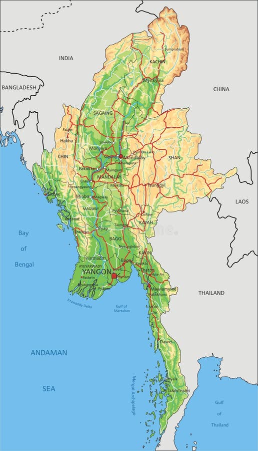
Free with trial Highly detailed Myanmar physical map with labeling. Mapping vectors Detailed Myanmar physical map with labeling. Highly detailed Myanmar physical map with labeling. Highly detailed Myanmar physical map with labeling.
Free with trial Vector map of the spanish mediterranean island of Mallorca. Mapping vectors Vector map of the spanish mediterranean island of Mallorca.
Free with trial Brittany outline map. Isolated on white background, France. Mapping vectors Brittany outline map. Isolated on white background, France
Free with trial Vector set of Mozambique country. Isometric 3d map, Mozambique map, Africa map - with region, state names and city names. Mapping vectors Vector set of Mozambique country. Isometric 3d map, Mozambique map, Africa map - with region, state names and city names
Free with trial Administrative vector map of the city of Baltimore, Maryland, United States. Mapping vectors Administrative vector map of the city of Baltimore, Maryland, United States.
Free with trial Road map of the US American State of kansas. Mapping vectors Road map of the US American State of kansas.
Free with trial Isometric 3D Switzerland map. Stylized vector map illustration with cities, borders, capital, administrative divisions and pointer marks; gradient background with grid. Mapping vectors Isometric Switzerland map with city names and administrative div. Isometric 3D Switzerland map. Stylized vector map illustration with cities, borders, capital. Isometric 3D Switzerland map. Stylized vector map illustration with cities, borders, capital, administrative divisions and pointer marks; gradient background with grid.
Free with trial Isometric 3D Lebanon map, vector illustration with cities, borders, capital, administrative divisions and pointer marks; gradient blue background. Concept for infographic. Mapping vectors Isometric 3D Lebanon vector map concept. Isometric 3D Lebanon map, vector illustration with cities, borders, capital, administrative divisions and pointer marks. Isometric 3D Lebanon map, vector illustration with cities, borders, capital, administrative divisions and pointer marks; gradient blue background. Concept for infographic.
Free with trial Italy - Highly detailed editable political map with separated layers. Vector illustration. Mapping vectors Italy - Highly detailed editable political map with separated layers. Vector illustration
Free with trial High detailed North Carolina road map with labeling. Mapping vectors Detailed North Carolina road map with labeling. High detailed North Carolina road map with labeling. High detailed North Carolina road map with labeling.
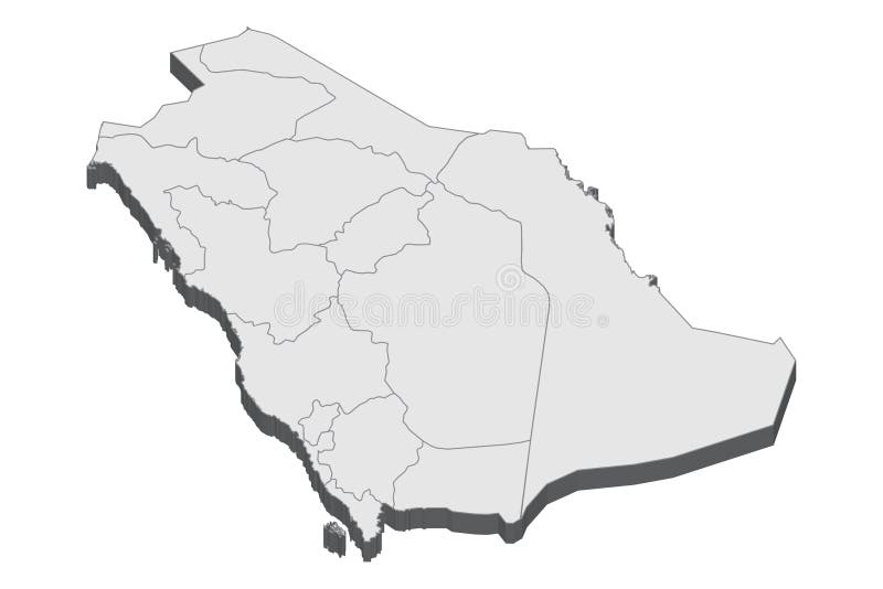
Free with trial Saudi Arabia 3d map with borders of regions. Vector illustration The map of Saudi Arabia isolated on white and rendered in 3D in white color. A stylized map of Saudi Arabia showing the different provinces. All isolated on white background. Mapping vectors Saudi Arabia map in 3D. 3d map with borders of regions. Saudi Arabia 3d map with borders of regions. Vector illustration. Saudi Arabia 3d map with borders of regions. Vector illustration The map of Saudi Arabia isolated on white and rendered in 3D in white color. A stylized map of Saudi Arabia showing the different provinces. All isolated on white background.
Free with trial Abstract vector cyberspace background. Mountain landscape grid illustration. 3d technology wireframe vector. Digital mesh. For banners. Mapping vectors Abstract vector cyberspace background.Mountain landscape grid illustration. 3d technology wireframe vector. Digital mesh. For banners
Free with trial Isometric 3D China map. Stylized vector map illustration with cities, borders, capital, administrative divisions and pointer marks; gradient background with grid. Mapping vectors Isometric China map with city names and administrative divisions. Isometric 3D China map. Stylized vector map illustration with cities, borders, capital. Isometric 3D China map. Stylized vector map illustration with cities, borders, capital, administrative divisions and pointer marks; gradient background with grid.
Free with trial Administrative and political map of the Indian state of Goa. Mapping vectors Administrative and political map of the Indian state of Goa. Administrative and political vector map of the Indian state of Goa
Free with trial Brazil map with borders, cities, capital and administrative divisions. Infographic vector map. Editable layers clearly labeled. Mapping vectors Brazil infographic map vector illustration. Brazil map with borders, cities, capital and administrative divisions. Infographic vector map. Editable layers. Brazil map with borders, cities, capital and administrative divisions. Infographic vector map. Editable layers clearly labeled.
Free with trial Landscape Background. Futuristic Landscape with Shiny Grid. Low Poly Terrain. 3D Wireframe Terrain. Network Abstract Background. Cyberspace Grid. Technology Vector Illustration of Low-Poly Landscape. Mapping vectors Landscape Background. Landscape with Shiny Grid. Low Poly Terrain. Landscape Background. Futuristic Landscape with Shiny Grid. Low Poly Terrain. 3D Wireframe. Landscape Background. Futuristic Landscape with Shiny Grid. Low Poly Terrain. 3D Wireframe Terrain. Network Abstract Background. Cyberspace Grid. Technology Vector Illustration of Low-Poly Landscape
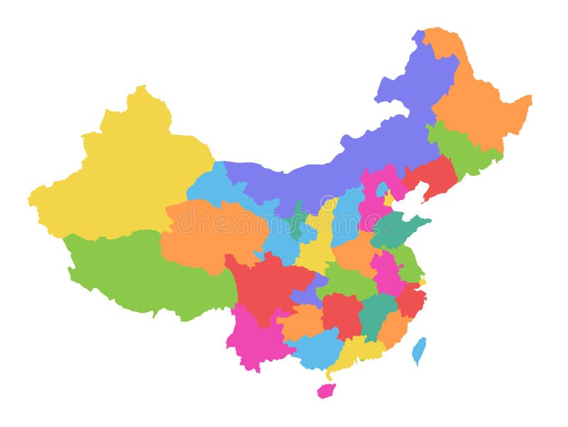
Free with trial China map, administrative division, separate individual region, color map isolated on white background blank. Template. Mapping vectors China map, administrative division, separate individual region, color map isolated on white background blank. Template
 Sign in