Free with trial Hand drawn genome sequencing concept. Human dna research technology symbols. Nano technology elements made in vector. Human genome project. Mapping vectors Hand drawn genome sequencing concept. Human dna research technology symbols. Nano technology elements made in vector. Human genome project
Free with trial Robot with digital circuit hand drawn outline doodle icon. Machine intelligence, machine learning, ai concept. Vector sketch illustration for print, web, mobile and infographics on white background. Mapping vectors Robot with digital circuit hand drawn outline doodle icon. Machine intelligence, machine learning, ai concept. Vector sketch illustration for print, web
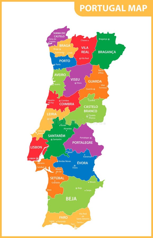
Free with trial The detailed map of the Portugal with regions or states and cities, capitals. Mapping vectors The detailed map of the Portugal with regions or states and cities, capitals.
Free with trial Simple outline map of the south american andes mountains. Mapping vectors Simple outline map of the south american andes mountains.
Free with trial Vector set of Spain country. Isometric 3d map, Spain map, Europe map - with region, state names and city names. Mapping vectors Vector set of Spain country. Isometric 3d map, Spain map, Europe map - with region, state names and city names
Free with trial Administrative and political map of indian state of Karnataka, india. Mapping vectors Administrative and political map of indian state of Karnataka, india.
Free with trial Geodetic measuring equipment, engineering technology for land survey. On world map background. Mapping vectors Geodetic measuring equipment, engineering technology for land survey. On world map background
Free with trial Myanmar Burma map with borders, cities, capital and administrative divisions. Infographic vector map. Editable layers clearly labeled. Mapping vectors Myanmar Burma infographic map vector illustration. Myanmar Burma map with borders, cities, capital and administrative divisions. Infographic vector map. Myanmar Burma map with borders, cities, capital and administrative divisions. Infographic vector map. Editable layers clearly labeled.
Free with trial Lets go like mobile game. concept of mapping, cartography tag, tracking, going, geolocation, roadmap, traffic, tour, player. flat style trend modern logo design vector illustration on white background. Mapping vectors Lets go like mobile game. Concept of mapping, cartography tag, tracking, going, geolocation, roadmap, traffic, tour, player. flat style trend modern logo
Free with trial Canada map administrative division, separates regions and names individual region, card paper 3D natural. Vector. Mapping vectors Canada map administrative division, separates regions and names individual region, card paper 3D natural. Vector
Free with trial Map of the Darien Gap region between Panama and Colombia. Mapping vectors Map of the Darien Gap region between Panama and Colombia.
Free with trial Korea map, north and south administrative division with region names, color map isolated on white background. Vector. Mapping vectors Korea map, north and south administrative division with region names, color map isolated on white background. Vector
Free with trial Landscape Background. Futuristic Landscape with Shiny Grid. Low Poly Terrain. 3D Wireframe Terrain. Network Abstract Background. Cyberspace Grid. Technology Vector Illustration of Low-Poly Landscape. Mapping vectors Landscape Background. Futuristic Landscape with Shiny Grid. Low Poly Terrain. 3D Wireframe Terrain. Network Abstract Background. Cyberspace Grid. Technology
Free with trial World map stylized with dots on white background. Illustration of World map stylized with dots on white background. Mapping vectors World map stylized with dots on white background. Illustration of World map stylized with dots on white background
Free with trial Geo Targeting and Document Management Icon Set with Target Pin. Vol 34556. Mapping vectors Geo Targeting and Document Management Icon Set with Target Pin. Vol 34556
Free with trial High detailed Alabama road map with labeling. Mapping vectors Detailed Alabama road map with labeling. High detailed Alabama road map with labeling. High detailed Alabama road map with labeling.
Free with trial The detailed map of the France with regions or states. Mapping vectors The detailed map of the France with regions or states.
Free with trial East Timor vector map. Editable template with regions, cities, red pins and blue surface on white background. Mapping vectors East Timor map vector with red pin. East Timor vector map. Editable template with regions, cities, red pins and blue surface on white background. East Timor vector map. Editable template with regions, cities, red pins and blue surface on white background.
Free with trial Navigation vector line icon isolated on white background. Navigation line icon for infographic, website or app. Scalable icon designed on a grid system. Mapping vectors Navigation line icon. Navigation vector line icon isolated on white background. Navigation line icon for infographic, website or app. Scalable icon designed on. Navigation vector line icon isolated on white background. Navigation line icon for infographic, website or app. Scalable icon designed on a grid system.
Free with trial The detailed map of the Portugal with regions or states and cities, capitals. Mapping vectors The detailed map of the Portugal with regions or states and cities, capitals.
Free with trial A futuristic digital radar chart featuring red and blue lines for comparing different data sets on a dark mesh background. Mapping vectors Modern hexagonal spider chart showing data analytics for business performance comparison displayed on a dark background. A futuristic digital radar chart. A futuristic digital radar chart featuring red and blue lines for comparing different data sets on a dark mesh background
Free with trial Poland map separates regions and names individual region, card paper 3D natural. Vector. Mapping vectors Poland map separates regions and names individual region, card paper 3D natural. Vector
Free with trial Vector set of Uruguay country. Isometric 3d map, Uruguay map, South America map - with region, state names and city names. Mapping vectors Vector set of Uruguay country. Isometric 3d map, Uruguay map, South America map - with region, state names and city names
Free with trial Hand drawn genome sequencing illustration. Human dna research technology symbol. Nano technology concept made in vector. Human genome project. Mapping vectors Spiral DNA - hand drawn genome sequencing illustration. Human dna research technology symbol. Hand drawn genome sequencing illustration. Human dna research. Hand drawn genome sequencing illustration. Human dna research technology symbol. Nano technology concept made in vector. Human genome project.
Free with trial This map showcases the outline of Africa political boundaries, featuring the continents diverse regions clearly marked and unfilled. Ideal for educational and illustrative purposes. Mapping vectors Blank political vector map of Africa. This map showcases the outline of Africa political boundaries, featuring the continents diverse regions clearly marked and. This map showcases the outline of Africa political boundaries, featuring the continents diverse regions clearly marked and unfilled. Ideal for educational and illustrative purposes.
Free with trial Simple red icon of dental clinic isolated on white. unusual flat style trend modern logotype or graphic design emblem. concept of address finder mapping and locate of dentistry clinic. Mapping vectors Simple red icon of dental clinic isolated on white. Unusual flat style trend modern logotype or graphic design emblem. concept of address finder mapping and
Free with trial Vector map of Iraq. High detailed country map with division, cities and capital Baghdad. Political map, world map, infographic. Elements. Mapping vectors Vector map of Iraq. High detailed country map with division, cities and capital Baghdad. Political map, world map, infographic. Elements
Free with trial Map of the Haida Gwaii archipelago off the coast of British Columbia, Canada. Mapping vectors Map of the Haida Gwaii archipelago off the coast of British Columbia, Canada.
Free with trial Isometric 3D Argentina map. Stylized vector map illustration with cities, borders, capital, administrative divisions and pointer marks; gradient background with grid. Mapping vectors Isometric Argentina map with city names and administrative divisions. Isometric 3D Argentina map. Stylized vector map illustration with cities, borders, capital. Isometric 3D Argentina map. Stylized vector map illustration with cities, borders, capital, administrative divisions and pointer marks; gradient background with grid.
Free with trial Western australia map silhouette with various styles black outlines, solid fill, and dotted patterns, geographic borders, state boundary, political mapping, and cartographic representation. Mapping vectors Western australia map silhouette vector illustration isolated on white background, different maps style. Western australia map silhouette with various styles. Western australia map silhouette with various styles black outlines, solid fill, and dotted patterns, geographic borders, state boundary, political mapping, and cartographic representation
Free with trial Australia map template isolated on white background. vector illustration. Mapping vectors Australia map. Template isolated on white background. vector illustration
Free with trial Oman map vector with red pin. Oman vector map. Editable template with regions, cities, red pins and blue surface on white background. Mapping vectors Oman map vector with red pin. Oman vector map. Editable template with regions, cities, red pins and blue surface on white background
Free with trial Abstract vector wireframe landscape background. Cyberspace grid. 3d technology wireframe vector illustration. Digital. Wireframe landscape. Mapping vectors Abstract vector wireframe landscape background. Cyberspace grid. 3d technology wireframe vector illustration. Digital. Wireframe landscape
Free with trial A simple blue arrow pointing right, symbolizing navigation, guidance, or direction. Mapping vectors Blue arrow pointing right for navigation and direction. A simple blue arrow pointing right, symbolizing navigation, guidance, or direction. A simple blue arrow pointing right, symbolizing navigation, guidance, or direction.
Free with trial Hand holding smartphone and touching screen with mobile map gps navigation. Finding the way concept. Flat vector illustration. Mapping vectors Smartphone with mobile map gps navigation on screen. Hand holding smartphone and touching screen with mobile map gps navigation. Finding the way concept. Flat. Hand holding smartphone and touching screen with mobile map gps navigation. Finding the way concept. Flat vector illustration.
Free with trial Peru vector map with infographic elements, pointer marks. Editable template with regions, cities and capital Lima. Mapping vectors Peru vector map with infographic elements, pointer marks. Editable template with regions, cities and capital Lima
Free with trial Place logo design vector illustration. Ready to use. Mapping vectors Place logo design vector illustration. Ready to use
Free with trial Genomic data. Dna, atom, neurons. Scientific molecule background for medicine, science technology chemistry with genomic data. Mapping vectors Genomic data visualization. Genomic data. Dna, atom, neurons. Scientific molecule background for medicine, science technology chemistry with genomic data. Genomic data. Dna, atom, neurons. Scientific molecule background for medicine, science technology chemistry with genomic data.
Free with trial Lean Production. Concept with keywords, letters and icons. Colored flat vector illustration. Isolated on white background. Mapping vectors Lean Production. Concept with keywords, letters and icons. Flat vector illustration. Isolated on white background. Lean Production. Concept with keywords. Lean Production. Concept with keywords, letters and icons. Colored flat vector illustration. Isolated on white background.
Free with trial Croatia - Highly detailed editable political map with labeling. Vector illustration. Mapping vectors Croatia - Highly detailed editable political map with labeling. Vector illustration
Free with trial Vector map of Caribbean island country Dominican Republic. Mapping vectors Vector map of Caribbean island country Dominican Republic.
Free with trial China map administrative division, separates regions and names individual region, card paper 3D natural. Vector. Mapping vectors China map administrative division, separates regions and names individual region, card paper 3D natural. Vector
Free with trial Moldova - Highly detailed editable political map with labeling. Mapping vectors Moldova - detailed editable political map with labeling. Moldova - Highly detailed editable political map with labeling. Moldova - Highly detailed editable political map with labeling.
Free with trial China vector map with infographic elements, pointer marks. Editable template with regions, cities and capital Beijing. Mapping vectors China vector map with infographic elements, pointer marks. Editable template with regions, cities and capital Beijing
Free with trial Ecuador vector map with infographic elements, pointer marks. Editable template with regions, cities and capital Quito. Mapping vectors Ecuador vector map with infographic elements, pointer marks. Editable template with regions, cities and capital Quito
Free with trial India vector map with infographic elements, pointer marks. Editable template with regions, cities and capital Delhi. Mapping vectors India vector map with infographic elements, pointer marks. Editable template with regions, cities and capital Delhi
Free with trial Stylized vector Kosovo map. Infographic 3d gold map illustration with cities, borders, capital, administrative divisions and pointer marks, shadow; gradient background. Mapping vectors Stylized Kosovo map vector illustration. Stylized vector Kosovo map. Infographic 3d gold map illustration with cities, borders, capital, administrative. Stylized vector Kosovo map. Infographic 3d gold map illustration with cities, borders, capital, administrative divisions and pointer marks, shadow; gradient background.
Free with trial High detailed Norway road map with labeling. Vector illustration. Mapping vectors High detailed Norway road map with labeling. Vector illustration
Free with trial Japan vector map with infographic elements, pointer marks. Editable template with regions, cities and capital Tokyo. Mapping vectors Japan vector map with infographic elements, pointer marks. Editable template with regions, cities and capital Tokyo
Free with trial Oman vector map with infographic elements, pointer marks. Editable template with regions, cities and capital Muscat. Mapping vectors Oman vector map with infographic elements, pointer marks. Editable template with regions, cities and capital Muscat
Free with trial Highly detailed Argentina physical map with labeling. Mapping vectors Detailed Argentina physical map with labeling. Highly detailed Argentina physical map with labeling. Highly detailed Argentina physical map with labeling.
Free with trial Big data and database. Big data technology managing datas with teams to database - concept idease with vintage color. Mapping vectors Big data and database. Big data technology managing datas with teams to database - concept idease with vintage color
Free with trial Malta vector map with infographic elements, pointer marks. Editable template with regions, cities and capital Valletta. Mapping vectors Malta vector map with infographic elements, pointer marks. Editable template with regions, cities and capital Valletta
Free with trial Administrative vector map of Belem metropolitan area, Para, Brazil. Mapping vectors Administrative vector map of Belem metropolitan area, Para, Brazil.
Free with trial The image showcases silhouettes of surveyors and construction workers engaged in land surveying activities, utilizing equipment like theodolites and measuring rods on a survey site. The figures are depicted in various work postures, highlighting outdoor site planning and safety measures typical in civil engineering and topographic survey tasks. This image is generated using AI technology. Mapping vectors Surveyor Silhouettes Construction Workers Land Surveying Equipment. The image showcases silhouettes of surveyors and construction workers engaged in land. The image showcases silhouettes of surveyors and construction workers engaged in land surveying activities, utilizing equipment like theodolites and measuring rods on a survey site. The figures are depicted in various work postures, highlighting outdoor site planning and safety measures typical in civil engineering and topographic survey tasks. This image is generated using AI technology.
Free with trial The detailed map of Sweden with regions or states. Administrative division. Mapping vectors The detailed map of Sweden with regions or states. Administrative division. The detailed map of Sweden with regions or states. Administrative division
Free with trial Map pin button. EPS 10 vector file has transparency (shadow under the icons) mapping pins icon Valentine's Day. Mapping vectors Map pin button. EPS 10 vector file has transparency (shadow under the icons) mapping pins icon Valentine's Day
Free with trial Ancestry or Genealogy Icon Set with Family Tree Album, DNA, beak. Ers, chemical family record, etc. Mapping vectors Ancestry or Genealogy Icon Set with Family Tree Album, DNA, beak. Ers, chemical family record, etc
Free with trial Vector map of the Río de la Plata, Argentina, Uruguay. Mapping vectors Vector map of the Río de la Plata, Argentina, Uruguay.
Free with trial Black map pin,. Map pin, black color on white background, vector illustration. Mapping vectors Black map pin,. Map pin, black color on white background, vector illustration
Free with trial Marshall Islands map with administrative divisions. Stylized vector Marshall Islands map. Mapping vectors Marshall Islands map with administrative divisions. Stylized vector Marshall Islands map
Free with trial Set Template article, Landing page, app design, Isometric bright concept users write comments, recall and feedback about services. Mapping vectors Isometric Users Write Feedback About Services. Set Template article, Landing page, app design, Isometric bright concept users write comments, recall and feedback. Set Template article, Landing page, app design, Isometric bright concept users write comments, recall and feedback about services.
Free with trial Stylized vector Pakistan map. Infographic 3d gold map illustration with cities, borders, capital, administrative divisions and pointer marks, shadow; gradient background. Mapping vectors Stylized Pakistan map vector illustration. Stylized vector Pakistan map. Infographic 3d gold map illustration with cities, borders, capital, administrative. Stylized vector Pakistan map. Infographic 3d gold map illustration with cities, borders, capital, administrative divisions and pointer marks, shadow; gradient background.
Free with trial Ancestry or Genealogy Icon Set web banner w Family Tree Album, f. Ancestry / Genealogy Icon Set web banner with Family Tree Album, family record, etc. Mapping vectors Ancestry or Genealogy Icon Set web banner w Family Tree Album, f. Ancestry / Genealogy Icon Set web banner with Family Tree Album, family record, etc
Free with trial Cambodia vector map with infographic elements, pointer marks. Editable template with regions, cities and capital Phnom Penh. Mapping vectors Cambodia vector map with infographic elements, pointer marks. Editable template with regions, cities and capital Phnom Penh
Free with trial Vector of white tile for background. Mapping vectors White tile vector. Vector of white tile for background. Vector of white tile for background.
Free with trial Russia map, individual regions with names, administrative division, colored map isolated on white background. Vector. Mapping vectors Russia map, individual regions with names, administrative division, colored map isolated on white background. Vector
Free with trial The detailed map of the Finland with regions. Vector illustration. Mapping vectors The detailed map of the Finland with regions. Vector illustration
Free with trial Lebanon vector map with infographic elements, pointer marks. Editable template with regions, cities and capital Beirut. Mapping vectors Lebanon vector map with infographic elements, pointer marks. Editable template with regions, cities and capital Beirut
Free with trial Poland vector map with infographic elements, pointer marks. Editable template with regions, cities and capital Warsaw. Mapping vectors Poland vector map with infographic elements, pointer marks. Editable template with regions, cities and capital Warsaw
Free with trial Long Island, NY dotter illuminated map. Vector illustration. Mapping vectors Long Island, NY dotter illuminated map. Vector illustration
Free with trial Cyprus vector map with infographic elements, pointer marks. Editable template with regions, cities and capital Nicosia. Mapping vectors Cyprus vector map with infographic elements, pointer marks. Editable template with regions, cities and capital Nicosia
Free with trial Croatia vector map with infographic elements, pointer marks. Editable template with regions, cities and capital Zagreb. Mapping vectors Croatia vector map with infographic elements, pointer marks. Editable template with regions, cities and capital Zagreb
Free with trial Icon set featuring three rows of symbols. The top row shows three clock icons in black and red, indicating different times. The middle row displays calendar icons with grid patterns, also in black and red. The bottom row presents location pin icons, in the same color scheme, surrounded by circular outlines. Each row represents a distinct concept, using a minimalist design with a consistent color palette against a white background. Mapping vectors Time, Date, Location icon set. Clock icon, Calendar icon, Pin point icon. Icon set featuring three rows of symbols. The top row shows three clock icons in black. Icon set featuring three rows of symbols. The top row shows three clock icons in black and red, indicating different times. The middle row displays calendar icons with grid patterns, also in black and red. The bottom row presents location pin icons, in the same color scheme, surrounded by circular outlines. Each row represents a distinct concept, using a minimalist design with a consistent color palette against a white background.
Free with trial Map of Independent State Papua New Guinea with Dot Pattern. Vector Image - Map of Independent State of Papua New Guinea with Dot Pattern. Mapping vectors Map of Independent State Papua New Guinea with Dot Pattern. Vector Image - Map of Independent State of Papua New Guinea with Dot Pattern
Free with trial Administrative vector map of the Alentejo region of southern Portugal. Mapping vectors Administrative vector map of the Alentejo region of southern Portugal.
Free with trial 3d map pointer. Red navigator symbol isolated on transparent background. Vector illustration. Mapping vectors 3d map pointer. Red navigator symbol isolated on transparent background. Vector illustration.
Free with trial The detailed map of the France with regions. Mapping vectors The detailed map of the France with regions.
Free with trial Abstract vector wireframe landscape background. Cyberspace grid. 3d. Futuristic vector illustration. Mapping vectors Abstract vector wireframe landscape background. Cyberspace grid. 3d. Futuristic vector illustration
Free with trial Blank block scheme mind map frame. Template. Mapping vectors Blank block scheme mind map frame. Template
 Sign in