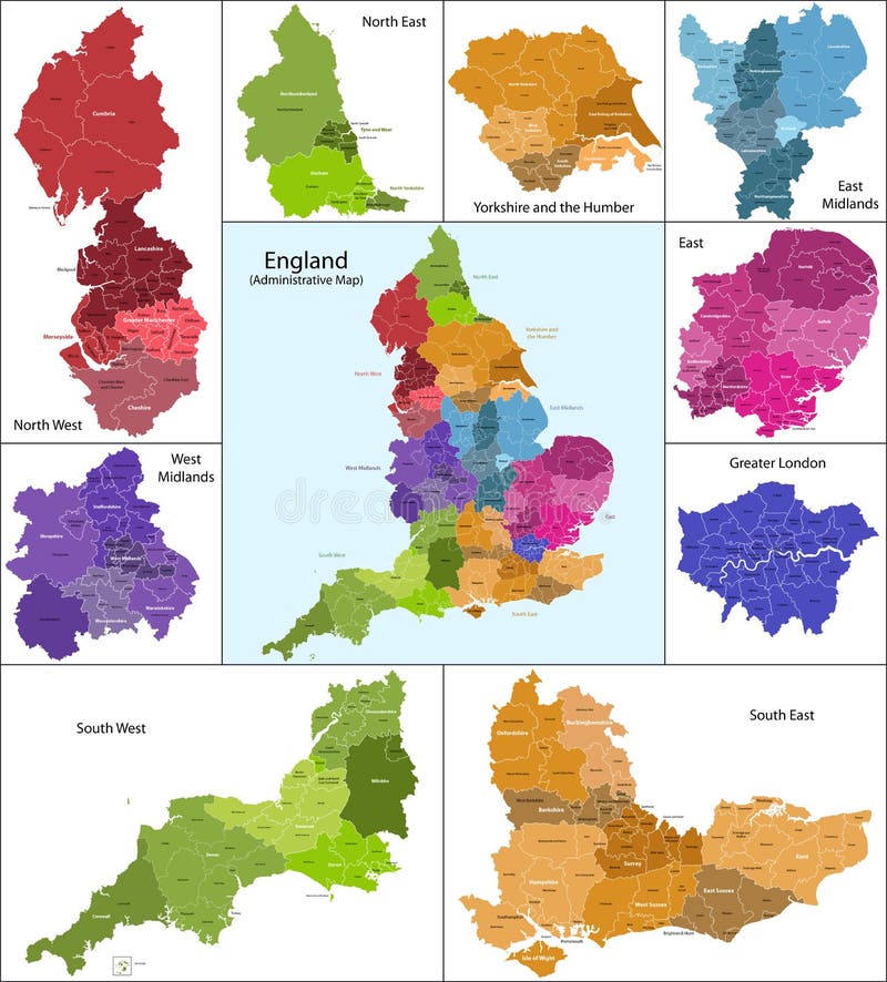
Free with trial The map shows the current subdivisions of England with a principal local authority: two-tier non-metropolitan counties and their non-metropolitan districts, metropolitan boroughs, unitary authorities, London boroughs and the sui generis City of London and Isles of Scilly. Midlands vectors England map. The map shows the current subdivisions of England with a principal local authority: two-tier non-metropolitan counties and their non-metropolitan. The map shows the current subdivisions of England with a principal local authority: two-tier non-metropolitan counties and their non-metropolitan districts, metropolitan boroughs, unitary authorities, London boroughs and the sui generis City of London and Isles of Scilly
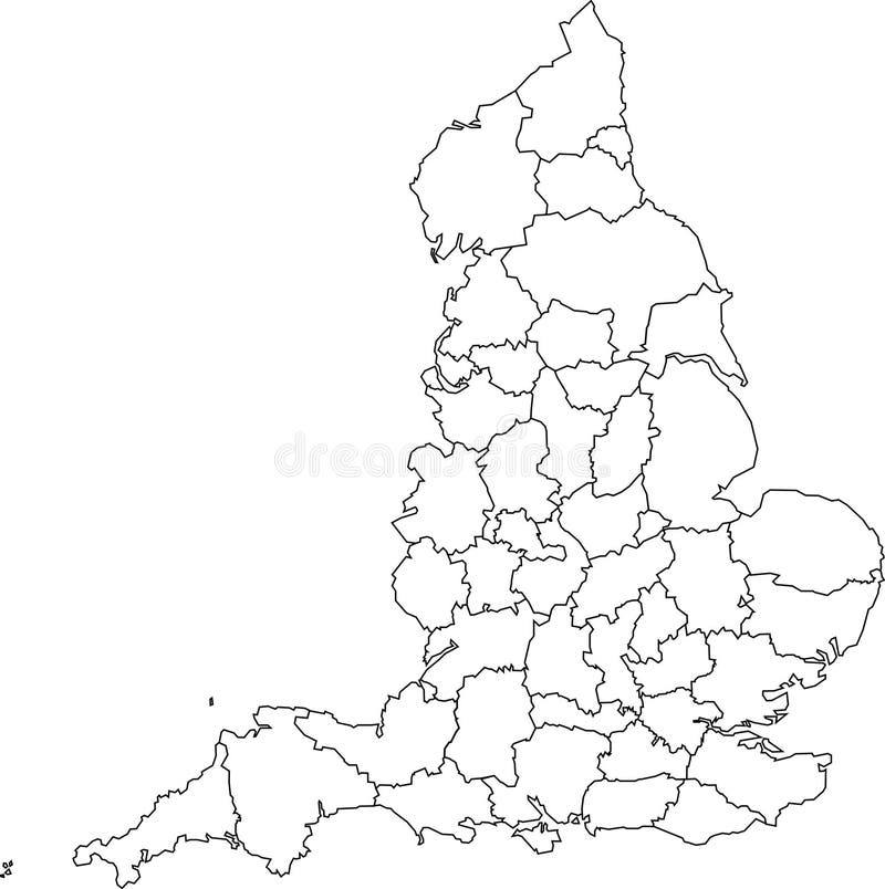
Free with trial A blank map of England featuring geographical counties (also known as ceremonial counties or Lieutenancy Areas). Midlands vectors Blank map of England - counties. A blank map of England featuring geographical counties (also known as ceremonial counties or Lieutenancy Areas. A blank map of England featuring geographical counties (also known as ceremonial counties or Lieutenancy Areas)
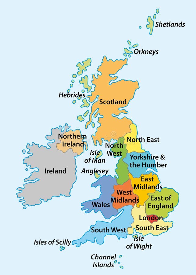
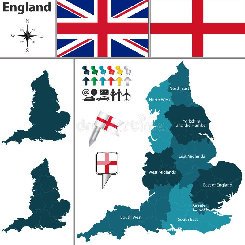
Free with trial Vector map with the English regions. Midlands vectors Regions of England. Vector map with the English regions. Vector map with the English regions.
Free with trial Vector map of British Isles administrative divisions colored by countries and regions. Districts and counties maps and flags of United Kingdom,Northern Ireland, Wales, Scotland and Republic of Ireland. Midlands vectors Vector map of British Isles administrative divisions colored by countries and regions. Districts and counties maps and flags of United Kingdom,Northern Ireland
Free with trial England counties vector map. On white background. Midlands vectors England counties vector map. On white background
Free with trial Graphical Ram, Sheep. Graphic illustration of Ram or Sheep in a frame with ribbon. Midlands vectors Graphical Ram, Sheep. Graphic illustration of Ram or Sheep in a frame with ribbon
Free with trial Ireland and counties. European country Ireland and counties in details. Midlands vectors Ireland and counties. European country Ireland and counties in details
Free with trial Ireland and counties. European country Ireland and counties in details. Midlands vectors Ireland and counties. European country Ireland and counties in details
Free with trial Vector map of United Kingdom colored by countries and regions. Districts and counties map of England, Wales, Scotland and Northern Ireland. Midlands vectors Vector map of United Kingdom administrative divisions colored by countries and regions. Districts and counties map of England, Wal. Vector map of United Kingdom. Vector map of United Kingdom colored by countries and regions. Districts and counties map of England, Wales, Scotland and Northern Ireland
Free with trial Outline map of the nine regions of England. Midlands vectors Outline map of the nine regions of England. Outline vektor map of the nine regions of England
Free with trial Vector map of British Isles. With administrative divisions. Midlands vectors Vector map of British Isles. With administrative divisions
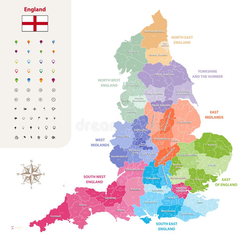
Free with trial England ceremonial counties vector map colored by regions. Isolated on light background. Midlands vectors England ceremonial counties vector map colored by regions. Isolated on light background
Free with trial Colored political map of Europe with countries` regions. Vector illustration. Midlands vectors Colored political map of Europe with countries` regions. Vector illustration. Vector colored political map of Europe with countries` regions. Vector illustration
Free with trial Map of British Isles with administrative divisions. Midlands vectors Map of British Isles with administrative divisions. Vector map of British Isles with administrative divisions
Free with trial Vector map of United Kingdom colored by countries, counties and regions. Midlands vectors Vector map of United Kingdom colored by countries, counties and regions
Free with trial Map of East Midlands England. Map of the subdivisions of England with the East Midlands that is one of nine official regions. Midlands vectors Map of East Midlands England. Map of the subdivisions of England with the East Midlands that is one of nine official regions
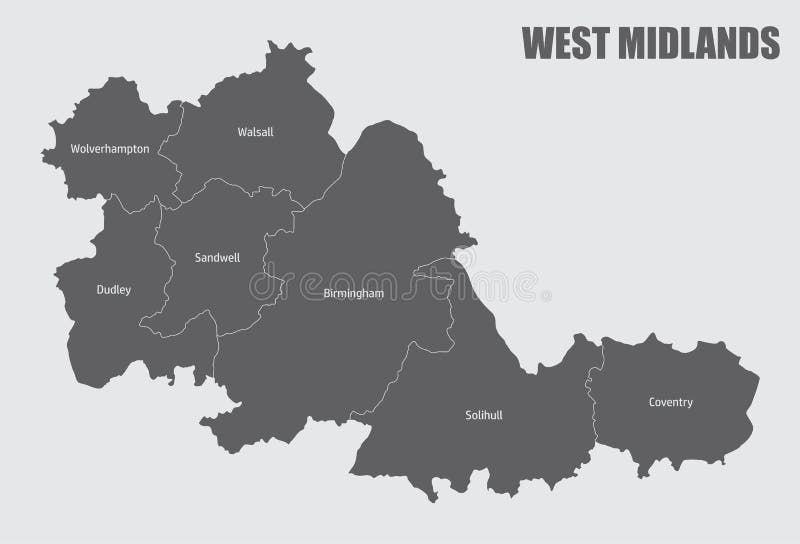
Free with trial West Midlands county administrative map. West Midlands county divided in districts with labels, England. Midlands vectors West Midlands county administrative map. West Midlands county divided in districts with labels, England
Free with trial A West Midlands, UK Map Postmark. A Silhouette Postal Passport. Stamp Round Vector Icon. Vintage Postage Designs. Midlands vectors West Midlands, UK Map Postmark. A Silhouette Postal Passport. Stamp Round Vector Icon. Vintage Postage Designs. A West Midlands, UK Map Postmark. A Silhouette. A West Midlands, UK Map Postmark. A Silhouette Postal Passport. Stamp Round Vector Icon. Vintage Postage Designs.
Free with trial A East Midlands, UK Map Postmark. A Silhouette Postal Passport. Stamp Round Vector Icon. Vintage Postage Designs. Midlands vectors East Midlands, UK Map Postmark. A Silhouette Postal Passport. Stamp Round Vector Icon. Vintage Postage Designs. A East Midlands, UK Map Postmark. A Silhouette. A East Midlands, UK Map Postmark. A Silhouette Postal Passport. Stamp Round Vector Icon. Vintage Postage Designs.
Free with trial A East Midlands, UK Map Postmark. Silhouette Postal Passport. Stamp Round Vector Icon. Vintage Postage Design. Midlands vectors East Midlands, UK Map Postmark. Silhouette Postal Passport. Stamp Round Vector Icon. Vintage Postage Design. A East Midlands, UK Map Postmark. Silhouette Postal. A East Midlands, UK Map Postmark. Silhouette Postal Passport. Stamp Round Vector Icon. Vintage Postage Design.
Free with trial East Midlands, United Kingdom. Vector map of East Midlands, United Kingdom with regions and flags. Midlands vectors East Midlands, United Kingdom. Vector map of East Midlands, United Kingdom with regions and flags
Free with trial East Midlands, United Kingdom. Vector map of East Midlands, United Kingdom with neighboring regions. Midlands vectors East Midlands, United Kingdom. Vector map of East Midlands, United Kingdom with neighboring regions
Free with trial West Midlands, United Kingdom. Vector map of West Midlands, United Kingdom with regions and flags. Midlands vectors West Midlands, United Kingdom. Vector map of West Midlands, United Kingdom with regions and flags
Free with trial East Midlands, England, UK. Flags of East Midlands region in England, United Kingdom in glossy badges. Vector image. Midlands vectors East Midlands, England, UK. Flags of East Midlands region in England, United Kingdom in glossy badges. Vector image
Free with trial West Midlands, UK. Flags of West Midlands region in England, United Kingdom in glossy badges. Vector image. Midlands vectors West Midlands, UK. Flags of West Midlands region in England, United Kingdom in glossy badges. Vector image
Free with trial Coat of arms of Birmingham is a major city in the West Midlands, England and is the second-largest city and metropolitan area in England and the United Kingdom. Vector illustration. Midlands vectors Coat of arms of Birmingham in West Midlands of England. Coat of arms of Birmingham is a major city in the West Midlands, England and is the second-largest city. Coat of arms of Birmingham is a major city in the West Midlands, England and is the second-largest city and metropolitan area in England and the United Kingdom. Vector illustration
Free with trial Flag of Birmingham is a major city in the West Midlands, England and is the second-largest city and metropolitan area in England and the United Kingdom. Vector illustration. Midlands vectors Flag of Birmingham in West Midlands of England. Flag of Birmingham is a major city in the West Midlands, England and is the second-largest city and metropolitan. Flag of Birmingham is a major city in the West Midlands, England and is the second-largest city and metropolitan area in England and the United Kingdom. Vector illustration
Free with trial Map of West Midlands England. Map of the subdivisions of England with the West Midlands that is one of nine official regions. Midlands vectors Map of West Midlands England. Map of the subdivisions of England with the West Midlands that is one of nine official regions
Free with trial UK Birmingham 3D vector logo. Set. West Midlands, England, United Kingdom isometric map pin, geolocation pointer, modern skyline icon, concept, isolated graphic. Midlands vectors UK Birmingham 3D vector logo. Set. West Midlands, England, United Kingdom isometric map pin, geolocation pointer, modern skyline icon, concept, isolated graphic
Free with trial Flag of Northamptonshire in England. Flag of Northamptonshire is a county in the East Midlands of England. Vector illustration. Midlands vectors Flag of Northamptonshire in England. Flag of Northamptonshire is a county in the East Midlands of England. Vector illustration
Free with trial Flag of Lincoln is a cathedral city and the county town of Lincolnshire in the East Midlands of England. Vector illustration. Midlands vectors Flag of Lincoln in Lincolnshire of England. Flag of Lincoln is a cathedral city and the county town of Lincolnshire in the East Midlands of England. Vector. Flag of Lincoln is a cathedral city and the county town of Lincolnshire in the East Midlands of England. Vector illustration
Free with trial Map of the city of Coventry, West Midlands, England, UK. Midlands vectors Map of the city of Coventry, West Midlands, England, UK. Vector map of the city of Coventry, West Midlands, England, UK
Free with trial Map of the city of Wolverhampton, West Midlands, England, UK. Midlands vectors Map of the city of Wolverhampton, West Midlands, England, UK. Vector map of the city of Wolverhampton, West Midlands, England, UK
Free with trial Leicester, England. Leicester, city and unitary authority area in the East Midlands of England. Midlands vectors Leicester, England. Leicester, city and unitary authority area in the East Midlands of England
Free with trial Sheep in graphic style. Illustration drawn by hand on paper and converted to vector. Midlands vectors Sheep in graphic style. Illustration drawn by hand on paper and converted to vector
Free with trial City map Birmingham, travel vector poster design. For design travel illustration. Midlands vectors City map Birmingham, travel vector poster design. For design travel illustration
Free with trial This map of the United Kingdom includes all four countries are colour coded to their national colours. Each of the counties is on a separate layer as well as the raised land. All elements are fully editable. Midlands vectors Map of United Kingdom including Countries and Coun. This map of the United Kingdom includes all four countries are colour coded to their national colours. Each. This map of the United Kingdom includes all four countries are colour coded to their national colours. Each of the counties is on a separate layer as well as the raised land. All elements are fully editable.
Free with trial Graphical Ram, Sheep. In vintage style. Midlands vectors Graphical Ram, Sheep. In vintage style
Free with trial Vector illustration of ram in the graphic style. Midlands vectors Graphical ram. Vector illustration of ram in the graphic style. Vector illustration of ram in the graphic style.
Free with trial Label sheep. Vector illustration. Label with sheep. Illustration animal is made as an engraving. Attention to detail. Midlands vectors Label sheep. Vector illustration. Label with sheep. Illustration animal is made as an engraving. Attention to detail
Free with trial United Kingdom administrative districts vector detailed map colored by regions and counties. Midlands vectors United Kingdom administrative districts vector high detailed map colored by regions and counties. United Kingdom administrative districts vector detailed map. United Kingdom administrative districts vector detailed map colored by regions and counties
Free with trial Modern Birmingham City Skyline Design. England. Midlands vectors Modern Birmingham City Skyline Design. England. Modern Birmingham City Skyline Design
Free with trial England cities isolated skylines. Vector illustration. Vector set illustrations. Midlands vectors England cities isolated skylines. Vector illustration. England cities isolated skylines. Vector set illustrations
Free with trial Nottingham city label. Nottingham Town Hall famous building. Nottingham Council House. Travel England sign. Sketch icon. Midlands vectors Nottingham city label. Nottingham Town Hall famous building. Travel England sign. Sketch icon. Nottingham city label. Nottingham Town Hall famous building. Nottingham city label. Nottingham Town Hall famous building. Nottingham Council House. Travel England sign. Sketch icon.
Free with trial United Kingdom administrative districts detailed vector map colored by regions with editable and labelled layers. Midlands vectors United Kingdom administrative districts high detailed vector map colored by regions with editable and labelled layers. United Kingdom administrative districts. United Kingdom administrative districts detailed vector map colored by regions with editable and labelled layers
Free with trial Color detailed road map, urban street plan city London and Birmingham with colorful neighborhoods and districts, Travel vector poster for design map of roads, rivers and paths. Midlands vectors Color detailed road map, urban street plan city London and Birmingham with colorful neighborhoods and districts, Travel vector. Poster for design map of roads
Free with trial Stamp set. Grunge rubber stamp set with text Birmingham, England inside. Midlands vectors Stamp set. Grunge rubber stamp set with text Birmingham, England inside
Free with trial United Kingdom isometric map colored by local government subdivisions and countries, with neighbouring countries on background. Vector illustration. Midlands vectors United Kingdom isometric map colored by local government subdivisions and countries, with neighbouring countries on background. Vector illustration
Free with trial Highly detailed political Zimbabwe Map. Midlands vectors Highly detailed political Zimbabwe Map.
Free with trial Birmingham Skyline City Landscape Vector Graphic Silhouette. Birmingham Cityscape Skyline Town Landscape, Monuments, Buildings in United Kingdom, UK. Midlands vectors Birmingham Skyline City Landscape Vector Graphic Silhouette. Birmingham Cityscape Skyline Town Landscape, Monuments, Buildings in United Kingdom, UK
Free with trial A North West, UK Map Postmark. Silhouette Postal Passport. Stamp Round Vector Icon. Vintage Postage Design. Midlands vectors North West, UK Map Postmark. Silhouette Postal Passport. Stamp Round Vector Icon. Vintage Postage Design. A North West, UK Map Postmark. Silhouette Postal. A North West, UK Map Postmark. Silhouette Postal Passport. Stamp Round Vector Icon. Vintage Postage Design.
Free with trial East Northamptonshire district map - England UK. Illustration. Midlands vectors East Northamptonshire district map - England UK. Illustration
Free with trial A North East, UK Map Postmark. Silhouette Postal Passport. Stamp Round Vector Icon. Vintage Postage Design. Midlands vectors North East, UK Map Postmark. Silhouette Postal Passport. Stamp Round Vector Icon. Vintage Postage Design. A North East, UK Map Postmark. Silhouette Postal. A North East, UK Map Postmark. Silhouette Postal Passport. Stamp Round Vector Icon. Vintage Postage Design.
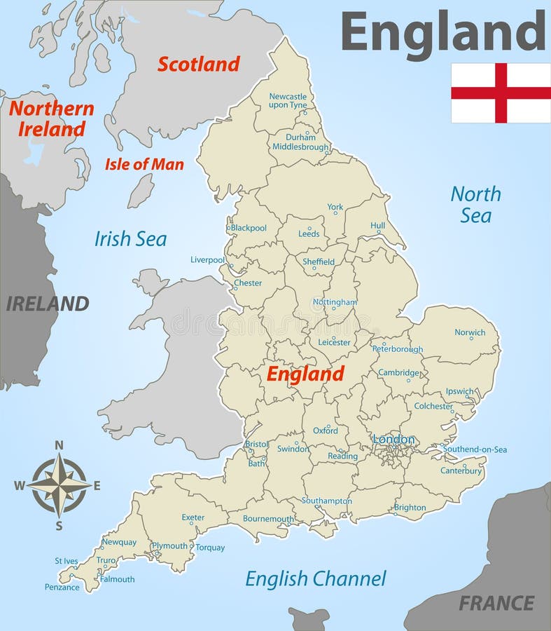
Free with trial Map of England with Districts. Vector map of England with named districts and icons. Midlands vectors Map of England with Districts. Vector map of England with named districts and icons
Free with trial England largest cities skylines. Vector illustration. Set. Midlands vectors England largest cities skylines. Vector illustration. Set
Free with trial High-detailed administrative units map of United Kingdom. Administrative units map of United Kingdom. All elements entitled and easy-to-use. Midlands vectors High-detailed administrative units map of United Kingdom. Administrative units map of United Kingdom. All elements entitled and easy-to-use
Free with trial Flags of England, UK. Vector flags of England, United Kingdom on white background. Midlands vectors Flags of England, UK. Vector flags of England, United Kingdom on white background
Free with trial Vector set of England largest cities skylines. Map and flag of England. Midlands vectors Vector set of England largest cities skylines. Map and flag of England. Vector set of England largest cities skylines
Free with trial Map of England with regions. Vector map of England with regions and flags. Midlands vectors Map of England with regions. Vector map of England with regions and flags
Free with trial Vector map of England ceremonial counties. Flag of England. Navigation and location icons. Map of England ceremonial counties. Navigation and. Midlands vectors Vector map of England ceremonial counties. Flag of England. Navigation and location icons. Map of England ceremonial counties. Flag of England. Navigation and
Free with trial England largest cities skylines icons vector set. Map and flag of England. Midlands vectors England largest cities skylines icons vector set. Map and flag of England. England largest cities skylines icons vector set
Free with trial Map of United Kingdom with Counties. Vector map of United Kingdom with named counties and cities. Midlands vectors Map of United Kingdom with Counties. Vector map of United Kingdom with named counties and cities
Free with trial Map of South Carolina with Regions. Vector map of South Carolina with named regions and travel icons. Midlands vectors Map of South Carolina with Regions. Vector map of South Carolina with named regions and travel icons
Free with trial United Kingdom largest cities skylines vector collection. Flags of United Kingdom, England, Scotland, Wales and Northern Ireland. Midlands vectors United Kingdom largest cities skylines vector set. Flags of United Kingdom, England, Scotland, Wales and Northern Ireland. United Kingdom largest cities skylines. United Kingdom largest cities skylines vector collection. Flags of United Kingdom, England, Scotland, Wales and Northern Ireland
Free with trial Vector highly detailed political map of The United Kingdom of Great Britain and Northern Ireland with regions and their capitals. All elements are separated in editable layers clearly labeled. EPS 10. Midlands vectors Political map of United Kingdom with regions and their capitals. Vector highly detailed political map of The United Kingdom of Great Britain and Northern Ireland. Vector highly detailed political map of The United Kingdom of Great Britain and Northern Ireland with regions and their capitals. All elements are separated in editable layers clearly labeled. EPS 10
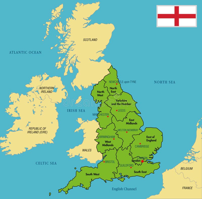
Free with trial Vector highly detailed political map of England with regions and their capitals. All elements are separated in editable layers clearly labeled. EPS 10. Midlands vectors Political map of England with regions and their capitals. Vector highly detailed political map of England with regions and their capitals. All elements are. Vector highly detailed political map of England with regions and their capitals. All elements are separated in editable layers clearly labeled. EPS 10
Free with trial Vector highly detailed political map of England with regions and their capitals. All elements are separated in editable layers clearly labeled. EPS 10. Midlands vectors Political map of England with regions and their capitals. Vector highly detailed political map of England with regions and their capitals. All elements are. Vector highly detailed political map of England with regions and their capitals. All elements are separated in editable layers clearly labeled. EPS 10
Free with trial Map of Zimbabwe with Named Provinces. Vector map of Zimbabwe with named provinces and travel icons. Midlands vectors Map of Zimbabwe with Named Provinces. Vector map of Zimbabwe with named provinces and travel icons
Free with trial Color detailed map of the regions and countries of the British Isles. For your design. Midlands vectors Color detailed map of the regions and countries of the British Isles. For your design
Free with trial Map of Northern Ireland Districts. White Labeled Map of Districts of Northern Ireland, United Kingdom. Midlands vectors Map of Northern Ireland Districts. White Labeled Map of Districts of Northern Ireland, United Kingdom
Free with trial Detailed, vector, blue map of the United Kingdom with administrative divisions into countries and counties, for your design. Midlands vectors Detailed, vector, blue map of the United Kingdom with administrative divisions into countries and counties. For your design
Free with trial County Flag of Devon, England. Flat Vector Flag of the English Ceremonial County of Devon. Midlands vectors County Flag of Devon, England. Flat Vector Flag of the English Ceremonial County of Devon
Free with trial Map of Scottish Council Areas. White Labeled Flat Map of Council Areas of Scotland. Midlands vectors Map of Scottish Council Areas. White Labeled Flat Map of Council Areas of Scotland
Free with trial Map of Scottish Council Areas. Labeled Color Flat Map of Council Areas of Scotland. Midlands vectors Map of Scottish Council Areas. Labeled Color Flat Map of Council Areas of Scotland
Free with trial County Flag of Kent, England. Flat Vector Flag of the English Ceremonial County of Kent. Midlands vectors County Flag of Kent, England. Flat Vector Flag of the English Ceremonial County of Kent
Free with trial Map of Welsh Principal Areas. Labeled Color Map of Principal Areas of Wales. Midlands vectors Map of Welsh Principal Areas. Labeled Color Map of Principal Areas of Wales
Free with trial Flag of Nottinghamshire in England. Flag of Nottinghamshire is a county in the East Midlands region of England. Vector illustration. Midlands vectors Flag of Nottinghamshire in England. Flag of Nottinghamshire is a county in the East Midlands region of England. Vector illustration
Free with trial Flag of Staffordshire in England. Flag of Staffordshire is a landlocked county in the West Midlands of England. Vector illustration. Midlands vectors Flag of Staffordshire in England. Flag of Staffordshire is a landlocked county in the West Midlands of England. Vector illustration
Free with trial Leicester Downtown Vector Map. Monochrome Artprint, Outline Version for Infographic Background, Black Streets and Waterways. Midlands vectors Leicester Downtown Vector Map. Monochrome Artprint, Outline Version for Infographic Background, Black Streets and Waterways
Free with trial Relief Map of Wales. Gray 3D Topography Map of European Country of Wales. Midlands vectors Relief Map of Wales. Gray 3D Topography Map of European Country of Wales
 Sign in