Free with trial Abstract topographic map. vector. Abstract topographic map in brown colors. Map vectors Abstract topographic map. vector. Abstract topographic map in brown colors. vector
Free with trial Funny cartoon world map with traditional animals of all the continents and oceans. Vector illustration for preschool education. And kids design. Map vectors Funny cartoon world map with traditional animals of all the continents and oceans. Vector illustration for preschool education. And kids design
Free with trial Abstract computer graphic World map of blue round dots. Vector illustration. Map vectors World map of blue round dots. Abstract computer graphic World map of blue round dots. Vector illustration. Abstract computer graphic World map of blue round dots. Vector illustration.
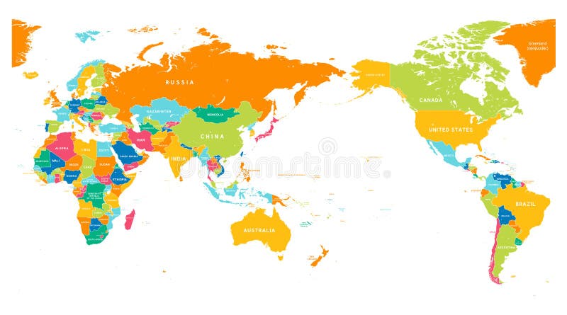
Free with trial Asia Center World Map Color. World Map Color Detailed - Asia in Center. Map vectors Asia Center World Map Color. World Map Color Detailed - Asia in Center
Free with trial Detailed Political World map. Vector illustration. Map vectors Detailed Political World map. Vector illustration
Free with trial Amsterdam colored vector map. View from above. Map vectors Amsterdam colored vector map. View from above
Free with trial Vector poster map city Paris. Detailed city plan, vector map of Paris for poster printing. Map vectors Vector poster map city Paris. Detailed city plan, vector map of Paris for poster printing
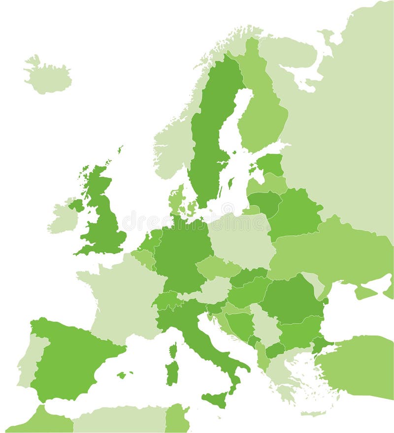
Free with trial Map of Europe in green. Color coded map of the Europe. Map vectors Map of Europe in green. Color coded map of the Europe
Free with trial High detailed sky map of Northern hemisphere with names of stars. And constellations colored on white. Map vectors High detailed sky map of Northern hemisphere with names of stars. And constellations colored on white
Free with trial World map illustrated template. World map vector illustrated template. Map vectors World map illustrated template. World map vector illustrated template
Free with trial Great Detail Illustration of the world map in vintage style with all countries boundaries and names on a old parchment background. Map vectors Vintage Illustrated World Map. Great Detail Illustration of the world map in vintage style with all countries boundaries and names on a old parchment background. Great Detail Illustration of the world map in vintage style with all countries boundaries and names on a old parchment background.
Free with trial Cartoon Grunge Earth Map Icon. Illustration of a symbolized earth and treasure map icon with countries, river, and legends and grunge texture. Map vectors Cartoon Grunge Earth Map Icon. Illustration of a symbolized earth and treasure map icon with countries, river, and legends and grunge texture
Free with trial Old grungy world map on paper. An old world map drawn onto parchment paper. Map vectors Old grungy world map on paper. An old world map drawn onto parchment paper
Free with trial Michigan state road map with Interstates, U. S. Highways and state roads. All elements on separate layers for easy editing. Map vectors Michigan State Interstate Map. Michigan state road map with Interstates, U.S. Highways and state roads. All elements on separate layers for easy editing. Michigan state road map with Interstates, U.S. Highways and state roads. All elements on separate layers for easy editing.
Free with trial Colorful continents world map illustration. Abstract background. [America, Europe, asia, Africa, Australia]. Map vectors World map - colorful continents. Colorful continents world map illustration. Abstract background. [America, Europe, asia, Africa, Australia. Colorful continents world map illustration. Abstract background. [America, Europe, asia, Africa, Australia]
Free with trial Simple blank vector world map. Modern style simple blank vector world map. Map vectors Simple blank vector world map. Modern style simple blank vector world map
Free with trial Vector poster map city Moscow. Detailed city map, vector map of Moscow for printing posters. Map vectors Vector poster map city Moscow. Detailed city map, vector map of Moscow for printing posters
Free with trial Square regular puzzle map from , accurate, easily editable (grid 200x150 squares). For business card, postcard, call card. Map vectors World map: square - puzzle. Square regular puzzle map from , accurate, easily editable (grid 200x150 squares). For business card, postcard, call card. Square regular puzzle map from , accurate, easily editable (grid 200x150 squares). For business card, postcard, call card...
Free with trial Map of Europe in orange. Color coded map of the Europe. Map vectors Map of Europe in orange. Color coded map of the Europe
Free with trial Map of the world vector. Detailed map of the world vector. Map vectors Map of the world vector. Detailed map of the world vector
Free with trial Treasure Island And Pirate Map. Illustration of a cartoon treasure island and its map, with skull and cross bones, pirate chest and compass. Map vectors Treasure Island And Pirate Map. Illustration of a cartoon treasure island and its map, with skull and cross bones, pirate chest and compass
Free with trial Tennessee state road map with Interstates, U. S. Highways and state roads. All elements on separate layers for easy editing. Map vectors Tennessee State Interstate Map. Tennessee state road map with Interstates, U.S. Highways and state roads. All elements on separate layers for easy editing. Tennessee state road map with Interstates, U.S. Highways and state roads. All elements on separate layers for easy editing.
Free with trial Vector Globe featuring a Vintage illustrated map of the World. Map vectors Vector Globe Vintage World Map. Vector Globe featuring a Vintage illustrated map of the World. Vector Globe featuring a Vintage illustrated map of the World.
Free with trial Vector poster map city Chicago. Detailed city map, vector map Chicago for poster printing. Map vectors Vector poster map city Chicago. Detailed city map, vector map Chicago for poster printing
Free with trial Large detailed vintage color political World Map with lakes and rivers. Highly detailed vector illustration of World Map. Map vectors Large detailed vintage color political World Map with lakes and. Rivers. Highly detailed vector illustration of World Map
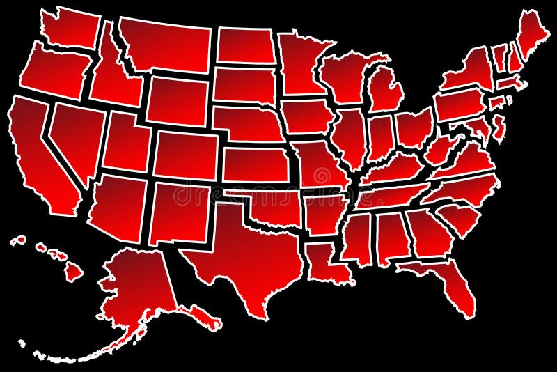
Free with trial US Map 50 United States borders. Map of America USA fifty states separated white border isolated on black. Map vectors US Map 50 United States borders. Map of America USA fifty states separated white border isolated on black
Free with trial Isometric city map creation kit. Isometric set of the simplified buildings, road elements and plants for map creation. Map vectors Isometric city map creation kit. Isometric set of the simplified buildings, road elements and plants for map creation
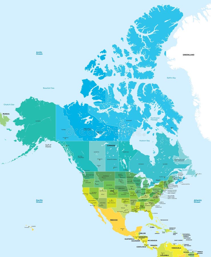
Free with trial Color map of the USA and Canada. Administrative color map of the USA and Canada. Map vectors Color map of the USA and Canada. Administrative color map of the USA and Canada
Free with trial Africa map on ethnic background. Africa map on ethnic texture background. Map vectors Africa map on ethnic background. Africa map on ethnic texture background
Free with trial Cartoon world map with a lot of funny animals, sea creatures, various landscapes and peoples of various nationalities. Great for kids design, educational game, magnet or poster design. Map vectors Global map with cartoon animals. Cartoon world map with a lot of funny animals, sea creatures, various landscapes and peoples of various nationalities. Great for. Cartoon world map with a lot of funny animals, sea creatures, various landscapes and peoples of various nationalities. Great for kids design, educational game, magnet or poster design.
Free with trial South Africa map. Color South africa map isolated over white. Map vectors South Africa map. Color South africa map isolated over white
Free with trial Vector poster map city Barcelona. Detailed city map, vector map Barcelona for printing posters. Map vectors Vector poster map city Barcelona. Detailed city map, vector map Barcelona for printing posters
Free with trial Vector green globe and world map for design elements. Map vectors Vector Green Globe and World Map. For design elements. Vector green globe and world map for design elements
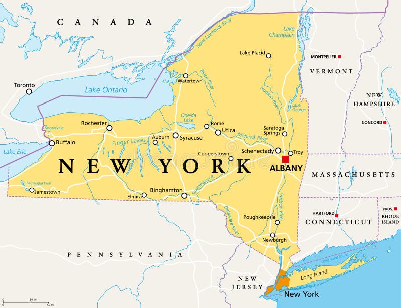
Free with trial New York State NYS, political map, with capital Albany, borders, important cities, rivers and lakes. State in the Northeastern United States of America. English labeling. Illustration. Vector. Map vectors New York State NYS, political map. With capital Albany, borders, important cities, rivers and lakes. State in the Northeastern United States of America. New York State NYS, political map, with capital Albany, borders, important cities, rivers and lakes. State in the Northeastern United States of America. English labeling. Illustration. Vector.
Free with trial Vector poster map city Amsterdam. Detailed city map, vector map Amsterdam for poster printing. Map vectors Vector poster map city Amsterdam. Detailed city map, vector map Amsterdam for poster printing
Free with trial Costa Rica map designed in illustration with 7 provinces colored in green colors and with the main cities. Neighbouring countries are in an additional format (. AI) in the latent layer. Map vectors Vector Costa Rica map. Costa Rica map designed in illustration with 7 provinces colored in green colors and with the main cities. Neighbouring countries are in. Costa Rica map designed in illustration with 7 provinces colored in green colors and with the main cities. Neighbouring countries are in an additional format (.AI) in the latent layer.
Free with trial World map with countries in cool colors. Vector illustration. Map vectors Extruded World map with countries. World map with countries in cool colors. Vector illustration. World map with countries in cool colors. Vector illustration.
Free with trial Road map timeline infographic template with 5 colorful pin pointers on the way. Vector illustration. Map vectors Road map timeline infographic template with 5 colorful pin pointers on the way. Vector illustration.
Free with trial Map of the World and Travel Icons. World Travel Map with Sightseeings. Vector Illustration. Map vectors Map of the World and Travel Icons. World Travel Map with Sightseeings. Vector Illustration
Free with trial Vector abstract topographical map. With colorful lines. Map vectors Vector abstract topographical map. With colorful lines
Free with trial Color map of China. Administrative vector сolor map of China. Map vectors Color map of China. Administrative vector сolor map of China
Free with trial Colorful world map. Illustration. Abstract background. Map vectors Colorful world map. Illustration. Abstract background
Free with trial Cartoon australia map with animals. Cartoon australia continent map with landscapes and cute animals. Vector illustration. Map vectors Cartoon australia map with animals. Cartoon australia continent map with landscapes and cute animals.Vector illustration
Free with trial Set with symbols and map of Sweden. Vector set with design elements of symbols of Sweden and map. Map vectors Set with symbols and map of Sweden. Vector set with design elements of symbols of Sweden and map
Free with trial Map location icon set, vector eps10. Map vectors Map location icon set, vector eps10.
Free with trial Vector red map of Canada with state boundaries, isolated on white background. Map vectors Canada Map (separable by province). Vector red map of Canada with state boundaries, isolated on white background. Vector red map of Canada with state boundaries, isolated on white background.
Free with trial World travel or communications map. A world map network background with flight paths or trade routes or communication between countries and cities. Map vectors World travel or communications map. A world map network background with flight paths or trade routes or communication between countries and cities
Free with trial Watercolor map Australia pink blue. Watercolor map of Australia in vector format in pink and blue colors on a background of crumpled paper. Map vectors Watercolor map Australia pink blue. Watercolor map of Australia in vector format in pink and blue colors on a background of crumpled paper
Free with trial Globe sketch. Hand drawn earth planet with continents and oceans. Doodle world map vector illustration. Planet and world sketch map with ocean and land. Map vectors Globe sketch. Hand drawn earth planet with continents and oceans. Doodle world map vector illustration. Planet and world sketch map with ocean and land
Free with trial Dot world map with countries, vector. Political dot world map with countries, vector illustration map source NASA Public Domain. Map vectors Dot world map with countries, vector. Political dot world map with countries, vector illustration map source NASA Public Domain
Free with trial Black and white map pattern with abstract topographical contour line. Topography map art drawing. Vector illustration. Map vectors Black and white map pattern with abstract topographical contour line. Topography map art drawing. Vector illustration
Free with trial Blue blank world map. Modern style blue blank world map. Map vectors Blue blank world map. Modern style blue blank world map
Free with trial Hong Kong travel map. Attractive Hong Kong travel map with attractions icons in flat design. Map vectors Hong Kong travel map. Attractive Hong Kong travel map with attractions icons in flat design
Free with trial Map of the World. Vector illustration. Names of countries and cities, continents, state borders are located on separate layers. Map vectors Map of the World. Vector illustration. Names of countries and cities, continents, state borders are located on separate layers
Free with trial World travel with map and air planes. Illustration of world travel with map and air planes. Map vectors World travel with map and air planes. Illustration of world travel with map and air planes
Free with trial Central America and the Caribbean map. Highly detailed vector, map of the caribbean area. Map vectors Central America and the Caribbean map. Highly detailed vector, map of the caribbean area
Free with trial Crowd of people composing a world map, aerial view, global community, international communications and human rights concept. Map vectors Crowd of people composing a world map. Aerial view, global community, international communications and human rights concept
Free with trial Hand drawing World Map with countries, Vector Illustration. Map vectors Hand drawing World Map with countries. Vector Illustration
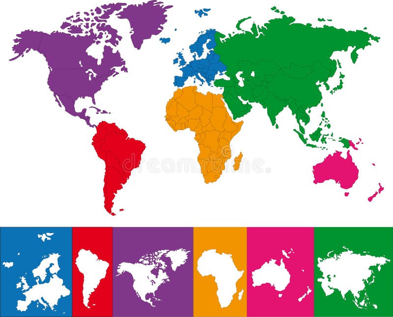
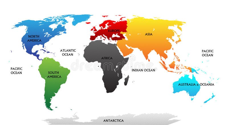
Free with trial World map with highlighted continents in different colors. All labels are in the separate layer. Map vectors World map with highlighted continents. In different colors. All labels are in the separate layer
Free with trial Africa map with ethnic motifs pattern. Map vectors Africa map with ethnic motifs pattern. Africa map with colored ethnic motifs pattern
Free with trial USA - United States of America - colored vector map with the division into states. Map vectors USA - United States of America - colored vector map with the division into states.
Free with trial Detailed vector poster city map Berlin, vector illustration for design. Map vectors Detailed vector poster city map Berlin. Vector illustration for design
Free with trial US Map. A simple vector map of the US. Map vectors US Map. A simple vector map of the US
Free with trial World Map - Miller Cylindrical Projection. A world map with country borders in Miller's Cylindrical projection. Map vectors World Map - Miller Cylindrical Projection. A world map with country borders in Miller's Cylindrical projection
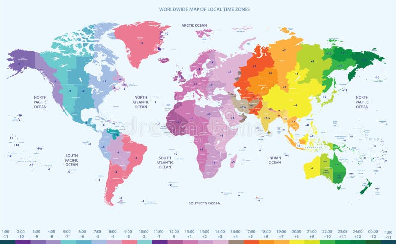
Free with trial Color worldwide map of local time zones. Vector color worldwide map of local time zones. Map vectors Color worldwide map of local time zones. Vector color worldwide map of local time zones
Free with trial Vector Infographic with a tortuous road separating blank space from a Perspective city map with red markers and rounded icons. Map vectors Vector Perspective city map infographic. Vector Infographic with a tortuous road separating blank space from a Perspective city map with red markers and rounded. Vector Infographic with a tortuous road separating blank space from a Perspective city map with red markers and rounded icons.
Free with trial Political map of the Caribbean - Large and Lesser Antilles - with their capitals, national borders, rivers and lakes. Vector illustration with english labeling and scale. Map vectors Large And Lesser Antilles Political Map. Political map of the Caribbean - Large and Lesser Antilles - with their capitals, national borders, rivers and lakes. Political map of the Caribbean - Large and Lesser Antilles - with their capitals, national borders, rivers and lakes. Vector illustration with english labeling and scale.
Free with trial Map of provinces and territories of Canada. Detailed map of administrative divisions of Canada. Map vectors Map of provinces and territories of Canada. Detailed map of administrative divisions of Canada
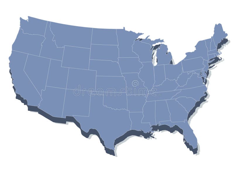
Free with trial Vector map of the united states of america. In 3d view. Map vectors Vector map of the united states of america. In 3d view
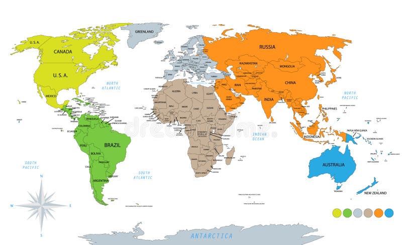
Free with trial Political world map on white background, with every state labeled and selectable. Colored by continents. Versatile file, turn on an off visibility and color of each country in one click. Map vectors Political world map on white background. With every state labeled and selectable. Colored by continents. Versatile file, turn on an off visibility and color of. Political world map on white background, with every state labeled and selectable. Colored by continents. Versatile file, turn on an off visibility and color of each country in one click.
Free with trial Business background with world map, red and silver, vector. Map vectors Business background with world map. Red and silver, vector
Free with trial Map of European Countries. In blue and grey tones. Map vectors Map of European Countries. In blue and grey tones
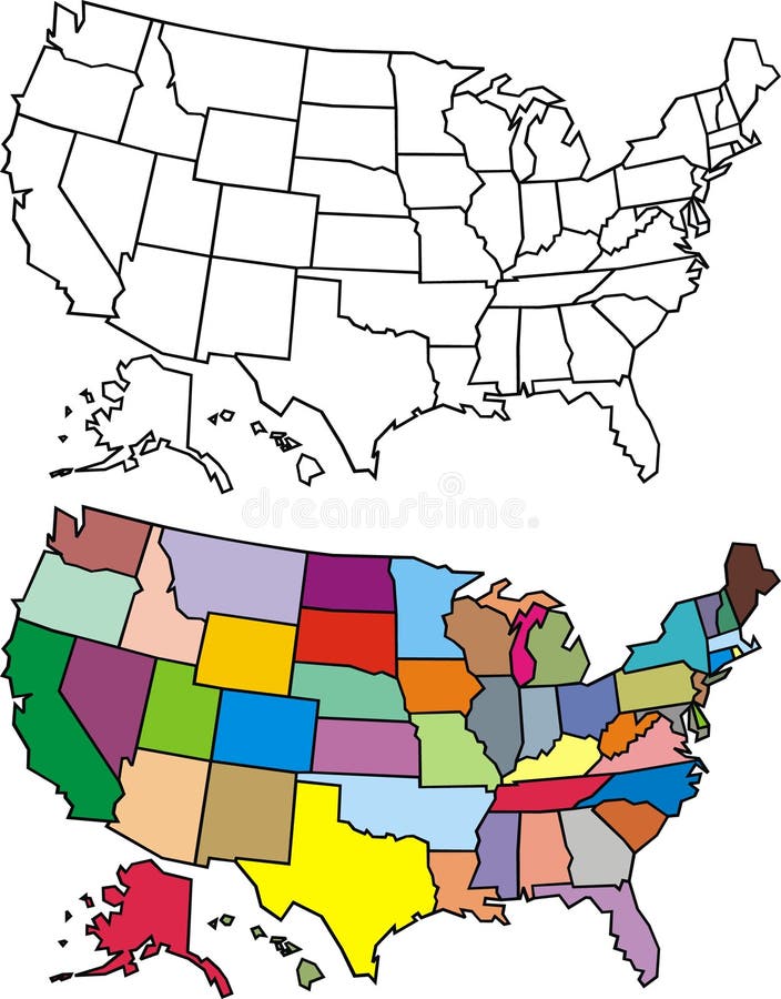
Free with trial USA map. In many colors with black and white version. Map vectors USA map. In many colors with black and white version
Free with trial Map USA. A simple map of the United States. Map vectors Map USA. A simple map of the United States
Free with trial USA map with all the states in easily editable separate layers. EPS8 file added. Map vectors USA map. With all the states in easily editable separate layers.EPS8 file added
Free with trial USA map - United States of America with all 50 states - blue color - isolated on white - Vector. Map vectors USA map. United States of America with all 50 states - blue color - isolated on white - Vector
Free with trial USA map showing all states with two-letter state abbreviations. Clipped to US border. Map vectors USA Map. Showing all states with two-letter state abbreviations. Clipped to US border
Free with trial Outline map of United States and the Hawaii and alaska. Hand drawn vector political map. Map vectors Outline map of United States. Outline map of United States and the Hawaii and alaska. Hand drawn vector political map. Outline map of United States and the Hawaii and alaska. Hand drawn vector political map.
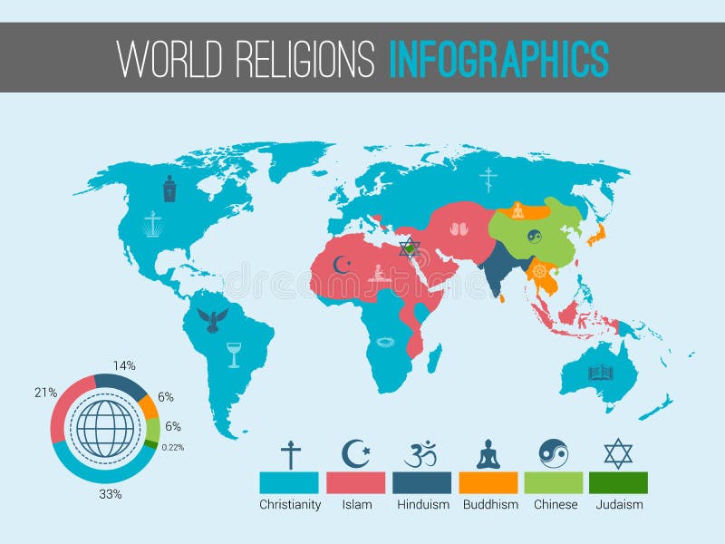
Free with trial World religions infographic with pie chart and map vector illustration. Map vectors World religions map. World religions infographic with pie chart and map vector illustration. World religions infographic with pie chart and map vector illustration.
 Sign in