Free with trial World map of 2008. The maps are in vectorial format (EPS), and contains almost 250 countries and territories (including Kosovo, Abkhazia and others with little international recognition). The maps have legend about the colour representation. Maps are made in Robinson World projection, with central meridian at E11. Map vectors Political world map (vector). World map of 2008. The maps are in vectorial format (EPS), and contains almost 250 countries and territories (including Kosovo. World map of 2008. The maps are in vectorial format (EPS), and contains almost 250 countries and territories (including Kosovo, Abkhazia and others with little international recognition). The maps have legend about the colour representation. Maps are made in Robinson World projection, with central meridian at E11.
Free with trial Map of the city of Riyadh, Saudi Arabia. Vector map of the city of Riyadh, Riyadh Province , Saudi Arabia. Map vectors Map of the city of Riyadh, Saudi Arabia. Vector map of the city of Riyadh, Riyadh Province , Saudi Arabia
Free with trial State of Hawaii. Map of Hawaii state designed in illustration with the counties and the county seats. (Map is hight resolution. Map vectors State of Hawaii. Map of Hawaii state designed in illustration with the counties and the county seats. (Map is hight resolution
Free with trial Georgia State Outline Map and Seal. State map outline of Georgia over a white background with map inset. Map vectors Georgia State Outline Map and Seal. State map outline of Georgia over a white background with map inset
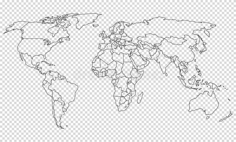
Free with trial World map on transparent background. Gray silhouette of world map. Map vectors World map on transparent background. Gray silhouette of world map
Free with trial Bright map of Ukraine with landscape, symbols,food buildings, cities, characters. Vector design with tourist attractions. For travel guides, posters, leaflets. Map vectors Bright map of Ukraine with landscape, symbols. Food buildings, cities, characters. Vector design with tourist attractions. For travel guides, posters, leaflets
Free with trial Map contains topographic contours, country and land names, cities, water objects, flag, roads, railways. Map vectors Canada - detailed topographic map - illustration. Map contains topographic contours, country and land names, cities, water objects, flag, roads, railways. Map contains topographic contours, country and land names, cities, water objects, flag, roads, railways.
Free with trial Spain map and flag - highly detailed vector illustration Image contains next layers: - land contours - country and land names - city names - water object names - flag - navigation icons. Map vectors Spain - map, flag and navigation labels - illustration. Spain map and flag - highly detailed vector illustration Image contains next layers: - land contours. Spain map and flag - highly detailed vector illustration Image contains next layers: - land contours - country and land names - city names - water object names - flag - navigation icons
Free with trial Vector sketch map of Texas with flag, hand drawn chalk illustration. Grunge design. Map vectors Texas map with flag inside on the blackboard. Chalk sketch vector illustration. Vector sketch map of Texas with flag, hand drawn chalk illustration. Grunge. Vector sketch map of Texas with flag, hand drawn chalk illustration. Grunge design
Free with trial Map of the U. S. state of Texas. Vector. Map vectors Map of the U.S. state of Texas. Vector
Free with trial Map of Canada icon, outline style. Map of Canada icon. Outline illustration of map of Canada vector icon for web. Map vectors Map of Canada icon, outline style. Map of Canada icon. Outline illustration of map of Canada vector icon for web
Free with trial Ireland Sketch Doodles. Hand Drawn Irish Elements Set with flag and map of Ireland, Celtic Cross, Castle, Shamrock, Celtic Harp, Mill and Sheep, Whiskey Bottles and Irish Beer, Vector on chalkboard. Map vectors Ireland Sketch Doodles. Hand Drawn Irish Elements Set with flag and map of Ireland, Celtic Cross, Castle, Shamrock, Celtic Harp, M. Ill and Sheep, Whiskey. Ireland Sketch Doodles. Hand Drawn Irish Elements Set with flag and map of Ireland, Celtic Cross, Castle, Shamrock, Celtic Harp, Mill and Sheep, Whiskey Bottles and Irish Beer, Vector on chalkboard.
Free with trial Tennessee county map. A large and detailed map of the State of Tennessee with all counties and county seats. Map vectors Tennessee county map. A large and detailed map of the State of Tennessee with all counties and county seats
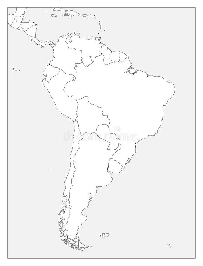
Free with trial Blank political map of South America. Simple flat vector outline map. Map vectors Blank political map of South America. Simple flat vector outline map.
Free with trial Card with wine bottle, glass and Italy map in national flag colors, an be used for tourism or for wine tasting, vector illustration in sketch style. Map vectors Card with wine bottle, glass and Italy map in national flag colors. An be used for tourism or for wine tasting, vector illustration in sketch style
Free with trial North America map icon. Flat vector illustration. North America sign symbol with shadow on white background. Map vectors North America map icon. Flat vector illustration. North America. Sign symbol with shadow on white background
Free with trial Map of Europe with European Union members and Great Britain or United Kingdom in brexit. Vector illustration. Map vectors Map of Europe with European Union members and Great Britain or United Kingdom in brexit. Vector illustration
Free with trial Canada map. Flat vector illustration. Map vectors Canada map. Flat vector illustration.
Free with trial Red map pointer location pin icon marker flag symbol. Vector illustration EPS10. Map vectors Red map pointer location pin icon marker flag symbol. Vector illustration EPS10
Free with trial USA flag in a shape of US map silhouette. United States of America symbol. EPS10 vector illustration. Map vectors USA flag in a shape of US map silhouette. United States of America symbol. EPS10 vector illustration.
Free with trial Vector set. Map of Canada with provinces and territories borders and vector flags. Map vectors Vector set. Map of Canada with provinces and territories flags. Vector set. Map of Canada with provinces and territories borders and vector flags. Vector set. Map of Canada with provinces and territories borders and vector flags.
Free with trial United States of American Map, line icon. United States of American Map on white background. Map vectors United States of American Map, line icon. United States of American Map on white background
Free with trial Viva mexico map decoration confetti. Vector illustration eps 10. Map vectors Viva mexico map decoration confetti. Vector illustration eps 10
Free with trial Worldwide map political, political division world map, world maps, worldwide map with names and political division, vector map, mapamundial 2010, vector-illustration, maps of countries and oceans, worldwide map editable quality. Map vectors Worldwide Map political-Illustration-vector maps. Worldwide map political, political division world map, world maps, worldwide map with names and political. Worldwide map political, political division world map, world maps, worldwide map with names and political division, vector map, mapamundial 2010, vector-illustration, maps of countries and oceans, worldwide map editable quality
Free with trial Blank political map of South America. Simple flat vector outline map. Map vectors Blank political map of South America. Simple flat vector outline map.
Free with trial Classic and post-classic Maya civilization in Mesoamerica. Political map with capitals, national borders, most important ancient cities, rivers and lakes. Vector illustration with English labeling and scaling. Map vectors Maya High Culture Area Map. Classic and post-classic Maya civilization in Mesoamerica. Political map with capitals, national borders, most important ancient. Classic and post-classic Maya civilization in Mesoamerica. Political map with capitals, national borders, most important ancient cities, rivers and lakes. Vector illustration with English labeling and scaling.
Free with trial Vector illustration of a NEW 2011 High Detail Political Map of the world with different colors for each continent and variations for each country. Global colors used, easy to edit. Map vectors World map continents multicolored. Vector illustration of a NEW 2011 High Detail Political Map of the world with different colors for each continent and. Vector illustration of a NEW 2011 High Detail Political Map of the world with different colors for each continent and variations for each country. Global colors used, easy to edit.
Free with trial Ukraine country flag inside map contour design icon logo. Ukraine country flag inside country border map design suitable for a logo icon design. Map vectors Ukraine country flag inside map contour design icon logo. Ukraine country flag inside country border map design suitable for a logo icon design
Free with trial Hand drawn background with vintage sailing ship, compass, lighthouse, ship wheel, anchor and world map on old craft paper texture. Template for your design works. Map vectors Hand drawn background with vintage sailing ship, compass, lighthouse, ship wheel, anchor and world map on old craft paper texture. Template for your design
Free with trial Virginia state road map with Interstates and U. S. Highways. All elements on 3 separate layers for easy editing. Map created May 31, 2009. Source: Public domain National Planning Network ( and United States Federal Highway Administration ( maps. Map vectors Virginia Interstate Map. Virginia state road map with Interstates and U. S. Highways. All elements on 3 separate layers for easy editing. Map created May 31. Virginia state road map with Interstates and U. S. Highways. All elements on 3 separate layers for easy editing. Map created May 31, 2009. Source: Public domain National Planning Network ( and United States Federal Highway Administration ( maps.
Free with trial Cuba map and flag in vintage rubber stamp of state colours. Grungy travel stamp with map and flag of Cuba. Country map and flag vector illustration. Map vectors Cuba map and flag in vintage rubber stamp of. Cuba map and flag in vintage rubber stamp of state colours. Grungy travel stamp with map and flag of Cuba. Country. Cuba map and flag in vintage rubber stamp of state colours. Grungy travel stamp with map and flag of Cuba. Country map and flag vector illustration.
Free with trial Arizona Map Flag. Map of Arizona, USA with the state flag of Arizona isolated on white background. United States, America, American, United States of America, US, AZ State. Vector illustration. Map vectors Arizona Map Flag. Map of Arizona, USA with the state flag of Arizona isolated on white background. United States, America, America. N, United States of America. Arizona Map Flag. Map of Arizona, USA with the state flag of Arizona isolated on white background. United States, America, American, United States of America, US, AZ State. Vector illustration.
Free with trial Palestine Map Silhouette Vector illustration eps 10. Map vectors Palestine Map Silhouette Vector illustration eps 10. Palestine Map Black Silhouette Vector illustration eps 10
Free with trial Milan Italy sketch elements. Hand drawn set with Duomo cathedral, flag, map, shoe, fashion items, pizza, shopping street, transport and traditional food. Drawing doodle collection, isolated on white. Map vectors Milan Italy sketch elements. Hand drawn set with Duomo cathedral, flag, map, shoe, fashion items, pizza, shopping street. Transport and traditional food. Milan Italy sketch elements. Hand drawn set with Duomo cathedral, flag, map, shoe, fashion items, pizza, shopping street, transport and traditional food. Drawing doodle collection, isolated on white.
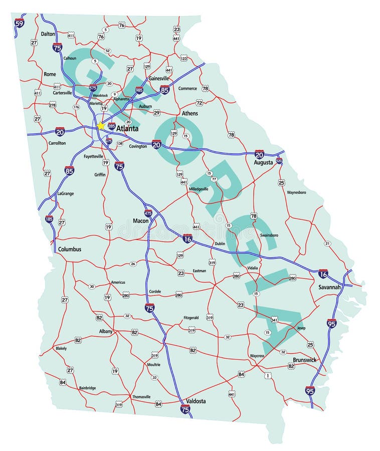
Free with trial Georgia state road map with Interstates, U. S. Highways and state roads. All elements on separate layers for easy editing. Map created December 1, 2009. ZIP File contains EPS-8 Adobe Illustrator file, Illustrator CS3 file, and large JPG file, 4212x5000. Source: Public domain National Planning Network ( and United States Federal Highway Administration (http:/. Map vectors Georgia State Interstate Map. Georgia state road map with Interstates, U.S. Highways and state roads. All elements on separate layers for easy editing. Map. Georgia state road map with Interstates, U.S. Highways and state roads. All elements on separate layers for easy editing. Map created December 1, 2009. ZIP File contains EPS-8 Adobe Illustrator file, Illustrator CS3 file, and large JPG file, 4212x5000. Source: Public domain National Planning Network ( and United States Federal Highway Administration (http:/
Free with trial Brazil infographic map with dotted map world. EPS10 vector with transparency organized in layers for easy editing. Map vectors Brazil Infographic map. With dotted map world. EPS10 vector with transparency organized in layers for easy editing
Free with trial Texas star logo design. abstract texas map with flag ideas. vector illustration. Eps10. Map vectors Texas star logo design . abstract texas map with flag ideas . vector illustration. Eps10
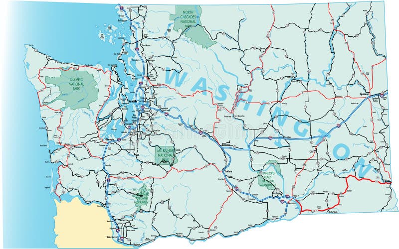
Free with trial Washington state road map with Interstates and U. S. Highways. All elements on 5 separate layers (State Fill, State Outline, Water, Roads, Cities) for easy editing. Map created November 26, 2008. ZIP File contains EPS-8 Adobe Illustrator file, Illustrator CS3 file, and large JPG file, 3508x5133. Source: Public domain National Planning Network ( and United S. Map vectors Washington State Road Map. With Interstates and U.S. Highways. All elements on 5 separate layers (State Fill, State Outline, Water, Roads, Cities) for. Washington state road map with Interstates and U.S. Highways. All elements on 5 separate layers (State Fill, State Outline, Water, Roads, Cities) for easy editing. Map created November 26, 2008. ZIP File contains EPS-8 Adobe Illustrator file, Illustrator CS3 file, and large JPG file, 3508x5133. Source: Public domain National Planning Network ( and United S
Free with trial U. S. state of Oklahoma Map Silhouette Vector illustration Eps 10. Map vectors U.S. state of Oklahoma Map Silhouette Vector illustration Eps 10.
Free with trial Map of Romania population growth from 1948 to 2004. Map vectors Population map of Romania. Map of Romania population growth from 1948 to 2004. Map of Romania population growth from 1948 to 2004.
Free with trial Vector Illustration of United States map with projected electoral states. Each of the states are grouped into separate, stroked shapes which can be easily edited. Map vectors United States Electoral Map. Vector Illustration of United States map with projected electoral states. Each of the states are grouped into separate, stroked. Vector Illustration of United States map with projected electoral states. Each of the states are grouped into separate, stroked shapes which can be easily edited.
Free with trial Map outline and flag of Texas, blue containing a single centered white star. The remaining field is divided horizontally into a white and red bar. With American flag. Map vectors Map outline and flag of Texas, blue containing a single centered white star into a white and red bar. Map outline and flag of Texas, blue containing a single. Map outline and flag of Texas, blue containing a single centered white star. The remaining field is divided horizontally into a white and red bar. With American flag.
Free with trial United States map design with 3D style. Blue usa map and National flag. Simple vector map with contour, shape, outline, on white. Map vectors United States map design with 3D style. Blue usa map and National flag. Simple vector map with contour, shape, outline, on white.
Free with trial USA Territories map - High detailed blue map with counties/regions/states of USA Territories. USA Territories map isolated on. Transparent background. Map vectors USA Territories map - High detailed blue map with counties/regions/states of USA Territories. USA Territories map isolated on. Transparent background
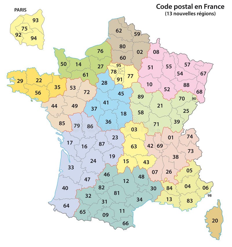
Free with trial France 2-digit postcodes map 2017. 13 Regions. Map vectors France 2-digit postcodes map 2017. 13 Regions
Free with trial China map - High detailed blue map with counties/regions/states of china. china map isolated on transparent background. Vector map. Map vectors China map - High detailed blue map with counties/regions/states of china. china map isolated on transparent background. Vector map
Free with trial Map outline and flag of South Carolina, White palmetto tree on an indigo field. The canton contains a white crescent. With American flag. Map vectors Map outline and flag of South Carolina, White palmetto tree on an indigo field. The canton contains a white crescent. With American flag
Free with trial Usa map - High detailed Black map with counties/regions/states of united state of America. us map isolated on transparent background. Map vectors Usa map - High detailed Black map with counties/regions/states of united state of America. us map isolated on transparent. Background
Free with trial Map of the city of Detroit, Michigan, USA. Vector map of the city of Detroit, Michigan, USA. Map vectors Map of the city of Detroit, Michigan, USA. Vector map of the city of Detroit, Michigan, USA
Free with trial Map of the city of Detroit, Michigan, USA. Vector map of the city of Detroit, Michigan, USA. Map vectors Map of the city of Detroit, Michigan, USA. Vector map of the city of Detroit, Michigan, USA
Free with trial Map of the city of Copenhagen, Denmark. Vector map of the city of Copenhagen, Denmark. Map vectors Map of the city of Copenhagen, Denmark. Vector map of the city of Copenhagen, Denmark
Free with trial Vectorial map of Europe and European Union (blue countries) with flags of all countries (2008). Map is in Lambert Azimuthal Equal-Area Projection (the best projection for Europe). Map vectors Map of Europe Union and flags. Vectorial map of Europe and European Union (blue countries) with flags of all countries (2008). Map is in Lambert Azimuthal Equal. Vectorial map of Europe and European Union (blue countries) with flags of all countries (2008). Map is in Lambert Azimuthal Equal-Area Projection (the best projection for Europe)
Free with trial Brazil map with 2016 text, great for your design. Map vectors Brazil map with 2016 text. Great for your design
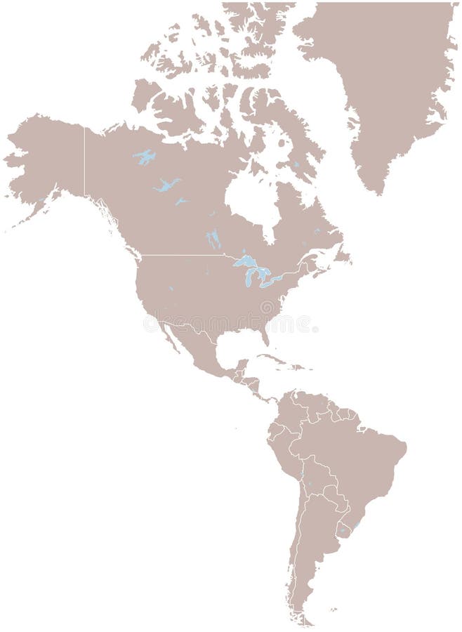
Free with trial America. Vector map america and illustration. Map vectors America. Vector map america and illustration
Free with trial Simple Set of Real Estate Related Vector Line Icons. Contains such Icons as Map, Plan, Bedrooms, Area, Bell and more. Editable Stroke. 48x48 Pixel Perfect. Map vectors Line Real Estate Icons. Simple Set of Real Estate Related Vector Line Icons. Contains such Icons as Map, Plan, Bedrooms, Area, Bell and more. Editable Stroke. Simple Set of Real Estate Related Vector Line Icons. Contains such Icons as Map, Plan, Bedrooms, Area, Bell and more. Editable Stroke. 48x48 Pixel Perfect.
Free with trial State of Alaska. Illustrated design of the map of Alaska (USA), including counties and county seats. Isolated against a white background. Map vectors State of Alaska. Illustrated design of the map of Alaska (USA), including counties and county seats. Isolated against a white background
Free with trial Map of Indiana (USA), including counties and county seats. Isolated against a white background. Map vectors State of Indiana. Map of Indiana (USA), including counties and county seats. Isolated against a white background. Map of Indiana (USA), including counties and county seats. Isolated against a white background.
Free with trial Map of Oklahoma state designed in illustration with the counties and the county seats. Map vectors State of Oklahoma. Map of Oklahoma state designed in illustration with the counties and the county seats. Map of Oklahoma state designed in illustration with the counties and the county seats.
Free with trial Vermont. Map of Vermont state designed in illustration with the counties and the county seats. (Map is hight resolution. Map vectors Vermont. Map of Vermont state designed in illustration with the counties and the county seats. (Map is hight resolution
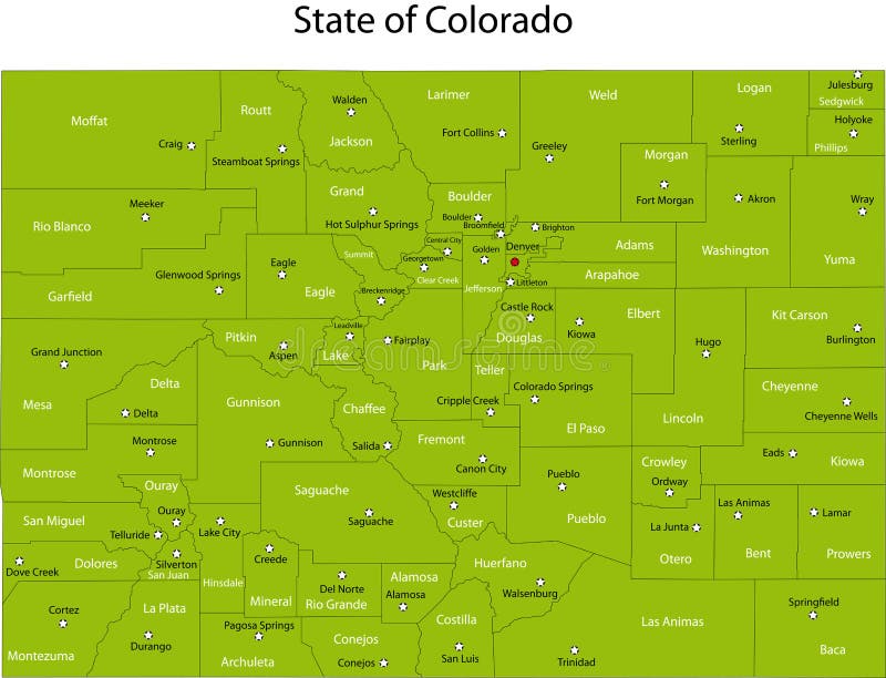
Free with trial Map of Colorado state designed in illustration with the counties and the county seats. Map vectors State of Colorado. Map of Colorado state designed in illustration with the counties and the county seats. Map of Colorado state designed in illustration with the counties and the county seats.
Free with trial Grungy Earth Day poster. Reference map from earthobservatory. nasa. gov/GlobalMaps. Map vectors Earth Day Poster. Grungy Earth Day poster. Reference map from. Grungy Earth Day poster. Reference map from earthobservatory.nasa.gov/GlobalMaps.
Free with trial Japan. Map designed in illustration with regions colored in bright colors. Vector illustration. Map vectors Japan. Map designed in illustration with regions colored in bright colors. Vector illustration
Free with trial Africa. Vector illustration of isolated Africa map with words of problems. Map vectors Africa. Vector illustration of isolated Africa map with words of problems
Free with trial Belize map designed in illustration with the regions colored in bright colors and with the main cities. Map vectors Belize. Map designed in illustration with the regions colored in bright colors and with the main cities
Free with trial Illustration of digital multimedia technology - flat LCD television set with world map and World News text. Additional illustration file is supplied for your needs (change colors, add or remove text and elements). Map vectors TV news. Illustration of digital multimedia technology - flat LCD television set with world map and World News text. Additional illustration file is supplied for. Illustration of digital multimedia technology - flat LCD television set with world map and World News text. Additional illustration file is supplied for your needs (change colors, add or remove text and elements)
Free with trial Compass. And map of the world illustration. Map vectors Compass. And map of the world illustration
Free with trial America. Very detailed map of Central America. File easy to edit and apply. Map vectors America. Very detailed map of Central America. File easy to edit and apply
Free with trial Compass. Over world map in white background. Map vectors Compass. Over world map in white background
Free with trial World map. Vector globe view - Africa Asia continent. Map vectors World map. Vector globe view - Africa Asia continent
Free with trial Europe map. Two europe maps: one soft coloured in light blue and one with colorful countries. Eps available. Map vectors Europe map. Two europe maps: one soft coloured in light blue and one with colorful countries. Eps available
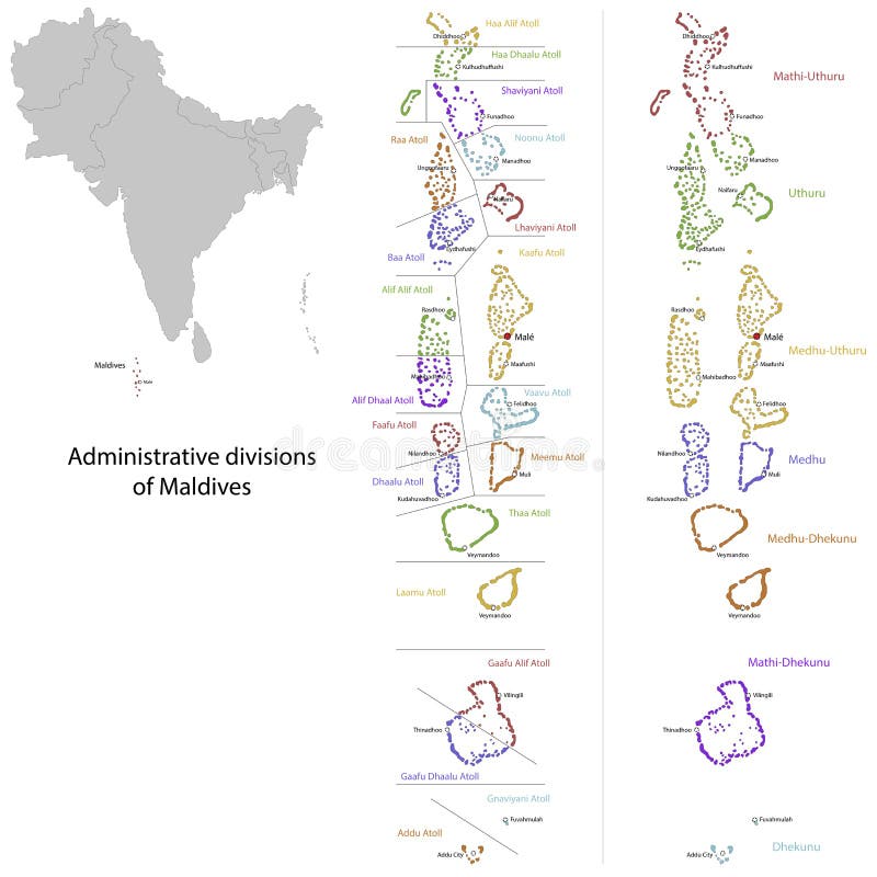
Free with trial Maldives map. Administrative division of the Republic of the Maldives. Map vectors Maldives map. Administrative division of the Republic of the Maldives
Free with trial Mountain ranges of the world. Vector map of the world with most notable mountain ranges and highest peaks, from rocky mountains to himalaya. Map vectors Mountain ranges of the world. Vector map of the world with most notable mountain ranges and highest peaks, from rocky mountains to himalaya
Free with trial Ethiopia map. Administrative division of the the Federal Democratic Republic of Ethiopia. Map vectors Ethiopia map. Administrative division of the the Federal Democratic Republic of Ethiopia
Free with trial Map of West Virginia state designed in illustration with the counties and the county seats. Map vectors West Virginia. Map of West Virginia state designed in illustration with the counties and the county seats. Map of West Virginia state designed in illustration with the counties and the county seats.
Free with trial Singapore map. Administrative division of the Republic of Singapore. Map vectors Singapore map. Administrative division of the Republic of Singapore
Free with trial State of Utah. Map of Utah state designed in illustration with the counties and the county seats. (Map is hight resolution. Map vectors State of Utah. Map of Utah state designed in illustration with the counties and the county seats. (Map is hight resolution
Free with trial Grid World Map. White grid on world globe background. Map vectors Grid World Map. White grid on world globe background
Free with trial State of Idaho. Map of Idaho state designed in illustration with the counties and the county seats. (Map is hight resolution. Map vectors State of Idaho. Map of Idaho state designed in illustration with the counties and the county seats. (Map is hight resolution
 Sign in