Free with trial Caribbean region map showing countries. Countries, capital cities and water bodies are labeled. Land areas have a slight drop shadow effect. Map vectors Caribbean Islands Map. Caribbean region map showing countries. Countries, capital cities and water bodies are labeled. Land areas have a slight drop shadow. Caribbean region map showing countries. Countries, capital cities and water bodies are labeled. Land areas have a slight drop shadow effect.
Free with trial Map of New Mexico state designed in illustration with the counties and the county seats. (Map is hight resolution). Map vectors State of New Mexico. Map of New Mexico state designed in illustration with the counties and the county seats. (Map is hight resolution. Map of New Mexico state designed in illustration with the counties and the county seats. (Map is hight resolution)
Free with trial Mexico. Blind map of Mexico with states borders. Map vectors Mexico. Blind map of Mexico with states borders
Free with trial State of Kansas. Colorful illustrated design of the map of Kansas (USA), including counties and county seats. Isolated against a white background. Map vectors State of Kansas. Colorful illustrated design of the map of Kansas (USA), including counties and county seats. Isolated against a white background
Free with trial State of Nevada. Map of Nevada state designed in illustration with the counties and the county seats. (Map is hight resolution. Map vectors State of Nevada. Map of Nevada state designed in illustration with the counties and the county seats. (Map is hight resolution
Free with trial A world map shows a global connection of people using technology to link together as a group. Map vectors Global Connection. A world map shows a global connection of people using technology to link together as a group. A world map shows a global connection of people using technology to link together as a group.
Free with trial An image of the latest, market leading, Apple ipod touch showing the touch screen and controls. Ideal for the storage and playing of music and images with all the latest apps. This image demonstrates how the screen image changes angle with the tilt of the ipod from vertical to horizontal. The screen shows a map of the world to imply that this product along with the other Apple products like iphone and ipad are market leaders. Map vectors Apple Ipod Touch. An image of the latest, market leading, Apple ipod touch showing the touch screen and controls. Ideal for the storage and playing of music and. An image of the latest, market leading, Apple ipod touch showing the touch screen and controls. Ideal for the storage and playing of music and images with all the latest apps.This image demonstrates how the screen image changes angle with the tilt of the ipod from vertical to horizontal. The screen shows a map of the world to imply that this product along with the other Apple products like iphone and ipad are market leaders.
Free with trial Background world. Background abstract world map illustration. Map vectors Background world. Background abstract world map illustration
Free with trial Background world. Background abstract world map illustration. Map vectors Background world. Background abstract world map illustration
Free with trial An image of the latest, market leading, Apple ipod touch showing the touch screen and controls. Ideal for the storage and playing of music and images with all the latest apps. This image demonstrates how the screen image changes angle with the tilt of the ipod from vertical to horizontal. The screen shows a map of the world to imply that this product along with the other Apple products like iphone and ipad are market leaders. Map vectors Apple Ipod Touch. An image of the latest, market leading, Apple ipod touch showing the touch screen and controls. Ideal for the storage and playing of music and. An image of the latest, market leading, Apple ipod touch showing the touch screen and controls. Ideal for the storage and playing of music and images with all the latest apps.This image demonstrates how the screen image changes angle with the tilt of the ipod from vertical to horizontal. The screen shows a map of the world to imply that this product along with the other Apple products like iphone and ipad are market leaders.
Free with trial Background world. Background abstract world map illustration. Map vectors Background world. Background abstract world map illustration
Free with trial An image of the latest, market leading, Apple iphone 4S 5 showing the touch screen and controls. The phones have a retina display screen for the highest resolution. This image also shows a drawing of the map of the world as this is a world leading product from Apple Mac and shows how the image on the screen tilts when the phone is held horizontally. Map vectors Apple Iphone 4S 5. An image of the latest, market leading, Apple iphone 4S 5 showing the touch screen and controls. The phones have a retina display screen for. An image of the latest, market leading, Apple iphone 4S 5 showing the touch screen and controls. The phones have a retina display screen for the highest resolution. This image also shows a drawing of the map of the world as this is a world leading product from Apple Mac and shows how the image on the screen tilts when the phone is held horizontally.
Free with trial America globe kit. Colorful aqua globes - map of america. Map vectors America globe kit. Colorful aqua globes - map of america
Free with trial State of Nebraska. Colorful illustrated design of the map of Nebraska (USA), including counties and county seats. Isolated against a white background. Map vectors State of Nebraska. Colorful illustrated design of the map of Nebraska (USA), including counties and county seats. Isolated against a white background
Free with trial State of Missouri. Colorful illustrated design of the map of Missouri (USA), including counties and county seats. Isolated against a white background. Map vectors State of Missouri. Colorful illustrated design of the map of Missouri (USA), including counties and county seats. Isolated against a white background
Free with trial Northern Ireland map. Illustration of Northern Ireland which divided into 26 districts for local government purposes. Map vectors Northern Ireland map. Illustration of Northern Ireland which divided into 26 districts for local government purposes
Free with trial Map of West Virginia state designed in illustration with the counties and the county seats. Map vectors West Virginia state. Map of West Virginia state designed in illustration with the counties and the county seats. Map of West Virginia state designed in illustration with the counties and the county seats.
Free with trial Map of Mississippi state designed in illustration with the counties and the county seats. Map vectors State of Mississippi. Map of Mississippi state designed in illustration with the counties and the county seats. Map of Mississippi state designed in illustration with the counties and the county seats.
Free with trial This is a continental regional world map done in illustrator. can be used for developing concept for global related ideas. Map vectors Continental worldmap. This is a continental regional world map done in illustrator. can be used for developing concept for global related ideas. This is a continental regional world map done in illustrator. can be used for developing concept for global related ideas.
Free with trial Smart phone with GPS. Illustration of mobile device displaying geo location on map. Map vectors Smart phone with GPS. Illustration of mobile device displaying geo location on map
Free with trial Technology background. Abstract color technology background with map. Map vectors Technology background. Abstract color technology background with map
Free with trial Bahamas map. Administrative division of the Commonwealth of the Bahamas. Map vectors Bahamas map. Administrative division of the Commonwealth of the Bahamas
Free with trial Canada. Black map of canada on gray background. Map vectors Canada. Black map of canada on gray background
Free with trial Layered vector illustration pattern map of London. Map vectors London. Layered vector illustration pattern map of London. Layered vector illustration pattern map of London.
Free with trial Illustrated silhouettes of famous landmark silhouettes with world map in the background. Map vectors Famous landmark silhouettes. Illustrated silhouettes of famous landmark silhouettes with world map in the background. Illustrated silhouettes of famous landmark silhouettes with world map in the background.
Free with trial Map tile. Editable vector seamless tile of a generic city without names. Map vectors Map tile. Editable vector seamless tile of a generic city without names
Free with trial Road map. Segments for easy creating own road maps. Map vectors Road map. Segments for easy creating own road maps
Free with trial A set of hiking flat icons in modern style. With camping infographic elements - car, tent, campfire, mountains, trees, camera, bagpack, map. Map vectors A set of hiking flat icons in modern style. With camping infographic elements - car, tent, campfire, mountains, trees, camera, bagpack, map
Free with trial Biomes. Terrestrial ecosystem is a community of living organisms. Biotope: montane, desert, tropics, savanna, steppe, mediterranean, mixed forest, taiga, tundra and polar desert. Vector map. Map vectors Biomes. Terrestrial ecosystem. Is a community of living organisms. Biotope: montane, desert, tropics, savanna, steppe, mediterranean, mixed forest, taiga. Biomes. Terrestrial ecosystem is a community of living organisms. Biotope: montane, desert, tropics, savanna, steppe, mediterranean, mixed forest, taiga, tundra and polar desert. Vector map
Free with trial Many world. All elements are separate objects and grouped. File is made with linear and radial gradient. No transparency. Map source Url. Map vectors Many world. All elements are separate objects and grouped. File is made with linear and radial gradient. No transparency. Map source Url
Free with trial Illustration of abstract map of farm, with various plants and animals. Travel theme series. Elements useful for agriculture infographics. Flat style. (Vector file is EPS8). Map vectors Small Farm. Illustration of abstract map of farm, with various plants and animals. Travel theme series. Elements useful for agriculture infographics. Flat style. Illustration of abstract map of farm, with various plants and animals. Travel theme series. Elements useful for agriculture infographics. Flat style. (Vector file is EPS8)
Free with trial Colorful illustrated design of the map of Emilia–Romagna (Italy), including provinces and main cities. Map vectors Region of Italy - Emilia-Romagna. Colorful illustrated design of the map of Emilia–Romagna (Italy), including provinces and main cities. Colorful illustrated design of the map of Emilia–Romagna (Italy), including provinces and main cities.
Free with trial Vector icon set for travel guides and maps with things to know as ruins, religious places, hotels, bus and train stops, money change, bar and coffee stores and more. Map vectors Travel map guide utility icons. Vector icon set for travel guides and maps with things to know as ruins, religious places, hotels, bus and train stops, money. Vector icon set for travel guides and maps with things to know as ruins, religious places, hotels, bus and train stops, money change, bar and coffee stores and more
Free with trial New Jersey state designed in illustration with the counties. (Map is hight resolution). Map vectors New Jersey state. Designed in illustration with the counties. (Map is hight resolution
Free with trial State of Montana. Map of Montana state designed in illustration with the counties and the county seats. (Map is hight resolution. Map vectors State of Montana. Map of Montana state designed in illustration with the counties and the county seats. (Map is hight resolution
Free with trial Travel the world vector concept. Vector illustration of world map with mark nails on visited places and more to place. Map vectors Travel the world vector concept. Vector illustration of world map with mark nails on visited places and more to place
Free with trial Mexico. Map of mexico drawn on illustrator. Map vectors Mexico. Map of mexico drawn on illustrator
Free with trial Spain regions. A political map of Spain showing the different regions. Map vectors Spain regions. A political map of Spain showing the different regions
Free with trial New York City. Illustration of New York City Map Infographic Elements. Map vectors New York City. Illustration of New York City Map Infographic Elements
Free with trial Vietnam. Map of Vietnam drawn on Adobe illustrator. Map vectors Vietnam. Map of Vietnam drawn on Adobe illustrator
Free with trial Weather system. Editable vector illustration of a generic weather system map. Map vectors Weather system. Editable vector illustration of a generic weather system map
Free with trial Iphone 4. Apple Iphone 4 with world map on screen. Map vectors Iphone 4. Apple Iphone 4 with world map on screen
Free with trial Global business. Businesspeople are standing on a large world map. The base map is from Central Intelligence Agency Web site. Map vectors Global business. Businesspeople are standing on a large world map. The base map is from Central Intelligence Agency Web site
Free with trial Province of Canada - British Columbia. Administrative division of Canada. Map of British Columbia with regions and main cities, vector illustration. Map vectors Province of Canada - British Columbia. Administrative division of Canada. Map of British Columbia with regions and main cities, vector illustration
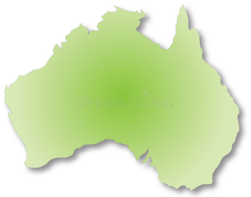
Free with trial Australia. Map of australia drawn in Adobe Illustrator. Map vectors Australia. Map of australia drawn in Adobe Illustrator
Free with trial Vector World Map. This is a vector illustration and requires vector editing software, such as Adobe Illustrator, Freehand, or CorelDRAW to edit this file. Map vectors Vector World Map. This is a vector illustration and requires vector editing software, such as Adobe Illustrator, Freehand, or CorelDRAW to edit this file
Free with trial World perspective with six differents worlds map. Map vectors World perspective. World perspective with six differents worlds map. World perspective with six differents worlds map.
Free with trial Oklahoma. Map of Oklahoma state designed in illustration with the counties and the county seats. Map vectors Oklahoma. Map of Oklahoma state designed in illustration with the counties and the county seats
Free with trial Map pins and arrows. Set of elements in navigation maps. Map vectors Map pins and arrows. Set of elements in navigation maps
Free with trial Hong Kong. Illustrated design of the map of Hong Kong. Isolated against a white background. Map vectors Hong Kong. Illustrated design of the map of Hong Kong. Isolated against a white background
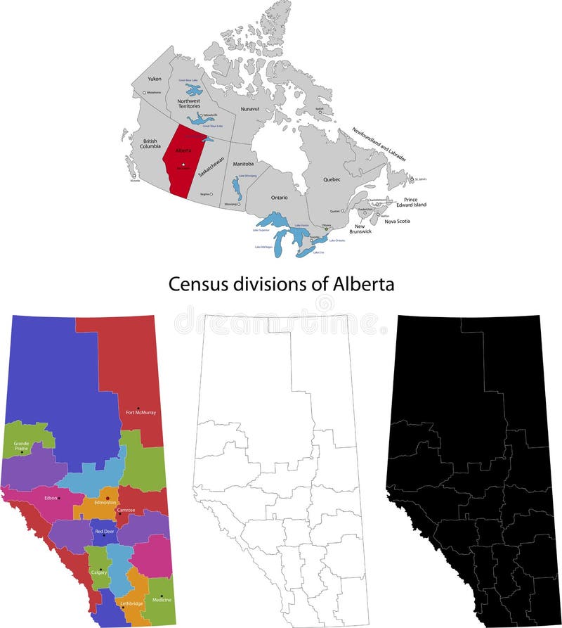
Free with trial Province of Canada - Alberta. Administrative division of Canada. Map of Alberta with regions and main cities, vector illustration. Map vectors Province of Canada - Alberta. Administrative division of Canada. Map of Alberta with regions and main cities, vector illustration
Free with trial Road trip poster with a stylized map with point of interests and sighseeing for travelers like city, old castle, monastery, fan fair, beach, sea, forest, mountain in black and white color. Map vectors Road trip poster with a stylized map with point of interests. And sighseeing for travelers like city, old castle, monastery, fan fair, beach, sea, forest. Road trip poster with a stylized map with point of interests and sighseeing for travelers like city, old castle, monastery, fan fair, beach, sea, forest, mountain in black and white color
Free with trial Nigeria map. Administrative division of the Federal Republic of Nigeria. Map vectors Nigeria map. Administrative division of the Federal Republic of Nigeria
Free with trial Glossy gold world atlas. Treasure earth isolated land crust texture. PNG with transparent background. Map vectors Golden world map flat earth. Glossy gold world atlas. Treasure earth isolated land crust texture. PNG with transparent background. Glossy gold world atlas. Treasure earth isolated land crust texture. PNG with transparent background.
Free with trial North Dakota. Map of North Dakota state designed in illustration with the counties and the county seats. (Map is hight resolution. Map vectors North Dakota. Map of North Dakota state designed in illustration with the counties and the county seats. (Map is hight resolution
Free with trial Delaware state. Map of Delaware state designed in illustration with the counties and the county seats. Map vectors Delaware state. Map of Delaware state designed in illustration with the counties and the county seats
Free with trial The user interface for the game. Main menu, settings, score, time, map, background forest and castle. Vector flat style. Map vectors The user interface for the game. Main menu, settings, score, time, map, background forest and castle. Vector flat style
Free with trial Vintage style vector infographics elements. Lots of different charts and graphs. Also a world map and badges. Map vectors Vintage infographic elements. Vintage style vector infographics elements. Lots of different charts and graphs. Also a world map and badges. Vintage style vector infographics elements. Lots of different charts and graphs. Also a world map and badges.
Free with trial An illustration of a road pint with a point of interest highlighted with a pin. Map vectors Road Map with Pin. An illustration of a road pint with a point of interest highlighted with a pin. An illustration of a road pint with a point of interest highlighted with a pin.
Free with trial State of Kentucky. Colorful illustrated design of the map of Kentucky (USA), including counties and county seats. Isolated against a white background. Map vectors State of Kentucky. Colorful illustrated design of the map of Kentucky (USA), including counties and county seats. Isolated against a white background
Free with trial Texas counties. Texas state counties map with boundaries and names, Eps file contains separate layers with county name, boundaries and layer with counties. Map vectors Texas counties. Texas state counties map with boundaries and names, Eps file contains separate layers with county name, boundaries and layer with counties
Free with trial City park furniture and roads set flat 3D city map elements isometry isometric infographic game tiles collection EPS 10 JPG JPEG illustration. Map vectors Game Set 13 Building Isometric. City park furniture and roads set flat 3D city map elements isometry isometric infographic game tiles collection EPS 10 JPG JPEG. City park furniture and roads set flat 3D city map elements isometry isometric infographic game tiles collection EPS 10 JPG JPEG illustration
Free with trial Game Set 02 Building Isometric. City Building Construction Site Tiles MEGA Collection Warehouse and Other Isometric 3d Urban Map Elements Set of Game Tiles. Map vectors Game Set 02 Building Isometric. City Building Construction Site Tiles MEGA Collection Warehouse and Other Isometric 3d Urban Map Elements Set of Game Tiles
Free with trial Corporate style background concept. Futuristic blue figure touching button with world map in background. Map vectors Future man touch screen concept. Corporate style background concept. Futuristic blue figure touching button with world map in background. Corporate style background concept. Futuristic blue figure touching button with world map in background.
Free with trial Massachusetts State by counties. Vector map of Massachusetts State by counties. Map vectors Massachusetts State by counties. Vector map of Massachusetts State by counties
Free with trial Every country is clearly defined. This is a vector illustration and requires vector editing software, such as Adobe Illustrator, Freehand, or CorelDRAW to edit this file. Map vectors Vector World Map. Every country is clearly defined. This is a vector illustration and requires vector editing software, such as Adobe Illustrator, Freehand, or. Every country is clearly defined. This is a vector illustration and requires vector editing software, such as Adobe Illustrator, Freehand, or CorelDRAW to edit this file.
Free with trial Japan. Blind map of Japan with regions borders. Vector illustration. Map vectors Japan. Blind map of Japan with regions borders. Vector illustration
Free with trial Europe Map with Famous Sightseeing. Travel Guide. Vector illustration. Map vectors Europe Travel Map. Europe Map with Famous Sightseeing. Travel Guide. Vector illustration. Europe Map with Famous Sightseeing. Travel Guide. Vector illustration.
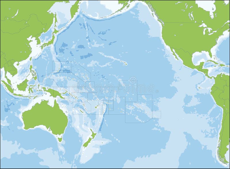
Free with trial Oceania, also known as Oceanica, is a region centred on the islands of the tropical Pacific Ocean. Map vectors Map of Oceania. Oceania, also known as Oceanica, is a region centred on the islands of the tropical Pacific Ocean. Oceania, also known as Oceanica, is a region centred on the islands of the tropical Pacific Ocean.
Free with trial Gelderland - province of the Netherlands. Administrative division of the Netherlands. Map of Gelderland with municipalities. Map vectors Gelderland - province of the Netherlands. Administrative division of the Netherlands. Map of Gelderland with municipalities
Free with trial Belgium map designed in illustration with the 21 counties colored in bright colors and with the main cities. Neighbouring countries are in an additional format (. AI) in the latent layer. Map vectors Sweden. Belgium map designed in illustration with the 21 counties colored in bright colors and with the main cities. Neighbouring countries are in an additional. Belgium map designed in illustration with the 21 counties colored in bright colors and with the main cities. Neighbouring countries are in an additional format (.AI) in the latent layer.
Free with trial Continent of Africa formed with golden West African Adinkra symbols, ethnic tribal symbols on brown back ground. Map vectors Adinkra Symbol Map of Africa. Continent of Africa formed with golden West African Adinkra symbols, ethnic tribal symbols on brown back ground. Continent of Africa formed with golden West African Adinkra symbols, ethnic tribal symbols on brown back ground.
Free with trial Colorful illustrated design of the map of Tuscany (Italy), including provinces and main cities. Map vectors Region of Italy - Tuscany. Colorful illustrated design of the map of Tuscany (Italy), including provinces and main cities. Colorful illustrated design of the map of Tuscany (Italy), including provinces and main cities.
Free with trial Business abstract vector background. World map. Map vectors Business abstract vector background. World map
Free with trial GPS. Illustration of GPS with map on screen. Map vectors GPS. Illustration of GPS with map on screen
Free with trial Australia Travel Seamless Pattern. Australia Travel Map. Vector Illustration. Map vectors Australia Travel Set. Australia Travel Seamless Pattern. Australia Travel Map. Vector Illustration. Australia Travel Seamless Pattern. Australia Travel Map. Vector Illustration.
Free with trial Travel Typography Poster with cities and sightseeing attractions. Inspirational Vector Typography Travel Guide. Map vectors Typography World Map. Travel Typography Poster with cities and sightseeing attractions. Inspirational Vector Typography Travel Guide. Travel Typography Poster with cities and sightseeing attractions. Inspirational Vector Typography Travel Guide.
Free with trial Star constellations around the poles. Nothern and Southern high detailed star map with symbols and signs of zodiac. Astrological celestial map. Map vectors Star constellations around the poles. Nothern and Southern high detailed star map with symbols and signs of zodiac. Astrological celestial map
Free with trial London by night. London map at night with described districts as a stars and milky way as a Thames. Map vectors London by night. London map at night with described districts as a stars and milky way as a Thames
 Sign in