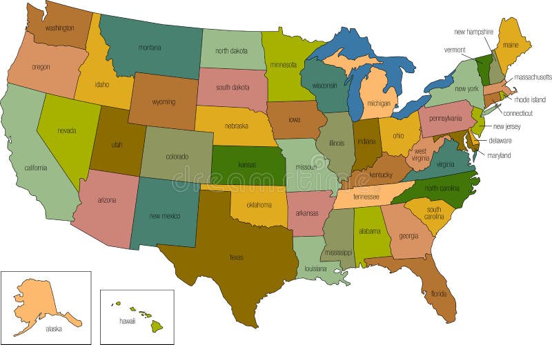
Free with trial United states 01. A full color map of the united states of america with the state names called out. Map vectors United states 01. A full color map of the united states of america with the state names called out
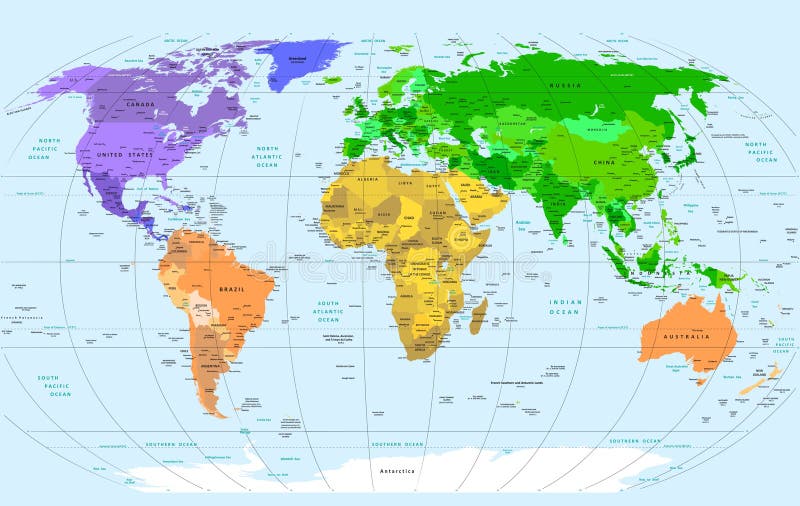
Free with trial Detailed Vector World Map. Layers objects (groups): continents, countries, names of countries, capitals, cites, water resources, meridians. Convenient editing of primary colors. ZIP: eps8 file - meridians in lines. Base map generated using map data from the public domain. - The url of the reference file is : - Software: Xara Designer Pro - Creation date: January, 2012. - Layers of Data Used: Outlines. Map vectors Detailed World Map. Detailed Vector World Map. Layers objects (groups): continents, countries, names of countries, capitals, cites, water resources, meridians. Detailed Vector World Map. Layers objects (groups): continents, countries, names of countries, capitals, cites, water resources, meridians. Convenient editing of primary colors. ZIP: eps8 file - meridians in lines. Base map generated using map data from the public domain. - The url of the reference file is : - Software: Xara Designer Pro - Creation date: January, 2012. - Layers of Data Used: Outlines
Free with trial City map. Seamless background. In vector file: all elements easy for select and change on separated layers; all colors easy for change (swatches). Map vectors City seamless vector wallpaper. City map. Seamless background. In vector file: all elements easy for select and change on separated layers; all colors easy for. City map. Seamless background. In vector file: all elements easy for select and change on separated layers; all colors easy for change (swatches)
Free with trial Map US state Florida silhouette Vector illustration Eps 10. Map vectors Map US state Florida silhouette Vector illustration Eps 10.
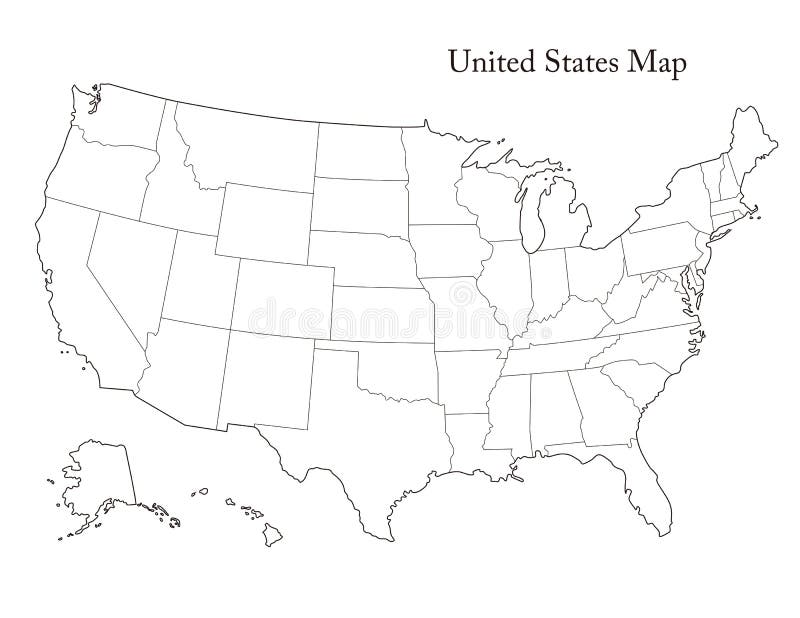
Free with trial Black and White United States Map with state borders, USA Map. Map vectors Black and White United States Map with state borders, USA Map. Black and White United States Map with state borders, simple USA Map
Free with trial Set colorful map pointer location pin icon marker flag symbol vector illustration. EPS10. Map vectors Set colorful map pointer location pin icon marker flag symbol vector illustration. EPS10
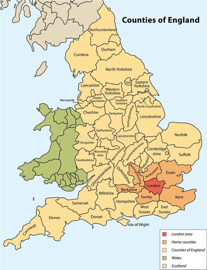
Free with trial Map of united Kingdom. High detailed vector map - united Kingdom. map shape/contour/outline/border with state isolate on white background. Map vectors Map of united Kingdom. High detailed vector map - united Kingdom. Map shape/contour/outline/border with state isolate on white background
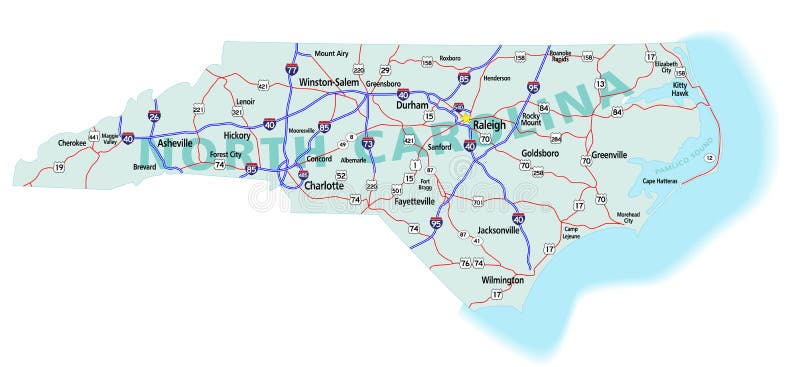
Free with trial North Carolina state road map with Interstates, U. S. Highways and state roads. All elements on separate layers (Fill, Roads, Cities, Outline) for easy editing. Map created December 3, 2009. ZIP File contains EPS-8 Adobe Illustrator file, Illustrator CS3 file, and large JPG file, 6806x3120. Source: Public domain National Planning Network ( and United States. Map vectors North Carolina State Interstate Map. North Carolina state road map with Interstates, U.S. Highways and state roads. All elements on separate layers (Fill. North Carolina state road map with Interstates, U.S. Highways and state roads. All elements on separate layers (Fill, Roads, Cities, Outline) for easy editing. Map created December 3, 2009. ZIP File contains EPS-8 Adobe Illustrator file, Illustrator CS3 file, and large JPG file, 6806x3120. Source: Public domain National Planning Network ( and United States
Free with trial Infographics vector template with road map using pointers. Top view vector elements. Road trip. Business and journey infographic design template with flags. Winding road on a brown background. Map vectors Infographics template with road map using pointers. Top view vector elements. Road trip. Business and journey. Infographics vector template with road map using. Infographics vector template with road map using pointers. Top view vector elements. Road trip. Business and journey infographic design template with flags. Winding road on a brown background
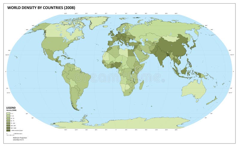
Free with trial World map with population density number (inhabitants/square kilometers). The maps are in ial format (EPS), and contains almost 250 countries and territories (including Kosovo, Abkhazia and others with little international recognition). The maps have legend about the colour representation. Maps are made in Robinson World projection, with central meridian at E11. Population datas are from 2008 (official and UN estimation). Map vectors World population density map. World map with population density number (inhabitants/square kilometers). The maps are in ial format (EPS), and contains almost 250. World map with population density number (inhabitants/square kilometers). The maps are in ial format (EPS), and contains almost 250 countries and territories (including Kosovo, Abkhazia and others with little international recognition). The maps have legend about the colour representation. Maps are made in Robinson World projection, with central meridian at E11. Population datas are from 2008 (official and UN estimation).
Free with trial California state road map with Interstates and U. S. Highways. All elements on 5 separate layers (State Fill, State Outline, Water, Roads, Cities) for easy editing. Map created January 9, 2009. Source: Public domain National Planning Network ( and United. Map vectors California Interstate Highway Map. California state road map with Interstates and U.S. Highways. All elements on 5 separate layers (State Fill, State. California state road map with Interstates and U.S. Highways. All elements on 5 separate layers (State Fill, State Outline, Water, Roads, Cities) for easy editing. Map created January 9, 2009. Source: Public domain National Planning Network ( and United
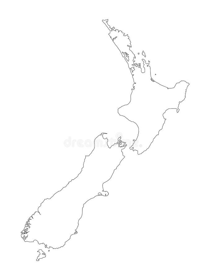
Free with trial A detailed black outline map of New Zealand on a white background. Vector illustration may be edited and re-sized without loosing quality. Host nation for the 2011 Rugby World Cup. Map vectors New Zealand Black Outline Map Vector Illustration. A detailed black outline map of New Zealand on a white background. Vector illustration may be edited and re. A detailed black outline map of New Zealand on a white background. Vector illustration may be edited and re-sized without loosing quality. Host nation for the 2011 Rugby World Cup.
Free with trial Sudan political map with new borders. Vector illustration of actual political situation in Sudan, Africa, 2011. Map vectors Sudan political map. With new borders. Vector illustration of actual political situation in Sudan, Africa, 2011
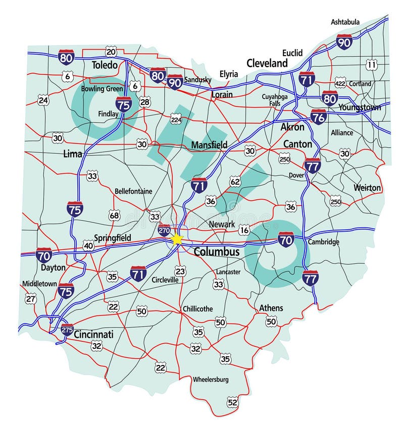
Free with trial Ohio state road map with Interstates, U. S. Highways and state roads. All elements on separate layers for easy editing. Map created November 26, 2009. ZIP File contains EPS-8 Adobefile,CS3 file, and large JPG file, 4469x4640. Source: Public domain National Planning Network ( and United States Federal Highway Administration (http:/. Map vectors Ohio State Interstate Map. Ohio state road map with Interstates, U.S. Highways and state roads. All elements on separate layers for easy editing. Map created. Ohio state road map with Interstates, U.S. Highways and state roads. All elements on separate layers for easy editing. Map created November 26, 2009. ZIP File contains EPS-8 Adobefile,CS3 file, and large JPG file, 4469x4640. Source: Public domain National Planning Network ( and United States Federal Highway Administration (http:/
Free with trial Florida state road map with Interstates, U. S. Highways and state roads. All elements on 5 separate layers (State Fill, State Outline, Water, Roads, Cities) for easy editing. Map created January 15, 2009. ZIP File contains EPS-8 Adobe Illustrator file, Illustrator CS3 file, and large JPG file, 4350x4162. Source: Public domain National Planning Network ( and. Map vectors Florida State Interstate Map. Florida state road map with Interstates, U.S. Highways and state roads. All elements on 5 separate layers (State Fill, State. Florida state road map with Interstates, U.S. Highways and state roads. All elements on 5 separate layers (State Fill, State Outline, Water, Roads, Cities) for easy editing. Map created January 15, 2009. ZIP File contains EPS-8 Adobe Illustrator file, Illustrator CS3 file, and large JPG file, 4350x4162. Source: Public domain National Planning Network ( and
Free with trial Political map of South Africa. South Africa political map with provincial boundaries-Host of Football World Cup 2010. Map vectors Political map of South Africa. South Africa political map with provincial boundaries-Host of Football World Cup 2010
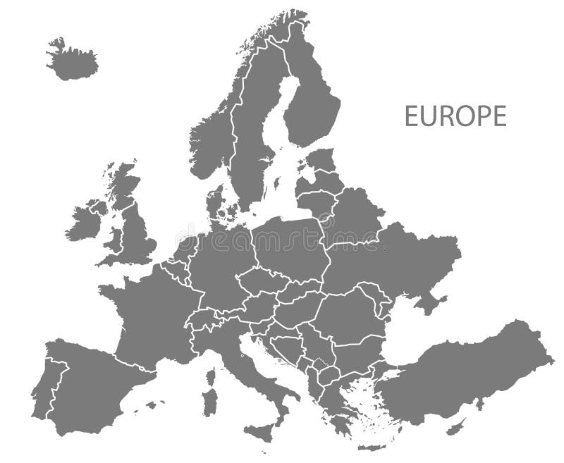
Free with trial Modern Map - Europe with updated states from 2019 in grey. Illustration. Map vectors Modern Map - Europe with updated states from 2019 in grey. Illustration
Free with trial South Africa map. Vector map of South Africa. Map vectors South Africa map. Vector map of South Africa
Free with trial Vectorial map of Europe with flags of all countries (2008). Map is in Lambert Azimuthal Equal-Area Projection (the best projection for Europe). Map vectors Vectorial map of Europe. With flags of all countries (2008). Map is in Lambert Azimuthal Equal-Area Projection (the best projection for Europe
Free with trial Vector illustration of flags of the 27 members of the European Union as of 2008 plus NATO and the EU spread in a circle around the countries' map. Map vectors European union map with flags in circle. Vector illustration of flags of the 27 members of the European Union as of 2008 plus NATO and the EU spread in a circle. Vector illustration of flags of the 27 members of the European Union as of 2008 plus NATO and the EU spread in a circle around the countries' map.
Free with trial North arrow icon or N direction point symbol. Vector logo for GPS navigator map isolated on transparent background. Map vectors North arrow icon N direction vector point symbol. North arrow icon or N direction point symbol. Vector logo for GPS navigator map isolated on transparent. North arrow icon or N direction point symbol. Vector logo for GPS navigator map isolated on transparent background
Free with trial Africa - vector. Africa map outline and silhouette shadowed green vector map. Map vectors Africa - vector. Africa map outline and silhouette shadowed green vector map
Free with trial Map of California state designed in illustration with the counties and the county seats. (Map is hight resolution). Map vectors State of California. Map of California state designed in illustration with the counties and the county seats. (Map is hight resolution. Map of California state designed in illustration with the counties and the county seats. (Map is hight resolution)
Free with trial South Holland - province of the Netherlands. Administrative division of the Netherlands. Map of South Holland with municipalities. Map vectors South Holland - province of the Netherlands. Administrative division of the Netherlands. Map of South Holland with municipalities
Free with trial Scotland map. Scotland is divided into 32 areas designated as council areas which are all governed by unitary authorities designated as councils. Map vectors Scotland map. Scotland is divided into 32 areas designated as council areas which are all governed by unitary authorities designated as councils
Free with trial South America. Vector map of america and illustration. Map vectors South America. Vector map of america and illustration
Free with trial State of Arizona. Map of Arizona state designed in illustration with the counties and the county seats. (Map is hight resolution. Map vectors State of Arizona. Map of Arizona state designed in illustration with the counties and the county seats. (Map is hight resolution
Free with trial Flat design vector illustration of city map landscape with school building. Bus, playground with playing kids, road, girls and boys with backpacks going to learn. Education concept. The Knowledge day. Map vectors School map. Flat design vector illustration of city map landscape with school building. Bus, playground with playing kids, road, girls and boys with backpacks. Flat design vector illustration of city map landscape with school building. Bus, playground with playing kids, road, girls and boys with backpacks going to learn. Education concept. The Knowledge day.
Free with trial Collection of eight colorful blank GPS navigation and map icons or symbols, on white background. Eps file available. Map vectors GPS and Navigation Blank Icons. Collection of eight colorful blank GPS navigation and map icons or symbols, on white background. Eps file available. Collection of eight colorful blank GPS navigation and map icons or symbols, on white background. Eps file available.
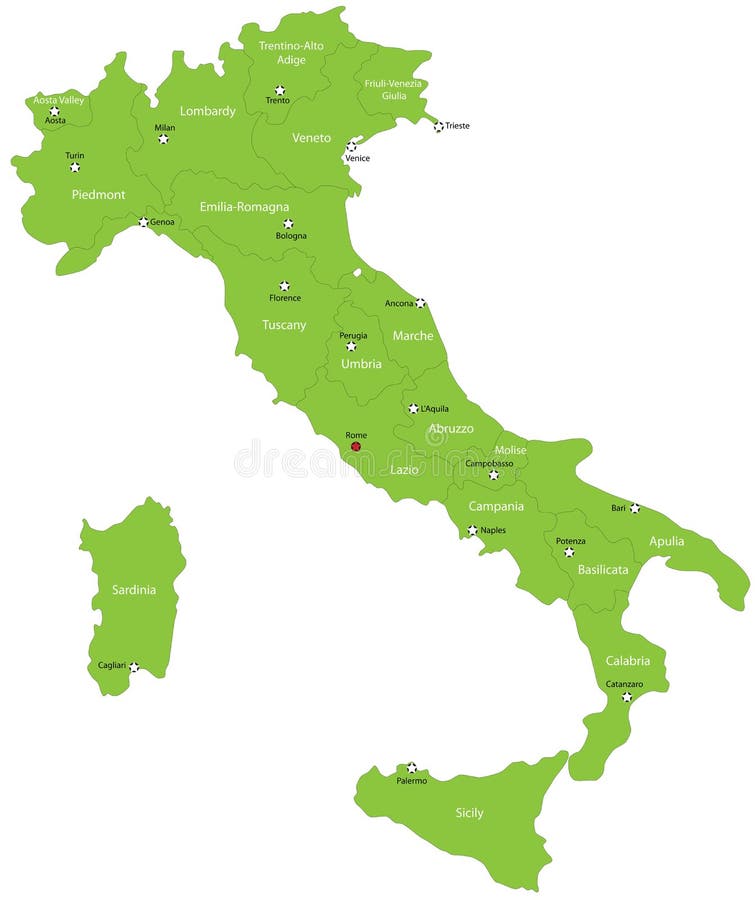
Free with trial Italy map designed in illustration with the 20 regions colored in green colors and with the main cities. Neighbouring countries are in an additional format (. AI) in the latent layer. Map vectors Italy. Map designed in illustration with the 20 regions colored in green colors and with the main cities. Neighbouring countries are in an additional format (. Italy map designed in illustration with the 20 regions colored in green colors and with the main cities. Neighbouring countries are in an additional format (. AI) in the latent layer.
Free with trial Map of Alabama state designed in illustration with the counties and the county seats. Map vectors Alabama state. Map of Alabama state designed in illustration with the counties and the county seats. Map of Alabama state designed in illustration with the counties and the county seats.
Free with trial Michigan state. Map of Michigan state designed in illustration with the counties and the county seats. (Map is hight resolution. Map vectors Michigan state. Map of Michigan state designed in illustration with the counties and the county seats. (Map is hight resolution
Free with trial State of Texas. Colorful illustrated design of the map of Texas (USA), including counties and county seats. Isolated against a white background. Map vectors State of Texas. Colorful illustrated design of the map of Texas (USA), including counties and county seats. Isolated against a white background
Free with trial State of Oregon. Map of Oregon state designed in illustration with the counties and the county seats. (Map is hight resolution. Map vectors State of Oregon. Map of Oregon state designed in illustration with the counties and the county seats. (Map is hight resolution
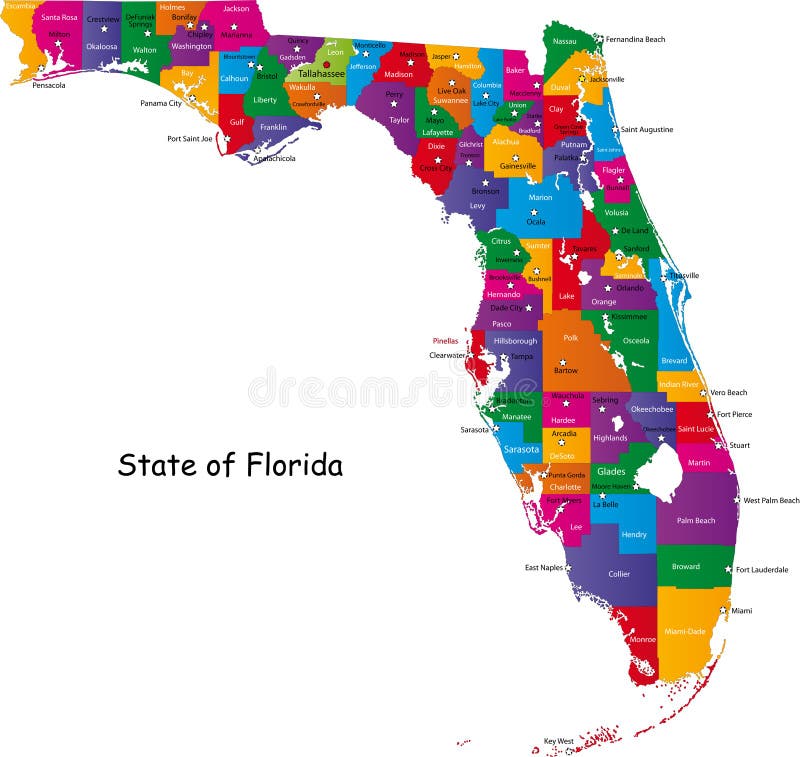
Free with trial State of Florida. Map of Florida state designed in illustration with the counties and the county seats. (Map is hight resolution. Map vectors State of Florida. Map of Florida state designed in illustration with the counties and the county seats. (Map is hight resolution
Free with trial State of Georgia. Map of Georgia state designed in illustration with the counties and the county seats. (Map is hight resolution. Map vectors State of Georgia. Map of Georgia state designed in illustration with the counties and the county seats. (Map is hight resolution
Free with trial Map of Alabama state designed in illustration with the counties and the county seats. Map vectors State of Alabama. Map of Alabama state designed in illustration with the counties and the county seats. Map of Alabama state designed in illustration with the counties and the county seats.
Free with trial State of Illinois. Illustrated design of the map of Illinois (USA), including counties and county seats. Isolated against a white background. Map vectors State of Illinois. Illustrated design of the map of Illinois (USA), including counties and county seats. Isolated against a white background
Free with trial Map of Wisconsin state designed in illustration with the counties and the county seats. (Map is hight resolution). Map vectors State of Wisconsin. Map of Wisconsin state designed in illustration with the counties and the county seats. (Map is hight resolution. Map of Wisconsin state designed in illustration with the counties and the county seats. (Map is hight resolution)
Free with trial A map illustrating the main star constellations. Map vectors Star Constellations. A map illustrating the main star constellations. A map illustrating the main star constellations.
Free with trial Map of South Carolina state designed in illustration with the counties and the county seats. (Map is hight resolution). Map vectors South Carolina state. Map of South Carolina state designed in illustration with the counties and the county seats. (Map is hight resolution. Map of South Carolina state designed in illustration with the counties and the county seats. (Map is hight resolution)
Free with trial Japan. Map designed in illustration with regions colored in bright colors. Vector illustration. Map vectors Japan. Map designed in illustration with regions colored in bright colors. Vector illustration
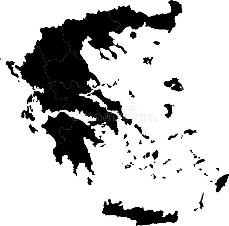
Free with trial Greece. Blind map of Greece with regions borders. Names of the regions, main cities, and neighbouring countries are in an additional format (. AI) in the latent. Map vectors Greece. Blind map of Greece with regions borders. Names of the regions, main cities, and neighbouring countries are in an additional format (.AI) in the latent
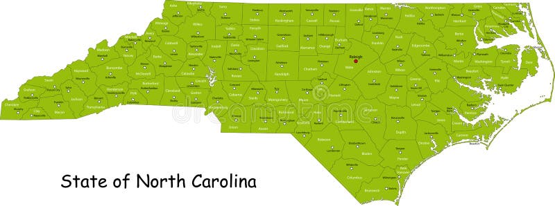
Free with trial Illustrated design of the map of North Carolina (USA), including counties and county seats. Isolated against a white background. Map vectors State of North Carolina. Illustrated design of the map of North Carolina (USA), including counties and county seats. Isolated against a white background. Illustrated design of the map of North Carolina (USA), including counties and county seats. Isolated against a white background.
Free with trial Dinosaur Fossils, Eggs, Bones Skeletons. Dinosaurs map of the world for children and kids. Map vectors Dinosaur Fossils, Eggs, Bones Skeletons. Dinosaurs map of the world for children and kids
Free with trial Province of Canada - Quebec. Administrative division of Canada. Map of Quebec with regions and main cities, vector illustration. Map vectors Province of Canada - Quebec. Administrative division of Canada. Map of Quebec with regions and main cities, vector illustration
Free with trial Administrative division of Canada with regions and main cities. Map vectors Canada map. Administrative division of Canada with regions and main cities. Administrative division of Canada with regions and main cities.
Free with trial Commonwealth of Pennsylvania designed in illustration with the counties and the county seats. (Map is hight resolution). Map vectors Commonwealth of Pennsylvania. Designed in illustration with the counties and the county seats. (Map is hight resolution
Free with trial Commonwealth of Pennsylvania designed in illustration with the counties and the county seats. (Map is hight resolution). Map vectors Commonwealth of Pennsylvania. Designed in illustration with the counties and the county seats. (Map is hight resolution
Free with trial Vector design of famous landmarks in europe on it's map, with eiffel tower, coliseum in rome, london big ben and moscow saint basil's. Map vectors Travel destinations in europe. Vector design of famous landmarks in europe on it's map, with eiffel tower, coliseum in rome, london big ben and moscow saint. Vector design of famous landmarks in europe on it's map, with eiffel tower, coliseum in rome, london big ben and moscow saint basil's
Free with trial Happy Memorial Day. In memory of our heroes. Hand-lettering greeting card with textured sketch of silhouette US map. Vintage typography illustration isolated on white background. Map vectors Happy Memorial Day hand-lettering greeting card. Happy Memorial Day. In memory of our heroes. Hand-lettering greeting card with textured sketch of silhouette US. Happy Memorial Day. In memory of our heroes. Hand-lettering greeting card with textured sketch of silhouette US map. Vintage typography illustration isolated on white background
Free with trial Travel icon set. Of vacation tourism, place, transportation, airplane, car, train, bus, boat, map and money. Map vectors Travel icon set. Of vacation tourism, place, transportation, airplane, car, train, bus, boat, map and money
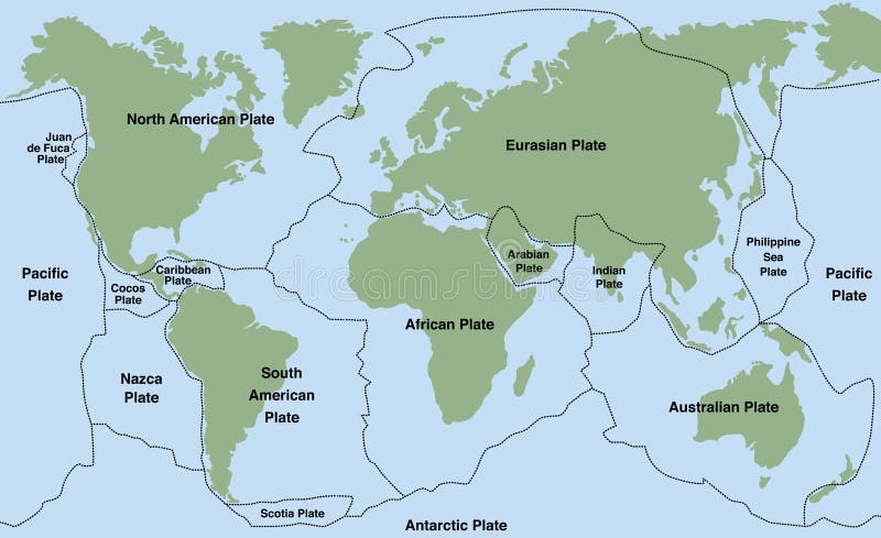
Free with trial Plate tectonics - world map with major an minor plates. Vector illustration. Map vectors Plate Tectonics. World map with major an minor plates. Vector illustration
Free with trial Map of Washington state designed in illustration with the counties and the county seats. (Map is hight resolution). Map vectors State of Washington. Map of Washington state designed in illustration with the counties and the county seats. (Map is hight resolution. Map of Washington state designed in illustration with the counties and the county seats. (Map is hight resolution)
Free with trial Social media chart. Social media mind map with networking concept words. Map vectors Social media chart. Social media mind map with networking concept words
Free with trial Turkey. Map designed in illustration with regions colored in bright colors. Vector illustration. Map vectors Turkey. Map designed in illustration with regions colored in bright colors. Vector illustration
Free with trial Detailed world map with countries, big cities and other labels. Map vectors World map-countries. Detailed world map with countries, big cities and other labels. Detailed world map with countries, big cities and other labels.
Free with trial Route location icon, two map pin sign and road or path, start and end journey symbol, black color vector illustration isolated on white background. Map vectors Route location icon. Two map pin sign and road or path, start and end journey symbol, black color vector illustration isolated on white background
Free with trial Global network World. Global network background. World map point, international meaning. Vector illustration. Map vectors Global network World. Global network background. World map point, international meaning. Vector illustration
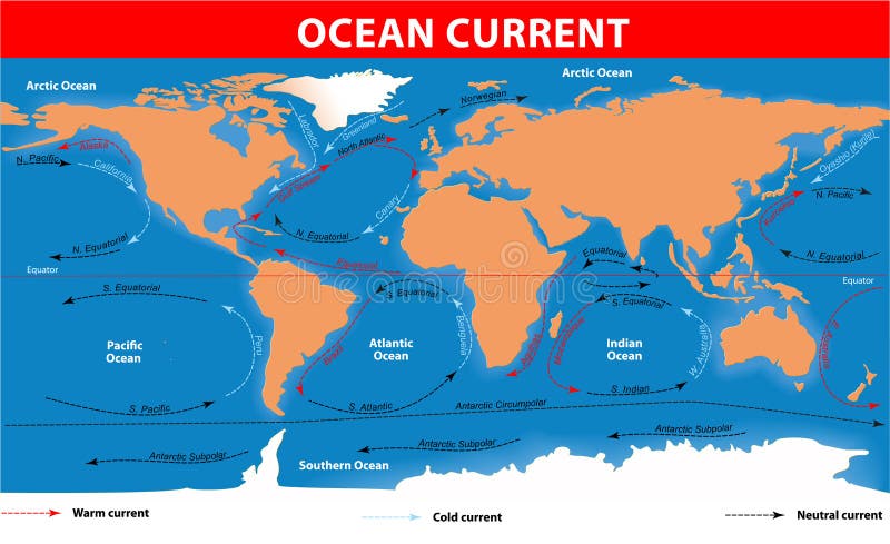
Free with trial Ocean surface currents. The ocean currents. Vector map. Map vectors Ocean surface currents. The ocean currents. Vector map
Free with trial World physical map. Robinson projection, centered on Africa, colored according to elevation, with contour lines, rivers and ocean depths. Isolated on white with clipping path. Fully editable vector version with 22 layers available. Map vectors Globe centered on Africa. World physical map. Robinson projection, centered on Africa, colored according to elevation, with contour lines, rivers and ocean. World physical map. Robinson projection, centered on Africa, colored according to elevation, with contour lines, rivers and ocean depths. Isolated on white with clipping path. Fully editable vector version with 22 layers available.
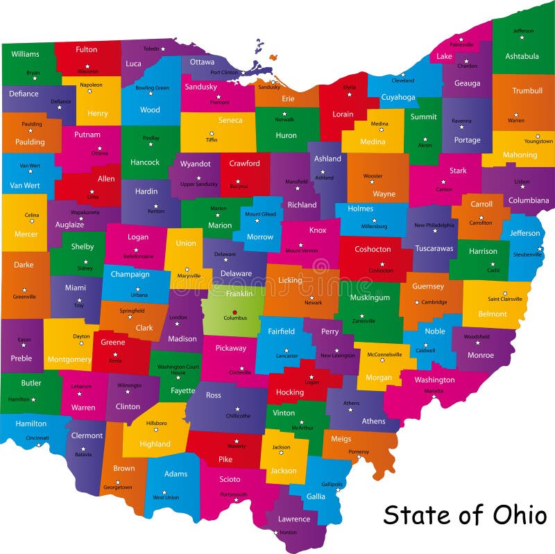
Free with trial Map of Ohio state designed in illustration with the counties and the county seats. Map vectors State of Ohio. Map of Ohio state designed in illustration with the counties and the county seats. Map of Ohio state designed in illustration with the counties and the county seats.
Free with trial Michigan state. Map of Michigan state designed in illustration with the counties and the county seats. (Map is hight resolution. Map vectors Michigan state. Map of Michigan state designed in illustration with the counties and the county seats. (Map is hight resolution
Free with trial California map warning sign. Warning sign in shape of California on blue illustration. Map vectors California map warning sign. Warning sign in shape of California on blue illustration
Free with trial Set of treetop symbols, for architectural or landscape design, for map, vector. Map vectors Set of treetop symbols, for architectural or landscape design. For map, vector
Free with trial New Jersey State by counties. Vector map of New Jersey State by counties. Map vectors New Jersey State by counties. Vector map of New Jersey State by counties
Free with trial State of Nevada. Map of Nevada state designed in illustration with the counties and the county seats. (Map is hight resolution. Map vectors State of Nevada. Map of Nevada state designed in illustration with the counties and the county seats. (Map is hight resolution
Free with trial Green tree World Atlas. Vector clip art of an ecology green world atlas map, growing a strong, green tree. Map vectors Green tree World Atlas. Vector clip art of an ecology green world atlas map, growing a strong, green tree
Free with trial New Jersey state designed in illustration with the counties and the county seats. (Map is hight resolution). Map vectors New Jersey state. Designed in illustration with the counties and the county seats. (Map is hight resolution
Free with trial State of Florida. Map of Florida state designed in illustration with the counties and the county seats. (Map is hight resolution. Map vectors State of Florida. Map of Florida state designed in illustration with the counties and the county seats. (Map is hight resolution
Free with trial State of Georgia. Map of Georgia state designed in illustration with the counties and the county seats. (Map is hight resolution. Map vectors State of Georgia. Map of Georgia state designed in illustration with the counties and the county seats. (Map is hight resolution
Free with trial State of Virginia. Colorful illustrated design of the map of Virginia (USA), including counties and county seats. Isolated against a white background. Map vectors State of Virginia. Colorful illustrated design of the map of Virginia (USA), including counties and county seats. Isolated against a white background
Free with trial State of New York designed in illustration with the counties and the main cities. (Map is hight resolution). Map vectors State of New York. Designed in illustration with the counties and the main cities. (Map is hight resolution
Free with trial State of New York designed in illustration with the counties and the main cities. (Map is hight resolution). Map vectors State of New York. Designed in illustration with the counties and the main cities. (Map is hight resolution
Free with trial Map of Washington state designed in illustration with the counties and the county seats. (Map is hight resolution). Map vectors Stae of Washington. Map of Washington state designed in illustration with the counties and the county seats. (Map is hight resolution. Map of Washington state designed in illustration with the counties and the county seats. (Map is hight resolution)
Free with trial Map of Wisconsin state designed in illustration with the counties and the county seats. (Map is hight resolution). Map vectors State of Wisconsin. Map of Wisconsin state designed in illustration with the counties and the county seats. (Map is hight resolution. Map of Wisconsin state designed in illustration with the counties and the county seats. (Map is hight resolution)
Free with trial Map of Minnesota state designed in illustration with the counties and the county seats. Map vectors State of Minnesota. Map of Minnesota state designed in illustration with the counties and the county seats. Map of Minnesota state designed in illustration with the counties and the county seats.
Free with trial New Jersey state designed in illustration with the counties and the county seats. (Map is hight resolution). Map vectors State of New Jersey. New Jersey state designed in illustration with the counties and the county seats. (Map is hight resolution. New Jersey state designed in illustration with the counties and the county seats. (Map is hight resolution)
Free with trial Map of South Carolina state designed in illustration with the counties and the county seats. (Map is hight resolution). Map vectors South Carolina state. Map of South Carolina state designed in illustration with the counties and the county seats. (Map is hight resolution. Map of South Carolina state designed in illustration with the counties and the county seats. (Map is hight resolution)
 Sign in