Free with trial Coronavirus poster set with infographics elements. Novel coronavirus 2019-nCoV banners. Concept of dangerous Covid-19 pandemic. Vector illustration. Map vectors Coronavirus poster set with infographics elements. Novel coronavirus 2019-nCoV banners. Concept of dangerous Covid-19 pandemic. Vector illustration
Free with trial Vector illustration of button flags of the 27 members of the European Union as of 2008 plus NATO and the EU. Coupled with national maps. Map vectors European union modern style flags with maps. Vector illustration of button flags of the 27 members of the European Union as of 2008 plus NATO and the EU. Coupled. Vector illustration of button flags of the 27 members of the European Union as of 2008 plus NATO and the EU. Coupled with national maps.
Free with trial Facebook Instagram Twitter Google applications logo, Youtube, Line, Reddit, Weibo, Qzone - popular social media, messengers, message passing, post, internet services. Kyiv, Ukraine - April 12, 2020. Map vectors Facebook Instagram Twitter Google applications logo, Youtube, Line, Reddit, Weibo, Qzone - popular social media, messengers,. Message passing, post, internet. Facebook Instagram Twitter Google applications logo, Youtube, Line, Reddit, Weibo, Qzone - popular social media, messengers, message passing, post, internet services. Kyiv, Ukraine - April 12, 2020.
Free with trial Happy New Year digital web banner template with futuristic glowing low polygonal 2021 number and Earth globe hanging on a ribbon bow on dark blue background. Map vectors Happy New Year digital web banner with futuristic 2021 number and Earth globe hanging on ribbon bow. Happy New Year digital web banner template with futuristic. Happy New Year digital web banner template with futuristic glowing low polygonal 2021 number and Earth globe hanging on a ribbon bow on dark blue background.
Free with trial RIO Summer abstract landscape. Olympiad Sports competition Games wallpaper. Summer Olympi world Paraly Games sport in Brazil Colorful Illustration. Abstract sun, mountain, trees, sky and clouds, green grass, sea waves, Brazil. Vector Illustration. For Art, Print, web design. Map vectors Rio Olympi sports athletics images athlete Game Sports abstract wallpaper poster banner template brochure cover. RIO Summer abstract landscape. Olympiad Sports. RIO Summer abstract landscape. Olympiad Sports competition Games wallpaper. Summer Olympi world Paraly Games sport in Brazil Colorful Illustration. Abstract sun, mountain, trees, sky and clouds, green grass, sea waves, Brazil. Vector Illustration. For Art, Print, web design.
Free with trial Europe championship Soccer abstract blue background with sport symbols. Euro 2016 France football championship pattern blue color sports football game tournament elements shapes lines soccer ball gate goal field doodle. Vector Illustration. For Art, Print, Web design. 2025, 2026 2027 UEFA world cup navy blue color. Map vectors Championship soccer 2027 uefa blue wallpaper pattern background template. Europe championship Soccer abstract blue background with sport symbols. Euro 2016. Europe championship Soccer abstract blue background with sport symbols. Euro 2016 France football championship pattern blue color sports football game tournament elements shapes lines soccer ball gate goal field doodle. Vector Illustration. For Art, Print, Web design. 2025, 2026 2027 UEFA world cup navy blue color
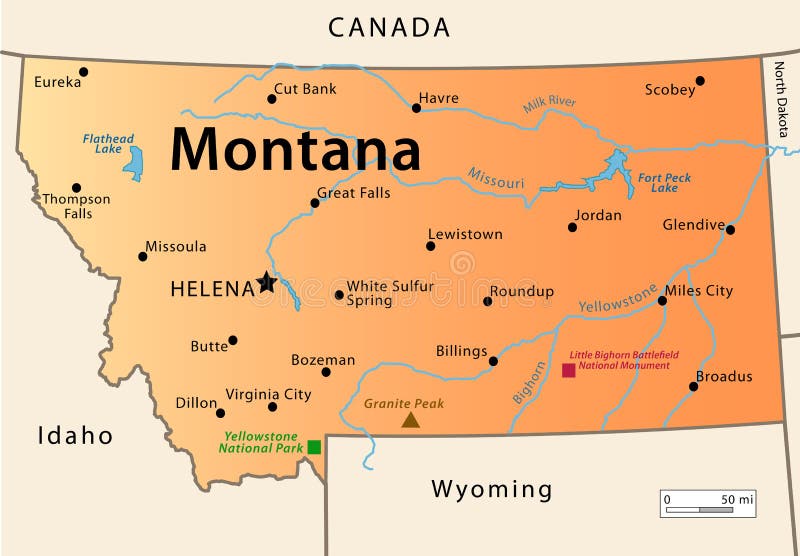
Free with trial Montana Map. Illustration of the map of the Great State of Montana, USA. Featuring its main cities, rivers, lakes and the highest peak of the state. Map vectors Montana Map. Illustration of the map of the Great State of Montana, USA. Featuring its main cities, rivers, lakes and the highest peak of the state
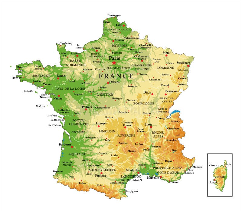
Free with trial Highly detailed physical map of France, in vector format, with all the relief forms, regions and big cities. Map vectors France physical map. Highly detailed physical map of France, in vector format, with all the relief forms, regions and big cities. Highly detailed physical map of France, in vector format, with all the relief forms, regions and big cities.
Free with trial Colorful Classic Robinson projection vector map of the World, cleverly layered and with names of all countries, capitals and main cities, main geographical features. Map vectors Robinson projection map of the World. Colorful Classic Robinson projection vector map of the World, cleverly layered and with names of all countries, capitals. Colorful Classic Robinson projection vector map of the World, cleverly layered and with names of all countries, capitals and main cities, main geographical features.
Free with trial Political map of Africa in vector. Map vectors Africa political map. Political map of Africa in vector. Political map of Africa in vector.
Free with trial USA map. Vector illustration on white background. Map vectors USA map. Vector illustration on white background
Free with trial World map. And binary code abstract background. Map vectors World map. And binary code abstract background
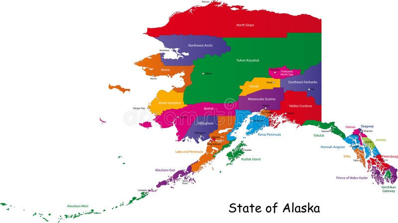
Free with trial Alaska map. Colorful illustrated design of the map of Alaska (USA), including counties and county seats. Isolated against a white background. Map vectors Alaska map. Colorful illustrated design of the map of Alaska (USA), including counties and county seats. Isolated against a white background
Free with trial Hungary map designed in illustration with the regions colored in green colors and with the main cities. Neighbouring countries are in an additional format (. AI) in the latent layer. Map vectors Hungary map. Designed in illustration with the regions colored in green colors and with the main cities. Neighbouring countries are in an additional format (.AI
Free with trial Map of Japan. Japan map designed in illustration with regions colored in bright colors. Vector illustration. Map vectors Map of Japan. Japan map designed in illustration with regions colored in bright colors. Vector illustration
Free with trial Illustration of a detailed political map of Montenegro. Map vectors Montenegro map. Illustration of a detailed political map of Montenegro. Illustration of a detailed political map of Montenegro.
Free with trial El Salvador map designed in illustration with the regions colored in bright colors and with the main cities. Map vectors El Salvador map. Designed in illustration with the regions colored in bright colors and with the main cities
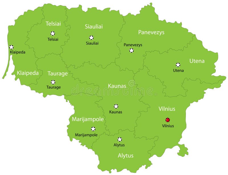
Free with trial Lithuania map designed in illustration with the 10 counties colored in green colors and with the main cities. Neighbouring countries are in an additional format (. AI) in the latent layer. Map vectors Vector Lithuania map. Lithuania map designed in illustration with the 10 counties colored in green colors and with the main cities. Neighbouring countries are in. Lithuania map designed in illustration with the 10 counties colored in green colors and with the main cities. Neighbouring countries are in an additional format (.AI) in the latent layer.
Free with trial Sky map. Vector sky map, constellations and stars on dark background. Map vectors Sky map. Vector sky map, constellations and stars on dark background
Free with trial Morocco map. Kingdom of Morocco map designed in illustration with the regions and main cities. Map vectors Morocco map. Kingdom of Morocco map designed in illustration with the regions and main cities
Free with trial World Map. A simple vector map of the World - Blue color. Map vectors World Map. A simple vector map of the World - Blue color
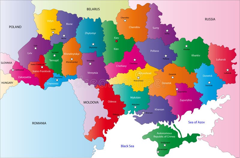
Free with trial Map of Ukraine with the regions colored in bright colors and the main cities. Map vectors Map of Ukraine. With the regions colored in bright colors and the main cities
Free with trial Yellow Bee Vector Map, Icon, Logo, Logo Icon Design. Cartoon. Map vectors Yellow Bee Vector Map, Icon, Logo. Logo Icon Design.Cartoon
Free with trial World map blue. Blue and white Illustrated world map with white background. Map vectors World map blue. Blue and white Illustrated world map with white background
Free with trial Weather system map. Editable vector illustration of an angled generic weather system map. Map vectors Weather system map. Editable vector illustration of an angled generic weather system map
Free with trial Map of European Union with 27 member states. Each member state is filled with blue, each capital is displayed as a yellow star. Other states are grey. Map vectors European Union Map. Map of European Union with 27 member states. Each member state is filled with blue, each capital is displayed as a yellow star. Other states. Map of European Union with 27 member states. Each member state is filled with blue, each capital is displayed as a yellow star. Other states are grey.
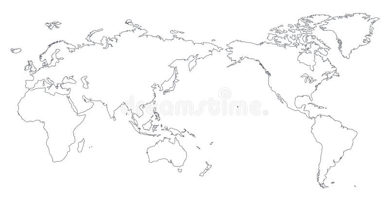
Free with trial World Map Outline Contour Silhouette - Asia in Center. Map vectors World Map Outline Contour Silhouette. Asia in Center
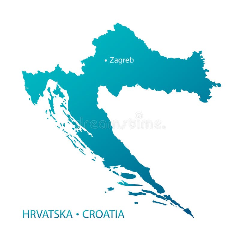
Free with trial Highly detailed Croatia map with islands, capital city Zagreb, names of Country in Croatian and international. Blue gradient object, isolated background, file. Map vectors Croatia map highly detailed blue vector. Highly detailed Croatia map with islands, capital city Zagreb, names of Country in Croatian and international. Blue. Highly detailed Croatia map with islands, capital city Zagreb, names of Country in Croatian and international. Blue gradient object, isolated background, file
Free with trial Germany Political Map with capital Berlin, national borders, most important cities, rivers and lakes. English labeling and scaling. Illustration. Map vectors Germany Political Map. With capital Berlin, national borders, most important cities, rivers and lakes. English labeling and scaling. Illustration
Free with trial United states map of states. All the 50 states of united states of america as maps isolated and forming map of the federation. Map vectors United states map of states. All the 50 states of united states of america as maps isolated and forming map of the federation
Free with trial Hong Kong travel map. Lovely Hong Kong travel map design in flat design. Map vectors Hong Kong travel map. Lovely Hong Kong travel map design in flat design
Free with trial Laos map designed in illustration with the regions and provinces with the main cities. (Map is hight resolution). Map vectors Laos map. Designed in illustration with the regions and provinces with the main cities. (Map is hight resolution
Free with trial Site Map. A diagram illustrates visually the map of a site with all pages stemming from the home/index page. Map vectors Site Map. A diagram illustrates visually the map of a site with all pages stemming from the home/index page
Free with trial World map. Extra detailed map of the world illustration. Map vectors World map. Extra detailed map of the world illustration
Free with trial World map. Illustration with grids - vector. Map vectors World map. Illustration with grids - vector
Free with trial World map. Illustration with grids - vector. Map vectors World map. Illustration with grids - vector
Free with trial World map. Illustration abstract background. Map vectors World map. Illustration abstract background
Free with trial World map. And binary code abstract background. Map vectors World map. And binary code abstract background
Free with trial World map. And binary code abstract background. Map vectors World map. And binary code abstract background
Free with trial World map. And binary code abstract background. Map vectors World map. And binary code abstract background
Free with trial World map. Illustration abstract background. Map vectors World map. Illustration abstract background
Free with trial World map. And binary code abstract background. Map vectors World map. And binary code abstract background
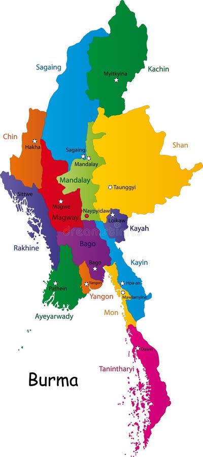
Free with trial Burma map designed in illustration with the provinces and the main cities. (Map is hight resolution). Map vectors Burma map. Designed in illustration with the provinces and the main cities. (Map is hight resolution
Free with trial A simple illustration of a simple world map. Map vectors World Map. A simple illustration of a simple world map. A simple illustration of a simple world map.
Free with trial World map. Illustration abstract background. Map vectors World map. Illustration abstract background
Free with trial Map world. Abstract background map of the world. Map vectors Map world. Abstract background map of the world
Free with trial World map. Illustration abstract background. Map vectors World map. Illustration abstract background
Free with trial World map. Illustration abstract background. Map vectors World map. Illustration abstract background
Free with trial World map. Illustration with grids in soft colour - vector. Map vectors World map. Illustration with grids in soft colour - vector
Free with trial World map. And binary code abstract background. Map vectors World map. And binary code abstract background
Free with trial World map. Illustration abstract background. Map vectors World map. Illustration abstract background
Free with trial World map. Illustration with grids - black and white. Map vectors World map. Illustration with grids - black and white
Free with trial Paraguay map designed in illustration with the provinces and the main cities. (Map is hight resolution). Map vectors Paraguay map. Designed in illustration with the provinces and the main cities. (Map is hight resolution
Free with trial Morocco map. Kingdom of Morocco map designed in illustration with the regions and main cities. Map vectors Morocco map. Kingdom of Morocco map designed in illustration with the regions and main cities
Free with trial Ecuador map. Vector color map of Ecuador country. Map vectors Ecuador map. Vector color map of Ecuador country
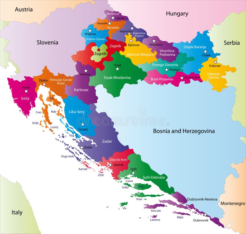
Free with trial Croatia map. Designed in illustration with regions colored in bright colors. Vector illustration. Map vectors Croatia map. Designed in illustration with regions colored in bright colors. Vector illustration
Free with trial Tunisia map. Designed in illustration with the regions and main cities. Map vectors Tunisia map. Designed in illustration with the regions and main cities
Free with trial Map symbols. Vector map symbols on white background. Map vectors Map symbols. Vector map symbols on white background
Free with trial Central Europe Map. Blue Central Europe Map in vectors. Map vectors Central Europe Map. Blue Central Europe Map in vectors
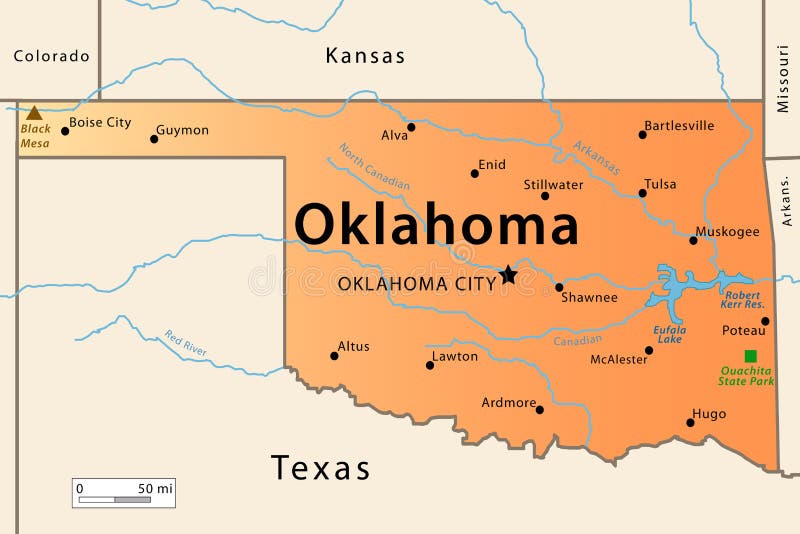
Free with trial Oklahoma Map. Illustration of the map of the Great State of Oklahoma , USA. Featuring its main cities, rivers, lakes and the highest peak of the state. Map vectors Oklahoma Map. Illustration of the map of the Great State of Oklahoma , USA. Featuring its main cities, rivers, lakes and the highest peak of the state
Free with trial Combodia map designed in illustration with the provinces and the main cities. Map vectors Combodia map. Designed in illustration with the provinces and the main cities
Free with trial Mongolia map. Designed in illustration with administrative divisions and his capitals. Map vectors Mongolia map. Designed in illustration with administrative divisions and his capitals
Free with trial Greenland map designed in illustration with the main cities. (Map is high resolution). Map vectors Greenland map. Designed in illustration with the main cities. (Map is high resolution
Free with trial Russian Federation designed in illustration with the regions (Map is hight resolution). Map vectors Map of Russia. Russian Federation designed in illustration with the regions (Map is hight resolution. Russian Federation designed in illustration with the regions (Map is hight resolution)
Free with trial Guatemala map designed in illustration with the regions colored in bright colors and with the main cities. Map vectors Guatemala map. Designed in illustration with the regions colored in bright colors and with the main cities
Free with trial A simple illustration of an old world map. Map vectors Old World Map. A simple illustration of an old world map. A simple illustration of an old world map.
Free with trial Ukraine map designed in illustration with the region colored in bright colors and with the main cities. On an illustration neighbouring countries are shown too. Map vectors Map of Ukraine. Ukraine map designed in illustration with the region colored in bright colors and with the main cities. On an illustration neighbouring countries. Ukraine map designed in illustration with the region colored in bright colors and with the main cities. On an illustration neighbouring countries are shown too
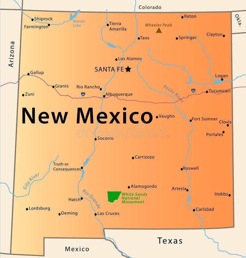
Free with trial Illustration of the map of the Great State of New Mexico, USA. Featuring rivers, the highest peak of the state, the route 66, White Sands National Park and main cities. Map vectors New Mexico Map. Illustration of the map of the Great State of New Mexico, USA. Featuring rivers, the highest peak of the state, the route 66, White Sands. Illustration of the map of the Great State of New Mexico, USA. Featuring rivers, the highest peak of the state, the route 66, White Sands National Park and main cities.
Free with trial Costa Rica map designed in illustration with the states colored in bright colors and with the main cities. On an illustration neighbouring countries are shown too. Map vectors Costa Rica map. Designed in illustration with the states colored in bright colors and with the main cities. On an illustration neighbouring countries are shown
Free with trial Iceland map designed in illustration with provinces colored in bright colors and with the main cities. Neighbouring countries are in an additional format (. AI) in the latent layer. Map vectors Map of Iceland. Iceland map designed in illustration with provinces colored in bright colors and with the main cities. Neighbouring countries are in an. Iceland map designed in illustration with provinces colored in bright colors and with the main cities. Neighbouring countries are in an additional format (.AI) in the latent layer.
Free with trial Iceland map designed in illustration with provinces colored in green colors and with the main cities. Neighbouring countries are in an additional format (. AI) in the latent layer. Map vectors Map of Iceland. Iceland map designed in illustration with provinces colored in green colors and with the main cities. Neighbouring countries are in an additional. Iceland map designed in illustration with provinces colored in green colors and with the main cities. Neighbouring countries are in an additional format (.AI) in the latent layer.
Free with trial City map, Vector illustration. Map vectors City map, Vector illustration. City map image, Vector illustration
Free with trial Honduras map designed in illustration with the regions colored in green and with the main cities. Map vectors Map of Honduras. Honduras map designed in illustration with the regions colored in green and with the main cities. Honduras map designed in illustration with the regions colored in green and with the main cities.
Free with trial A map of the Australian continent with islands and countries which surround continent. Map vectors Map of Australia. A map of the Australian continent with islands and countries which surround continent. A map of the Australian continent with islands and countries which surround continent.
Free with trial World Map Vector. World map demographic abstract background. Map vectors World Map Vector. World map demographic abstract background
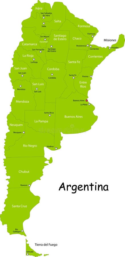
Free with trial Argentina map designed in illustration with states colored in green colors and with the main cities. Neighbouring countries are in an additional format (. AI) in the latent layer. Map vectors Map of Argentina. Argentina map designed in illustration with states colored in green colors and with the main cities. Neighbouring countries are in an. Argentina map designed in illustration with states colored in green colors and with the main cities. Neighbouring countries are in an additional format (.AI) in the latent layer.
Free with trial World map dynamic. Abstract background. Map vectors World map dynamic. Abstract background
Free with trial Location on a map. Icon of location and map on white. Map vectors Location on a map. Icon of location and map on white
Free with trial Squared world map. A squared world map - vector. Map vectors Squared world map. A squared world map - vector
 Sign in