Free with trial Black flat blank highlighted location map of the YORK regional municipality inside gray administrative map of the Canadian province of Ontario, Canada. Maple map vectors Locator map of the YORK regional municipality. Black flat blank highlighted location map of the YORK regional municipality inside gray administrative map of the. Black flat blank highlighted location map of the YORK regional municipality inside gray administrative map of the Canadian province of Ontario, Canada
Free with trial Black flat blank highlighted location map of the LA VALLÉE-DU-RICHELIEU Regional County Municipality inside gray administrative map of Montérégie, Quebec, Canada. Maple map vectors Locator map of the LA VALLÉE-DU-RICHELIEU Municipality. Black flat blank highlighted location map of the LA VALLÉE-DU-RICHELIEU Regional County Municipality. Black flat blank highlighted location map of the LA VALLÉE-DU-RICHELIEU Regional County Municipality inside gray administrative map of Montérégie, Quebec, Canada
Free with trial Black flat blank highlighted location map of the QIKIQTAALUK-BAFFIN Region inside gray administrative map of the Canadian territory of Nunavut, Canada. Maple map vectors Location map of the QIKIQTAALUK-BAFFIN Region. Black flat blank highlighted location map of the QIKIQTAALUK-BAFFIN Region inside gray administrative map of the. Black flat blank highlighted location map of the QIKIQTAALUK-BAFFIN Region inside gray administrative map of the Canadian territory of Nunavut, Canada
Free with trial Canada map with waving flag of country. Vector illustration. Maple map vectors Canada map with waving flag of country. Vector illustration
Free with trial Gray flat blank vector administrative map of Canadian province of SASKATCHEWAN, CANADA with white border lines of its rural and urban districts. Maple map vectors Gray administrative map of SASKATCHEWAN, CANADA. Gray flat blank vector administrative map of Canadian province of SASKATCHEWAN, CANADA with white border lines. Gray flat blank vector administrative map of Canadian province of SASKATCHEWAN, CANADA with white border lines of its rural and urban districts
Free with trial Canada Maple Leaf Flag 3D Red and White Flag in wide circle and rectangle Icon Set. Maple map vectors Canada Maple Leaf Flag 3D Red and White Flag in wide circle and rectangle Icon Set. Canada Maple Leaf Flag 3D Red and White Flag in wide circle and rectangle
Free with trial White flat blank vector administrative map of GREATER TORONTO AREA, ONTARIO, CANADA with black border lines of its regions. Maple map vectors White map of regions of GREATER TORONTO AREA, ONTARIO, CANADA. White flat blank vector administrative map of GREATER TORONTO AREA, ONTARIO, CANADA with black. White flat blank vector administrative map of GREATER TORONTO AREA, ONTARIO, CANADA with black border lines of its regions
Free with trial Black flat blank highlighted location map of the KITIMAT–STIKINE regional district inside gray administrative map of the Canadian province of British Columbia, Canada. Maple map vectors Locator map of the KITIMAT–STIKINE regional district. Black flat blank highlighted location map of the KITIMAT–STIKINE regional district inside gray. Black flat blank highlighted location map of the KITIMAT–STIKINE regional district inside gray administrative map of the Canadian province of British Columbia, Canada
Free with trial Black flat blank highlighted location map of the THOMPSON–NICOLA regional district inside gray administrative map of the Canadian province of British Columbia, Canada. Maple map vectors Locator map of the THOMPSON–NICOLA regional district. Black flat blank highlighted location map of the THOMPSON–NICOLA regional district inside gray. Black flat blank highlighted location map of the THOMPSON–NICOLA regional district inside gray administrative map of the Canadian province of British Columbia, Canada
Free with trial Black flat blank highlighted location map of the LENNOX AND ADDINGTON COUNTY inside gray administrative map of the Canadian province of Ontario, Canada. Maple map vectors Locator map of the LENNOX AND ADDINGTON COUNTY. Black flat blank highlighted location map of the LENNOX AND ADDINGTON COUNTY inside gray administrative map of. Black flat blank highlighted location map of the LENNOX AND ADDINGTON COUNTY inside gray administrative map of the Canadian province of Ontario, Canada
Free with trial Black flat blank highlighted location map of the IQALUIT-MANIRAJAK District inside gray administrative map of the territorial electoral districts of Canadian territory of Nunavut, Canada. Maple map vectors Location map of the IQALUIT-MANIRAJAK District. Black flat blank highlighted location map of the IQALUIT-MANIRAJAK District inside gray administrative map of the. Black flat blank highlighted location map of the IQALUIT-MANIRAJAK District inside gray administrative map of the territorial electoral districts of Canadian territory of Nunavut, Canada
Free with trial Black flat blank highlighted location map of the VICTORIA COUNTY inside gray administrative map of counties of Canadian province of Nova Scotia, Canada. Maple map vectors Locator map of the VICTORIA COUNTY. Black flat blank highlighted location map of the VICTORIA COUNTY inside gray administrative map of counties of Canadian. Black flat blank highlighted location map of the VICTORIA COUNTY inside gray administrative map of counties of Canadian province of Nova Scotia, Canada
Free with trial Black flat blank highlighted location map of the VICTORIA COUNTY inside gray administrative map of counties of Canadian territory of New Brunswick, Canada. Maple map vectors Locator map of the VICTORIA COUNTY. Black flat blank highlighted location map of the VICTORIA COUNTY inside gray administrative map of counties of Canadian. Black flat blank highlighted location map of the VICTORIA COUNTY inside gray administrative map of counties of Canadian territory of New Brunswick, Canada
Free with trial White flat blank vector administrative map of Canadian province of SASKATCHEWAN, CANADA with black border lines of its rural and urban districts. Maple map vectors White administrative map of SASKATCHEWAN, CANADA. White flat blank vector administrative map of Canadian province of SASKATCHEWAN, CANADA with black border lines. White flat blank vector administrative map of Canadian province of SASKATCHEWAN, CANADA with black border lines of its rural and urban districts
Free with trial White flat blank vector administrative map of the regions of Canadian province of QUEBEC, CANADA with black border lines of its regions. Maple map vectors White map of regions of QUEBEC, CANADA. White flat blank vector administrative map of the regions of Canadian province of QUEBEC, CANADA with black border lines. White flat blank vector administrative map of the regions of Canadian province of QUEBEC, CANADA with black border lines of its regions
Free with trial Black flat blank highlighted location map of the HALTON regional municipality inside gray administrative map of the Canadian province of Ontario, Canada. Maple map vectors Locator map of the HALTON regional municipality. Black flat blank highlighted location map of the HALTON regional municipality inside gray administrative map of. Black flat blank highlighted location map of the HALTON regional municipality inside gray administrative map of the Canadian province of Ontario, Canada
Free with trial Black flat blank highlighted location map of the DURHAM regional municipality inside gray administrative map of the Canadian province of Ontario, Canada. Maple map vectors Locator map of the DURHAM regional municipality. Black flat blank highlighted location map of the DURHAM regional municipality inside gray administrative map of. Black flat blank highlighted location map of the DURHAM regional municipality inside gray administrative map of the Canadian province of Ontario, Canada
Free with trial Greater Toronto map. Isolated on white background. Maple map vectors Greater Toronto map. Isolated on white background
Free with trial Greater Toronto map. Isolated on white background. Maple map vectors Greater Toronto map. Isolated on white background
Free with trial Black flat blank highlighted location map of the STRATHCONA regional district inside gray administrative map of the Canadian province of British Columbia, Canada. Maple map vectors Locator map of the STRATHCONA regional district. Black flat blank highlighted location map of the STRATHCONA regional district inside gray administrative map of. Black flat blank highlighted location map of the STRATHCONA regional district inside gray administrative map of the Canadian province of British Columbia, Canada
Free with trial Black flat blank highlighted location map of the COLUMBIA–SHUSWAP regional district inside gray administrative map of the Canadian province of British Columbia, Canada. Maple map vectors Locator map of the COLUMBIA–SHUSWAP regional district. Black flat blank highlighted location map of the COLUMBIA–SHUSWAP regional district inside gray. Black flat blank highlighted location map of the COLUMBIA–SHUSWAP regional district inside gray administrative map of the Canadian province of British Columbia, Canada
Free with trial White flat blank vector administrative map of MONTÉRÉGIE, QUEBEC, CANADA with black border lines of its municipalities. Maple map vectors White map of municipalities of MONTÉRÉGIE, QUEBEC, CANADA. White flat blank vector administrative map of MONTÉRÉGIE, QUEBEC, CANADA with black border lines. White flat blank vector administrative map of MONTÉRÉGIE, QUEBEC, CANADA with black border lines of its municipalities
Free with trial Black flat blank highlighted location map of the LES MASKOUTAINS Regional County Municipality inside gray administrative map of Montérégie, Quebec, Canada. Maple map vectors Locator map of the LES MASKOUTAINS Municipality. Black flat blank highlighted location map of the LES MASKOUTAINS Regional County Municipality inside gray. Black flat blank highlighted location map of the LES MASKOUTAINS Regional County Municipality inside gray administrative map of Montérégie, Quebec, Canada
Free with trial Black flat blank highlighted location map of the RANKIN INLET SOUTH District inside gray administrative map of the territorial electoral districts of Canadian territory of Nunavut, Canada. Maple map vectors Location map of the RANKIN INLET SOUTH District. Black flat blank highlighted location map of the RANKIN INLET SOUTH District inside gray administrative map of. Black flat blank highlighted location map of the RANKIN INLET SOUTH District inside gray administrative map of the territorial electoral districts of Canadian territory of Nunavut, Canada
Free with trial Black flat blank highlighted location map of the IQALUIT-NIAQUNNGUU District inside gray administrative map of the territorial electoral districts of Canadian territory of Nunavut, Canada. Maple map vectors Location map of the IQALUIT-NIAQUNNGUU District. Black flat blank highlighted location map of the IQALUIT-NIAQUNNGUU District inside gray administrative map of. Black flat blank highlighted location map of the IQALUIT-NIAQUNNGUU District inside gray administrative map of the territorial electoral districts of Canadian territory of Nunavut, Canada
Free with trial Gray flat blank vector administrative map of the municipalities of GREATER TORONTO AREA, ONTARIO, CANADA with white border lines of its regions. Maple map vectors Gray map of regions of GREATER TORONTO AREA, ONTARIO, CANADA. Gray flat blank vector administrative map of the municipalities of GREATER TORONTO AREA, ONTARIO. Gray flat blank vector administrative map of the municipalities of GREATER TORONTO AREA, ONTARIO, CANADA with white border lines of its regions
Free with trial Pastel flat vector administrative map of the Canadian province of NOVA SCOTIA, CANADA with black border lines and name tags of its counties. Maple map vectors Pastel tagged map of counties of NOVA SCOTIA, CANADA. Pastel flat vector administrative map of the Canadian province of NOVA SCOTIA, CANADA with black border. Pastel flat vector administrative map of the Canadian province of NOVA SCOTIA, CANADA with black border lines and name tags of its counties
Free with trial Gray flat blank vector administrative map of the regions of Canadian territory of NORTHWEST TERRITORIES, CANADA with white border lines of its regions. Maple map vectors Gray map of regions of NORTHWEST TERRITORIES, CANADA. Gray flat blank vector administrative map of the regions of Canadian territory of NORTHWEST TERRITORIES. Gray flat blank vector administrative map of the regions of Canadian territory of NORTHWEST TERRITORIES, CANADA with white border lines of its regions
Free with trial Black flat blank highlighted location map of the EAST GWILLIMBURY MUNICIPALITY inside gray administrative map of Greater Toronto Area. Maple map vectors Locator map of the EAST GWILLIMBURY MUNICIPALITY. Black flat blank highlighted location map of the EAST GWILLIMBURY MUNICIPALITY inside gray administrative map. Black flat blank highlighted location map of the EAST GWILLIMBURY MUNICIPALITY inside gray administrative map of Greater Toronto Area
Free with trial White flat vector administrative map of Canadian province of QUEBEC, CANADA with black border lines and name tags of its municipalities, counties and districts. Maple map vectors White tagged administrative map of QUEBEC, CANADA. White flat vector administrative map of Canadian province of QUEBEC, CANADA with black border lines and name. White flat vector administrative map of Canadian province of QUEBEC, CANADA with black border lines and name tags of its municipalities, counties and districts
Free with trial Black flat blank highlighted location map of the NIAGARA regional municipality inside gray administrative map of the Canadian province of Ontario, Canada. Maple map vectors Locator map of the NIAGARA regional municipality. Black flat blank highlighted location map of the NIAGARA regional municipality inside gray administrative map. Black flat blank highlighted location map of the NIAGARA regional municipality inside gray administrative map of the Canadian province of Ontario, Canada
Free with trial Black flat blank highlighted location map of the MUSKOKA district municipality inside gray administrative map of the Canadian province of Ontario, Canada. Maple map vectors Locator map of the MUSKOKA district municipality. Black flat blank highlighted location map of the MUSKOKA district municipality inside gray administrative map. Black flat blank highlighted location map of the MUSKOKA district municipality inside gray administrative map of the Canadian province of Ontario, Canada
Free with trial Black flat blank highlighted location map of the BROME-MISSISQUOI Regional County Municipality inside gray administrative map of Montérégie, Quebec, Canada. Maple map vectors Locator map of the BROME-MISSISQUOI Municipality. Black flat blank highlighted location map of the BROME-MISSISQUOI Regional County Municipality inside gray. Black flat blank highlighted location map of the BROME-MISSISQUOI Regional County Municipality inside gray administrative map of Montérégie, Quebec, Canada
Free with trial Maple leaf canada online service logo design concept. Maple map vectors Cursor and maple leaf logo design. Maple leaf canada online service logo design concept. Maple leaf canada online service logo design concept.
Free with trial Gray flat blank vector administrative map of counties of Canadian province of PRINCE EDWARD ISLAND, CANADA with white border lines of its counties. Maple map vectors Gray map of counties of PRINCE EDWARD ISLAND, CANADA. Gray flat blank vector administrative map of counties of Canadian province of PRINCE EDWARD ISLAND, CANADA. Gray flat blank vector administrative map of counties of Canadian province of PRINCE EDWARD ISLAND, CANADA with white border lines of its counties
Free with trial Black flat blank highlighted location map of the ALBERNI–CLAYOQUOT regional district inside gray administrative map of the Canadian province of British Columbia, Canada. Maple map vectors Locator map of the ALBERNI–CLAYOQUOT regional district. Black flat blank highlighted location map of the ALBERNI–CLAYOQUOT regional district inside gray. Black flat blank highlighted location map of the ALBERNI–CLAYOQUOT regional district inside gray administrative map of the Canadian province of British Columbia, Canada
Free with trial Gray map of BRITISH COLUMBIA, CANADA. Gray flat blank vector administrative map of the Canadian province of BRITISH COLUMBIA, CANADA. Maple map vectors Gray map of BRITISH COLUMBIA, CANADA. Gray flat blank vector administrative map of the Canadian province of BRITISH COLUMBIA, CANADA
Free with trial Black flat blank highlighted location map of the NORTH COAST regional district inside gray administrative map of the Canadian province of British Columbia, Canada. Maple map vectors Locator map of the NORTH COAST regional district. Black flat blank highlighted location map of the NORTH COAST regional district inside gray administrative map. Black flat blank highlighted location map of the NORTH COAST regional district inside gray administrative map of the Canadian province of British Columbia, Canada
Free with trial Black flat blank highlighted location map of the SQUAMISH–LILLOOET regional district inside gray administrative map of the Canadian province of British Columbia, Canada. Maple map vectors Locator map of the SQUAMISH–LILLOOET regional district. Black flat blank highlighted location map of the SQUAMISH–LILLOOET regional district inside gray. Black flat blank highlighted location map of the SQUAMISH–LILLOOET regional district inside gray administrative map of the Canadian province of British Columbia, Canada
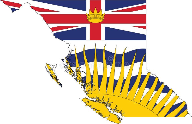
Free with trial Flag map of BRITISH COLUMBIA, CANADA. Flat vector administrative flag map of the Canadian province of BRITISH COLUMBIA, CANADA. Maple map vectors Flag map of BRITISH COLUMBIA, CANADA. Flat vector administrative flag map of the Canadian province of BRITISH COLUMBIA, CANADA
Free with trial Flag map of BRITISH COLUMBIA, CANADA. Flat vector administrative flag map of the Canadian province of BRITISH COLUMBIA combined with official flag of CANADA. Maple map vectors Flag map of BRITISH COLUMBIA, CANADA. Flat vector administrative flag map of the Canadian province of BRITISH COLUMBIA combined with official flag of CANADA
Free with trial Black flat blank highlighted location map of the PIERRE-DE SAUREL Regional County Municipality inside gray administrative map of Montérégie, Quebec, Canada. Maple map vectors Locator map of the PIERRE-DE SAUREL Municipality. Black flat blank highlighted location map of the PIERRE-DE SAUREL Regional County Municipality inside gray. Black flat blank highlighted location map of the PIERRE-DE SAUREL Regional County Municipality inside gray administrative map of Montérégie, Quebec, Canada
Free with trial Black flat blank highlighted location map of the LA HAUTE-YAMASKA Regional County Municipality inside gray administrative map of Montérégie, Quebec, Canada. Maple map vectors Locator map of the LA HAUTE-YAMASKA Municipality. Black flat blank highlighted location map of the LA HAUTE-YAMASKA Regional County Municipality inside gray. Black flat blank highlighted location map of the LA HAUTE-YAMASKA Regional County Municipality inside gray administrative map of Montérégie, Quebec, Canada
Free with trial Map of Canada with a pinned blue pin. Pinned flag of Canada, vector illustration. Maple map vectors Map of Canada with a pinned blue pin. Pinned flag of Canada. Vector illustration
Free with trial Prince Edward Island Map on Canadian Flag. PE, CA Province Map on Canada Flag. EPS Vector Graphic Clipart Icon. Maple map vectors Prince Edward Island Map on Canadian Flag. PE, CA Province Map on Canada Flag. EPS Vector Graphic Clipart Icon.
Free with trial Pastel flat vector administrative map of MONTÉRÉGIE, QUEBEC, CANADA with black border lines and name tags of its municipalities. Maple map vectors Pastel tagged map of municipalities of MONTÉRÉGIE, QUEBEC, CANADA. Pastel flat vector administrative map of MONTÉRÉGIE, QUEBEC, CANADA with black border. Pastel flat vector administrative map of MONTÉRÉGIE, QUEBEC, CANADA with black border lines and name tags of its municipalities
Free with trial Pastel flat vector administrative map of Canadian province of QUEBEC, CANADA with black border lines and name tags of its municipalities, counties and districts. Maple map vectors Pastel tagged administrative map of QUEBEC, CANADA. Pastel flat vector administrative map of Canadian province of QUEBEC, CANADA with black border lines and name. Pastel flat vector administrative map of Canadian province of QUEBEC, CANADA with black border lines and name tags of its municipalities, counties and districts
Free with trial Shape map and flag of Canada country. Maple map vectors Shape map and flag of Canada country.
Free with trial Black flat blank highlighted location map of the FRASER–FORT GEORGE regional district inside gray administrative map of the Canadian province of British Columbia, Canada. Maple map vectors Locator map of the FRASER–FORT GEORGE regional district. Black flat blank highlighted location map of the FRASER–FORT GEORGE regional district inside gray. Black flat blank highlighted location map of the FRASER–FORT GEORGE regional district inside gray administrative map of the Canadian province of British Columbia, Canada
Free with trial White flat vector administrative map of Canadian province of ALBERTA, CANADA with black border lines and name tags of its municipal districts, special areas, specialized municipalities and improvement districts. Maple map vectors White tagged administrative map of ALBERTA, CANADA. White flat vector administrative map of Canadian province of ALBERTA, CANADA with black border lines and name. White flat vector administrative map of Canadian province of ALBERTA, CANADA with black border lines and name tags of its municipal districts, special areas, specialized municipalities and improvement districts
Free with trial Black flat blank highlighted location map of the COMOX VALLEY regional district inside gray administrative map of the Canadian province of British Columbia, Canada. Maple map vectors Locator map of the COMOX VALLEY regional district. Black flat blank highlighted location map of the COMOX VALLEY regional district inside gray administrative map. Black flat blank highlighted location map of the COMOX VALLEY regional district inside gray administrative map of the Canadian province of British Columbia, Canada
Free with trial Black flat blank highlighted location map of the WATERLOO regional municipality inside gray administrative map of the Canadian province of Ontario, Canada. Maple map vectors Locator map of the WATERLOO regional municipality. Black flat blank highlighted location map of the WATERLOO regional municipality inside gray administrative map. Black flat blank highlighted location map of the WATERLOO regional municipality inside gray administrative map of the Canadian province of Ontario, Canada
Free with trial Black flat blank highlighted location map of the LE HAUT-RICHELIEU Regional County Municipality inside gray administrative map of Montérégie, Quebec, Canada. Maple map vectors Locator map of the LE HAUT-RICHELIEU Municipality. Black flat blank highlighted location map of the LE HAUT-RICHELIEU Regional County Municipality inside gray. Black flat blank highlighted location map of the LE HAUT-RICHELIEU Regional County Municipality inside gray administrative map of Montérégie, Quebec, Canada
Free with trial Magnifying glass showing a map of Canada on a world map. Canada flag and map enlarge in lens. Vector Illustration. Maple map vectors Magnifying glass showing a map of Canada on a world map. Canada flag and map enlarge in lens. Vector Illustration
Free with trial Colored canada day template with map of Canada Vector. Illustration. Maple map vectors Colored canada day template with map of Canada Vector. Illustration
Free with trial Pastel flat vector administrative map of the Canadian territory of NEW BRUNSWICK, CANADA with black border lines and name tags of its counties. Maple map vectors Pastel tagged map of counties of NEW BRUNSWICK, CANADA. Pastel flat vector administrative map of the Canadian territory of NEW BRUNSWICK, CANADA with black. Pastel flat vector administrative map of the Canadian territory of NEW BRUNSWICK, CANADA with black border lines and name tags of its counties
Free with trial Black flat blank highlighted location map of the PEACE NO. 135 municipal district inside gray administrative map of the Canadian province of Alberta, Canada. Maple map vectors Locator map of the PEACE NO. 135 municipal district. Black flat blank highlighted location map of the PEACE NO. 135 municipal district inside gray administrative. Black flat blank highlighted location map of the PEACE NO. 135 municipal district inside gray administrative map of the Canadian province of Alberta, Canada
Free with trial Black flat blank highlighted location map of the LEDUC COUNTY municipal district inside gray administrative map of the Canadian province of Alberta, Canada. Maple map vectors Locator map of the LEDUC COUNTY municipal district. Black flat blank highlighted location map of the LEDUC COUNTY municipal district inside gray administrative. Black flat blank highlighted location map of the LEDUC COUNTY municipal district inside gray administrative map of the Canadian province of Alberta, Canada
Free with trial Black flat blank highlighted location map of the BIGHORN NO. 8 municipal district inside gray administrative map of the Canadian province of Alberta, Canada. Maple map vectors Locator map of the BIGHORN NO. 8 municipal district. Black flat blank highlighted location map of the BIGHORN NO. 8 municipal district inside gray administrative. Black flat blank highlighted location map of the BIGHORN NO. 8 municipal district inside gray administrative map of the Canadian province of Alberta, Canada
Free with trial Black flat blank highlighted location map of the KANANASKIS IMPROVEMENT DISTRICT inside gray administrative map of the Canadian province of Alberta, Canada. Maple map vectors Locator map of the KANANASKIS IMPROVEMENT DISTRICT. Black flat blank highlighted location map of the KANANASKIS IMPROVEMENT DISTRICT inside gray administrative. Black flat blank highlighted location map of the KANANASKIS IMPROVEMENT DISTRICT inside gray administrative map of the Canadian province of Alberta, Canada
Free with trial Black flat blank highlighted location map of the OTTAWA single-tier municipality inside gray administrative map of the Canadian province of Ontario, Canada. Maple map vectors Locator map of the OTTAWA single-tier municipality. Black flat blank highlighted location map of the OTTAWA single-tier municipality inside gray administrative. Black flat blank highlighted location map of the OTTAWA single-tier municipality inside gray administrative map of the Canadian province of Ontario, Canada
Free with trial Pastel flat tagged vector administrative map of the Canadian territory of NORTHWEST TERRITORIES, CANADA with black border lines and name tags of its regions. Maple map vectors Pastel map of regions of NORTHWEST TERRITORIES, CANADA. Pastel flat tagged vector administrative map of the Canadian territory of NORTHWEST TERRITORIES, CANADA. Pastel flat tagged vector administrative map of the Canadian territory of NORTHWEST TERRITORIES, CANADA with black border lines and name tags of its regions
Free with trial Vector flag of Manitoba Map, Manitoba Map, illustration, Canada States Vector Map. Maple map vectors Vector flag of Manitoba Map, Manitoba Map, illustration. Canada States Vector Map
Free with trial Made in Canada rubber stamps icon isolated on transparent background. Manufactured or Produced in Canada. Map of Canada. Set of grunge rubber stamps. EPS10. Maple map vectors Made in Canada rubber stamps icon isolated on transparent background. Manufactured or Produced in Canada. Map of Canada. Set of grunge rubber stamps. EPS10
Free with trial Black flat blank highlighted location map of the FRASER VALLEY regional district inside gray administrative map of the Canadian province of British Columbia, Canada. Maple map vectors Locator map of the FRASER VALLEY regional district. Black flat blank highlighted location map of the FRASER VALLEY regional district inside gray administrative. Black flat blank highlighted location map of the FRASER VALLEY regional district inside gray administrative map of the Canadian province of British Columbia, Canada
Free with trial Black flat blank highlighted location map of the JASPER specialized municipality inside gray administrative map of the Canadian province of Alberta, Canada. Maple map vectors Locator map of the JASPER specialized municipality. Black flat blank highlighted location map of the JASPER specialized municipality inside gray administrative. Black flat blank highlighted location map of the JASPER specialized municipality inside gray administrative map of the Canadian province of Alberta, Canada
Free with trial Black flat blank highlighted location map of the ACADIA NO. 34 municipal district inside gray administrative map of the Canadian province of Alberta, Canada. Maple map vectors Locator map of the ACADIA NO. 34 municipal district. Black flat blank highlighted location map of the ACADIA NO. 34 municipal district inside gray administrative. Black flat blank highlighted location map of the ACADIA NO. 34 municipal district inside gray administrative map of the Canadian province of Alberta, Canada
Free with trial Pastel flat vector administrative map of Canadian province of ALBERTA, CANADA with black border lines and name tags of its municipal districts, special areas, specialized municipalities and improvement districts. Maple map vectors Pastel tagged administrative map of ALBERTA, CANADA. Pastel flat vector administrative map of Canadian province of ALBERTA, CANADA with black border lines and. Pastel flat vector administrative map of Canadian province of ALBERTA, CANADA with black border lines and name tags of its municipal districts, special areas, specialized municipalities and improvement districts
Free with trial Black flat blank highlighted location map of the EAST KOOTENAY regional district inside gray administrative map of the Canadian province of British Columbia, Canada. Maple map vectors Locator map of the EAST KOOTENAY regional district. Black flat blank highlighted location map of the EAST KOOTENAY regional district inside gray administrative. Black flat blank highlighted location map of the EAST KOOTENAY regional district inside gray administrative map of the Canadian province of British Columbia, Canada
Free with trial Black flat blank highlighted location map of the CENTRAL COAST regional district inside gray administrative map of the Canadian province of British Columbia, Canada. Maple map vectors Locator map of the CENTRAL COAST regional district. Black flat blank highlighted location map of the CENTRAL COAST regional district inside gray administrative. Black flat blank highlighted location map of the CENTRAL COAST regional district inside gray administrative map of the Canadian province of British Columbia, Canada
Free with trial Gray flat blank vector administrative map of Canadian province of BRITISH COLUMBIA, CANADA with white border lines of its regional districts. Maple map vectors Gray administrative map of BRITISH COLUMBIA, CANADA. Gray flat blank vector administrative map of Canadian province of BRITISH COLUMBIA, CANADA with white border. Gray flat blank vector administrative map of Canadian province of BRITISH COLUMBIA, CANADA with white border lines of its regional districts
Free with trial Northwest Territories Map on Canadian Flag. NT, CA Territory Map on Canada Flag. EPS Vector Graphic Clipart Icon. Maple map vectors Northwest Territories Map on Canadian Flag. NT, CA Territory Map on Canada Flag. EPS Vector Graphic Clipart Icon.
Free with trial Topographic relief map of YUKON, CANADA. Topographic relief map of the Canadian territory of YUKON, CANADA with black contour lines on beige background. Maple map vectors Topographic relief map of YUKON, CANADA. Topographic relief map of the Canadian territory of YUKON, CANADA with black contour lines on beige background
Free with trial Black flat blank highlighted location map of the COUNTY OF NEWELL municipal district inside gray administrative map of the Canadian province of Alberta, Canada. Maple map vectors Locator map of the COUNTY OF NEWELL municipal district. Black flat blank highlighted location map of the COUNTY OF NEWELL municipal district inside gray. Black flat blank highlighted location map of the COUNTY OF NEWELL municipal district inside gray administrative map of the Canadian province of Alberta, Canada
Free with trial Black flat blank highlighted location map of the VULCAN COUNTY municipal district inside gray administrative map of the Canadian province of Alberta, Canada. Maple map vectors Locator map of the VULCAN COUNTY municipal district. Black flat blank highlighted location map of the VULCAN COUNTY municipal district inside gray administrative. Black flat blank highlighted location map of the VULCAN COUNTY municipal district inside gray administrative map of the Canadian province of Alberta, Canada
Free with trial Black flat blank highlighted location map of the PONOKA COUNTY municipal district inside gray administrative map of the Canadian province of Alberta, Canada. Maple map vectors Locator map of the PONOKA COUNTY municipal district. Black flat blank highlighted location map of the PONOKA COUNTY municipal district inside gray administrative. Black flat blank highlighted location map of the PONOKA COUNTY municipal district inside gray administrative map of the Canadian province of Alberta, Canada
Free with trial Black flat blank highlighted location map of the LAMONT COUNTY municipal district inside gray administrative map of the Canadian province of Alberta, Canada. Maple map vectors Locator map of the LAMONT COUNTY municipal district. Black flat blank highlighted location map of the LAMONT COUNTY municipal district inside gray administrative. Black flat blank highlighted location map of the LAMONT COUNTY municipal district inside gray administrative map of the Canadian province of Alberta, Canada
Free with trial Black flat blank highlighted location map of the TORONTO single-tier municipality inside gray administrative map of the Canadian province of Ontario, Canada. Maple map vectors Locator map of the TORONTO single-tier municipality. Black flat blank highlighted location map of the TORONTO single-tier municipality inside gray administrative. Black flat blank highlighted location map of the TORONTO single-tier municipality inside gray administrative map of the Canadian province of Ontario, Canada
Free with trial Gray map of QUEBEC, CANADA. Gray flat blank vector administrative map of the Canadian province of QUEBEC, CANADA. Maple map vectors Gray map of QUEBEC, CANADA. Gray flat blank vector administrative map of the Canadian province of QUEBEC, CANADA
Free with trial Topographic negative relief map of the Canadian territory of YUKON, CANADA with white contour lines on dark gray background. Maple map vectors Topographic relief map of YUKON, CANADA. Topographic negative relief map of the Canadian territory of YUKON, CANADA with white contour lines on dark gray. Topographic negative relief map of the Canadian territory of YUKON, CANADA with white contour lines on dark gray background
 Sign in