Free with trial Black flat blank highlighted location map of the BEAVER COUNTY municipal district inside gray administrative map of the Canadian province of Alberta, Canada. Maple map vectors Locator map of the BEAVER COUNTY municipal district. Black flat blank highlighted location map of the BEAVER COUNTY municipal district inside gray administrative. Black flat blank highlighted location map of the BEAVER COUNTY municipal district inside gray administrative map of the Canadian province of Alberta, Canada
Free with trial Black flat blank highlighted location map of the OKANAGAN–SIMILKAMEEN regional district inside gray administrative map of the Canadian province of British Columbia, Canada. Maple map vectors Locator map of the OKANAGAN–SIMILKAMEEN regional district. Black flat blank highlighted location map of the OKANAGAN–SIMILKAMEEN regional district inside. Black flat blank highlighted location map of the OKANAGAN–SIMILKAMEEN regional district inside gray administrative map of the Canadian province of British Columbia, Canada
Free with trial Black flat blank highlighted location map of the STIKINE REGION regional district inside gray administrative map of the Canadian province of British Columbia, Canada. Maple map vectors Locator map of the STIKINE REGION regional district. Black flat blank highlighted location map of the STIKINE REGION regional district inside gray administrative. Black flat blank highlighted location map of the STIKINE REGION regional district inside gray administrative map of the Canadian province of British Columbia, Canada
Free with trial Black flat blank highlighted location map of the NORTH OKANAGAN regional district inside gray administrative map of the Canadian province of British Columbia, Canada. Maple map vectors Locator map of the NORTH OKANAGAN regional district. Black flat blank highlighted location map of the NORTH OKANAGAN regional district inside gray administrative. Black flat blank highlighted location map of the NORTH OKANAGAN regional district inside gray administrative map of the Canadian province of British Columbia, Canada
Free with trial Black flat blank highlighted location map of the SUNSHINE COAST regional district inside gray administrative map of the Canadian province of British Columbia, Canada. Maple map vectors Locator map of the SUNSHINE COAST regional district. Black flat blank highlighted location map of the SUNSHINE COAST regional district inside gray administrative. Black flat blank highlighted location map of the SUNSHINE COAST regional district inside gray administrative map of the Canadian province of British Columbia, Canada
Free with trial Black flat blank highlighted location map of the VAUDREUIL-SOULANGES Regional County Municipality inside gray administrative map of Montérégie, Quebec, Canada. Maple map vectors Locator map of the VAUDREUIL-SOULANGES Municipality. Black flat blank highlighted location map of the VAUDREUIL-SOULANGES Regional County Municipality inside. Black flat blank highlighted location map of the VAUDREUIL-SOULANGES Regional County Municipality inside gray administrative map of Montérégie, Quebec, Canada
Free with trial Canada National Flag Map Design, Canada Country Flag Inside The Map. Canada National Flag Map Design, Illustration Of Canada Country Flag Inside The Map. Maple map vectors Canada National Flag Map Design, Canada Country Flag Inside The Map. Canada National Flag Map Design, Illustration Of Canada Country Flag Inside The Map
Free with trial Black flat blank highlighted location map of the CYPRESS COUNTY municipal district inside gray administrative map of the Canadian province of Alberta, Canada. Maple map vectors Locator map of the CYPRESS COUNTY municipal district. Black flat blank highlighted location map of the CYPRESS COUNTY municipal district inside gray. Black flat blank highlighted location map of the CYPRESS COUNTY municipal district inside gray administrative map of the Canadian province of Alberta, Canada
Free with trial Black flat blank highlighted location map of the LACOMBE COUNTY municipal district inside gray administrative map of the Canadian province of Alberta, Canada. Maple map vectors Locator map of the LACOMBE COUNTY municipal district. Black flat blank highlighted location map of the LACOMBE COUNTY municipal district inside gray. Black flat blank highlighted location map of the LACOMBE COUNTY municipal district inside gray administrative map of the Canadian province of Alberta, Canada
Free with trial Black flat blank highlighted location map of the BRAZEAU COUNTY municipal district inside gray administrative map of the Canadian province of Alberta, Canada. Maple map vectors Locator map of the BRAZEAU COUNTY municipal district. Black flat blank highlighted location map of the BRAZEAU COUNTY municipal district inside gray. Black flat blank highlighted location map of the BRAZEAU COUNTY municipal district inside gray administrative map of the Canadian province of Alberta, Canada
Free with trial Topographic negative relief map of the Canadian province of QUEBEC, CANADA with white contour lines on dark gray background. Maple map vectors Topographic relief map of QUEBEC, CANADA. Topographic negative relief map of the Canadian province of QUEBEC, CANADA with white contour lines on dark gray. Topographic negative relief map of the Canadian province of QUEBEC, CANADA with white contour lines on dark gray background
Free with trial Black flat blank highlighted location map of the HAMILTON single-tier municipality inside gray administrative map of the Canadian province of Ontario, Canada. Maple map vectors Locator map of the HAMILTON single-tier municipality. Black flat blank highlighted location map of the HAMILTON single-tier municipality inside gray. Black flat blank highlighted location map of the HAMILTON single-tier municipality inside gray administrative map of the Canadian province of Ontario, Canada
Free with trial Topographic relief map of QUEBEC, CANADA. Topographic relief map of the Canadian province of QUEBEC, CANADA with black contour lines on beige background. Maple map vectors Topographic relief map of QUEBEC, CANADA. Topographic relief map of the Canadian province of QUEBEC, CANADA with black contour lines on beige background
Free with trial Black flat blank highlighted location map of the ARVIAT NORTH-WHALE COVE District inside gray administrative map of the territorial electoral districts of Canadian territory of Nunavut, Canada. Maple map vectors Location map of the ARVIAT NORTH-WHALE COVE District. Black flat blank highlighted location map of the ARVIAT NORTH-WHALE COVE District inside gray. Black flat blank highlighted location map of the ARVIAT NORTH-WHALE COVE District inside gray administrative map of the territorial electoral districts of Canadian territory of Nunavut, Canada
Free with trial Flat vector administrative flag map of the Canadian province of PRINCE EDWARD ISLAND combined with official flag of CANADA. Maple map vectors Flag map of PRINCE EDWARD ISLAND, CANADA. Flat vector administrative flag map of the Canadian province of PRINCE EDWARD ISLAND combined with official flag of. Flat vector administrative flag map of the Canadian province of PRINCE EDWARD ISLAND combined with official flag of CANADA
Free with trial Flag map of PRINCE EDWARD ISLAND, CANADA. Flat vector administrative flag map of the Canadian province of PRINCE EDWARD ISLAND CANADA. Maple map vectors Flag map of PRINCE EDWARD ISLAND, CANADA. Flat vector administrative flag map of the Canadian province of PRINCE EDWARD ISLAND CANADA
Free with trial Gray map of PRINCE EDWARD ISLAND, CANADA. Gray flat blank vector administrative map of the Canadian province of PRINCE EDWARD ISLAND, CANADA. Maple map vectors Gray map of PRINCE EDWARD ISLAND, CANADA. Gray flat blank vector administrative map of the Canadian province of PRINCE EDWARD ISLAND, CANADA
Free with trial Black flat blank highlighted location map of the METRO VANCOUVER regional district inside gray administrative map of the Canadian province of British Columbia, Canada. Maple map vectors Locator map of the METRO VANCOUVER regional district. Black flat blank highlighted location map of the METRO VANCOUVER regional district inside gray. Black flat blank highlighted location map of the METRO VANCOUVER regional district inside gray administrative map of the Canadian province of British Columbia, Canada
Free with trial Black flat blank highlighted location map of the TORONTO MUNICIPALITY inside gray administrative map of Greater Toronto Area. Maple map vectors Locator map of the TORONTO MUNICIPALITY. Black flat blank highlighted location map of the TORONTO MUNICIPALITY inside gray administrative map of Greater Toronto. Black flat blank highlighted location map of the TORONTO MUNICIPALITY inside gray administrative map of Greater Toronto Area
Free with trial Black flat blank highlighted location map of the COWICHAN VALLEY regional district inside gray administrative map of the Canadian province of British Columbia, Canada. Maple map vectors Locator map of the COWICHAN VALLEY regional district. Black flat blank highlighted location map of the COWICHAN VALLEY regional district inside gray. Black flat blank highlighted location map of the COWICHAN VALLEY regional district inside gray administrative map of the Canadian province of British Columbia, Canada
Free with trial White flat vector administrative map of the regions of Canadian territory of NUNAVUT, CANADA with black border lines and name tags of its regions. Maple map vectors White map of the regions of NUNAVUT, CANADA. White flat vector administrative map of the regions of Canadian territory of NUNAVUT, CANADA with black border lines. White flat vector administrative map of the regions of Canadian territory of NUNAVUT, CANADA with black border lines and name tags of its regions
Free with trial White flat blank vector administrative map of the regions of Canadian territory of NUNAVUT, CANADA with black border lines of its regions. Maple map vectors White map of the regions of NUNAVUT, CANADA. White flat blank vector administrative map of the regions of Canadian territory of NUNAVUT, CANADA with black border. White flat blank vector administrative map of the regions of Canadian territory of NUNAVUT, CANADA with black border lines of its regions
Free with trial Black flat blank highlighted location map of the THORHILD COUNTY municipal district inside gray administrative map of the Canadian province of Alberta, Canada. Maple map vectors Locator map of the THORHILD COUNTY municipal district. Black flat blank highlighted location map of the THORHILD COUNTY municipal district inside gray. Black flat blank highlighted location map of the THORHILD COUNTY municipal district inside gray administrative map of the Canadian province of Alberta, Canada
Free with trial Black flat blank highlighted location map of the FAIRVIEW NO. 136 municipal district inside gray administrative map of the Canadian province of Alberta, Canada. Maple map vectors Locator map of the FAIRVIEW NO. 136 municipal district. Black flat blank highlighted location map of the FAIRVIEW NO. 136 municipal district inside gray. Black flat blank highlighted location map of the FAIRVIEW NO. 136 municipal district inside gray administrative map of the Canadian province of Alberta, Canada
Free with trial Black flat blank highlighted location map of the GREENVIEW NO. 16 municipal district inside gray administrative map of the Canadian province of Alberta, Canada. Maple map vectors Locator map of the GREENVIEW NO. 16 municipal district. Black flat blank highlighted location map of the GREENVIEW NO. 16 municipal district inside gray. Black flat blank highlighted location map of the GREENVIEW NO. 16 municipal district inside gray administrative map of the Canadian province of Alberta, Canada
Free with trial Black flat blank highlighted location map of the WESTLOCK COUNTY municipal district inside gray administrative map of the Canadian province of Alberta, Canada. Maple map vectors Locator map of the WESTLOCK COUNTY municipal district. Black flat blank highlighted location map of the WESTLOCK COUNTY municipal district inside gray. Black flat blank highlighted location map of the WESTLOCK COUNTY municipal district inside gray administrative map of the Canadian province of Alberta, Canada
Free with trial Black flat blank highlighted location map of the KNEEHILL COUNTY municipal district inside gray administrative map of the Canadian province of Alberta, Canada. Maple map vectors Locator map of the KNEEHILL COUNTY municipal district. Black flat blank highlighted location map of the KNEEHILL COUNTY municipal district inside gray. Black flat blank highlighted location map of the KNEEHILL COUNTY municipal district inside gray administrative map of the Canadian province of Alberta, Canada
Free with trial Black flat blank highlighted location map of the PARKLAND COUNTY municipal district inside gray administrative map of the Canadian province of Alberta, Canada. Maple map vectors Locator map of the PARKLAND COUNTY municipal district. Black flat blank highlighted location map of the PARKLAND COUNTY municipal district inside gray. Black flat blank highlighted location map of the PARKLAND COUNTY municipal district inside gray administrative map of the Canadian province of Alberta, Canada
Free with trial Black flat blank highlighted location map of the STURGEON COUNTY municipal district inside gray administrative map of the Canadian province of Alberta, Canada. Maple map vectors Locator map of the STURGEON COUNTY municipal district. Black flat blank highlighted location map of the STURGEON COUNTY municipal district inside gray. Black flat blank highlighted location map of the STURGEON COUNTY municipal district inside gray administrative map of the Canadian province of Alberta, Canada
Free with trial Black flat blank highlighted location map of the RED DEER COUNTY municipal district inside gray administrative map of the Canadian province of Alberta, Canada. Maple map vectors Locator map of the RED DEER COUNTY municipal district. Black flat blank highlighted location map of the RED DEER COUNTY municipal district inside gray. Black flat blank highlighted location map of the RED DEER COUNTY municipal district inside gray administrative map of the Canadian province of Alberta, Canada
Free with trial Black flat blank highlighted location map of the CARDSTON COUNTY municipal district inside gray administrative map of the Canadian province of Alberta, Canada. Maple map vectors Locator map of the CARDSTON COUNTY municipal district. Black flat blank highlighted location map of the CARDSTON COUNTY municipal district inside gray. Black flat blank highlighted location map of the CARDSTON COUNTY municipal district inside gray administrative map of the Canadian province of Alberta, Canada
Free with trial Black flat blank highlighted location map of the NORTHUMBERLAND COUNTY inside gray administrative map of the Canadian province of Ontario, Canada. Maple map vectors Locator map of the NORTHUMBERLAND COUNTY. Black flat blank highlighted location map of the NORTHUMBERLAND COUNTY inside gray administrative map of the Canadian. Black flat blank highlighted location map of the NORTHUMBERLAND COUNTY inside gray administrative map of the Canadian province of Ontario, Canada
Free with trial Gray map of NORTHWEST TERRITORIES, CANADA. Gray flat blank vector administrative map of the Canadian territory of NORTHWEST TERRITORIES, CANADA. Maple map vectors Gray map of NORTHWEST TERRITORIES, CANADA. Gray flat blank vector administrative map of the Canadian territory of NORTHWEST TERRITORIES, CANADA
Free with trial Flag map of NORTHWEST TERRITORIES, CANADA. Flat vector administrative flag map of the Canadian territory of NORTHWEST TERRITORIES, CANADA. Maple map vectors Flag map of NORTHWEST TERRITORIES, CANADA. Flat vector administrative flag map of the Canadian territory of NORTHWEST TERRITORIES, CANADA
Free with trial Flat vector administrative flag map of the Canadian territory of NORTHWEST TERRITORIES combined with official flag of CANADA. Maple map vectors Flag map of NORTHWEST TERRITORIES, CANADA. Flat vector administrative flag map of the Canadian territory of NORTHWEST TERRITORIES combined with official flag of. Flat vector administrative flag map of the Canadian territory of NORTHWEST TERRITORIES combined with official flag of CANADA
Free with trial Topographic relief map of NUNAVUT, CANADA. Topographic relief map of the Canadian territory of NUNAVUT, CANADA with black contour lines on beige background. Maple map vectors Topographic relief map of NUNAVUT, CANADA. Topographic relief map of the Canadian territory of NUNAVUT, CANADA with black contour lines on beige background
Free with trial Topographic negative relief map of the Canadian territory of NUNAVUT, CANADA with white contour lines on dark gray background. Maple map vectors Topographic relief map of NUNAVUT, CANADA. Topographic negative relief map of the Canadian territory of NUNAVUT, CANADA with white contour lines on dark gray. Topographic negative relief map of the Canadian territory of NUNAVUT, CANADA with white contour lines on dark gray background
Free with trial Black flat blank highlighted location map of the NORTHUMBERLAND COUNTY inside gray administrative map of counties of Canadian territory of New Brunswick, Canada. Maple map vectors Locator map of the NORTHUMBERLAND COUNTY. Black flat blank highlighted location map of the NORTHUMBERLAND COUNTY inside gray administrative map of counties of. Black flat blank highlighted location map of the NORTHUMBERLAND COUNTY inside gray administrative map of counties of Canadian territory of New Brunswick, Canada
Free with trial Vector flag of Nova Scotia Map, Nova Scotia Map, illustration, Canada Map Vector. Maple map vectors Vector flag of Nova Scotia Map, Nova Scotia Map, illustration. Canada Map Vector
Free with trial Canada map, stylish location icon with Canada map and flag. Green pin icon. Maple map vectors Canada map, stylish location icon with Canada map and flag. Green pin icon
Free with trial Black flat blank highlighted location map of the RANCHLAND NO. 66 municipal district inside gray administrative map of the Canadian province of Alberta, Canada. Maple map vectors Locator map of the RANCHLAND NO. 66 municipal district. Black flat blank highlighted location map of the RANCHLAND NO. 66 municipal district inside gray. Black flat blank highlighted location map of the RANCHLAND NO. 66 municipal district inside gray administrative map of the Canadian province of Alberta, Canada
Free with trial Topographic negative relief map of the Canadian province of ALBERTA, CANADA with white contour lines on dark gray background. Maple map vectors Topographic relief map of ALBERTA, CANADA. Topographic negative relief map of the Canadian province of ALBERTA, CANADA with white contour lines on dark gray. Topographic negative relief map of the Canadian province of ALBERTA, CANADA with white contour lines on dark gray background
Free with trial Black flat blank highlighted location map of the IMPROVEMENT DISTRICT NO. 4 WATERTON inside gray administrative map of the Canadian province of Alberta, Canada. Maple map vectors Locator map of the IMPROVEMENT DISTRICT NO. 4 WATERTON. Black flat blank highlighted location map of the IMPROVEMENT DISTRICT NO. 4 WATERTON inside gray. Black flat blank highlighted location map of the IMPROVEMENT DISTRICT NO. 4 WATERTON inside gray administrative map of the Canadian province of Alberta, Canada
Free with trial Black flat blank highlighted location map of the STARLAND COUNTY municipal district inside gray administrative map of the Canadian province of Alberta, Canada. Maple map vectors Locator map of the STARLAND COUNTY municipal district. Black flat blank highlighted location map of the STARLAND COUNTY municipal district inside gray. Black flat blank highlighted location map of the STARLAND COUNTY municipal district inside gray administrative map of the Canadian province of Alberta, Canada
Free with trial Black flat blank highlighted location map of the NORTHERN ROCKIES regional district inside gray administrative map of the Canadian province of British Columbia, Canada. Maple map vectors Locator map of the NORTHERN ROCKIES regional district. Black flat blank highlighted location map of the NORTHERN ROCKIES regional district inside gray. Black flat blank highlighted location map of the NORTHERN ROCKIES regional district inside gray administrative map of the Canadian province of British Columbia, Canada
Free with trial Black flat blank highlighted location map of the MOUNT WADDINGTON regional district inside gray administrative map of the Canadian province of British Columbia, Canada. Maple map vectors Locator map of the MOUNT WADDINGTON regional district. Black flat blank highlighted location map of the MOUNT WADDINGTON regional district inside gray. Black flat blank highlighted location map of the MOUNT WADDINGTON regional district inside gray administrative map of the Canadian province of British Columbia, Canada
Free with trial Black flat blank highlighted location map of the CENTRAL OKANAGAN regional district inside gray administrative map of the Canadian province of British Columbia, Canada. Maple map vectors Locator map of the CENTRAL OKANAGAN regional district. Black flat blank highlighted location map of the CENTRAL OKANAGAN regional district inside gray. Black flat blank highlighted location map of the CENTRAL OKANAGAN regional district inside gray administrative map of the Canadian province of British Columbia, Canada
Free with trial Black flat blank highlighted location map of the CENTRAL KOOTENAY regional district inside gray administrative map of the Canadian province of British Columbia, Canada. Maple map vectors Locator map of the CENTRAL KOOTENAY regional district. Black flat blank highlighted location map of the CENTRAL KOOTENAY regional district inside gray. Black flat blank highlighted location map of the CENTRAL KOOTENAY regional district inside gray administrative map of the Canadian province of British Columbia, Canada
Free with trial Black flat blank highlighted location map of the MARGUERITE-D`YOUVILLE Regional County Municipality inside gray administrative map of Montérégie, Quebec, Canada. Maple map vectors Locator map of the MARGUERITE-D`YOUVILLE Municipality. Black flat blank highlighted location map of the MARGUERITE-D`YOUVILLE Regional County Municipality inside. Black flat blank highlighted location map of the MARGUERITE-D`YOUVILLE Regional County Municipality inside gray administrative map of Montérégie, Quebec, Canada
Free with trial Black flat blank highlighted location map of the BEAUHARNOIS-SALABERRY Regional County Municipality inside gray administrative map of Montérégie, Quebec, Canada. Maple map vectors Locator map of the BEAUHARNOIS-SALABERRY Municipality. Black flat blank highlighted location map of the BEAUHARNOIS-SALABERRY Regional County Municipality inside. Black flat blank highlighted location map of the BEAUHARNOIS-SALABERRY Regional County Municipality inside gray administrative map of Montérégie, Quebec, Canada
Free with trial Black flat blank highlighted location map of the LE HAUT-SAINT-LAURENT Regional County Municipality inside gray administrative map of Montérégie, Quebec, Canada. Maple map vectors Locator map of the LE HAUT-SAINT-LAURENT Municipality. Black flat blank highlighted location map of the LE HAUT-SAINT-LAURENT Regional County Municipality inside. Black flat blank highlighted location map of the LE HAUT-SAINT-LAURENT Regional County Municipality inside gray administrative map of Montérégie, Quebec, Canada
Free with trial America with selected Canada map and Canada flag icon. Vector map and flag. Maple map vectors America with selected Canada map and Canada flag icon. Vector map and flag
Free with trial Map, Canada, Leaf Line Icon Vector. Maple map vectors Map, Canada, Leaf Line Icon Vector
Free with trial Newfoundland and Labrador Map on Canadian Flag. NL, CA Province Map on Canada Flag. EPS Vector Graphic Clipart Icon. Maple map vectors Newfoundland and Labrador Map on Canadian Flag. NL, CA Province Map on Canada Flag. EPS Vector Graphic Clipart Icon.
Free with trial Vector flag of Saskatchewan Map, Saskatchewan Map, illustration, Canada States, Vector flag of Saskatchewan Map, Saskatchewan Map, illustration, Canada States. Maple map vectors Vector flag of Saskatchewan Map, Saskatchewan Map, illustration. Canada States, , Canada States. Vector flag of Saskatchewan Map, Saskatchewan Map, illustration, Canada States, Vector flag of Saskatchewan Map, Saskatchewan Map, illustration, Canada States
Free with trial Topographic negative relief map of the Canadian province of MANITOBA, CANADA with white contour lines on dark gray background. Maple map vectors Topographic relief map of MANITOBA, CANADA. Topographic negative relief map of the Canadian province of MANITOBA, CANADA with white contour lines on dark gray. Topographic negative relief map of the Canadian province of MANITOBA, CANADA with white contour lines on dark gray background
Free with trial Topographic relief map of MANITOBA, CANADA. Topographic relief map of the Canadian province of MANITOBA, CANADA with black contour lines on beige background. Maple map vectors Topographic relief map of MANITOBA, CANADA. Topographic relief map of the Canadian province of MANITOBA, CANADA with black contour lines on beige background
Free with trial Black flat blank highlighted location map of the FOOTHILLS COUNTY municipal district inside gray administrative map of the Canadian province of Alberta, Canada. Maple map vectors Locator map of the FOOTHILLS COUNTY municipal district. Black flat blank highlighted location map of the FOOTHILLS COUNTY municipal district inside gray. Black flat blank highlighted location map of the FOOTHILLS COUNTY municipal district inside gray administrative map of the Canadian province of Alberta, Canada
Free with trial Black flat blank highlighted location map of the FLAGSTAFF COUNTY municipal district inside gray administrative map of the Canadian province of Alberta, Canada. Maple map vectors Locator map of the FLAGSTAFF COUNTY municipal district. Black flat blank highlighted location map of the FLAGSTAFF COUNTY municipal district inside gray. Black flat blank highlighted location map of the FLAGSTAFF COUNTY municipal district inside gray administrative map of the Canadian province of Alberta, Canada
Free with trial Black flat blank highlighted location map of the BIG LAKES COUNTY municipal district inside gray administrative map of the Canadian province of Alberta, Canada. Maple map vectors Locator map of the BIG LAKES COUNTY municipal district. Black flat blank highlighted location map of the BIG LAKES COUNTY municipal district inside gray. Black flat blank highlighted location map of the BIG LAKES COUNTY municipal district inside gray administrative map of the Canadian province of Alberta, Canada
Free with trial Black flat blank highlighted location map of the OXFORD COUNTY regional municipality inside gray administrative map of the Canadian province of Ontario, Canada. Maple map vectors Locator map of the OXFORD COUNTY regional municipality. Black flat blank highlighted location map of the OXFORD COUNTY regional municipality inside gray. Black flat blank highlighted location map of the OXFORD COUNTY regional municipality inside gray administrative map of the Canadian province of Ontario, Canada
Free with trial Black flat blank highlighted location map of the UNITED COUNTIES OF LEEDS AND GRENVILLE inside gray administrative map of the Canadian province of Ontario, Canada. Maple map vectors Locator map of the UNITED COUNTIES OF LEEDS AND GRENVILLE. Black flat blank highlighted location map of the UNITED COUNTIES OF LEEDS AND GRENVILLE inside gray. Black flat blank highlighted location map of the UNITED COUNTIES OF LEEDS AND GRENVILLE inside gray administrative map of the Canadian province of Ontario, Canada
Free with trial Black flat blank highlighted location map of the WAINWRIGHT NO. 61 municipal district inside gray administrative map of the Canadian province of Alberta, Canada. Maple map vectors Locator map of the WAINWRIGHT NO. 61 municipal district. Black flat blank highlighted location map of the WAINWRIGHT NO. 61 municipal district inside gray. Black flat blank highlighted location map of the WAINWRIGHT NO. 61 municipal district inside gray administrative map of the Canadian province of Alberta, Canada
Free with trial Black flat blank highlighted location map of the WHEATLAND COUNTY municipal district inside gray administrative map of the Canadian province of Alberta, Canada. Maple map vectors Locator map of the WHEATLAND COUNTY municipal district. Black flat blank highlighted location map of the WHEATLAND COUNTY municipal district inside gray. Black flat blank highlighted location map of the WHEATLAND COUNTY municipal district inside gray administrative map of the Canadian province of Alberta, Canada
Free with trial Black flat blank highlighted location map of the ATHABASCA COUNTY municipal district inside gray administrative map of the Canadian province of Alberta, Canada. Maple map vectors Locator map of the ATHABASCA COUNTY municipal district. Black flat blank highlighted location map of the ATHABASCA COUNTY municipal district inside gray. Black flat blank highlighted location map of the ATHABASCA COUNTY municipal district inside gray administrative map of the Canadian province of Alberta, Canada
Free with trial Black flat blank highlighted location map of the WOODLANDS COUNTY municipal district inside gray administrative map of the Canadian province of Alberta, Canada. Maple map vectors Locator map of the WOODLANDS COUNTY municipal district. Black flat blank highlighted location map of the WOODLANDS COUNTY municipal district inside gray. Black flat blank highlighted location map of the WOODLANDS COUNTY municipal district inside gray administrative map of the Canadian province of Alberta, Canada
Free with trial Black flat blank highlighted location map of the BONNYVILLE NO. 87 municipal district inside gray administrative map of the Canadian province of Alberta, Canada. Maple map vectors Locator map of the BONNYVILLE NO. 87 municipal district. Black flat blank highlighted location map of the BONNYVILLE NO. 87 municipal district inside gray. Black flat blank highlighted location map of the BONNYVILLE NO. 87 municipal district inside gray administrative map of the Canadian province of Alberta, Canada
Free with trial Black flat blank highlighted location map of the WHITCHURCH-STOUFFVILLE MUNICIPALITY inside gray administrative map of Greater Toronto Area. Maple map vectors Locator map of the WHITCHURCH-STOUFFVILLE MUNICIPALITY. Black flat blank highlighted location map of the WHITCHURCH-STOUFFVILLE MUNICIPALITY inside gray. Black flat blank highlighted location map of the WHITCHURCH-STOUFFVILLE MUNICIPALITY inside gray administrative map of Greater Toronto Area
Free with trial Black flat blank highlighted location map of the KOOTENAY BOUNDARY regional district inside gray administrative map of the Canadian province of British Columbia, Canada. Maple map vectors Locator map of the KOOTENAY BOUNDARY regional district. Black flat blank highlighted location map of the KOOTENAY BOUNDARY regional district inside gray. Black flat blank highlighted location map of the KOOTENAY BOUNDARY regional district inside gray administrative map of the Canadian province of British Columbia, Canada
Free with trial White flat vector administrative map of MONTÉRÉGIE, QUEBEC, CANADA with black border lines and name tags of its municipalities. Maple map vectors White tagged map of municipalities of MONTÉRÉGIE, QUEBEC, CANADA. White flat vector administrative map of MONTÉRÉGIE, QUEBEC, CANADA with black border lines. White flat vector administrative map of MONTÉRÉGIE, QUEBEC, CANADA with black border lines and name tags of its municipalities
Free with trial Travel to Canada, top view airplane with map and flag of Canada. Travel and tourism banner design. Maple map vectors Travel to Canada, top view airplane with map and flag of Canada. Travel and tourism banner design
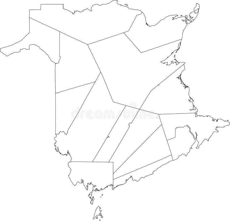
Free with trial White flat blank vector administrative map of the counties of Canadian territory of NEW BRUNSWICK, CANADA with black border lines of its counties. Maple map vectors White map of counties of NEW BRUNSWICK, CANADA. White flat blank vector administrative map of the counties of Canadian territory of NEW BRUNSWICK, CANADA with. White flat blank vector administrative map of the counties of Canadian territory of NEW BRUNSWICK, CANADA with black border lines of its counties
Free with trial Black flat blank highlighted location map of the CLEARWATER COUNTY municipal district inside gray administrative map of the Canadian province of Alberta, Canada. Maple map vectors Locator map of the CLEARWATER COUNTY municipal district. Black flat blank highlighted location map of the CLEARWATER COUNTY municipal district inside gray. Black flat blank highlighted location map of the CLEARWATER COUNTY municipal district inside gray administrative map of the Canadian province of Alberta, Canada
Free with trial Black flat blank highlighted location map of the ROCKY VIEW COUNTY municipal district inside gray administrative map of the Canadian province of Alberta, Canada. Maple map vectors Locator map of the ROCKY VIEW COUNTY municipal district. Black flat blank highlighted location map of the ROCKY VIEW COUNTY municipal district inside gray. Black flat blank highlighted location map of the ROCKY VIEW COUNTY municipal district inside gray administrative map of the Canadian province of Alberta, Canada
Free with trial Black flat blank highlighted location map of the LETHBRIDGE COUNTY municipal district inside gray administrative map of the Canadian province of Alberta, Canada. Maple map vectors Locator map of the LETHBRIDGE COUNTY municipal district. Black flat blank highlighted location map of the LETHBRIDGE COUNTY municipal district inside gray. Black flat blank highlighted location map of the LETHBRIDGE COUNTY municipal district inside gray administrative map of the Canadian province of Alberta, Canada
Free with trial Black flat blank highlighted location map of the OPPORTUNITY NO. 17 municipal district inside gray administrative map of the Canadian province of Alberta, Canada. Maple map vectors Locator map of the OPPORTUNITY NO. 17 municipal district. Black flat blank highlighted location map of the OPPORTUNITY NO. 17 municipal district inside gray. Black flat blank highlighted location map of the OPPORTUNITY NO. 17 municipal district inside gray administrative map of the Canadian province of Alberta, Canada
Free with trial Black flat blank highlighted location map of the UNITED COUNTIES OF PRESCOTT AND RUSSELL inside gray administrative map of the Canadian province of Ontario, Canada. Maple map vectors Locator map of the UNITED COUNTIES OF PRESCOTT AND RUSSELL. Black flat blank highlighted location map of the UNITED COUNTIES OF PRESCOTT AND RUSSELL inside gray. Black flat blank highlighted location map of the UNITED COUNTIES OF PRESCOTT AND RUSSELL inside gray administrative map of the Canadian province of Ontario, Canada
Free with trial Black flat blank highlighted location map of the SMOKY LAKE COUNTY municipal district inside gray administrative map of the Canadian province of Alberta, Canada. Maple map vectors Locator map of the SMOKY LAKE COUNTY municipal district. Black flat blank highlighted location map of the SMOKY LAKE COUNTY municipal district inside gray. Black flat blank highlighted location map of the SMOKY LAKE COUNTY municipal district inside gray administrative map of the Canadian province of Alberta, Canada
Free with trial Black flat blank highlighted location map of the YELLOWHEAD COUNTY municipal district inside gray administrative map of the Canadian province of Alberta, Canada. Maple map vectors Locator map of the YELLOWHEAD COUNTY municipal district. Black flat blank highlighted location map of the YELLOWHEAD COUNTY municipal district inside gray. Black flat blank highlighted location map of the YELLOWHEAD COUNTY municipal district inside gray administrative map of the Canadian province of Alberta, Canada
Free with trial White flat vector administrative map of GREATER TORONTO AREA, ONTARIO, CANADA with black border lines and name tags of its regions. Maple map vectors White tagged map of regions of GREATER TORONTO AREA, ONTARIO, CANADA. White flat vector administrative map of GREATER TORONTO AREA, ONTARIO, CANADA with black. White flat vector administrative map of GREATER TORONTO AREA, ONTARIO, CANADA with black border lines and name tags of its regions
 Sign in