Free with trial Vector map of Lesser Sunda Islands, Indonesia East Timor. Mapping vectors Vector map of Lesser Sunda Islands, Indonesia East Timor.
Free with trial England map with administrative divisions. Stylized vector England map showing big cities, capital London, administrative divisions and country borders. Mapping vectors England map with administrative divisions. Stylized vector England map showing big cities, capital London, administrative divisions and country borders
Free with trial Stylized vector Russia map showing big cities, capital Moscow, administrative divisions. Mapping vectors Russia map with administrative divisions. Stylized vector Russia map showing big cities, capital Moscow, administrative divisions. Stylized vector Russia map showing big cities, capital Moscow, administrative divisions.
Free with trial Globes and arrows. Illustration with globes and arrows. Mapping vectors Globes and arrows. Illustration with globes and arrows
Free with trial High detailed Croatia road map with labeling. Vector illustration. Mapping vectors High detailed Croatia road map with labeling. Vector illustration
Free with trial Road map of the US American State of north dakota. Mapping vectors Road map of the US American State of north dakota.
Free with trial Logistics, global services, delivery tracking, security, ecommerce, geolocation. A globe, location pin shield with checkmark and package box. Logistics and delivery tracking concept. Mapping vectors Global Delivery and Security Icon Set with Globe, Shield, Location Pin, and Package. Logistics, global services, delivery tracking, security, ecommerce. Logistics, global services, delivery tracking, security, ecommerce, geolocation. A globe, location pin shield with checkmark and package box. Logistics and delivery tracking concept
Free with trial Vector map of the southern Italian region of Calabria in Italian language. Mapping vectors Vector map of the southern Italian region of Calabria in Italian language.
Free with trial Highly detailed Taiwan physical map. Mapping vectors Detailed Taiwan physical map. Highly detailed Taiwan physical map. Highly detailed Taiwan physical map.
Free with trial Croatia-Serbia border dispute,political map. Yellow marked Danube area under Serbian control,but claimed by Croatia. Two areas of no mans land are claimed by the micronations Liberland and Verdis. Mapping vectors Croatia-Serbia border dispute, with Liberland and Verdis, political map. Croatia-Serbia border dispute,political map. Yellow marked Danube area under Serbian. Croatia-Serbia border dispute,political map. Yellow marked Danube area under Serbian control,but claimed by Croatia. Two areas of no mans land are claimed by the micronations Liberland and Verdis.
Free with trial Road vector map of the brazilian state sergipe. Mapping vectors Road vector map of the brazilian state sergipe.
Free with trial Aland islands administrative and political map. Mapping vectors Aland islands administrative and political map. Aland islands administrative and political vector map
Free with trial Map of the North German Metropolregion of Hamburg. Mapping vectors Map of the North German Metropolregion of Hamburg.
Free with trial Abstract landscape background. Mosaic vector illustration. Can be used for banner, flyer, book cover, poster, web banners. Mapping vectors Abstract landscape background. Mosaic vector. Illustration. Can be used for banner, flyer, book cover, poster, web banners
Free with trial High detailed Ukraine physical map. Vector illustration. Mapping vectors High detailed Ukraine physical map. Vector illustration
Free with trial Map of the EPS. Abstract map located in the projection and stylized ancient scroll. Vector illustration of a format EPS. Mapping vectors Map of the EPS. Abstract map located in the projection and stylized ancient scroll. Vector illustration of a format EPS
Free with trial Hispaniola and surroundings,gray political map. Caribbean island divided into Haiti and Dominican Republic,part of Greater Antilles,next to Cuba,The Bahamas,Puerto Rico,Turks and Caicos Islands. Mapping vectors Hispaniola and surroundings, Caribbean islands, gray political map. Hispaniola and surroundings,gray political map. Caribbean island divided into Haiti and. Hispaniola and surroundings,gray political map. Caribbean island divided into Haiti and Dominican Republic,part of Greater Antilles,next to Cuba,The Bahamas,Puerto Rico,Turks and Caicos Islands.
Free with trial Cape of Good Hope,region in South Africa,gray political map. From Cape Town and Cape Peninsula,a rocky headland on the South Atlantic coast,to Cape Agulhas,southern tip of the continent Africa. Mapping vectors Cape of Good Hope and Cape Agulhas in South Africa, gray political map. Cape of Good Hope,region in South Africa,gray political map. From Cape Town and Cape. Cape of Good Hope,region in South Africa,gray political map. From Cape Town and Cape Peninsula,a rocky headland on the South Atlantic coast,to Cape Agulhas,southern tip of the continent Africa.
Free with trial Hainan,southernmost province of China,and surrounding area,political map. Hainan Island,and the Paracel Islands,in the South China Sea,south of the Leizhou Peninsula,and east of Gulf of Tonkin. Mapping vectors Hainan, a province of China, and the Paracel Islands, political map. Hainan,southernmost province of China,and surrounding area,political map. Hainan Island,and. Hainan,southernmost province of China,and surrounding area,political map. Hainan Island,and the Paracel Islands,in the South China Sea,south of the Leizhou Peninsula,and east of Gulf of Tonkin.
Free with trial Mesoamerica, political map. Historical region and cultural area in southern North America and most of Central America, from Mexico to Costa Rica. Within this region pre Columbian societies flourished. Mapping vectors Mesoamerica, political map, pre Columbian region and cultural area. Mesoamerica, political map. Historical region and cultural area in southern North America and. Mesoamerica, political map. Historical region and cultural area in southern North America and most of Central America, from Mexico to Costa Rica. Within this region pre Columbian societies flourished.
Free with trial Kuril Islands political map. A volcanic archipelago part of Sakhalin Oblast in the Russian Far East. It stretches from Hokkaido in Japan to Kamchatka Peninsula in Russia. Under Russian administration. Mapping vectors Kuril Islands, from Hokkaido to Kamchatka Peninsula, political map. Kuril Islands political map. A volcanic archipelago part of Sakhalin Oblast in the Russian. Kuril Islands political map. A volcanic archipelago part of Sakhalin Oblast in the Russian Far East. It stretches from Hokkaido in Japan to Kamchatka Peninsula in Russia. Under Russian administration.
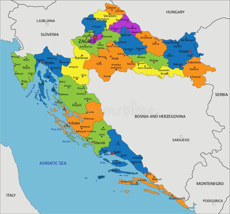
Free with trial Colorful Croatia political map with clearly labeled, separated layers. Vector illustration. Mapping vectors Colorful Croatia political map with clearly labeled, separated layers. Vector illustration
Free with trial Madhya Pradesh administrative and political map. Mapping vectors Madhya Pradesh administrative and political map. Madhya Pradesh administrative and political vector map
Free with trial Turkey map with administrative divisions. Stylized vector Turkey map showing big cities, capital Ankara, administrative divisions and country borders. Mapping vectors Turkey map with administrative divisions. Stylized vector Turkey map showing big cities, capital Ankara, administrative divisions and country borders
Free with trial Stylized vector Latvia map showing big cities, capital Riga, administrative divisions. Mapping vectors Latvia map with administrative divisions. Stylized vector Latvia map showing big cities, capital Riga, administrative divisions. Stylized vector Latvia map showing big cities, capital Riga, administrative divisions.
Free with trial Neighborhood map of the Canadian city of Toronto. Mapping vectors Neighborhood map of the Canadian city of Toronto. Vector neighborhood map of the Canadian city of Toronto
Free with trial Ship wheel and compass rose on white background. Nautical icon design. Mapping vectors Ship wheel compass rose design. Ship wheel and compass rose on white background. Nautical icon design. Ship wheel and compass rose on white background. Nautical icon design.
Free with trial North and South Korea map separate region names individual card blackboard chalkboard. Vector. Mapping vectors North and South Korea map separate region names individual card blackboard chalkboard. Vector
Free with trial Detailed vector map of the Australian continent. Mapping vectors Detailed vector map of the Australian continent.
Free with trial Markers to map. Vector illustration markers for cards. Mapping vectors Markers to map. Vector illustration markers for cards
Free with trial Dominican Republic vector map. Editable template with regions, cities, red pins and blue surface on white background. Mapping vectors Dominican Republic map vector with red pin. Dominican Republic vector map. Editable template with regions, cities, red pins and blue surface on white background. Dominican Republic vector map. Editable template with regions, cities, red pins and blue surface on white background.
Free with trial Lake Balaton,political map. Freshwater rift lake in the Transdanubian region of Hungary in Europe. Tourist region with many resort towns. Most popular are Siofok,Keszthely,Balatonfured and Zamardi. Mapping vectors Lake Balaton in the Transdanubian region of Hungary, political map. Lake Balaton,political map. Freshwater rift lake in the Transdanubian region of Hungary in. Lake Balaton,political map. Freshwater rift lake in the Transdanubian region of Hungary in Europe. Tourist region with many resort towns. Most popular are Siofok,Keszthely,Balatonfured and Zamardi.
Free with trial Marketing Blue Line Icons Set. Content,Search,Strategies,Marketing,Ecommerce,Branding,Seo,Electronic Devices,Reports,Analysis,Social and more Vector Line icons Collection. Mapping vectors Marketing Blue Line Icons Set. Content, Search, Strategies, Marketing, Ecommerce... Marketing Blue Line Icons Set. Content,Search,Strategies,Marketing,Ecommerce. Marketing Blue Line Icons Set. Content,Search,Strategies,Marketing,Ecommerce,Branding,Seo,Electronic Devices,Reports,Analysis,Social and more Vector Line icons Collection
Free with trial Stylized vector Taiwan map. Infographic 3d gold map illustration with cities, borders, capital, administrative divisions and pointer marks, shadow; gradient background. Mapping vectors Stylized Taiwan map vector illustration. Stylized vector Taiwan map. Infographic 3d gold map illustration with cities, borders, capital, administrative. Stylized vector Taiwan map. Infographic 3d gold map illustration with cities, borders, capital, administrative divisions and pointer marks, shadow; gradient background.
Free with trial Jharkhand administrative and political map, India. Mapping vectors Jharkhand administrative and political map, India.
Free with trial Stylized vector Romania map showing big cities, capital Bucharest, administrative divisions. Mapping vectors Romania map with administrative divisions. Stylized vector Romania map showing big cities, capital Bucharest, administrative divisions. Stylized vector Romania map showing big cities, capital Bucharest, administrative divisions.
Free with trial Vector of white tile for background. Mapping vectors White tile vector. Vector of white tile for background. Vector of white tile for background.
Free with trial Road vector map of the brazilian state amazonas. Mapping vectors Road vector map of the brazilian state amazonas,. Road vector map of the brazilian state amazonas. Road vector map of the brazilian state amazonas.
Free with trial World Map Illustration. Modern and colorful world map illustration. Mapping vectors World Map Illustration. Modern and colorful world map illustration
Free with trial Big data analysis to database. Big data technology managing datas from public to database - concept ideas with vintage color. Mapping vectors Big data analysis to database. Big data technology managing datas from public to database - concept ideas with vintage color
Free with trial Road vector map of the brazilian state rio grande do su. Mapping vectors Road map of the brazilian state rio grande do su. Road vector map of the brazilian state rio grande do su. Road vector map of the brazilian state rio grande do su.
Free with trial Neural networks inside a human brain and the sensory inputs. Illustration of neural networks inside a human brain and the sensory inputs. Mapping vectors Neural networks inside a human brain and the sensory inputs. Illustration of neural networks inside a human brain and the sensory inputs
Free with trial Glowing blue digital globe surrounded by interconnected nodes, geometric mesh and orbital routes on a dark background, illustrating worldwide communication and data infrastructure. Mapping vectors Glowing blue digital globe surrounded by interconnected nodes, geometric mesh and orbital routes on a dark background,. Illustrating worldwide communication and
Free with trial Gulf of Naples, political map. Also Bay of Naples, located along south-western coast of Italy, opening to the Tyrrhenian Sea. Campanian volcanic arc with islands Ischia and Capri and Mount Vesuvius. Mapping vectors Gulf of Naples, Ischia, Capri and Mount Vesuvius, Italy, political map. Gulf of Naples, political map. Also Bay of Naples, located along south-western coast of. Gulf of Naples, political map. Also Bay of Naples, located along south-western coast of Italy, opening to the Tyrrhenian Sea. Campanian volcanic arc with islands Ischia and Capri and Mount Vesuvius.
Free with trial Europe with a part of the Middle East, gray political map. Western part of the continent Eurasia, located in the Northern Hemisphere. Countries with international borders and English labeling. Vector. Mapping vectors Europe with part of Middle East, Western Eurasia, gray political map. Europe with a part of the Middle East, gray political map. Western part of the continent. Europe with a part of the Middle East, gray political map. Western part of the continent Eurasia, located in the Northern Hemisphere. Countries with international borders and English labeling. Vector
Free with trial Stylized vector Malaysia map showing big cities, capital Kuala Lumpur, administrative divisions. Mapping vectors Malaysia map with administrative divisions. Stylized vector Malaysia map showing big cities, capital Kuala Lumpur, administrative divisions. Stylized vector Malaysia map showing big cities, capital Kuala Lumpur, administrative divisions.
Free with trial Paraiba colorful administrative and political map. Mapping vectors Paraiba colorful administrative and political map.
Free with trial Simple outline map of the Japanese capital Tokyo. Mapping vectors Simple outline map of the Japanese capital Tokyo.
Free with trial Colorful New Zealand political map with clearly labeled, separated layers. Vector illustration. Mapping vectors Colorful New Zealand political map with clearly labeled, separated layers. Vector illustration
Free with trial Vector map of the wine growing regions of the Australian state of Victoria. Mapping vectors Vector map of the wine growing regions of the Australian state of Victoria.
Free with trial Abstract detailed colored topographic contour map. Mapping vectors Abstract detailed colored topographic contour map.
Free with trial Isometric 3D Indonesia map, vector illustration with cities, borders, capital, administrative divisions and pointer marks; gradient blue background. Concept for infographic. Mapping vectors Isometric 3D Indonesia vector map concept. Isometric 3D Indonesia map, vector illustration with cities, borders, capital, administrative divisions and pointer. Isometric 3D Indonesia map, vector illustration with cities, borders, capital, administrative divisions and pointer marks; gradient blue background. Concept for infographic.
Free with trial Cotton Belt of the United States, political map. Region of the American South, from Delaware to East Texas, where cotton was the predominant cash crop from the late 18th century into the 20th century. Mapping vectors Cotton Belt of United States, region where cotton was the dominant crop, map. Cotton Belt of the United States, political map. Region of the American South, from. Cotton Belt of the United States, political map. Region of the American South, from Delaware to East Texas, where cotton was the predominant cash crop from the late 18th century into the 20th century.
Free with trial Southern Italy,known as Meridione or Mezzogiorno,political map. Macroregion of Italy consisting of its southern regions Abruzzo,Apulia,Basilicata,Calabria,Campania,Molise,Sardinia,and Sicily. Mapping vectors Southern Italy, also known as Meridione or Mezzogiorno, political map. Southern Italy,known as Meridione or Mezzogiorno,political map. Macroregion of Italy. Southern Italy,known as Meridione or Mezzogiorno,political map. Macroregion of Italy consisting of its southern regions Abruzzo,Apulia,Basilicata,Calabria,Campania,Molise,Sardinia,and Sicily.
Free with trial States of Brazil,political map. Differently colored federative units,with their borders and capitals. Subnational entities with certain degree of autonomy,forming the Federative Republic of Brazil. Mapping vectors States of Brazil, differently colored federative units, political map. States of Brazil,political map. Differently colored federative units,with their borders. States of Brazil,political map. Differently colored federative units,with their borders and capitals. Subnational entities with certain degree of autonomy,forming the Federative Republic of Brazil.
Free with trial Tahiti, French Polynesia, political map. Largest island of the Windward group of the Society Islands, with capital Papeete. Overseas collectivity of France, located in the South Pacific Ocean. Vector. Mapping vectors Tahiti, French Polynesia, a part of the Society Islands, political map. Tahiti, French Polynesia, political map. Largest island of the Windward group of the. Tahiti, French Polynesia, political map. Largest island of the Windward group of the Society Islands, with capital Papeete. Overseas collectivity of France, located in the South Pacific Ocean. Vector.
Free with trial Ryukyu Islands,also known as Nansei Islands,gray political map. The Ryukyu Arc,a Japanese,mostly volcanic island chain stretching from Kyushu,Japan,to westernmost Yonaguni Island east of Taiwan. Mapping vectors Ryukyu Islands, also Nansei Islands, Japanese island chain, gray political map. Ryukyu Islands,also known as Nansei Islands,gray political map. The Ryukyu Arc,a. Ryukyu Islands,also known as Nansei Islands,gray political map. The Ryukyu Arc,a Japanese,mostly volcanic island chain stretching from Kyushu,Japan,to westernmost Yonaguni Island east of Taiwan.
Free with trial Ithaca, regional unit, political map. Part of Ionian Islands in Greece, with capital Vathy. Ithaca, Arkoudi, Atokos, and the Echinades islands Drakonera, Vromonas, Makri, Oxeia, Kalogiros and Kouneli. Mapping vectors Ithaca, regional unit, part of the Greek Ionian Islands, political map. Ithaca, regional unit, political map. Part of Ionian Islands in Greece, with capital. Ithaca, regional unit, political map. Part of Ionian Islands in Greece, with capital Vathy. Ithaca, Arkoudi, Atokos, and the Echinades islands Drakonera, Vromonas, Makri, Oxeia, Kalogiros and Kouneli.
Free with trial Hungary map with administrative divisions. Stylized vector Hungary map showing big cities, capital Budapest, administrative divisions and country borders. Mapping vectors Hungary map with administrative divisions. Stylized vector Hungary map showing big cities, capital Budapest, administrative divisions and country borders
Free with trial Turquoise green wavy ribbon background. Abstract papercut decoration. 3d topography relief. Vector realistic illustration. Modern cover layout template. Architectural concept. Mapping vectors Turquoise green wavy ribbon background. Abstract papercut decoration. 3d topography relief. Vector realistic illustration. Modern cover layout template
Free with trial Quadrotor quadcopter equipped with camera hovering near foliage against clouds. Ideal for technology, security, surveillance, innovation, artificial intelligence, outdoor exploration, privacy awareness. Mapping vectors Surveillance quadcopter flying above clouds near bushes for monitoring and security tasks. Quadrotor quadcopter equipped with camera hovering near foliage. Quadrotor quadcopter equipped with camera hovering near foliage against clouds. Ideal for technology, security, surveillance, innovation, artificial intelligence, outdoor exploration, privacy awareness
Free with trial Russia vector map with infographic elements, pointer marks. Editable template with regions, cities and capital Moscow. Mapping vectors Russia vector map with infographic elements, pointer marks. Editable template with regions, cities and capital Moscow
Free with trial Vector map of the spanish autonomous region of Aragon. Mapping vectors Vector map of the spanish autonomous region of Aragon.
Free with trial Landscape Background. Futuristic Landscape with Shiny Grid. Low Poly Terrain. 3D Wireframe Terrain. Network Abstract Background. Cyberspace Grid. Technology Vector Illustration of Low-Poly Landscape. Mapping vectors Landscape Background. Futuristic Landscape with Shiny Grid. Low Poly Terrain. 3D Wireframe Terrain. Network Abstract Background. Cyberspace Grid. Technology
Free with trial Survey map of the Canadian Atlantic States, Atlantic canada. Mapping vectors Survey map of the Canadian Atlantic States, Atlantic canada. Survey map of the four Canadian Atlantic States, Atlantic canada
Free with trial South America,gray political map with international borders and capitals. A continent,bordered by the Pacific and Atlantic Ocean,North America and the Caribbean Sea. Isolated illustration. Vector. Mapping vectors South America, continent, gray political map with borders and capitals. South America,gray political map with international borders and capitals. A continent. South America,gray political map with international borders and capitals. A continent,bordered by the Pacific and Atlantic Ocean,North America and the Caribbean Sea. Isolated illustration. Vector.
Free with trial High detailed Russia physical map. Vector illustration. Mapping vectors High detailed Russia physical map. Vector illustration
Free with trial High detailed Russia physical map. Vector illustration. Mapping vectors High detailed Russia physical map. Vector illustration
Free with trial Colorful Netherlands political map with clearly labeled, separated layers. Vector illustration. Mapping vectors Colorful Netherlands political map with clearly labeled, separated layers. Vector illustration
Free with trial Hand drawn navigations pins isolate on white. Vector map pointers. Position navigation point, illustration of pointer direction mark. Mapping vectors Hand drawn navigations pins isolate on white. Vector map pointers. Position navigation point, illustration of pointer direction mark
Free with trial France vector map with infographic elements, pointer marks. Editable template with regions, cities and capital Paris. Mapping vectors France vector map with infographic elements, pointer marks. Editable template with regions, cities and capital Paris
Free with trial Poland map with borders, cities, capital and administrative divisions. Infographic vector map. Editable layers clearly labeled. Mapping vectors Poland infographic map vector illustration. Poland map with borders, cities, capital and administrative divisions. Infographic vector map. Editable layers. Poland map with borders, cities, capital and administrative divisions. Infographic vector map. Editable layers clearly labeled.
Free with trial Hand holds smartphone with city map gps navigator on smartphone screen. Gps navigation app on mobile phone. Tracking system. Mobile GPS Navigation concept. Mapping vectors Mobile phone with GPS mark. Hand holds smartphone with city map gps navigator on smartphone screen. Gps navigation app on mobile phone. Tracking system. Mobile. Hand holds smartphone with city map gps navigator on smartphone screen. Gps navigation app on mobile phone. Tracking system. Mobile GPS Navigation concept.
Free with trial Isometric 3D Netherlands map, vector illustration with cities, borders, capital, administrative divisions and pointer marks; gradient blue background. Concept for infographic. Mapping vectors Isometric 3D Netherlands vector map concept. Isometric 3D Netherlands map, vector illustration with cities, borders, capital, administrative divisions and. Isometric 3D Netherlands map, vector illustration with cities, borders, capital, administrative divisions and pointer marks; gradient blue background. Concept for infographic.
Free with trial Isometric City Road Elements Set with Trees. Vector illustration. Mapping vectors Isometric City Road Elements Set with Trees. Vector illustration
Free with trial Road vector map of indonesian island of nias, indonesia. Mapping vectors Road vector map of indonesian island of nias, indonesia.
Free with trial Clinical Study Web Header Banner & Icon Set. Mapping vectors Clinical Study Web Header Banner & Icon Set. Clinical Study - Web Header Banner and Icon Set
Free with trial Ukraine map administrative division separate regions color map isolated on white background blank. Template. Mapping vectors Ukraine map administrative division separate regions color map isolated on white background blank. Template
Free with trial Map of the Greek Cycladic island of Paros. Mapping vectors Map of the Greek Cycladic island of Paros.
Free with trial Map of the Greek Cycladic island of Naxos. Mapping vectors Map of the Greek Cycladic island of Naxos.
 Sign in