Free with trial Rhode island state outline administrative and political vector map in color. Mapping vectors Rhode island state outline administrative and political vector map in color.
Free with trial Seamless pattern. Fictional topo contour map design. Vector. Geography concept. Abstract wavy graphic backdrop. Cartography and topology. Line topographic contour map background. Black and white. Mapping vectors Line topographic contour map background. Seamless. Seamless pattern. Fictional topo contour map design. Vector. Geography concept. Abstract wavy graphic. Seamless pattern. Fictional topo contour map design. Vector. Geography concept. Abstract wavy graphic backdrop. Cartography and topology. Line topographic contour map background. Black and white.
Free with trial Road vector map of the autonomous community of andalusia, spain. Mapping vectors Road vector map of the autonomous community of andalusia, spain.
Free with trial High detailed Turkey physical map with labeling. Vector illustration. Mapping vectors High detailed Turkey physical map with labeling. Vector illustration
Free with trial Graticule globe Meridian and parallel , the field lines on the surface Meridian and parallel, vector template graticule. Mapping vectors Graticule globe Meridian and parallel. The field lines on the surface Meridian and parallel, vector template graticule
Free with trial High detailed Belgium physical map with labeling. clearly labeled, separated layers, vector illustration. Mapping vectors High detailed Belgium physical map with labeling. Clearly labeled, separated layers, vector illustration
Free with trial High detailed Belgium physical map with labeling. clearly labeled, separated layers, vector illustration. Mapping vectors High detailed Belgium physical map with labeling. Clearly labeled, separated layers, vector illustration
Free with trial Vector illustration of political map of Europe designed with dots of different sizes and tones of blue. Mapping vectors Political map of Europe designed with dots of different sizes and tones of blue. Vector illustration of political map of Europe designed with dots of different. Vector illustration of political map of Europe designed with dots of different sizes and tones of blue.
Free with trial Vector map of the Indonesian megacity urban area Jabodetabek. Mapping vectors Vector map of the Indonesian megacity urban area Jabodetabek.
Free with trial High detailed Italy road map with labeling. Vector illustration. Mapping vectors High detailed Italy road map with labeling. Vector illustration
Free with trial High detailed Ukraine physical map with labeling. Vector illustration. Mapping vectors High detailed Ukraine physical map with labeling. Vector illustration
Free with trial Ceara colorful administrative and political vector map, brazil. Mapping vectors Ceara colorful administrative and political vector map, brazil.
Free with trial Administrative and political map of indian state of Assam, india. Mapping vectors Administrative and political map of indian state of Assam, india.
Free with trial City map Krakow, color detailed plan, vector illustration. Streets and trails. Mapping vectors City map Krakow, color detailed plan, vector illustration. Streets and trails
Free with trial Colorful Europe political map with clearly labeled, separated layers. Vector illustration. Mapping vectors Colorful Europe political map with clearly labeled, separated layers. Vector illustration
Free with trial Map of a top view from the rooftops, city streets, trees and highways. Mapping vectors Map of a top view from the rooftops. City streets, trees and highways
Free with trial La Gomera island, political map, with capital San Sebastian de La Gomera. One of the Canary Islands, an archipelago and autonomous community of Spain, in North Atlantic Ocean, off the coast of Africa. Mapping vectors La Gomera island, political map, part of the Canary Islands, Spain. La Gomera island, political map, with capital San Sebastian de La Gomera. One of the Canary. La Gomera island, political map, with capital San Sebastian de La Gomera. One of the Canary Islands, an archipelago and autonomous community of Spain, in North Atlantic Ocean, off the coast of Africa.
Free with trial Vektor road map of the island state of Mauritius in the Indian Ocean. Mapping vectors Vektor road map of the island state of Mauritius in the Indian Ocean.
Free with trial Black map pin,. Map pin, black color on white background, vector illustration. Mapping vectors Black map pin,. Map pin, black color on white background, vector illustration
Free with trial Political map of Europe in gray color with white background and the names of the countries in English. Vector illustration. Mapping vectors Political map of Europe in gray color with white background and the names of the countries in English. Vector illustration
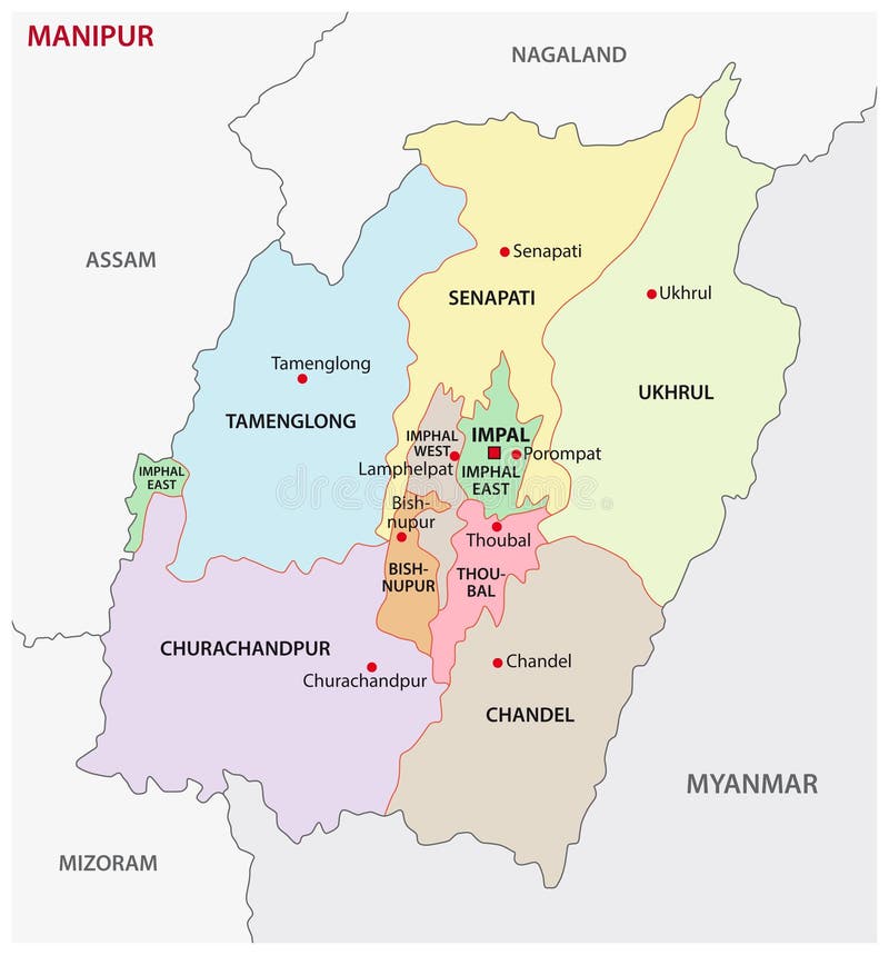
Free with trial Manipur administrative and political map, india. Mapping vectors Manipur administrative and political map, india.
Free with trial Flat 3d Isometric Woman owner Standing at Her Shopping Store with GPS Location Pin. Store Location and Gps Navigation Concept. Mapping vectors Isometric Woman owner Standing at Her Shopping Store with GPS Location Pin. Flat 3d Isometric Woman owner Standing at Her Shopping Store with GPS Location Pin. Flat 3d Isometric Woman owner Standing at Her Shopping Store with GPS Location Pin. Store Location and Gps Navigation Concept
Free with trial North America - Highly detailed editable political map with separated layers. Mapping vectors North America - Highly detailed editable political map. North America - Highly detailed editable political map with separated layers. North America - Highly detailed editable political map with separated layers.
Free with trial Vector map of the autonomous Italian region of Aosta Valley, Italy. Mapping vectors Vector map of the autonomous Italian region of Aosta Valley, Italy.
Free with trial Montana state outline administrative and political vector map in black and white. Mapping vectors Montana state outline administrative and political vector map in black and white
Free with trial Colombia administrativ and political vector map in black and white. Mapping vectors Colombia administrativ and political vector map in black and white.
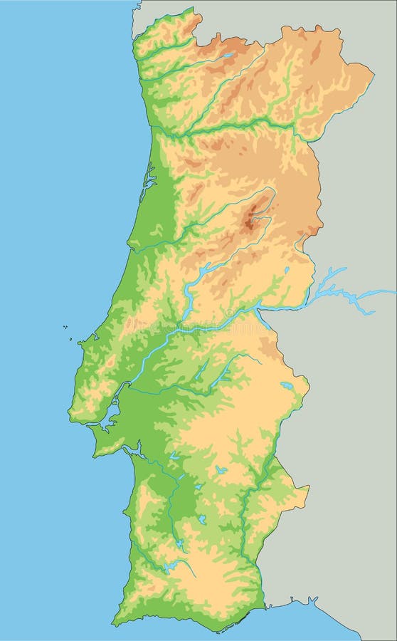
Free with trial High detailed Portugal physical map. Vector illustration. Mapping vectors High detailed Portugal physical map. Vector illustration
Free with trial Kentucky state outline administrative and political vector map in black and white. Mapping vectors Kentucky state outline administrative and political vector map in black and white.
Free with trial Iran, political map with provinces, borders, capital Tehran and major cities. The Islamic Republic of Iran, IRI, also known as Persia, a country in West Asia, divided into 31 provinces. Illustration. Mapping vectors Iran, political map with provinces, borders, capital Tehran and major cities. The Islamic Republic of Iran, IRI, also known as Persia, a country in West Asia
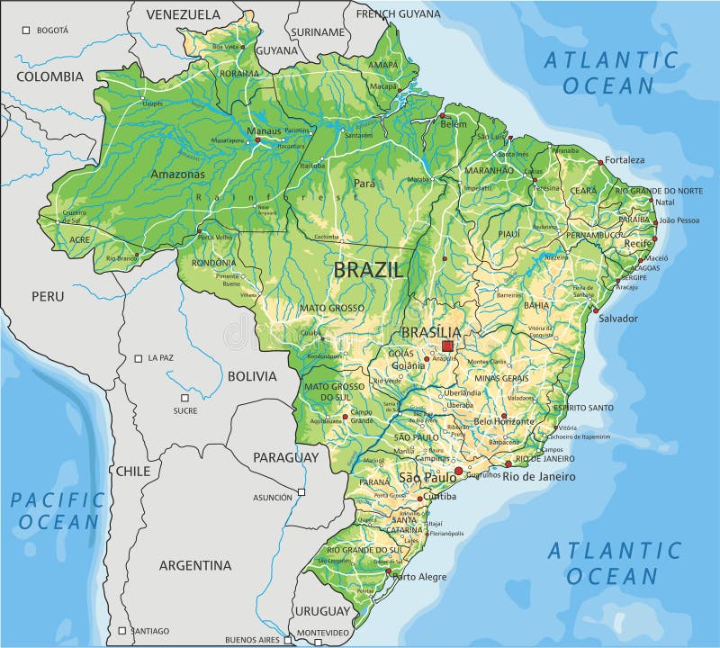
Free with trial High detailed Brazil physical map. Clearly labeled, separated layers, vector illustration. Mapping vectors High detailed Brazil physical map with labeling. High detailed Brazil physical map. Clearly labeled, separated layers, vector illustration. High detailed Brazil physical map. Clearly labeled, separated layers, vector illustration.
Free with trial Neighborhood and district map of the Finnish capital Helsinki, Helsingfors. Mapping vectors Neighborhood and district map of the Finnish capital Helsinki. Helsingfors
Free with trial Administrative and political map of the republic of Chile. Mapping vectors Administrative and political map of the republic of Chile.
Free with trial Metropolitan Region of Jundiai administrative vector map, Brazil. Mapping vectors Metropolitan Region of Jundiai administrative vector map, Brazil.
Free with trial Vector map of the Mascarene Islands, Mauritius, Reunion, Rodrigues. Mapping vectors Vector map of the Mascarene Islands, Mauritius, Reunion, Rodrigues.
Free with trial Poland is a country located in Central Europe. Mapping vectors Republic of Poland location on Europe map. Poland is a country located in Central Europe. Poland is a country located in Central Europe.
Free with trial Roatan island road vector map, honduras. Mapping vectors Roatan island road vector map, honduras.
Free with trial Cuba vector map. Editable template with regions, cities, red pins and blue surface on white background. Mapping vectors Cuba vector map. Editable template with regions, cities, red pins and blue surface on white background
Free with trial Taiwan Area, gray political map, with capital Taipei. Free Area of the Republic of China, ROC. Main Island and island groups of Taiwan, located between the East and the South China Sea. Illustration. Mapping vectors Taiwan Area, gray political map, Free Area of the Republic of China. Taiwan Area, gray political map, with capital Taipei. Free Area of the Republic of China. Taiwan Area, gray political map, with capital Taipei. Free Area of the Republic of China, ROC. Main Island and island groups of Taiwan, located between the East and the South China Sea. Illustration.
Free with trial Administrative and political map of indian state of kerala, india. Mapping vectors Administrative and political map of indian state of kerala, india.
Free with trial Isometric 3D Iraq map. Stylized vector map illustration with cities, borders, capital, administrative divisions and pointer marks; gradient background with grid. Mapping vectors Isometric Iraq map with city names and administrative divisions. Isometric 3D Iraq map. Stylized vector map illustration with cities, borders, capital. Isometric 3D Iraq map. Stylized vector map illustration with cities, borders, capital, administrative divisions and pointer marks; gradient background with grid.
Free with trial Vector map of the five geographic regions of Canada. Mapping vectors Vector map of the five geographic regions of Canada.
Free with trial Administrative and political map of the Colombian city of Medellin. Mapping vectors Administrative and political map of the Colombian city of Medellin.
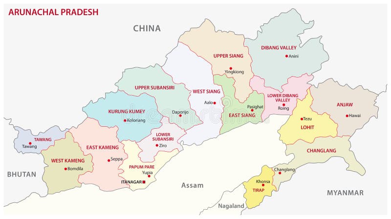
Free with trial Arunachal Pradesh administrative and political vector map, india. Mapping vectors Arunachal Pradesh administrative and political vector map, india.
Free with trial Constructor roads in isometric view. Isometric road elements. Create your own isometric city road. Vector illustration. Mapping vectors Constructor roads in isometric view. Isometric road elements. Create your own isometric city road. Vector illustration
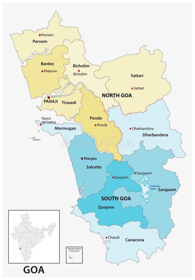
Free with trial Administrative and political vector map of the Indian state of Goa. Mapping vectors Administrative and political vector map of the Indian state of Goa.
Free with trial Administrative and political map of the Indonesian city of Bandung. Mapping vectors Administrative and political map of the Indonesian city of Bandung.
Free with trial Vector map of Oman. Country map with division, cities and capital Muscat. Political map, world map, infographic elements. Mapping vectors Vector map of Oman. Country map with division, cities and capital Muscat. Political map, world map, infographic elements
Free with trial Black smartphone with map gps navigation application with pin point to current location isolated on white. Vector illustration. Mapping vectors Black smartphone with map gps navigation application with pin point to current location isolated on white. Vector illustration.
Free with trial Road map New Caledonia French island group in the South Pacific. Mapping vectors Road map New Caledonia French island group in the South Pacific.
Free with trial Vector map of the Pacific volcanic island of Rarotonga, Cook Islands. Mapping vectors Vector map of the Pacific volcanic island of Rarotonga, Cook Islands.
Free with trial One of regions of the French Republic. Auvergne Rhone Alpes is a region in southeast-central France. Mapping vectors One of regions of the French Republic. Auvergne Rhone Alpes is a region in southeast-central France
Free with trial Great Lakes of North America, gray political map. Lakes Superior, Michigan, Huron, Erie and Ontario. Series of large interconnected freshwater lakes, on or near the border of Canada and United States. Mapping vectors Great Lakes of North America, freshwater lakes, gray political map. Great Lakes of North America, gray political map. Lakes Superior, Michigan, Huron, Erie and. Great Lakes of North America, gray political map. Lakes Superior, Michigan, Huron, Erie and Ontario. Series of large interconnected freshwater lakes, on or near the border of Canada and United States.
Free with trial NEOM,regions and places,gray political map. Planned smart city in Saudi Arabia (Tabuk Province) with four regions. A floating industrial complex,global trade hub,tourist resorts and a linear city. Mapping vectors Regions and places of NEOM, planned smart city in Saudi Arabia, political map. NEOM,regions and places,gray political map. Planned smart city in Saudi Arabia (. NEOM,regions and places,gray political map. Planned smart city in Saudi Arabia (Tabuk Province) with four regions. A floating industrial complex,global trade hub,tourist resorts and a linear city.
Free with trial Mesoamerica and its cultural areas map. Historical region from southern part of North America to most of Central America. North of Mexico,West,Center,Gulf,Guerrero,Oaxaca,Maya and Centroamerica. Mapping vectors Mesoamerica and its cultural areas, map of a historical region. Mesoamerica and its cultural areas map. Historical region from southern part of North America to. Mesoamerica and its cultural areas map. Historical region from southern part of North America to most of Central America. North of Mexico,West,Center,Gulf,Guerrero,Oaxaca,Maya and Centroamerica.
Free with trial INSTC, International North–South Transport Corridor, political map. Network for moving freight, with Moscow as north end and Mumbai as south end, replacing the standard route across Mediterranean Sea. Mapping vectors INSTC, International North–South Transport Corridor, political map. Network for moving freight, with Moscow as north end and Mumbai as south end, replacing
Free with trial Mozambique map vector with red pin. Mozambique vector map. Editable template with regions, cities, red pins and blue surface on white background. Mapping vectors Mozambique map vector with red pin. Mozambique vector map. Editable template with regions, cities, red pins and blue surface on white background
Free with trial Saxony administrative and political map in german language. Mapping vectors Saxony administrative and political map in german language.
Free with trial Isometric industrial factory buildings, warehouse, water purification system. Plant buildings, factories with tanks, pipes, crane vector illustration set. Industrial objects city map planning. Mapping vectors Isometric industrial factory buildings, warehouse, water purification system. Plant buildings, factories with tanks. Pipes, crane vector illustration set. Isometric industrial factory buildings, warehouse, water purification system. Plant buildings, factories with tanks, pipes, crane vector illustration set. Industrial objects city map planning
Free with trial Vegetation vector map of Costa Rica country with important cities. Mapping vectors Vegetation vector map of Costa Rica country with important cities.
Free with trial High detailed Spain physical map. Vector illustration. Mapping vectors High detailed Spain physical map. Vector illustration
Free with trial Administrative, political and road map of the Colombian city of Cali. Mapping vectors Administrative, political and road map of the Colombian city of Cali.
Free with trial High detailed India physical map. Vector illustration. Mapping vectors High detailed India physical map. Vector illustration
Free with trial Aegean Sea region with Aegean Islands,political map. An elongated embayment of the Mediterranean Sea,located between Europe and Asia,and between the Balkans and Anatolia,Greece and Turkey. Vector. Mapping vectors Aegean Sea region, with Aegean Islands, political map. Aegean Sea region with Aegean Islands,political map. An elongated embayment of the Mediterranean Sea. Aegean Sea region with Aegean Islands,political map. An elongated embayment of the Mediterranean Sea,located between Europe and Asia,and between the Balkans and Anatolia,Greece and Turkey. Vector.
Free with trial Vector map of Nepal. Country map with division, cities and capital Kathmandu. Political map, world map, infographic elements. Mapping vectors Vector map of Nepal. Country map with division, cities and capital Kathmandu. Political map, world map, infographic elements
Free with trial Colorado state map with neighboring states. Mapping vectors Colorado state map with neighboring states.
Free with trial Administrative and political map of the australian state victoria. Mapping vectors Administrative and political map of the australian state victoria.
Free with trial Eyelash types, false eyelashes Extension Procedure. Woman Eye with Long Eyelashes. Doll Lashes vector. Mapping vectors Eyelash types, false eyelashes Extension Procedure. Woman Eye with Long Eyelashes. Doll Lashes in vector. Eyelash types, false eyelashes Extension Procedure. Eyelash types, false eyelashes Extension Procedure. Woman Eye with Long Eyelashes. Doll Lashes vector
Free with trial Vector map of Mexico. Country map with division, cities and capital. Political map, world map, infographic elements. Mapping vectors Vector map of Mexico. Country map with division, cities and capital. Political map, world map, infographic elements
Free with trial A collection of various north arrow symbols and compass designs used for orientation in architecture blueprints and maps. Mapping vectors North arrow compass indicators set for architectural plans and maps. A collection of various north arrow symbols and compass designs used for orientation in. A collection of various north arrow symbols and compass designs used for orientation in architecture blueprints and maps
Free with trial South America,political map with borders,capitals and the largest rivers. A continent,bordered by the Pacific and the Atlantic Ocean,by North America and the Caribbean Sea. Illustration. Vector. Mapping vectors South America, political map with borders, capitals and rivers. South America,political map with borders,capitals and the largest rivers. A continent,bordered by. South America,political map with borders,capitals and the largest rivers. A continent,bordered by the Pacific and the Atlantic Ocean,by North America and the Caribbean Sea. Illustration. Vector.
Free with trial High detailed Romania road map with labeling. Vector illustration. Mapping vectors High detailed Romania road map with labeling. Vector illustration
Free with trial The Global South, political world map, showing developing countries or territories highlighted in yellow, least developed countries in orange, and the Global North in gray color. Illustration. Vector. Mapping vectors Global South, political map with developing and least developed countries. The Global South, political world map, showing developing countries or territories. The Global South, political world map, showing developing countries or territories highlighted in yellow, least developed countries in orange, and the Global North in gray color. Illustration. Vector.
Free with trial A comprehensive set of minimalist black-and-white outline symbols designed for public navigation, transit hubs, and commercial building wayfinding systems. The icons emphasize visual economy and high legibility for architectural signage. Mapping vectors Public Transit Wayfinding Outline Symbols. A comprehensive set of minimalist black-and-white outline symbols designed for public navigation, transit hubs, and. A comprehensive set of minimalist black-and-white outline symbols designed for public navigation, transit hubs, and commercial building wayfinding systems. The icons emphasize visual economy and high legibility for architectural signage.
Free with trial Medical Healthcare Icons with People Charting Disease / Scientif. Medical Healthcare Icons w People Charting Disease or Scientific Discovery Web Header Banner. Mapping vectors Medical Healthcare Icons with People Charting Disease / Scientif. Medical Healthcare Icons w People Charting Disease or Scientific Discovery Web Header Banner
Free with trial High detailed Portugal physical map with labeling. Vector illustration. Mapping vectors High detailed Portugal physical map with labeling. Vector illustration
Free with trial High detailed Portugal physical map with labeling. Vector illustration. Mapping vectors High detailed Portugal physical map with labeling. Vector illustration
Free with trial Navigator for road. Ui template Route with points pin map top view distance visualization garish vector navigator screen. road, Illustration route navigation, ui city map. Mapping vectors Navigator for road. Ui template Route with points pin map top view distance visualization garish vector navigator screen. Road, Illustration route navigation
Free with trial Vector map of the Indonesian island of Nusa Penida located east of Bali. Mapping vectors Vector map of the Indonesian island of Nusa Penida located east of Bali.
Free with trial Administrative and political map of the Indonesian city of Yogyakarta. Mapping vectors Administrative and political map of the Indonesian city Yogyakarta. Administrative and political map of the Indonesian city of Yogyakarta. Administrative and political map of the Indonesian city of Yogyakarta.
Free with trial Global Heat Map of Temperature Distribution. This image displays a world map illustrating temperature distribution with color-coded regions. Mapping vectors Global Heat Map of Temperature Distribution. This image displays a world map illustrating temperature distribution with color-coded regions
 Sign in