Free with trial United Kingdom - Highly detailed editable political map with separated layers. Vector illustration. Mapping vectors United Kingdom - Highly detailed editable political map with separated layers. Vector illustration
Free with trial Vector road map of the Malaysian states of Sarawak and Sabah on the island of Borneo, Malaysia. Mapping vectors Vector road map of the Malaysian states of Sarawak and Sabah on the island of Borneo, Malaysia.
Free with trial Video Content Visual Multimedia Modern Art Interactive Design Icon Set. Vector Illustration. Mapping vectors Video Content Visual Multimedia Modern Art Interactive Design Icon Set. Vector Illustration
Free with trial West, census region of the United States of America, gray political map of census region 4, consisting of 13 single states. Map with geographical borders and capitals. Isolated illustration. Mapping vectors West, census region of the United States, gray political map. West, census region of the United States of America, gray political map of census region 4. West, census region of the United States of America, gray political map of census region 4, consisting of 13 single states. Map with geographical borders and capitals. Isolated illustration.
Free with trial Southern Italy,Meridione or Mezzogiorno,gray political map. Macroregion of Italy consisting of its southern regions Abruzzo,Apulia,Basilicata,Calabria,Campania,Molise,Sardinia,and Sicily. Mapping vectors Southern Italy, Meridione or Mezzogiorno, gray political map. Southern Italy,Meridione or Mezzogiorno,gray political map. Macroregion of Italy consisting of its. Southern Italy,Meridione or Mezzogiorno,gray political map. Macroregion of Italy consisting of its southern regions Abruzzo,Apulia,Basilicata,Calabria,Campania,Molise,Sardinia,and Sicily.
Free with trial Bahia road and administrative map brazil. Mapping vectors Bahia road and administrative map brazil.
Free with trial Smart farm - modern colorful line design style icons. Technologies in agriculture industry. Crop spraying drone, livestock monitoring, soil scanning, temperature control, field mapping, hydroponics. Mapping vectors Smart farm - modern colorful line design style icons. Technologies in agriculture industry. Crop spraying drone, livestock monitoring, soil scanning
Free with trial Mobile gps navigation on mobile phone with map. Smartphone with navigation map in hand. Mobile technologies concept. Mapping vectors Mobile gps navigation on mobile phone with map. Smartphone with navigation map in hand. Mobile technologies concept
Free with trial Isometric location pin. Map position pointer. Place tag. Mapping vectors Isometric location pin. Map position pointer. Place tag
Free with trial Administrative and political map of the mexican state of sonora in spanish language. Mapping vectors Administrative and political map of the mexican state of sonora in spanish language.
Free with trial Isometric 3D Uzbekistan map. Stylized vector map illustration with cities, borders, capital, administrative divisions and pointer marks; gradient background with grid. Mapping vectors Isometric Uzbekistan map with city names and administrative divisions. Isometric 3D Uzbekistan map. Stylized vector map illustration with cities, borders. Isometric 3D Uzbekistan map. Stylized vector map illustration with cities, borders, capital, administrative divisions and pointer marks; gradient background with grid.
Free with trial One line drawing of classroom classroom. Teacher raises hand while teaching in class, shown in a continuous line art, representing education, learning, and lesson engagement. Mapping vectors One Line Drawing of Teacher Teaching in Classroom. One line drawing of classroom classroom. Teacher raises hand while teaching in class, shown in a continuous. One line drawing of classroom classroom. Teacher raises hand while teaching in class, shown in a continuous line art, representing education, learning, and lesson engagement
Free with trial Isometric 3D Australia map vector map illustration with cities, borders, capital, administrative divisions and pointer marks; gradient blue background. Concept for infographic. Mapping vectors Isometric 3D Australia map vector map. Illustration with cities, borders, capital, administrative divisions and pointer marks; gradient blue background. Concept
Free with trial Colorful Ukraine political map with clearly labeled, separated layers. Vector illustration. Mapping vectors Colorful Ukraine political map with clearly labeled, separated layers. Vector illustration
Free with trial Nanpo Islands,island groups of Japan,political map. Volcanic islands,located in the Pacific east of Philippine Sea,south of Japanese archipelago,comprising the Izu,Ogasawara and Volcano Islands. Mapping vectors Nanpo Islands, volcanic island groups of Japan, political map. Nanpo Islands,island groups of Japan,political map. Volcanic islands,located in the Pacific east. Nanpo Islands,island groups of Japan,political map. Volcanic islands,located in the Pacific east of Philippine Sea,south of Japanese archipelago,comprising the Izu,Ogasawara and Volcano Islands.
Free with trial Black Sea region,gray political map. Marginal mediterranean sea of the Atlantic Ocean,between Europe and Asia. With Crimea,Sea of Azov,Sea of Marmara,Bosporus,Dardanelles and the Kerch Strait. Mapping vectors Black Sea region, with Crimea and Sea of Azov, gray political map. Black Sea region,gray political map. Marginal mediterranean sea of the Atlantic Ocean,between. Black Sea region,gray political map. Marginal mediterranean sea of the Atlantic Ocean,between Europe and Asia. With Crimea,Sea of Azov,Sea of Marmara,Bosporus,Dardanelles and the Kerch Strait.
Free with trial Gulf States of the United States, political map. Also known as Gulf South. Coastline along the Southern US, where the states Texas, Louisiana, Mississippi, Alabama and Florida meet the Gulf of Mexico. Mapping vectors Gulf States of the United States, also Gulf Coast or Gulf South, political map. Gulf States of the United States, political map. Also known as Gulf South. Gulf States of the United States, political map. Also known as Gulf South. Coastline along the Southern US, where the states Texas, Louisiana, Mississippi, Alabama and Florida meet the Gulf of Mexico.
Free with trial Leeward Islands,gray political map. Western part of the Society Islands in French Polynesia. Overseas collectivity of France in the South Pacific,with capital Uturoa on the largest island Raiatea. Mapping vectors Leeward Islands, part of French Polynesia, gray political map. Leeward Islands,gray political map. Western part of the Society Islands in French Polynesia. Leeward Islands,gray political map. Western part of the Society Islands in French Polynesia. Overseas collectivity of France in the South Pacific,with capital Uturoa on the largest island Raiatea.
Free with trial Regions of Iceland, gray political map, with capital Reykjavik. Eight regions and their seats, used for statistical purposes. Nordic island country in Atlantic Ocean. Isolated illustration. Vector. Mapping vectors Regions of Iceland, Nordic island country, gray political map. Regions of Iceland, gray political map, with capital Reykjavik. Eight regions and their seats. Regions of Iceland, gray political map, with capital Reykjavik. Eight regions and their seats, used for statistical purposes. Nordic island country in Atlantic Ocean. Isolated illustration. Vector.
Free with trial Corn Belt, Wheat Belt and Rice Belt of the United States, political map. Regions in the U. S. states, that grow the nations dominant portion of maize, wheat and rice. Isolated illustration, over white. Mapping vectors Corn Belt, Wheat Belt and Rice Belt of the United States, political map. Regions in the U.S. states, that grow the nations dominant portion of maize, wheat and
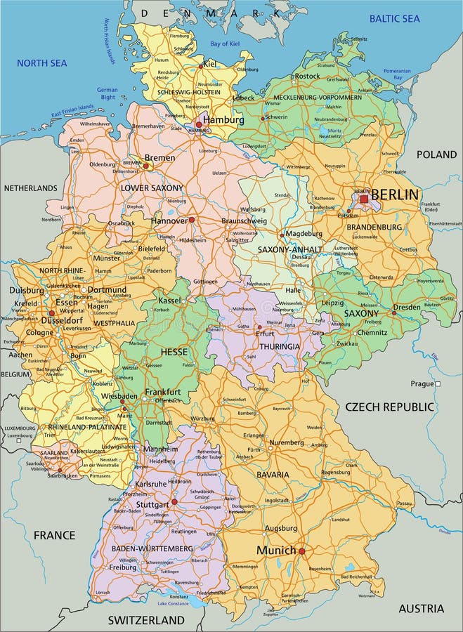
Free with trial Germany - Highly detailed editable political map with separated layers. Vector illustration. Mapping vectors Germany - Highly detailed editable political map with separated layers. Vector illustration
Free with trial Cancun,Cozumel and Riviera Maya in Mexico,gray political map. Cancun,city on Yucatan Peninsula coast,north of Riviera Maya,a Caribbean coast resort,with Cozumel in the east of Playa del Carmen. Mapping vectors Cancun, Cozumel and Riviera Maya in Mexico, gray political map. Cancun,Cozumel and Riviera Maya in Mexico,gray political map. Cancun,city on Yucatan Peninsula. Cancun,Cozumel and Riviera Maya in Mexico,gray political map. Cancun,city on Yucatan Peninsula coast,north of Riviera Maya,a Caribbean coast resort,with Cozumel in the east of Playa del Carmen.
Free with trial High detailed Spain physical map. Vector illustration. Mapping vectors High detailed Spain physical map. Vector illustration
Free with trial Abstract World Map - Vector illustration - Geometric Structure in gray color for presentation, booklet, website and other design projects. Polygonal background. Mapping vectors Abstract World Map - Vector illustration - Geometric Structure in gray color for presentation, booklet, website and other design. Abstract World Map - Vector. Abstract World Map - Vector illustration - Geometric Structure in gray color for presentation, booklet, website and other design projects. Polygonal background.
Free with trial High detailed Brazil physical map. Clearly labeled, separated layers, vector illustration. Mapping vectors High detailed Brazil physical map. Clearly labeled, separated layers, vector illustration
Free with trial Nagaland administrative and political map. Mapping vectors Nagaland administrative and political map. Nagaland administrative and political vector map
Free with trial Zakynthos, Greek island, gray political map. Also Zakinthos or Zante, a part of the Ionian Islands of Greece, and a separate regional unit, with the same named capital Zakynthos. Illustration. Vector. Mapping vectors Zakynthos, Zykinthos or Zante, Greek island, gray political map. Zakynthos, Greek island, gray political map. Also Zakinthos or Zante, a part of the Ionian. Zakynthos, Greek island, gray political map. Also Zakinthos or Zante, a part of the Ionian Islands of Greece, and a separate regional unit, with the same named capital Zakynthos. Illustration. Vector.
Free with trial Leeward Antilles, gray political map. Caribbean island chain. From Aruba, Curacao and Bonaire to La Tortuga and Margarite Island. Southerly islands of the Lesser Antilles, north the Venezuelan coast. Mapping vectors Leeward Antilles, a Caribbean island chain, gray political map. Leeward Antilles, gray political map. Caribbean island chain. From Aruba, Curacao and Bonaire to. Leeward Antilles, gray political map. Caribbean island chain. From Aruba, Curacao and Bonaire to La Tortuga and Margarite Island. Southerly islands of the Lesser Antilles, north the Venezuelan coast.
Free with trial Ibiza and Formentera Island, Spain, political map. Pityusic Islands commonly known as Pine Islands, part of the Balearic Islands, an archipelago of Spain in the Mediterranean Sea. Illustration. Vector. Mapping vectors Ibiza and Formentera Island, Spain, political map, the Pityusic Islands. Ibiza and Formentera Island, Spain, political map. Pityusic Islands commonly known as. Ibiza and Formentera Island, Spain, political map. Pityusic Islands commonly known as Pine Islands, part of the Balearic Islands, an archipelago of Spain in the Mediterranean Sea. Illustration. Vector
Free with trial Map of the twenty-two clubs of the North American football league. Mapping vectors Map of the twenty-two clubs of the North American football league.
Free with trial Detailed colored vector road map of ukraine. Mapping vectors Detailed colored vector road map of ukraine.
Free with trial Assorted curved and straight road segments with lane markings Assorted curved and straight road segments with lane markings. Mapping vectors Assorted curved and straight road segments with lane markings. Assorted curved and straight road segments with lane markings Assorted curved and straight road segments with lane markings
Free with trial Australia - Highly detailed editable political map with separated layers. Vector illustration. Mapping vectors Australia - Highly detailed editable political map with separated layers. Vector illustration
Free with trial Seamless background airplanes flying with dashed. Seamless background with airplanes flying with dashed lines as tracks or routes on blue sky. Mapping vectors Seamless background airplanes flying with dashed. Seamless background with airplanes flying with dashed lines as tracks or routes on blue sky
Free with trial Abstract landscape background. Mosaic. 3d technology vector illustration. Can be used for banner, flyer, book cover, poster, web banners. Mapping vectors Abstract landscape background. Mosaic. 3d. Technology vector illustration. Can be used for banner, flyer, book cover, poster, web banners
Free with trial Vector Outline Mind Map, Hand Drawn Plan, Business Planning, Background Template. Mapping vectors Vector Outline Mind Map, Hand Drawn Plan, Business Planning. Vector Outline Mind Map, Hand Drawn Plan, Business Planning, Background Template. Vector Outline Mind Map, Hand Drawn Plan, Business Planning, Background Template.
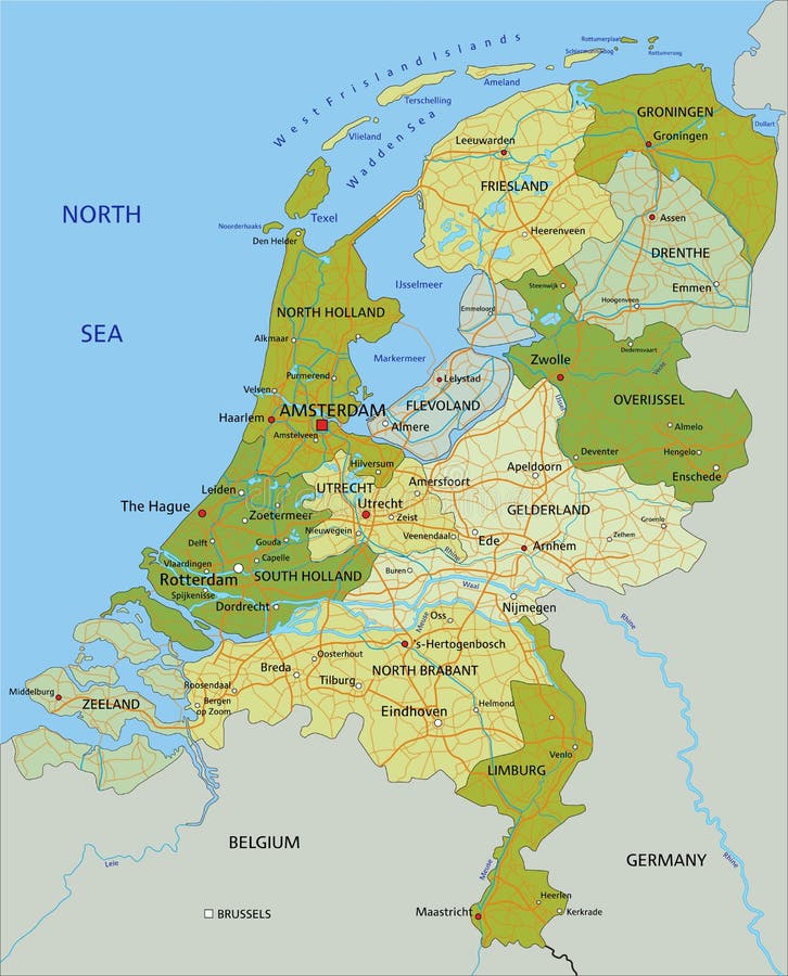
Free with trial Highly detailed editable political map with separated layers. Netherlands. Vector illustration. Mapping vectors Highly detailed editable political map with separated layers. Netherlands. Vector illustration
Free with trial Netherlands - Highly detailed editable political map with separated layers. Vector illustration. Mapping vectors Netherlands - Highly detailed editable political map with separated layers. Vector illustration
Free with trial High detailed Mexico physical map. Vector illustration. Mapping vectors High detailed Mexico physical map. Vector illustration
Free with trial States of Brazil,gray political map. Federative units with borders and capitals. Subnational entities with certain degree of autonomy,forming the Federative Republic of Brazil with capital Brasilia. Mapping vectors States of Brazil, federative units with capitals, gray political map. States of Brazil,gray political map. Federative units with borders and capitals. States of Brazil,gray political map. Federative units with borders and capitals. Subnational entities with certain degree of autonomy,forming the Federative Republic of Brazil with capital Brasilia.
Free with trial High detailed Canada physical map. Vector illustration. Mapping vectors High detailed Canada physical map. Vector illustration
Free with trial High detailed Canada physical map. Vector illustration. Mapping vectors High detailed Canada physical map. Vector illustration
Free with trial Vector map of the Mayan Ruins of Tulum, Mexico. Mapping vectors Vector map of the Mayan Ruins of Tulum, Mexico.
Free with trial Stylized map of Canada. Isometric 3D green map with cities, borders, capital Ottawa, regions. Vector illustration. Editable layers clearly labeled. English language. Mapping vectors Stylized map of Canada. Isometric 3D. Green map with cities, borders, capital Ottawa, regions. Vector illustration. Editable layers clearly labeled. English
Free with trial South Sandwich Islands, political map. Part of the British Overseas Territory of South Georgia and the South Sandwich Islands. Group of islands in the South Atlantic Ocean and Scotia Sea. Vector. Mapping vectors South Sandwich Islands, political map, Island group in South Atlantic. South Sandwich Islands, political map. Part of the British Overseas Territory of South. South Sandwich Islands, political map. Part of the British Overseas Territory of South Georgia and the South Sandwich Islands. Group of islands in the South Atlantic Ocean and Scotia Sea. Vector.
Free with trial Ascension Island, political map. Tropical island and British Overseas Territory in the South Atlantic Ocean, with capital Georgetown. Illustration. Vector. Mapping vectors Ascension Island, political map, tropical island in the South Atlantic. Ascension Island, political map. Tropical island and British Overseas Territory in the. Ascension Island, political map. Tropical island and British Overseas Territory in the South Atlantic Ocean, with capital Georgetown. Illustration. Vector.
Free with trial Ibiza and Formentera Island, Spain, gray political map. Pityusic Islands, also known as Pine Islands, part of Balearic Islands, an archipelago of Spain, in the Mediterranean Sea. Illustration. Vector. Mapping vectors Ibiza and Formentera Island, Spain, gray political map, Pityusic Islands. Ibiza and Formentera Island, Spain, gray political map. Pityusic Islands, also known as. Ibiza and Formentera Island, Spain, gray political map. Pityusic Islands, also known as Pine Islands, part of Balearic Islands, an archipelago of Spain, in the Mediterranean Sea. Illustration. Vector.
Free with trial Mind Map Head Infographic template. flat icons collection. simple design vector. Mapping vectors Mind Map Head Infographic template. flat icons collection. simple design vector.
Free with trial Mind Map Head Infographic template. flat icons collection. simple design vector. Mapping vectors Mind Map Head Infographic template. flat icons collection. simple design vector.
Free with trial Dna test infographic. Vector illustration. Genome sequence map. Template for your design. Background, wallpaper. Mapping vectors Dna test infographic. Vector illustration. Genome sequence map. Template for your design. Background, wallpaper. Dna test infographic. Vector illustration
Free with trial Stylized map of Serbia. Isometric 3D green map with cities, borders, capital Belgrade, regions. Vector illustration. Editable layers clearly labeled. English language. Mapping vectors Stylized map of Serbia. Isometric 3D. Green map with cities, borders, capital Belgrade, regions. Vector illustration. Editable layers clearly labeled. English
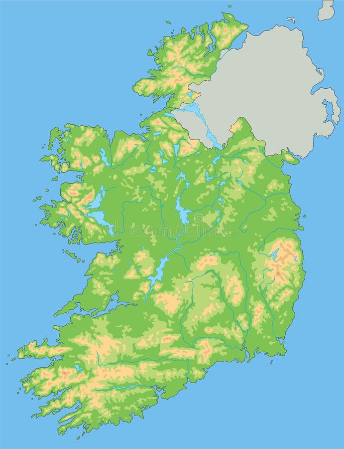
Free with trial High detailed Ireland physical map. Vector illustration. Mapping vectors High detailed Ireland physical map. Vector illustration
Free with trial Colorful South America political map with clearly labeled, separated layers. Vector illustration. Mapping vectors Colorful South America political map with clearly labeled, separated layers. Vector illustration
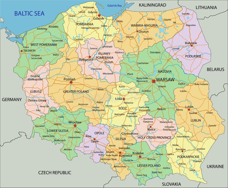
Free with trial Poland - Highly detailed editable political map with labeling. Vector illustration. Mapping vectors Poland - Highly detailed editable political map with labeling. Vector illustration
Free with trial South Atlantic Islands political map. Islands and archipelagos between Africa and Brazil, Cape Verde and Antarctic Region. With British Overseas Territory Saint Helena, Ascension and Tristan da Cunha. Mapping vectors South Atlantic Islands, between Africa and Brazil, political map. South Atlantic Islands political map. Islands and archipelagos between Africa and Brazil, Cape. South Atlantic Islands political map. Islands and archipelagos between Africa and Brazil, Cape Verde and Antarctic Region. With British Overseas Territory Saint Helena, Ascension and Tristan da Cunha.
Free with trial Oregon, U. S. state, subdivided into 36 counties, multi colored political map with capital Salem, borders and county names. State in the Pacific Northwest region of the United States. The Beaver State. Mapping vectors Oregon, U.S. state, subdivided into 36 counties, multi colored map. Oregon, U.S. state, subdivided into 36 counties, multi colored political map with capital. Oregon, U.S. state, subdivided into 36 counties, multi colored political map with capital Salem, borders and county names. State in the Pacific Northwest region of the United States. The Beaver State.
Free with trial Bay of Bengal, political map. Northeastern part of the Indian Ocean and largest bay of the world, positioned between the Indian subcontinent and Indochinese peninsula, located below the Bengal region. Mapping vectors Bay of Bengal, northeastern part of the Indian Ocean, political map. Bay of Bengal, political map. Northeastern part of the Indian Ocean and largest bay of the. Bay of Bengal, political map. Northeastern part of the Indian Ocean and largest bay of the world, positioned between the Indian subcontinent and Indochinese peninsula, located below the Bengal region.
Free with trial Liguria and the Italian Riviera, or Ligurian Riviera, gray political map. Region of north-western Italy, with capital Genoa. Narrow coastal strip between Ventimiglia and La Spezia on the Ligurian Sea. Mapping vectors Liguria and the Italian Riviera, or Ligurian Riviera, gray political map. Region of north-western Italy, with capital Genoa. Narrow coastal strip between
Free with trial Forecast weather isobar map, meteorology wind front and temperature diagram, vector background. Weather forecast and climate generic system map with cyclone and anticyclone wind in graphic chart. Mapping vectors Forecast weather isobar map, temperature diagram. Forecast weather isobar map, meteorology wind front and temperature diagram, vector background. Weather. Forecast weather isobar map, meteorology wind front and temperature diagram, vector background. Weather forecast and climate generic system map with cyclone and anticyclone wind in graphic chart
Free with trial High detailed Japan physical map. Vector illustration. Mapping vectors High detailed Japan physical map. Vector illustration
Free with trial High detailed Japan physical map. Vector illustration. Mapping vectors High detailed Japan physical map. Vector illustration
Free with trial Finland - Highly detailed editable political map with labeling. Vector illustration. Mapping vectors Finland - Highly detailed editable political map with labeling. Vector illustration
Free with trial Colored administrative and political vector map of us federal state oregon with seal. Mapping vectors Colored administrative and political vector map of us federal state oregon with seal.
Free with trial High detailed Germany physical map with labeling. Vector illustration. Mapping vectors High detailed Germany physical map with labeling. Vector illustration
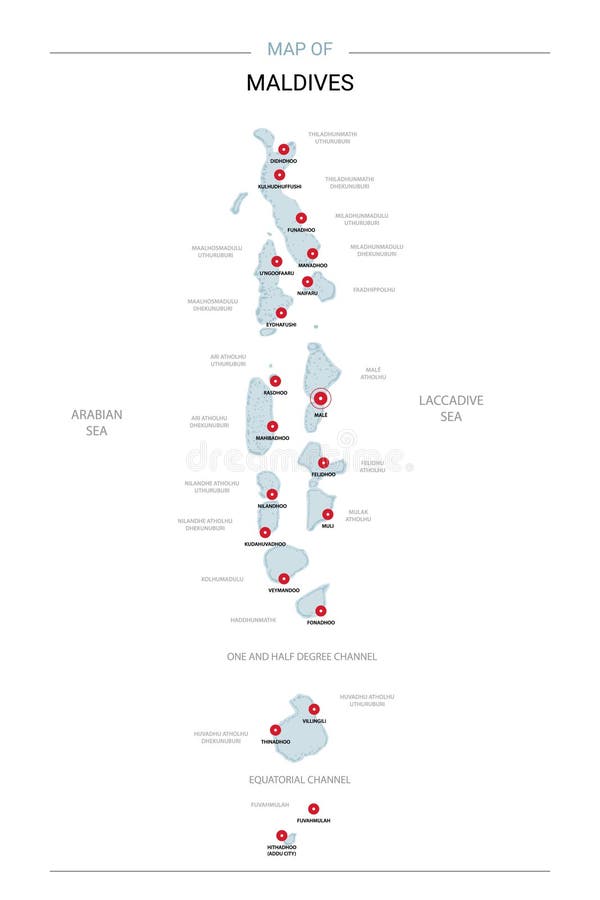
Free with trial Maldives map vector with red pin. Maldives vector map. Editable template with regions, cities, red pins and blue surface on white background. Mapping vectors Maldives map vector with red pin. Maldives vector map. Editable template with regions, cities, red pins and blue surface on white background
Free with trial Isometric 3D Thailand map, vector illustration with cities, borders, capital, administrative divisions and pointer marks; gradient blue background. Concept for infographic. Mapping vectors Isometric 3D Thailand vector map concept. Isometric 3D Thailand map, vector illustration with cities, borders, capital, administrative divisions and pointer. Isometric 3D Thailand map, vector illustration with cities, borders, capital, administrative divisions and pointer marks; gradient blue background. Concept for infographic.
Free with trial High detailed United States of America physical map. Vector illustration. Mapping vectors High detailed United States of America physical map. Vector illustration
Free with trial Isometric 3D India map, vector illustration with cities, borders, capital, administrative divisions and pointer marks; gradient blue background. Concept for infographic. Mapping vectors Isometric 3D India vector map concept. Isometric 3D India map, vector illustration with cities, borders, capital, administrative divisions and pointer marks. Isometric 3D India map, vector illustration with cities, borders, capital, administrative divisions and pointer marks; gradient blue background. Concept for infographic.
Free with trial Stylized vector Oman map. Infographic 3d gold map illustration with cities, borders, capital, administrative divisions and pointer marks, shadow; gradient background. Mapping vectors Stylized Oman map vector illustration. Stylized vector Oman map. Infographic 3d gold map illustration with cities, borders, capital, administrative divisions. Stylized vector Oman map. Infographic 3d gold map illustration with cities, borders, capital, administrative divisions and pointer marks, shadow; gradient background.
Free with trial Ithaca,island and regional unit in Greece,gray political map. Part of the Ionian Islands. Ithaca,Arkoudi,Atokos,and the Echinades islands Drakonera,Vromonas,Makri,Oxeia,Kalogiros and Kouneli. Mapping vectors Ithaca, an island and regional unit in Greece, gray political map. Ithaca,island and regional unit in Greece,gray political map. Part of the Ionian Islands. Ithaca,island and regional unit in Greece,gray political map. Part of the Ionian Islands. Ithaca,Arkoudi,Atokos,and the Echinades islands Drakonera,Vromonas,Makri,Oxeia,Kalogiros and Kouneli.
Free with trial Persian Gulf region,gray political map. Also the Arabian Gulf,a mediterranean Sea in West Asia,located between Iran and Arabian Peninsula,connected to Gulf of Oman in the east by Strait of Hormuz. Mapping vectors Persian Gulf region, and the Strait of Hormuz, gray political map. Persian Gulf region,gray political map. Also the Arabian Gulf,a mediterranean Sea in West Asia. Persian Gulf region,gray political map. Also the Arabian Gulf,a mediterranean Sea in West Asia,located between Iran and Arabian Peninsula,connected to Gulf of Oman in the east by Strait of Hormuz.
Free with trial Japan political map. Main islands Honshu,Hokkaido,Kyushu,Shikoku and Okinawa. East Asian island country in the North Pacific bordered by Sea of Japan and Okhotsk,and East China and Philippine Sea. Mapping vectors Japan, main islands, political of the island country in East Asia. Japan political map. Main islands Honshu,Hokkaido,Kyushu,Shikoku and Okinawa. East Asian. Japan political map. Main islands Honshu,Hokkaido,Kyushu,Shikoku and Okinawa. East Asian island country in the North Pacific bordered by Sea of Japan and Okhotsk,and East China and Philippine Sea.
Free with trial Principal tectonic plates of the Earth,gray map. The sixteen major pieces of crust and uppermost mantle of the Earth,called the lithosphere,and consisting of oceanic and continental crust. Vector. Mapping vectors Principal tectonic plates, 16 major pieces of the Earth, gray map. Principal tectonic plates of the Earth,gray map. The sixteen major pieces of crust and. Principal tectonic plates of the Earth,gray map. The sixteen major pieces of crust and uppermost mantle of the Earth,called the lithosphere,and consisting of oceanic and continental crust. Vector.
Free with trial Gulf of Venice, gray political map. A bay of water in the northern Adriatic Sea, limited by the Po delta and Venetian Lagoon in Italy, and the Istrian Peninsula in Croatia, also bordered by Slovenia. Mapping vectors Gulf of Venice, bay of water in the Adriatic Sea, gray political map. Gulf of Venice, gray political map. A bay of water in the northern Adriatic Sea, limited by. Gulf of Venice, gray political map. A bay of water in the northern Adriatic Sea, limited by the Po delta and Venetian Lagoon in Italy, and the Istrian Peninsula in Croatia, also bordered by Slovenia.
Free with trial Western New Guinea, gray political map. Also Papua, is a Western portion of the Melanesian island of New Guinea, administered by Indonesia, with the provinces Papua and West Papua. English labeling. Mapping vectors Western New Guinea, Papua, a part of Indonesia, gray political map. Western New Guinea, gray political map. Also Papua, is a Western portion of the Melanesian. Western New Guinea, gray political map. Also Papua, is a Western portion of the Melanesian island of New Guinea, administered by Indonesia, with the provinces Papua and West Papua. English labeling.
Free with trial Czech Republic - Highly detailed editable political map with labeling. Vector illustration. Mapping vectors Czech Republic - Highly detailed editable political map with labeling. Vector illustration
Free with trial Detailed railway map of the main routes of India. Mapping vectors Detailed railway map of the main routes of India.
Free with trial Stylized vector Mexico map. Infographic 3d gold map illustration with cities, borders, capital, administrative divisions and pointer marks, shadow; gradient background. Mapping vectors Stylized Mexico map vector illustration. Stylized vector Mexico map. Infographic 3d gold map illustration with cities, borders, capital, administrative. Stylized vector Mexico map. Infographic 3d gold map illustration with cities, borders, capital, administrative divisions and pointer marks, shadow; gradient background.
Free with trial India map with administrative divisions. Stylized vector India map showing big cities, capital New Delhi, administrative divisions and country borders. Mapping vectors India map with administrative divisions. Stylized vector India map showing big cities, capital New Delhi, administrative divisions and country borders
Free with trial Road vector map of the brazilian state ceara. Mapping vectors Road vector map of the brazilian state ceara.
 Sign in