Free with trial Road Map for GPS Application. Easy to edit vector illustration of road map for GPS application. Mapping vectors Road Map for GPS Application. Easy to edit vector illustration of road map for GPS application
Free with trial Texas state icon on vertical blue wave backdrop. Vertical blue wave background with a texas icon. Mapping vectors Texas state icon on vertical blue wave backdrop. Vertical blue wave background with a texas icon
Free with trial A stylizedmap of Iceland showing the different provinces. Mapping vectors Map Iceland. A stylizedmap of Iceland showing the different provinces. A stylizedmap of Iceland showing the different provinces.
Free with trial India Political Map. No roads. Vector illustration. Mapping vectors India Political Map. No roads. Vector illustration
Free with trial Hexagon pointer. Set on white background. Mapping vectors Hexagon pointer. Set on white background
Free with trial New York State NYS, gray political map, with capital Albany, borders and important cities. State in Northeastern United States of America. English labeling. Illustration on white background. Vector. Mapping vectors New York State NYS, gray colored political map. New York State NYS, gray political map, with capital Albany, borders and important cities. State in Northeastern. New York State NYS, gray political map, with capital Albany, borders and important cities. State in Northeastern United States of America. English labeling. Illustration on white background. Vector.
Free with trial Massachusetts, U. S. state, political map. The Commonwealth of Massachusetts, a state in the New England region of Northeastern United States, with capital Boston, nicknamed The Bay State. Vector. Mapping vectors Massachusetts, U.S. state, political map. The Commonwealth of Massachusetts, a state in the New England region of Northeastern United States, with capital
Free with trial Comoros map. Administrative division of the Union of the Comoros. Mapping vectors Comoros map. Administrative division of the Union of the Comoros
Free with trial Map of Austria. Stylized map of Austria showing cities, provinces and several rivers. All on white background. german caption. Mapping vectors Map of Austria. Stylized map of Austria showing cities, provinces and several rivers. All on white background. german caption
Free with trial A stylized map of Afghanistan showing the diferent provinces. Mapping vectors Map Afghanistan. A stylized map of Afghanistan showing the diferent provinces. A stylized map of Afghanistan showing the diferent provinces.
Free with trial Utah, UT, political map, with the capital Salt Lake City. State in the Mountain West subregion of the Western United States of America, nicknamed Beehive State, The Mormon State, and Deseret. Vector. Mapping vectors Utah, UT, political map, US state, nicknamed Beehive State. Utah, UT, political map, with the capital Salt Lake City. State in the Mountain West subregion of the. Utah, UT, political map, with the capital Salt Lake City. State in the Mountain West subregion of the Western United States of America, nicknamed Beehive State, The Mormon State, and Deseret. Vector.
Free with trial Travel poster, urban street plan city map Prague and Vienna, vector illustration. For design. Mapping vectors Travel poster, urban street plan city map Prague and Vienna, vector illustration. For design
Free with trial Set of travel posters with London, detailed urban street plan city map, Silhouette city skyline, vector artwork, set 2. For decorating walls. Mapping vectors Set of travel posters with London, detailed urban street plan city map, Silhouette city skyline, vector artwork, set 2. For decorating walls
Free with trial Compasses, pencil and drawing pen. Vector 3d icon of pair of compasses, pencil and drawing pen. Mapping vectors Compasses, pencil and drawing pen. Vector 3d icon of pair of compasses, pencil and drawing pen
Free with trial Montana, MT, political map with the capital Helena. State in the Mountain West subregion of the Western United States of America, nicknamed Big Sky Country and The Treasure State. Illustration. Vector. Mapping vectors Montana, MT, political map, US state, Big Sky Country. Montana, MT, political map with the capital Helena. State in the Mountain West subregion of the Western. Montana, MT, political map with the capital Helena. State in the Mountain West subregion of the Western United States of America, nicknamed Big Sky Country and The Treasure State. Illustration. Vector
Free with trial Travel poster, urban street plan city map Florence and Milan, vector illustration. For design. Mapping vectors Travel poster, urban street plan city map Florence and Milan, vector illustration. For design
Free with trial Cape Verde map. Administrative division of the Republic of Cape Verde. Mapping vectors Cape Verde map. Administrative division of the Republic of Cape Verde
Free with trial Travel poster, urban street plan city map Brussels and Antwerp, vector illustration. For design. Mapping vectors Travel poster, urban street plan city map Brussels and Antwerp, vector illustration. For design
Free with trial Travel poster, urban street plan city map Budapest and Zagreb, vector illustration. For design. Mapping vectors Travel poster, urban street plan city map Budapest and Zagreb, vector illustration. For design
Free with trial Geo location navigator in mobile application. Vector illustration layered for easy manipulation and custom coloring. Mapping vectors GPS city map arrow. Geo location navigator in mobile application. Vector illustration layered for easy manipulation and custom coloring. Geo location navigator in mobile application. Vector illustration layered for easy manipulation and custom coloring.
Free with trial Travel poster, urban street plan city map Belfast and Edinburgh, vector illustration. For design. Mapping vectors Travel poster, urban street plan city map Belfast and Edinburgh, vector illustration. For design
Free with trial A dynamic 3d world map with background. Mapping vectors Globe Word Map of Earth Background. A dynamic 3d world map with background. A dynamic 3d world map with background.
Free with trial Set of travel posters with Marseille, detailed urban street plan city map, Silhouette city skyline, vector artwork. For design. Mapping vectors Set of travel posters with Marseille, detailed urban street plan city map, Silhouette city skyline, vector artwork. For design
Free with trial Set of travel posters with Cairo, detailed urban street plan city map, Silhouette city skyline, vector artwork. For decorating walls. Mapping vectors Set of travel posters with Cairo, detailed urban street plan city map, Silhouette city skyline, vector artwork. For decorating walls
Free with trial Texas icon on blue and black arrows. Mapping vectors Texas icon on blue and black arrows. Texas icon on blue and black arrow banners
Free with trial Europe Political Map. Vintage Colors. Detailed illustration of Europe Map. Mapping vectors Europe Political Map. Vintage Colors. Detailed illustration of Europe Map
Free with trial Guinea-Bissau map. Administrative division of the Republic of Guinea-Bissau. Mapping vectors Guinea-Bissau map. Administrative division of the Republic of Guinea-Bissau
Free with trial Old vintage map of Russian Federation with separated layers. Mapping vectors Old vintage map of Russian Federation. With separated layers
Free with trial Vector Blue Map of the European Union. With extra UE countries in grey on a White Background. Mapping vectors Vector Blue Map of the European Union. With extra UE countries in grey on a White Background
Free with trial Oregon Coast, political map. Coastal region of U. S. state of Oregon, bordered by Pacific Ocean to the west and Oregon Coast Range to the east, stretching from Columbia River to the California border. Mapping vectors Oregon Coast, coastal region of U.S. state of Oregon, political map. Oregon Coast, political map. Coastal region of U.S. state of Oregon, bordered by Pacific. Oregon Coast, political map. Coastal region of U.S. state of Oregon, bordered by Pacific Ocean to the west and Oregon Coast Range to the east, stretching from Columbia River to the California border.
Free with trial Canary Islands map. Administrative division of the Canary Islands. Mapping vectors Canary Islands map. Administrative division of the Canary Islands
Free with trial World map Gps navigator icon shape. Vector file layered for easy manipulation and custom coloring. Mapping vectors GPS world map concept. World map Gps navigator icon shape. Vector file layered for easy manipulation and custom coloring. World map Gps navigator icon shape. Vector file layered for easy manipulation and custom coloring.
Free with trial Detailed United States of America map. Vector a large color map of the USA. Mapping vectors Detailed United States of America map. Vector a large color map of the USA
Free with trial A stylized map of Iceland showing different big cities. Mapping vectors Map of Iceland. A stylized map of Iceland showing different big cities. A stylized map of Iceland showing different big cities.
Free with trial Smart phone navigation - mobile gps. Mapping vectors Smart phone navigation. Mobile gps
Free with trial Island of Hawaii, gray colored political map. Largest island in the U. S. State of Hawaii in the North Pacific Ocean. Big Island, Big I, Hawaii Island. English labeling. Illustration over white. Vector. Mapping vectors Island of Hawaii, Big Island, gray political map. Island of Hawaii, gray colored political map. Largest island in the U. S. State of Hawaii in the North Pacific. Island of Hawaii, gray colored political map. Largest island in the U. S. State of Hawaii in the North Pacific Ocean. Big Island, Big I, Hawaii Island. English labeling. Illustration over white. Vector
Free with trial Seamless floral rose vector background. Seamless floral rose background. Colorful vector illustration. Mapping vectors Seamless floral rose vector background. Seamless floral rose background. Colorful vector illustration
Free with trial Lonestar state icon on striped banners. Blue and silver checkered striped banners with a texas lonestar icon. Mapping vectors Lonestar state icon on striped banners. Blue and silver checkered striped banners with a texas lonestar icon
Free with trial Travel poster, urban street plan city map Buenos aires and Montevideo, vector illustration. For decorating walls. Mapping vectors Travel poster, urban street plan city map Buenos aires and Montevideo, vector illustration. For decorating walls
Free with trial New Jersey, U. S. state, subdivided into 21 counties, multi colored political map with capital Trenton, borders and county names. State in the Mid-Atlantic and Northeastern region of the United States. Mapping vectors New Jersey, U.S. state, subdivided into 21 counties, multi colored map. New Jersey, U.S. state, subdivided into 21 counties, multi colored political map with. New Jersey, U.S. state, subdivided into 21 counties, multi colored political map with capital Trenton, borders and county names. State in the Mid-Atlantic and Northeastern region of the United States.
Free with trial Europe Map in Colors of Blue and Map Markers. Detailed illustration of Europe Map. Mapping vectors Europe Map in Colors of Blue and Map Markers. Detailed illustration of Europe Map
Free with trial Town Suburb Road Maker Construction Kit. Suburb Road construction Kit to Build your own, see my portfolio for other kits. Mapping vectors Town Suburb Road Maker Construction Kit. Suburb Road construction Kit to Build your own, see my portfolio for other kits
Free with trial Africa old vintage political map with separated layers. Mapping vectors Old vintage map of Africa. Africa old vintage political map with separated layers. Africa old vintage political map with separated layers.
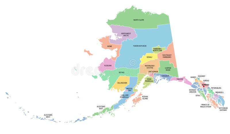
Free with trial Alaska, U. S. state, subdivided into 19 organized boroughs and 11 census areas, multi colored political map. State on the northwest extremity of North America in the Western USA region. Last Frontier. Mapping vectors Alaska, U.S. state, boroughs and census areas, multi colored political map. Alaska, U.S. state, subdivided into 19 organized boroughs and 11 census areas, multi. Alaska, U.S. state, subdivided into 19 organized boroughs and 11 census areas, multi colored political map. State on the northwest extremity of North America in the Western USA region. Last Frontier.
Free with trial Set of travel posters with Manchester, detailed urban street plan city map, Silhouette city skyline, vector artwork, set 2. For decorating walls. Mapping vectors Set of travel posters with Manchester, detailed urban street plan city map, Silhouette city skyline, vector artwork, set 2. For decorating walls
Free with trial Channel Islands of California, political map. Eight-island archipelago in the Pacific, southwest of Los Angeles metropolitan area, administered by the counties Santa Barbara, Ventura and Los Angeles. Mapping vectors Channel Islands of California, political map. Eight-island archipelago in the Pacific, southwest of Los Angeles metropolitan area, administered by the counties
Free with trial Bosporus and Dardanelles, political map. The Turkish Straits, internationally significant and narrow waterways in Turkey. Passages, connecting the Aegean Sea and the Sea of Marmara with the Black Sea. Mapping vectors Bosporus and Dardanelles, the Turkish Straits, political map. Bosporus and Dardanelles, political map. The Turkish Straits, internationally significant and. Bosporus and Dardanelles, political map. The Turkish Straits, internationally significant and narrow waterways in Turkey. Passages, connecting the Aegean Sea and the Sea of Marmara with the Black Sea.
Free with trial Streets and Roads Pattern in Retro Blue Gray Flat Design Transport concept. Streets and Roads Pattern in Retro Blue Gray Flat Design - grouped easy to edit. Mapping vectors Streets and Roads Pattern in Retro Blue Gray Flat Design Transport concept. Streets and Roads Pattern in Retro Blue Gray Flat Design - grouped easy to edit
Free with trial Oceania, colored single states, political map. Geographic region, southeast of the Asia-Pacific region including Australasia, Melanesia, Micronesia and Polynesia. Illustration over white. Vector. Mapping vectors Oceania, colored single states, political map. Geographic region, southeast of the Asia-Pacific region including Australasia, Melanesia, Micronesia and
Free with trial A simple 3D map of Germany. Mapping vectors Map_Germany. A simple 3D map of Germany. A simple 3D map of Germany.
Free with trial Oregon Coast, gray political map. Coastal region of U. S. state of Oregon, bordered by Pacific Ocean to the west and Oregon Coast Range to the east, stretching from Columbia River to California border. Mapping vectors Oregon Coast, coastal region of U.S. state of Oregon, gray political map. Oregon Coast, gray political map. Coastal region of U.S. state of Oregon, bordered by. Oregon Coast, gray political map. Coastal region of U.S. state of Oregon, bordered by Pacific Ocean to the west and Oregon Coast Range to the east, stretching from Columbia River to California border.
Free with trial Globe map - abstract geometric vector illustration. Globe polygonal illustration. Design element. Mapping vectors Globe map - abstract geometric vector illustration. Globe polygonal illustration. Design element
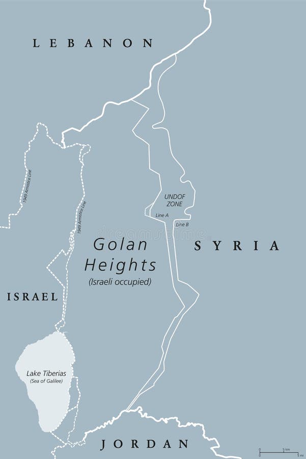
Free with trial Golan Heights. political map with borders, important places, rivers and Lake Tiberias. A region in the Levant. Area, captured from Syria and occupied by Israel. English labeling. Illustration. Vector. Mapping vectors Golan Heights political map. Golan Heights. political map with borders, important places, rivers and Lake Tiberias. A region in the Levant. Area, captured from. Golan Heights. political map with borders, important places, rivers and Lake Tiberias. A region in the Levant. Area, captured from Syria and occupied by Israel. English labeling. Illustration. Vector.
Free with trial Oregon, OR, political map with the capital Salem. State in the Pacific Northwest region of the Western United States of America, with the nickname The Beaver State. Illustration. Vector. Mapping vectors Oregon, OR, political map, US state, The Beaver State. Oregon, OR, political map with the capital Salem. State in the Pacific Northwest region of the Western. Oregon, OR, political map with the capital Salem. State in the Pacific Northwest region of the Western United States of America, with the nickname The Beaver State. Illustration. Vector.
Free with trial A stylized map of Colombia showing different cities and nearby countries. Mapping vectors Map Colombia. A stylized map of Colombia showing different cities and nearby countries. A stylized map of Colombia showing different cities and nearby countries.
Free with trial The Caucasus, or Caucasia, political map. A region between the Black Sea and the Caspian Sea, mainly occupied by Armenia, Azerbaijan, Georgia, and parts of Southern Russia, with disputed areas. Vector. Mapping vectors The Caucasus, or Caucasia, political map. A region between the Black Sea and the Caspian Sea, mainly occupied by Armenia, Azerbaijan, Georgia, and parts of
Free with trial Continent on Rotatable Globe. Continent and Ocean Rotatable Globe, Credit World Map from NASA. Mapping vectors Continent on Rotatable Globe. Continent and Ocean Rotatable Globe, Credit World Map from NASA
Free with trial Floral light green floral wallpaper. Illustration. Mapping vectors Floral light green floral wallpaper. Illustration
Free with trial Georgia, GA, gray political map with capital Atlanta and largest cities. State in the southeastern region of the United States of America. Peach State. Empire State of the South. Illustration. Vector. Mapping vectors Georgia, GA, gray political map, Peach State, Empire State of the South. Georgia, GA, gray political map with capital Atlanta and largest cities. State in the. Georgia, GA, gray political map with capital Atlanta and largest cities. State in the southeastern region of the United States of America. Peach State. Empire State of the South. Illustration. Vector
Free with trial GPS Navigator. Using his map and tracking the way to the destination place. Mapping vectors GPS Navigator. Using his map and tracking the way to the destination place
Free with trial Travel poster, urban street plan city map Vilnius and Minsk, vector illustration. Detailed city plan for design. Mapping vectors Travel poster, urban street plan city map Vilnius and Minsk, vector illustration. Detailed city plan for design
Free with trial Texas icon on stylized banner. Blue halftone stylized advertisement with a texas state icon. Mapping vectors Texas icon on stylized banner. Blue halftone stylized advertisement with a texas state icon
Free with trial Portugal Physical Map. No text. Detailed vector illustration of map. Mapping vectors Portugal Physical Map. No text. Detailed vector illustration of map
Free with trial Arrondissements of Paris, capital of France, Europe, political map. Paris is divided into 20 municipal arrondissements. They spiral outwards clockwise, starting with Louvre, the first arrondissement. Mapping vectors Arrondissements of Paris, capital of France, Europe, political map. Paris is divided into 20 municipal arrondissements. They spiral outwards clockwise
Free with trial Travel poster, urban street plan city map Kyiv and Lviv, vector illustration. Detailed city plan for design. Mapping vectors Travel poster, urban street plan city map Kyiv and Lviv, vector illustration. Detailed city plan for design
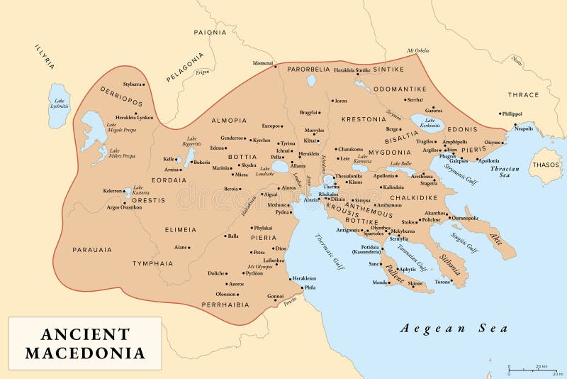
Free with trial Ancient Macedonia, Macedon, history map with approximate boundaries before Roman conquest. Kingdom on periphery of Archaic and Classical Greece which later become dominant state of Hellenistic Greece. Mapping vectors Ancient Macedonia, Macedon, history map. With approximate boundaries before Roman conquest. Kingdom on periphery of Archaic and Classical Greece which later. Ancient Macedonia, Macedon, history map with approximate boundaries before Roman conquest. Kingdom on periphery of Archaic and Classical Greece which later become dominant state of Hellenistic Greece.
Free with trial Globe vector logo icon map international, global icon business maps countries. Mapping vectors Globe vector logo icon map international. Global icon business maps countries
Free with trial Hand holding phone showing map. Vector illustration of hand holding phone showing map. Mapping vectors Hand holding phone showing map. Vector illustration of hand holding phone showing map
Free with trial Channel Islands of California, gray political map. Eight-island archipelago in the Pacific, southwest of Los Angeles metropolitan area, administered by counties Santa Barbara, Ventura and Los Angeles. Mapping vectors Channel Islands of California, gray political map. Eight-island archipelago in the Pacific, southwest of Los Angeles metropolitan area, administered by
Free with trial Travel poster, urban street plan city map Cardiff and Dublin, vector illustration. For design. Mapping vectors Travel poster, urban street plan city map Cardiff and Dublin, vector illustration. For design
Free with trial Detailed borough map of Manhattan New York city, vector poster or postcard for city road and park plan. For design. Mapping vectors Detailed borough map of Manhattan New York city, vector poster or postcard for city road and park plan. For design
Free with trial Map pointer. Navigation marker, map pointer, icon. Mapping vectors Map pointer. Navigation marker, map pointer, icon
Free with trial Map markers. Navigation marker, map pointer, icon. Mapping vectors Map markers. Navigation marker, map pointer, icon
Free with trial Big data concept. With elephant in line style. Mapping vectors Big data concept. With elephant in line style
Free with trial Set of travel posters with Hong Kong, detailed urban street plan city map, Silhouette city skyline, vector artwork, set 2. For decorating walls. Mapping vectors Set of travel posters with Hong Kong, detailed urban street plan city map, Silhouette city skyline, vector artwork, set 2. For decorating walls
Free with trial Golan Heights. political map with borders. A region in the Levant. Area, captured from Syria and occupied by Israel. English labeling. Gray illustration on white background. Vector. Mapping vectors Golan Heights political map gray. Golan Heights. political map with borders. A region in the Levant. Area, captured from Syria and occupied by Israel. English. Golan Heights. political map with borders. A region in the Levant. Area, captured from Syria and occupied by Israel. English labeling. Gray illustration on white background. Vector.
Free with trial Mallorca political map, with capital Palma and important towns. Majorca, largest Island of the autonomous community of the Balearic Islands, and part of Spain, located in the Mediterranean Sea. Vector. Mapping vectors Mallorca, Majorca political map, with capital Palma. Mallorca political map, with capital Palma and important towns. Majorca, largest Island of the autonomous. Mallorca political map, with capital Palma and important towns. Majorca, largest Island of the autonomous community of the Balearic Islands, and part of Spain, located in the Mediterranean Sea. Vector
Free with trial Florida Keys, United States, gray political map. Coral cay archipelago off southern coast of Florida Peninsula, extend in an arc to the westernmost of the inhabited islands Key West, to Dry Tortugas. Mapping vectors Florida Keys, United States, gray political map. Coral cay archipelago off southern coast of Florida Peninsula, extend in an arc to the westernmost of the
Free with trial Set of travel posters with San Francisco, detailed urban street plan city map, Silhouette city skyline, vector artwork, set 2 for decorating walls for decorating walls. Mapping vectors Set of travel posters with San Francisco, detailed urban street plan city map, Silhouette city skyline, vector artwork, set 2. For decorating walls for
 Sign in