Free with trial Italy, gray political map with administrative divisions. Italian Republic with capital Rome, 20 regions, their borders and capitals. English labeling. Isolated illustration on white background. Vector. Mapping vectors Italy, gray political map with regions and administrative divisions. Italy, gray political map with administrative divisions. Italian Republic with capital Rome. Italy, gray political map with administrative divisions. Italian Republic with capital Rome, 20 regions, their borders and capitals. English labeling. Isolated illustration on white background. Vector
Free with trial Malaysia country detailed editable map. With regions cities and towns, roads and railways, geographic sites. Vector EPS-10 file. Mapping vectors Malaysia country detailed editable map. With regions cities and towns, roads and railways, geographic sites. Vector EPS-10 file
Free with trial Business mind map hand drawing. Business mind map icon and chart hand drawing vector background. Mapping vectors Business mind map hand drawing. Business mind map icon and chart hand drawing vector background
Free with trial Map of the Japanese island of Sadu. Mapping vectors Map of the Japanese island of Sadu.
Free with trial Map pointers. Set of hand drawn map pointers. Navigation pin icons drawing sketch collection. Color pencil and crayon technique. Mapping vectors Map pointers. Set of hand drawn map pointers. Navigation pin icons drawing sketch collection. Color pencil and crayon technique
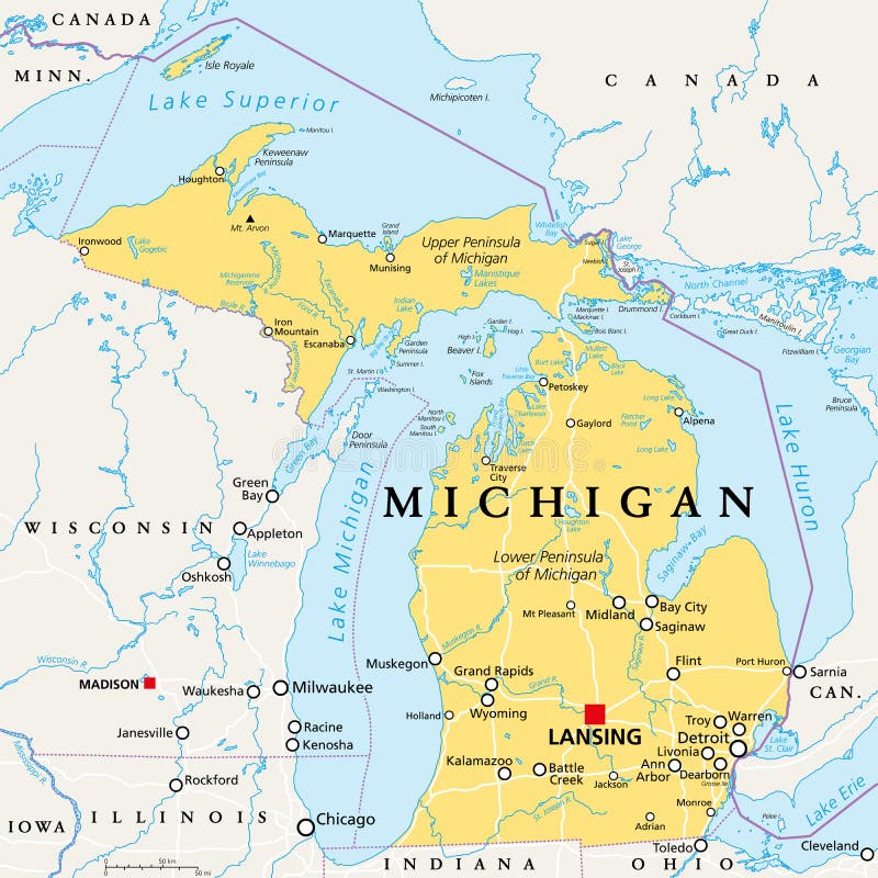
Free with trial Michigan, MI, political map, with capital Lansing and metropolitan area Detroit. State in Great Lakes region of upper Midwestern United States, nicknamed The Great Lake State, and The Wolverine State. Mapping vectors Michigan, MI, political map, US state, nicknamed The Great Lake State. Michigan, MI, political map, with capital Lansing and metropolitan area Detroit. State in. Michigan, MI, political map, with capital Lansing and metropolitan area Detroit. State in Great Lakes region of upper Midwestern United States, nicknamed The Great Lake State, and The Wolverine State.
Free with trial Travel poster, urban street plan city map Dubai and Doha, vector illustration. For design map of roads, rivers and paths. Mapping vectors Travel poster, urban street plan city map Dubai and Doha, vector illustration. For design map of roads, rivers and paths
Free with trial California Physical Map Retro Colors - No text - Highly Detailed Relief Map of California State vector illustration - All elements are separated in editable layers clearly labeled. Mapping vectors California Physical Map Retro Colors. No text - Highly Detailed Relief Map of California State vector illustration - All elements are separated in editable
Free with trial Pin icons. Map marker. 3D place mark or GPS destination point. Arrow position tag symbol. Navigation pointer. Trip location button. Travel position. Journey direction. Vector geolocation symbols set. Mapping vectors Pin icons. Map marker. 3D place mark or GPS destination point. Arrow position tag symbol. Navigation pointer. Trip. Location button. Travel position. Journey. Pin icons. Map marker. 3D place mark or GPS destination point. Arrow position tag symbol. Navigation pointer. Trip location button. Travel position. Journey direction. Vector geolocation symbols set
Free with trial Isometric city on white. This is file of EPS10 format. Mapping vectors Isometric city vector. Isometric city on white. This is file of EPS10 format. Isometric city on white. This is file of EPS10 format.
Free with trial Alabama, AL, political map with the capital Montgomery, cities, rivers and lakes. State in the Southeastern region of the United States, nicknamed Yellowhammer State, Heart of Dixie, and Cotton State. Mapping vectors Alabama, AL, political map, US state, nicknamed The Yellowhammer State. Alabama, AL, political map with the capital Montgomery, cities, rivers and lakes. State. Alabama, AL, political map with the capital Montgomery, cities, rivers and lakes. State in the Southeastern region of the United States, nicknamed Yellowhammer State, Heart of Dixie, and Cotton State.
Free with trial Yucatán Peninsula, gray political map. Peninsula in southeastern Mexico and adjectants portions of Belize and Guatemala, separating the Gulf of Mexico and Caribbean Sea. With El Salvador and Honduras. Mapping vectors Yucatán Peninsula gray political map, peninsula in southeastern Mexico. Yucatán Peninsula, gray political map. Peninsula in southeastern Mexico and adjectants. Yucatán Peninsula, gray political map. Peninsula in southeastern Mexico and adjectants portions of Belize and Guatemala, separating the Gulf of Mexico and Caribbean Sea. With El Salvador and Honduras.
Free with trial Florida Keys, United States, political map. Coral cay archipelago off the southern coast of Florida Peninsula, extend in an arc to the westernmost of the inhabited islands Key West, to Dry Tortugas. Mapping vectors Florida Keys, United States, political map. Coral cay archipelago off the southern coast of Florida Peninsula, extend in an arc to the westernmost of the
Free with trial San Francisco Bay Area, region of the U. S. state California, gray political map with counties and largest cities. Area that surrounds and include the San Francisco Bay, which is a large tidal estuary. Mapping vectors San Francisco Bay Area, region of U.S. state California, gray political map. San Francisco Bay Area, region of the U.S. state California, gray political map with. San Francisco Bay Area, region of the U.S. state California, gray political map with counties and largest cities. Area that surrounds and include the San Francisco Bay, which is a large tidal estuary.
Free with trial Virginia, U. S. state, subdivided into 95 counties and 38 independent cities, colored political map with capital Richmond, and county names. State in the Southeastern and Mid-Atlantic regions of USA. Mapping vectors Virginia, U.S. state, counties and independent cities, colored map. Virginia, U.S. state, subdivided into 95 counties and 38 independent cities, colored. Virginia, U.S. state, subdivided into 95 counties and 38 independent cities, colored political map with capital Richmond, and county names. State in the Southeastern and Mid-Atlantic regions of USA.
Free with trial United States of America, gray political map. Fifty single states with their own geographic territories and borders, bound together in a union and federal government, with the capital Washington, D. C. Mapping vectors United States of America with capital Washington, gray political map. United States of America, gray political map. Fifty single states with their own geographic. United States of America, gray political map. Fifty single states with their own geographic territories and borders, bound together in a union and federal government, with the capital Washington, D.C.
Free with trial Kentucky, U. S. state, multi colored political map with borders, county names and Capital Frankfort. State in the Southeastern Region of the United States, subdivided into 120 counties. Bluegrass State. Mapping vectors Kentucky, U.S. state, subdivided into 120 counties, multi colored map. Kentucky, U.S. state, multi colored political map with borders, county names and Capital. Kentucky, U.S. state, multi colored political map with borders, county names and Capital Frankfort. State in the Southeastern Region of the United States, subdivided into 120 counties. Bluegrass State
Free with trial Age. Ancestry or Genealogy Icon DNA neanderthal man. Mapping vectors Age. Ancestry or Genealogy Icon DNA neanderthal man
Free with trial ?A comprehensive set of 2D top-view vegetation outlines . These symbols focus on organic textures and complex canopy patterns, ideal for high-detail architectural site plans and landscape masterplans. Mapping vectors Professional Vegetation CAD Plan Symbols. ?A comprehensive set of 2D top-view vegetation outlines. These symbols focus on organic textures and complex canopy. ?A comprehensive set of 2D top-view vegetation outlines. These symbols focus on organic textures and complex canopy patterns, ideal for high-detail architectural site plans and landscape masterplans.
Free with trial USA political map with state borders and capitals. Color vector illustration for infographics or political articles. Сorrect proportions and forms. Names of the states and capitals on the map. Mapping vectors USA political map. Color vector map with state borders and capitals. USA political map with state borders and capitals. Color vector illustration for. USA political map with state borders and capitals. Color vector illustration for infographics or political articles. Сorrect proportions and forms. Names of the states and capitals on the map
Free with trial Galapagos Islands, Ecuador, political map, with capital Puerto Baquerizo Moreno. Archipelago of volcanic islands on either side of equator in Pacific Ocean known for a large number of endemic species. Mapping vectors Galapagos Islands, part of Ecuador, political map, an archipelago. Galapagos Islands, Ecuador, political map, with capital Puerto Baquerizo Moreno. Archipelago. Galapagos Islands, Ecuador, political map, with capital Puerto Baquerizo Moreno. Archipelago of volcanic islands on either side of equator in Pacific Ocean known for a large number of endemic species.
Free with trial Vector High detailed accurate USA map, american road, motorway map with labeling and colorful state areas and borders. Geographic, traditional, administrative atlas. Editable cartography illustration. Mapping vectors Vector High detailed accurate USA map, american road, motorway m. Ap with labeling and colorful state areas and borders. Geographic, traditional, administrative. Vector High detailed accurate USA map, american road, motorway map with labeling and colorful state areas and borders. Geographic, traditional, administrative atlas. Editable cartography illustration
Free with trial France, political map with multicolored regions of Metropolitan France. French Republic, capital Paris, administrative regions and prefectures on the mainland of Europe. English. Illustration. Vector. Mapping vectors France, political map with multicolored regions of Metropolitan France. French Republic, capital Paris, administrative regions and prefectures on the mainland
Free with trial Vector High detailed accurate, exact United States of America, american road, motorway map with labeling. Geographic black and white monochrome administrative. Editable cartography illustration. Mapping vectors Vector High detailed accurate, exact United States of America, a. Merican road, motorway map with labeling. Geographic black and white monochrome administrative. Vector High detailed accurate, exact United States of America, american road, motorway map with labeling. Geographic black and white monochrome administrative. Editable cartography illustration
Free with trial Massachusetts, U. S. state, multi colored political map with borders, county names and capital Boston. State in the New England region of the Northeastern United States, subdivided into 14 counties. Mapping vectors Massachusetts, U.S. state, subdivided into 14 counties, multi colored map. Massachusetts, U.S. state, multi colored political map with borders, county names and. Massachusetts, U.S. state, multi colored political map with borders, county names and capital Boston. State in the New England region of the Northeastern United States, subdivided into 14 counties.
Free with trial Italy, political map, administrative divisions. Italian Republic with capital Rome, 20 regions and their capitals, international borders and neighbor countries. English labeling. Illustration. Vector. Mapping vectors Italy, political map, regions and administrative divisions. Italy, political map, administrative divisions. Italian Republic with capital Rome, 20 regions and. Italy, political map, administrative divisions. Italian Republic with capital Rome, 20 regions and their capitals, international borders and neighbor countries. English labeling. Illustration. Vector.
Free with trial Travel poster, urban street plan city map Cleveland and Cincinnati, vector illustration, collection of wall tourist decorations. Mapping vectors Travel poster, urban street plan city map Cleveland and Cincinnati, vector illustration. Collection of wall tourist decorations
Free with trial Scientific Process Icon Set with Web Header Banner. Mapping vectors Scientific Process Icon Set with Web Header Banner. Scientific Process Icon Set & Web Header Banner
Free with trial Murmansk Oblast and Kola Peninsula, political map. Federal subject of Russia, part of Lapland region, bordering Norway and Finland. With Murmansk, most important port city of Russia on Arctic Ocean. Mapping vectors Murmansk Oblast and Kola Peninsula map, Federal subject of Russia. Murmansk Oblast and Kola Peninsula, political map. Federal subject of Russia, part of Lapland. Murmansk Oblast and Kola Peninsula, political map. Federal subject of Russia, part of Lapland region, bordering Norway and Finland. With Murmansk, most important port city of Russia on Arctic Ocean.
Free with trial Mascarene Islands political map with capitals, consisting of Mauritius, Reunion and Rodrigues. Mascarenhas Archipelago, a group of islands in the Indian Ocean. English labeling. Illustration. Vector. Mapping vectors Mascarene Islands political map, Mauritius, Reunion and Rodrigues. Mascarene Islands political map with capitals, consisting of Mauritius, Reunion and Rodrigues. Mascarene Islands political map with capitals, consisting of Mauritius, Reunion and Rodrigues. Mascarenhas Archipelago, a group of islands in the Indian Ocean. English labeling. Illustration. Vector.
Free with trial Vector isometric map in flat design style. Tablet PC with mobile navigation program. A pin is pointing at the hotel near the sea and rocky mountains. EPS 10 file. Mapping vectors Vector isometric map in flat design style. Tablet PC with mobile. Navigation program. A pin is pointing at the hotel near the sea and rocky mountains. EPS 10
Free with trial Circle on cycle template. Can use for brochure and business project background. Mapping vectors Circle on cycle template. Can use for brochure and business project background
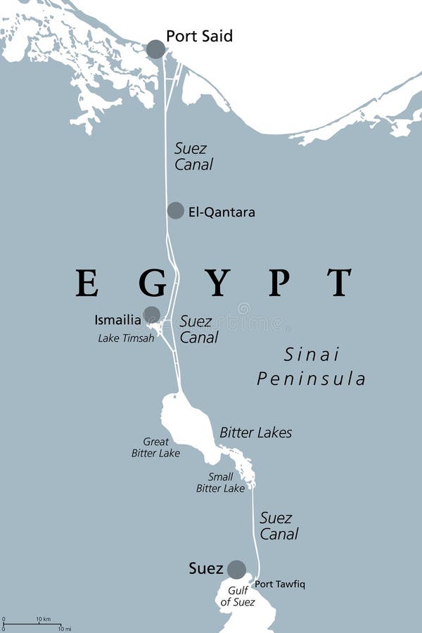
Free with trial Suez Canal, political map. An artificial sea-level waterway in Egypt, connecting the Mediterranean Sea to the Red Sea, dividing Africa and Asia. It extends from Port Said to Suez. Illustration. Vector. Mapping vectors Suez Canal, artificial sea-level waterway in Egypt, political map. Suez Canal, political map. An artificial sea-level waterway in Egypt, connecting the. Suez Canal, political map. An artificial sea-level waterway in Egypt, connecting the Mediterranean Sea to the Red Sea, dividing Africa and Asia. It extends from Port Said to Suez. Illustration. Vector
Free with trial Vector Construction. On white background. Mapping vectors Vector Construction. On white background
Free with trial Christmas background with sheet of paper. Illustration. Mapping vectors Christmas background with sheet of paper. Illustration
Free with trial Startup rocket with a words illustration. Mapping vectors Startup rocket with a words illustration
Free with trial United States of America, silhouettes of states, gray political map. Fifty geographical areas and borders, united by a union and federal government with the capital city of the District of Columbia. Mapping vectors United States of America silhouettes, gray political map. United States of America, silhouettes of states, gray political map. Fifty geographical areas and. United States of America, silhouettes of states, gray political map. Fifty geographical areas and borders, united by a union and federal government with the capital city of the District of Columbia.
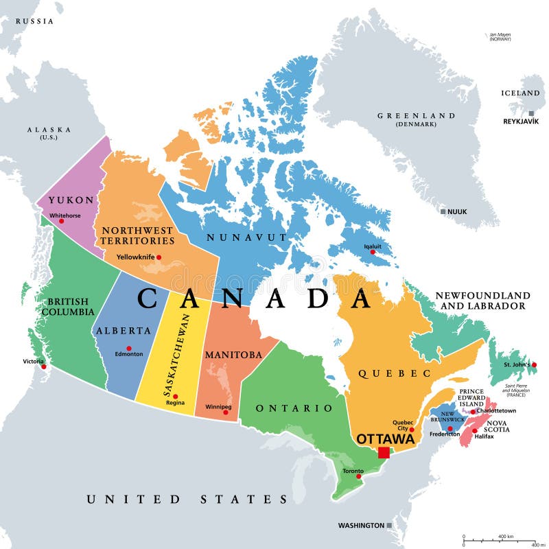
Free with trial Canada,administrative divisions,colored political map. Ten provinces and three territories of Canada,with borders and capitals. Country in North America,and second largest country of the world. Mapping vectors Canada, administrative divisions, provinces and territories, colored map. Canada,administrative divisions,colored political map. Ten provinces and three. Canada,administrative divisions,colored political map. Ten provinces and three territories of Canada,with borders and capitals. Country in North America,and second largest country of the world.
Free with trial West, U. S. census region, multi colored political map. Census region 4 of the United States, consisting of 13 single states. Colored silhouettes of single states with borders and their capitals. Mapping vectors West, U.S. census region, multi colored political map. Census region 4 of the United States, consisting of 13 single states. Colored silhouettes of single
Free with trial Halftone world map. World map with halftone effect. Mapping vectors Halftone world map. World map with halftone effect
Free with trial Mobile GPS navigation, travel and tourism concept. View a map on the mobile phone on bike and search GPS coordinates. Flat 3d vector isometric illustration. Mapping vectors Mobile GPS navigation, travel and tourism concept. View a map on the mobile phone on bike and search GPS coordinates. Flat 3d vector isometric illustration
Free with trial Cyberspace view. Cyberpunk hud elements. Abstract vector landscape background. Topographic attitude relief grid. Lowpoly surface. Hexagon structure. Space in cosmos. Space technologies vector abstract. Mapping vectors Abstract vector landscape background. Cyberspace view. Cyberpunk hud elements. Abstract vector landscape background. Topographic attitude relief grid. Lowpoly. Cyberspace view. Cyberpunk hud elements. Abstract vector landscape background. Topographic attitude relief grid. Lowpoly surface. Hexagon structure. Space in cosmos. Space technologies vector abstract
Free with trial Colorful isometric political map of the world. Perspective cartography vector illustration. Puzzle and mosaic concept of world countires borders. Africa, Australia, Europe, Asia,a and America blocks. Mapping vectors Isometric political map of the world. Colorful isometric political map of the world. Perspective cartography vector illustration. Puzzle and mosaic concept of. Colorful isometric political map of the world. Perspective cartography vector illustration. Puzzle and mosaic concept of world countires borders. Africa, Australia, Europe, Asia,a and America blocks.
Free with trial Political Map of Iran Vintage Color. Image contains layers with outline contours, land names, city names, water objects and it`s names. Mapping vectors Political Map of Iran Vintage Color. Image contains layers with outline contours, land names, city names, water objects and it`s names
Free with trial Portugal Map Vintage Color - Detailed map of Portugal vector illustration - All elements are separated in editable layers clearly labeled. Mapping vectors Portugal Map Vintage Color. Detailed map of Portugal vector illustration - All elements are separated in editable layers clearly labeled
Free with trial Conifers, bushes, and mushrooms set for summer boreal forest scene on oblique projection. Images are designed to align into square grid for easy game tile-mapping. Mapping vectors Conifers Forest Plants Set. Conifers, bushes, and mushrooms set for summer boreal forest scene on oblique projection. Images are designed to align into square. Conifers, bushes, and mushrooms set for summer boreal forest scene on oblique projection. Images are designed to align into square grid for easy game tile-mapping.
Free with trial Backup database. Database management. Database icon. Mapping vectors Backup database. Database management. Database icon
Free with trial Automotive accessories set. Automotive accessories, first aid kit and fire extinguisher, stereo or gps navigation. Vector illustration. Mapping vectors Automotive accessories set. Automotive accessories, first aid kit and fire extinguisher, stereo or gps navigation. Vector illustration
Free with trial Vector abstract topography map with river and lakes. Concept background. Mapping vectors Vector abstract topography map with river and lakes. Concept background
Free with trial Globe map - abstract geometric vector illustration in blue colors. Globe polygonal illustration. Design element. Mapping vectors Globe map - abstract geometric vector illustration in blue colors. Globe polygonal illustration. Design element
Free with trial Northern Europe, gray political map. British Isles, Fennoscandia, Jutland Peninsula, Baltic plain lying to the east, and islands offshore from mainland Northern Europe and the main European continent. Mapping vectors Northern Europe, gray political map. British Isles, Fennoscandia, Jutland Peninsula, Baltic plain lying to the east, and islands offshore from mainland
Free with trial Set of Vector Elements for City Map Design. Useful Vector Illustration with Objects for Creating Town Map. Mapping vectors Set of Vector Elements for City Map Design. Useful Vector Illustration with Objects for Creating Town Map
Free with trial Chalk blackboard mind map seamless pattern. Vector chalk blackboard mind map seamless pattern background. Mapping vectors Chalk blackboard mind map seamless pattern. Vector chalk blackboard mind map seamless pattern background
Free with trial A simple 3D map of Bavaria. Mapping vectors Map_Bavaria. A simple 3D map of Bavaria. A simple 3D map of Bavaria.
Free with trial The Virginias, political map. The two Virginias, two states in the Southeastern and Mid-Atlantic regions of the United States. Virginia with capital Richmond and West Virginia with capital Charleston. Mapping vectors The Virginias, the two U.S. states Virginia and West Virginia, political map. The Virginias, political map. The two Virginias, two states in the Southeastern and. The Virginias, political map. The two Virginias, two states in the Southeastern and Mid-Atlantic regions of the United States. Virginia with capital Richmond and West Virginia with capital Charleston.
Free with trial Isometric city on a smartphone screen. EPS10 vector. Mapping vectors City on a smartphone screen. Isometric city on a smartphone screen. EPS10 vector. Isometric city on a smartphone screen. EPS10 vector.
Free with trial New Caledonia political map with capital Noumea. Special collectivity of France in Pacific Ocean. Archipelago with main Island Grand Terre and Loyalty Islands. English labeling. Illustration. Vector. Mapping vectors New Caledonia political map. With capital Noumea. Special collectivity of France in Pacific Ocean. Archipelago with main Island Grand Terre and Loyalty Islands. New Caledonia political map with capital Noumea. Special collectivity of France in Pacific Ocean. Archipelago with main Island Grand Terre and Loyalty Islands. English labeling. Illustration. Vector.
Free with trial Travel map of Vienna, Austria with landmarks. Plague or trinity column, Opera and flower garden, Hundertwasserhaus and Donauturm, Modern art museum, Prater park, cemetery, St. Peter church. Sightseeing. Mapping vectors Travel map of Vienna, Austria with landmarks. Plague or trinity column, Opera and flower garden, Hundertwasserhaus and Donauturm, Modern art museum, Prater
Free with trial Travel logo with map pointer sign and heart. Vector illustration in flat style. Mapping vectors Travel logo with map pointer sign and heart. Vector illustration in flat style
Free with trial Big Data concept. Abstract vector background. Eps8. RGB Global colors. Mapping vectors Big Data concept. Abstract vector background. Eps8. RGB Global colors
Free with trial Flat banner set with hand holding phone with city background and. Tourist way with points. Map application ads. Eps10. Mapping vectors Flat banner set with hand holding phone with city background and. Tourist way with points. Map application ads. Eps10
Free with trial Vector isometric cut of a house. Single store building. Simple interior, schematic illustrating of sewerage arrangement. . Can be used as icon or gameplay for games and mobile apps. Mapping vectors A cut of the house. Isometric view. Vector isometric cut of a house. Single store building. Simple interior, schematic illustrating of sewerage arrangement. Vector isometric cut of a house. Single store building. Simple interior, schematic illustrating of sewerage arrangement. . Can be used as icon or gameplay for games and mobile apps.
Free with trial Europe Political Map. No text. Detailed illustration of Europe Map. Mapping vectors Europe Political Map. No text. Detailed illustration of Europe Map
Free with trial Southeast Asia, political map with capitals and borders. Subregion of Asia with countries south of China, east of India, west of New Guinea, north of Australia. English labeling. Illustration. Vector. Mapping vectors Southeast Asia, political map. With capitals and borders. Subregion of Asia with countries south of China, east of India, west of New Guinea, north of Australia. Southeast Asia, political map with capitals and borders. Subregion of Asia with countries south of China, east of India, west of New Guinea, north of Australia. English labeling. Illustration. Vector.
Free with trial Gps navigator interface and city map. This is file of EPS10 format. Mapping vectors Gps navigator interface and city map. This is file of EPS10 format
Free with trial South, census region of the United States of America, gray political map of census region 3, consisting of 13 single states and the District of Columbia. Map with geographical borders and capitals. Mapping vectors South, census region of the United States, gray political map. South, census region of the United States of America, gray political map of census region 3. South, census region of the United States of America, gray political map of census region 3, consisting of 13 single states and the District of Columbia. Map with geographical borders and capitals.
Free with trial Oklahoma, U. S. state, political map with borders and county names. State in the South Central region of the USA, subdivided into 77 counties. Native America, Land of the Red Man, and Sooner State. Mapping vectors Oklahoma, U.S. state, subdivided into 77 counties, political map. Oklahoma, U.S. state, political map with borders and county names. State in the South Central. Oklahoma, U.S. state, political map with borders and county names. State in the South Central region of the USA, subdivided into 77 counties. Native America, Land of the Red Man, and Sooner State.
Free with trial Kaliningrad Region, gray political map. Kaliningrad Oblast, federal subject and semi-enclave of Russia, located on the coast of Baltic Sea, with administrative centre Kaliningrad. Illustration. Vector. Mapping vectors Kaliningrad Region, Kaliningrad Oblast, gray political map. Kaliningrad Region, gray political map. Kaliningrad Oblast, federal subject and semi-enclave of. Kaliningrad Region, gray political map. Kaliningrad Oblast, federal subject and semi-enclave of Russia, located on the coast of Baltic Sea, with administrative centre Kaliningrad. Illustration. Vector
Free with trial Sydney map with Australian Reptile Park and Opera House, Observatory and Jenolan Caves, Blue Mountains and Bondi Beach, Taronga Zoo and national maritime museum, garden mount annan. Landmark, tourism. Mapping vectors Map of Sydney with landmarks for sightseeing. Sydney map with Australian Reptile Park and Opera House, Observatory and Jenolan Caves, Blue Mountains and Bondi. Sydney map with Australian Reptile Park and Opera House, Observatory and Jenolan Caves, Blue Mountains and Bondi Beach, Taronga Zoo and national maritime museum, garden mount annan. Landmark, tourism
Free with trial Suez Canal, gray political map. Artificial sea-level waterway in Egypt, connecting the Mediterranean Sea to the Red Sea, dividing Africa and Asia, extends from Port Said to Suez. Illustration. Vector. Mapping vectors Suez Canal, artificial sea-level waterway in Egypt, gray political map. Suez Canal, gray political map. Artificial sea-level waterway in Egypt, connecting the. Suez Canal, gray political map. Artificial sea-level waterway in Egypt, connecting the Mediterranean Sea to the Red Sea, dividing Africa and Asia, extends from Port Said to Suez. Illustration. Vector.
Free with trial Circle scale arrow with icons. Can use for brochure and business project background. Mapping vectors Circle scale arrow with icons. Can use for brochure and business project background
Free with trial Digital mobile maps concept as illustration with hand holding tablet. Mapping vectors Digital mobile maps concept as illustration with hand holding tablet.
Free with trial A isometric citymap of an imaginary city with destinations between districts. Urban mobile navigation vector illustration. City plan geomarketing consept. Mapping vectors A isometric citymap and urban mobile navigation vector illustration. A isometric citymap of an imaginary city with destinations between districts. Urban mobile. A isometric citymap of an imaginary city with destinations between districts. Urban mobile navigation vector illustration. City plan geomarketing consept.
Free with trial Mobile gps navigation on mobile phone with map poster. Smartphone with navigation map in hand. Mobile technologies ad campaign or cover concept. Mapping vectors Mobile gps navigation on mobile phone with map poster. Smartphone with navigation map in hand. Mobile technologies ad campaign or cover concept
Free with trial Thermal imaging icons depict heat detection, heat signature, and temperature distribution. Outline icons set. Mapping vectors Thermal imaging icons depict heat detection, heat signature, and temperature ... Thermal imaging icons depict heat detection, heat signature, and temperature. Thermal imaging icons depict heat detection, heat signature, and temperature distribution. Outline icons set.
Free with trial Trees which are supposed to be birch tree bushes, and grass set for spring birch forest scene on oblique projection. Images are designed to align into square grid for easy game tile-mapping. Mapping vectors Spring Birch Forest Plants Set. Trees which are supposed to be birch tree bushes, and grass set for spring birch forest scene on oblique projection. Images are. Trees which are supposed to be birch tree bushes, and grass set for spring birch forest scene on oblique projection. Images are designed to align into square grid for easy game tile-mapping.
Free with trial Africa map vector illustration. On white. Mapping vectors Africa map vector illustration. On white
Free with trial Mobile gps navigation with map. vector. Mapping vectors Mobile gps navigation with map. Vector
Free with trial Stamp with map of Transylvania. Grunge stamp with map of Transylvania - vector illustration. Mapping vectors Stamp with map of Transylvania. Grunge stamp with map of Transylvania - vector illustration
 Sign in