Free with trial Map of the United States by population. Mapping vectors Map of the United States by population.
Free with trial Detailed Canada physical map. Vector illustration. Mapping vectors Detailed Canada physical map. Vector illustration
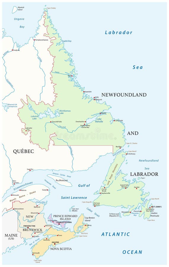
Free with trial Map of the four canada atlantic provinces. Vector map of the four canada atlantic provinces. Mapping vectors Map of the four canada atlantic provinces. Vector map of the four canada atlantic provinces
Free with trial Travel poster, urban street plan city map Houston and Dallas, vector illustration. For design map of roads, rivers and paths. Mapping vectors Travel poster, urban street plan city map Houston and Dallas, vector illustration. For design map of roads, rivers and paths
Free with trial 3D glowing neon digital relief of particles. Abstract technology background. Futuristic vector illustration. Virtual cyberspace. Mapping vectors 3D glowing neon digital relief of particles. Abstract technology background. Futuristic vector illustration. Virtual cyberspace
Free with trial The Sahel, a region in Africa, political map. Ecoclimatic and biogeographic realm of transition between the Sahara to the north and the Sudanian savanna to the south, having a hot semi-arid climate. Mapping vectors The Sahel, region in Africa between Sahara and Sudanian savanna, political map. The Sahel, a region in Africa, political map. Ecoclimatic and biogeographic realm. The Sahel, a region in Africa, political map. Ecoclimatic and biogeographic realm of transition between the Sahara to the north and the Sudanian savanna to the south, having a hot semi-arid climate.
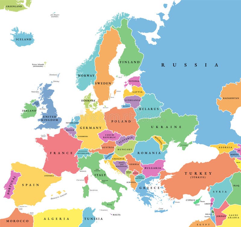
Free with trial Europe with a part of the Middle East countries, political map. Western part of continent Eurasia, located in the Northern Hemisphere. Countries with international borders and English labeling. Vector. Mapping vectors Europe with a part of the Middle East countries, political map. Western part of continent Eurasia, located in the Northern Hemisphere. Countries with
Free with trial Scientific Process Icon Set with hypothesis, analysis, etc. Mapping vectors Scientific Process Icon Set with hypothesis, analysis, etc. Scientific Process Icon Set - hypothesis, analysis, etc
Free with trial Simple location pin icon. Isolated on white background. Mapping vectors Simple location pin icon. Isolated on white background
Free with trial Globe - black icon on white background vector illustration. Earth planet concept sign. Abstract world symbol. Graphic design element. Mapping vectors Globe - black icon on white background vector illustration. Earth planet concept sign. Abstract world symbol. Graphic design. Element
Free with trial Paros, Greek island, political map. Island of Greece in the Aegean Sea, west of Naxos, and part of the Cyclades. With the islands Antiparos, Despotiko and Stroggyli in the west. Illustration. Vector. Mapping vectors Paros, Greek island, Island of Greece in the Aegean Sea, political map. Paros, Greek island, political map. Island of Greece in the Aegean Sea, west of Naxos. Paros, Greek island, political map. Island of Greece in the Aegean Sea, west of Naxos, and part of the Cyclades. With the islands Antiparos, Despotiko and Stroggyli in the west. Illustration. Vector.
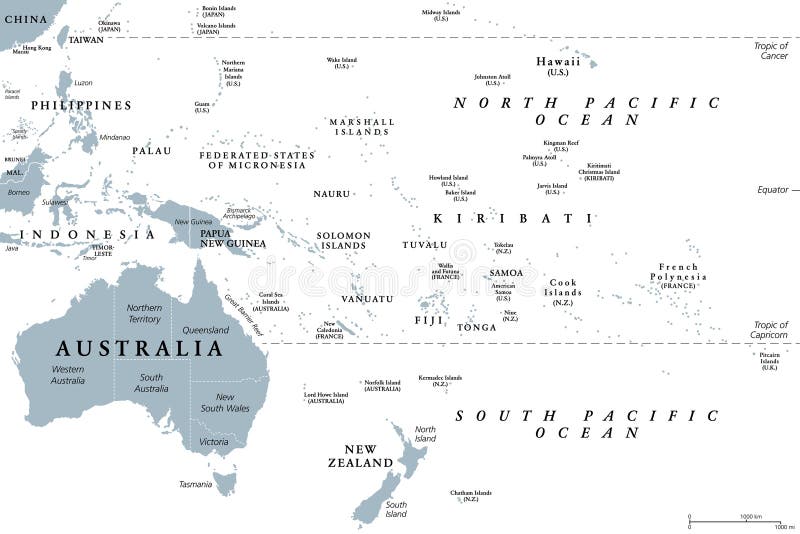
Free with trial Oceania, gray political map. Australia and the Pacific, including New Zealand. Geographic region, southeast of the Asia-Pacific region, including Australasia, Melanesia, Micronesia and Polynesia. Mapping vectors Oceania, gray political map, Australia and the Pacific, including New Zealand. Oceania, gray political map. Australia and the Pacific, including New Zealand. Oceania, gray political map. Australia and the Pacific, including New Zealand. Geographic region, southeast of the Asia-Pacific region, including Australasia, Melanesia, Micronesia and Polynesia.
Free with trial Central african republic road vector map. Mapping vectors Central african republic road vector map.
Free with trial Mid-Atlantic, or Middle Atlantic states, gray political map, with capitals. United States Census division of the Northeast region, consisting of the states New Jersey, New York and Pennsylvania. Mapping vectors Mid-Atlantic states in the Northeast region of USA, gray political map. Mid-Atlantic, or Middle Atlantic states, gray political map, with capitals. United States. Mid-Atlantic, or Middle Atlantic states, gray political map, with capitals. United States Census division of the Northeast region, consisting of the states New Jersey, New York and Pennsylvania.
Free with trial The Middle East,gray political map with capitals and international borders. Geopolitical region encompassing the Arabian Peninsula,the Levant,Turkey,Egypt,Iran and Iraq. Also called Near East. Mapping vectors The Middle East, gray political map with capitals and international borders. The Middle East,gray political map with capitals and international borders. The Middle East,gray political map with capitals and international borders. Geopolitical region encompassing the Arabian Peninsula,the Levant,Turkey,Egypt,Iran and Iraq. Also called Near East.
Free with trial Set of hand-painted figures, arrows, mathematical symbols. Vector illustration. Mapping vectors Set of hand-painted figures, arrows, symbols. Set of hand-painted figures, arrows, mathematical symbols. Vector illustration. Set of hand-painted figures, arrows, mathematical symbols. Vector illustration.
Free with trial State of Hawaii, counties, outline map. Island state of the United States in the Pacific Ocean, subdivided into the five counties Hawaii, Honolulu, Kalawao, Kauai, and Maui, nicknamed The Aloha State. Mapping vectors State of Hawaii, counties, outline map. Island state of the United States in the Pacific Ocean, subdivided into the five counties Hawaii, Honolulu, Kalawao
Free with trial Map of russian wrangel island in arctic ocean. Mapping vectors Map of russian wrangel island in arctic ocean.
Free with trial Lake michigan drainage basin vector map. Mapping vectors Lake michigan drainage basin vector map.
Free with trial Abstract Blue World Map Concept. 1. Mapping vectors Abstract Blue World Map Concept. 1
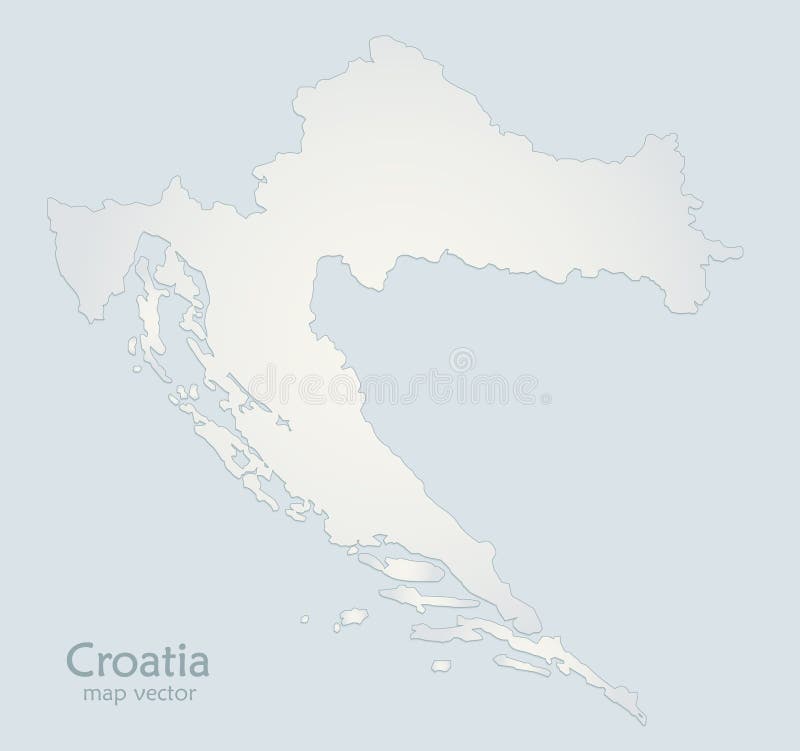
Free with trial Croatia map blue white paper 3D. Vector. Mapping vectors Croatia map blue white paper 3D. Vector
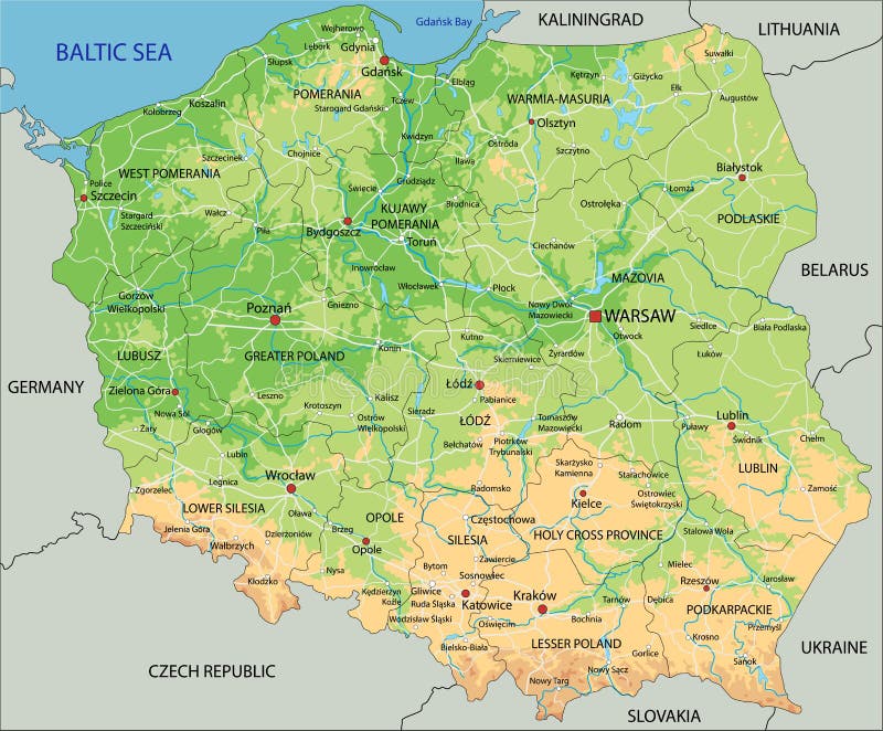
Free with trial High detailed Poland physical map with labeling. Vector illustration. Mapping vectors High detailed Poland physical map with labeling. Vector illustration
Free with trial Medical Healthcare Icons. With People. Mapping vectors Medical Healthcare Icons. With People
Free with trial Greater Perth administrative map, Australia. Greater Perth administrative and political map, Australia. Mapping vectors Greater Perth administrative map, Australia. Greater Perth administrative and political map, Australia
Free with trial Wooden icons. Series of the computer icons in wooden stiletto. Mapping vectors Wooden icons. Series of the computer icons in wooden stiletto
Free with trial Abstract world map - vector illustration - geometric structure in blue color for presentation, booklet, website and other design projects. Digital background in glitch style. Mapping vectors Abstract world map - vector illustration - geometric structure in blue color for presentation, booklet, website and other design. Projects. Digital background
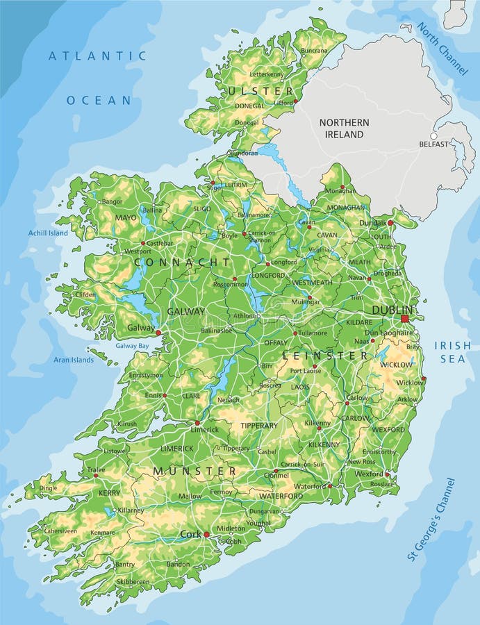
Free with trial High detailed Ireland physical map with labeling. Vector illustration. Mapping vectors High detailed Ireland physical map with labeling. Vector illustration
Free with trial Israel and the Sinai Peninsula,political map. The Southern Levant,an arid geographical and historical region,encompassing Israel,Palestine,Jordan,Lebanon,southern Syria and the Sinai Peninsula. Mapping vectors Israel and the Sinai Peninsula, the Southern Levant, political map. Israel and the Sinai Peninsula,political map. The Southern Levant,an arid geographical and. Israel and the Sinai Peninsula,political map. The Southern Levant,an arid geographical and historical region,encompassing Israel,Palestine,Jordan,Lebanon,southern Syria and the Sinai Peninsula.
Free with trial City map Krakow, monochrome detailed plan, vector illustration. Streets and trails. Mapping vectors City map Krakow, monochrome detailed plan, vector illustration. Streets and trails
Free with trial Medical Healthcare Icons with People Charting Disease or Scientific Discovery. Scientific Medical Healthcare Icons with People Charting Disease. Mapping vectors Medical Healthcare Icons with People Charting Disease or Scientific Discovery. Scientific Medical Healthcare Icons with People Charting Disease
Free with trial New York State counties, gray political map. New York, a state of the Northeastern United States, one of the Mid-Atlantic states, subdivided into 62 counties. Map with boundaries and county names. Mapping vectors U.S. state of New York, subdivided into 62 counties, gray political map. New York State counties, gray political map. New York, a state of the Northeastern. New York State counties, gray political map. New York, a state of the Northeastern United States, one of the Mid-Atlantic states, subdivided into 62 counties. Map with boundaries and county names.
Free with trial High detailed Mexico physical map. Vector illustration. Mapping vectors High detailed Mexico physical map. Vector illustration
Free with trial Science and Research Icons - Medical. Mapping vectors Science and Research Icons. Medical
Free with trial Rhodes, Greek island, gray political map. Largest of Dodecanese islands of Greece, in the Mediterranean Sea, with nicknames, such as Island of the Sun, The Pearl Island, and The Island of the Knights. Mapping vectors Rhodes, gray political map, largest of Dodecanese island of Greece. Rhodes, Greek island, gray political map. Largest of Dodecanese islands of Greece, in the. Rhodes, Greek island, gray political map. Largest of Dodecanese islands of Greece, in the Mediterranean Sea, with nicknames, such as Island of the Sun, The Pearl Island, and The Island of the Knights.
Free with trial Road map of sardinia Iseland. Road map of the italian mediterranean sardinia Iseland. Mapping vectors Road map of sardinia Iseland. Road map of the italian mediterranean sardinia Iseland
Free with trial Vector illustration of Romania location on Europe map. Romania is a country located at the crossroads of Central, Eastern, and Southeastern Europe. Mapping vectors Vector illustration of Romania location on Europe map. Romania is a country located at the crossroads of Central, Eastern, and Southeastern Europe
Free with trial Highly detailed editable political map with separated layers. Europe. Vector illustration. Mapping vectors Highly detailed editable political Europe map. Highly detailed editable political map with separated layers. Europe. Vector illustration. Highly detailed editable political map with separated layers. Europe. Vector illustration.
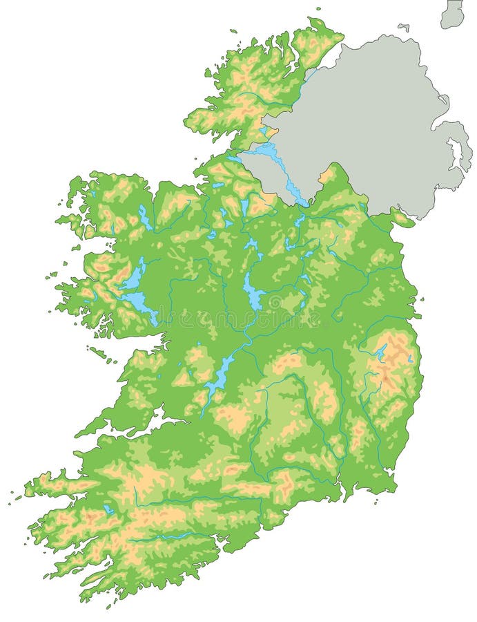
Free with trial High detailed Ireland physical map. Vector illustration. Mapping vectors High detailed Ireland physical map. Vector illustration
Free with trial Kanto region of Japan, gray political map. Geographical region of the island Honshu, including Greater Tokyo Area, encompassing prefectures Gunma, Tochigi, Ibaraki, Saitama, Tokyo, Chiba and Kanagawa. Mapping vectors Kanto region of Japan, gray political map. Geographical region of the island Honshu, including Greater Tokyo Area, encompassing prefectures Gunma, Tochigi
Free with trial Medical Healthcare Icons with People Charting Disease or Scienti. Medical Healthcare Icons with People Charting Disease / Scientific Discovery Header Banner. Mapping vectors Medical Healthcare Icons with People Charting Disease or Scienti. Medical Healthcare Icons with People Charting Disease / Scientific Discovery Header Banner
Free with trial High detailed Japan physical map. Vector illustration. Mapping vectors High detailed Japan physical map. Vector illustration
Free with trial Road vector map of the Italian region Tuscany. Mapping vectors Road vector map of the Italian region Tuscany.
Free with trial Colorful Italy political map with clearly labeled, separated layers. Vector illustration. Mapping vectors Colorful Italy political map with clearly labeled, separated layers. Vector illustration
Free with trial Map of the Rio Grande, Rio Bravo Drainage Basin, Mexico, United States. Mapping vectors Map of the Rio Grande, Rio Bravo Drainage Basin, Mexico, United States.
Free with trial Utah state detailed editable map with cities and towns, geographic sites, roads, railways, interstates and U. S. highways. Vector EPS-10 file, trending color scheme. Mapping vectors Utah state detailed editable map. With cities and towns, geographic sites, roads, railways, interstates and U.S. highways. Vector EPS-10 file, trending color
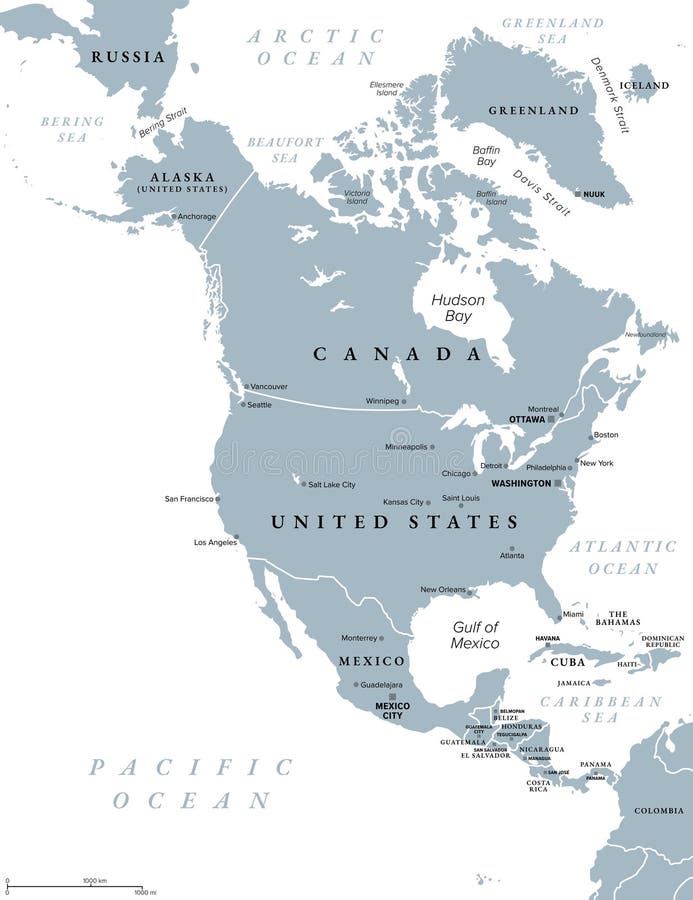
Free with trial North America, gray political map. Continent bordered by South America, Caribbean Sea, and by the Arctic, Atlantic and Pacific Ocean. The largest countries are Canada, the United States, and Mexico. Mapping vectors North America, continent, gray political map of Canada, USA, and Mexico. North America, gray political map. Continent bordered by South America, Caribbean Sea. North America, gray political map. Continent bordered by South America, Caribbean Sea, and by the Arctic, Atlantic and Pacific Ocean. The largest countries are Canada, the United States, and Mexico.
Free with trial Collection dark blue icons underwater exploration marine life, Radar Communication Sonar Rescue ,. Mapping vectors Collection dark blue icons underwater exploration marine life. Radar Communication Sonar Rescue , AI generated. collection dark blue icons underwater exploration marine life, Radar Communication Sonar Rescue ,
Free with trial Borneo, divided among Malaysia, Brunei and Indonesia, political map. Third-largest island in the world and one of the Greater Sunda Islands, in the geographic centre of Maritime Southeast Asia. Vector. Mapping vectors Borneo, divided among Malaysia, Brunei and Indonesia, political map. Third-largest island in the world and one of the Greater Sunda Islands, in the geographic
Free with trial Greater london administrative and political map. Mapping vectors Greater london administrative and political map. Greater london administrative and political vector map
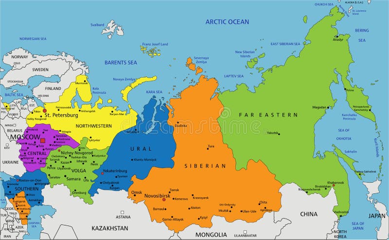
Free with trial Colorful Russia political map with clearly labeled, separated layers. Vector illustration. Mapping vectors Colorful Russia political map with clearly labeled, separated layers. Vector illustration
Free with trial Highly detailed editable political map with separated layers. Russia. Vector illustration. Mapping vectors Highly detailed editable political map with separated layers. Russia. Vector illustration
Free with trial Handdrawn nano technology concept with genome symbols. Human dna research illustration made in vector. Mapping vectors Human Genome Project. Handdrawn nano technology concept with genome symbols. Human dna research illustration made in vector. Handdrawn nano technology concept with genome symbols. Human dna research illustration made in vector.
Free with trial Aegean Sea region,with Aegean Islands,gray political map. An elongated embayment of the Mediterranean Sea,located between Europe and Asia,between the Balkans and Anatolia,and Greece and Turkey. Mapping vectors Aegean Sea region, with Aegean Islands, gray political map. Aegean Sea region,with Aegean Islands,gray political map. An elongated embayment of the Mediterranean. Aegean Sea region,with Aegean Islands,gray political map. An elongated embayment of the Mediterranean Sea,located between Europe and Asia,between the Balkans and Anatolia,and Greece and Turkey.
Free with trial The Bermuda Triangle or Devils Triangle,political map. Region in the North Atlantic Ocean between Bermuda,Miami and Puerto Rico,where aircrafts and ships disappeared under mysterious circumstances. Mapping vectors The Bermuda Triangle or also Devils Triangle, political map. The Bermuda Triangle or Devils Triangle,political map. Region in the North Atlantic Ocean between. The Bermuda Triangle or Devils Triangle,political map. Region in the North Atlantic Ocean between Bermuda,Miami and Puerto Rico,where aircrafts and ships disappeared under mysterious circumstances.
Free with trial New Jersey, NJ, gray political map with capital Trenton. State in the Mid-Atlantic region of the Northeastern United States of America. The Garden State. Illustration on white background. Vector. Mapping vectors New Jersey, NJ, gray political map, The Garden State. New Jersey, NJ, gray political map with capital Trenton. State in the Mid-Atlantic region of the. New Jersey, NJ, gray political map with capital Trenton. State in the Mid-Atlantic region of the Northeastern United States of America. The Garden State. Illustration on white background. Vector.
Free with trial Mid-Atlantic, or Middle Atlantic states, multi colored political map. United States Census division of the Northeast region, consisting of the states New Jersey, New York and Pennsylvania. Vector. Mapping vectors Mid-Atlantic states in the Northeast region of USA, colored political map. Mid-Atlantic, or Middle Atlantic states, multi colored political map. United States. Mid-Atlantic, or Middle Atlantic states, multi colored political map. United States Census division of the Northeast region, consisting of the states New Jersey, New York and Pennsylvania. Vector
Free with trial Road map of the US state of Alabama. Mapping vectors Road map of the US state of Alabama.
Free with trial The United Mexican States vector map. Mapping vectors United Mexican States vector map. The United Mexican States vector map. The United Mexican States vector map.
Free with trial Europe, gray political map. Continent and part of Eurasia, located in the Northern Hemisphere, with about 50 sovereign states. Map with borders and English country names. Gray illustration over white. Mapping vectors Europe, gray political map, a continent and part of Eurasia. Europe, gray political map. Continent and part of Eurasia, located in the Northern Hemisphere, with. Europe, gray political map. Continent and part of Eurasia, located in the Northern Hemisphere, with about 50 sovereign states. Map with borders and English country names. Gray illustration over white.
Free with trial Cyprus vector map. Editable template with regions, cities, red pins and blue surface on white background. Mapping vectors Cyprus vector map. Editable template with regions, cities, red pins and blue surface on white background
Free with trial Road map of the Indian state of Goa. Vector road map of the Indian state of Goa. Mapping vectors Road map of the Indian state of Goa. Vector road map of the Indian state of Goa
Free with trial Abstract green tiled map of South Africa isolated on white background. Mapping vectors Green map of South Africa. Abstract green tiled map of South Africa isolated on white background. Abstract green tiled map of South Africa isolated on white background.
Free with trial Map of wet and dry areas in spain. Mapping vectors Map of wet and dry areas in spain.
Free with trial City map Kyiv, monochrome detailed plan, vector illustration. Roads, trails and rivers. Mapping vectors City map Kyiv, monochrome detailed plan, vector illustration. Roads, trails and rivers
Free with trial Administrative map of the Italian region Marche. Administrative and political map of the Italian region Marche. Mapping vectors Administrative map of the Italian region Marche. Administrative and political map of the Italian region Marche
Free with trial High detailed Netherlands physical map with labeling. Vector illustration. Mapping vectors High detailed Netherlands physical map with labeling. Vector illustration
Free with trial From Ko Samui to Phuket, Thailand, gray political map. Travel destinations west and east of the Malay Peninsula, off the coast of Thailand, with most important islands and cities. Illustration. Vector. Mapping vectors From Ko Samui to Phuket, Thailand, gray political map. Travel destinations west and east of the Malay Peninsula, off the coast of Thailand, with most important
Free with trial High detailed South America physical map with rivers and surface elements. Mapping vectors High detailed South America physical map. High detailed South America physical map with rivers and surface elements. High detailed South America physical map with rivers and surface elements.
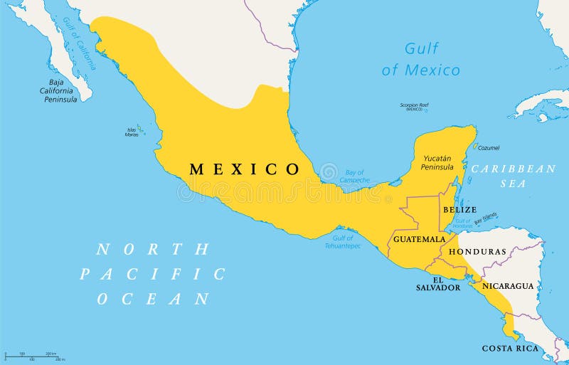
Free with trial Location of Mesoamerica, political map. Historical region and cultural area in southern North America and most of Central America, from Mexico to Costa Rica, where pre Columbian societies flourished. Mapping vectors Location of Mesoamerica, political map, pre Columbian region and area. Location of Mesoamerica, political map. Historical region and cultural area in southern. Location of Mesoamerica, political map. Historical region and cultural area in southern North America and most of Central America, from Mexico to Costa Rica, where pre Columbian societies flourished.
Free with trial Antarctic Peninsula area, political map. From southern Patagonia and Falkland Islands, to South Georgia and the South Sandwich Islands, South Orkney Islands, and Drake Passage, to Antarctic Peninsula. Mapping vectors Antarctic Peninsula area, from Patagonia to Antarctica, political map. Antarctic Peninsula area, political map. From southern Patagonia and Falkland Islands, to. Antarctic Peninsula area, political map. From southern Patagonia and Falkland Islands, to South Georgia and the South Sandwich Islands, South Orkney Islands, and Drake Passage, to Antarctic Peninsula.
Free with trial Medical Healthcare Icons. With People Researching Scientific Discovery. Mapping vectors Medical Healthcare Icons. With People Researching Scientific Discovery
Free with trial 5W1H infographic scribble concept - vector illustration. Six Ws questions (who, why, when, what, how, where - vector illustration chart with icons - 5W1H. Mapping vectors 5W1H infographic scribble concept - vector illustration. Six Ws questions (who, why, when, what, how, where - vector illustration chart with icons - 5W1H
Free with trial Color detailed road map, urban street plan city New York and Washington with colorful neighborhoods and districts, Travel vector poster for design map of roads, rivers and paths. Mapping vectors Color detailed road map, urban street plan city New York and Washington with colorful neighborhoods and districts, Travel vector. Poster for design map of roads
Free with trial Oxygen cascade and heart rate performance shown through lungs, heart, and muscles, mapping mechanics, gas exchange, transport, and ATP use to explain load and efficiency. Outline diagram. Mapping vectors Oxygen cascade and heart rate performance shown through lungs, heart, ... Oxygen cascade and heart rate performance shown through lungs, heart, and muscles. Oxygen cascade and heart rate performance shown through lungs, heart, and muscles, mapping mechanics, gas exchange, transport, and ATP use to explain load and efficiency. Outline diagram
Free with trial Stock vector AFRICA map icon Vector illustration 3. Mapping vectors Stock vector AFRICA map icon Vector illustration 3
Free with trial Cancun,Cozumel and Riviera Maya,Mexico,political map. Cancun,city on the coast of Yucatan Peninsula,north of Riviera Maya,a Caribbean coast resort,with Cozumel in the east of Playa del Carmen. Mapping vectors Cancun, Cozumel and Riviera Maya, Mexico, political map. Cancun,Cozumel and Riviera Maya,Mexico,political map. Cancun,city on the coast of Yucatan Peninsula. Cancun,Cozumel and Riviera Maya,Mexico,political map. Cancun,city on the coast of Yucatan Peninsula,north of Riviera Maya,a Caribbean coast resort,with Cozumel in the east of Playa del Carmen.
Free with trial Circle loop with icon. Can use for brochure and business project background. Mapping vectors Circle loop with icon. Can use for brochure and business project background
Free with trial Colorful Danmark administrative and political map. Mapping vectors Colorful Danmark administrative and political map.
Free with trial Monaco, Nice and Cannes, political map. The coastal strip of Alpes-Maritimes, a department of France, located on the French Riviera and Mediterranean Sea. With the microstate Principality of Monaco. Mapping vectors Monaco, Nice and Cannes, the coastal strip of Alpes-Maritimes, political map. Monaco, Nice and Cannes, political map. The coastal strip of Alpes-Maritimes, a. Monaco, Nice and Cannes, political map. The coastal strip of Alpes-Maritimes, a department of France, located on the French Riviera and Mediterranean Sea. With the microstate Principality of Monaco.
 Sign in