Free with trial Bats use echolocation by emitting high-frequency sounds and analyzing returning echoes to navigate, hunt prey, and avoid obstacles in the dark. Mapping vectors Echolocation in Bats Using Sound Waves to Navigate and Hunt in the Dark. Bats use echolocation by emitting high-frequency sounds and analyzing returning echoes. Bats use echolocation by emitting high-frequency sounds and analyzing returning echoes to navigate, hunt prey, and avoid obstacles in the dark
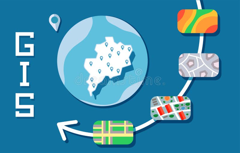
Free with trial GIS Software Concept, Geographic Information System. Vector illustration on blue background. Mapping vectors GIS Software Concept, Geographic Information System. Vector illustration. GIS Software Concept, Geographic Information System. Vector illustration on blue. GIS Software Concept, Geographic Information System. Vector illustration on blue background.
Free with trial Map of the Indonesian volcano island Krakatau. Mapping vectors Map of the Indonesian volcano island Krakatau. Vector map of the Indonesian volcano island Krakatau
Free with trial High detailed Germany physical map with labeling. Vector illustration. Mapping vectors High detailed Germany physical map with labeling. Vector illustration
Free with trial Statistical subregions of the world, geoscheme and political map. System that divides all countries and territories of the world into 22 subregional groups. Colored division for statistical purposes. Mapping vectors Statistical subregions of the world, geoscheme and political map. System that divides all countries and territories of the world into 22 subregional groups
Free with trial Medical Healthcare Icons w People Charting Disease or Scientific Discovery Web Header Banner. Mapping vectors Medical Healthcare Icons with People Charting Disease / Scientific Discovery Web Header Banner. Medical Healthcare Icons w People Charting Disease or Scientific. Medical Healthcare Icons w People Charting Disease or Scientific Discovery Web Header Banner
Free with trial Travel poster, urban street plan city map Montreal and Ottawa, vector illustration. For design map of roads, rivers and paths. Mapping vectors Travel poster, urban street plan city map Montreal and Ottawa, vector illustration. For design map of roads, rivers and paths
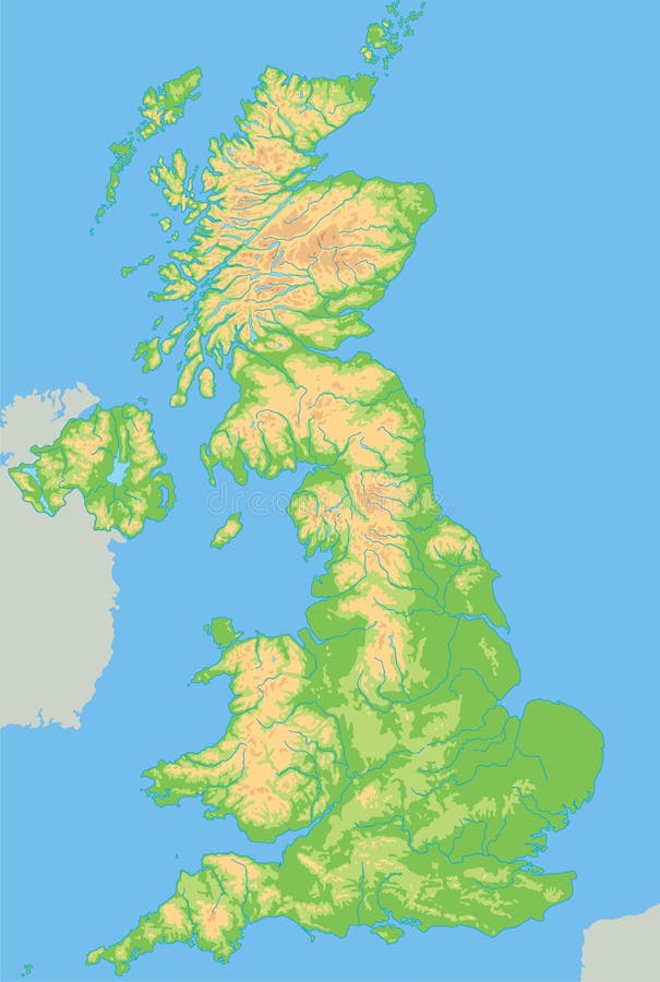
Free with trial High detailed United Kingdom physical map. Vector illustration. Mapping vectors High detailed United Kingdom physical map. Vector illustration
Free with trial Haryana administrative and political map, India. Mapping vectors Haryana administrative and political map, India.
Free with trial Map of Cayman Brac, an island in the Cayman Islands, UK. Mapping vectors Map of Cayman Brac, an island in the Cayman Islands, UK.
Free with trial Map of Cayman Brac, an island in the Cayman Islands, UK. Mapping vectors Map of Cayman Brac, an island in the Cayman Islands, UK.
Free with trial Big data technology. Scaning the databases and applications running on operation system with teams - concept ideas with vintage color. Mapping vectors Big data technology. Scaning the databases and applications running on operation system with teams - concept ideas with vintage color
Free with trial 3D abstract blue background with paper cut shapes. Design layout for business and elements posters. Colorful carving art. Paper frame backdrop. Vector illustration. Mapping vectors 3D abstract blue background with paper cut shapes. Design layout for business and elements posters. Colorful carving art. Paper frame backdrop. Vector
Free with trial AI routing workflow shows input, call router, and LLM calls leading to output, illustrating automated decision processes. Outline diagram. Mapping vectors AI routing workflow shows input, call router, and LLM calls ... AI routing workflow shows input, call router, and LLM calls leading to output, illustrating. AI routing workflow shows input, call router, and LLM calls leading to output, illustrating automated decision processes. Outline diagram
Free with trial Romania - Highly detailed editable political map with labeling. Vector illustration. Mapping vectors Romania - Highly detailed editable political map with labeling. Vector illustration
Free with trial Organic wavy silver stripes. Abstract 3d background. Vector realistic illustration. Topography pattern. Jewelry decoration. Luxury ornament. Modern cover design. Banner template. Mapping vectors Organic wavy silver stripes. Abstract 3d background. Vector realistic illustration. Topography pattern. Jewelry decoration. Luxury ornament. Modern cover
Free with trial Koh Samui road and beach vector map. Mapping vectors Koh Samui road and beach vector map.
Free with trial Road vector map of the brazilian state santa catarina. Mapping vectors Road map of the brazilian state santa catarina. Road vector map of the brazilian state santa catarina. Road vector map of the brazilian state santa catarina.
Free with trial High detailed Switzerland physical map with labeling. Vector illustration. Mapping vectors High detailed Switzerland physical map with labeling. Vector illustration
Free with trial Socialist Republic of Vietnam road vector map. Mapping vectors Socialist Republic of Vietnam road vector map.
Free with trial Taiwan Strait,gray political map. Important waterway and disputed international waters,separating the island of Taiwan and continental Asia,which connects the East China Sea and South China Sea. Mapping vectors Taiwan Strait, separating Taiwan and continental Asia, gray political map. Taiwan Strait,gray political map. Important waterway and disputed international waters. Taiwan Strait,gray political map. Important waterway and disputed international waters,separating the island of Taiwan and continental Asia,which connects the East China Sea and South China Sea.
Free with trial New Guinea gray political map. Second largest island in the world located in the South Pacific Ocean. The eastern half is the major landmass of Papua New Guinea. The western half is part of Indonesia. Mapping vectors New Guinea, gray political map, second largest island in the world. New Guinea gray political map. Second largest island in the world located in the South. New Guinea gray political map. Second largest island in the world located in the South Pacific Ocean. The eastern half is the major landmass of Papua New Guinea. The western half is part of Indonesia.
Free with trial Arrow business concept with icons. Can use for brochure and business project background. Mapping vectors Arrow business concept with icons. Can use for brochure and business project background
Free with trial Vector road map of the Greater Sunda Island Sulawesi, Indonesia. Mapping vectors Vector road map of the Greater Sunda Island Sulawesi, Indonesia.
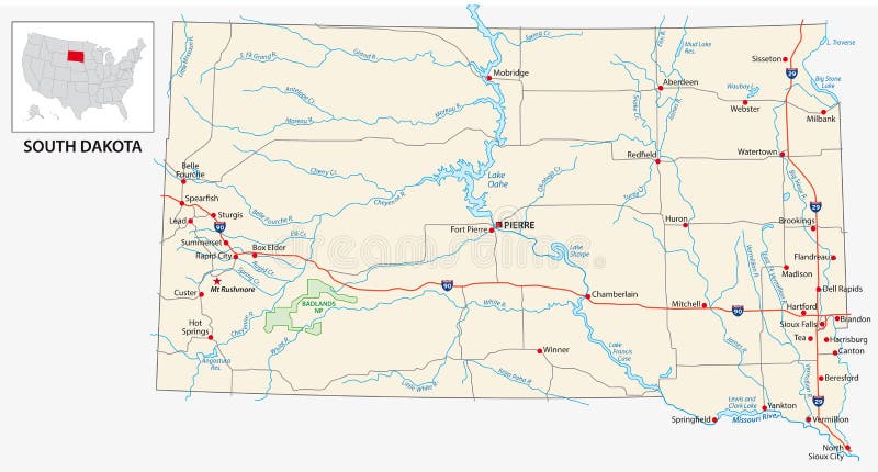
Free with trial Road map of the US American State of South Dakota. Mapping vectors Road map of the US American State of South Dakota.
Free with trial High detailed Germany physical map. Vector illustration. Mapping vectors High detailed Germany physical map. Vector illustration
Free with trial Destination place pin. Red place pointer. Map position mark. Mapping vectors Destination place pin. Red place pointer. Map position mark. Destination place pin. Red place pointer. Map position mark
Free with trial State of Illinois, subdivided into 102 counties, outline map. State in the Midwestern United States, nicknamed Land of Lincoln, Prairie State, and Inland Empire State. Isolated illustration. Vector. Mapping vectors State of Illinois, subdivided into 102 counties, outline map. State in the Midwestern United States, nicknamed Land of Lincoln, Prairie State, and Inland
Free with trial Elba, political map, Mediterranean island in Tuscany, Italy, with capital Portoferraio. Located in the Tyrrhenian Sea and largest island in the Tuscan Archipelago. Site of the first exile of Napoleon. Mapping vectors Elba, Italy, political map, Site of the first exile of Napoleon. Elba, political map, Mediterranean island in Tuscany, Italy, with capital Portoferraio. Located. Elba, political map, Mediterranean island in Tuscany, Italy, with capital Portoferraio. Located in the Tyrrhenian Sea and largest island in the Tuscan Archipelago. Site of the first exile of Napoleon.
Free with trial City map Tokyo, urban planning travel vector poster design, collection of wall tourist decorations. Mapping vectors City map Tokyo, urban planning travel vector poster design. Collection of wall tourist decorations
Free with trial Brain illustration concept with leaves theme. Rainbow color of human brain illustration concept with leaves theme. Mapping vectors Brain illustration concept with leaves theme. Rainbow color of human brain illustration concept with leaves theme
Free with trial Serbia and Kosovo,landlocked countries in Southeast Europe,political map. The Republic of Serbia,with capital Belgrade,and Republic of Kosovo,partially recognized country,with capital Pristina. Mapping vectors Serbia and Kosovo, landlocked countries in Southeast Europe, political map. Serbia and Kosovo,landlocked countries in Southeast Europe,political map. The. Serbia and Kosovo,landlocked countries in Southeast Europe,political map. The Republic of Serbia,with capital Belgrade,and Republic of Kosovo,partially recognized country,with capital Pristina.
Free with trial A versatile set of six black and white icons representing diverse human shelters and traditional dwellings. This minimalist silhouette collection features a modern canopy tent, a geodesic dome, an A frame cabin, a nomadic yurt, a traditional Viking longhouse, and an indigenous pueblo adobe building. Ideal for travel graphics, anthropology infographics, historical mapping, and glamping design projects. Mapping vectors Traditional dwellings and nomadic shelters black and white icon set. A versatile set of six black and white icons representing diverse human shelters and. A versatile set of six black and white icons representing diverse human shelters and traditional dwellings. This minimalist silhouette collection features a modern canopy tent, a geodesic dome, an A frame cabin, a nomadic yurt, a traditional Viking longhouse, and an indigenous pueblo adobe building. Ideal for travel graphics, anthropology infographics, historical mapping, and glamping design projects.
Free with trial Portland Map. Jamaica state. With cities and towns. Mapping vectors Portland Map. Jamaica state. With cities and towns
Free with trial Liberland,political map. Free Republic of Liberland,unrecognized micronation in Europe,claiming Siga,an uninhabited parcel of disputed land on western bank of Danube,between Croatia and Serbia. Mapping vectors Free Republic of Liberland, unrecognised micronation, political map. Liberland,political map. Free Republic of Liberland,unrecognized micronation in Europe. Liberland,political map. Free Republic of Liberland,unrecognized micronation in Europe,claiming Siga,an uninhabited parcel of disputed land on western bank of Danube,between Croatia and Serbia.
Free with trial South Africa,gray political map with nine provinces,with largest cities,and borders. Republic and southernmost country in Africa,with the three capitals Pretoria,Cape Town and Bloemfontein. Mapping vectors South Africa, gray political map with provinces and largest cities. South Africa,gray political map with nine provinces,with largest cities,and borders. Republic. South Africa,gray political map with nine provinces,with largest cities,and borders. Republic and southernmost country in Africa,with the three capitals Pretoria,Cape Town and Bloemfontein.
Free with trial Hainan,southernmost province of China,and surrounding area,gray political map. Hainan Island,and Paracel Islands in the South China Sea,south of the Leizhou Peninsula,and east of Gulf of Tonkin. Mapping vectors Hainan, a province of China, and Paracel Islands, gray political map. Hainan,southernmost province of China,and surrounding area,gray political map. Hainan. Hainan,southernmost province of China,and surrounding area,gray political map. Hainan Island,and Paracel Islands in the South China Sea,south of the Leizhou Peninsula,and east of Gulf of Tonkin.
Free with trial Map of the Districts and sub-districts of the United States Virgin Islands. Mapping vectors Map of the Districts and sub-districts of the United States Virgin Islands.
Free with trial Vector map with the most important wine regions of New Zealand. Mapping vectors Vector map with the most important wine regions of New Zealand.
Free with trial Asturias administrative and political vector map. Mapping vectors Asturias administrative and political vector map.
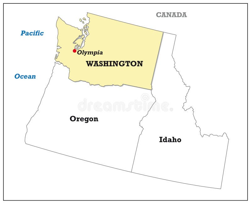
Free with trial Washington state map with its neighboring states. Mapping vectors Washington state map with its neighboring states.
Free with trial Administrative vector map of the five New England states, United States. Mapping vectors Administrative vector map of the five New England states, United States.
Free with trial Indonesia, a country in Southeast Asia and Oceania, gray political map. Republic and archipelago with capital Jakarta, and largest islands Sumatra, Java, Sulawesi, and parts of Borneo and New Guinea. Mapping vectors Indonesia, a country in Southeast Asia and Oceania, gray political map. Republic and archipelago with capital Jakarta, and largest islands Sumatra, Java
Free with trial Road vector map of the brazilian state tocantins. Mapping vectors Road map of the brazilian state tocantins. Road vector map of the brazilian state tocantins. Road vector map of the brazilian state tocantins.
Free with trial SAARC, member states, political map. The South Asian Association for Regional Cooperation, a regional intergovernmental organization and geopolitical union of eight states in South Asia. Illustration. Mapping vectors SAARC, South Asian Association for Regional Cooperation, members map. SAARC, member states, political map. The South Asian Association for Regional Cooperation. SAARC, member states, political map. The South Asian Association for Regional Cooperation, a regional intergovernmental organization and geopolitical union of eight states in South Asia. Illustration.
Free with trial Middle East, colored countries, political map with international borders. Geopolitical region encompassing the Arabian Peninsula, the Levant, Turkey, Egypt, Iran and Iraq. Formerly known as Near East. Mapping vectors Middle East, colored countries, political map, formerly known as Near East. Middle East, colored countries, political map with international borders. Middle East, colored countries, political map with international borders. Geopolitical region encompassing the Arabian Peninsula, the Levant, Turkey, Egypt, Iran and Iraq. Formerly known as Near East.
Free with trial Road and national park map of southwestern africa. Mapping vectors Road and national park map of southwestern africa. Vector road and national park map of southwestern africa
Free with trial Map of the railroad tracks in the three Baltic states. Mapping vectors Map of the railroad tracks in the three Baltic states.
Free with trial High detailed Romania road map with labeling. Vector illustration. Mapping vectors High detailed Romania road map with labeling. Vector illustration
Free with trial India - Highly detailed editable political map. Vector illustron. Mapping vectors India - Highly detailed editable political map. Vector illustron
Free with trial Road map of the British province of Northern Ireland. Mapping vectors Road map of the British province of Northern Ireland. Detailed road map of the British province of Northern Ireland
Free with trial Color detailed road map, urban street plan city Stockholm and Helsinki with colorful neighborhoods and districts, Travel vector poster for design map of roads, rivers and paths. Mapping vectors Color detailed road map, urban street plan city Stockholm and Helsinki with colorful neighborhoods and districts, Travel vector. Poster for design map of roads
Free with trial Road map of the West African state of Gambia. Mapping vectors Road map of the West African state of Gambia.
Free with trial High detailed Spain physical map. Vector illustration. Mapping vectors High detailed Spain physical map. Vector illustration
Free with trial Strait of Gibraltar, waterway between Spain and Morocco vector map. Mapping vectors Strait of Gibraltar, waterway between Spain and Morocco vector map.
Free with trial Germany - Highly detailed editable political map with separated layers. Vector illustration. Mapping vectors Germany - Highly detailed editable political map with separated layers. Vector illustration
Free with trial States of Brazil,political map. Federative units with borders and capitals. Subnational entities with a certain degree of autonomy. They form the Federative Republic of Brazil,with capital Brasilia. Mapping vectors States of Brazil, federative units with their capitals, political map. States of Brazil,political map. Federative units with borders and capitals. Subnational. States of Brazil,political map. Federative units with borders and capitals. Subnational entities with a certain degree of autonomy. They form the Federative Republic of Brazil,with capital Brasilia.
Free with trial Lublin Triangle, political map. Alliance of the three European countries Lithuania, Poland and Ukraine for strengthening mutual cooperation and supporting the integration of Ukraine into EU and NATO. Mapping vectors Lublin Triangle, political map, Lithuania, Poland and Ukraine alliance. Lublin Triangle, political map. Alliance of the three European countries Lithuania. Lublin Triangle, political map. Alliance of the three European countries Lithuania, Poland and Ukraine for strengthening mutual cooperation and supporting the integration of Ukraine into EU and NATO.
Free with trial Manchester Map. Jamaica state. With cities and towns. Mapping vectors Manchester Map. Jamaica state. With cities and towns
Free with trial Imaginary weather map of Australia and New Zealand. Mapping vectors Imaginary weather map of Australia and New Zealand.
Free with trial Milos,island of Greece,political map. Volcanic Greek island in the Aegean Sea and part of the Cyclades. Together with Antimilos and smaller islets a municipality,neighboring Kimolos and Polyaigos. Mapping vectors Milos, or Melos, Greek island, in the Aegean Sea, political map. Milos,island of Greece,political map. Volcanic Greek island in the Aegean Sea and part of the. Milos,island of Greece,political map. Volcanic Greek island in the Aegean Sea and part of the Cyclades. Together with Antimilos and smaller islets a municipality,neighboring Kimolos and Polyaigos.
Free with trial High detailed Ireland physical map with labeling. Vector illustration. Mapping vectors High detailed Ireland physical map with labeling. Vector illustration
Free with trial Maui, Hawaii, gray political map with capital Wailuku. Part of Hawaiian Islands and Hawaii, a state of the United States in North Pacific Ocean. With unpopulated island Kahoolawe. Illustration. Vector. Mapping vectors Maui, Hawaii, United States, gray political map, capital Wailuku. Maui, Hawaii, gray political map with capital Wailuku. Part of Hawaiian Islands and Hawaii, a. Maui, Hawaii, gray political map with capital Wailuku. Part of Hawaiian Islands and Hawaii, a state of the United States in North Pacific Ocean. With unpopulated island Kahoolawe. Illustration. Vector
Free with trial Ancestry or Genealogy Icon Set with Family Tree Album, DNA, beak. Ers, chemical family record, etc. Mapping vectors Ancestry or Genealogy Icon Set with Family Tree Album, DNA, beak. Ers, chemical family record, etc
Free with trial Ancestry or Genealogy Icon Set with Family Tree Album, DNA, beak. Ers, chemical family record, etc. Mapping vectors Ancestry or Genealogy Icon Set with Family Tree Album, DNA, beak. Ers, chemical family record, etc
Free with trial World map of the five oceans,model of oceanic divisions with approximate boundaries. Pacific,Atlantic,Indian,Arctic,and Southern or Antarctic Ocean. Map of the world oceans,bodies of salt water. Mapping vectors World map of the five oceans, model of oceanic divisions with boundaries. World map of the five oceans,model of oceanic divisions with approximate boundaries. World map of the five oceans,model of oceanic divisions with approximate boundaries. Pacific,Atlantic,Indian,Arctic,and Southern or Antarctic Ocean. Map of the world oceans,bodies of salt water.
Free with trial Kinki Map. Map of Japan Prefecture. Vector illustration. Mapping vectors Kinki Map. Map of Japan Prefecture. Vector illustration
Free with trial The Caucasus, or Caucasia, gray political map. Region between the Black Sea and the Caspian Sea, mainly occupied by Armenia, Azerbaijan, Georgia, and parts of Southern Russia. Map with disputed areas. Mapping vectors The Caucasus, gray political map, region between Black and Caspian Sea. The Caucasus, or Caucasia, gray political map. Region between the Black Sea and the. The Caucasus, or Caucasia, gray political map. Region between the Black Sea and the Caspian Sea, mainly occupied by Armenia, Azerbaijan, Georgia, and parts of Southern Russia. Map with disputed areas.
Free with trial United kingdom Postcodes or postal codes vector map. Mapping vectors United kingdom Postcodes or postal codes vector map.
Free with trial Netherlands - Highly detailed editable political map with separated layers. Vector illustration. Mapping vectors Netherlands - Highly detailed editable political map with separated layers. Vector illustration
Free with trial GIS Software Concept, Geographic Information System. Vector illustration on blue background. Mapping vectors GIS Software Concept, Geographic Information System. Vector illustration. GIS Software Concept, Geographic Information System. Vector illustration on blue. GIS Software Concept, Geographic Information System. Vector illustration on blue background.
Free with trial Vector map of France. Country map with division, cities and capital Paris. Political map, world map, infographic elements. Mapping vectors Vector map of France. Country map with division, cities and capital Paris. Political map, world map, infographic elements
Free with trial Prince Edward Island, Maritime and Atlantic province of Canada, political map. The Island, located in the Gulf of St. Lawrence, bordered to New Brunswick and Nova Scotia, with capital Charlottetown. Mapping vectors Prince Edward Island, Maritime province of Canada, political map. Prince Edward Island, Maritime and Atlantic province of Canada, political map. The Island. Prince Edward Island, Maritime and Atlantic province of Canada, political map. The Island, located in the Gulf of St. Lawrence, bordered to New Brunswick and Nova Scotia, with capital Charlottetown.
Free with trial South Africa,political map with provinces,largest cities,international and administrative borders. Republic and southernmost country in Africa,with capitals Pretoria,Cape Town and Bloemfontein. Mapping vectors South Africa, political map with provinces, largest cities and borders. South Africa,political map with provinces,largest cities,international and administrative. South Africa,political map with provinces,largest cities,international and administrative borders. Republic and southernmost country in Africa,with capitals Pretoria,Cape Town and Bloemfontein.
Free with trial Road map of the french mediterranean island corsica. Mapping vectors Road map of the french mediterranean island corsica. Road vector map of the french mediterranean island corsica
Free with trial Vector map France with the regions, rivers and the most important cities. Mapping vectors Vector map France with the regions, rivers and the most important cities.
Free with trial Map of the Brazilian road Transamazonica BR 230. eps. Mapping vectors Map of the Brazilian road Transamazonica BR 230.eps. Vector map of the Brazilian road Transamazonica BR 230.eps
Free with trial Highly detailed editable political map with separated layers. New Zealand. Vector illustration. Mapping vectors Highly detailed editable political map with separated layers. New Zealand. Vector illustration
Free with trial Stylized map of Taiwan. Isometric 3D green map with cities, borders, capital Taipei, regions. Vector illustration. Editable layers clearly labeled. English language. Mapping vectors Stylized map of Taiwan. Isometric 3D. Green map with cities, borders, capital Taipei, regions. Vector illustration. Editable layers clearly labeled. English
Free with trial Map of the Costa rican lake arenal. Mapping vectors Map of the Costa rican lake arenal.
 Sign in